

This article was automatically translated from the original Turkish version.
+2 More
Period | 7th century BCE Kingdom of Urartu | ||||||||
|---|---|---|---|---|---|---|---|---|---|
Location | Bitlis Province Approximately 5–6 km north of Adilcevaz district | ||||||||
Geographic Location | On the southern slopes of Mount Süphan A volcanic hill dominating the northwestern shore of Lake Van | ||||||||
Dating | Approximately 685–645 BCE | ||||||||
Name during the Urartian Period | The City of Haldi of the Land of Ziuquni | ||||||||
Founder | Argişti's son Rusa / generally accepted as Rusa II | ||||||||
Name | Kef Kalesi | ||||||||
Elevation | Approximately 2270–2300 m | ||||||||
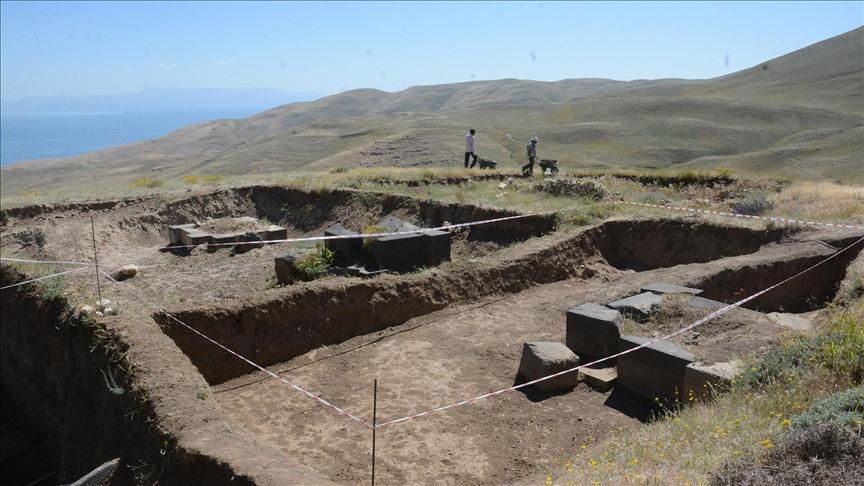
Kef Kalesi is a historical fortress located near the district of Adilcevaz in Bitlis province, on the southern slopes of Mount Süphan, commanding a strategic position over the Van Lake basin. Situated at an elevation of 2300 meters above sea level, the fortress occupies a dominant location overlooking Van Lake and controls the critical route between Erciş and Bitlis. Due to its natural topography, the eastern, western and southern sides consist of steep and sheer cliffs, making access from these directions nearly impossible; therefore, the main entrance has been identified on the more accessible northern side. From the surrounding hills of the fortress, the Malazgirt Plain is visible, and the site also commands a commanding view over the fertile agricultural lands and pastoral highlands of the region.
Kef Kalesi (Anadolu Ajansı)
The fortress was constructed during the reign of King Rusa II (7th century BCE) of the Urartian Kingdom, who placed great emphasis on construction projects. According to cuneiform inscriptions found in Adilcevaz, the fortress was known during the Urartian period as “The City of Haldi in the Land of Ziuquni”. The inscriptions state that King Rusa II ordered the construction of this fortress in the name of the god Haldi, relocated populations from conquered territories to this region, and built the fortress on an untouched rock mass that had never been previously developed by any king.
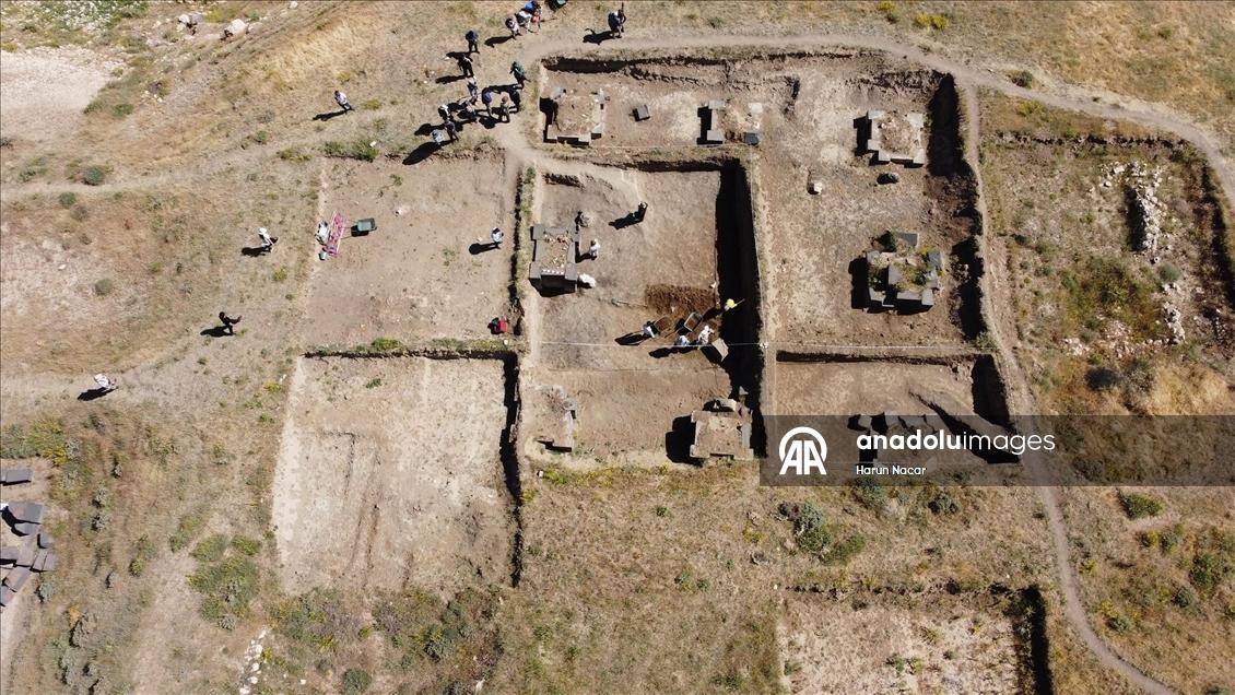
Scientific research at Kef Kalesi was first initiated in 1964 by Emin Bilgiç and Baki Öğün and continued until 1972. After an interval of approximately fifty years, second-phase excavation work was launched in 2021 under the leadership of Associate Professor Dr. İsmail Coşkun of Van Yüzüncü Yıl University. In modern excavation efforts, geophysical methods such as Ground Penetrating Radar (GPR) are employed to analyze large areas without destruction. Thanks to this technology, palace walls and column foundations beneath the soil were identified prior to excavation, significantly increasing the speed and efficiency of archaeological work.
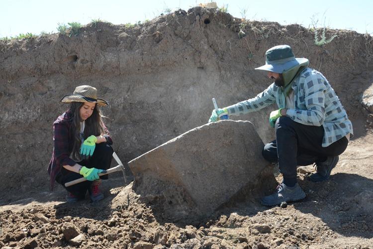
Kef Kalesi Kazı Çalışmaları (Anadolu Ajansı)
Kef Kalesi, an advanced example of Urartian architectural engineering, consists of two main sections: the “Upper City” and the “Lower City”. While the entire settlement is enclosed by walls, the Upper City, serving as the administrative and religious center, is further fortified by an additional wall system. The total area of the fortress extends over 20 hectares. The architecture is fully integrated with the topography, with structures built on at least three distinct terraces following the natural slope of the terrain. In wall construction, large basalt stone blocks were used for the foundations, while sun-dried brick was employed for upper sections.
The palace structure, located at the highest point of the fortress, is estimated to comprise approximately 140 rooms and feature a four-story architectural layout. Within the palace, large halls known as the “Upper Hall” and the “Middle Hall” have been identified. Their most distinctive feature is their support by massive basalt columns referred to as “elephant feet”; 49 of these columns have been unearthed since excavation work began in 2021. Early interpretations of the Ašihusi structure described it as a “ritual libation chamber” or “drink-offering site,” but recent studies propose the meaning “house of food/bounty.” Large grain silos and storage rooms are found beneath or near these structures, with more than 170 large cubic containers identified within them. The palace walls were decorated with blue and red frescoes, indicating the prestigious and sacred character of the space.
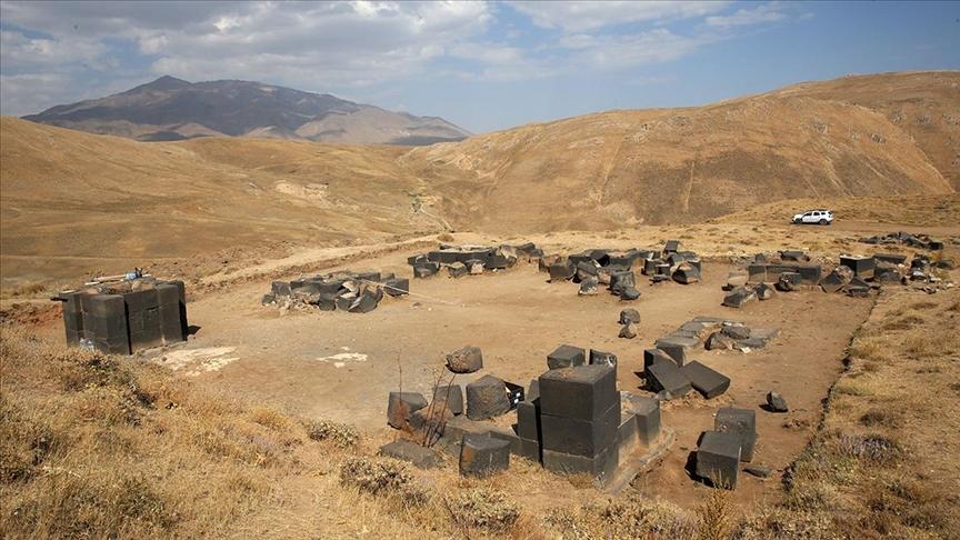
Kef Kalesi Kalıntıları (Anadolu Ajansı)
Artifacts recovered from excavations at Kef Kalesi demonstrate how Urartian art synthesized influences from Northern Syria and Assyria with local stylistic traditions:
The abundance of animal bone remains discovered in the Upper Hall of the palace indicates that this space was not merely an administrative center but also a venue for communal feasts and ritual sacrificial ceremonies. Taxonomic analyses reveal that the majority of the bones belong to domestic sheep and goats, with remains of hunted animals such as roe deer also present. Butchery marks and fire burns on the bones suggest that these animals were consumed in feasts following sacred rituals.
Anadolu Ajansı. “Kef Kalesi'nde 2 bin 700 yıllık mutfak ve hizmet odaları tespit edildi.” Accessed March 19, 2026.https://www.aa.com.tr/tr/kultur/kef-kalesinde-2-bin-700-yillik-mutfak-ve-hizmet-odalari-tespit-edildi/2678818
Anadolu Ajansı. “Süphan Dağı eteğindeki Kef Kalesi’nde 49 ‘fil ayağı’ gün yüzüne çıkarıldı.” Accessed March 19, 2026.https://www.aa.com.tr/tr/kultur/suphan-dagi-etegindeki-kef-kalesinde-49-fil-ayagi-gun-yuzune-cikarildi/3629578
Coşkun, İsmail, Orhan Varol, and Erdal Polat. “Adilcevaz Kef Kalesi Kazısı: Yeni Bulgular ve Değerlendirmeler.” *OANNES - International Journal of Ancient History* 5, no. 1 (2023): 253–274. Accessed March 19, 2026.https://dergipark.org.tr/en/pub/oannes/article/1234641
Coşkun, İsmail, and Zehra Özbulut. “Kef Kalesi Yukarı Salon ve Orta Salon, Aşihusi Yapıları Mı?” *Van Yüzüncü Yıl Üniversitesi Sosyal Bilimler Enstitüsü Dergisi*, Van Gölü Havzası Özel Sayısı (2026): 204–212. Accessed March 19, 2026.https://dergipark.org.tr/tr/download/article-file/4781205
Coşkun, İsmail, and Ömer Tanyürek. “Investigation of Adilcevaz Kef Fortress with Geophysical Ground Penetrating Radar Method.” *Arteoloji Dergisi* 3, no. 2 (2024): 24–35. Accessed March 19, 2026.https://www.arteoloji.com/dergi/investigation-of-adilcevaz-kef-fortress-with-geophysical-ground-penetrating-radar-method20241013085908.pdf
Öğün, Baki. “1964 Adilcevaz Kef Kalesi Kazıları.” *Anadolu* 8 (1964): 65–92. Accessed March 19, 2026.https://dergipark.org.tr/tr/pub/anatolia/article/813982
Period | 7th century BCE Kingdom of Urartu | ||||||||
|---|---|---|---|---|---|---|---|---|---|
Location | Bitlis Province Approximately 5–6 km north of Adilcevaz district | ||||||||
Geographic Location | On the southern slopes of Mount Süphan A volcanic hill dominating the northwestern shore of Lake Van | ||||||||
Dating | Approximately 685–645 BCE | ||||||||
Name during the Urartian Period | The City of Haldi of the Land of Ziuquni | ||||||||
Founder | Argişti's son Rusa / generally accepted as Rusa II | ||||||||
Name | Kef Kalesi | ||||||||
Elevation | Approximately 2270–2300 m | ||||||||
History and Foundation
History of Excavations and Research Methods
Architectural Structure and Urban Planning
Palace Complex and “Ašihusi” Structures
Artistic and Archaeological Finds
Economic and Ritual Activities