This article was automatically translated from the original Turkish version.
+2 More
Location | Diyarbakır Türkiye | ||||||||
|---|---|---|---|---|---|---|---|---|---|
Building Type | Historical Defense Walls | ||||||||
Sections | Inner Castle and Outer Castle | ||||||||
Initial Settlement | Inner Castle (northeastern part of the city) | ||||||||
Construction Date | Although not definitively known, dating to 3000–2500 BCE (Hurrians) and the 4th century (Rome, 349 CE, Constantius II) | ||||||||
Total Length | Approximately 5800 m (Inner Castle: 599 m, Outer Castle: 5200 m) | ||||||||
Destroyed Section | 645 m | ||||||||
Number of Towers | 101 (Outer Castle: 82, Inner Castle: 19) | ||||||||
Foundation | Volcanic basalt plateau | ||||||||
Wall Height | 8–12 metres | ||||||||
Wall Thickness | 3–5 metres | ||||||||
Main Gates | Dağ Gate Urfa Gate Mardin Gate Yeni Gate | ||||||||
UNESCO Status | Inscribed on the World Heritage List in 2015 | ||||||||
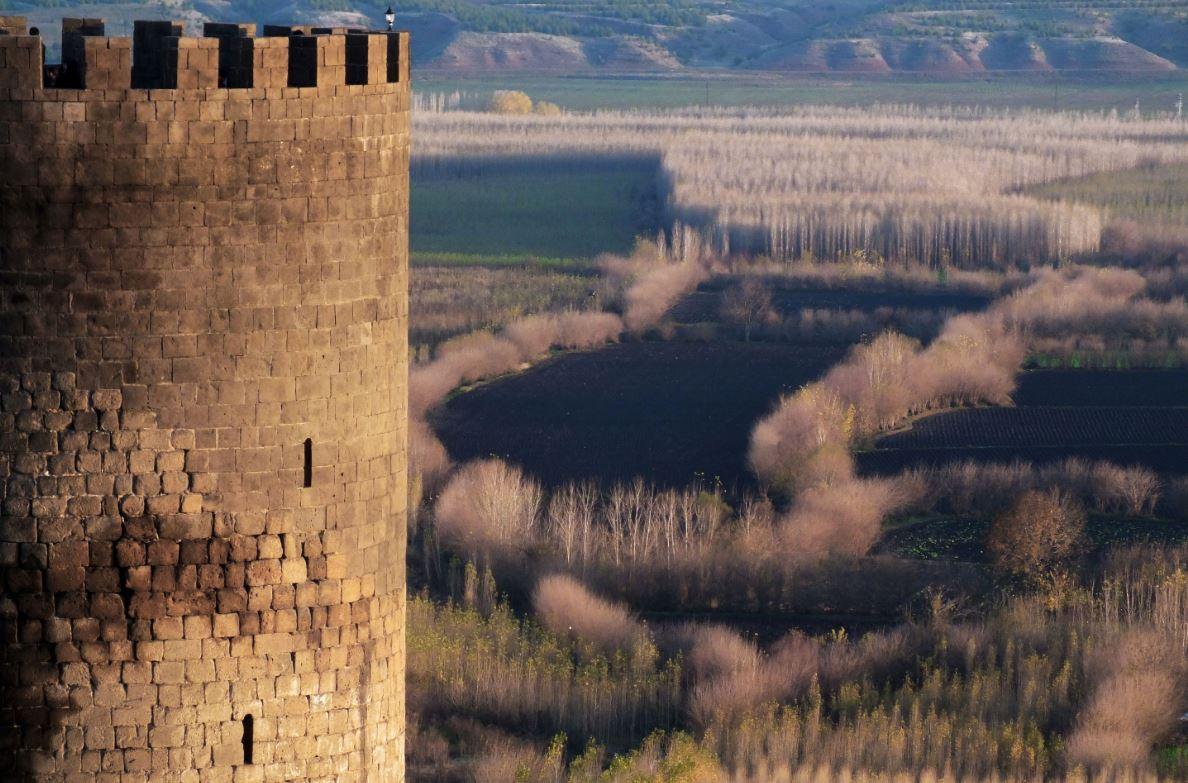
The Diyarbakır Walls are a historical defensive structure built on a volcanic basalt plateau 70 to 100 meters above the Tigris River, located in the center of Diyarbakır. The walls consist of two main sections: the Inner Citadel and the Outer Citadel. The earliest construction phase dates to the Hurri-Mitanni period between 3000 and 2500 BCE, and the structure acquired its current overall form during architectural works carried out under the Roman Emperor Constantius II in 349 CE. Throughout history, the walls have preserved their physical characteristics through repairs and additions by various civilizations including the Romans, Byzantines, Seljuks, Artuqids, Akkoyunlu, and Ottomans, with a total perimeter length of 5800 meters. The defensive system features 82 circular, square, and polygonal towers along the Outer Citadel walls and 19 towers within the Inner Citadel, the city’s administrative center. The defensive system’s height ranges from 8 to 12 meters, with wall thickness varying between 3 and 5 meters. Black basalt stone, brick, and mortar were the primary materials used in its construction. The Outer Citadel has four main access points: Dağ Kapı, Urfa Kapı, Mardin Kapı, and Yeni Kapı. This entire complex was inscribed on the UNESCO World Heritage List in 2015.
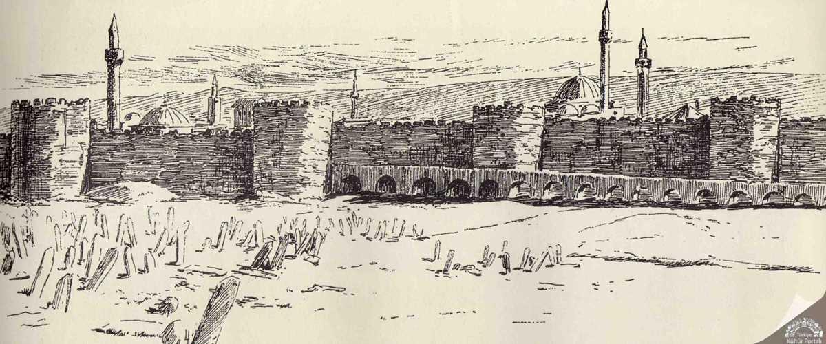
Diyarbakır Surları 1893 (Kültür Portalı)
The earliest settlement area of Diyarbakır is located in the northeastern part of the city, known as Amida Höyük, Virakale, or Toptepe. The oldest phase of the defensive system dates to around 3000 BCE, during the Hurri-Mitanni (Subaru) period. This early wall construction was built using a mixture of stone and mudbrick. During the 9th century BCE, when the city served as the capital of the Bit Zamani tribe, the existing ancient walls were repaired and utilized for defense. Under the reign of the Assyrian King Adad-nirari II (911–891 BCE), the walls were physically strengthened to enhance the city’s defensive capacity. Early settlements were confined to the Inner Citadel and its immediate surroundings; urban expansion accelerated in subsequent centuries.
The Roman conquest of Diyarbakır in 69 BCE marked a decisive turning point in the city’s military strategy, leading to the reorganization of the walls according to Roman military vision. The walls encircling the city were expanded between 330 and 363 CE during the reign of Emperor Constantius II, acquiring largely their present shield-shaped form during this phase. According to the records of the Roman soldier and historian Ammianus Marcellinus, before 359 CE the city was relatively small, and Constantius transformed the area into a fortified stronghold with strong walls and towers, naming it after himself. Constantius also ordered the construction of a second military settlement, Antoninupolis, surrounded by walls outside the city to provide refuge for neighboring populations in case of attack.
The treaty signed in 363 CE between the Roman and Sasanian Empires, known as the “Unlucky Jovian Peace,” resulted in the cession of Nusaybin (Nisibis) to the Sasanians, directly affecting the architectural scale of the Diyarbakır walls. To accommodate the influx of approximately 40,000 Christian migrants from the Nusaybin region, it became necessary to expand the city’s western boundaries. As a result of this demographic shift, between 367 and 375 CE, the western section of the city walls was demolished and replaced by a new, wider wall segment extending from Urfa Kapı to Mardin Kapı. These expansion efforts ensured that the growing population remained protected within the walls.
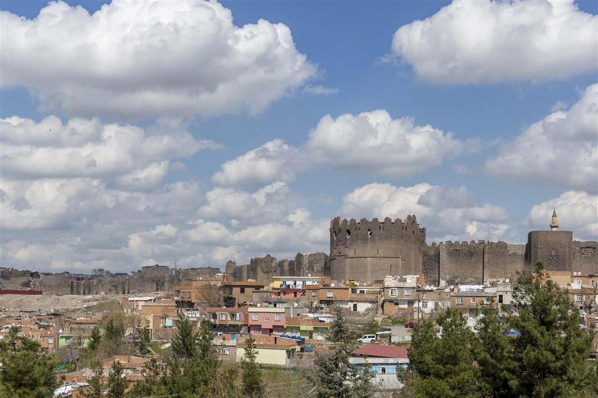
Diyarbakır Surları (Diyarbakır Valiliği)
During the Byzantine period, systematic reinforcement and repair of the city’s defensive system continued in response to threats from the Sasanians along the eastern frontier. Emperor Anastasius, during his reign from 491 to 518 CE, repaired damaged or incomplete wall sections and completed the defensive line. During Anastasius’s rule, the Nestorian Monastery Church within the Inner Citadel was restored, and new barracks were added for garrison troops. In 528 CE, under Emperor Justinian, the weakened sections of the walls were reinforced with new supporting walls, enhancing the level of fortification. Justinian also ordered the construction of several defensive outposts between Diyarbakır and Dara to strengthen the city’s external security.
The four main gates—Dağ Kapı, Urfa Kapı, Mardin Kapı, and Yeni Kapı—were positioned along the main transportation arteries of the Hellenistic urban plan established during the Roman period. The city’s principal streets were arranged to connect these four gates in accordance with Roman and Byzantine urban organization. During the reign of Gratian, repairs were carried out in the city, and structures for commercial activities were added outside the walls. The outer surfaces of the walls were clad with durable basalt blocks to resist enemy attacks, while the inner fill sections preferred smaller rubble stones.
During the Roman and Byzantine periods, pentagonal and circular towers were integrated into the wall system, and the openings of the main gates were enlarged. Monumental wall structures were constructed with heights ranging from 8 to 12 meters and thicknesses between 3 and 5 meters. The primary building material was black volcanic basalt stone extracted from the Karacadağ plateau on which the city is situated. For the construction of added towers and gates, Horasan mortar—composed of lime, sand, and crushed brick—was preferred for its high resistance to water and environmental factors. Physical evidence of Roman and Byzantine contributions to the wall architecture has been identified through Latin and Greek inscriptions surviving on the walls and towers near Dağ Kapı. The inscriptions on the inner side of Dağ Kapı date to the period of Valentinian, Valens, and Gratian in 375 CE.
The Arab armies under the command of Iyaz ibn Ganem captured Diyarbakır in 639 CE, initiating the Islamic era in the city. Interventions by Islamic civilizations in the wall architecture primarily involved repairing damaged sections and strengthening the defensive line with new towers. A large portion of the wall and towers between Tower 22, located south of Urfa Kapı, and Mardin Kapı, were added during the Great Seljuk and Artuqid periods. Inscriptions dating to the reign of Seljuk Sultan Malik-Shah serve as enduring records of the city’s Seljuk-era fortification policies. Most surviving inscriptions and structural additions from the Great Seljuk period are concentrated in areas such as Selçuklu Burcu, Nur Burcu, and Fındık Burcu.
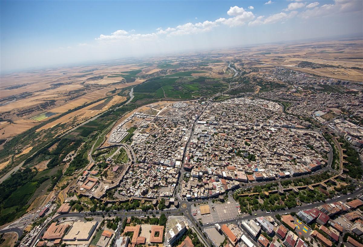
Diyarbakır Surları (Diyarbakır Valiliği)
The Artuqid period (1183–1232 CE) witnessed significant architectural and monumental changes to the walls. In 1208–1209, Artuqid ruler Melik Salih Mahmut commissioned the construction of the Ulu Beden (Evli Beden) and Yedi Kardeş towers along the southwestern city wall. The architectural design and construction of the Ulu Beden Tower were carried out by Ibrahim ibn Ja’far. These circular-plan structures, beyond their military function, exhibit characteristics of medieval military architecture through their inscription bands. The Artuqids also renovated the existing architecture of Urfa Kapı and placed figurative reliefs depicting the struggle between eagles and lion-bulls on the gate niches. Artuqid emirs constructed a small pentagonal fortress on the hilltop between the Inner Citadel to divide and protect the palace complex.
During the Ayyubid period, the Diyarbakır Walls underwent extensive repairs and the defensive mechanisms were updated. Under Melik Kamil, the outer wall sections were demolished, and the stones obtained were used to repair and reinforce the inner walls. These repair and reinforcement activities were completed between 1236 and 1237 under Melik Salih Ayyubi, with Ayyubid inscriptions placed on the towers between Dağ Kapı and Hindibaba Kapı. In the repaired and reconstructed wall sections during the Ayyubid period, cylindrical stone blocks were used to support wall construction. The defensive moats surrounding the outer walls were demolished during the Ayyubid period, and the stones from the moat edges were directly used to strengthen the main walls.
When the city came under Ottoman rule in 1515, the Diyarbakır Walls assumed a new strategic function as a military assembly and movement hub. To secure the eastern frontier against the Safavids, during the reign of Kanuni Sultan Süleyman (1524–1526), the physical boundaries of the Inner Citadel were expanded and surrounded by a second layer of walls. Within Ottoman administration, the Inner Citadel towers acquired functions such as armory, grain storage, and prison, and continued to receive repairs until the 19th century. Within the Inner Citadel walls, gates named Fetih, Oğrun, Saray, and Küpeli were constructed, and cisterns and church structures were preserved. In 1815–1816, Diyarbakır Governor Süleyman Paşa undertook a comprehensive restoration of the city’s damaged wall sections.
Inscription bands created in ornamental Kufic script encircle the bodies of the towers, documenting the technical level of Islamic stone craftsmanship. Support walls (buttresses) were constructed at regular intervals to enhance the static stability of the towers and ensure structural integrity. The towers along the outer perimeter of the walls were strategically positioned to cover weak points in the defensive line. During periods of siege, integrated channels and aqueducts within the walls were renewed and utilized by successive civilizations to meet the civilian population’s water needs.
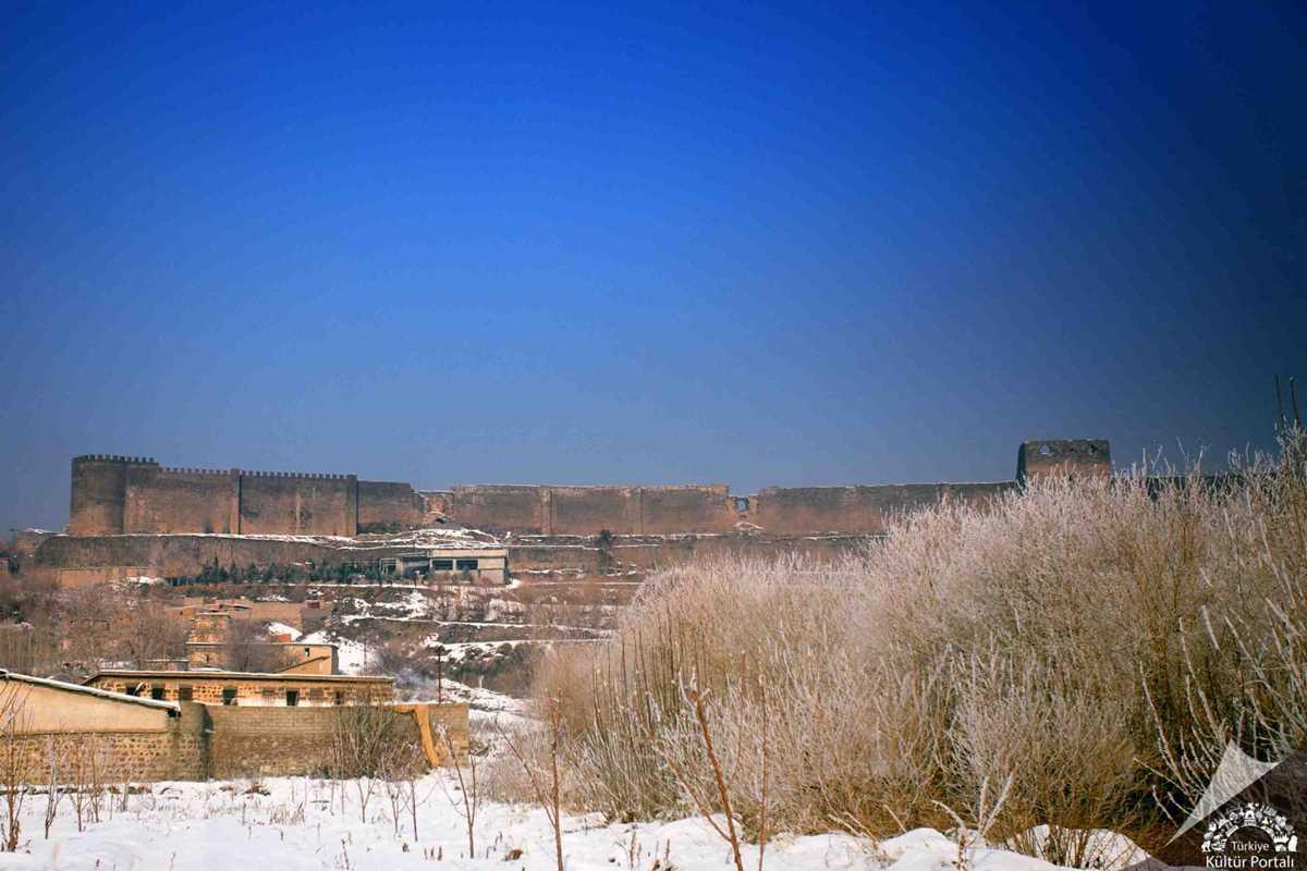
Diyarbakır Surları 2007 (Kültür Portalı)
The architectural activities of the Seljuk, Artuqid, Ayyubid, and Ottoman civilizations ensured the continued defensive function of the walls. Within the Outer Citadel, numerous civil architectural structures such as mosques, caravanserais, bathhouses, and madrasas were constructed, integrating military and civilian settlement areas. The primary building material used in these constructions was black basalt stone from the region, and lime mortar was employed to bind the stones. Relief carvings depicting suns, stars, double-headed eagles, lions, and scorpions, along with inscriptions in Arabic and Persian, were added to the surfaces of the towers. As a result of this historical process, the defensive structures evolved into a unified architectural ensemble incorporating the construction techniques of the ruling civilizations.
The Diyarbakır Walls form a monumental defensive system shaped like a shield due to topographical conditions, consisting of two main sections: the Outer Citadel and the Inner Citadel. The structure extends 1700 meters from east to west and 1300 meters from north to south. The total area covered by the walls, including the Inner Citadel, is approximately 1.57 square kilometers. This architectural complex, situated on a volcanic basalt plateau extending from Karacadağ to the Tigris River, has physically defined the city’s boundaries and urban fabric throughout history.
When examining the perimeter lengths, the Outer Citadel, which encircles the city, measures 5200 meters. The portion of the Inner Citadel that lies within the outer walls has a length of 599 meters, bringing the total perimeter of the entire system to approximately 5800 meters. The wall height varies between 8 and 12 meters along the main line, reaching up to 22 meters at certain points. Wall thickness ranges between 3 and 5 meters. The system features 82 defensive towers in the Outer Citadel and 19 towers in the Inner Citadel.
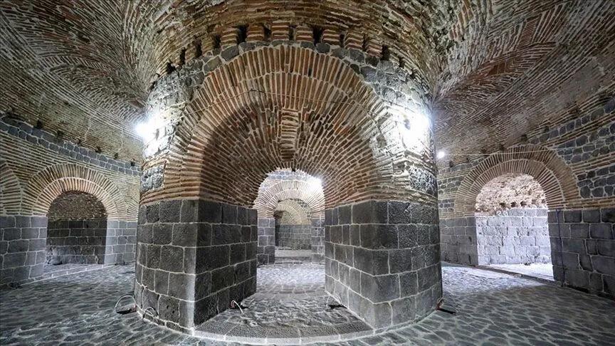
Diyarbakır Surları İçi (Anadolu Ajansı)
In earlier periods, to enhance the city’s defensive capacity, the Outer Citadel was designed with two parallel wall layers and a moat system. The outer wall was lower, while the inner wall, directly surrounding the city, was built higher. Between these two walls, a defensive moat was constructed, narrowing from 15 meters in the north to 6 meters in the south. Over time, due to urban changes and destruction, the outer low wall and the moat structure largely disappeared, leaving only the single main wall line intact today.
The Inner Citadel is located on the northeastern edge of the city, atop the steep and elevated rocky terrain known as Fis Kayası (Virantepe), overlooking the Tigris Valley. Thanks to the natural defensive advantages provided by the topography, the Inner Citadel has a pentagonal plan and is physically isolated from the city by an intermediate wall called Hendekönü. The Inner Citadel reflects the structural characteristics of the Outer Citadel on a smaller scale and served throughout history as the city’s administrative, governing, and military assembly center.
During Ottoman activities between 1524 and 1526, the area of the Inner Citadel was expanded, and 16 additional towers were constructed along new wall sections. As a result of these expansions, the Inner Citadel became a monumental internal defense mechanism with 19 towers. Within the boundaries of the Inner Citadel, throughout history, administrative, military, and religious structures such as beylerbeyi palaces, military barracks, prisons, courthouses, churches, cisterns, and the Hz. Süleyman Mosque were organized.
The Diyarbakır Walls feature four original main gates, positioned according to cardinal directions and connected to the city’s principal trade routes. These gates, located on the Outer Citadel walls, are named Dağ Kapı (Harput Kapı) to the north, Urfa Kapı (Rum or Halep Kapı) to the west, Mardin Kapı (Tell Kapı) to the south, and Yeni Kapı (Su or Satt Kapı) to the east, opening toward the Tigris River. These gates represent the endpoints and exits of the main north-south and east-west transportation axes established in Hellenistic and Roman urban planning.
Archival records confirm that until the early 20th century, these four main gates were opened at sunrise and closed at sunset for security and control purposes. Special guards and clerks responsible for inspecting travel permits (mürur tezkere) were assigned to each gate to ensure passage security. In addition to these main gates, two secondary gates—Çift Kapı (Hindibaba Kapı) and Tek Kapı—were added during the Republican period to meet increasing traffic and transportation needs along the Outer Citadel walls.
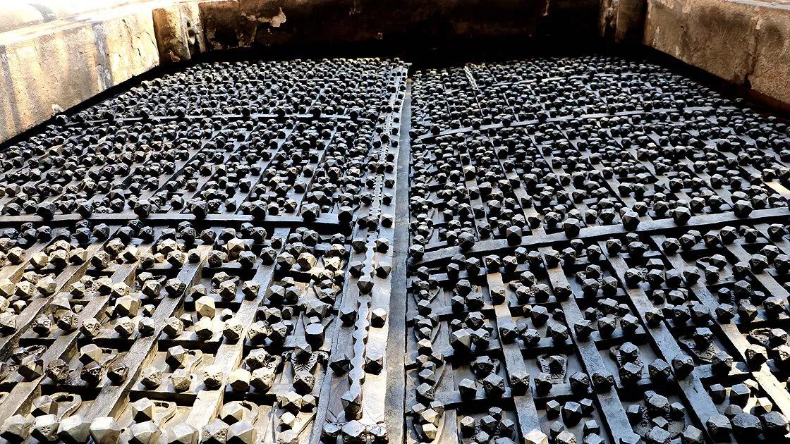
Diyarbakır Surları Kapı (Anadolu Ajansı)
Four gates were also constructed within the Inner Citadel, the city’s administrative center, to control access. Saray Kapı and Küpeli Kapı are designed inward, connecting the Inner Citadel to the urban fabric of Suriçi. In contrast, Fetih Kapı and Oğrun Kapı are designed to open directly outward, with Oğrun Kapı providing a strategic route descending into the Tigris Valley.
Examining the architectural characteristics of the gate passages, it is evident that the gate openings were generally constructed using arch forms. The gate systems were made of thick wooden materials to enhance resistance against external forces and covered with iron, copper, or bronze plates nailed onto the surface. Metal clappers known locally as “şak-şak” and multiple locking mechanisms were used on the gate wings.
Dağ Kapı has a flat lintel on its inner face and a semicircular arch on its outer face, measuring 2.50 meters in width and 4.55 meters in height. This gate is slightly emphasized forward by square columns and detailed with niches containing reliefs and inscriptions on its upper sections. Urfa Kapı has three separate passage openings (K1, K2, K3), with the central main gate (K2) featuring a monumental semicircular arch design, later raised to a width of 5.63 meters and a height of 11.20 meters. Yeni Kapı was constructed as a single-entry, low-arched structure accessed via a ramp system built against the steep slopes of the Tigris River.
The structural resilience and defensive strategy of the Diyarbakır Walls are organized around a total of 101 monumental towers—82 in the Outer Citadel and 19 in the Inner Citadel. The placement and spacing of the towers are not uniform but determined entirely by the natural defensive features of the topography. Due to the natural security provided by precipices facing the Tigris Valley in the eastern and southern sections, towers are spaced more widely apart. In the most vulnerable northern and western sections (between Dağ Kapı and Urfa Kapı), towers were constructed at close intervals of approximately 40–45 meters to maximize fortification.
In terms of geometric form, the towers are classified into three main typologies: circular, square, and polygonal. Circular-plan towers, offering a 180-degree wide observation angle and high static resistance to impact, were generally preferred along the vulnerable northern and western lines. The towers numbered 25 to 56, covering the area around Yeni Kapı in the eastern and southern parts of the city, are predominantly square-plan. Polygonal-plan towers, such as pentagonal or hexagonal ones (e.g., towers 4, 41–44, and 48), were applied at specific corners and critical access points.
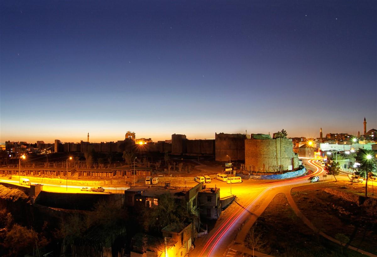
Gece Vakti Diyarbakır Surları (Diyarbakır Valiliği)
The architectural dimensions of the towers exceed the standard height and thickness of the wall sections. Their base heights vary between 8 and 22 meters, with measurable heights of surviving towers generally falling within the 20-meter range. Wall thicknesses on the eastern façades range from 1.40 to 2.60 meters, while on the circular-plan towers of the western and northern sections—where structural load and attack risk are highest—wall thicknesses reach 4.5 to 5.0 meters.
In terms of spatial organization, the towers were constructed as two-, three-, or four-story structures following a functional hierarchy. The windowless, dark ground floors, aligned with the city’s ground level, served as storage areas for military supplies, weapons, grain, and logistical materials. The first and second floors above, featuring ventilation openings, niches, and spacious rooms, were used as barracks and active defense spaces for soldiers.
Architectural mastery is evident in the ceiling systems of the soldier quarters: the upper roofs of the spaces were closed using barrel vaults, domes, and elliptical domes constructed by laying bricks in a herringbone pattern. Corbelled cornices and pendentives were used in dome transitions. Access between floors and to the uppermost terrace level was provided by stone staircases hidden within the structure or added to the inner-facing surfaces of the walls. The uppermost terrace levels (seğirdim yolları) are open combat areas surrounded by parapets (mazgallar) that provide protection against incoming arrows and cannon fire.
To maintain the static balance of the walls and massive towers over centuries, supporting architectural elements were employed. To reduce lateral loads caused by the walls’ length and enhance wall resistance, stone buttresses (support walls) were constructed perpendicular to the straight wall sections between towers. These buttresses were not placed at standard intervals but positioned according to the slope of the ground and the structural needs of the wall to ensure the building’s structural integrity.
The primary building material of the Diyarbakır Walls consists of black and dark gray basalt rocks extracted from the Karacadağ volcanic formations. The active eruption process of the Karacadağ volcano, spanning from 11 million years ago to 100,000 years ago, produced a massive lava flow covering an area of 10,000 square kilometers and reaching a thickness of 80 meters. The historic city is situated on this volcanic basalt plateau, 100 meters above the Tigris Valley. The exclusive use of dark volcanic stone in wall construction led to the city being historically referred to in records as Karaamid, Karakale, and Karahamid. Basalt, a volcanic rock, exhibits properties of non-absorbency and non-corrosion, demonstrating high physical resistance to frost, impact, and abrasion.
Two distinct types of basalt were used in wall construction, determined by the cooling processes of the Karacadağ lava flows: porous and non-porous. The type containing large voids due to trapped gas bubbles during cooling is called “female basalt.” This porous structure has a high capacity for water absorption and heat retention. Due to its large pores, achieving a smooth and even surface is technically difficult, resulting in a coarser texture. The water-retaining property of this porous stone creates a cooling effect in interior spaces, making female basalt the preferred material for non-load-bearing partition walls, courtyards, and eyvan floors.
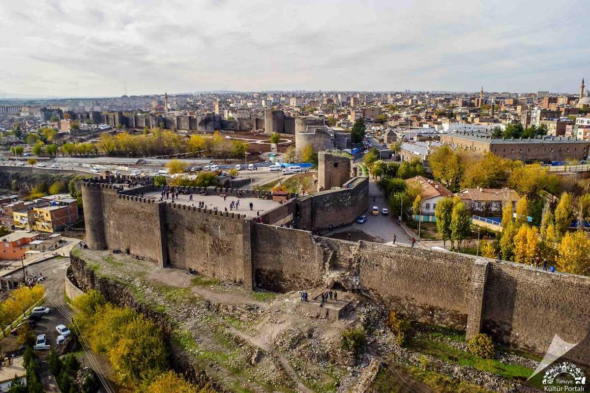
Diyarbakır Surları 2013 (Kültür Portalı)
The volcanic rock type with a smoother, harder surface and no gas voids is called “male basalt.” Male basalt exhibits significantly higher compressive and load-bearing strength compared to the porous type, though it is more difficult to work with. Due to its high static strength, non-porous basalt was used as the primary material in the main load-bearing walls, columns, column capitals, door and window lintels, thresholds, pools, cornices, and crenellations. Extraction of both stone types was carried out primarily from the cooling fractures on the eastern and southern parts of the basalt plateau, using the buffer zone along the Tigris River slopes.
The dimensions and weights of the basalt stones used in wall construction vary significantly according to their structural and architectural functions. Standard wall block heights range from 20 to 60 centimeters, lengths from 30 to 100 centimeters, and thicknesses from 20 to 50 centimeters. Individual weights of these wall blocks range from 25 to 300 kilograms. Basalt blocks used for specialized architectural elements such as arch stones, lintels, voussoirs, column capitals, and profile cornices exceed standard dimensions and total mass. During the initial construction and repair phases, these massive blocks were entirely shaped by hand.
In addition to basalt, white and yellow limestone (lime) stone, containing over 90% calcium carbonate, was used at specific locations in wall construction. Limestone, much easier to cut and carve than basalt, was preferred for inscriptions, reliefs, moldings, and decorative door details. The limestone was quarried from mines in the Ergani district, located 56 kilometers northwest of the city, and transported to the construction site. Alternating rows of dark gray basalt blocks and white limestone stones created two-tone checkerboard wall patterns on certain building façades.
The primary mortar binding the stone masonry and giving the structure its monolithic character is Horasan mortar, made by mixing river sand, lime, and crushed brick in specific proportions. This special lime-based mortar exhibits exceptional resistance to water erosion and harsh weather conditions. During Roman-era construction and emergency repairs, the “hot mortar” technique was applied, using lime immediately after burning and slaking without waiting. To enhance the chemical bonding and physical strength of the mortar, a special gray soil with pozzolanic activity, locally sourced, was added to the mixture.
The composition of the lime-based mortars used in the inner and outer layers of the walls varied across different repair periods. The proportions of river sand and lime, as well as the particle size of the sand in microns, differed depending on the technological capabilities and material availability of each era. Recent laboratory analyses indicate that the original mortar contains 35–40% slaked and aged lime, 45–50% washed river sand, and 5–10% stone dust. To increase volume and improve interlocking between stones, pebble fragments measuring 1 to 1.5 cubic centimeters were added to the lime paste.
In addition to stone and mortar, locally produced adobe bricks, manufactured from soil compatible with the region’s geology, were actively used in wall construction. Brick material was primarily used as the main structural element in the construction of barrel vaults, spherical domes, and ceiling systems of staircases within the towers. Bricks, varying in size and application method according to the historical period, were positioned to carry structural loads in curved transitions of vaults and arches. These brick courses in the ceilings were laid with light-colored mortar and left exposed without plastering.
The wall masonry of the Diyarbakır Walls employs a triple-layered rubble construction technique consisting of an outer façade, an inner façade, and a core infill layer between them. The walls facing outward, forming the front of the defensive line, are built with large, precisely cut and dressed basalt stones arranged in a highly regular pattern. In contrast, the inner walls facing the city use irregularly sized rough-cut stones and a sequential rubble masonry pattern. Wall thickness varies according to the underlying terrain: on rocky ground in the eastern sections, thickness ranges from 1.50 to 2.00 meters, while in the western sections with higher topographic risk, it reaches up to 5.00 meters.
Wall thickness exhibits a decreasing profile along the vertical axis, dependent on structural loads. At ground level, wall width reaches up to 4.40 meters and gradually narrows toward upper levels and terraces. In the outer façade’s cut-stone masonry, the bedding and side surfaces of stones are precisely carved to form right angles, and stones are fitted together using the “zero joint” technique, eliminating any visible gaps. In the rubble masonry of the inner façades, average joint gaps of two centimeters are left between stone blocks and filled with rich lime-based binding mortar.
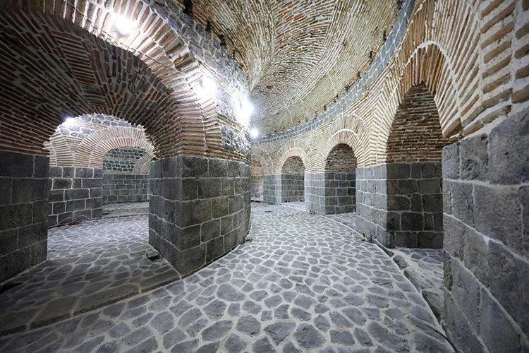
Diyarbakır Surları İçi (Anadolu Ajansı)
The internal volume between the outer and inner stone façades is filled with a thick core infill layer composed of a mixture of lime-based mortar and coarse and fine rubble stones. This core infill mechanically connects both rigid surfaces, enabling the wall to act as a rigid mass. Horizontal brick courses are laid within the inner façade walls, between stone layers, extending along the horizontal axis. These horizontal brick bands counteract lateral pressures generated by the rubble infill, enhancing the structure’s flexibility and overall resistance to tensile and shear forces.
To prevent separation and outward bulging of the massive walls, special bonding stones were integrated into the outer façade. These cylindrical basalt blocks, known as “kılıç taşı” (sword stone), extend up to two-thirds of the wall’s thickness. Embedded deeply from the outer surface into the core infill, these anchoring elements strongly lock the outer cladding to the inner core. This anchoring system was particularly employed in weak soil areas such as towers 9 and 10, where groundwater levels are high and bedrock is absent, to preserve the wall’s structural integrity.
In the interior spaces of the towers, brick masonry was used to construct various forms of arches, vaults, and domes. In U-shaped towers, barrel vaults and spherical half-domes extending from them are commonly used. In areas with rounded niches, full domes are placed on pendentives to span the openings. In these curved transitions, bricks are laid in a herringbone pattern, with their narrow surfaces facing inward. To prevent vertical joints from aligning, a staggered arrangement was employed, and surfaces were left unplastered.
To counteract lateral pressures along the long straight sections of the walls and ensure static balance, rectangular buttresses (support walls) were added, intersecting the main wall at right angles. The primary engineering function of these buttresses is to support the center of gravity of tall walls and prevent outward toppling. The buttresses were not arranged at standard intervals but positioned according to the wall’s height, ground topography, and turning angles in the plan axis. These support units, with widths up to 2 meters and outward projections up to 1.80 meters, contribute to the resistance of the outer wall system.
Another architectural element that adds layering to the defense mechanism is a parallel structure 1.80 meters thick, located in front of the main wall and known as the “hendek önü duvarı” (moat-front wall). This outer barrier wall was constructed based on the principle of compressing rubble stones between two vertically dressed stone surfaces using a mixture of lime and mortar. The basalt stones covering the outer surface of this wall, arranged in a sloping form, have an average height of 40 to 45 centimeters and a wall thickness of approximately 35 centimeters. This secondary wall system defines the boundary of the moat while simultaneously forming the first line of defense before reaching the main wall.
Under the areas adjacent to the moat-front wall and below the terrace level, approximately 2-meter-wide underground passageways covered with brick barrel vaults were designed for defense and logistical purposes. These corridors, equipped with firing apertures facing the outer wall, provided secure and enclosed military communication between distant defense points. Simultaneously, these vaulted internal passages reduced the weight of the upper stone wall mass, thereby decreasing the overall structural load on the walls and preventing collapse under their own weight—an intelligent engineering function.
The plastic elements of the Diyarbakır Walls consist of inscriptions, human figures, animal figures, botanical motifs, and geometric symbols. Black basalt stone served as the primary substrate for these elements, while white and yellow limestone (lime) stone was used for detailed carvings. Decorations were executed using techniques such as carving, low relief, high relief, sgraffito, and curved cutting. Due to the hardness of basalt, which limits fine craftsmanship, limestone stone from the Ergani region was preferred for inscriptions and detailed reliefs. In the spatial organization of plastic elements on architectural surfaces, symmetry rules were generally followed, and compositions were framed within specific outer boundaries or niches. The color contrast between black basalt and white limestone enhanced the visual definition of the reliefs.
A total of 63 inscriptions, written in different alphabets and languages, have been identified on the walls and monumental towers, documenting the city’s historical construction layers. Six of these inscriptions date to the Byzantine period, four in Greek and one in Latin. The remaining inscriptions were added during the Islamic period. Islamic-era inscriptions were predominantly carved in Arabic using Arabic script during the Umayyad, Abbasid, Marwanid, Great Seljuk, Damascus Seljuks, Inalids, Nisanoğulları, Artuqid, Ayyubid, and Akkoyunlu administrations. Ottoman-era inscriptions from the 1525–1527 wall repairs used Persian and Ottoman Turkish. Inscription blocks were generally positioned horizontally around the outer bodies of the towers, forming continuous bands during construction or repair phases.
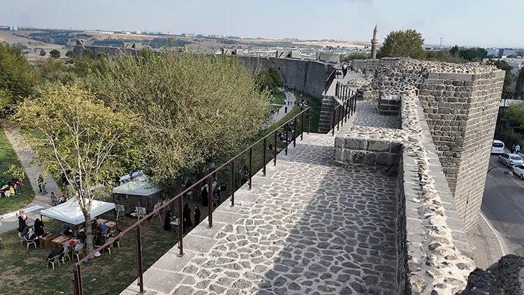
Diyarbakır Surları (Anadolu Ajansı)
The most frequently used script in Islamic-era stone carving is Kufic. Kufic inscriptions on tower surfaces were designed using straight, slanted, and transitional geometric forms and executed in high relief. The Kufic inscriptions on the main façades of the Yedi Kardeş, Ulu Beden, and Selçuklu towers are integrated into a unified decorative band combining botanical motifs, rumi patterns, and curling branches. The spaces between the inscription lines and the outer edges of the inscription frames are filled with geometric stone knots and multi-pointed star motifs. Lion figures, predatory birds, or small bull-head reliefs are directly integrated at the physical start and end points of the Kufic bands near Dağ Kapı, Mardin Kapı, and Urfa Kapı. The ends of Kufic letters often transform into botanical forms, concluding the composition.
Human figure reliefs are relatively limited in the monumental plastic repertoire of the walls. On the front face of the Akrep Burcu, completed during the Ayyubid period, a nude male figure seated in a cross-legged position is carved within a circular stone medallion 30 centimeters in diameter. In this high-relief composition, the figure holds a vertical staff in its right hand, rising to shoulder height with a conical object at its tip. In its left hand, the figure holds a scorpion clearly depicted with a dangling tail, segmented body, and two-pronged pincers. On the outer façades of the Selçuklu and Nur towers, detailed female figures are depicted, with their heads shown frontally, body contours in profile, hair carved at chin level, and seated in a cross-legged posture.
Among animal figure reliefs, lions and bulls are the most numerous. The lion figures on Dağ Kapı, Ulu Beden, and Yedi Kardeş towers are rendered with deeply carved external contours, with muscle and mane systems emphasized by curved geometric lines. Compositions depicting a physical struggle between lions and bulls are found on the outer gate wall of Dağ Kapı and on Artuqid inner arch surfaces. In these scenes, the upper lion has all four legs extended and its tail curved inward toward the back region, while the lower bull figure is shown entirely in profile with a bowed neck. The bull’s facial anatomy features deeply carved eye sockets and a straight, cut-line mouth. Similar lion-bull figures at the city gates are also designed in high relief and monumental scale.
Composite creatures combining anatomical features of different species are among the most monumental examples of the walls’ plastic decoration. On the right and left ends of the main inscription bands surrounding the Ulu Beden and Yedi Kardeş towers, sphinx reliefs are found, with human heads and lion or bird bodies. The carved tails of these sphinxes and winged lions curve upward between the hind legs, forming a circular arc and terminating in a pointed dragon head. Similarly, double-headed eagle reliefs, with their wingtips shaped directly into dragon heads, are applied to basalt surfaces. Dragon depictions, as anatomical extensions of the double-headed eagles, winged lions, and sphinxes, are detailed with hollow almond-shaped eyes and prominent jaw structures.
Predatory birds and horse figures were incorporated into the plastic organization of the defensive walls through large-scale carving. On the front façade of Nur Burcu, two horse reliefs, depicted galloping with saddles and tack but without riders, are placed horizontally on a porous female basalt surface. The horses’ tails are tied into knots, and all leg and neck muscles are clearly carved in profile. The eagle and falcon figures on the surfaces of the Great Selçuklu Burcu and Dağ Kapı have wings spread backward into five distinct fan-like segments, swollen chest cavities, and downward-curving hooked beaks. Most eagle reliefs are depicted either clutching prey tightly in their talons or positioned directly above a severed bull’s head.
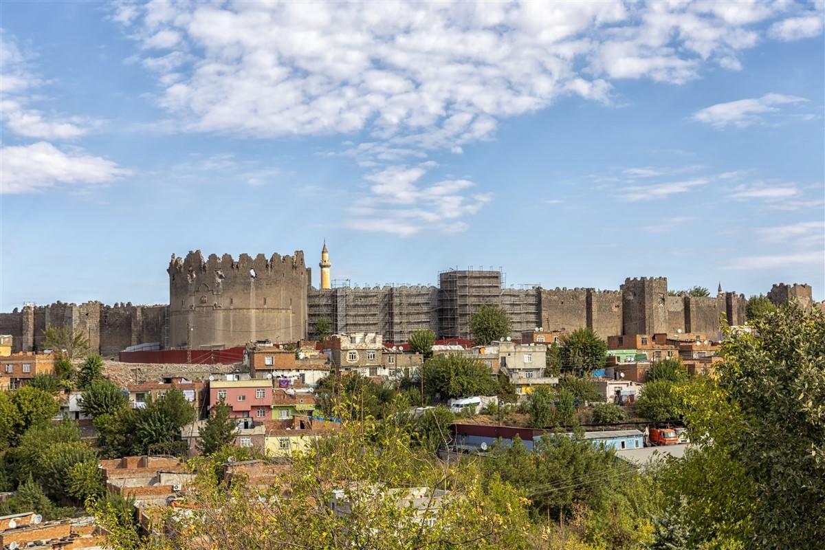
Diyarbakır Surları (Diyarbakır Valiliği)
Botanical motifs are applied on basalt and limestone surfaces through a combination of naturalistic curves and rigid geometric lines. At the center of the stone composition on the Dağ Kapı façade, completed during the 9th-century Abbasid period, a tree relief is positioned, with its trunk formed by vertical straight lines and branches extending horizontally in two directions. In this design, spanning three separate basalt blocks, bird figures with extended beaks are placed toward the upper part of the tree, and two lion figures are symmetrically positioned at the base of the roots. The tree’s roots, trunk, and drooping branches are schematized on the main stone surface using clear, deep geometric lines without detailed leaf textures. Some six-leaf botanical motifs at gate entrances are arranged in an interlocking pattern of closed geometric ornaments.
Geometric shapes and cosmological symbols actively appear on tower surfaces and gate lintel arches as supportive plastic elements. On the façades of Dağ Kapı and Keçi Burcu, independent symbols such as gamma-shaped crosses within square frames, interlocking hexagonal stars, multi-centered circles, and continuous meander motifs are carved into the stone surface. Circular sun motifs with detailed rays are added to the center of some animal reliefs or exactly between two figures. These sun depictions vertically divide stone scenes featuring two opposing animals, such as lions and wolves, forming a circular compositional axis. All these reliefs in the walls’ plastic inventory serve as tangible architectural components documenting the stone-carving techniques and proportional geometry skills of the artisans active during the city’s construction periods.
The Diyarbakır Walls lost their military defense function from the late 19th century onward. Under increasing population pressure and spatial mobility demands, the northern entrance gate and some wall sections were demolished in 1916 to open İzzet Paşa Caddesi, enabling urban expansion beyond the walls. By the 1930s, the Yenişehir district was developed to the west of the city for public buildings and new housing. As part of these urban expansion strategies, some towers and wall sections near Dağ Kapı were demolished using dynamite in 1930 on the grounds that the walls obstructed air circulation. As a result of these demolitions, five monumental towers were completely eliminated.
The demolition process was halted in 1932 following the scientific report prepared by Albert Louis Gabriel, who conducted archaeological investigations in the region. In his report submitted to the Ministry of National Education, Gabriel documented the historical, architectural, and epigraphic value of the walls and proved with topographic data that their demolition would not improve the city’s health or wind conditions. As a result, demolition activities ceased and structural repairs were carried out on damaged foundation sections. From the 1950s onward, accelerated rural-to-urban migration led to unauthorized upper floors and additions being built on traditional housing units in the Suriçi area. In the 1980s, waves of migration intensified due to security concerns, subjecting the historic urban site to physical and spatial degradation.
Diyarbakır Surları Onarım (Anadolu Ajansı)
A 103-day conflict period, beginning on 2 December 2015 and ending on 9 March 2016 in the Suriçi region, caused large-scale spatial damage. During the conflict, curfews were imposed in six of the 16 neighborhoods comprising Suriçi (Cemal Yılmaz, Cevatpaşa, Dabanoğlu, Fatihpaşa, Hasırlı, and Savaş) and along Gazi Caddesi. Before the conflict, there were 8,935 structures in the area; as a result of the events, 3,569 of these were completely destroyed. Of the demolished structures, 87 were registered monumental or civil architectural works, and 247 were traditional structures worthy of registration. Spatial analyses using satellite imagery revealed that structural fabric was entirely lost over 46.3 hectares of the 75.3-hectare total area of the six curfew zones. The rate of destruction reached 61% spatially and 72% structurally.
The conflict directly inflicted physical damage on the historic wall sections and monumental towers listed on the UNESCO World Heritage List. Concrete was poured into the foundations, interior spaces, and roofs of Yenikapı Burcu, Keçi Burcu, and Fındık Burcu. Portable toilets were constructed on top of Keçi Burcu, and wastewater was directly discharged onto the historic wall surfaces, creating conditions for chemical degradation. At Mardin Kapı, the foundations of security structures built over buried wall remains were damaged by clean and wastewater channels. Fires lit for heating in wall sections used as security points caused darkening, soot layers, and thermal cracks on basalt and brick surfaces.
Following the end of the conflict, on 21 March 2016, the Council of Ministers issued a decision for “expropriation” of immovable properties, initiating an urban transformation process.
In 2000, the Ministry of Culture and Tourism submitted an application to include the Diyarbakır Walls and Hevsel Gardens on UNESCO’s Tentative World Heritage List. The official organization of the candidacy process and dossier preparation began in 2012 with the participation of the Ministry of Culture and Tourism, Diyarbakır Governorship, Diyarbakır Metropolitan Municipality, and local civil society organizations.In 2013, the Ministry of Culture and Tourism officially declared the year “Diyarbakır Walls Year,” allocating 20 million Turkish Liras for national and international promotion and infrastructure activities. The comprehensive scientific report-based UNESCO World Heritage Candidacy Dossier was submitted to UNESCO authorities in 2014 through the relevant ministry.
Simultaneously and in support of the UNESCO candidacy dossier, the Diyarbakır Citadel and Hevsel Gardens Cultural Landscape Area Management Plan was developed with the goal of preserving the city’s historical and cultural diversity for future generations. Under the coordination of the Area Management Directorate within Diyarbakır Metropolitan Municipality, an interdisciplinary committee composed of archaeologists, landscape architects, urban designers, and city planners established decisions based on scientific and holistic criteria. Local and academic stakeholders such as TMMOB Chamber of Architects, Chamber of City Planners, and Dicle University Environmental Problems Application and Research Center actively participated in the plan’s development process.
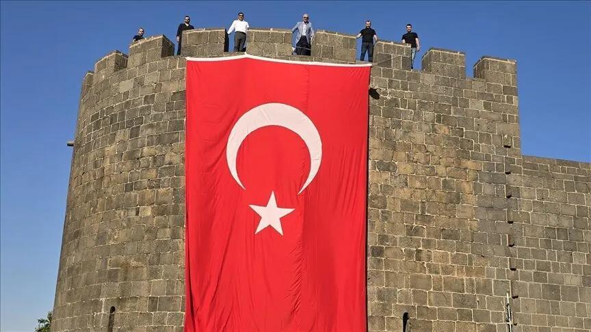
Under the Area Management Plan, registered protection areas are divided into three distinct physical zones. The central protection zone, known as the “Heritage Area,” measures 520.76 hectares, including the Inner Citadel and wall sections. The “Suriçi Buffer Zone” surrounding the Heritage Area covers 132.20 hectares, and the “Tigris Valley Buffer Zone,” where agricultural activities are conducted to the east of the city, is delimited at 1,289.69 hectares. In total, 1,942.66 hectares of urban, historical, and natural areas are included within the official protective boundaries.
Diyarbakır Surları (Anadolu Ajansı)
The fundamental aim of the Area Management Plan is to inventory tangible and intangible cultural heritage, elevate restoration quality to high standards, and transfer the monuments to future generations with minimal intervention. Within the plan, training local labor for restoration activities, establishing a specialized conservation laboratory, and integrating the towers into social and tourism functions under a comprehensive plan are identified as strategic actions. Creating an inventory of the rural landscape texture of the Hevsel Gardens and ensuring the sustainability of the natural ecosystems along the Tigris Riverbank are included as indispensable natural heritage objectives.
At the 39th UNESCO World Heritage Committee meeting held in Bonn, Germany, from 28 June to 8 July 2015, technical evaluations were completed. Based on a unanimous decision by committee members with 121 votes, “Diyarbakır Citadel and Hevsel Gardens Cultural Landscape” was officially inscribed on the UNESCO World Heritage List. With this inscription, the area gained the status of Türkiye’s 14th UNESCO World Heritage site. Following this international inscription, the Walls and Hevsel Gardens attained global protection status as absolute heritage areas, while the Suriçi Region became a first-degree buffer zone.
Following the inscription decision, the UNESCO World Heritage Committee presented Türkiye, as the state party, with a list of scientific obligations to ensure the conservation and sustainability of the site’s Outstanding Universal Value. New procedures based on scientific data were urgently required for the restoration, structural documentation, and periodic maintenance of the wall sections. Improvement of the drainage system was requested to control vegetation near the walls and prevent groundwater from damaging the bedrock. Additionally, the continuous production function of the Hevsel Gardens required the mapping and documentation of current agricultural and water management systems.
Just five months after the UNESCO inscription, the 2015–2016 urban conflicts in Suriçi rendered the 2012-approved Conservation Master Plan and the 2014-approved Area Management Plan physically and administratively unimplementable. UNESCO reviewed damage and action reports submitted by Türkiye and issued committee decisions calling for the suspension of the 2016 revised Conservation Plan, which damaged the traditional fabric of Suriçi. It was mandated that Environmental Impact Assessment reports for any new urban transformation and infrastructure projects within or outside the walls be submitted to the committee at early stages to identify potential harm to the site’s Outstanding Universal Value.
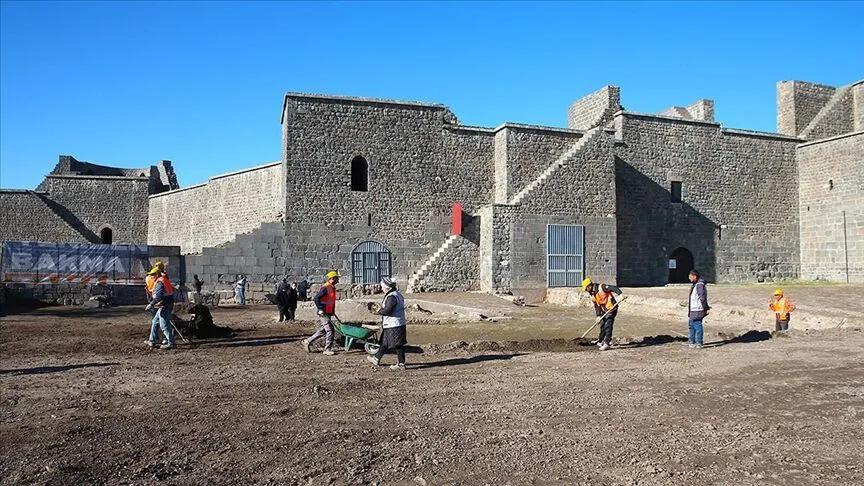
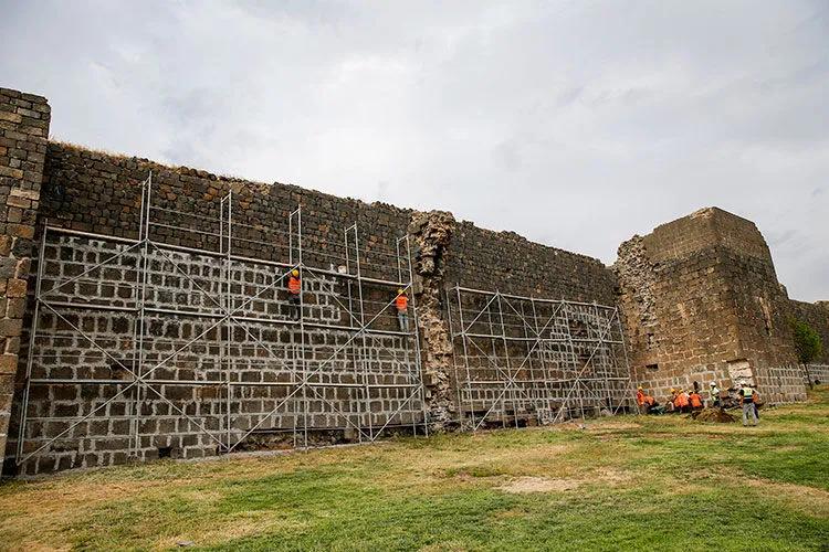
Following the urban conflicts, a comprehensive restoration project under the motto “Revival of the Walls” was launched under the coordination of Diyarbakır Metropolitan Municipality and the Ministry of Environment and Urbanization to preserve the physical integrity of the walls. Designated as the largest restoration effort in the history of the Republic, this project was divided into eight separate tender stages with a total budget of 300 million Turkish Liras. Before the project, documentation studies determined that 98 of the 101 monumental towers had survived to the present day; restoration of 70 towers has since been completed. Restoration priority was given to monumental structures with high static risk, such as Keçi Burcu, Ulu Beden Burcu, Yedi Kardeş, Benusen, Selçuklu, and Nur towers. The entire restoration process is conducted under the supervision of a Consultative Board composed of experts and academic scholars affiliated with the Ministry of Culture and Tourism.
At the initial stage of restoration, the dark interior spaces, ground floors, and enclosed passageways of the towers were cleared of accumulated soil, debris, and rubble from decades of neglect. The use of heavy machinery, hammers, and breakers was strictly prohibited to protect the structure from vibrations. Fine handcrafting was preferred to preserve the original patina of the materials; soot, paint, and organic contaminants on stone surfaces were cleaned stone by stone using water, soft brushes, and low-pressure micro-sandblasting techniques. New basalt stone blocks added during restoration were hand-carved to match the overall form, staggered masonry pattern, and historical “zero joint” system of the walls.
Sensitive engineering techniques were applied to remove concrete additions resulting from previous faulty repairs. During the dismantling of the low-quality concrete slab on the Mervani Mosque atop Dağ Kapı Burcu, the direct diamond-wire cutting method was used to prevent micro-cracks that vibrations could cause to the historic fabric. At restoration sites, detailed archaeological excavations reached foundation levels, uncovering the earliest wall foundation layers dating to 3000 BCE and two distinct arch remnants from Ottoman-era shops added in front of the walls. Original lime mortar and stone samples retrieved from excavations were analyzed in laboratory conditions to recreate authentic mortar components for structural reinforcement.
Diyarbakır Surları (Anadolu Ajansı)
To document the current structural and static condition of the walls non-invasively, a geophysical method called Ground Penetrating Radar (GPR) was deployed. Seismic surveys were conducted at Saray Kapı, Yeni Kapı, Mardin Kapı, Urfa Kapı, Tek Kapı, Çift Kapı, and Dağ Kapı using the Zond Python 3 GPR device and antennas with frequencies between 25–100 MHz. Ground surveys penetrated up to 10–20 meters in depth, while wall surveys reached 2–4 meters in thickness using electromagnetic waves. Analysis of the radar profiles revealed subsurface void structures, geometric behaviors of underground fractures, and stratigraphic changes invisible to the naked eye.
According to GPR data analysis, structural fractures and crack systems measuring 8 to 15 centimeters in size were detected within the core infill of the monumental towers and load-bearing systems. Due to the freeze-thaw effect of atmospheric water seeping into the gas voids of the porous female basalt stones, micro-cracks were measured within the walls. Localized subsidence and collapse deformations (anomalies) with depths ranging from 1.00 to 7.00 meters were identified at main gate foundations. These radar data provided absolute numerical references for restoration engineers regarding where to install structural anchors or inject hydraulic lime.
To document seismic damage caused by modern vehicle traffic to the historic gateways, three-axis ultra-sensitive accelerometers were used for vibration measurement analyses. Thirteen separate measurements were taken at eight different gate points, simultaneously recording vehicle axle weights, speeds, and types with the vibration waves generated in the walls. According to AASHTO (American Association of State Highway and Transportation Officials) standards, the fatigue and damage threshold for historic masonry structures is set at 2.5 mm/s. Measurements at the Diyarbakır gateways revealed that maximum particle velocity values remained below this damage threshold under current conditions.
Although current ground vibration levels from vehicle traffic do not pose an immediate risk of structural collapse, geophysical data confirm that continuous shaking causes long-term material fatigue in the wall core and leads to structural cracking. Measurements showed that inconsistencies and code differences in the asphalt and paving stones at gate passage zones increase the impact intensity of heavy wheels, thereby elevating lateral acceleration of the structure. Based on these findings, essential protection policies were proposed: reducing vehicle speed limits at gate passages, restricting heavy-load vehicle access, and installing stabilized drainage fills to prevent ground settlement and water pooling. It was decided that the condition of the walls must be continuously monitored using sensitive sensors and cameras to maintain control over vibration effects.
The Diyarbakır Walls constitute a multi-layered architectural ensemble shaped by successive construction activities of civilizations since antiquity, defining the physical boundaries and defensive strategies of the urban fabric. The monumental forms, epigraphic documents, and plastic elements on the structure provide concrete evidence of how ruling administrations organized military and urban space, presenting the region’s historical process as a physical inventory. Current instrumental measurements, geophysical surveys, and laboratory analyses demonstrate that preserving the static condition of the monumental towers, wall sections, and gate systems requires multidisciplinary conservation approaches grounded in geological and seismic data. Sustaining the physical integrity of this urban and military area with international protection status necessitates continuous monitoring of environmental, seismic, and anthropogenic damage factors using advanced technologies, periodic documentation updates, and full implementation of urban area management plans based on the principle of minimal intervention.
Akoğlan, Mehmet. “Diyarbakır Surları.” Türkiye Turizm Ansiklopedisi. Accessed July 1, 2026.https://turkiyeturizmansiklopedisi.com/diyarbakir-surlari
Anadolu Ajansı. "Tarihi surlar, millet bahçesine kavuştu." Accessed July 1, 2026.https://www.aa.com.tr/tr/pg/foto-galeri/tarihi-surlar-millet-bahcesine-kavustu/0
Anadolu Ajansı. “Diyarbakır Surları UNESCO yolunda.” Accessed July 1, 2026.https://www.aa.com.tr/tr/kultur-sanat/diyarbakir-surlari-unesco-yolunda/187303
Anadolu Ajansı. “Diyarbakır Surları restore edilen ihtişamlı kapılarına birbiri ardına kavuştu.” Accessed July 1, 2026.https://www.aa.com.tr/tr/kultur-sanat/diyarbakir-surlari-restore-edilen-ihtisamli-kapilarina-birbiri-ardina-kavustu-/2405414
Anadolu Ajansı. “Diyarbakır Surları ve Hevsel Bahçeleri, 8 yıl önce UNESCO Dünya Mirası Listesi'ne alındı.” Accessed July 1, 2026.https://www.aa.com.tr/tr/pg/foto-galeri/diyarbakir-surlari-ve-hevsel-bahceleri-8-yil-once-unesco-dunya-mirasi-listesine-alindi/0
Anadolu Ajansı. “Diyarbakır Surları'nın bazı burçlarına ziyaretçilerin düşme riskine karşı korkuluk takılıyor.” Accessed July 1, 2026.https://www.aa.com.tr/tr/gundem/diyarbakir-surlarinin-bazi-burclarina-ziyaretcilerin-dusme-riskine-karsi-korkuluk-takiliyor/3357991
Anadolu Ajansı. “Diyarbakır surları UNESCO yolunda.” Accessed July 1, 2026.https://www.aa.com.tr/tr/yasam/diyarbakir-surlari-unesco-yolunda/415542
Anadolu Ajansı. “Diyarbakır'da tarihi surun bir bölümü gün yüzüne çıkarıldı.” Accessed July 1, 2026.https://www.aa.com.tr/tr/kultur/diyarbakirda-tarihi-surun-bir-bolumu-gun-yuzune-cikarildi/3774634
Anadolu Ajansı. “Diyarbakır'ın tarihi surları 5 milyon turist hedefiyle ihtişamlı hale getiriliyor.” Accessed July 1, 2026.https://www.aa.com.tr/tr/kultur-sanat/diyarbakirin-tarihi-surlari-5-milyon-turist-hedefiyle-ihtisamli-hale-getiriliyor/2367288
Anadolu Ajansı. “Dünya mirası 'Diyarbakır Surları' restorasyonla geleceğe taşınıyor.” Accessed July 1, 2026.https://www.aa.com.tr/tr/kultur/dunya-mirasi-diyarbakir-surlari-restorasyonla-gelecege-tasiniyor-/2993301
Anadolu Ajansı. “Dünya mirası 'Diyarbakır Surları'ndaki 70 burç restore edildi.” Accessed July 1, 2026.https://www.aa.com.tr/tr/kultur/dunya-mirasi-diyarbakir-surlarindaki-70-burc-restore-edildi/3093668
Anadolu Ajansı. “Tarihi Diyarbakır Surları'na 'Terörsüz Türkiye'ye destek için Türk bayrağı asıldı.” Accessed July 1, 2026.https://www.aa.com.tr/tr/gundem/tarihi-diyarbakir-surlarina-terorsuz-turkiyeye-destek-icin-turk-bayragi-asildi/3629416
Anadolu Ajansı. “Tarihi Diyarbakır Surlarına 'hassas' dokunuş.” Accessed July 1, 2026.https://www.aa.com.tr/tr/kultur-sanat/tarihi-diyarbakir-surlarina-hassas-dokunus/2456396
Atan, Ahmet. “Tarihi Estetik Değerleriyle Diyarbakır Surları.” Diyarbakır İl Millî Eğitim Müdürlüğü. Accessed July 1, 2026.https://diyarbakir.meb.gov.tr/www/turizm/icerik/16
Bilmez, Mehmet Mesut. “Diyarbakır Surları Üzerindeki Motiflerin Araştırılması ve Seramiğe Uyarlanması.” Master's thesis, Dokuz Eylül University Institute of Fine Arts, 2017. Accessed July 1, 2026.https://tez.yok.gov.tr/UlusalTezMerkezi/tezDetay.jsp?id=1SQWTvGWwazXvfvN79hGiw&no=aOtv4ukzeO9SY2DD5bswjw
Bozan, Özgür Haktan. “Diyarbakır 7, 8 ve 9 Numaralı Sur Burçları Çevresindeki Yeraltısuyu Problemi ve Drenaj Yöntemleri.” Master's thesis, Çukurova Üniversitesi Fen Bilimleri Enstitüsü, 2025. Accessed July 1, 2026.https://tezara.org/theses/920922
Culture Portal. "Diyarbakır Surları – Diyarbakır." Ministry of Culture and Tourism of the Republic of Türkiye. Accessed July 1, 2026.https://www.kulturportali.gov.tr/turkiye/diyarbakir/kulturenvanteri/diyarbakir-surlari
Culture Portal. "Diyarbakır Surları." Ministry of Culture and Tourism of the Republic of Türkiye. Accessed July 1, 2026.https://www.kulturportali.gov.tr/portal/diyarbakir-surlari
Diyarbakır Kent ve Tanıtım Portalı. "Diyarbakır Surlar." Accessed July 1, 2026.https://diyarbakir.org.tr/mekan/diyarbakir-surlar/
Diyarbakır İl Kültür ve Turizm Müdürlüğü. "Surlar." T.C. Kültür ve Turizm Bakanlığı. Accessed July 1, 2026.
Gülcemal, Beritan Adar. "Diyarbakır Suriçi Tarihi Yerleşim Alanında Yenilenen Konutların Çevresel Sürdürülebilirlik Kapsamında İrdelenmesi." Master's thesis, Yıldız Teknik Üniversitesi Fen Bilimleri Enstitüsü, 2024.
Güler, Mehmet Şakir. “Diyarbakır Sur Kapılarında Trafiğe Bağlı Titreşimlerin İncelenmesi ve Koruma Önerilerinin Geliştirilmesi.” PhD thesis, Dicle Üniversitesi Fen Bilimleri Enstitüsü, 2025. Accessed July 1, 2026.https://acikerisim.dicle.edu.tr/items/e8c8317a-0d67-4b3c-9590-023a17782007/full
Halifeoğlu, F. Meral, and Neslihan Dalkılıç. “Diyarbakır Surları ve Koruma Sorunları.” Mimarlık Dergisi. Accessed July 1, 2026.http://www.mimarlikdergisi.com/index.cfm?sayfa=mimarlik&DergiSayi=37&RecID=904
Kaya, Ergin. “Diyarbakır Surlarındaki Figüratif Öğelerin Plastik Analizi.” Master's thesis,Dicle Üniversitesi Institute of Educational Sciences, 2019. Accessed July 1, 2026.https://acikerisim.dicle.edu.tr/items/61226454-39bd-41bb-ad5a-b195377b8d43/full
Meşe, Abdullah. “Diyarbakır Surlarındaki Belli Başlı Kabartmaların Panofsky’nin İkonografik Çözümleme Yöntemi ile Analizi.” Master's thesis,Dicle Üniversitesi Institute of Educational Sciences, 2025. Accessed July 1, 2026.https://acikerisim.dicle.edu.tr/items/e8e49f55-b665-4a4b-985c-35ee03707961
Parla, Canan. “Diyarbakır Surları ve Kent Tarihi.” *Orta Doğu Teknik Üniversitesi Mimarlık Fakültesi Dergisi* 22, no. 1 (2005): 57–84. Accessed July 1, 2026.https://jfa.arch.metu.edu.tr/uploads/docs/sayilar/sayi-22-1/57-84.pdf
Pıçak, Murat, and Osman Eroğlu. 2018. “OSMANLI DÖNEMİNDE DİYARBAKIR’IN SOSYO-EKONOMİK YAPISI”. Dicle Üniversitesi Sosyal Bilimler Enstitüsü Dergisi, no. 20: 70–82. Accessed July 1, 2026.https://dergipark.org.tr/tr/pub/diclesosbed/article/920316?issue_id=61627
Seren, Rengin. "Çatışma Altındaki Dünya Miras Alanlarında UNESCO’nun ve Taraf Devletlerin Tutumu: Diyarbakır Surları, Hevsel Bahçeleri ve Suriçi Bölgesi." PhD thesis, Atılım Üniversitesi Fen Bilimleri Enstitüsü, 2023.
Sur Belediyesi. "Tarihçe." Accessed July 1, 2026.https://sur.bel.tr/tarihce
T.C. Diyarbakır Valiliği. "Diyarbakır Surları." Accessed July 1, 2026.https://www.diyarbakir.gov.tr/diyarbakir-surlari
T.C. Diyarbakır Valiliği. "Diyarbakır Surları." Accessed July 1, 2026. https://www.diyarbakir.gov.tr/diyarbakir-surlari
T.C.Sur Kaymakamlığı Governorship. "Diyarbakır Surları." Accessed July 1, 2026.https://www.sur.gov.tr/diyarbakir-surlari
TRT Avaz. “Dünya mirası 'Diyarbakır Surları' restorasyonla geleceğe taşınıyor.” Accessed July 1, 2026.https://www.trtavaz.com.tr/haber/tur/turkistandan/dunya-mirasi-diyarbakir-surlari-restorasyonla-gelecege-tasiniyor/650570fe3a5fbe2c9483c23c
TRT Haber. "5 bin yıllık Diyarbakır surlarının sırrı araştırılıyor." Accessed July 1, 2026.https://www.trthaber.com/haber/turkiye/5-bin-yillik-diyarbakir-surlarinin-sirri-arastiriliyor-593042.html
TRT Haber. "Diyarbakır surları koruma altında." Accessed July 1, 2026.https://www.trthaber.com/haber/turkiye/diyarbakir-surlari-koruma-altinda-447197.html
TRT Haber. "Dünya mirası 'Diyarbakır Surları' restorasyonla geleceğe taşınıyor." Accessed July 1, 2026.https://www.trthaber.com/foto-galeri/dunya-mirasi-diyarbakir-surlari-restorasyonla-gelecege-tasiniyor/59453/sayfa-1.html
TRT Haber. “Kültür hazineleriyle hayran bırakan şehir: Diyarbakır.” Accessed July 1, 2026.https://www.trthaber.com/haber/yasam/kultur-hazineleriyle-hayran-birakan-sehir-diyarbakir-377534.html
Tuğalan, Esra, Özge Lale, and Neslihan Dalkılıç. 2024. “Seyyahların Gözüyle Diyarbakır Surları (10-20. Yüzyıl Arası).” Artium 12, no. 2: 162–172. Accessed July 1, 2026.https://dergipark.org.tr/tr/download/article-file/3381130
Uğuş, Ömer. "Diyarbakır Surları." Master's thesis, Şırnak Üniversitesi Lisansüstü Eğitim Enstitüsü, 2023.
Çağlar, Zehra. “UNESCO Dünya Miras Listelerinin Turizme Etkisi: Diyarbakır Surları ve Hevsel Bahçeleri Örneği.” Master's thesis,Batman Üniversitesi Institute of Social Sciences, 2018. Accessed July 1, 2026.https://tez.yok.gov.tr/UlusalTezMerkezi/tezDetay.jsp?id=6QzpmNdNCk8VTsUlHVueCQ&no=J1AZFw-hE9wLbUlpWv1MWQ
Çelik, Yılmaz. “Diyarbakır Surlarında Hayvan Figürleri.” Master's thesis,Dicle Üniversitesi Institute of Social Sciences, 2008. Accessed July 1, 2026.https://tez.yok.gov.tr/UlusalTezMerkezi/tezDetay.jsp?id=1y_fGXQDeQ9XscuH7W8pLA&no=KWOMSkFR5UvlJAMT_cpWqg
Öcal, Yunus Emre. "Dünya Mirası Korunmasında Alan Yönetimi: Diyarbakır Surları ve Hevsel Bahçesi Örneği." Master's thesis, Adana Alparslan Türkeş Bilim ve Teknoloji Üniversitesi Lisansüstü Eğitim Enstitüsü, 2023.
Özdemir, Özge, and Emre Hastaoğlu. 2024. “DİYARBAKIR İLİNİN KÜLTÜREL MİRASLARININ TURİZM POTANSİYELİ VE YEREL HALKIN GÖRÜŞLERİ ÜZERİNE BİR ARAŞTIRMA”. Sivas Interdisipliner Turizm Araştırmaları Dergisi 7, no. 2: 291-316. Accessed July 1, 2026.
Özdemir, Özge, and Emre Hastaoğlu. 2024. “DİYARBAKIR İLİNİN KÜLTÜREL MİRASLARININ TURİZM POTANSİYELİ VE YEREL HALKIN GÖRÜŞLERİ ÜZERİNE BİR ARAŞTIRMA”. Sivas Interdisipliner Turizm Araştırmaları Dergisi 7, no. 2: 291–316. Accessed July 1, 2026.
Location | Diyarbakır Türkiye | ||||||||
|---|---|---|---|---|---|---|---|---|---|
Building Type | Historical Defense Walls | ||||||||
Sections | Inner Castle and Outer Castle | ||||||||
Initial Settlement | Inner Castle (northeastern part of the city) | ||||||||
Construction Date | Although not definitively known, dating to 3000–2500 BCE (Hurrians) and the 4th century (Rome, 349 CE, Constantius II) | ||||||||
Total Length | Approximately 5800 m (Inner Castle: 599 m, Outer Castle: 5200 m) | ||||||||
Destroyed Section | 645 m | ||||||||
Number of Towers | 101 (Outer Castle: 82, Inner Castle: 19) | ||||||||
Foundation | Volcanic basalt plateau | ||||||||
Wall Height | 8–12 metres | ||||||||
Wall Thickness | 3–5 metres | ||||||||
Main Gates | Dağ Gate Urfa Gate Mardin Gate Yeni Gate | ||||||||
UNESCO Status | Inscribed on the World Heritage List in 2015 | ||||||||
Historical Development of the Diyarbakır Walls
Early Period, Roman and Byzantine Additions
Structural Changes During the Seljuk, Artuqid, and Ottoman Periods
Architectural and Structural Features
Outer Citadel and Inner Citadel Organization
Main and Secondary Gates on the Walls
Typology and Spatial Characteristics of the Towers
Construction Techniques and Material Use
Basalt Stone and Mortar Properties
Wall Masonry Systems and Buttresses
Plastic Elements: Reliefs, Figures, and Inscriptions
Conservation Status, Damage, and Restoration Efforts
Impact of Urban Expansion and Conflict Processes on the Walls
UNESCO World Heritage Listing Process and Area Management Plan
Documentation, Repair, and Current Restoration Practices