


This article was automatically translated from the original Turkish version.
+1 More
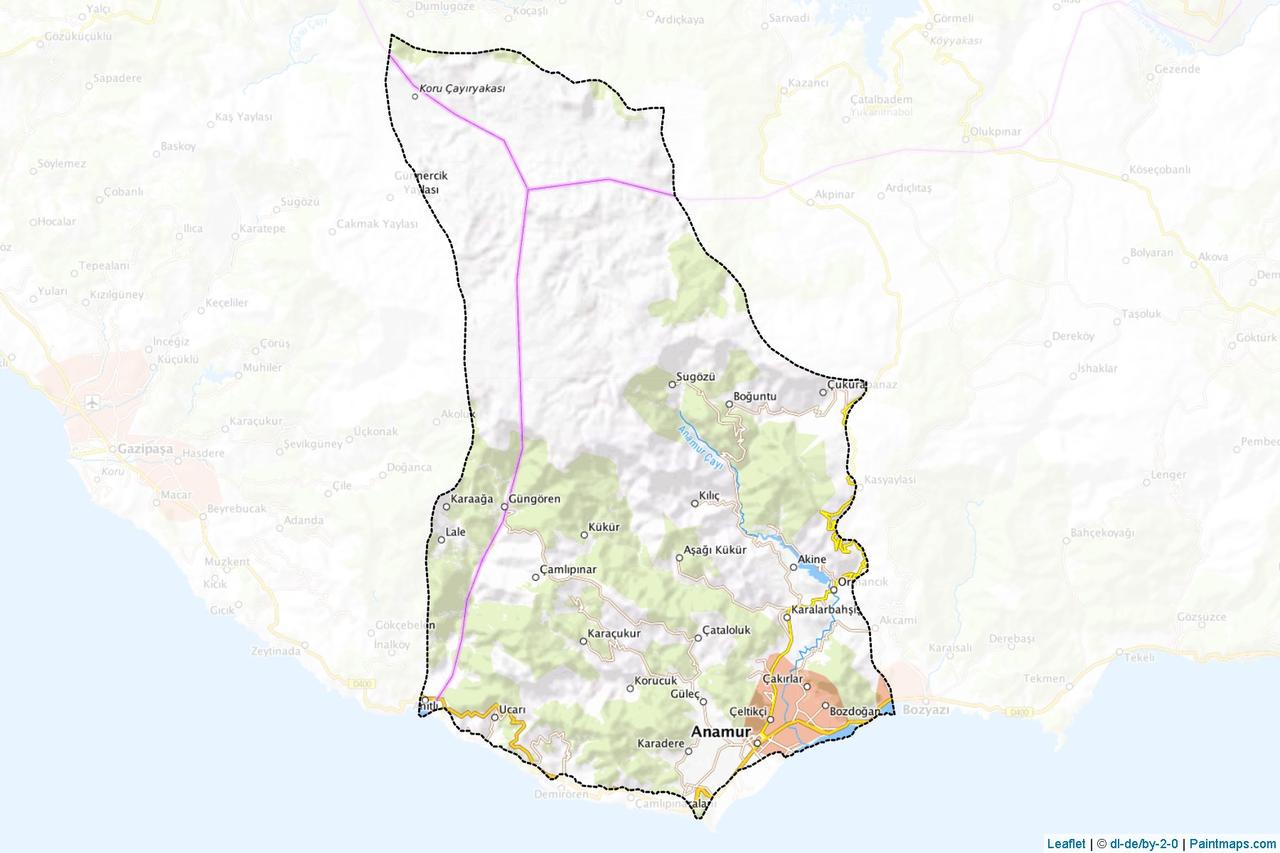
Anamur (District)
Location | Mersin / Türkiye | ||||||||
|---|---|---|---|---|---|---|---|---|---|
Area | 1.241 km² | ||||||||
Population | 66.846 (2022) | ||||||||
Climate | mild and rainy winters Mediterranean climate – hot and dry summers | ||||||||
Vegetation | Subtropical microclimate | ||||||||
Mountains | Alamoz, Kınıldağ, Naldöken | ||||||||
Rivers | Sultansuyu, Dragon Çayı | ||||||||
District Governor | Bilal BOZDEMİR | ||||||||
Mayor | Durmuş DENİZ | ||||||||
Historical Structures | Anemurium Antik Kenti Mamure Kalesi Tol Kervansarayı Akcamii | ||||||||
Anamur, Mersin province’s westernmost district, located on the Mediterranean coast. With an area of 1,241 km², Anamur is bordered by Ermenek (Karaman) to the north, Gazipaşa (Antalya) to the west, Bozyazı districts to the east, and the Mediterranean Sea to the south. The district center is 230 km from Mersin, 265 km from Antalya, and 40 nautical miles from Cyprus. The southern extensions of the Central Taurus Mountains run through the district’s territory, making the terrain generally mountainous and rugged.
The district’s history extends back to the 4th century BCE and includes numerous remains from the Roman and Byzantine periods, most notably the Anamur Ancient City (Anemurium). Agriculture, particularly banana, strawberry, and citrus production, is the dominant economic activity. The coastal areas also serve as breeding grounds for the sea turtle species Caretta caretta.
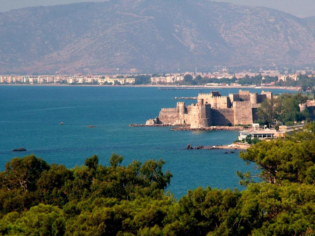
Anamur (Anamur Municipality)
Anamur’s history reflects a layered cultural heritage dating back to antiquity. Its name derives from the Latin “Anemurium,” formed from “anemos” (wind) and “ourion” (promontory), meaning “Wind Cape.” This refers to Anamur Cape, located approximately 7 kilometers southwest of the district center, which constitutes the southernmost point of Anatolia extending into the Mediterranean.
According to archaeological and historical sources, the region came under Assyrian control in the 8th century BCE, followed by Persian rule. In 333 BCE, during Alexander the Great’s campaign in Anatolia, it became part of the Macedonian Kingdom. After Alexander’s death, Anamur fell under Seleucid control and in the 1st century BCE was granted by Roman Emperor Caligula, along with the entire Cilician coast, to King Antiochus IV of Commagene.
During the Roman period, Anemurium became an important center due to its strategic location, facilitating maritime trade with Cyprus and overland connections with Roman cities such as Germaniopolis in the Taurus Mountains. The city was surrounded by walls in the 1st century CE and remained under Commagene control for a short time. It was captured by the Sassanids in 260 CE and suffered repeated damage from pirate raids originating from the Taurus Mountains and the Mediterranean during the 4th and 5th centuries. It was abandoned following Arab raids in 650 CE.
During the Middle Ages, the region changed hands between the Arabs and Byzantines. Seljuk Sultan I. Alaaddin Keykubat appointed Ertokuş Bey to conquer cities along the Mediterranean coast, leading to the capture of Anamur in 1228. The Mamure Kalesi was repaired and put into use during the Seljuk period. In the 14th century, the region came under the control of the Karamanids and was incorporated into the Ottoman Empire in 1471 by Ottoman commander Gedik Ahmet Paşa.
During the Ottoman period, Anamur was initially administered as a bucak and gained district status in 1869. In the Republican era, it was administratively attached to Mersin Province. Today, Anamur continues to preserve its historical heritage through its ancient sites, archaeological remains, and historic structures.
Anamur district is located in southern Türkiye, within the eastern section of the Mediterranean Region, and is part of Mersin Province. It occupies the westernmost tip of Mersin and lies along the Mediterranean coast. Geographically, Anamur Cape, situated 7 km southwest of the district center, is the southernmost point of Anatolia and is recognized as the southernmost point of Türkiye.
To the east, Anamur borders the Bozyazı district; to the west, the Gazipaşa district of Antalya Province; and to the north, the Ermenek district of Karaman Province. The Mediterranean Sea lies to the south. The district center is 230 km from Mersin city center, 265 km from Antalya, 230 km from Karaman, and 40 nautical miles (approximately 76 km) from Cyprus. With a total area of 1,241 km², approximately 60% of this area is covered by forested land.
Anamur district exhibits the characteristic features of the Mediterranean climate: hot, dry summers and mild, rainy winters. The average annual rainfall is around 1,032 mm, with an average of 75 rainy days per year. The summer season is long, with temperatures frequently exceeding seasonal norms. This climatic structure provides favorable conditions for agricultural activities.
In terms of vegetation, Anamur possesses rich natural biodiversity. Influenced by Mediterranean and subtropical climate zones, the region supports the cultivation of numerous agricultural products, with banana, strawberry, citrus, and various tropical fruits being prominent. Approximately 60% of the district’s land area, or 850–853 km², is covered by forests. These forests consist primarily of pine, cedar, and fir trees and play a vital role in both the ecological and economic structure of the region.

Anamur Strawberry (Anamur District Governorship)
Anamur’s economy is predominantly based on agriculture. Due to its climate and geographical features, the region is one of Türkiye’s leading producers of bananas and strawberries. Anamur banana, distinguished by its unique aroma and quality, has received geographical indication registration and is widely recognized nationwide. Protected cultivation is common in the district; thanks to greenhouse production, vegetables such as tomato, pepper, and cucumber are grown year-round.
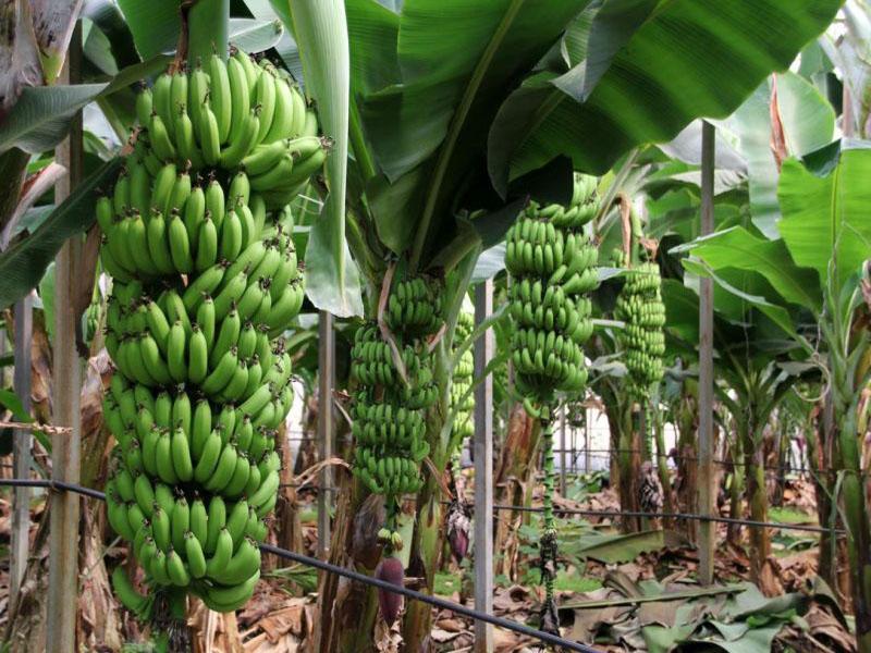
Anamur Banana (Anamur District Governorship)
Citrus products (lemon, orange, mandarin) and tropical fruits (avocado, dragon fruit) have also seen increasing production volumes in recent years. Modern irrigation systems, biotechnological applications, and smart farming solutions are becoming increasingly widespread in agriculture, enhancing production efficiency.
In addition to agriculture, local producers are encouraged through state-supported credit programs and cooperatives, promoting economic sustainability. While some of the produced goods are supplied domestically, a significant portion is exported, contributing to the district’s foreign trade revenues.
Livestock farming, though less dominant than agriculture, remains another source of livelihood in rural areas. Tourism also contributes to the local economy, especially during summer months, through attractions such as Pullu Nature Park, the Anemurium Ancient City, and Mamure Castle.
According to the Turkish Statistical Institute’s Address-Based Population Registration System (ADNKS) data for 2022, Anamur’s total population is 66,846, of which 33,853 are male and 32,993 are female. The gender distribution shows that males slightly outnumber females in the district.
Settlement in Anamur is distributed between coastal central neighborhoods and rural highland and mountain villages. Following Law No. 6360, enacted in 2014, settlements previously classified as villages were reclassified as neighborhoods, resulting in the administrative integration of the rural population into the urban framework. Seasonal population movements linked to agricultural production are observed; population increases occur in coastal settlements during summer months, while temporary population growth is also recorded in highland pastures.
Anamur’s social structure has been shaped by the influence of various civilizations throughout history, and these interactions are still evident in traditional cultural elements. A significant portion of the population descends from Yörük-Turkmen communities. These groups are descendants of Turkish tribes that migrated from the Taşeli Plateau and adopted a settled lifestyle from the 13th century onward. Today, Yörük culture persists in many aspects, including traditional clothing, hospitality customs, folk music, and handicrafts.
Rural and highland lifestyles remain vibrant in Anamur, with the tradition of seasonal migration to highland pastures during summer continuing. The Taşeli Highlands (Mut, Silifke, Ermenek, Anamur) form a vital part of this cultural cycle. Alongside this pastoral tradition, two-story houses with stables on the ground floor and living quarters above represent enduring examples of vernacular architecture.
Basic infrastructure for education, healthcare, and public services is available in the district. The majority of the population is employed in agriculture and service sectors. Youth in urban areas increasingly migrate to large cities due to educational and economic opportunities. Nevertheless, seasonal labor mobility occurs, particularly during the agricultural season, when temporary worker populations increase.
Anamur is a district of significant cultural and touristic interest due to its historical, archaeological, and natural richness. The district contains numerous cultural heritage structures from the Roman, Byzantine, Seljuk, and Ottoman periods. Among the most prominent is the Anemurium Ancient City. The site includes numerous well-preserved structures such as a theater, odeon, bathhouse, necropolis, and city walls. Vaulted tombs adorned with mosaics and frescoes reflect the region’s archaeological significance.
Located on the seashore in the southeastern part of the district, Mamure Castle dates back to the 4th century CE and has undergone multiple restorations over the centuries. Inside the castle is a mosque, and outside its courtyard lies the Mamure Bathhouse. The castle is regarded as one of the best-preserved defensive structures in Anatolia and attracts thousands of visitors annually.
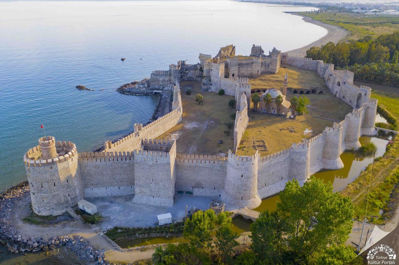
Mamure Castle (Anamur Municipality)
Other cultural heritage sites in the district include the Tol Caravanserai, Ala Bridge, Altı Kapı Han, Çoban Castle, and the Titiopolis Ancient City. Additionally, religious structures such as Akcamii, dating from the Karamanid period, are important elements reflecting the historical fabric of the area.
Anamur also possesses considerable potential for natural tourism. Pullu Nature Park attracts visitors with its seaside and forest camping facilities, while geological formations such as Çukurpınar Cave and Köşekbükü Cave enhance interest in nature tourism. Köşekbükü Cave is believed by locals to have therapeutic benefits for asthma, making it an attractive destination for health tourism.
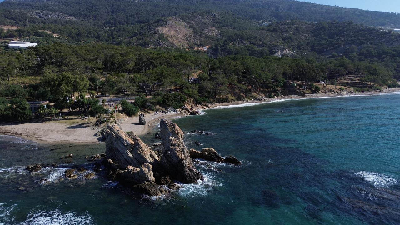
Pullu Nature Park (Anamur Municipality)
Anamur’s coastlines are among the most important breeding grounds in the Mediterranean for the Caretta caretta sea turtle. Each year, thousands of hatchlings emerge from approximately 500 nests and reach the sea, granting the district significant ecological importance.
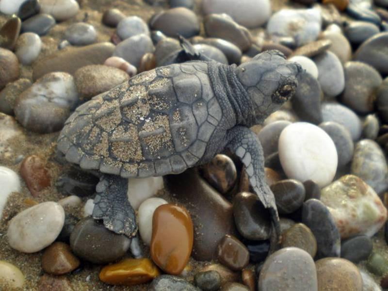
Caretta caretta (Anamur District Governorship)
In cultural life, the Yörük-Turkmen tradition continues to influence local customs; traditional handicrafts, regional attire, and highland lifestyles remain integral parts of the cultural memory. Traditional festivals and fairs are held in Anamur, and the local cuisine prominently features dishes based on agricultural products.
Anamur Belediyesi. "Anamur Tarımı: Günümüzde Geldiği Nokta." Accessed April 19, 2025.https://anamur.bel.tr/anamurtarimi/
Anamur Belediyesi. "Pullu Tabiat Parkı ve Kamp Alanı." Accessed April 19, 2025.https://anamur.bel.tr/pullu-tabiat-parki-ve-kamp-alani/
T.C. Anamur Kaymakamlığı. "Anamur Muz Diyarı." Accessed April 19, 2025.http://www.anamur.gov.tr/anamur-muz-diyari
T.C. Anamur Kaymakamlığı. "Anamurium Antik Kenti." T.C. Anamur Kaymakamlığı. Accessed April 19, 2025.http://www.anamur.gov.tr/anamurium-antik-kenti
T.C. Anamur Kaymakamlığı. "Anamur’un Tarihi." Accessed April 19, 2025.http://www.anamur.gov.tr/anamurun-tarihi
T.C. Anamur Kaymakamlığı. "Caretta Caretta." Accessed April 19, 2025.http://www.anamur.gov.tr/caretta-caretta
T.C. Mersin Valiliği. "Anamurium Antik Kenti." Accessed April 19, 2025.http://www.mersin.gov.tr/nufus-ve-dagilim
T.C. Mersin Valiliği. “Anamur İlçesi.” Accessed April 19, 2025.http://www.mersin.gov.tr/anamur
T.C. Ministry of Culture and Tourism. "Anamur." Mersin İl Kültür veTurizm Müdürlüğü. Accessed April 19, 2025.https://mersin.ktb.gov.tr/tr-73139/anamur.html
T.C.Anamur Kaymakamlığı Governorship. "Anamur Çileği." Accessed April 19, 2025.http://www.anamur.gov.tr/anamur-cilegi
T.C.Anamur Kaymakamlığı Governorship. "Anamur’un Coğrafyası." Accessed April 19, 2025.http://www.anamur.gov.tr/anamurun-cografyasi
T.C.Anamur Kaymakamlığı Governorship. "Tarihi Camilerimiz." Accessed April 19, 2025.http://www.anamur.gov.tr/tarihi-camilerimiz
Anamur (District)
Location | Mersin / Türkiye | ||||||||
|---|---|---|---|---|---|---|---|---|---|
Area | 1.241 km² | ||||||||
Population | 66.846 (2022) | ||||||||
Climate | mild and rainy winters Mediterranean climate – hot and dry summers | ||||||||
Vegetation | Subtropical microclimate | ||||||||
Mountains | Alamoz, Kınıldağ, Naldöken | ||||||||
Rivers | Sultansuyu, Dragon Çayı | ||||||||
District Governor | Bilal BOZDEMİR | ||||||||
Mayor | Durmuş DENİZ | ||||||||
Historical Structures | Anemurium Antik Kenti Mamure Kalesi Tol Kervansarayı Akcamii | ||||||||
History
Geographical Structure
Location and Boundaries
Climate and Vegetation
Economic Structure
Demographic Structure
Social Structure
Tourism and Culture