


This article was automatically translated from the original Turkish version.
Mersin
Country | Türkiye | ||||||||
|---|---|---|---|---|---|---|---|---|---|
Region | Mediterranean Region | ||||||||
Population (Number) | 1954279 | ||||||||
Area (km²) | 15.853 km² | ||||||||
Climate | Mediterranean climate | ||||||||
Local Government | Governor: Atilla Toros, Metropolitan Mayor: Vahap Seçer | ||||||||
Area Code(s) | 0324 | ||||||||
License Plate Code | 33 | ||||||||
Mersin is an important city located on Türkiye’s Mediterranean coast, formerly known as İçel. With an area of 15,853 km², Mersin had a population of 1,954,279 as of 2024. It is bordered by Adana to the east, Antalya to the west, and Niğde, Konya and Karaman to the north, while its southern boundary lies along the Mediterranean Sea. Mersin’s geographical structure includes the Bolkar Mountains, a section of the Taurus Mountains, with its highest point being Medetsiz Tepe at 3,524 meters. Mersin also features important passes such as Gülek Boğazı and Sertavul Geçidi, and is notable for its combination of mountainous and flatland areas. The plains are formed by alluvial deposits and contain sea-connected lakes such as Akgöl in Silifke, Keklik Gölü and Paradeniz. The waters of these lakes are saline and support various fish species.
Mersin’s vegetation consists of Mediterranean-type maquis adapted to the regional climate. Common plant species include laurel, wild olive, cornel, myrtle, zakkum, blackberry and rosehip. Vegetation varies with altitude: oak trees are found between 100 and 1,000 meters, pine trees between 1,000 and 1,200 meters, black pine at 1,500 meters, and cedar and juniper above 2,000 meters. Thanks to its natural beauty and climate, Mersin is also a prominent tourist center. The city attracts visitors with its Mediterranean beaches, historical structures and natural landscapes. Districts under Mersin’s administration include Akdeniz, Anamur, Aydıncık, Bozyazı, Çamlıyayla, Gülnar, Erdemli, Mezitli, Mut, Silifke, Tarsus, Toroslar and Yenişehir.
During the classical period, Mersin was known as Cilicia and has been an important settlement since prehistoric times. It was ruled by the Hittites, Phrygians, Assyrians, Persians, Macedonians, Romans and Byzantines, and came under the control of the Seljuks in the 11th century and the Ottoman Empire in the 15th century. Although occupied by the Allied Powers during the First World War, it was reintegrated into Turkish territory on 3 January 1922 through the National Struggle.
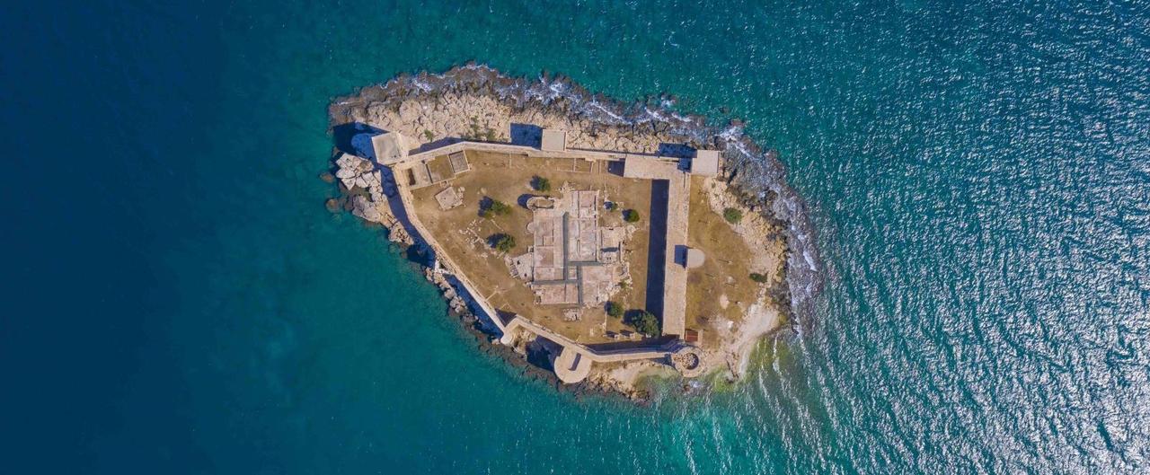
Mersin Kız Kalesi
Mersin became a province in 1924, merged in 1933 with the İçel province centered in Silifke and adopted the name İçel, before reverting to the name Mersin in 2002. The most significant archaeological evidence of its historical past has been uncovered at the excavations of Yumuktepe and Gözlükule, revealing continuous human settlement since the Neolithic Age.
There are two widely accepted theories regarding the origin of the name Mersin. One attributes it to the presence of the Mersin tree (Myrtus) in the region, while the other traces it to the Turkmen family known as the Mersinoğulları who once lived there.
Mersin, Türkiye’s 9th largest province, covers an area of 15,853 km² with a land border of 608 km and a coastline of 321 km. The Central Taurus Mountains cover much of the province and separate it from Central Anatolia. Its highest point is Medetsiz Tepe in the Bolkar Mountains at 3,585 meters. Mersin is also renowned for its highland pastures, or yaylas, including Aslanköy, Gözne, Fındıkpınarı, Soğucak, Bekiralanı, Ayvagediği, Güzeloluk and Sertavul. The flatlands are formed along the southern slopes of the Taurus Mountains. The Tarsus, Mersin, Erdemli and Silifke plains are suitable for agricultural production.
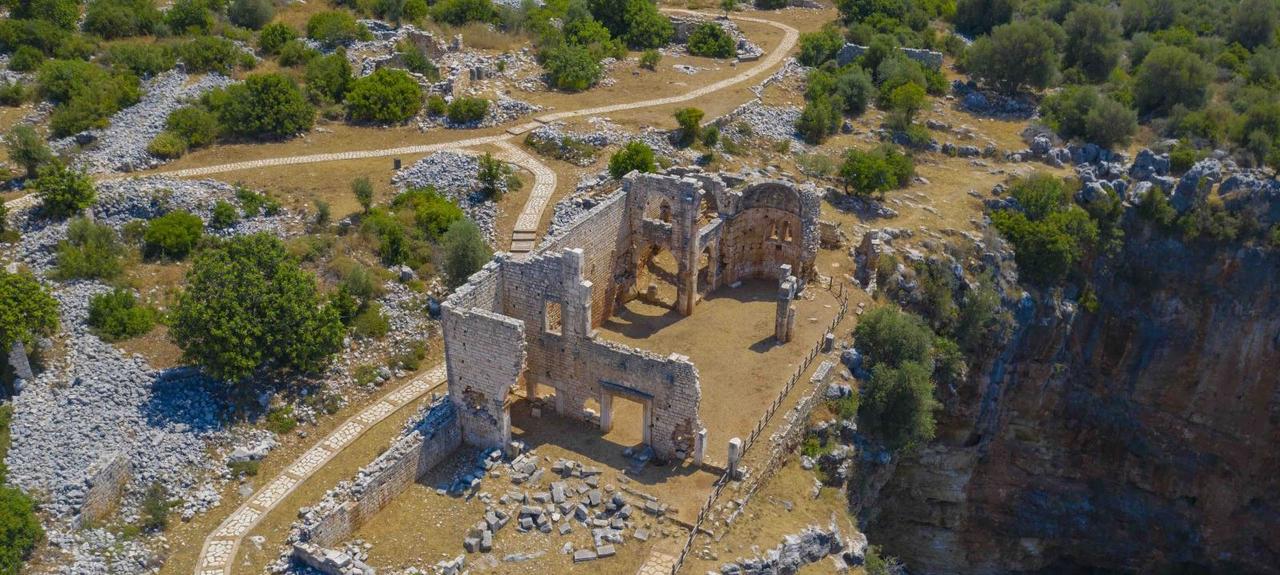
Kanlı Divane Örenyeri
The province’s largest rivers are the Göksu River and the Tarsus (Berdan) Creek. Other rivers of varying lengths and sizes include Mezitli, Müftü, Deliçay and Anamur Çayı. Mersin’s natural lakes are known as Akgöl, Keklik Gölü, Paradeniz Gölü and Aygır Gölü. Additionally, the Gezende and Berdan Dam lakes are used for energy production and irrigation.
Mersin’s coastline extends from Karataş Burnu in the east to İncekum Burnu in the west. Various bays and capes shape the natural structure of the coast.
Mersin has significant mineral deposits that are actively used in the province’s industry, road construction and building sectors. The main minerals found in Mersin are:
Mersin has a Mediterranean climate characterized by hot, dry summers and mild, rainy winters. The annual average temperature is 18.7°C, with annual rainfall ranging between 450 and 736 mm. Humidity levels average around 64% and remain relatively stable throughout the year. Sea water temperature averages 20.8°C.
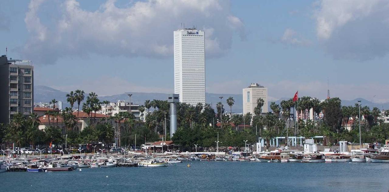
Mersin İli Manzarası
Population distribution by district:
Mersin is rich in tourism resources. With its castles, waterfalls, monasteries, mosques, museums, social areas and other significant historical sites, it is one of the most important tourist cities in Türkiye’s Mediterranean region.
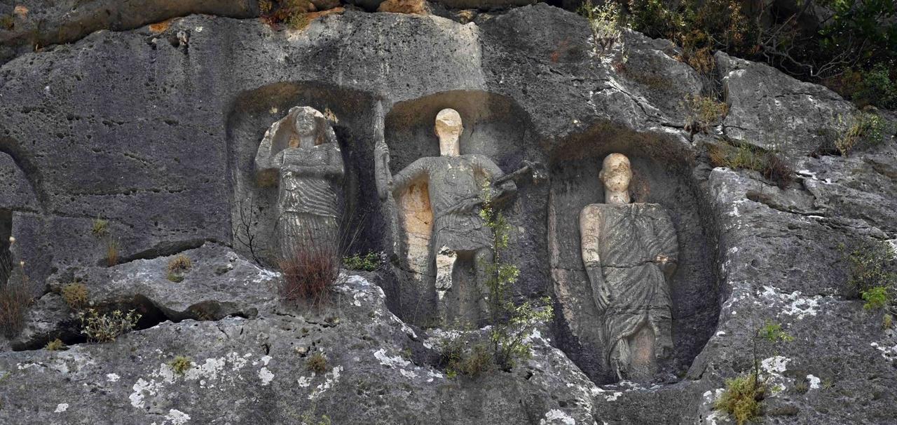
Erdemli Kanlıdivane Çanakçı Kaya Mezararı
Examples of tourist sites include:
The provincial government organizes various social activities and festivals in Mersin at regular intervals. Large-scale events in categories such as music, sport, travel and food actively promote the province’s social life.
Examples of these festivals include:
Mersin province, with its diverse range of desserts and home-cooked dishes, is one of the richest culinary centers in Türkiye’s food culture. Popular local dishes and desserts include:
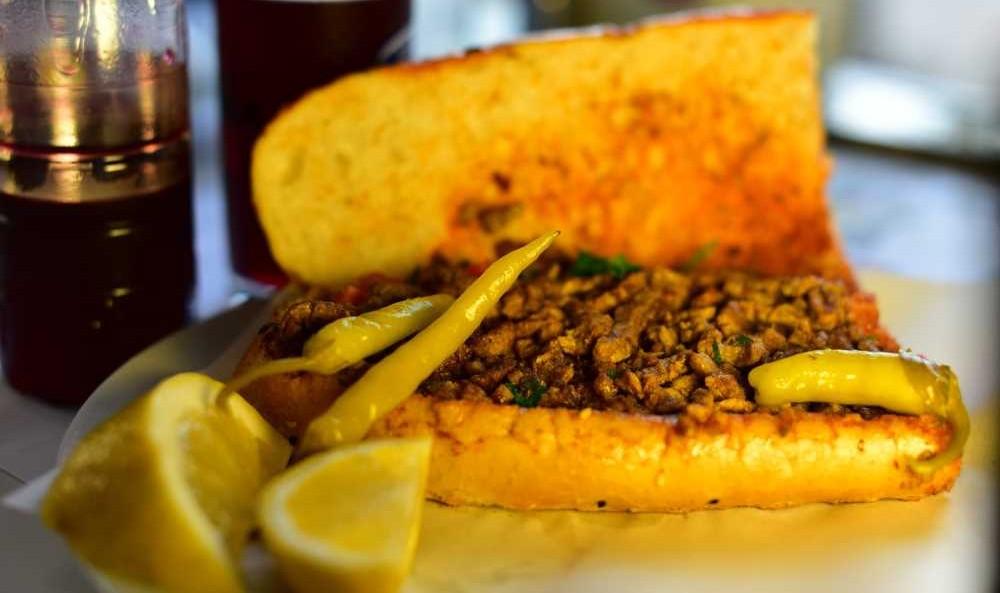
Mersin Tantunisi
Ministry of Environment, Urbanization and Climate Change of the Republic of Türkiye. (2024). *Mersin-Genel Bilgiler*. Accessed February 13, 2025.
T.C. Kültür ve Turizm Bakanlığı. (2025). *Mersin*. Accessed February 13, 2025.https://mersin.ktb.gov.tr/TR-73136/mersin.html
T.C. Mersin Valiliği. (2024). *Mersin Kent Özeti*. Accessed February 13, 2025.http://www.mersin.gov.tr/mersin-kent-ozeti
T.D.V. İslam Ansiklopedisi. (2016). *Mersin*. Accessed February 13, 2025.
Turkish Statistical Institute (TÜİK) Population Statistics Portal. (2024). *Total Population Table*. Accessed February 13, 2025.https://nip.tuik.gov.tr/
Türkiye Kültür Portalı. (2025). *Geleneksel Mutfak*. Accessed February 13, 2025.https://www.kulturportali.gov.tr/turkiye/mersin/neyenir
Türkiye Kültür Portalı. (2025). *Gezilecek Yerler*. Accessed February 13, 2025.https://www.kulturportali.gov.tr/turkiye/mersin/gezilecekyer?ilId=29&keyword=&tur=0&turizmtur=0&gorsel=0&nearest=0&etiket=&sayfa=1&sayi=100&lat=0&lang=0
Mersin
Country | Türkiye | ||||||||
|---|---|---|---|---|---|---|---|---|---|
Region | Mediterranean Region | ||||||||
Population (Number) | 1954279 | ||||||||
Area (km²) | 15.853 km² | ||||||||
Climate | Mediterranean climate | ||||||||
Local Government | Governor: Atilla Toros, Metropolitan Mayor: Vahap Seçer | ||||||||
Area Code(s) | 0324 | ||||||||
License Plate Code | 33 | ||||||||
History and Culture
Geography and Natural Structure
Subterranean Resources
Climate
Population and Settlement Distribution
Tourism
Touristic Social Activities
Cuisine