

`urban-transformation` Related Article Results
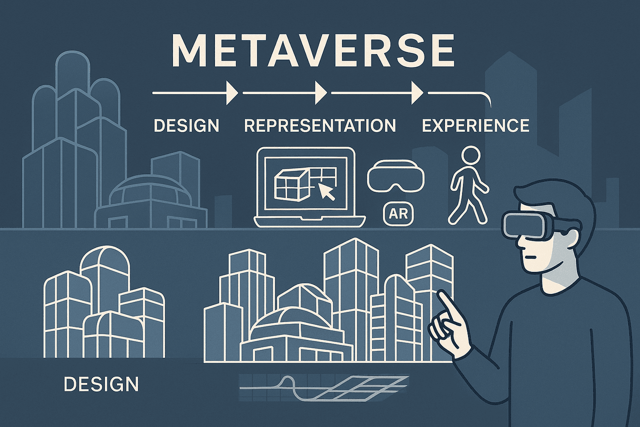
Architecture and the Metaverse
The metaverse is a virtual universe composed of three-dimensional, persistent digital environments in which users interact through avatars. It is conceived as an immersive space independent of the physical world, shaped by the integration of technologies such as virtual reality, augmented reality, artificial intelligence, blockchain, and Web 3.0, and encompasses permanent, collectively experienced digital spaces. In the context of architecture, the metaverse offers a new medium that transcends t
EN
Esra Özkafa
 Ja
JaJanuary 24, 2020 Elazığ Sivrice Earthquake
On 24 January 2020, a magnitude Mw 6.8 earthquake occurred with its epicenter in Çevrimtaş village of the Sivrice district in Elazığ. This shallow-focus earthquake took place along the Pütürge segment of the East Anatolian Fault System (EAFT) and was felt across Elazığ and neighboring provinces. The earthquake resulted in 41 fatalities, 1,607 injuries, and approximately 47,800 people directly affected. In the city center of Elazığ, about 13 percent of the 27,438 buildings sustained damage, with
EN
Yunus Emre Sağlam
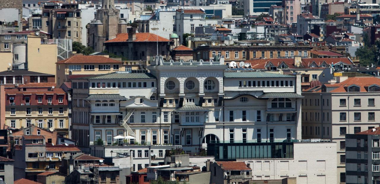
Urban Palimpsest
Urban palimpsest is a socio-spatial and architectural concept that refers to a city’s physical, spatial, and cultural fabric accumulating layers of traces from different historical periods, social practices, needs, and ideologies.【1】 The term derives from the Greek words palin, meaning "again," and psestos, meaning "scraped," combining to form palimpsēstos.【2】 In antiquity, due to the rarity and cost of parchment and papyrus, manuscripts with erased or scraped-off older texts rewritten on top we
EN
Kadriye Beyza Kirenci
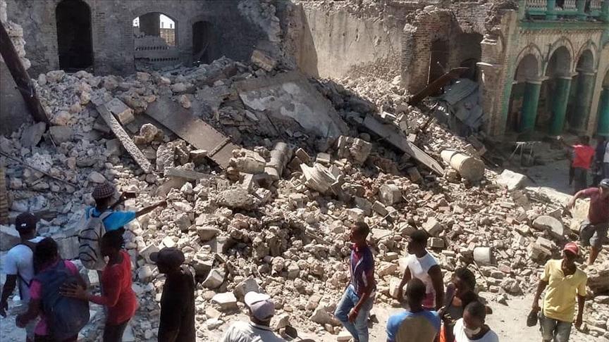
2010 Haiti Earthquake
The 2010 Haiti earthquake was a seismic event of magnitude 7.0 that occurred on January 12, 2010 at 16:53 local time, near the town of Léogâne approximately 25 kilometers southwest of Haiti’s capital, Port-au-Prince. This rupture, occurring at a depth of about 13 kilometers beneath the surface, is identified by seismological data as the most destructive earthquake recorded in the region over the past 200 years.BBC News Türkçe, "Haiti'de deprem felaketi," BBC, erişim 22 Aralık 2025, https://www.b
EN
Nursena Şahin
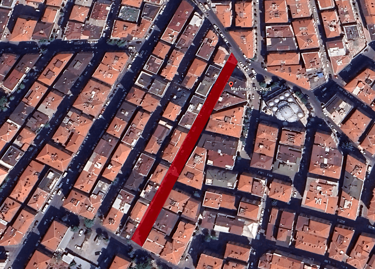
Marmara 1 Street
Marmara 1 Street is located in the Soğanlı Mahallesi neighborhood of Istanbul’s Bahçelievler district. In the early 1970s, Marmara 1 Street was characterized by a high concentration of informal settlements. However, in 1976, the Çoban Apartmanı, constructed by Mehmet Çoban along with his father Mustafa Çoban, brother Adil Çoban, and brother Kadir Çoban, marked one of the first steps toward a new era in the street’s development. The Çoban family moved into this building in 1977. This development
EN
Enes Tayyar
JaJanuary 24, 2020 Elazığ Sivrice Earthquake
On 24 January 2020, a magnitude Mw 6.8 earthquake occurred with its epicenter in Çevrimtaş village of the Sivrice district in Elazığ. This shallow-focus earthquake took place on the Pütürge segment of the East Anatolian Fault System (EAFS) and was felt in Elazığ and surrounding provinces. The earthquake resulted in 41 fatalities, 1,607 injuries, and direct impact on approximately 47,800 people. In the city center of Elazığ, 13 percent of approximately 27,438 buildings sustained damage, particula
EN
Yunus Emre Sağlam
Pervititch Maps
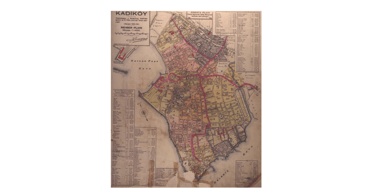
Pervititch Maps are insurance maps created in the first half of the 20th century that meticulously document the urban fabric of Istanbul. Prepared by Croatian cartographer Jacques Pervititch between 1922 and 1945, these maps were originally commissioned by insurance companies to assess fire risks. Over time, however, they have become an invaluable source of information on Istanbul’s architectural structure, street layout, and social life. Pervititch Maps The Pervititch maps are the product of a
EN
Yağmur Yıldız Parıltı
Urban Anthropology
Urban Anthropology is a subfield of socio-cultural anthropology that examines cultural systems in cities and their interactions at local, regional, and global scales.【1】 Unlike traditional anthropology, which focused on non-modern, primitive, or rural communities, this field centers on complex and industrialized urban structures. Urban anthropology views the city not merely as a physical settlement but as a dynamic habitat where social processes, spatial forms, and ideological representations ar
EN
Büşra Tuğa
Zağnos Valley
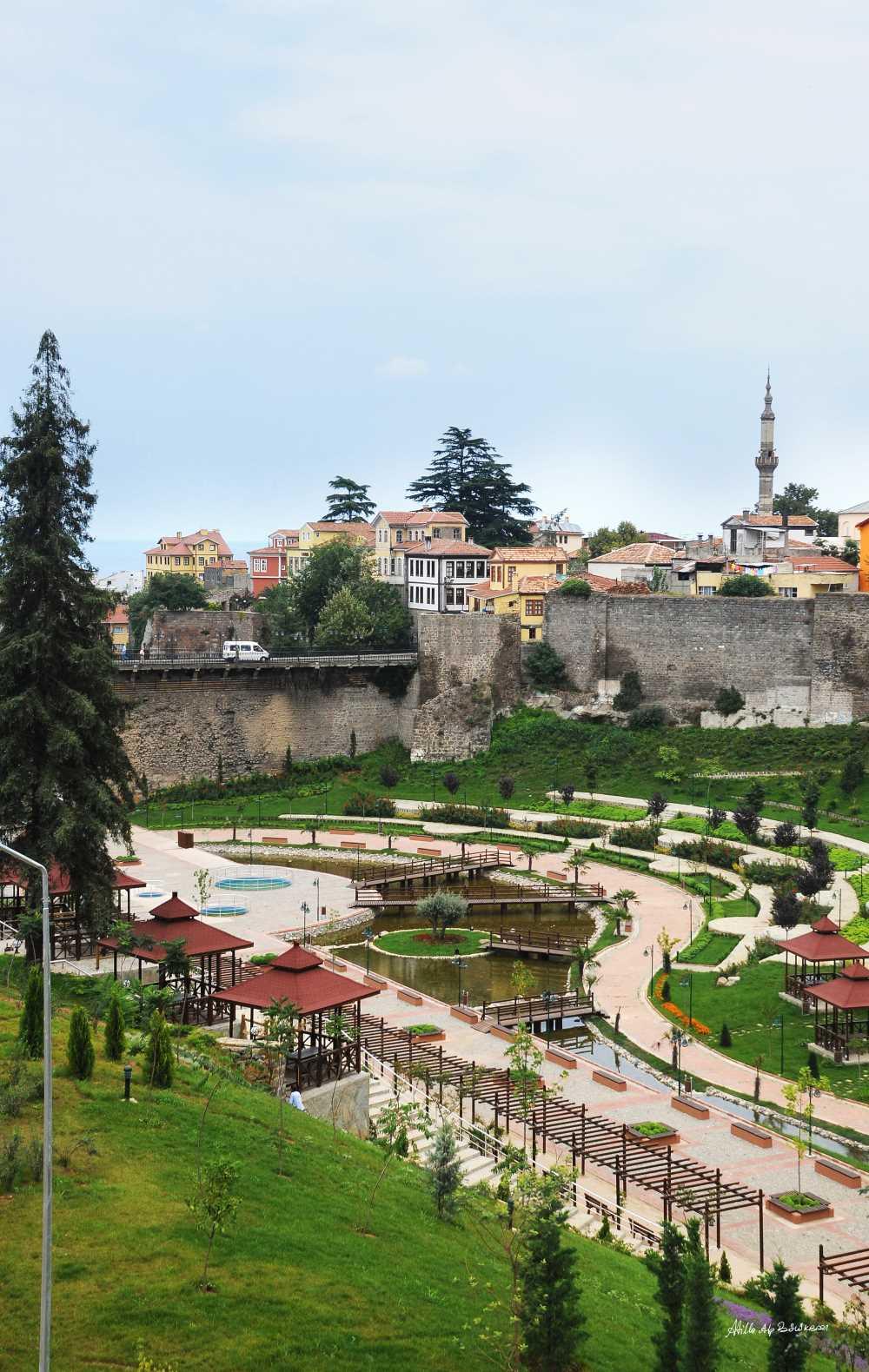
Zağnos Valley is a historical and recreational valley located within the Ortahisar district boundaries of Trabzon in Türkiye’s Black Sea Region. The valley is named after Zağnos Pasha, who undertook construction activities following Trabzon’s incorporation into Ottoman territory in the 15th century. The area has been redeveloped through urban transformation initiatives since the 2000s. Historical Structures The Zağnos Bridge within the valley contains architectural traces from the Roman Byzantin
EN
Zeynep Şule Bingöl
Informal settlement
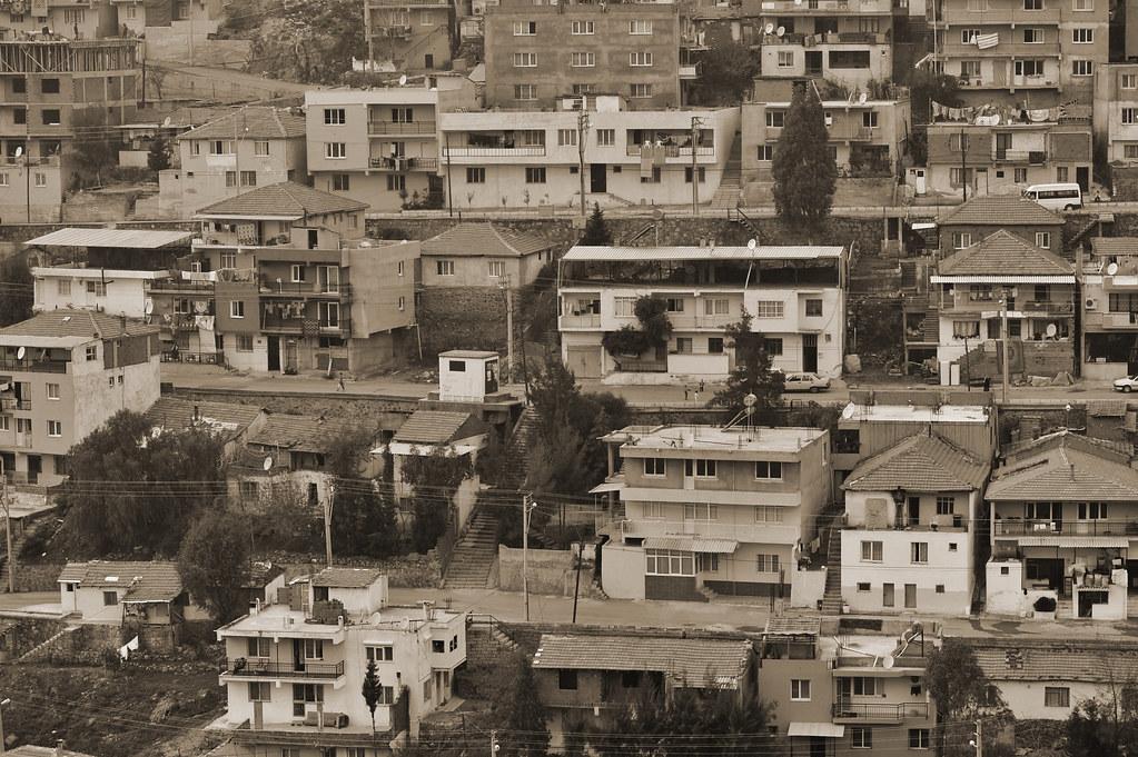
Gecekondulaşma is a form of urban settlement characterized by the unauthorized and often unplanned construction of dwellings on land not owned by the builders, in violation of settlement and zoning regulations. In Türkiye, the term "gecekondu" is commonly used to describe illegal housing units built by low-income groups who migrated from rural areas to cities in response to housing shortages. Gecekondulaşma (Flickr) " image-element-format="right" image-source="https://cdn.t3pedia.org/media/uploa
EN
Emine Erdal