This article was automatically translated from the original Turkish version.
+2 More
Location | Islahiye Türkiye Gaziantep | ||||||||
|---|---|---|---|---|---|---|---|---|---|
Discovery | Prof. Dr. U. Bahadır Alkım and Team | ||||||||
Civilization | Tilmen Kingdom, Hittites, Roman-Byzantine | ||||||||
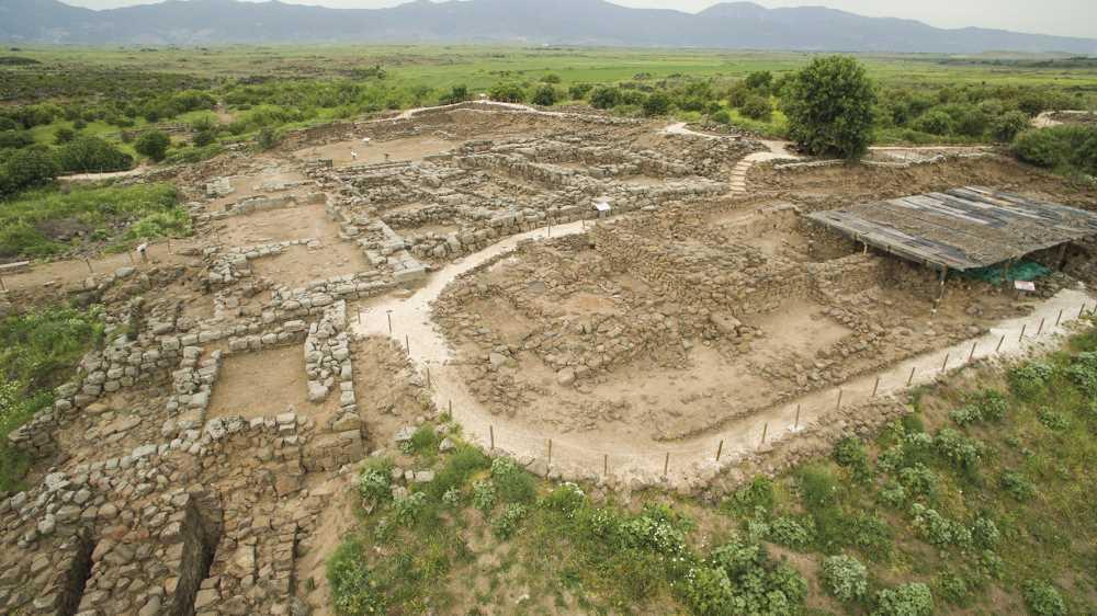
Tilmen Höyük is an important archaeological settlement located approximately 10 kilometers east of the district of Gaziantep, 2 kilometers west of the village of Yelliburun. It lies in the center of a hilly plain surrounded by volcanic basalt veins and hillocks. The mound consists of an oval-shaped hill 21 meters high, 220 meters long and 150 meters wide, with a 160-meter-long spur extending toward the west. The settlement area is surrounded by water channels formed by tributaries of the Karasu River.
Tilmen Höyük was identified during the 1958 İslahiye Region Surface Survey led by Professor Dr. Uluğ Bahadır Alkım. In 1959, excavations were initiated through a collaboration between the Turkish Historical Society, the Faculty of Letters of Istanbul University, and the General Directorate of Monuments and Museums. These efforts were carried out by a team including Refik Duru and Handan Alkım and continued uninterrupted until 1964. Excavations resumed in 1969 and were completed in 1972.
In 2002, under the direction of Professor Dr. Refik Duru, the “Tilmen Höyük Restoration and Environmental Planning Project” was implemented. Subsequently, in 2003, a Turkish-Italian team led by Nicolò Marchetti resumed excavations. These latest excavations also included the transformation of the site into an archaeological park and its integration with the local community.
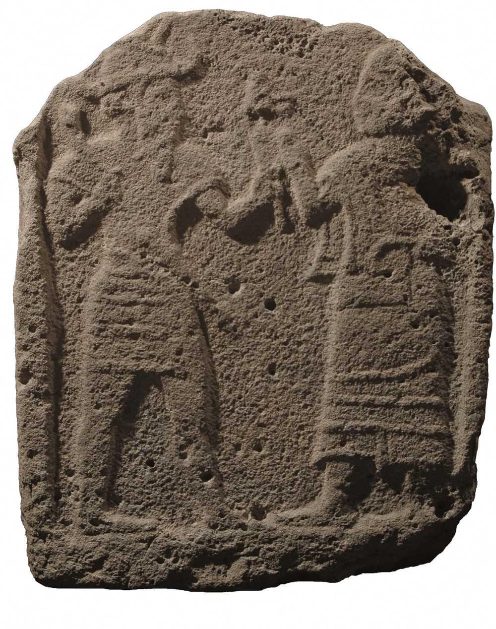
An Artifact Found at Tilmen Höyük (Culture Portal)
Tilmen Höyük is a multi-layered mound with continuous occupation phases extending from the Late Chalcolithic period to the Byzantine era. Excavations have revealed that the mound was influenced by multiple cultures throughout its history, with their settlement layers clearly discernible.
The earliest settlement at Tilmen Höyük was uncovered in the IV d architectural layer. Remains from this period were identified through deep soundings conducted among palace ruins on the mound’s summit. At a depth of approximately 19.5 meters, traces of mudbrick walls and floor surfaces were found. This initial settlement phase is believed to have been established by a small community around 3400 BCE. The settlement ended with a destruction layer following prolonged use.
Early Bronze Age settlements were built directly atop the Late Chalcolithic layers and consist of nine distinct strata within the III j–c architectural layers. The architecture of this period is represented by small stone-walled circular storage and silo structures. Three burials have also been identified: one chamber tomb and two box tombs. Wall construction techniques vary across these layers; early phases feature rough stone foundations, while later phases show more refined stonework.
The most brilliant and monumental phase of Tilmen Höyük belongs to the Middle Bronze Age. This period is represented by the III b–a and II c–a architectural layers. During this time, the settlement evolved into a planned city enclosed by both inner and outer walls. On the mound’s summit, palace complexes, temples, and administrative buildings were located, while residential areas occupied the outer zones.
The city was protected by strong stone walls constructed using dry-stone masonry with large basalt blocks, reinforced at intervals by towers. The most striking monumental finds of this period are the basalt “gate lions” located in front of the eastern gate.
Architecturally, Tilmen was closely connected with the Old Hittite Kingdom and Northern Syrian cultures during this era. Layers II c and II b represent the majority of architectural remains visible on the surface today. It is believed that Tilmen became a royal center during this period and that its palace complex was likely destroyed during the Syrian campaigns of King Hattusili I.
After the destruction of the Middle Bronze Age settlement, reoccupation began, represented by the I a and I b architectural layers. These layers contain simple dwellings with stone foundations and mudbrick superstructures. Pottery finds correspond to ceramic types associated with the Late Hittite culture. Some metal artifacts (arrowheads, needles) indicate that the settlement retained a partial military character during this period.
Tilmen Höyük was not entirely abandoned in subsequent centuries. In the uppermost layers, fragments of Roman and Byzantine pottery, stone foundation remains, and minor architectural traces have been found. These discoveries suggest that the mound was intermittently used during later periods as an agricultural or rural settlement.
Tilmen Höyük is one of the best-preserved urban sites in Anatolian archaeology, particularly for its architecture from the Middle Bronze Age (c. 2000–1500 BCE). Excavations have demonstrated that during this period, the site functioned as a planned city enclosed by inner and outer walls, exhibiting a sophisticated urban organization.
The Middle Bronze Age settlement consisted of two main sections:
The inner and outer walls were planned parallel to each other, serving simultaneously as defensive, transportation, and urban boundary systems.
One of Tilmen Höyük’s most striking architectural features is its multi-layered, planned defense system.
The inner city wall, approximately 500 meters long, protected the palace area. The outer city wall enclosed a broader zone. Both walls share similar construction techniques and appear to have been planned during the same period.
The citadels and towers uncovered during excavations represent advanced examples of defensive architecture:
Three main gates providing access to the city have been identified:
These gates controlled access to the city and also fulfilled ceremonial functions.
At the highest point of Tilmen Höyük lies the palace complex dating to the II layer of the Middle Bronze Age. Access to this terrace is via the K-5 gate, reached by a 17-step staircase.
These palaces served as the administrative center of the settlement. The presence of nearby temples and public buildings further confirms Tilmen’s administrative significance.
Within the inner city, residences, storage units, workshops, and administrative buildings were arranged in an orderly fashion. Structures feature stone foundations and mudbrick walls. Floors show compacted clay surfaces, and wall plaster traces are visible. This planning demonstrates that Tilmen was not only a fortified center but also a highly developed urban center in terms of urbanization.
During the Middle Bronze Age, Tilmen Höyük functioned as a political and cultural center in the Gaziantep region. The discovered “gate lion” statues, wall systems, and palace structures provide fundamental evidence for understanding pre-Hittite architecture in the region.
In the 2000s, environmental planning transformed the site into the Tilmen Höyük Archaeological Park, with walking paths and information panels added following the principle of minimal intervention. This effort has preserved the mound while making it accessible and comprehensible to visitors.
Alkım, U. Bahadır. "1961 Dönemi Tilmen Höyük ve Yesemek Kazıları." *Türk Arkeoloji Dergisi*, 17. (1961): 5-7. Accessed October 11, 2025.https://dergipark.org.tr/tr/pub/turkarkeolojidergisi/issue/67100/1047978
Alkım, U. Bahadır. "Tilmen Höyük Çalışmaları (1958-1960)." *Belleten*, 103 (July 1962): 447-500. Accessed October 11, 2025.https://belleten.gov.tr/tam-metin/3143/tur
Savrum Kortanoğlu, Müge. "Tilmen Höyük Orta Tunç Çağı Mimarisi ve Sunumu." Akademik Sosyal Araştırmalar Dergisi, Year: 8, no. 109 (October 2020): 158-179. Accessed October 11, 2025.https://asosjournal.com/?mod=makale_tr_ozet&makale_id=46010
Türkiye Kültür Portalı. "Tilmen Höyük - Gaziantep." kulturportali. Accessed October 11, 2025.https://www.kulturportali.gov.tr/turkiye/gaziantep/gezilecekyer/tilmen-hoyuk

Location | Islahiye Türkiye Gaziantep | ||||||||
|---|---|---|---|---|---|---|---|---|---|
Discovery | Prof. Dr. U. Bahadır Alkım and Team | ||||||||
Civilization | Tilmen Kingdom, Hittites, Roman-Byzantine | ||||||||
Discovery and Excavation History
Stratification and Historical Development
Late Chalcolithic Period (c. 3400–3000 BCE)
Early Bronze Age (c. 3000–2000 BCE)
Middle Bronze Age (c. 2000–1500 BCE)
Iron Age (c. 1200–1000 BCE)
Roman, Byzantine, and Islamic Periods
Architecture and Settlement Layout
General Plan and Settlement Layout
Defensive Structures and Wall System
Citadels and Towers
City Gates
Monumental Structures and Palace Complex
Internal Settlement and Building Groups
Archaeological Significance and Current Status