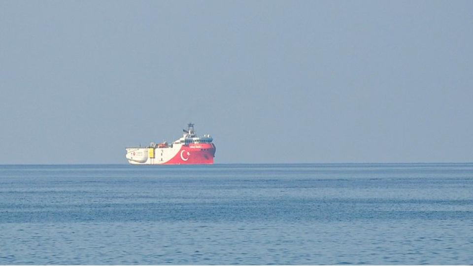
Türkiye has issued a NAVTEX valid until 30 August 2026 as part of a pipeline project designed to deliver natural gas to the Turkish Republic of Northern Cyprus. Alongside this maritime notice, the seismic research vessel Oruç Reis has commenced geological and geophysical surveys of the seabed along the planned route of the pipeline.
These research activities aim to determine the structure of the seabed, establish the technical route of the pipeline, and collect engineering data for implementation. The work constitutes the first technical phase of the implementation process initiated following the signing on 10 July 2026 of the “Memorandum of Understanding on the Supply of Natural Gas to the Turkish Republic of Northern Cyprus” between Türkiye and the TRNC.
Scope of the Natural Gas Pipeline Project
According to the project announced by the Minister of Energy and Natural Resources Alparslan Bayraktar, the total length of the natural gas pipeline is planned to be 101 kilometres. Of this, 97 kilometres will run underwater and 4 kilometres will traverse land. The pipeline is expected to be constructed between Anamur district of Mersin and the Teknecik area near Girne.
One of the most notable features of the project is the design of the pipeline to have bidirectional flow capacity. This will enable not only the delivery of natural gas from Türkiye to the TRNC but also, in future phases, the transportation of natural gas produced in the Eastern Mediterranean to European energy markets via Türkiye.
Energy Cooperation and Strategic Objectives
The natural gas pipeline project is a strategic infrastructure investment aimed at enhancing energy cooperation between Türkiye and the TRNC. It seeks to establish the TRNC’s natural gas infrastructure, strengthen energy supply security, and enable the use of lower-cost energy sources for electricity generation.
In addition, the bidirectional pipeline system has the potential to form the foundational infrastructure of an energy corridor that could facilitate the transport of future hydrocarbon resources from the Eastern Mediterranean to international markets via Türkiye. In this regard, the project encompasses not only an energy link between the two countries but also a long-term strategic framework for regional energy trade.
Technical Function of Seismic Surveys
The seismic surveys conducted under the NAVTEX notice aim to determine the geological characteristics of the seabed along the pipeline route and identify an engineering-compatible alignment. Data collected on the subsurface structure of the seabed will be used in the design, construction, and operational safety planning of the pipeline.
These studies, a standard preparatory step in international energy infrastructure projects, generate technical data to identify potential geological risks and ensure the long-term operational safety of the pipeline.
History of NAVTEX Applications in the Eastern Mediterranean
NAVTEX applications have, at times, been a source of regional diplomatic tensions in the Eastern Mediterranean due to disputes over maritime jurisdiction and continental shelf rights. In particular, in 2020, Türkiye and Greece issued reciprocal NAVTEX notices, and the seismic activities conducted by the Oruç Reis research vessel became one of the key issues in the maritime jurisdiction dispute between the two countries.
The NAVTEX notice issued in 2026 differs from previous examples in that it is specifically related to the technical preparatory work for the natural gas pipeline project planned between Türkiye and the TRNC, covering seismic surveys on the seabed. These activities form part of the first field operations undertaken to implement the natural gas cooperation agreement signed between Türkiye and the TRNC.


 Recently Added: