


This article was automatically translated from the original Turkish version.
+2 More
Kızılkoyun Necropolis
Site | Eyyübiye Şanlıurfa Tılfındır Tepesi | ||||||||
|---|---|---|---|---|---|---|---|---|---|
Area | ~5 hectares | ||||||||
Sit Degree | Second- and Third-Degree Archaeological Site Area | ||||||||
Archaeological Discovery | 105 rock tombs, frescoes, mosaics, inscriptions | ||||||||
Discovery Year | 2012 (official site declaration) | ||||||||
Opening to Visitors | 2020 | ||||||||
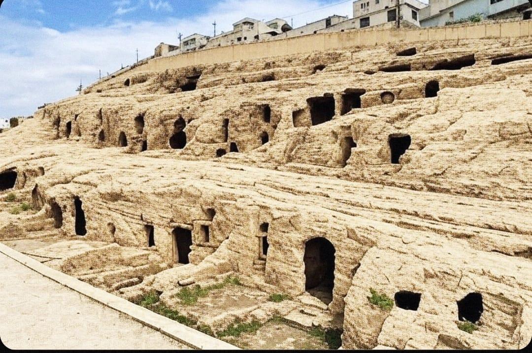
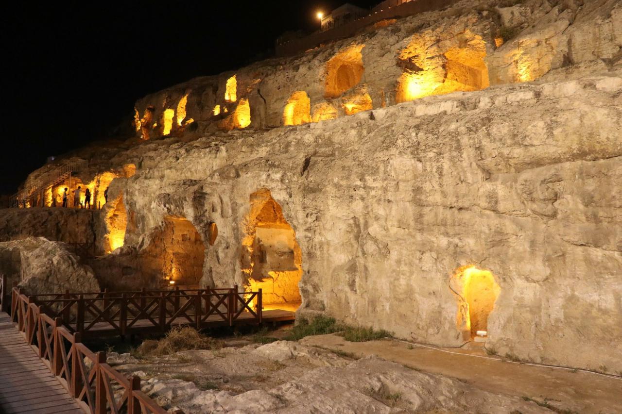
Kızılkoyun Necropolis is an archaeological site located on the slopes of Tılfındır Hill, above the Balıklıgöl Plateau, north of the city center of Şanlıurfa. It is notable for its rock-cut tombs, inscriptions, reliefs, and mosaics dating to the Roman period. Considered part of the necropolis zone of the ancient city of Edessa, this site forms a cohesive component of Şanlıurfa’s historical landscape together with surrounding cultural heritage areas.
Kızılkoyun Nekropolü (Şanlıurfa Belediyesi)
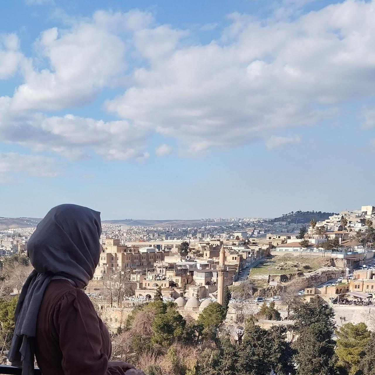
Şanlıurfa is one of the oldest settlement areas in Mesopotamia. Over its approximately 12,000-year history it has hosted numerous civilizations and gained strategic importance due to its proximity to water sources, fertile agricultural land, and its position along major trade routes. Known in antiquity as Edessa, the city became the capital of the Kingdom of Osroene, established in 132 BCE, and maintained its independence until 244 CE. Subsequently incorporated into the Roman Empire, Edessa played a critical role in the early spread of Christianity. Under Roman administration it attained provincial status and emerged as a prominent center on Rome’s eastern frontier. During this period, monumental necropolises with elaborate tomb structures were constructed around the city. The Kızılkoyun Necropolis emerged as a burial ground situated just beyond the city walls, outside the ancient urban core.
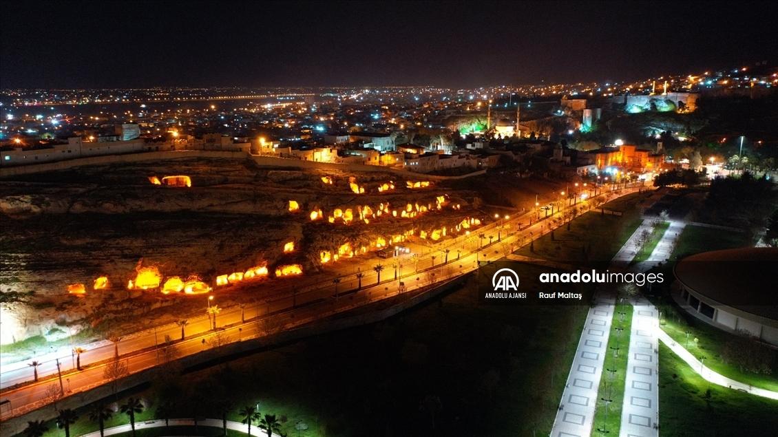
The Kızılkoyun Necropolis is located within the Eyyübiye district of Şanlıurfa and covers an area of approximately five hectares. The site is built on a sloping terrain composed of limestone bedrock, which allowed for easy carving of rock-cut tombs. This natural feature was decisive in the development of the necropolis. The site is bordered by the Yenimahalle Archaeological Site to the east, the Haleplibahçe Archeopark to the west, the Urfa Castle and Balıklıgöl to the south, and the Bedüzzaman Cemetery to the north.
During planning efforts in 1979, the Kızılkoyun area was not included in the protective scope alongside neighboring cultural sites. In the 1992 Conservation-Oriented Urban Plan, it was designated for use as a park and children’s playground. However, the first serious conservation measures were initiated in 2008 when the area was officially declared a Second-Degree Archaeological Site. Subsequent evaluations in 2012 resulted in the official registration of two zones: the area with concentrated rock-cut tombs as the “Kızılkoyun Necropolis Second-Degree Archaeological Site,” and the northern section containing tombs that had lost their original character as the “Kızılkoyun Necropolis Third-Degree Archaeological Site.”
Between 2015 and 2017, excavation and cleaning works carried out in collaboration between the Şanlıurfa Metropolitan Municipality and the Museum Directorate uncovered 105 rock-cut tombs and demolished 389 informal settlements. Archaeological inventory work in the area is still ongoing.
Kızılkoyun Nekropolü (Anadolu Ajansı)
The majority of the rock-cut tombs are connected to the main burial chamber via a dromos, a staircase or sloped entrance corridor. Tombs M-1, M-5, and M-24 feature dromoses with five to seven steps. In this type of tomb, the entrance to the burial chamber is typically protected by monolithic stone doors.
Some tombs consist of a single chamber containing three arcosolia (arched burial niches). In examples such as M-8 and M-33, a two-part plan with a front and rear chamber has been identified. Access between chambers is provided by stone arches, and within the inner chambers are bone-filled pits where the deceased were interred.
Loculi, rectangular prism-shaped burial cells carved into the walls, are found in tombs such as M-43, M-59, and M-59A. In some cases, more than ten loculi are arranged in rows, and some feature ornamental small niches above them.
Kızılkoyun Necropolis (Youtube)
The rock-cut tombs contain Greek and Syriac inscriptions, figural frescoes, and reliefs. In tomb M-16, a relief depicts a male figure reclining on a kline alongside two women and a child. Greek inscriptions appear among the frescoes in tomb M-30, while a three-line Syriac mosaic inscription is located on the floor of tomb M-65. The Labarum symbol, representing Christ, carved on the lintel of tomb M-54, indicates early Christian iconography.
As part of the documentation efforts at the Kızılkoyun Necropolis, photogrammetry, laser scanning, and unmanned aerial vehicle (UAV)-assisted multi-method documentation were applied in accordance with the work of Şenol, Memduhoğlu, and Ulukavak. A three-dimensional (3D) model of tomb M-54 was created using Agisoft software, generating a point cloud, orthophoto, CAD-based drawings, and architectural vector data. These records enable the digital archiving of the tomb structures and support the development of restoration plans.
Following the completion of environmental landscaping in 2020, the Kızılkoyun Necropolis was opened to the public as an open-air archaeological site contributing to Şanlıurfa’s tourism. The site attracts significant interest from both domestic and international visitors and remains accessible for academic research.
Albayrak, Yılmaz. 2017. “Şanlıurfa Kale Eteği Nekropolü Kaya Mezarları.” *Karadeniz*, no. 36: 269–273. Accessed May 29, 2025.https://doi.org/10.17498/kdeniz.366359
Anadolu Ajansı. “Şanlıurfa’daki Turistik Mekanlar Özel Işıklandırmayla Gece de Görenleri Cezbediyor.” aa.com.tr. Accessed May 29, 2025.https://www.aa.com.tr/tr/pg/foto-galeri/-sanliurfadaki-turistik-mekanlar-ozel-isiklandirmayla-gece-de-gorenleri-cezbediyor/0
Aydın, İsmail, Celal Oso, Mahmut Yaşar, and Nihat Polat. 2023. “Tarihi Kızılkoyun Nekropol Alanında M54 No.lu Kaya Mezarının Fotogrametri ile 3B Modellemesi.” *Türkiye Fotogrametri Dergisi* 5, no. 1: 36–42. Accessed May 29, 2025.https://doi.org/10.53030/tufod.1304794
Visit Urfa. "Kızılkoyun Nekropolü." YouTube Video. Accessed May 29, 2025.https://www.youtube.com/watch?v=VT_sFBhUwk0
Öztürk Tel, Hatice, and Fatma Şule Kuloğlu Yüksel. 2017. “Kızılkoyun Nekropolü Arkeolojik Sit Alanı’nın Koruma-Planlama Kapsamında Değerlendirilmesi.” *İnönü Üniversitesi Sanat ve Tasarım Dergisi* 7, no. 16: 1–16. Accessed May 29, 2025.https://doi.org/10.16950/iujad.335643
Şanlıurfa Büyükşehir Municipality. "Kızılkoyun Nekropolleri Işıl Işıl Görüntüsüyle Ziyaretçi Akınına Uğruyor." sanliurfa.bel.tr. Accessed May 29, 2025.https://sanliurfa.bel.tr/icerik/14331/21/kizilkoyun-nekropolleri-isil-isil-goruntusuyle-ziyaretci-akinina-ugruyor
Şenol, H. İbrahim, Ahmet Memduhoğlu, and Mehmet Ulukavak. 2020. “Multi Instrumental Documentation and 3D Modelling of an Archaeological Site: A Case Study in Kızılkoyun Necropolis Area.” *Dicle University Journal of Engineering* 11 (3): 1241–1250. Accessed May 29, 2025.https://dergipark.org.tr/en/download/article-file/1315627
Kızılkoyun Necropolis
Site | Eyyübiye Şanlıurfa Tılfındır Tepesi | ||||||||
|---|---|---|---|---|---|---|---|---|---|
Area | ~5 hectares | ||||||||
Sit Degree | Second- and Third-Degree Archaeological Site Area | ||||||||
Archaeological Discovery | 105 rock tombs, frescoes, mosaics, inscriptions | ||||||||
Discovery Year | 2012 (official site declaration) | ||||||||
Opening to Visitors | 2020 | ||||||||
No Discussion Added Yet
Start discussion for "Kızılkoyun Necropolis" article
Historical Background
Physical Location and Geological Structure
Site Status and Conservation Process
Tomb Architecture and Typology
Dromos Tombs
Single and Multi-Chamber Tombs
Loculus Tombs
Artistic and Epigraphic Findings
Digital Documentation and 3D Modeling
Current Status and Tourism