


This article was automatically translated from the original Turkish version.
+1 More
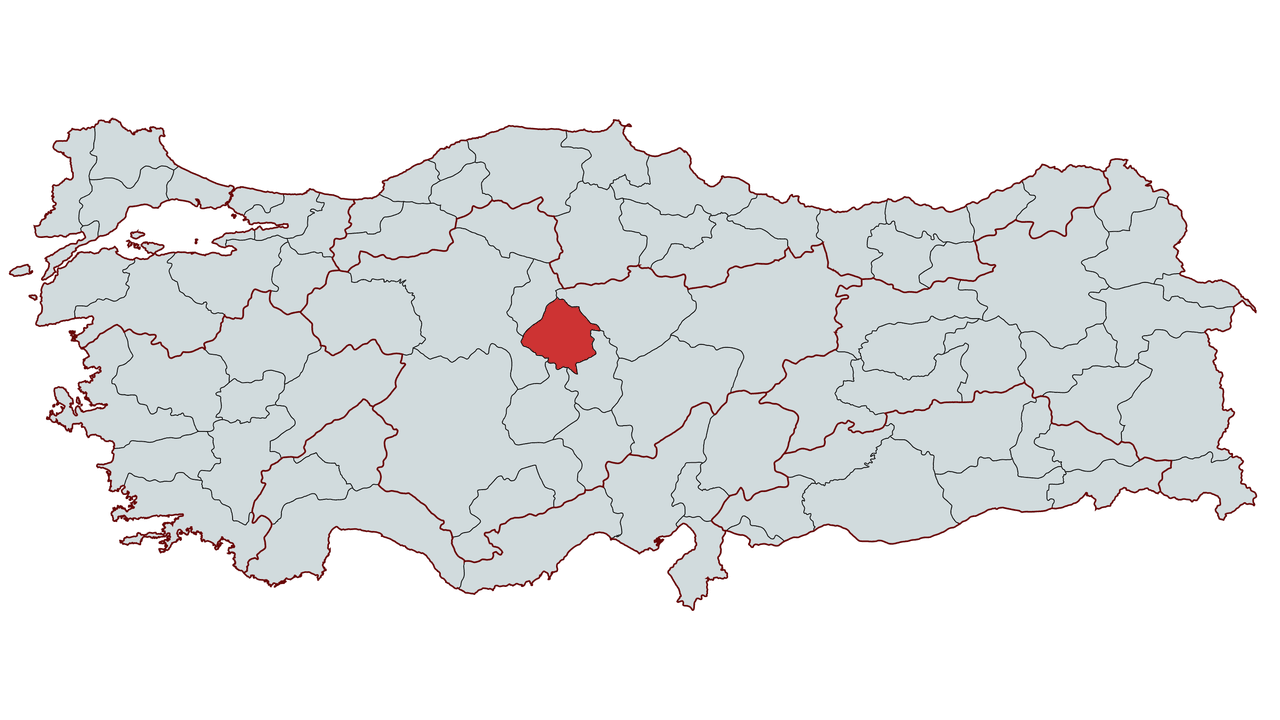
Kırşehir
Country | Türkiye | ||||||||
|---|---|---|---|---|---|---|---|---|---|
Region | Central Anatolia Region | ||||||||
Population | 244546 (2024) | ||||||||
Area | 6570 km² | ||||||||
Climate | Continental Climate | ||||||||
Area Code | 386 | ||||||||
License Plate Code | 40 | ||||||||
Governor | Murat Sefa Demiryürek | ||||||||
Mayor | Selahattin Ekicioğlu | ||||||||
Kırşehir is a city located in the Central Anatolia Region of Türkiye. It has an area of 6,570 km² and a total population of 244,546 according to 2024 data. Throughout history, Kırşehir has been home to various civilizations including the Hittites, Phrygians, Romans, Byzantines and Seljuks. During the Seljuk and Ottoman periods, it became an important center, particularly shaping its commercial and social structure through the activities of Ahi Evran, the founder of the Ahi Organization.
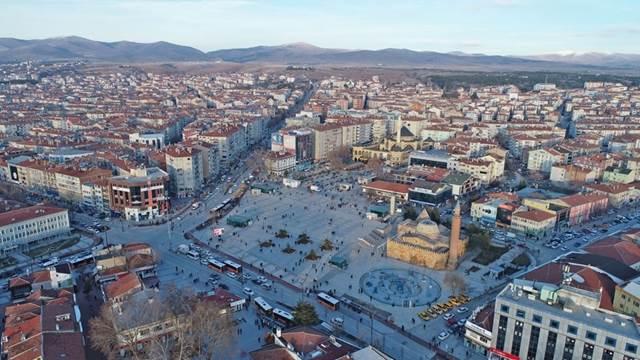
Kırşehir - NTV
Kırşehir and its surroundings have been inhabited since prehistoric times. Archaeological excavations have revealed that the region has a history extending back to the Neolithic period. Kırşehir’s history becomes more distinct during the Hittite era.
During the Hittite period, the region, though not a major administrative center, attracted attention due to its location along key trade routes of Anatolia. After the collapse of the Hittite Empire, the Phrygians took control of the region and established an agrarian civilization. Later, Kırşehir came under the control of various civilizations including the Lydians and Persians.
During the Roman period, the region was administered as part of the Cappadocia province. In the Byzantine period, it became a center for the spread of Christianity, though it suffered periodic damage due to Arab raids.
Following the Turkish settlement in Anatolia after the 1071 Battle of Manzikert, the Kırşehir region was conquered. During the 12th and 13th centuries, Kırşehir became one of the important centers of the Anatolian Seljuk State.
During this period, the region served as the stage for the activities of Ahi Evran, the founder of the Ahi Organization, and gained importance as an Ahi center. The Ahi Evran Külliyesi and various Seljuk structures in Kırşehir preserve the legacy of this era.
After the collapse of the Anatolian Seljuk State, Kırşehir came under the rule of Anatolian beyliks such as the Karamanids and the Eretna Beylik.
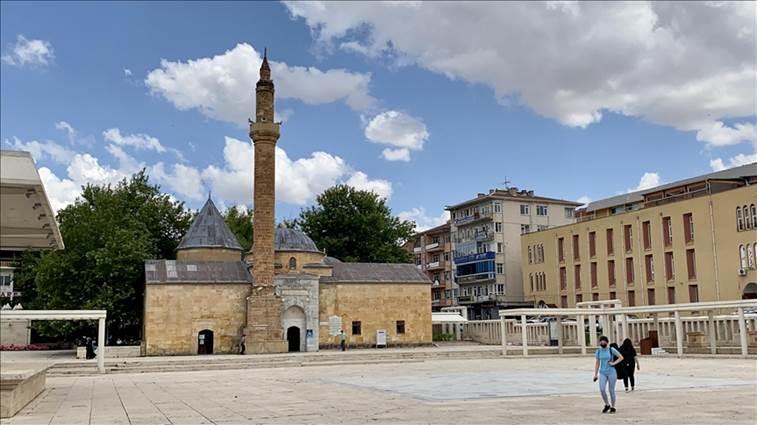
Ahi Evran Zaviyesi - AA
Kırşehir was incorporated into the Ottoman Empire in the early 15th century and became a sanjak center. During the Ottoman period, the region primarily sustained itself through farming and animal husbandry. In the 19th century, it continued to exist as a relatively quiet settlement within the Ottoman administrative framework.
During the War of Independence, Kırşehir became one of the key centers of resistance in central Anatolia and served as one of the stops during Atatürk’s journey to Ankara.
Mustafa Kemal Paşa’s visits to Kırşehir strengthened public support for the Republic and aligned with the Ahi tradition to support the new era’s economic and social policies.
During the Republican period, Kırşehir was initially separated from Ankara and established as an independent province. However, in 1954, under the political climate of the time, its provincial status was revoked and it was attached to Nevşehir. In 1957, it regained provincial status and has since continued to stand out for its regional economy and cultural heritage.
Kırşehir has a vast geography characteristic of Central Anatolia. The city is spread across undulating plateaus ranging from 900 to 1,200 meters in elevation. The Kızılırmak River is one of the most important waterways in the province and vital for agricultural activities. The province contains water sources such as the Hirfanlı Dam and Seyfe Lake. Seyfe Lake is an important wetland for bird diversity and serves as a resting place for migratory birds.
Kırşehir’s vegetation is predominantly steppe, with limited forested areas. Oak and juniper trees are found in mountainous regions, while extensive grasslands cover areas with a steppe climate. Baran Mountain, one of the highest points in the city, reaches an elevation of 1,635 meters.
A continental climate dominates in Kırşehir. Summers are hot and dry, while winters are cold and snowy. Summer temperatures can reach up to 35°C, while winter temperatures may drop to -15°C. Spring and autumn are marked by variable temperatures and higher precipitation. The annual average rainfall in the province is between 400 and 450 mm. This climatic structure directly influences agricultural and livestock activities in the region.
As of 2024, Kırşehir’s population is 244,546. The majority of the city’s population resides in the central district, while rural areas have lower population density. The districts with the highest populations are Merkez, Kaman and Mucur.
The population growth rate in the province varies according to migration trends and fertility rates. Since the 2000s, Kırşehir has been among the provinces experiencing outward migration, particularly among the youth who move toward major centers such as Ankara, Istanbul and Konya. However, the development of Kırşehir Ahi Evran University, increased industrial investment and improved transportation infrastructure aim to balance population distribution.
In Kırşehir’s population structure, male and female population ratios are nearly equal, with females accounting for 50.3% and males for 49.7%. In terms of education level, Kırşehir is at the national average. The educational opportunities provided by the university contribute significantly to the academic development of the youth population.
Kırşehir’s economy is based on agriculture, livestock and industry. Major agricultural products include wheat, barley, sugar beet and sunflower. Livestock farming, both large and small animal husbandry, is widespread. The city has an organized industrial zone contributing to economic development.
Although the industrial sector contributes only marginally to the provincial economy, several large enterprises stand out. Industrialization accelerated from the 1970s onward, with major companies such as Petlas Tire Industry A.Ş. and Çemaş Casting Industry A.Ş. making significant contributions. Petlas, privatized in 1997, is Turkey’s first and only manufacturer of military aircraft tires and exports to over 50 countries. Çemaş Casting Industry A.Ş. produces casting parts for the cement, automotive and white goods industries.
Industrial establishments in the city are primarily concentrated in the food, metal processing, plastic and construction materials sectors. The Kırşehir Sugar Factory, which began production in 2001, is one of the largest agro-based industrial facilities in the province.
Throughout history, Kırşehir has been a trade center along caravan routes. Today, the province’s major trade items include automotive spare parts, steel castings, agricultural machinery, batteries, flour, animal feed and marble. Petlas’s production constitutes a large portion of the province’s trade volume. While most trade activity is concentrated in the provincial center, Kaman and Mucur districts are also significant commercial areas.
Kırşehir possesses a rich cultural heritage due to its role as the center of the Ahi Organization. Historical sites in the city include the Cacabey Medresesi, the Ahi Evran Külliyesi and the Kesikköprü Caravanserai. Seyfe Lake and Hirfanlı Dam Lake attract attention for their natural beauty.
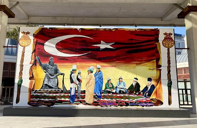
Ahi Representation in Kırşehir - AA
Kırşehir cuisine embodies the traditional flavors of Anatolia. Notable dishes include:
Kırşehir is an important educational center due to Ahi Evran University. The University conducts activities in education and research through various faculties.
Kırşehir is located on the Ankara-Kayseri highway and has easy road access to surrounding provinces. Although there is no railway line, the nearest railway station is in Kayseri. The closest airport is Nevşehir Kapadokya Airport.
The governorship of Kırşehir is currently held by Murat Sefa Demiryürek. The following individuals have served as governors from the past to the present:
The administration of Kırşehir Municipality is currently led by Selahattin Ekicioğlu.
Kırşehir has seven districts:
Kırşehir Belediyesi. "Kırşehir Belediyesi." Accessed February 12, 2025.https://www.kirsehir.bel.tr/.
Kırşehir Ticaret ve Sanayi Odası. "Kırşehir Ticaret ve Sanayi Odası." Accessed February 12, 2025.https://kirsehirtso.org.tr/.
Kırşehir Valiliği. "Kırşehir Valiliği." Accessed February 12, 2025.http://www.kirsehir.gov.tr/.
Kırşehir İl Kültür ve Turizm Müdürlüğü. "Kırşehir İl Kültür ve Turizm Müdürlüğü." Accessed February 12, 2025.https://kirsehir.ktb.gov.tr/.
Türkiye İstatistik Kurumu. "Coğrafi Bilgiler Portalı." Accessed February 12, 2025.https://cip.tuik.gov.tr/.

Kırşehir
Country | Türkiye | ||||||||
|---|---|---|---|---|---|---|---|---|---|
Region | Central Anatolia Region | ||||||||
Population | 244546 (2024) | ||||||||
Area | 6570 km² | ||||||||
Climate | Continental Climate | ||||||||
Area Code | 386 | ||||||||
License Plate Code | 40 | ||||||||
Governor | Murat Sefa Demiryürek | ||||||||
Mayor | Selahattin Ekicioğlu | ||||||||
No Discussion Added Yet
Start discussion for "Kırşehir (Province)" article
History
Prehistory and Antiquity
Seljuk and Beylik Periods
Ottoman Period and Kırşehir’s Status
National Struggle and Republican Period
Geography and Climate
Population and Demographic Structure
Economy
Trade
Culture and Tourism
Local Cuisine
Education and University
Transportation
Administration
Governor
Municipality
Districts