


This article was automatically translated from the original Turkish version.
+2 More
Location | Türkiye Giresun Dereli | ||||||||
|---|---|---|---|---|---|---|---|---|---|
Elevation | 1800-2000 metres | ||||||||
Vegetation Cover | Mixed forests (oak, beech, chestnut...) Endemic plant species Beech forest Meadow Herbaceous and shrub species | ||||||||
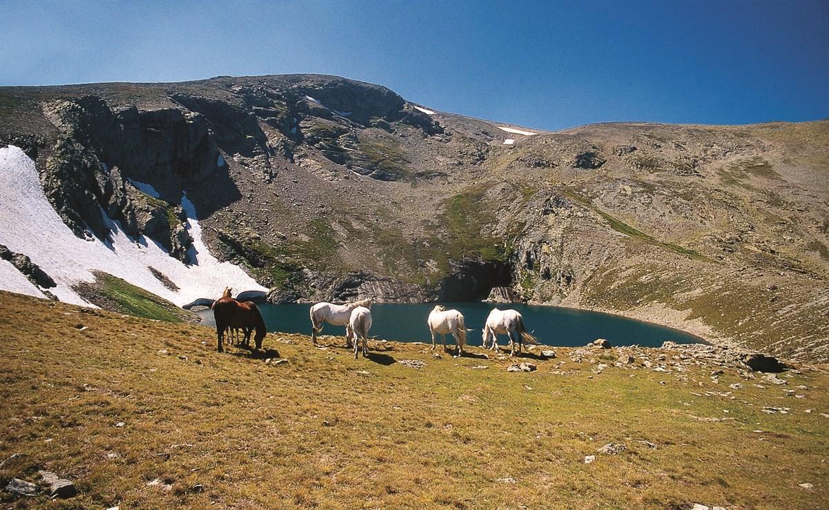
Karagöl Yaylası is located in northeastern Türkiye, within the Eastern Black Sea Region, under the administrative boundaries of Giresun, atop the Giresun Mountains. The plateau is situated near the tripoint boundary of Giresun, Ordu and Sivas provinces, on the northern slopes of Karagöl Dağı. Karagöl Dağı, with an elevation of 3,275 metres, is the second highest peak in the region. The elevation of the plateau ranges approximately between 1,800 and 2,000 metres above sea level.
Karagöl Yaylası lies on a geological structure composed of limestone, marble and metamorphic rocks. The region features rugged and steep slopes characteristic of its geology. The surrounding landscape has been shaped by glacial activity, including cirque basins and glacial valleys. Lakes such as Karagöl, Sağrak Gölü and Aygır Gölü formed within cirques left behind by glacial movements. The topography of the plateau includes deep valleys and sharp ridges. Additionally, there are areas with high risks of rockfalls and landslides.
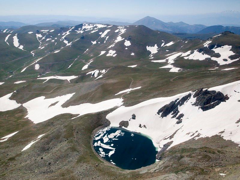
Karagöl Yaylası Buzul Göl (Giresun Valiliği)
Karagöl Yaylası lies at the intersection of the humid Black Sea climate of the Eastern Black Sea Region and the high mountain climate. Summers are cool and rainy while winters are long and harsh with heavy snowfall. Annual average precipitation exceeds 1,200 mm. Intense snowfall occurs particularly between November and March. Snow depth can reach 1 to 2 metres. During summer, fog dew and rain are common. The moist air from the Black Sea directly influences the vegetation cover and hydrological regime of the plateau. Winter temperatures frequently drop below freezing and frost events are widespread.
Karagöl Yaylası is situated within the high mountain alpine meadow zone. The tree line occurs at approximately 1,800 metres elevation and tree cover is limited in the upper sections of the plateau. In the lower areas forests of black pine (Pinus nigra), Oriental spruce (Picea orientalis) and Nordmann fir (Abies nordmanniana) are found. The meadow areas are covered with low herbaceous plants grass species and endemic high-mountain flora. The natural ecosystem of the plateau supports the nitrogen cycle through atmospheric phenomena such as fog dew and lightning which enhance soil fertility and contribute to plant diversity. Furthermore the plateau provides a natural habitat for numerous bird species small mammals and insects.
The area surrounding Karagöl Yaylası is rich in a network of small springs and streams. The main water sources are cirque lakes such as Karagöl and Sağrak Gölü located to the north of the plateau. These lakes consist of naturally accumulated water within basins formed by glacial activity. During summer months meltwater from glaciers feeds streams that flow from these lakes and springs toward the valleys of Giresun and Ordu ultimately reaching the Black Sea. The main streams in the region are Aksu Pazarsuyu and Batlama. The water resources of the plateau serve both the pastoral needs of the highland communities and the water demands of lower settlements.
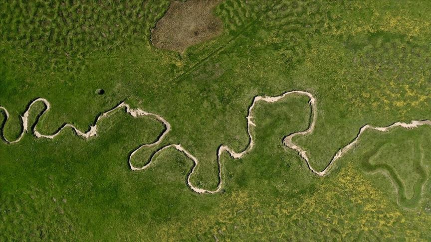
Karagöl Yaylası Menderes Görünümü (Anadolu Ajansı)
Karagöl Yaylası and its surroundings encompass approximately 216 highland settlement units including yaylas and obas. These settlements are typically active during the summer months and remain uninhabited in winter due to harsh climatic conditions. The settlements are established above the tree line near meadow areas. Traditional structures built primarily from wood and stone are common in these settlements. The main economic activities in the region are transhumant pastoralism and animal husbandry involving sheep and cattle. During the summer season local populations bring their livestock to graze and produce animal-based products. Additionally traditional crafts and regional customs associated with highland culture are preserved.
Karagöl Yaylası is one of the high mountain ecosystems of the Eastern Black Sea region known for its endemic plant species and rich biological diversity. The plateau supports ecological balance through its alpine meadows glacial lakes and natural water sources. Natural processes that transport nitrogen from the atmosphere to the soil play a vital role in the sustainability of the plateau’s ecosystem. The area is surrounded by various natural reserves and protected zones aimed at conserving its flora and fauna. Local authorities implement conservation measures to prevent human activities from damaging the ecosystem.
Access to Karagöl Yaylası is provided via mountain roads originating from the city centre of Giresun. The roads are generally unpaved or earthen and often become impassable during winter due to snow and ice. Summer offers easier access and is suitable for hiking and nature tourism. Although improvement efforts are underway to enhance the regional transportation infrastructure access to the plateau remains challenging. Walking trails and routes for mountaineering and nature sports are available around the plateau.
The area where Karagöl Yaylası is located was affected by Quaternary glaciers. Glacial movements shaped the plateau’s current topography. Cirque basins moraine ridges and glacial lakes in the surrounding area are geological remnants of this period. The glaciers identified in the region covered the plateau’s surroundings during the last glacial maximum. Today small glaciers or permanent snow patches are observed around Karagöl and its vicinity.
Karagöl Yaylası has historically been one of the central highland cultural areas of the Black Sea region. The tradition of transhumant pastoralism in the region reflects a way of life that has continued since the Middle Ages. Cultural elements documenting highland life including ancient structures and settlement remains are found within and around the plateau. It is also known that the plateau has traditionally served as a summer residence for local communities for animal husbandry and social activities.
Cin, Mustafa, and Emiroğlu Aydın, Fatma. "Karagöl Dağı ve Çevresinin Coğrafi Özellikleri." *Giresun Üniversitesi Bilimsel Araştırma Projeleri Komisyon Başkanlığı* (2022): 19–29.https://giramer.giresun.edu.tr/Files/ckFiles/giramer-giresun-edu-tr/Kitaplar/Karag%C3%B6l%20B%C3%B6lgesi.pdf#page=25Accessed May 24, 2025.
T. C. Giresun Valiliği. "KARAGÖL DAĞLARI VE YAYLALARI." T. C. Giresun Valiliği Resmî Web Sitesi. Accessed May 24, 2025.http://www.giresun.gov.tr/yaylalarimiz
T. C.Giresun Valiliği Directorate of Culture and Tourism. "Coğrafi Durum." T. C. Giresun Provincial Directorate of Culture and Tourism Official Website. Accessed May 24, 2025.
T. C.Karadeniz Bölge Directorate. "Karagöl." T. C. Karadeniz Regional Directorate Official Website. Accessed May 24, 2025.https://karadeniz.gov.tr/karagol-2/
Yozoğlu, İbrahim. “Karagöl Yaylası'ndaki menderesler bölgeye ayrı güzellik katıyor.” *Anadolu Ajansı.* Accessed May 24, 2025.
Özmenli, Mehmet. "Karagöl Dağı ve Obalarındaki Tarihsel Süreç." Giresun Üniversitesi Bilimsel Araştırma Projeleri Komisyon Başkanlığı. (2022): 30-38. Accessed May 24, 2025.
Location | Türkiye Giresun Dereli | ||||||||
|---|---|---|---|---|---|---|---|---|---|
Elevation | 1800-2000 metres | ||||||||
Vegetation Cover | Mixed forests (oak, beech, chestnut...) Endemic plant species Beech forest Meadow Herbaceous and shrub species | ||||||||
No Discussion Added Yet
Start discussion for "Karagöl Plateau (Giresun)" article
Geomorphological Features
Climate Characteristics
Vegetation and Ecosystem
Hydrography and Water Resources
Settlement and Human Activities
Ecological Importance and Conservation Status
Access and Connectivity
Geological History and Glacial Period Traces
Cultural and Historical Aspects