


This article was automatically translated from the original Turkish version.
+2 More
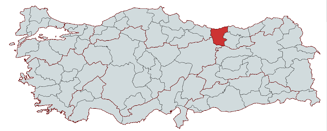
Giresun
Country | Türkiye | ||||||||
|---|---|---|---|---|---|---|---|---|---|
Region | Black Sea Region | ||||||||
Population | 455.922 (2023) | ||||||||
Area | 6934 km² | ||||||||
Climate | Continental Climate Black Sea Climate | ||||||||
Important Structure | Giresun Castle Hacı Miktad Mosque | ||||||||
Area Code(s) | 454 | ||||||||
License Plate Code | 28 | ||||||||
Governor | Mehmet Fatih Serdengeçti | ||||||||
Mayor | Fuat Köse | ||||||||
Giresun is an important Anatolian city located in the eastern section of the Black Sea region with a deep historical heritage. Since ancient times, this region has come under the rule of various civilizations and became a strategic center particularly during the Roman Byzantine and Ottoman periods.
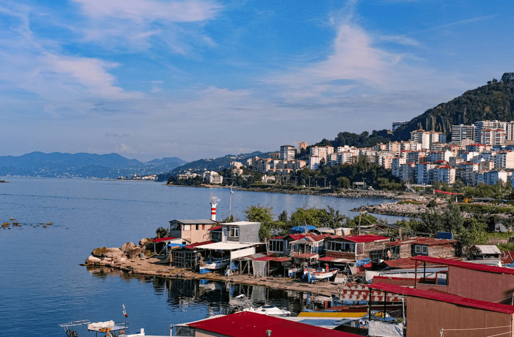
Giresun (Source: Pexels/Seyyah)
The history of Giresun extends back to the 2000s BCE. The earliest settlement traces in the region are attributed to the Kaska people mentioned in Hittite sources. However the first organized state structure in Giresun and its surroundings developed in the 8th century BCE under Colchian and Scythian influence.
The earliest known name of Giresun is Kerasus or Cerasus derived from the Greek word "Keras" meaning "horn". The region was settled in antiquity particularly by the Amazons Milesians and Persians. Under Persian rule in the 6th century BCE the area became part of the Hellenistic world following the campaigns of Alexander the Great in the 4th century BCE.
With the expansion of the Roman Empire into Anatolia Giresun came under the dominion of the Kingdom of Pontus. During the reign of King Mithridates VI the city became an important trade center. After Rome took control of the region Giresun served as a commercial and military base among the port cities of the Eastern Black Sea.
During the Byzantine period Giresun developed as an important center for Christianity with monasteries and churches constructed throughout the region. After the Fourth Crusade in 1204 the city was incorporated into the Empire of Trebizond and established intense commercial relations with the Genoese in the 14th century.
Giresun was incorporated into Ottoman territory in 1461 during the campaign of Fatih Sultan Mehmet against Trebizond. During the Ottoman period Giresun developed as an important port and trade center known for its hazelnut and lumber trade. In the 17th century Evliya Çelebi's Seyahatname noted that Giresun was a developed port city with a large population.
In the 19th century as part of the Ottoman Empire’s administrative reforms Giresun became a district subordinate to the Trabzon Vilayet. During this period the city had a substantial Muslim Turk community alongside significant Greek and Armenian populations.
During the First World War (1914–1918) and the Turkish War of Independence (1919–1922) Giresun gained attention through the Giresun Volunteer Regiments commanded by Osman Ağa and Topal Osman. With the founding of the Republic of Türkiye in 1923 Giresun attained provincial status and emerged as an economically and culturally significant center in the Black Sea Region.
In the early years of the Republic Giresun gained prominence through hazelnut production and export and continues to be one of Türkiye’s most important production centers for hazelnuts today.
Giresun is located in the Eastern Black Sea Region between latitudes 40º 07' and 41º 08' north and longitudes 37º 50' and 39º 12' east. Bordered by the Black Sea to the north the province shares its eastern boundary with Trabzon and Gümüşhane its southern boundary with Sivas and Erzincan and its western boundary with Ordu. With an area of 6934 square kilometers Giresun constitutes approximately 0.89 percent of Türkiye’s total land area.
The province’s geography features a narrow coastal strip in the north and rugged mountainous terrain in the south. The Giresun Mountains run parallel to the coast and rise gradually toward the interior. As one approaches the Kelkit Valley lower elevations are observed. The coastal area exhibits a humid and rainy climate under the influence of the Black Sea while the mountainous southern regions experience continental climatic effects.
Narrow plains along the coast have formed along river valleys. Rivers such as Harşit Aksu Batlama and Pazarsuyu are significant hydrographic features within the province. The Harşit Çayı the longest river in Giresun originates in Gümüşhane and flows into the Black Sea through the Tirebolu district with a total length of 160 kilometers. Although glacial and karstic lakes are rare in Giresun the Karagöl in the Karagöl Mountains and the Mavi Göl in the Kuzalan Nature Park are notable natural lakes.
Among Giresun’s highest points are Abdal Musa Tepe at 3330 meters elevation Cankurtaran Tepe at 3278 meters and Gâvurdağı Tepe reaching 3248 meters. Pastoral activities are widespread on the slopes of these mountains and have historically been part of a transhumant lifestyle. Pastures such as Kulakkaya Bektaş Tamdere Karagöl and Kazıkbeli are areas where agriculture and livestock farming continue.
The provincial center of Giresun is situated on a peninsula extending toward the sea between the Aksu and Batlama valleys. To the east of this peninsula lies Giresun Island the only island along the Black Sea coast suitable for human settlement. Giresun Island has been an important settlement site since antiquity and contains ruins of a Byzantine castle and remnants of the Ayios Fokas Monastery.
Giresun’s ecosystem and biological diversity are exceptionally rich due to the humid climate of the Black Sea. From sea level up to 600 meters elevation deciduous forests dominated by hazelnut and fruit trees are common. At higher elevations coniferous species such as Turkish pine larch and fir predominate. Wildlife in the region includes wolves jackals wild boars hawks eagles and griffon vultures. Additionally fishing has historically been one of the fundamental elements of the provincial economy due to the rich aquatic ecosystems of the Black Sea.
The inland settlements of Giresun have historically been part of commercial and cultural networks through land connections with the provinces of Sivas and Erzincan. During the Ottoman period this area known as Karahisar-i Şarkî served as a gateway to the Kelkit Valley. This region has a distinct character shaped by its connections to southern trade routes both agriculturally and culturally.
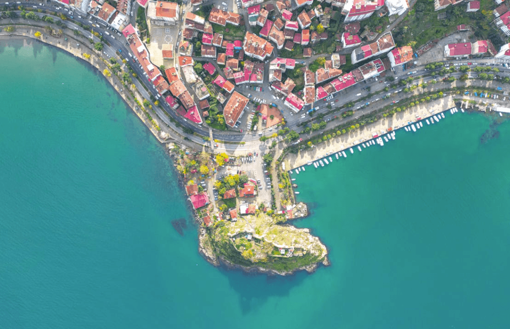
Giresun (Source: Pexels/Furkan)
Giresun Province has an economy based primarily on agriculture due to its geographical structure and climatic conditions. Hazelnut production is the most important agricultural activity and Giresun is internationally renowned for the quality of its hazelnuts. Besides agriculture livestock farming forestry fishing and the industrial sector contribute to the provincial economy though limited industrial and large-scale commercial activity has led Giresun to be among the provinces experiencing emigration with its economy remaining largely dependent on agriculture and agro-based industries.
Agricultural activities in Giresun differ between the coastal and inland areas. The most important agricultural product along the coast is hazelnut. Giresun accounts for approximately 14 percent of Türkiye’s total hazelnut production and holds a significant position in both national and international markets. In addition to hazelnuts the region also produces tea kiwi maize beans vegetables and fruits. In recent years tea production has increased notably in the districts of Tirebolu and Eynesil providing an alternative income source for local communities.
In the inland areas agriculture is centered on cereal production. In the districts of Şebinkarahisar Alucra and Çamoluk cereals such as wheat barley and rye are cultivated alongside significant production of walnuts and apples. The walnut variety known as "Şebin Walnut" is commercially valued for its distinctive characteristics.
Maize one of the widely cultivated cereal crops was extensively produced in the early 20th century but its cultivation area has declined over time due to the expansion of hazelnut production. Similarly while orange and grape cultivation were once significant in Giresun their commercial importance has diminished in recent times.
Livestock farming along the coastal area has not developed on a large scale due to limited pastureland. However small-scale livestock farming (sheep and goat rearing) is practiced in the high-altitude pastures of the inland areas. In the districts of Şebinkarahisar Alucra and Çamoluk located south of the Eğribel Pass large-scale livestock farming is also an important economic activity.
Beekeeping is widespread in the districts of Bulancak Keşap and Dereli. The majority of beekeepers in Giresun practice migratory beekeeping. However due to the harmful effects of agricultural pesticides used in hazelnut orchards on bees beekeepers often migrate to neighboring provinces to continue their production activities.
As a province with a coastline on the Black Sea Giresun has significant potential for fishing activities. There are 609 licensed fishing vessels in the province most of which operate on a small scale with only 11 being large-scale trawlers.
The most commonly caught fish species along the Giresun coast include anchovy sprat horse mackerel red mullet mullet bluefish and mackerel. Sprat fishing can be carried out year-round while mackerel fishing intensifies between September and November. The kalkan fish is fished between January and April. Although fishing does not play as dominant a role in the Giresun economy as in the past it remains a vital livelihood source for coastal communities.
The industrial sector in Giresun is largely based on agriculture. Industrial activities in the province are primarily concentrated on hazelnut processing and the production of hazelnut products. Hazelnuts produced in Giresun are processed into shelled and kernel forms for export and further transformed into value-added products such as hazelnut oil hazelnut paste hazelnut flour and chocolate.
There are two organized industrial zones in the province. The First Organized Industrial Zone (OSB) located in the provincial center covers 70 hectares but operates below full capacity due to infrastructure issues. The Second OSB located in Bulancak district spans 48 hectares and has completed its infrastructure development. A total of 676 companies hold an Industrial Registry Certificate and operate across the province. Food industry forest products and furniture manufacturing constitute the majority of industrial enterprises.
Industrial enterprises in Giresun largely rely on low and medium-low technology production and are at a disadvantage in terms of international competition. The industrial sector remains limited in its development due to insufficient large-scale investments and inadequate adoption of technology.
Analysis of Giresun’s foreign trade structure reveals that exports are overwhelmingly based on hazelnuts and hazelnut products. Hazelnuts account for approximately 85 percent of the province’s exports with the main export destinations being Germany Italy Sweden the United Kingdom France Belgium and the Netherlands among other European countries.
According to 2019 data Giresun recorded exports worth 233.493 million US dollars. Imports primarily consist of agricultural and livestock products machinery equipment and food items from Germany India and China.
Giresun possesses significant tourism potential due to its natural beauty and cultural heritage. Giresun Island the only island along the Eastern Black Sea suitable for human settlement is one of the province’s key tourist attractions. In addition Giresun Castle pastures (Bektaş Kümbet Kulakkaya) and natural areas serve as important tourist attractions.
According to 2019 data the number of domestic and foreign tourists visiting Giresun was recorded at 229206. There are 77 facilities with a total accommodation capacity of 3886 beds. However the province’s tourism infrastructure requires development and promotional activities need to be expanded.
The majority of Giresun’s population is concentrated along the coastal areas and in the provincial center. The parallel alignment of the Eastern Black Sea mountains with the coast has led to settlements being squeezed into the narrow coastal strip. The population in urban centers and district towns maintains strong ties with rural areas. Particularly hazelnut cultivation has caused seasonal migration between rural villages and the city center.
The districts of Şebinkarahisar Alucra and Çamoluk located in the south of the province have lower population densities compared to coastal districts due to their geographical features and transportation challenges. These districts serve as Giresun’s gateway to Central Anatolia and have experienced distinct economic and social development compared to the coastal region throughout history.
The earliest Ottoman population records for Giresun date back to the 15th century. According to Ottoman tax registers in 1486 the population was predominantly Christian with settlements clustered around the castle. After the Ottoman state secured control over Trabzon and its surroundings the migration of Muslim Turkish populations to the region accelerated.
In the 19th century Giresun experienced a major demographic shift and its ethnic structure changed due to Ottoman reforms and population movements. According to 1895 records Giresun’s population was 74963 of whom 61196 were Muslim 12322 were Greek and 1445 were Armenian.
The Çepni Turks played a significant role in the Turkification of the region. Arriving on the Black Sea coast from the 13th century onward the Çepnis settled permanently in Giresun and its surroundings during the Ottoman period. In the 16th century the region was administratively referred to as "Vilayet-i Çepni". The Çepnis continue to exist today as one of the Turkish tribes residing in the rural areas of Giresun.
Social and political developments in the 19th century affected population movements in Giresun. A portion of the Christian population migrated due to the Ottoman-Russian wars and security concerns related to mining areas. Additionally after the 1857 Reform Edict some families who had previously converted to Islam declared themselves Christian again reflecting religious identity shifts in the region.
Giresun has been significantly affected by the broader rural-to-urban migration trend in Türkiye. Until the 1960s the majority of the rural population remained in place but after this period economic factors accelerated migration primarily to large cities such as Istanbul Ankara Izmir and Bursa. Limited employment opportunities in rural areas and low agricultural productivity were key drivers of this migration.
Regarding internal migration there has been movement from rural areas to provincial and district centers. Since the 1970s coastal districts such as Bulancak Tirebolu Görele and Espiye have received more migration than the provincial center. Inland districts such as Alucra and Şebinkarahisar have gradually experienced population loss as young people leave in search of better employment opportunities in larger cities due to economic stagnation.
Another type of migration observed in Giresun is seasonal migration. During the hazelnut harvest season families from other cities return to their villages to engage in agricultural activities. In addition seasonal agricultural workers arriving from neighboring provinces and the Southeastern Anatolia Region temporarily increase the province’s population during specific periods of the year.
Giresun’s total population has undergone changes over the years due to the decline in rural population and the acceleration of urbanization. The urban center population which was 11888 in 1927 rose to 19902 in 1960. As of 2023 Giresun’s total population is approximately 450000.
The rate of urbanization is high along the coast while population density is lower in inland areas. The concentration of agricultural and industrial activities in coastal districts is one of the main factors supporting population growth in these areas.
Mehmet Fatih Serdengeçti is currently serving as Governor in Ankara. Serdengeçti was appointed Governor of Giresun by Presidential Decree No. 2023/376 dated August 2023. The Mayor of the province is Fuat Köse.
Giresun consists of 15 districts 24 municipalities 8 towns and 549 villages.
Giresun Valiliği. *Giresun Valiliği Resmî Web Sitesi.* Accessed February 14, 2025.http://www.giresun.gov.tr/.
Giresun Üniversitesi Office of International Relations. *Giresun Tanıtım.* Accessed February 14, 2025.https://disiliskiler.giresun.edu.tr/tr/page/giresun-tanitim/7657.
T.C. Giresun Valiliği İl Çevre ve Orman Müdürlüğü. Giresun İl Çevre Durum Raporu 2005. Giresun: Giresun Valiliği, 2005.
T.C. Ministry of Culture and TourismGiresun İl Directorate of Culture and Tourism. "Giresun Provincial Directorate of Culture and Tourism Official Website." Accessed February 14, 2025.https://giresun.ktb.gov.tr/.

Giresun
Country | Türkiye | ||||||||
|---|---|---|---|---|---|---|---|---|---|
Region | Black Sea Region | ||||||||
Population | 455.922 (2023) | ||||||||
Area | 6934 km² | ||||||||
Climate | Continental Climate Black Sea Climate | ||||||||
Important Structure | Giresun Castle Hacı Miktad Mosque | ||||||||
Area Code(s) | 454 | ||||||||
License Plate Code | 28 | ||||||||
Governor | Mehmet Fatih Serdengeçti | ||||||||
Mayor | Fuat Köse | ||||||||
History
Ancient Period and Early Settlements
Roman and Byzantine Period
Ottoman Period and Turkish Rule
Republican Era and Modern Giresun
Geographical Structure
Economic Structure
Agricultural Activities
Livestock Farming and Beekeeping
Fishing
Industry and Trade
Foreign Trade
Tourism and Service Sector
Demographic Structure
Historical Population Structure and Ethnic Distribution
Migration Movements
Urban and Rural Population
Administration
Districts of Giresun