`glacial-lakes` Related Article Results
Karagöl Plateau (Giresun)
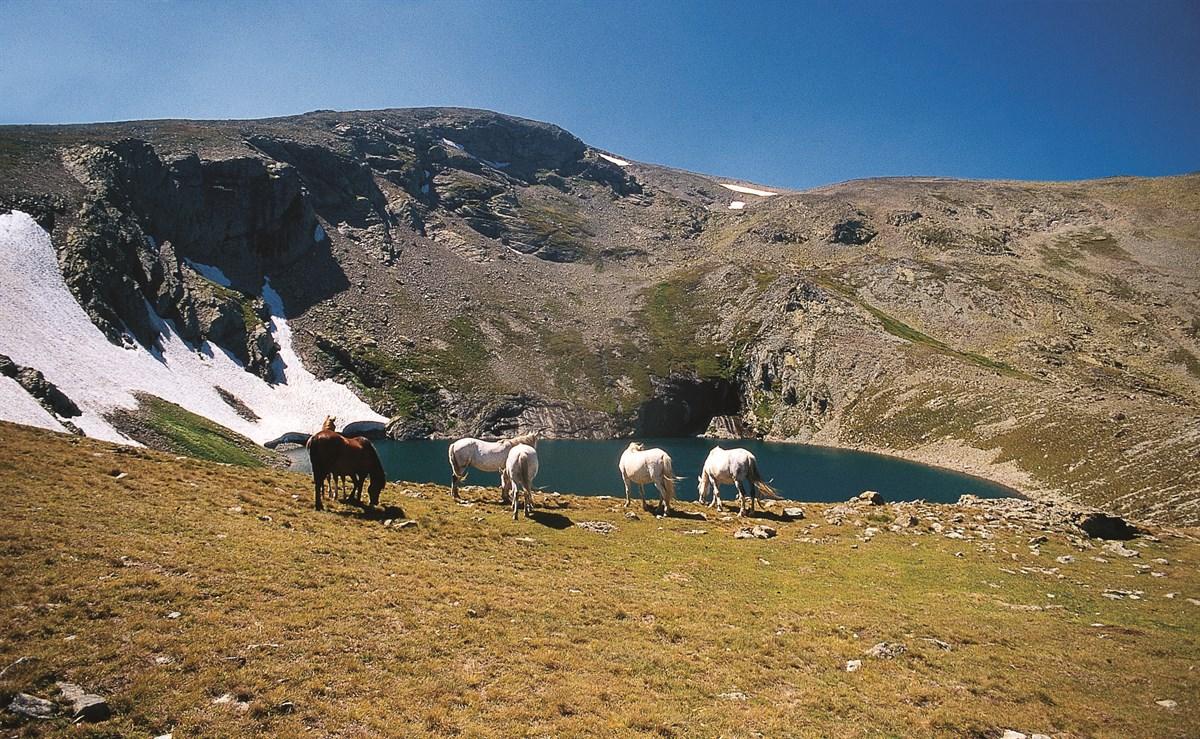
Karagöl Yaylası is located in northeastern Türkiye, within the Eastern Black Sea Region, under the administrative boundaries of Giresun Province, atop the Giresun Mountains. The plateau is situated near the tripoint of Giresun, Ordu, and Sivas provinces, on the northern slopes of Karagöl Mountain. Karagöl Mountain, with an elevation of 3,275 metres, is the second highest peak in the region. The altitude of the plateau ranges approximately between 1,800 and 2,000 metres above sea level.Geomorphol
EN
Nursena Güller

Arsiyan Plateau
Arsiyan Yaylası is a natural highland located within the boundaries of Şavşat district in Artvin province. Situated at elevations between approximately 2,600 and 3,500 metres, the highland is known for its numerous natural lakes and floating islands. Due to its proximity to Karagöl-Sahara National Park, it is one of the region’s most important ecological areas. Access to the highland is typically provided by off-road vehicles due to its rugged and rocky terrain.Natural FeaturesArsiyan Yaylası is
EN
Zelal Çakar

Berçelan Plateau
Berçelan Yayla is located approximately 18 kilometers northeast of the city center of Hakkâri. Situated at an elevation of about 2,800 to 3,500 meters above sea level, the plateau is among the highest in Hakkâri, set within the surrounding mountainous terrain.Natural FeaturesBerçelan Yayla is distinguished by streams, creeks, and glacial lakes formed by melting snow during the summer months. The glacial lakes and mountain ranges surrounding the plateau clearly reveal the region’s geographical an
ENZelal Çakar