


This article was automatically translated from the original Turkish version.
+2 More
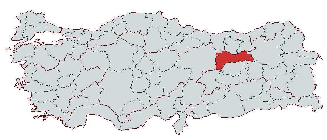
Erzincan
Country | Türkiye | ||||||||
|---|---|---|---|---|---|---|---|---|---|
Region | Eastern Anatolia Region | ||||||||
Population | 241.239 (2023) | ||||||||
Area | 11.903 km² | ||||||||
Climate | Continental Climate | ||||||||
Important Structure | Mamahatun Caravanserai Otlukbeli Lake Altın Tepe | ||||||||
Area Code(s) | 446 | ||||||||
License Plate Code | 24 | ||||||||
Governor | Assoc. Prof. Dr. Hamza Aydoğdu | ||||||||
Mayor | Bekir Aksun | ||||||||
Erzincan is a city located in the Eastern Anatolia Region of Türkiye, which has been under the rule of many civilizations throughout its history. Strategically situated along the Silk Road, Erzincan has been influenced by numerous cultures and states. The city, with settlement traces dating back to the 2000s BCE, has come under the influence of major civilizations such as the Urartians, Medes, Persians, Hellenes, Romans, Byzantines, and Ottomans.
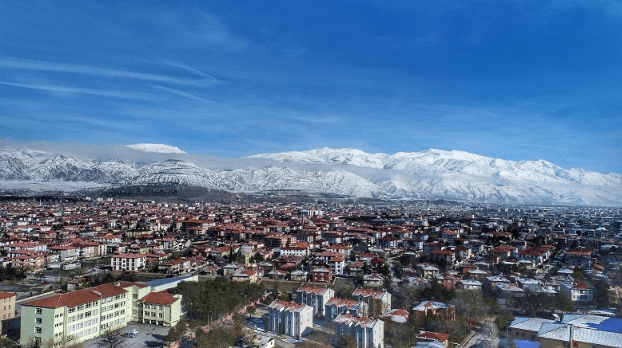
Erzincan (Source: Erzincan Municipality)
Ancient Period
Although definitive information about Erzincan’s ancient history remains limited, it is recorded that the Hurrians inhabited the region, followed later by the Hayasans and Azzi. It is also believed that Erzincan was under the dominance of the Hittites during their period of rule over Anatolia between 1850 and 1180 BCE, leaving significant traces in the region.
Urartian Period
Around 900 BCE, the Kingdom of Urartu, established in Eastern Anatolia, ruled over a vast territory that included Erzincan. With its capital at Van, the Urartians extended their borders from the Caspian Sea to Malatya, and from Erzincan to Aleppo and Mosul. Excavations near Altıntepe in Erzincan have confirmed the region’s subjugation under Urartian control.
Median Period
After the fall of the Urartians, the Erzincan region came under Median control in 612 BCE. The Medes conquered Anatolia and governed a vast territory extending as far as the Persians.
Persian Period
Around 550 BCE, the Persians defeated the Medes and took control of Anatolia, bringing Erzincan under their rule. After Persian dominance, the region was conquered by the Macedonians.
Hellenistic and Roman Periods
Following the death of Macedonian King Alexander the Great, the Erzincan region became part of the Macedonian Empire. Subsequently, the Roman Empire captured the region in 70 BCE. During the Roman period, Erzincan became a center of numerous conflicts and later served as a stage for various dominations under Byzantine influence.
Islamic Period
Following the Islamic conquests, Erzincan came under Muslim control in 655 during the time of Caliph Osman. During the Abbasid period, the region fell under Arab rule. Throughout this era, Erzincan remained under Arab administration despite repeated Byzantine attacks.
Turkic Period
Turkic incursions into Anatolia accelerated after the Battle of Manzikert in 1071. Ahmet Gazi Mengücek, a commander of Alparslan, conquered Erzincan and founded the Mengücek Beylik. In 1228, Erzincan was captured by Seljuk Sultan Alaaddin Keykubat and came under Seljuk rule. After the Battle of Köse Dağ in 1243, Erzincan fell under the administration of the Ilkhanids.
Eretna Beylik Period
During the decline of the Ilkhanids, Alaeddin Eretna seized control of Erzincan in 1335 and declared its independence. The Eretna Beylik governed the region through various alliances with the Akkoyunlus and other local beyliks.
Ottoman Period
The Ottomans conquered Erzincan in 1473 following the Battle of Otlukbeli, bringing the region under Ottoman rule. After the Çaldıran Campaign against the Safavids in 1514, Erzincan rejoined the Ottoman Empire. During the Ottoman period, the city became an important center both strategically and culturally.
Modern Period
After the proclamation of the Republic, Erzincan became a province of the Republic of Türkiye in 1923. In 1939, it suffered a devastating earthquake that caused massive destruction and claimed tens of thousands of lives. Reconstruction began after the disaster, leading to the establishment of modern Erzincan. The Russian occupation of 1916 and the liberation of 1918 are among the significant events in Erzincan’s history.
Erzincan is located in the Upper Euphrates Basin within the Eastern Anatolia Region of Türkiye. Its geographical coordinates lie between 39°02' and 40°05' north latitude and 38°16' and 40°45' east longitude. Erzincan borders Erzurum to the east, Sivas to the west, Tunceli to the south, Bingöl to the southeast, Elazığ and Malatya to the southwest, Gümüşhane and Bayburt to the north, and Giresun to the northwest. The province covers an area of 11,903 km², and its provincial center is situated at an elevation of 1,185 meters above sea level.
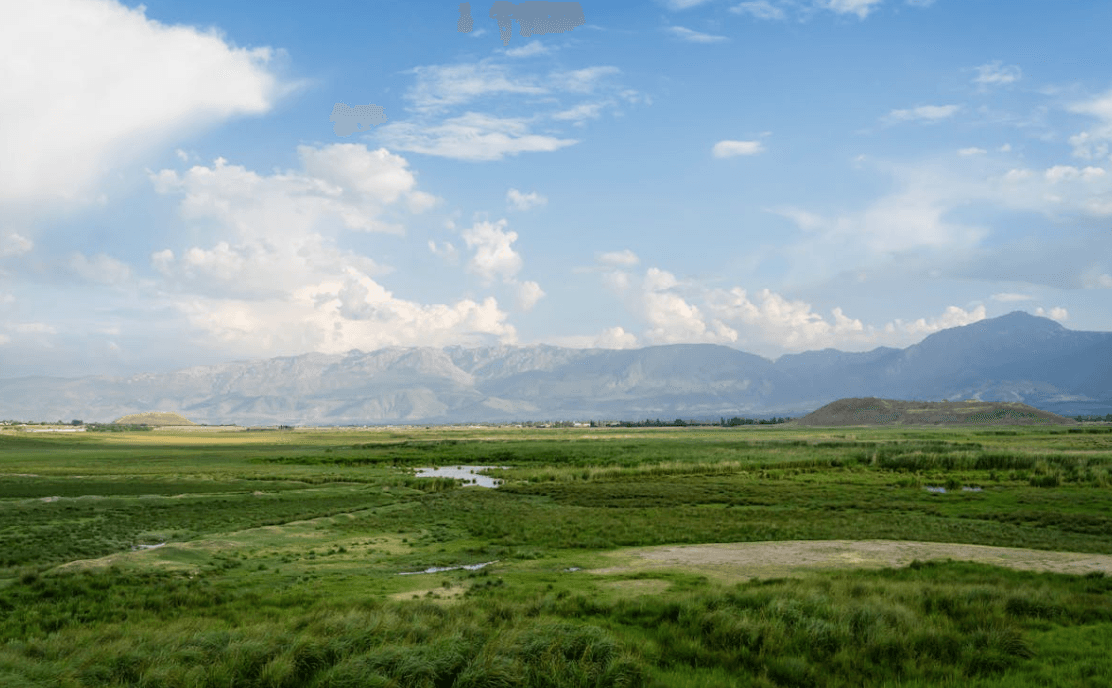
Erzincan (Source: Pexels/Selim Özgün)
The geography of Erzincan province is largely covered by mountains and plateaus. Mountain ranges occupy approximately 60% of the province’s territory and extend in various directions. The Munzur Mountains enter from the southwest, while the Refahiye Mountains extend from the northwest. Erzincan features a terrain shaped by valleys and plains between these mountains. The Erzincan Plain stretches 40 km in an east-west direction and covers an area of 500 km², offering extensive arable land.
Other important plains within the provincial boundaries include the Tercan Plains on either side of the Euphrates Valley. These plains support irrigated agriculture and produce significant agricultural crops. Erzincan’s mountains are known for peaks of varying elevations. The Esence Mountains, at 3,549 meters, represent the highest point in the province. Other notable high peaks include Köhnem Dağı (3,045 m), Sipikör Dağı (3,010 m), and the Munzur Mountains (3,449 m).
The vegetation cover of Erzincan is predominantly steppe. However, in the western districts of Refahiye and Kemah, pine forests, oak woodlands, and shrublands are common. In the southern part of the province, particularly in the Munzur Mountains, vegetation is especially rich.
The climate of Erzincan is generally continental. Compared to surrounding provinces, Erzincan experiences longer and hotter summers, while winters are harsh and cold. The annual average temperature is 16.6 °C, with the coldest month, January, dropping to -3.7 °C, and the hottest month, August, reaching 23.9 °C. The annual average precipitation is 380.6 mm, with spring being the season of highest rainfall.
The largest river in Erzincan is the Euphrates. The Euphrates flows through the Tercan Plain, divides the Erzincan Plain into two parts, and is fed by various tributaries. The river’s water is used for irrigation, energy production, and water sports. Other important water sources in the province include Çayırlık Dere, Tuzla Suyu, and Kadıgölü in Kemaliye.
The geographical structure of Erzincan province features a diverse composition of mountainous areas, plains, rivers, and vegetation. These geographical characteristics significantly influence the province’s agricultural activities, climate, and economic structure. Erzincan stands out for its natural and climatic diversity, which has shaped its historical and cultural development.
Thanks to its geographical location and natural resources, Erzincan has a structure conducive to various economic activities. The economy of Erzincan is largely based on agriculture. The most important agricultural products in the province include wheat, barley, sugar beet, alfalfa, and beans. The Erzincan Plain and Tercan Plain are fertile agricultural areas that support production through irrigation. Approximately 44% of the province’s agricultural land is dedicated to field crops, while the remainder is used for vegetable and fruit cultivation. The largest income source from agriculture comes from wheat and sugar beet. In addition, settled farmers in Erzincan engage in both large and small livestock farming. The number of large livestock in Erzincan is 114,915 and small livestock is 434,457. The livestock sector plays a significant role in meat and milk production. Erzincan is also a region engaged in fish production, with a total output of 589.25 tons recorded in 2018.
Erzincan’s industry sector is primarily composed of small-scale factories and production facilities. Industrial enterprises in Erzincan operate in the food, textile, automotive, and construction sectors. Erzincan has notable production capacity in the food industry, hosting numerous businesses involved in dairy products, flour-based goods, and meat processing. In addition, the automotive and construction sectors are among the province’s growing economic areas. Industrial enterprises in Erzincan primarily serve local markets, but in recent years, steps have been taken to enhance export potential.
Another important sector in Erzincan’s economy is industry based on livestock and agriculture. Erzincan also plays a significant economic role as a transportation hub. The city is a crucial junction for both railway and road transport. This strategic location supports trade and the logistics sector. Erzincan is striving to diversify its economy through exports to regional markets. In the industrial sector, regional development incentives aim to attract investment and increase the local labor force capacity.
Erzincan possesses tourism potential through its natural beauty and historical and cultural heritage. Natural areas such as the Munzur Mountains and the Erzincan Plain are important attractions for nature tourism. Additionally, Erzincan attracts tourists through its cultural heritage elements, including historical mosques, madrasas, and bridges. Various festivals are held annually in Erzincan that draw the interest of both domestic and international tourists, contributing to the development of the province’s tourism potential.
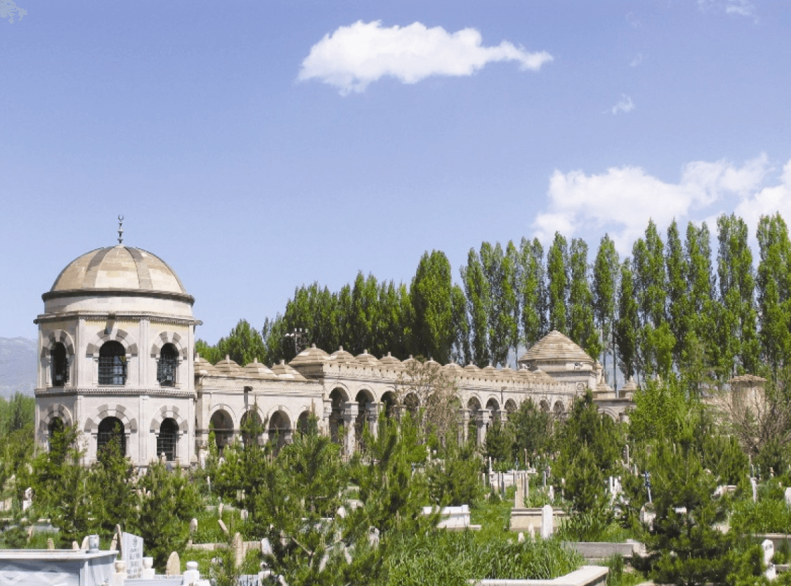
Terzi Baba Türbesi (Source: Erzincan Municipality)
Erzincan province plays a significant role in regional development through its road networks, railways, air transport, and infrastructure improvements. With a total road network of 830 km, Erzincan is one of the main transportation nodes in the Eastern Anatolia Region. The length of divided highways in Erzincan increased from 7 km to 266 km by 2002, significantly improving intra-city and inter-city transportation. Village roads also hold considerable importance, with a total network of 3,611 km comprising 2,991 km of first-priority village roads and 620 km of second-priority village roads. These roads strengthen the connection between rural settlements and the city.
In terms of rail transport, Erzincan has a total of 243 km of railway lines, providing important transportation links through the Eastern Express between Kars and Haydarpaşa, as well as passenger services between Erzincan and Divriği. Erzincan is also hosting project studies for the Sivas-Erzincan high-speed rail line.
Air transport in Erzincan is gradually developing. Türk Hava Yolları operates scheduled flights to Istanbul Atatürk Airport, while Sun Express offers flights to İzmir Adnan Menderes Airport. These air connections strengthen Erzincan’s position within the national transportation network.
Infrastructure improvements, particularly the dynamic development of transportation networks, aim to enhance the quality of life in the city. In this context, the construction of new roads, upgrading of existing roads, and development of public transportation systems are key initiatives. These efforts in Erzincan seek to reduce urban traffic congestion and accelerate connectivity with neighboring provinces. Additionally, innovations in the energy infrastructure contribute to the city’s economic and environmental sustainability by establishing a resilient structure. These improvements will significantly contribute to Erzincan’s future development.
The active Governor of Erzincan is Assoc. Prof. Dr. Hamza Aydoğdu. He was appointed Governor of Erzincan by Presidential Decree No. 2023/376 dated 10.08.2023.
Erzincan Kültür Atlası. "Erzincan Tarihi ve Coğrafyası." Accessed February 17, 2025.https://erzincankulturatlasi.com/erzincan-tarihi-ve-cografyasi/.
Erzincan Valiliği. "Anasayfa." Accessed February 17, 2025.http://www.erzincan.gov.tr/
Erzincan İl Kültür ve Turizm Müdürlüğü. "Anasayfa." Accessed February 17, 2025.https://erzincan.ktb.gov.tr/
Şehrim Erzincan. "Anasayfa." Accessed February 17, 2025.https://sehrimerzincan.com/.

Erzincan
Country | Türkiye | ||||||||
|---|---|---|---|---|---|---|---|---|---|
Region | Eastern Anatolia Region | ||||||||
Population | 241.239 (2023) | ||||||||
Area | 11.903 km² | ||||||||
Climate | Continental Climate | ||||||||
Important Structure | Mamahatun Caravanserai Otlukbeli Lake Altın Tepe | ||||||||
Area Code(s) | 446 | ||||||||
License Plate Code | 24 | ||||||||
Governor | Assoc. Prof. Dr. Hamza Aydoğdu | ||||||||
Mayor | Bekir Aksun | ||||||||
No Discussion Added Yet
Start discussion for "Erzincan (Province)" article
Geographical Structure
Economic Structure
Historical Sites and Tourism
Transportation and Infrastructure
Regional Cuisine
Local Administration
Governor