


This article was automatically translated from the original Turkish version.
+1 More
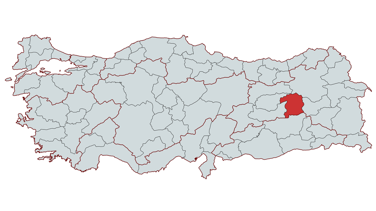
Bingöl
Country | Türkiye | ||||||||
|---|---|---|---|---|---|---|---|---|---|
Region | Eastern Anatolia Region | ||||||||
Population | 283,276 (2024) | ||||||||
Area | 8,253 km² | ||||||||
Climate | Continental Climate | ||||||||
Important Structures and Natural Areas | Buban Chimneys Hesarek Ski Center Sentarius Castle Zağ Caves Kös Spas Floating Islands | ||||||||
Governor | Ahmet Hamdi Usta | ||||||||
Mayor | Erdal Arıkan | ||||||||
Area Code | 426 | ||||||||
License Plate Code | 10 | ||||||||
Bingöl is a province located in the Eastern Anatolia Region of Türkiye, with a history of domination by various civilizations. Its geographical structure is largely mountainous and highland, shaped by river valleys and lakes. It is said that the name Bingöl derives from the numerous lakes and water sources in the region.
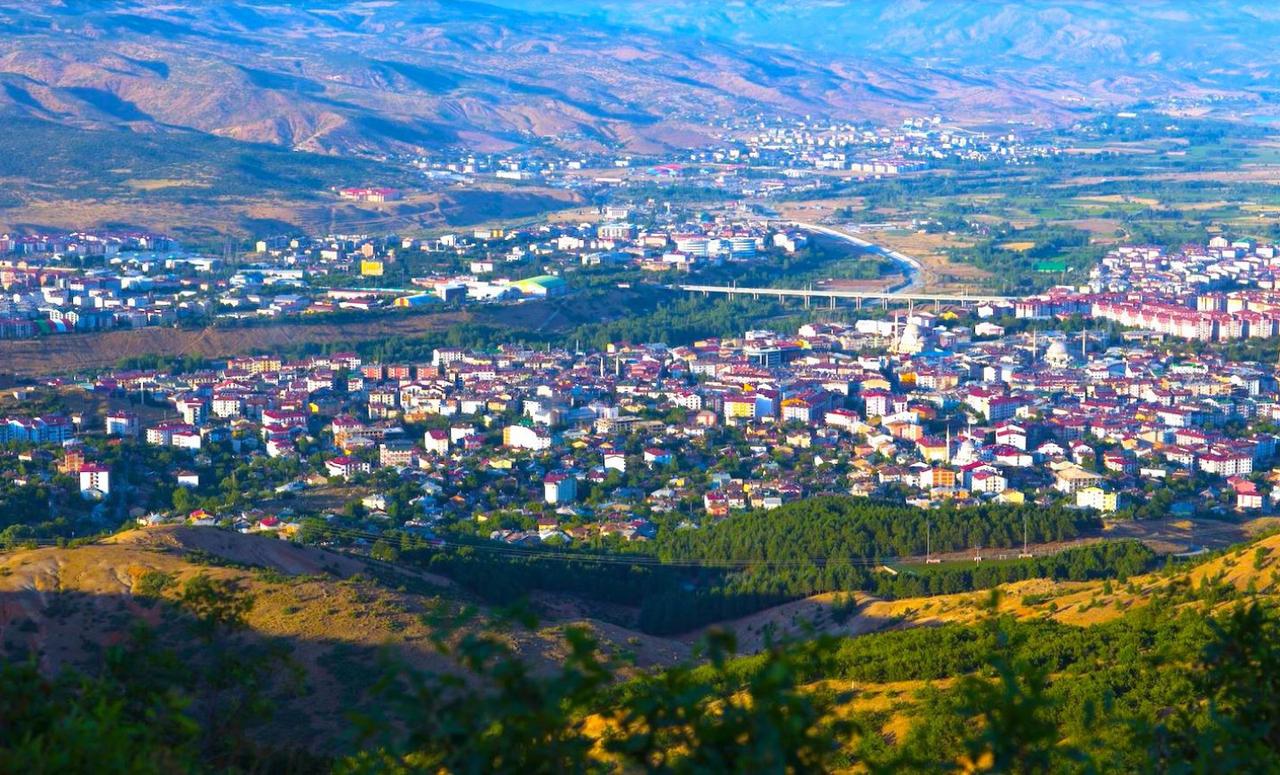
Bingöl City Center - Bingöl Municipality
Bingöl has served as a home to many civilizations throughout history and has been a stage for significant events due to its strategic location. The city’s history encompasses a long process spanning from antiquity through the Turkish-Islamic period, Ottoman rule, and into the Republican era.
Archaeological research conducted in Bingöl and its surroundings reveals a history extending back to 3000 BCE. The Hattians, Hittites, Urartians, Medes, Persians, Macedonians, and Roman-Byzantine civilizations all established dominance over the territory of Bingöl.
From the 7th century onward, Bingöl began to come under Islamic influence through raids by Muslim armies. However, lasting Turkish-Islamic dominance was established after the Battle of Manzikert in 1071.
In 1514, during Yavuz Sultan Selim’s Çaldıran Campaign, Bingöl was incorporated into Ottoman territory and attached to the Diyarbakır Eyalet. During the Ottoman period, Bingöl maintained an autonomous structure under tribal governance and became an important stop along trade routes.
Bingöl is a mountainous and rugged city located in the Upper Euphrates Section of the Eastern Anatolia Region. It is bordered by Muş to the east, Tunceli and Elazığ to the west, Erzurum and Erzincan to the north, and Diyarbakır to the south. The provincial center is situated at an elevation of 1,172 meters and possesses a rich geographical structure characterized by extensive plateaus, mountains, rivers, and lakes.
Bingöl covers an area of 8,253 km², with approximately 80 percent of its terrain mountainous, 10 percent plateau, and 10 percent plain. High mountains, broad plateaus, and valleys define the region’s general geographical structure. Bingöl Mountains, at 3,195 meters, are the highest point in the province and remain snow-covered for extended periods during the winter months. Şeytan Mountains, Karlıova Mountains, and Sülbüs Mountain near Kiğı district are other significant elevations.
Bingöl’s plains are important areas for agriculture and animal husbandry. Genç Plain is the largest plain in the province and holds significant importance for agricultural activity. Muş Plain lies to the east of Bingöl, while Karlıova Plain stands out as a vast flat area primarily used for animal husbandry. In addition to plains, extensive plateaus shape the province’s natural landscape. Çiçektepe Plateau, Kuşburnu Plateau, and Kabaçayır Plateau are among the areas used by nomadic herders during the summer months.
Bingöl is a province rich in water resources, hosting numerous rivers and lakes. The Murat River, one of the main tributaries of the Euphrates, flows from the east of Bingöl and constitutes the region’s most important water source. Peri Stream originates in the Munzur Mountains and flows through Tunceli into the Keban Dam, playing a major role in irrigation and hydroelectric power generation. Göynük Creek is one of the smaller rivers within Bingöl’s boundaries.
Lakes and dams are also important natural features in the province. Karlıova Turna Lake is the largest lake in the region and attracts attention for its natural beauty. Kiğı Dam and Lake is a reservoir created for hydroelectric power generation. Sülbüs Lake lies at the foot of Sülbüs Mountain and is one of the areas attracting visitors for nature tourism.
Bingöl generally experiences a continental climate with very cold and snowy winters and hot, dry summers. Winter temperatures can drop as low as -30°C, and Karlıova district stands out as one of the regions in Türkiye with the longest snow cover. Summer temperatures can reach up to 35°C, with significant differences between day and night temperatures.
Annual average precipitation ranges between 800 and 1,200 mm, with the highest rainfall occurring in spring and autumn. Under the influence of the continental climate, summers are dry while winters bring heavy snowfall. Due to these climatic conditions, agriculture primarily focuses on hardy cereal crops and animal husbandry.
Bingöl features a combination of steppe and forest ecosystems. Forested areas cover approximately 30 percent of the province, with the densest forests located in Kiğı, Genç, and Karlıova districts. Oak, pine, and hornbeam trees are among the most common species. In lower elevation areas, steppe vegetation dominates, with yellow grasses and wild herbs spreading widely during the summer months.
Bingöl is also rich in biological diversity. Wild animals such as wolf, brown bear, wolf, wild goat, jackal, fox, and wild boar inhabit the region. Additionally, along the Murat River and Peri Stream, waterfowl such as herons, wild ducks, and various aquatic birds can be observed. The high plateaus in mountainous areas are suitable for beekeeping, and Bingöl honey is known as one of Türkiye’s highest quality honeys.
Bingöl Province consists of eight districts, five towns, and 325 villages.
Districts: Central, Adaklı, Genç, Karlıova, Kiğı, Solhan, Yayladere, Yedisu
According to the 2023 Address-Based Population Registration System results, Bingöl’s total population is 285,655. Of this, 189,424 reside in urban areas and 96,231 in rural areas. The urban population ratio is 66.31 percent and the rural population ratio is 33.69 percent.
The population of the provincial center is 172,007, and the overall population density of Bingöl is 34 people per km². The largest district by population is the Central district, while the smallest is Kiğı. By area, the largest district is Central and the smallest is Yayladere.
Demographic data shows that the population aged 0–15 constitutes 24.96 percent of the total, those aged 15–64 make up 66.94 percent, and those aged 65 and over account for 8.08 percent.
The annual population growth rate in the province is measured at 10.9 percent, while Bingöl’s net migration rate is -10.70 percent. This indicates high levels of outward migration and a portion of the population relocating to other regions. Particularly notable is the migration trend from rural areas to urban centers and neighboring provinces.
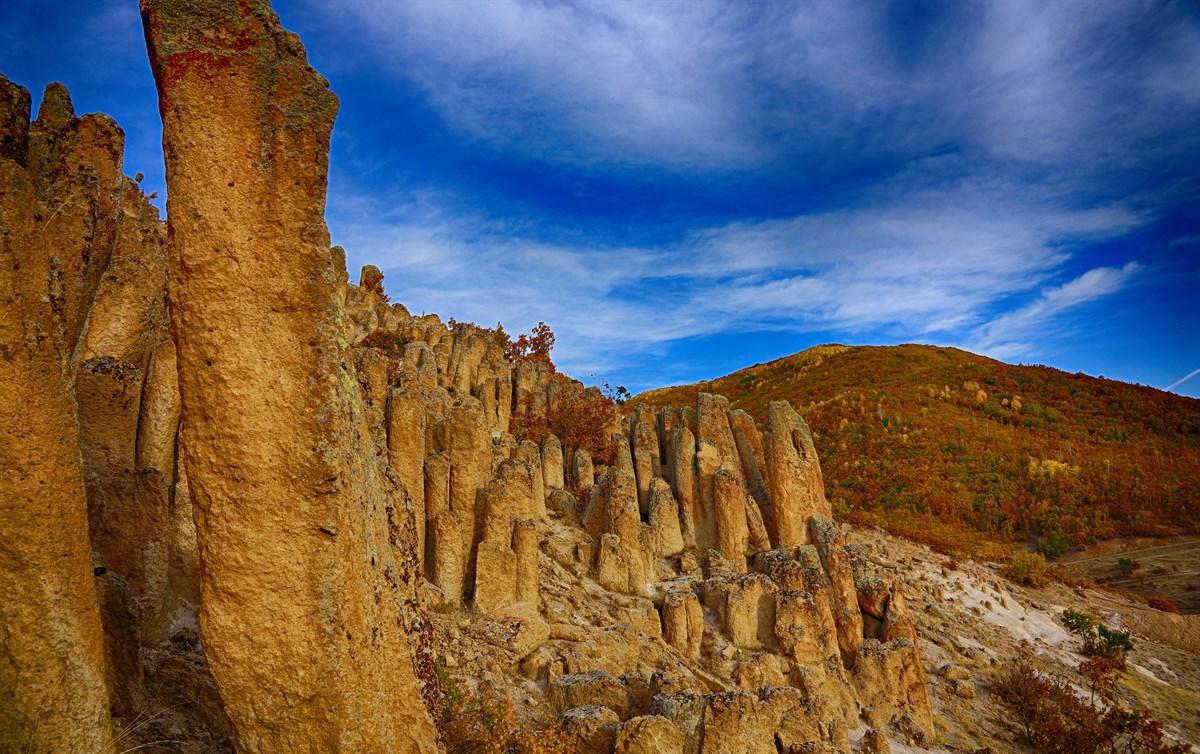
Bingöl Buban Chimneys - Bingöl Municipality
Bingöl’s economy is based on agriculture, animal husbandry, industry, and trade. Traditionally dominated by agriculture and animal husbandry, the province’s economic structure has diversified in recent years with the growth of industry and trade.
Bingöl possesses significant potential for agriculture and animal husbandry due to its vast arable land and fertile pastures. Crops such as wheat, barley, maize, and forage plants are cultivated, with alfalfa and silage maize playing a major role in the regional economy. Furthermore, Bingöl holds the highest share of cereal and plant production in the TRB1 region.
Animal husbandry is one of the cornerstones of Bingöl’s economy. Large and small livestock farming is widespread, with milk production and fattening being key livelihood sources. With the increasing use of cultured and crossbred cattle, productivity in animal husbandry is being enhanced. Bingöl is also notable for beekeeping and contributes a significant portion of the region’s total honey production.
Industry has emerged as one of the fastest-growing sectors in Bingöl in recent years. The number of enterprises operating in food, textiles, furniture, and animal product sectors is increasing. The Organized Industrial Zone (OSB) is undergoing expansion, and production capacity has been enhanced through new investments.
One of the largest investments in Bingöl is the dairy products factory built by SÜTAŞ. This facility supports the animal husbandry sector by providing economic benefits to producers and making a major contribution to regional development. Additionally, small industrial sites and local artisans in the province create important employment opportunities and inject vitality into the local economy.
Bingöl possesses tourism potential due to its natural beauty and thermal springs.
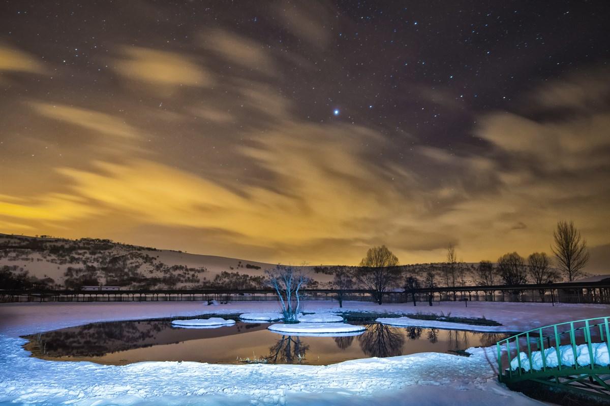
Bingöl Floating Islands - Bingöl Municipality
Bingöl stands out for its rich cultural heritage and traditional way of life.
Bingöl cuisine is known for its traditional Anatolian flavors centered on meat and dough products.
Bingöl is situated along key transportation routes connecting Eastern Anatolia with other regions.
Bingöl Belediyesi. "Bingöl Municipality Official Website." Accessed February 18, 2025.https://www.bingol.bel.tr/tr.
Bingöl University. "Bingöl Hakkında." Bingöl Üniversitesi Uluslararası İlişkiler Ofisi. Accessed February 18, 2025.https://international.bingol.edu.tr/hakkimizda/bingol-hakkinda/.
Bingöl Valiliği. *Bingöl Valiliği Resmî Web Sitesi.* Accessed February 18, 2025.http://www.bingol.gov.tr.
Fırat Kalkınma Ajansı. "Bingöl Tanıtım." Fırat Kalkınma Ajansı. Accessed February 18, 2025.https://fka.gov.tr/bingol-tanitim.
T.C. Ministry of Culture and Tourism. "Bingöl İl Directorate of Culture and Tourism." T.C. Ministry of Culture and Tourism Bingöl Provincial Directorate of Culture and Tourism Official Website. Accessed February 18, 2025.https://bingol.ktb.gov.tr/

Bingöl
Country | Türkiye | ||||||||
|---|---|---|---|---|---|---|---|---|---|
Region | Eastern Anatolia Region | ||||||||
Population | 283,276 (2024) | ||||||||
Area | 8,253 km² | ||||||||
Climate | Continental Climate | ||||||||
Important Structures and Natural Areas | Buban Chimneys Hesarek Ski Center Sentarius Castle Zağ Caves Kös Spas Floating Islands | ||||||||
Governor | Ahmet Hamdi Usta | ||||||||
Mayor | Erdal Arıkan | ||||||||
Area Code | 426 | ||||||||
License Plate Code | 10 | ||||||||
History
Ancient and Medieval Period
Turkish-Islamic Period
Ottoman Period
Republican Era and Present
Geographical Structure
Landforms
Rivers and Lakes
Climate
Vegetation and Natural Life
Administrative Structure
Population and Demographics
Economy
Agriculture and Animal Husbandry
Industry and Trade
Tourism
Culture
Culinary Culture
Transportation and Infrastructure