


This article was automatically translated from the original Turkish version.
+1 More
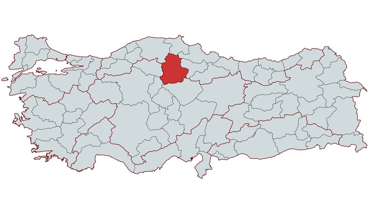
Çorum
Country | Türkiye | ||||||||
|---|---|---|---|---|---|---|---|---|---|
Climate | Continental Climate | ||||||||
Area Code | 364 | ||||||||
License Plate Code | 19 | ||||||||
Governor | Ali Çalgan | ||||||||
Mayor | Halil İbrahim Aşgın | ||||||||
Çorum is a city located in the interior regions of Türkiye’s Black Sea Region. Throughout its historical process, it has served as a home to numerous civilizations and was particularly significant as a political and cultural center during the Hittite period. Due to its geographical position at a transitional zone, Çorum exhibits influences from both Inner Anatolia and the Black Sea climate. Its economy is based on agriculture, industry and trade, and it is notable for its archaeological and historical structures as part of its cultural heritage.
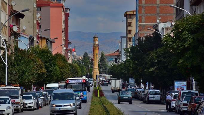
Çorum City Center – Çorum Provincial Directorate of Culture and Tourism
Çorum and its surroundings have been inhabited since prehistoric times. The region, settled from the Chalcolithic Age, was used as an important center by the Hattian and Hittite civilizations. Particularly Boğazköy (Hattusa) and Alacahöyük were among the most important cities of the Hittite Empire. Hattusa served as the administrative and religious capital of the Hittites. Alacahöyük contains royal tombs and temple remains.
After the Hittites, the Phrygians dominated the region and left behind their distinctive rock monuments and reliefs. Phrygian rule ended with the invasions of the Cimmerians in the 7th century BCE. Subsequently, the region came under the control of the Medes and Persians and during the Achaemenid Empire, Çorum was administered as part of the satrapy system.
With Alexander the Great’s conquest of Anatolia, Hellenistic culture spread to the region. However, after Alexander’s death, control of the area shifted between the Seleucids and the Kingdom of Pontus. As the Roman Empire consolidated its dominance over Anatolia, Çorum came under Roman rule and gained military and commercial importance due to its location at a crossroads of major routes. In 395 CE, following the division of the Roman Empire, the region came under the control of the Byzantine Empire.
During the Byzantine period, Çorum frequently changed hands due to Arab raids and internal revolts. After the 1071 Battle of Manzikert, the Seljuks took control of the region and encouraged the settlement of Turkmen tribes. Çorum became an important trade center during the Anatolian Seljuk period, with numerous caravanserais, madrasas and mosques constructed.
With the weakening of the Anatolian Seljuk State, Çorum suffered Mongol invasions and came under Ilkhanid control. After the end of Ilkhanid rule, the region briefly fell under the administration of the Eretna Beylik. Subsequently, Çorum came under the control of beyliks such as the Candaroğulları and the state of Kadı Burhaneddin. In 1398, it was incorporated into Ottoman territory by Yıldırım Bayezid. However, after the 1402 Ankara Battle, it was detached from Ottoman lands by Timur and definitively came under Ottoman rule in the mid-15th century.
During the Ottoman period, Çorum attained the status of a sanjak and became an administrative unit subordinate to the Anatolia Eyalet. During the Celali rebellions of the 17th century, the region experienced major unrest but was later brought back under central Ottoman authority. In the 19th century, as part of administrative reforms, Çorum retained its sanjak status and was incorporated into the vilayet system. During this period, agricultural production increased, local trade developed, and population growth was observed.
After the proclamation of the Republic, Çorum experienced development through industrialization and infrastructure investments. It served as an important center of resistance during the War of Independence, with the local population supporting the Kuva-yı Milliye movement. From the mid-20th century onwards, investments were made in sectors such as flour, cement and machinery industries, and Çorum became one of the region’s industrial centers. Industry based on agriculture expanded, new factories were established, and the city’s economic structure diversified.
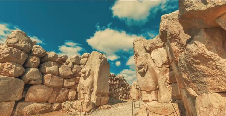
Hattusa Ancient City – Central Black Sea Development Agency
Çorum is located within Türkiye’s Black Sea Region but lies within the transition zone to Inner Anatolia. To the north it borders Sinop and Samsun, to the east Amasya, to the south Yozgat, and to the west Çankırı. The city is situated between 40° 33' north latitude and 34° 57' east longitude. Its total area is approximately 12,820 km².
Çorum’s terrain is hilly, with extensive plains and plateaus. The northern part features extensions of the Köroğlu Mountains, while the southern part consists of the flatlands of Inner Anatolia. Important mountains in the province include Kösedağ (2,026 m), İskilip Dağı and Elmalı Dağ. The largest plain is the Çorum Plain, which is significant for irrigation.
Çorum exhibits a transitional climate between the continental climate of Inner Anatolia and the Black Sea climate. Summer months are hot and dry, while winter months are cold and snowy. The average annual temperature is around 11–12°C. The highest precipitation occurs in spring.
The most important river in Çorum is the Kızılırmak, on which several dams have been constructed. In addition, Delice Çayı, Çat Çayı and Budaközü Çayı are significant water bodies that shape the region’s hydrological structure.
Çorum’s population has fluctuated throughout history due to migration and economic changes. According to 2024 data from the Turkish Statistical Institute (TÜİK), the total population of Çorum is 521,335. The population of the provincial center is 297,255. The population density is 41 people per km².
Çorum has historically been a stage for significant migration movements. Since the 1950s, due to industrialization, it has been a city sending migrants to Istanbul, Ankara and other major cities, and is also one of the provinces that has sent labor migrants abroad, particularly to Germany and France. In recent years, developments in industry and trade have led to population concentration in the city center.
Today, Çorum’s industry is continuously expanding in many areas including animal feed, food, automobile radiators, soil industry, paper industry, corrugated cardboard, sterile syringes, steel casting, ceramics, machinery, computer parts, nails and furniture. Çorum also holds a significant position in the economy through its factories built on a turnkey basis, manufacturing complete equipment for brick-tile, flour-irmik and feed plants.
Çorum has a developed industrial structure. The main industrial sectors in the city are as follows:
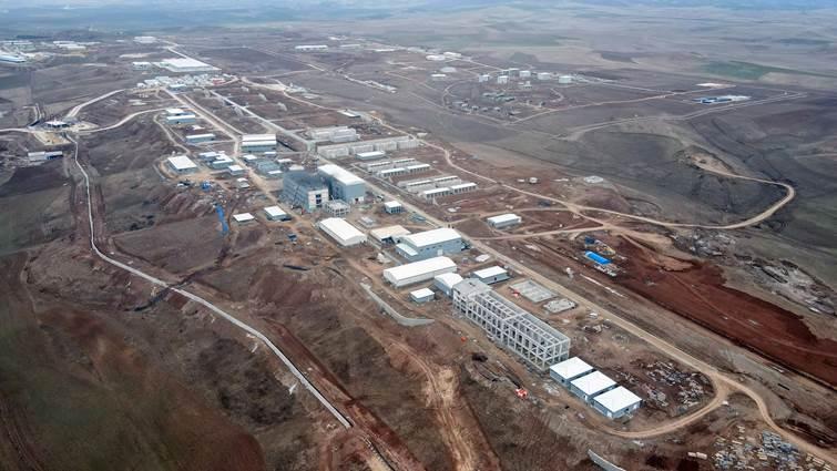
Sungurlu Organized Industrial Zone – Çorum Hakimiyet Newspaper
Agriculture is a vital component of Çorum’s economy. The main agricultural products are:
Livestock farming is also an important economic activity in Çorum. Both large and small livestock farming are widespread, with modern facilities dedicated to milk and meat production.
The population of Çorum is predominantly Turkish. However, throughout its historical process, Caucasian migrants, Balkan migrants and Turkmen groups have settled in Çorum. Particularly Ottoman settlement policies and the population migration from Crimea and Caucasus in the late 19th century significantly influenced Çorum’s ethnic composition. Today, cultural traces of various ethnic groups continue to exist in the city.
Çorum stands out for its historical heritage and traditional cultural fabric. Folk music and folk dances are among the city’s important cultural elements. The Çorum Halayı is a distinctive regional dance. Traditional crafts such as coppersmithing, carpet weaving and woodworking hold significant importance. Additionally, the local cuisine is a vital component of the city’s cultural identity.
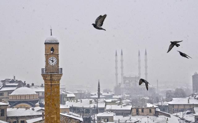
Çorum Clock Tower – Central Black Sea Development Agency
Çorum cuisine features a rich culinary culture rooted in the traditional flavors of Anatolia. Local dishes are prepared using ingredients derived from agricultural production and shaped by unique cooking techniques. Some notable specialties of Çorum cuisine include:
Çorum cuisine is also notable for its traditional food culture, where large feasts are prepared for weddings, festivals and special occasions. The cooking techniques and presentation styles of these dishes are integral elements of the city’s cultural identity.
Çorum stands out for its historical heritage and traditional cultural fabric. Folk music and folk dances are among the city’s important cultural elements. The Çorum Halayı is a distinctive regional dance. Traditional crafts such as coppersmithing, carpet weaving and woodworking hold significant importance.
Çorum is notable for its structures bearing traces of many civilizations. The main historical structures and sites in the city include:
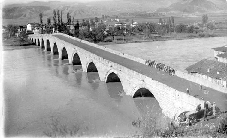
Koyunbaba Bridge – Çorum Provincial Directorate of Culture and Tourism
Hitit Üniversitesi. “Çorum Hakkında.” Accessed February 13, 2025.https://www.hitit.edu.tr/corum-hakkinda.
Ministry of Environment, Urbanization and Climate Change, Republic of Turkey,Çorum İl Directorate. “İlimiz Hakkında.” Accessed February 13, 2025.https://corum.csb.gov.tr/sharp304-l-sharp304-m-sharp304-z-hakkinda-i-650
Orta Karadeniz Kalkınma Ajansı (OKA). “Çorum.” Accessed February 13, 2025.https://oka.gov.tr/bolgemiz/corum.
T.C. Ministry of Culture and Tourism,Çorum İl Directorate of Culture and Tourism. "Çorum Kültür ve Turizm." Accessed February 13, 2025.https://corum.ktb.gov.tr/
Turkish Republic Directorate General of Population and Citizenship Affairs. “Çorum Nüfus Sayım Sonuçları Açıklandı.” Accessed February 13, 2025.https://www.nvi.gov.tr/corum/nufus-sayim-sonuclari-aciklandi.
Çorum Belediyesi. “Çorum Tarihçesi.” Accessed February 13, 2025.https://www.corum.bel.tr/corum/corum-tarihcesi.
Çorum Valiliği İl Kültür ve Turizm Müdürlüğü. Coğrafyası, Tarihi, Kültürü ve Edebiyatıyla Çorum. Çorum: Çorum Valiliği İl Kültür ve Turizm Müdürlüğü Yayınları, Yayın No: 2, 2025. ISBN: 978-605-378-017-5.
Çorum Valiliği. "Çorum Valiliği Resmi Web Sitesi." Accessed February 13, 2025.http://www.corum.gov.tr/.

Çorum
Country | Türkiye | ||||||||
|---|---|---|---|---|---|---|---|---|---|
Climate | Continental Climate | ||||||||
Area Code | 364 | ||||||||
License Plate Code | 19 | ||||||||
Governor | Ali Çalgan | ||||||||
Mayor | Halil İbrahim Aşgın | ||||||||
History
Ancient Period
Medieval and Ottoman Period
Republican Period
Geographical Structure
Location and Boundaries
Geomorphology
Climate
Hydrology
Population and Demographics
Population Distribution and Settlement
Migration and Population Mobility
Economy
Industry and Trade
Agriculture and Livestock
Ethnic and Cultural Structure
Ethnic Structure
Cultural Structure
Çorum Cuisine
Historical Structures and Sites