


This article was automatically translated from the original Turkish version.
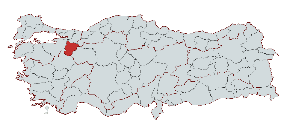
Bilecik
Country | Türkiye | ||||||||
|---|---|---|---|---|---|---|---|---|---|
Region | Central Anatolia Region Marmara Region | ||||||||
Population | 228,495 (2023) | ||||||||
Area | 4307 km² | ||||||||
Climate | Continental Climate | ||||||||
Important Structure | Köprülü Mehmet Paşa Kervansarayı Köprülü Mehmet Paşa Kervansarayı Şeyh Edebalı Türbesi | ||||||||
Area Code(s) | 228 | ||||||||
License Plate Code | 11 | ||||||||
Governor | Şefik Aygöl | ||||||||
Mayor | Melek Mızrak Subaşı | ||||||||
Bilecik is a city located in the southeastern part of Türkiye’s Marmara Region, playing a significant role in the foundation of the Ottoman State. Noted for its historical and cultural heritage, natural beauty, and industrial potential, Bilecik holds great importance as the land where the Ottoman Empire was established. Geographically, it is bordered by Bolu to the east, Sakarya to the north, Bursa to the west, and Kütahya and Eskişehir to the south.
Bilecik is regarded as a historical center due to its status as the birthplace of the Ottoman State. At the same time, this city, which held strategic importance during the War of Independence, is recognized as one of the key transit points in Anatolia.
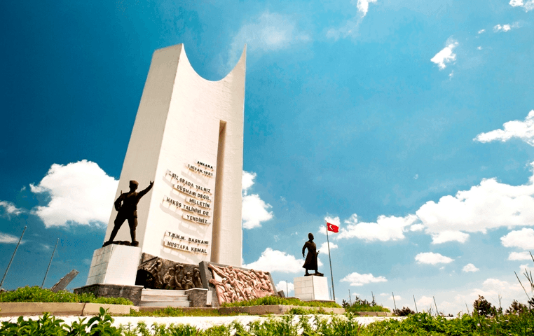
Metristepe Monument, Metristepe (Source: Bilecik Provincial Directorate of Culture and Tourism)
The earliest settlement in Bilecik dates back to around 3000 BCE. Archaeological findings indicate that communities engaged in agriculture and animal husbandry lived here since the Neolithic Age. Bilecik became an important settlement during the transition to the Bronze Age and emerged as one of the centers where tin, essential for bronze production, was mined.
In antiquity, Bilecik was known as Agrilion and Agrillum, and during the Roman Empire, it was referred to as Belekoma. As part of the region of Bithynia, Bilecik came under the rule of various civilizations throughout history, including the Thracians, Egyptians, Hittites, Phrygians, Cimmerians, Lydians, Persians, Macedonians, the Kingdom of Bithynia, the Roman and Byzantine Empires. The region became a significant settlement center particularly during the Kingdom of Bithynia and was incorporated into the Roman Empire in 74 BCE.
After the division of the Roman Empire in 395 CE, the region of Bithynia remained within the boundaries of the Eastern Roman (Byzantine) Empire. During the Byzantine era, Belekoma Castle was constructed, turning the area into a defensive center. Belekoma was administered as a tekfurship during this period. In 797, following campaigns led by the Abbasid Caliph Harun al-Rashid, the region came briefly under Abbasid control, but Byzantine authority was quickly restored.
With the expansion of the Anatolian Seljuk State, Bilecik was conquered in 1075 by Süleyman Şah of the Kutalmışoğlu line. However, during the First Crusade, the Byzantines recaptured the region. In the early 13th century, the Kayı tribe, under the leadership of Ertuğrul Gazi, settled in the areas of Söğüt and Domaniç. In 1231, during a campaign organized by Alaeddin Keykubat I against the Byzantines, the Kayı played a major role, and Ertuğrul Bey was granted the regions of Söğüt and Domaniç.
After the death of Ertuğrul Gazi in 1281, Osman Bey became the leader of the Kayı tribe and laid the foundations of the Ottoman State. In 1299, Osman Bey captured Belekoma Castle and incorporated Bilecik into Ottoman territory. The official process of the Ottoman State’s foundation began during this period, and Bilecik became one of the first administrative centers of the Ottoman State.
During the Ottoman period, Bilecik gained importance due to its location along major trade routes, leading to the construction of caravanserais, baths, mosques, and imarets. The residence of Sheikh Edebali in the city and the presence of his tomb transformed Bilecik into one of the spiritual capitals of the Ottoman Empire.
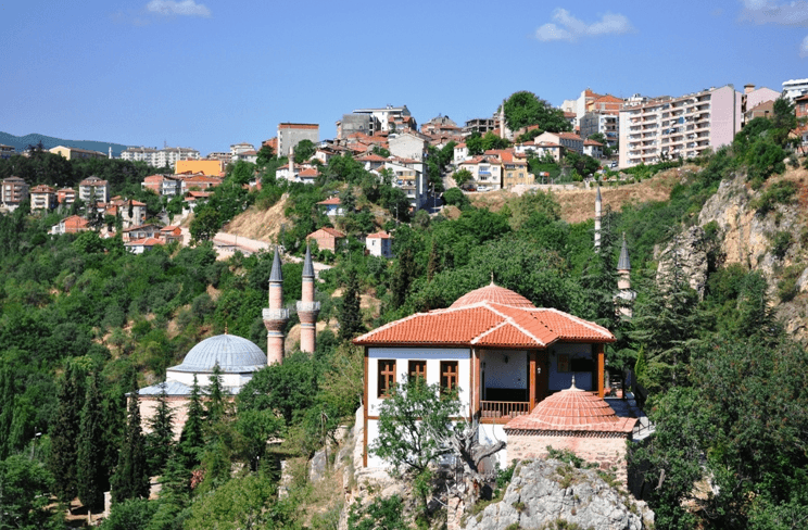
Sheikh Edebali Tomb, Bilecik (Source: Bilecik Provincial Directorate of Culture and Tourism)
Bilecik was one of the cities that suffered extensive damage during the War of Independence. Occupied by the Greek army on 6 January 1921, Bilecik became a battlefield during the First and Second Battles of İnönü. During these battles, Greek forces seized the region several times, but Bilecik was recaptured by the Turkish army. Fully liberated by the Turkish army on 6 September 1922, Bilecik endured severe economic and demographic losses due to the destruction caused by the war.
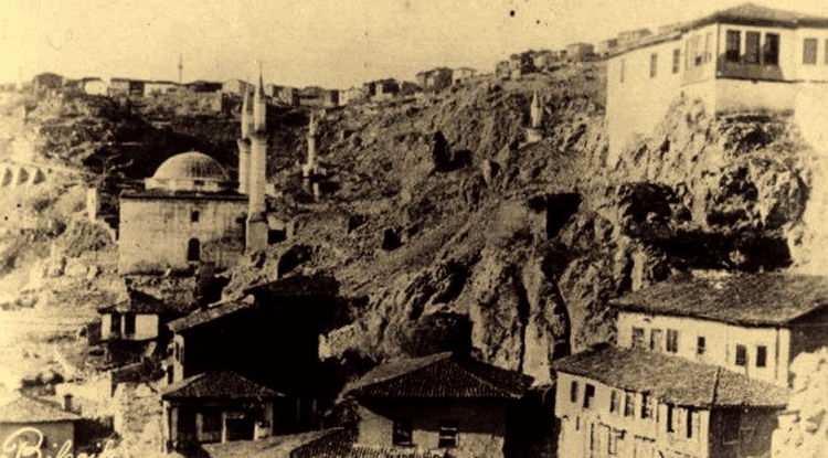
Old Bilecik (Source: Bilecik Provincial Directorate of Culture and Tourism)
After the proclamation of the Republic, Bilecik was restructured to recover from the war’s devastation. Silk production was revived, and an economic model based on industry and agriculture was adopted. Beginning in the 1970s, Bilecik entered an industrialization process and continued its economic development primarily through marble quarries and ceramic industries.
Today, Bilecik continues to exist as a city that unites its Ottoman heritage with modern industrial centers. With its historical structures, natural beauty, and cultural heritage, it remains an important attraction for both domestic and foreign tourists.
Bilecik lies at the intersection of the Marmara, Black Sea, Central Anatolia, and Aegean regions. It is situated between 39° and 40° 31’ north latitudes and 29° 43’ and 30° 41’ east longitudes. It is bordered by Bolu and Eskişehir to the east, Kütahya to the south, Bursa to the west, and Sakarya to the north. The province covers an area of 4,321 km² and has an elevation of 500 meters.
A transitional climate prevails in Bilecik. The Marmara climate dominates in the central district, while the continental climate of Central Anatolia influences the districts of Bozüyük and Pazaryeri. The annual precipitation is 450 kg/m², with the highest rainfall occurring in winter and spring. Summers are hot and dry, while winters are cold and wet.
A large portion of Bilecik consists of hilly terrain. The Köroğlu Mountains, an extension of the North Anatolian Mountains, extend to the eastern part of the province. Major elevations include Kala Mountain (1,906 m), Yirce Mountain (1,790 m), and Metristepe (1,300 m). The plains along the Sakarya River—Bozüyük, Gölpazarı, Osmaneli, and Pazaryeri—are the province’s main flatlands.
Bilecik is rich in important underground resources. It is particularly abundant in marble, calcite, and clay deposits. The most significant marble deposits are located in the districts of Bozüyük and Pazaryeri. Limestone and magnesite reserves are also present in the region.
Calcite (Cc)
Marble (Mr)
The most important river in Bilecik is the Sakarya River. Other significant water sources include Karasu, Göynük Creek, Göksu Stream, and Hamsu Stream. Dams used for energy production and irrigation in the city include Dodurga and Bozüyük Dams.
Bilecik’s economy is based on agriculture, animal husbandry, mining, and industry. The province is particularly notable for its marble, ceramic, brick, and metal industries. The majority of industrial activity is concentrated in the districts of Bozüyük and the provincial center.
Rich in mineral resources, Bilecik has extensive reserves of clay, kaolin, and feldspar used in ceramic and glass industries. Additionally, Bilecik is home to marble quarries known as “Bilecik Stone,” recognized nationwide. Pink and white somaki marble extracted from Vezirhan and Kösedere, red, pink, and peach-colored marble from Hırtılar and Külümbe villages, and black-speckled white marble from Söğüt enjoy high demand in both domestic and international markets.
Bilecik has demonstrated strong economic growth. Export volume, which stood at 80 million USD in 2013, reached 148 million USD in 2022, representing an 85% increase. According to 2021 data, Bilecik ranked fifth in Türkiye in terms of gross domestic product per capita at 11,713 USD.
According to the Socio-Economic Development Ranking of Provinces and Regions (SEGE-2017) prepared by the Ministry of Industry and Technology, Bilecik ranks 19th. Additionally, as of 2022, the province hosts seven R&D centers and ranks 22nd nationally in this field.
Bilecik has a total of eight organized industrial zones (OIZ), three of which are located in the provincial center. Its proximity to major industrial centers such as Istanbul, Bursa, and Ankara, along with logistical advantages and attractive incentive programs for investors, has enabled Bilecik to steadily develop its industry. Alongside ceramics and marble, metal, chemical, food, and machinery industries also hold significant shares in the provincial economy.
Bilecik is strategically located at the intersection of four of Türkiye’s regions, making it an important hub for transportation and logistics. The province is 200 km from Istanbul, 317 km from Ankara, 95 km from Bursa, 105 km from Kocaeli, and 85 km from Eskişehir, granting it a favorable regional position. It is also 51 km from Bursa Yenişehir Airport and 84 km from Eskişehir Anadolu Airport. The nearest seaports are Gemlik Port, 97 km away, and Yalova Port, 110 km away.
Bilecik is one of Türkiye’s key rail nodes, particularly since the commencement of High-Speed Train (YHT) services in 2015, which significantly enhanced rail transportation. YHT routes provide direct connections from Bilecik to Pendik, Gebze, İzmit, Arifiye, Bozüyük, Eskişehir, Polatlı, Sincan, Ankara, and Konya. Conventional freight transport continues along the conventional railway line.
In the 2019/2020 academic year, 13,632 students received education in 662 classrooms in the central district. The student-to-classroom ratio was 20 in primary education and 22 in secondary education. The student-to-teacher ratio was 17 in primary education and 12 in secondary education.
Bilecik is also developing in higher education. As of 2021–2022, Bilecik Şeyh Edebali University comprises 11 faculties and seven vocational schools. The total number of students in faculties located in the central district exceeds 10,000. Bilecik Şeyh Edebali University, which emphasizes industry-academia collaboration, operates academic and applied units such as the Technology Transfer Office, Technopark, and Industry-Based Vocational Education and Research Center.
The university has specialized faculties in engineering, economic sciences, health sciences, and natural stone technologies. Under its research activities, projects are developed in collaboration with industry, providing students with practical training opportunities.
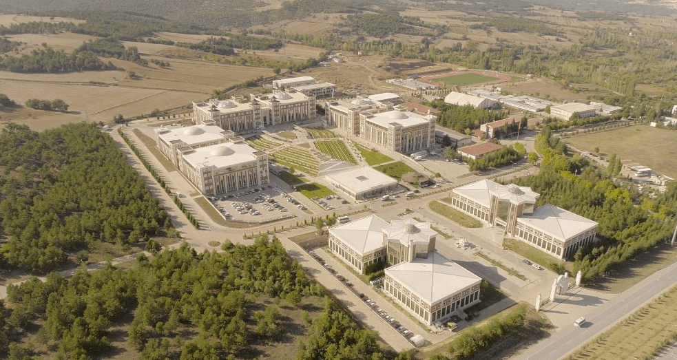
Bilecik Şeyh Edebali University (Source: Bilecik Şeyh Edebali University)
Bilecik has a total area of 4,300 km², and its population distribution is shaped by geographical factors and economic activities. As of 1990, 42.2% of the province’s population lived in urban areas and 57.8% in rural areas (villages and towns). By 2023, urbanization had increased, with population growth accelerating in the provincial center and districts with concentrated industrial activity.
The most densely populated areas include the portion of the İznik-Pamukova depression within the provincial boundaries, the alluvial basin of the Sakarya Valley, the Gölpazarı Plain, and the district of Bozüyük. Particularly due to industrial activity, Bozüyük has become one of Bilecik’s most populous districts. In contrast, population density is low in high-altitude areas such as the Sündiken Plateau, the eastern slopes of Yirce Mountain, most of the Söğüt Plateau, and Meryem Mountain.
Population density in Bilecik has changed over the years. In 1935, the population per square kilometer ranged between 16 and 30, but by 1985, this figure had increased in towns and city centers. In recent years, industrialization and infrastructure development have made Bozüyük and the Bilecik central district the most densely populated areas.
Bilecik’s population growth rate is directly linked to Türkiye’s broader industrialization and migration dynamics. Between 1950 and 1980, Bilecik was a province experiencing population outflow. However, after 1980, industrial investments led to an influx of migrants. Bozüyük, due to the growth of iron and steel and ceramic industries, became a destination for migration, while rural areas experienced population decline and accelerated rural-to-urban migration.
The majority of those who migrated from Bilecik moved to large cities such as Istanbul, Bursa, Eskişehir, and Kocaeli, where industry and services are well-developed. However, in recent years, the development of organized industrial zones in Bilecik has led to reverse migration trends.
Historically, Bilecik’s population structure has shown variations in gender balance. In 1940, the female population outnumbered the male population, but after 1980, industrialization and the presence of military units led to an increase in the male population. According to 1985 data, 52.1% of Bilecik’s population was male and 47.9% female. Today, the gender ratio has become more balanced.
In terms of age distribution, Bilecik shows a declining trend in the youth population. In 1985, individuals aged 0–14 constituted over 30% of the population; today, this figure has dropped below 25%. Conversely, the working-age population (15–64 years) has increased. The expansion of employment in the industrial sector has encouraged individuals of working age to remain in the province.

Ertuğrul Gazi Tomb (Source: Bilecik Provincial Directorate of Culture and Tourism)
The current governor of Bilecik is Şefik Aygöl, who previously served at the General Directorate of Population and Citizenship Affairs from 10 June 2020 to 16 August 2023. He was appointed Governor of Bilecik by Presidential Decree No. 2023/376 dated 9 August 2023. The following individuals have served as governors of the city:
Bilecik Valiliği. "Coğrafi Yapı." T.C. Bilecik Valiliği Resmî Web Sitesi. Accessed February 6, 2025.
Bilecik Valiliği. "Görev Yapmış Valilerimiz." T.C. Bilecik Valiliği Resmî Web Sitesi. Accessed February 6, 2025.
Bilecik Valiliği. "Vali." T.C. Bilecik Valiliği Resmî Web Sitesi. Accessed February 6, 2025.
Bilecik Valiliği. "İlimizin Tarihçesi." T.C. Bilecik Valiliği Resmî Web Sitesi. Accessed February 6, 2025.
Bursa Eskişehir Bilecik Kalkınma Ajansı. "Bölge: Bilecik." BEBKA. Accessed February 6, 2025.
Bursa Eskişehir Bilecik Kalkınma Ajansı. Bilecik Merkez İlçe Raporu. 2018. Accessed February 6, 2025.
Bursa Eskişehir Bilecik Kalkınma Ajansı. Bilecik Yatırım Ortamı Raporu. 2018. Accessed February 6, 2025.
Invest in Bilecik. "Ekonomi." Bilecik Yatırım Destek Ofisi. Accessed February 6, 2025.
Invest in Bilecik. "İklim ve Coğrafi Konum." Bilecik Yatırım Destek Ofisi. Accessed February 6, 2025.
T.C. Kültür ve Turizm Bakanlığı. "Coğrafya." Bilecik Kültür ve Turizm İl Müdürlüğü. Accessed February 6, 2025.
T.C. Kültür ve Turizm Bakanlığı. "Diğer Tarihi Yapılar." Bilecik Kültür ve Turizm İl Müdürlüğü. Accessed February 6, 2025.
T.C. Kültür ve Turizm Bakanlığı. "Genel Bilgiler." Bilecik Kültür ve Turizm İl Müdürlüğü. Accessed February 6, 2025.
T.C. Kültür ve Turizm Bakanlığı. "Tarihçe." Bilecik Kültür ve Turizm İl Müdürlüğü. Accessed February 6, 2025.
Vatan, Ahmet. "Bilecik İl Turizm Envanteri." Journal of Academic Social Sciences 2017. DOI: 10.16992/ASOS.12661. Accessed February 6, 2025.
Özgür, E. Murat. Bilecik İlinde Nüfusun Dağılışı, Yoğunluğu ve Özellikleri.

Bilecik
Country | Türkiye | ||||||||
|---|---|---|---|---|---|---|---|---|---|
Region | Central Anatolia Region Marmara Region | ||||||||
Population | 228,495 (2023) | ||||||||
Area | 4307 km² | ||||||||
Climate | Continental Climate | ||||||||
Important Structure | Köprülü Mehmet Paşa Kervansarayı Köprülü Mehmet Paşa Kervansarayı Şeyh Edebalı Türbesi | ||||||||
Area Code(s) | 228 | ||||||||
License Plate Code | 11 | ||||||||
Governor | Şefik Aygöl | ||||||||
Mayor | Melek Mızrak Subaşı | ||||||||
History
Prehistoric Period
Ancient Period
Byzantine Period
Seljuk Period
Foundation of the Ottoman State
War of Independence Period
Republican Period
Geographical Structure
Location and Boundaries
Climate
Landforms
Natural Resources and Minerals
Rivers and Dams
Districts
Economy
Transportation and Infrastructure
Rail Transport
Education
Higher Education
Demographic Structure
Population Growth Rate and Migration Patterns
Gender and Age Distribution
Historical Structures of Bilecik
Religious Structures
Tomb Structures
Caravanserais and Inns
Civil Architecture
Monuments and Cemeteries
Religious and Cultural Structures
Local Administration
Governor