


This article was automatically translated from the original Turkish version.
+1 More
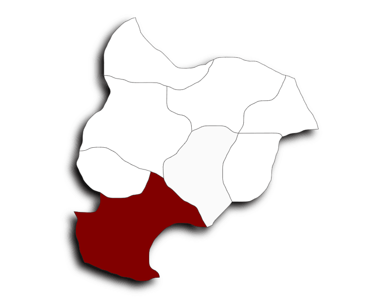
Bozüyük
Province | Bilecik | ||||||||
|---|---|---|---|---|---|---|---|---|---|
Geographic Region | Marmara | ||||||||
Population | 80.865 (2024) | ||||||||
District Governor | Adem Öztürk | ||||||||
Mayor | Mehmet Talat Bakkalcıoğlu | ||||||||
Bozüyük is one of the key crossroads of Anatolia, bearing traces of many civilizations throughout its historical past. Settlement in the region has been shaped under the influence of various cultures since antiquity.
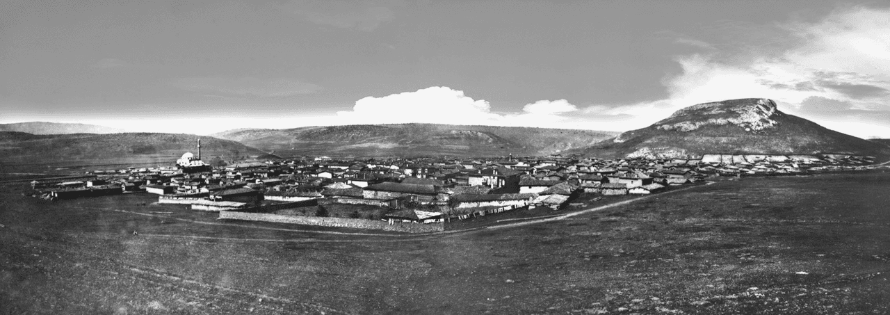
Bozüyük (Source: Bozüyük Municipality)
The history of Bozüyük extends back to the 12th century BCE. It was initially dominated by the Hittites. Following them, the Phrygians, who migrated from the Balkans in the 8th century BCE, gained control of the region. Phrygian rule lasted approximately 600 years, after which the Cimmerians settled in the area. The Cimmerians governed the region for about a century, until the Lydians ended their dominance in the 7th century BCE. After the Lydians, the Persians and then the Macedonians under Alexander the Great successively took control of the region. Following the fragmentation of Alexander’s empire, the Bithynians ruled these lands until the area became part of the Roman Empire. After the Roman Empire, Bozüyük came under the control of the Byzantine Empire from 395 CE onward.
During the Byzantine era, Bozüyük was known as Lamunia. Between 660 and 720 CE, Arab Umayyad forces used the region as a transit route during their campaigns toward Istanbul. After the Battle of Manzikert in 1071, the Seljuk Turks conquered Bozüyük and its surroundings, bringing the region under Turk control. During the Crusades in the 11th century, the region changed hands several times between Christians and Muslims.
In the early years of the Ottoman State, Bozüyük existed as a village under the Sultanönü Uç Beylik. During the foundation of the Ottoman state, Bozüyük became an important settlement. In 1289, Osman Gazi, the founder of the Ottoman Beylik, received the region through a charter from the Seljuk State and incorporated it into Ottoman territory.
In the early Ottoman Empire, Bozüyük further developed under the külliye commissioned by Kasımpaşa, commander of Kanuni Sultan Süleyman. This külliye included a mosque, caravanserai, bathhouse, and school, and was completed between 1525 and 1528.
During the Ottoman period, the region served as a vital military route. During Kanuni Sultan Süleyman’s Rhodes Campaign, Bozüyük was used as a rest and supply point for the army. During this time, the Kasımpaşa Mosque and Külliye were constructed, establishing Bozüyük as its central hub.
During the Republican era, Bozüyük became an important industrial center. Granted district status in 1924, Bozüyük experienced population growth following the 1877–1878 Russo-Turkish War, as immigrants arrived from the Balkans. During this period, Bozüyük’s population increased rapidly and the district saw its first industrial investments. Between 1914 and 2000, the population grew by 985 percent.
Bozüyük became one of the key centers of the War of Independence in the 1920s. During the First and Second Battles of İnönü, the Turkish army achieved significant victories here. These victories are regarded as turning points in the Turkish nation’s struggle for independence. Bozüyük was liberated from Greek occupation in 1922 and fully regained its freedom on 4 September 1922.
Since the 1970s, Bozüyük has become a major industrial center due to state industrial incentives. During this period, investments were made in sectors such as lumber, chemicals, ceramics, casting, food, cable, and glass industries, establishing Bozüyük as one of Türkiye’s key industrial regions.
Throughout its historical development, Bozüyük has served as a vital bridge between Asia and Europe, hosting numerous civilizations and maintaining strategic importance in every era. Today, it is a district notable for both its industrial and cultural heritage.
Bozüyük is a district of Bilecik Province in northwestern Türkiye. It borders the central district of Bilecik to the north, Pazaryeri to the northwest, Söğüt to the northeast, the İnönü district of Eskişehir to the east, the central and Tavşanlı districts of Kütahya to the south, Domaniç to the southwest, and İnegöl to the west. The district covers an area of 928 square kilometers and lies at an elevation of 740 meters above sea level.
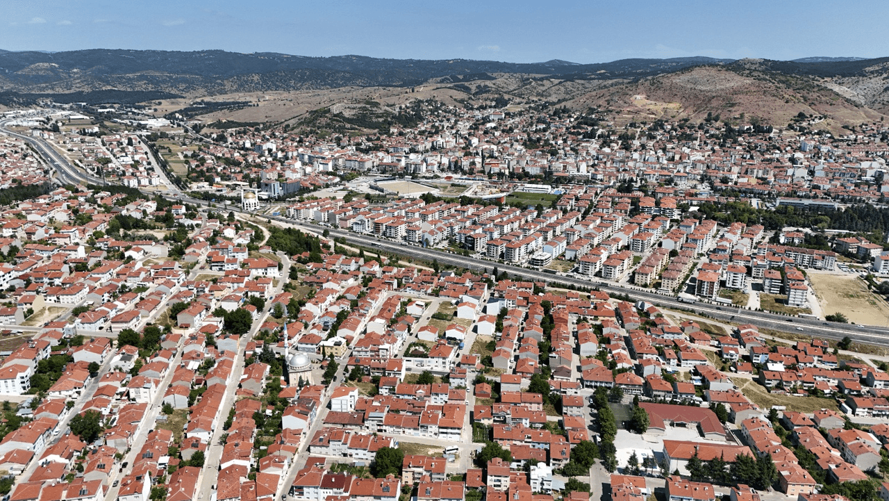
Bozüyük (Source: Bozüyük Municipality)
The landforms of Bozüyük are characterized by mountains, plains, and rivers.
Bozüyük lies within the influence of a continental climate, with cold, wet winters and hot, dry summers. Precipitation occurs mostly during the winter months in the form of snow. Frost and fog are common in January and February. The district’s average annual temperature is 10.7°C, with an average annual precipitation of approximately 485 mm. Under the influence of the continental climate, mountainous areas are generally covered with black pine and hornbeam trees. Above 1,000 meters, black pine and hornbeam dominate, while lower elevations feature red pine and oak. Additionally, above 1,500 meters on Yirce Dağı, fir trees grow together with juniper.
Bozüyük’s geographical structure exhibits diversity in the form of plains, mountains, and rivers. The plains provide fertile agricultural land, while mountainous and forested areas serve as natural reserves. Industrial and residential areas are also widely used across the district. According to 2018 data, land use in the district is balanced among agriculture, industry, and residential zones.
Bozüyük is a developed settlement both economically and culturally, with a distinct structure in terms of population and social services. Demographic composition, education levels, healthcare services, and socioeconomic development are key factors shaping Bozüyük’s social structure.
As of 31 December 2020, Bozüyük’s population was 76,987. Males constitute 50.2% of the population and females 49.8%. The majority of the district’s population resides in the district center; as of 2020, 57,491 people lived in the center, while 8,764 resided in towns and villages. Analysis of Bozüyük’s population pyramid reveals the highest population concentration in the 35–39 age group (approximately 8.30%). This is followed by the 40–44 age group (approximately 7.87%) and the 30–34 age group (approximately 7.84%).
The level of education in Bozüyük is quite high. As of 2019, the literacy rate was 98.56%, exceeding the provincial average. The student-to-classroom ratio in primary and secondary education is 20 and 19 respectively, indicating adequate infrastructure to meet educational needs. Educational institutions in Bozüyük include seven preschools, 19 primary schools, 19 middle schools, eight general high schools, and eight vocational high schools. Additionally, the Bozüyük Vocational School, affiliated with Bilecik Şeyh Edebali University, serves as a major educational center offering various higher education programs. As of the 2020–2021 academic year, 646 students were enrolled at the vocational school, which offers departments in banking, international trade, graphic design, accounting, and tax applications.
Bozüyük also possesses significant healthcare capacity. The Bozüyük State Hospital has a capacity of 150 beds and, as of 2020, employed 77 physicians, 19 dentists, and 464 other healthcare personnel. The district also has various family health centers and health houses. The hospital bed ratio is 1.4 beds per 1,000 people and the intensive care bed ratio is 0.25. Demand for healthcare services extends beyond the district, with patients also coming from neighboring provinces such as Eskişehir. This situation indicates that Bozüyük has become a regional healthcare center.
Bozüyük is a developed district in terms of industrialization. As of 2017, its socioeconomic development index (SEGE) was determined at 0.715, the second-highest level in the province. Bozüyük’s industry-based economy has made significant investments in sectors such as lumber, food, automotive components, and chemicals. Industrial growth has also influenced population increase and migration patterns. Migration from surrounding settlements such as Pazaryeri has increased living and employment opportunities in Bozüyük.
Bozüyük has a developed, industry-based economy and rapidly industrialized from the 1970s onward through large-scale investments. Its location at the intersection of major highways and railways connecting large cities such as Istanbul, Ankara, and Bursa has made it strategically important from a logistical perspective. This has facilitated the establishment of major industrial enterprises and accelerated economic growth.
In the 1970s, Bozüyük began attracting industrial investments through special state incentives and became a major industrial city through investments from outside the region. Today, over 100 industrial enterprises operate in the district. These enterprises produce in various sectors including metal-machinery, food, ceramics, glass, furniture, construction products, and energy. Leading industrial brands include Vitra, Esan Eczacıbaşı, Demirdöküm, Demirer Kablo, Eurodecor, and Parkcam.
Bozüyük is also a member of the Eskişehir, Bilecik, Kütahya (EBK) Ceramics Cluster. In this sector, tiles and vitrified products are major production items, and firms operating in the organized industrial zone (OSB) are expected to make significant contributions in terms of production, employment, and exports. The OSB currently has a fill rate of approximately 50%, and full capacity utilization is expected to significantly boost the district’s industrial output.
Agriculture holds an important place in Bozüyük’s economy. The district has a total agricultural area of 787,181 decares, where cereal crops, vegetables, fruits, livestock, and aquaculture are practiced. In vegetable production, pumpkin stands out, while apples and cherries are significant in fruit production. Bozüyük’s central location between major cities such as Istanbul, İzmit, Bursa, and Eskişehir provides easy access to markets. Additionally, large and small livestock farming, dairy cattle, poultry, and aquaculture are widespread in the district.
Bozüyük produces 421,835 poultry and 13,800,000 eggs annually. Beekeeping is also a significant sector, with activities carried out in 24 villages. The district produces 33.19 tons of honey annually, accounting for 0.06% of Turkey’s total production. ()
Bozüyük’s industrial structure comprises a wide variety of sectors. Numerous industrial enterprises operate in ceramics, metal-machinery, glass, food, wood products, and textiles. In the organized industrial zone (OSB), firms produce in sectors such as textiles, paper, rubber, and plastic products. The OSB covers a total area of 524 hectares and consists of 126 industrial plots. Currently operating at 24% capacity, the OSB is expected to make a major contribution to Bozüyük’s economy once fully operational.
Bozüyük also hosts small industrial sites. There are two such sites: Yeniköy KSS and Eski KSS. Yeniköy KSS operates on 56 decares with 200 businesses, while Eski KSS operates on 96 decares with 96 businesses. Both small industrial sites are operating at 100% capacity and provide employment for approximately 688 people.
In Bozüyük, the labor force is predominantly employed in the industrial sector. According to 2020 data, 85% of the workforce is covered by 4A social security. The highest concentration of these workers is in the manufacturing of non-metallic products (approximately 29%) and the production of fabricated metal products excluding machinery and equipment (10%). Additionally, 8% of the workforce consists of 4B-insured workers, primarily employed in road transportation and construction.
Bozüyük possesses significant tourism potential, both through its historical and cultural heritage and its natural beauty. Sites associated with the War of Independence, Ottoman-era monuments, and areas suitable for nature tourism make Bozüyük attractive to visitors.
Bozüyük has a rich historical past, which has resulted in the preservation of numerous historical monuments. Among its archaeological finds from the Phrygian period are a marble column, a sculpted female bust, and a sarcophagus lid found near Çamyayla Village. Additionally, the ruins of a church near Göynücek Village and rock-carved water cisterns on a hilltop are part of the region’s historical heritage.
The Kasımpaşa Mosque and Külliye, dating from the Ottoman period and one of Bozüyük’s iconic landmarks, was constructed between 1525 and 1528 by Kasımpaşa. The mosque’s walls are built of cut stone and adorned with rich tilework. The pulpit is made of white marble, and the column capitals are decorated with griffin motifs. The minaret stands 32.50 meters tall and has a single balcony. The mosque underwent restoration between 1938 and 1939. The adjacent soup kitchen is preserved by the General Directorate of Foundations.
On the Kovalıca road in Bozüyük district lies the Kumral Abdal Türbesi, another important historical site where Kumral Abdal (Dede), the standard-bearer of Ertuğrul Gazi, and his five sons are buried. It is also known as the Yediler Tekkesi.
Another historical structure in Bozüyük is the Atatürk Forest Lodge. Located in the Gülalan area, 10 kilometers from Muratdere Village, the lodge was built by Colonel İbrahim Çolak. Atatürk was hosted here during his visit to the district on 10 June 1930. The lodge was constructed in Bulgarian architectural style.
One of Bozüyük’s tourist attractions is the site of the İnönü Battles during the War of Independence. The İnönü Cemetery is located on a hill between Bozüyük and Akpınar Village and contains 844 graves. Built by the Ministry of National Defense in 1930, it is commemorated annually on 1 April with ceremonies marking the victory in the İnönü Battles. The İntikamtepe Cemetery was also built in memory of soldiers who fell during the İnönü Battles and was constructed by the Ministry of National Defense starting in 1950.
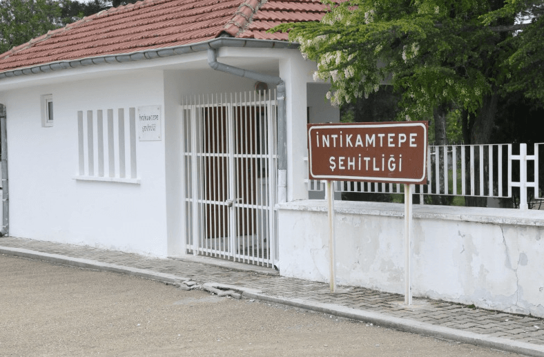
Bozüyük, İntikamtepe Cemetery (Source: Bozüyük Municipality)
Another important tourist site in Bozüyük is the Metristepe Monument. Built to symbolize the victory of the İnönü Battles, construction began in 1973 and it was inaugurated on 29 June 1975. The monument was erected in commemoration of the 50th anniversary of the Republic and is one of the district’s most important symbols.
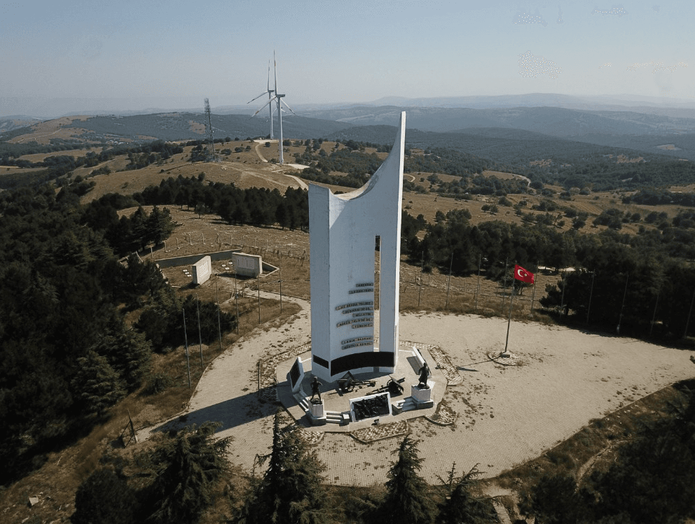
Metristepe Cemetery, Bozüyük (Source: Bozüyük Municipality)
Bozüyük also attracts attention for its natural beauty. The district offers suitable areas for activities such as trekking, camping, and winter tourism. Regions such as Kömürsu Highland, Türbin Recreation Area, Çiçekli Highland, and Sofular Highland provide ideal settings for nature tourism. These areas feature natural walking trails, camping grounds, and facilities for winter activities.
BEBKA. *Bozüyük İlçe Raporu 2023*. Accessed April 3, 2025.https://bebka.org.tr/wp-content/uploads/2023/12/Bozuyuk-Ilce-Raporu.pdf.
BEBKA. *Bozüyük İlçe Raporu*. Accessed April 3, 2025.https://bebka.org.tr/admin/datas/sayfas/198/bozuyuk-ilce-raporu_1568788074.pdf.
Bilecik Ticaret ve Sanayi Odası. "Bozüyük." Accessed April 3, 2025.https://bileciktso.org.tr/B%C4%B0LEC%C4%B0K/%C4%B0l%C3%A7eleri/B%C3%B6z%C3%BCy%C3%BCk/tabid/9153/Default.aspx.
Bozüyük Belediyesi. "Bozüyük Tarihi." Accessed April 3, 2025.https://www.bozuyuk.bel.tr/icerik/bozuyuk-tarihi.
Bozüyük Belediyesi. "Coğrafi Konumu." Accessed April 3, 2025.https://www.bozuyuk.bel.tr/icerik/cografi-konumu.
Bozüyük Kaymakamlığı. "Tarihi Mekanlar." Accessed April 3, 2025.http://www.bozuyuk.gov.tr/tarihi-mekanlar.
T.C. Bilecik Valiliği. "Coğrafi Yapı." Accessed April 3, 2025.http://www.bilecik.gov.tr/cografi-yapi.
T.C. Bilecik Valiliği. “Bozüyük.” Accessed April 3, 2025.http://www.bilecik.gov.tr/bozuyuk.

Bozüyük
Province | Bilecik | ||||||||
|---|---|---|---|---|---|---|---|---|---|
Geographic Region | Marmara | ||||||||
Population | 80.865 (2024) | ||||||||
District Governor | Adem Öztürk | ||||||||
Mayor | Mehmet Talat Bakkalcıoğlu | ||||||||
Antiquity and the Classical Period
Byzantine Period and the Arab Ascendancy
Ottoman Period
Republican Period
Industry and the Modern Era
Geographical Structure
Location and Boundaries
Landforms
Rivers and Lakes
Climate and Vegetation
Geographical Structure and Land Use
Social Structure
Population and Demographic Structure
Education
Healthcare Services
Socioeconomic Status and Development Level
Economic Structure
Agriculture and Livestock
Industry and Manufacturing Sector
Labor Force and Sectoral Distribution
Tourism Potential
Historical Monuments
Kasımpaşa Mosque and Külliye
Kumral Abdal Türbesi
Atatürk Forest Lodge
İnönü and İntikamtepe Cemeteries
Metristepe Monument
Nature Tourism