


This article was automatically translated from the original Turkish version.
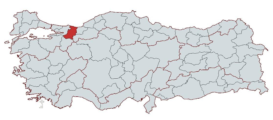
Eskişehir
Country | Türkiye | ||||||||
|---|---|---|---|---|---|---|---|---|---|
Region | Marmara Region | ||||||||
Population | 1,110,735 (2023) | ||||||||
Area | 4,817 km² | ||||||||
Climate | Black Sea and Marmara Climate | ||||||||
Important Structure | Orhan Mosque Taraklı Houses Earthquake Museum Sakarya Bridge | ||||||||
Area Code(s) | 264 | ||||||||
License Plate Code | 54 | ||||||||
Governor | Rahmi Doğan | ||||||||
Metropolitan Municipality Mayor | Yusuf Alemdar | ||||||||
Sakarya is a city located in the eastern part of the Marmara Region that has been influenced by various civilizations throughout history. It holds an important economic position due to its fertile agricultural lands, industrial activities, and transportation networks. The city possesses natural areas such as the Acarlar Wetland, Sapanca Lake, and highland meadows, and preserves its historical fabric through Taraklı and Ottoman-era structures. Due to its location in an earthquake zone, awareness campaigns are carried out through structures such as the Adapazarı Earthquake and Culture Museum.
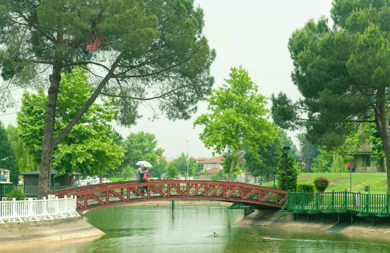
Kentpark
Due to its location along migration routes, Sakarya province has been home to human settlements since prehistoric times. Although archaeological research in the region has been limited, flint flakes found in Kaynarca, stone hand axes recovered in Kocaali, and fired clay vessels indicate settlement during the Neolithic and Chalcolithic periods. However, comprehensive excavations related to the prehistoric era have not yet been conducted.
Although Sakarya lay within the boundaries of the Hittites, the first political union in Anatolia, no remains from this period have survived to the present day. Following the migration of the Sea Peoples into Anatolia around 1200 BCE, Hittite dominance ended, and the Phrygians assumed control of the region. The Phrygians expanded across a vast territory stretching from the Sakarya River to the Büyük Menderes, creating a cultural influence zone extending as far east as Cappadocia.
During the Classical period, Sakarya was part of the region of Bithynia. Bithynia encompassed a broad geographical area corresponding to today’s Kocaeli, Yalova, Sakarya, Bilecik, Bolu, Zonguldak, and Bursa provinces. The region derived its name from the Bitians, who settled there and later established their own kingdom. The Sakarya River was known in Phrygian mythology as the river god Saggarios. During the Roman and Byzantine periods, the area remained under the influence of important cities such as Nicomedia (Izmit) and Prusias (Konuralp), becoming a strategic zone along military and trade routes.
Ottoman dominance in the region began in the first quarter of the 14th century. The lands of Sakarya, conquered by Ottoman commanders such as Konuralp Bey and Akçakoca Bey, played a significant role in the Ottoman expansion in Western Anatolia. During the Ottoman period, the region experienced intense migration from the Caucasus, the Balkans, and Rumelia, which greatly influenced its demographic structure.
The historical development of Adapazarı began in the 16th century as a small village. The clearing of surrounding forests during the Ottoman period created arable land, leading to increased settlement. By the 17th century, Adapazarı had gained importance as a market center and gradually became the region’s commercial hub. In the 19th century, it assumed the appearance of a town and became a district center under the Sanjak of İzmit. In 1869, a municipal organization was established, and the area became an administrative center alongside its commercial role. Additionally, the settlement of Caucasian migrants after the Crimean War significantly contributed to rapid population growth.
Sakarya held strategic importance during the years of the National Struggle. Adapazarı, occupied by the Greek army on March 25, 1921, was recaptured on June 21, 1921, following successful operations by the Turkish army. During this period, the local population demonstrated significant resistance in the War of Independence. Additionally, the Adapazarı Uprising, one of the local rebellions against the National Struggle, began on April 3, 1920, and was suppressed by Ali Fuat Cebesoy.
Following the proclamation of the Republic in 1923, Adapazarı continued to develop and diversify its economic activities. The first census in 1927 recorded the city’s population at 22,550. In the 1950s, the city entered an industrialization process and, in 1954, gained provincial status under the name Sakarya after separating from Kocaeli. Rapid industrialization in Sakarya from the 1950s onward led to the establishment of factories in the sugar, leather, oil, tractor, chemical, and automotive sectors. Alongside traditional agricultural products, industrial production began to occupy a significant place in the economic structure.
Sakarya lies in the first-degree earthquake zone and has been affected by various earthquakes throughout history. Major earthquakes in 1943, 1967, and 1999 caused serious damage to the city. The August 17, 1999 Marmara Earthquake was one of the most destructive disasters for Sakarya, resulting in 3,891 fatalities in Adapazarı, the collapse of thousands of buildings, and leaving hundreds of thousands homeless. Following the earthquake, the city was rebuilt with contributions from state and civil society organizations.
Today, Sakarya is a major center in industry, agriculture, and tourism. Its location between two major metropolises, Istanbul and Ankara, provides advantages in transportation networks. Natural resources such as the Sakarya River and Sapanca Lake, along with the Acarlar Wetland, highland meadows, and beaches along the Black Sea coast, attract tourism. Additionally, Taraklı preserves Ottoman-era architecture and historical monuments, continuing its cultural heritage. Today, with its rapidly growing population, developing industry, and natural beauty, Sakarya remains one of the important cities of the Marmara Region.
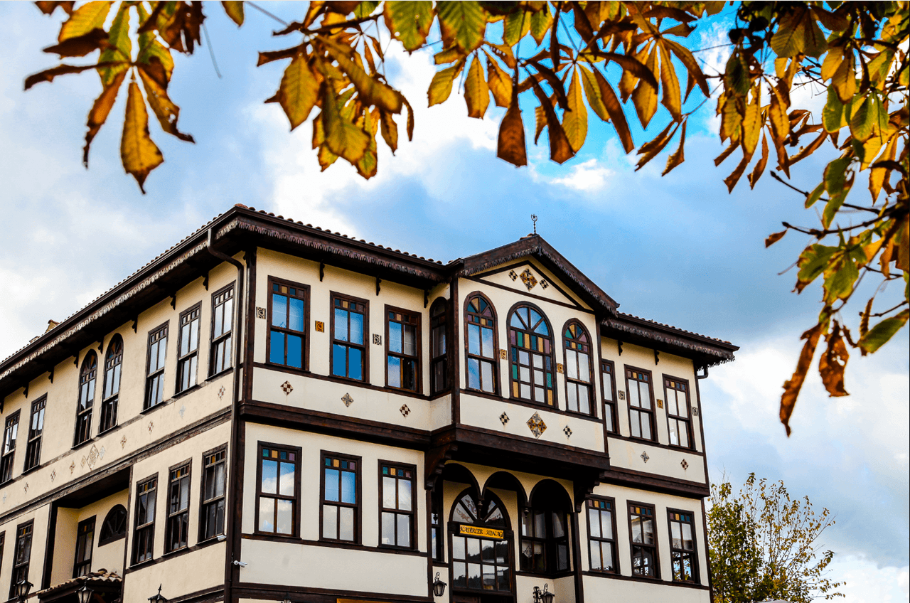
Taraklı Evleri
Sakarya is located in the northwestern part of Türkiye, in the eastern section of the Marmara Region. It borders Düzce to the east, Bolu to the southeast, Bilecik to the south, Kocaeli to the west, and the Black Sea to the north. The provincial center is Adapazarı, a key transit point between Istanbul and Ankara. Due to its geographical position, Sakarya enjoys advantages in industry, agriculture, and tourism.
Sakarya exhibits characteristics of both the Black Sea climate and the transitional Marmara climate. The northern region, bordering the Black Sea, generally has a mild and humid climate. Summers are cool and winters are warm and rainy. Precipitation levels remain high along the Black Sea coast throughout the year, while continental climate influences become more evident as one moves inland. Snowfall is common in higher elevations during winter months. The annual average temperature in Sakarya ranges between 13–15°C, with January being the coldest month and July the warmest.
Sakarya features a diverse topography encompassing both coastal areas and elevated inland regions. The majority of the province’s territory consists of low plains and gently undulating plateaus.
Sakarya is rich in water resources but has limited underground mineral reserves.
Sakarya is endowed with a rich network of rivers and water systems, named after the Sakarya River.
Sakarya occupies a favorable position for both agricultural and industrial production due to its geographical structure. It is an important city both economically and touristically, thanks to its natural resources, river systems, and climate.
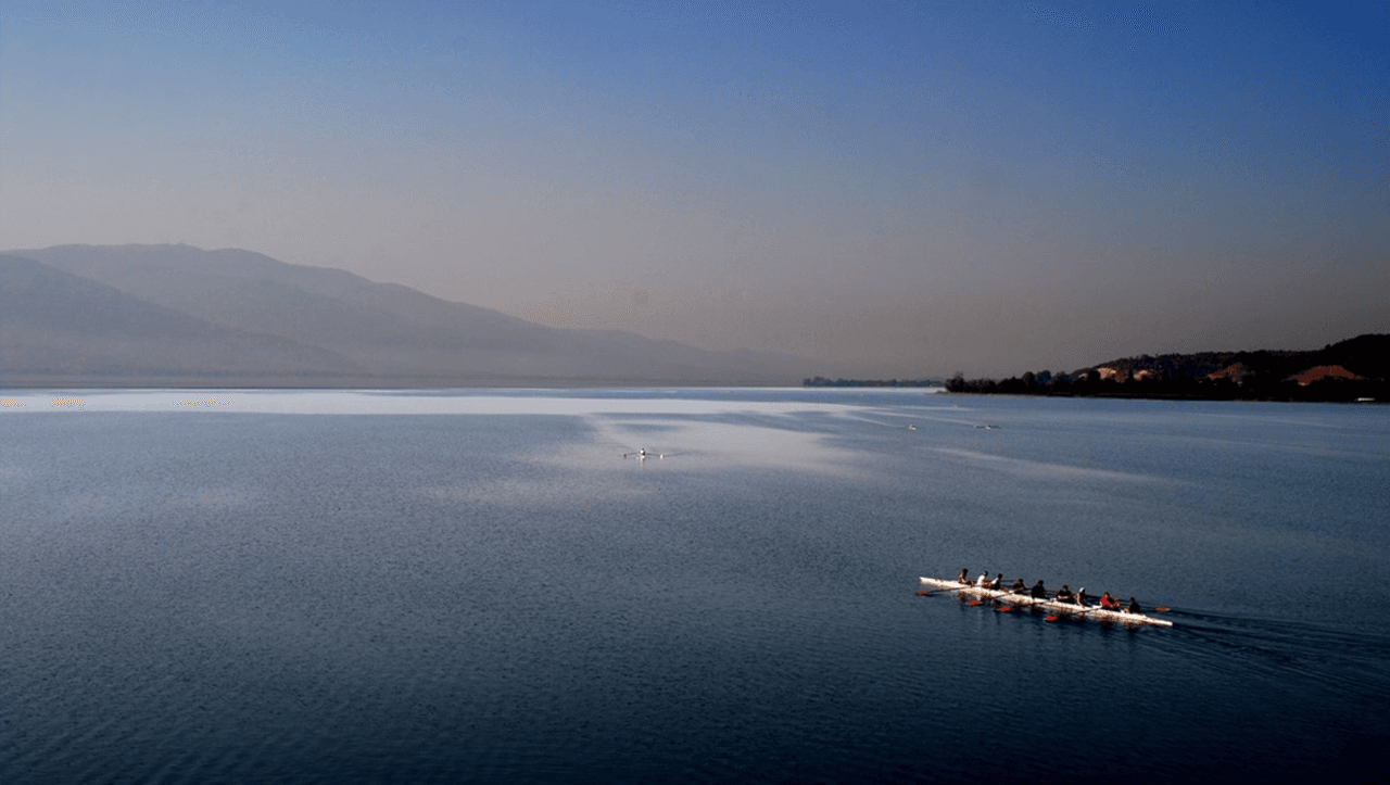
Sapanca Gölü
As one of the developing cities of the Marmara Region, Sakarya possesses significant economic potential in industry, agriculture, and trade. Its location between the two major metropolises of Istanbul and Ankara provides advantages in transportation networks. While the industrial sector dominates its economic structure, agricultural and commercial activities also hold important positions.
Sakarya is among Türkiye’s leading provinces in industrial production. The city’s industrialization process began in the 1950s and accelerated from the 1990s onward. Today, numerous organized industrial zones (OSB) support production activities across various sectors.
Sakarya is a key commercial hub between Istanbul and Ankara. In addition to agriculture and industry, the service sector plays a significant role in the city’s economy.
Sakarya continues to be one of the key economic centers of the Marmara Region through its development in industry, trade, and services. With the diversity of investment areas and its logistical advantages, it sustains its economic growth.
Sakarya, as a city developing in industry, trade, and tourism, is supported by infrastructure investments. The city has significant investments in urban transportation, educational institutions, and universities and is integrated into regional and national transportation networks.
Urban transportation in Sakarya is provided through public transit, private vehicle use, and bicycle lanes. Transportation services operated by the Metropolitan Municipality and private carriers connect the city center with districts and neighboring provinces.
Urban transportation continues to develop due to Sakarya’s proximity to its industrial and commercial centers, with new transportation projects being implemented by the metropolitan municipality.
Sakarya holds a regional position as an educational center, with a well-developed educational infrastructure comprising universities, technical, and vocational schools.
Sakarya is a significant educational center regionally, thanks to its universities, vocational high schools, and educational infrastructure. Educational investments are increasing in parallel with its growing industry and population.
Sakarya’s cuisine is highly rich in cultural diversity due to its geographical location and historical migration movements. Alongside dishes reflecting Ottoman culinary traditions, the influences of Balkan, Caucasian, and Black Sea cuisines are clearly evident in Sakarya’s food culture. The development of agriculture and animal husbandry has increased the variety of local ingredients, with grain-based products, meat dishes, dairy products, and vegetables forming the foundation of its culinary culture.
One of Sakarya’s most famous dishes, Islama Köfte, was introduced by Balkan migrants and later became a distinctive part of Sakarya’s cuisine. The meatballs are prepared with minced meat, onion, and spices and served with grilled bread slices dipped in bone broth. A sauce made with red pepper powder is poured over the top.
Keşkek is a dish prepared especially in Kaynarca district during weddings, holidays, and special occasions. Found in various forms across Anatolia, Sakarya’s version uses chicken meat. The wheat and meat are cooked for a long time and then pounded together. The dish is served with melted butter and a special spice called dartı.
Sakarya is one of Türkiye’s most important pumpkin-producing regions, making kabak tatlısı particularly popular here. Pumpkin is cut into thick slices, cooked with sugar, and served with tahini, walnuts, or hazelnuts. This dessert is commonly consumed during winter months.
Sakarya’s cuisine also reflects the influence of Caucasian migrants. Çerkez Tavuğu is made by mashing boiled chicken meat with walnuts, bread crumbs, and garlic to form a special sauce. This dish is served cold and commonly presented as a meze at guest tables.
Due to its significant apple production, quince dishes and desserts hold an important place in local cuisine. Quince is used to add a sweet-sour aroma to meat dishes. Particularly, quince cooked with lamb is flavored with cinnamon, cloves, and pomegranate molasses. Ayva tatlısı is served with kaymak.
Abundantly grown pumpkins in Sakarya are not only used for desserts but also consumed as soup. Balkabağı çorbası is prepared with milk, butter, and spices and served as a warm starter, especially during winter months.
A delicacy introduced by Balkan migrants to Sakarya’s cuisine, Boşnak Böreği is made by rolling thin dough around a filling of minced meat, potatoes, or cheese and baking it in a tray. It is served hot with melted butter drizzled on top.
A dough product prepared especially in the Pamukova and Geyve districts of Sakarya. Leeks mixed with minced meat and spices are placed inside leavened dough and baked in the oven.
A commonly prepared food in Sakarya’s villages, bazlama and gözleme are cooked on a griddle over wood fires and filled with cheese, potatoes, or minced meat.
Karadut şurubu, made from black mulberries grown in Sakarya, is consumed as a refreshing drink, especially during summer months. The berries are crushed and boiled with sugar and water.
Kızılcık şerbeti, commonly consumed in the Geyve and Taraklı districts, is a refreshing drink served at meals. The berries are boiled with sugar and then cooled before serving.
In conclusion, Sakarya’s cuisine is a rich and unique culinary tradition shaped by its historical and geographical characteristics and bearing traces of various migration movements. This cuisine, where local ingredients meet traditional recipes, offers a broad spectrum of flavors to both local residents and visitors.
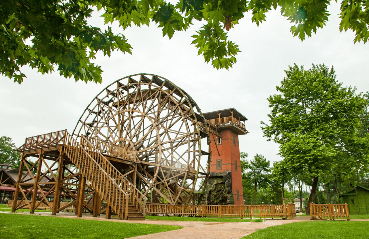
Kentpark
Throughout history, Sakarya has been influenced by various civilizations and has preserved significant structures from different eras. Remains from the Roman, Byzantine, and Ottoman periods reflect the city’s historical identity. Mosques, bridges, castles, and tombs are among the important monuments illuminating Sakarya’s past.
One of Sakarya’s oldest mosques, Orhan Mosque was built by Konuralp Bey in honor of Sultan Orhan Gazi following the Ottoman conquests in the region. The mosque, with a rectangular plan and a single minaret, was completely renovated during the reign of Sultan Abdülhamid II. Today, it continues to exist as an important structure both architecturally and historically.
Built in 1517 during the reign of Yavuz Sultan Selim by his vizier Yunus Paşa, the mosque is considered a work of Mimar Sinan. It exhibits characteristics of Ottoman classical architecture and was constructed from cut stone. Its dome is covered with lead, earning it the popular name “Kurşunlu Mosque.” Its interior decorations and inscriptions are particularly striking.
One of Adapazarı’s oldest mosques, Hacı Hasan Mosque reflects Ottoman architectural style. It has undergone various renovations over time and is notable for its minaret and interior decorations.
Built during the Byzantine period to protect the eastern borders, Harmantepe Castle was constructed in the 11th or 13th century. Located on the western bank of the Sakarya River, the castle served as a forward outpost and observation tower for defense purposes. Today, it is preserved as an important cultural heritage site.
Located in Pamukova district, Paşalar Castle is a Byzantine-era structure incorporated into Ottoman territory in 1314 during the reign of Osman Gazi. It was built to control trade routes and the Pamukova Plain. Reused Roman-period stones were used in its walls.
Constructed between 1936 and 1937 by order of Atatürk and commissioned by then Minister of Public Works Ali Çetinkaya, the Sakarya Bridge spans 108 meters in length and 4.80 meters in width across the Sakarya River. It is considered one of the most important transportation structures of the Republican era and has become one of the city’s symbols.
Built in 1495 by Ottoman Sultan II. Bayezid, the bridge spans the Sakarya River and is constructed from cut stone. Originally featuring 14 arches, a portion of the structure has survived to the present day, with some sections restored. It is recognized as one of the important bridge structures of Ottoman architecture.
Located on Keremali Highland in Akyazı district, the tomb is regarded as a sacred pilgrimage site. Local tradition holds that two warriors named Keremali and Ali were martyred here, and the tomb is named after them. The area, with its natural beauty and mystical atmosphere, attracts visitors.
The Sakarya Museum is housed in the home where Mustafa Kemal Atatürk met his mother, Zübeyde Hanım, on June 17, 1922, and stayed for three days. The building suffered major damage in the 1967 earthquake and was restored in 1983. Today, it operates as a museum displaying various artifacts from the Ottoman and Republican periods.
Opened in 2004, this museum narrates the aftermath of the 1999 Marmara Earthquake. It features photographs, remnants of collapsed buildings, seismograph instruments, and simulation rooms related to the earthquakes of 1967 and 1999. The museum is an important center for raising earthquake awareness and conveying Sakarya’s seismic history.
Taraklı district is one of the rare settlements that have preserved Ottoman-era civil architecture to the present day. Its wooden houses with tiled streets and traditional bazaar reflect the Ottoman urban fabric. Taraklı is also a member of the Cittaslow (Slow City) network based in Italy.
Maden Stream, located between Karasu and Kocaali districts, was used as a mining site during the Ottoman period. The remaining old mine galleries and walking paths constitute an important historical and tourist attraction.
Remains of stone structures and burial sites from the Roman and Byzantine periods are found around Poyrazlar Lake. The area attracts attention for both its natural beauty and historical traces.
Sakarya has hosted various civilizations throughout history and acquired significant structures during this process. Mosques, historical bridges, castles, and tombs representing the finest examples of Ottoman architecture shed light on Sakarya’s past. Additionally, museums and protected historical settlements are essential elements preserving the region’s cultural heritage. The city possesses great potential for cultural tourism through its natural and historical structures.
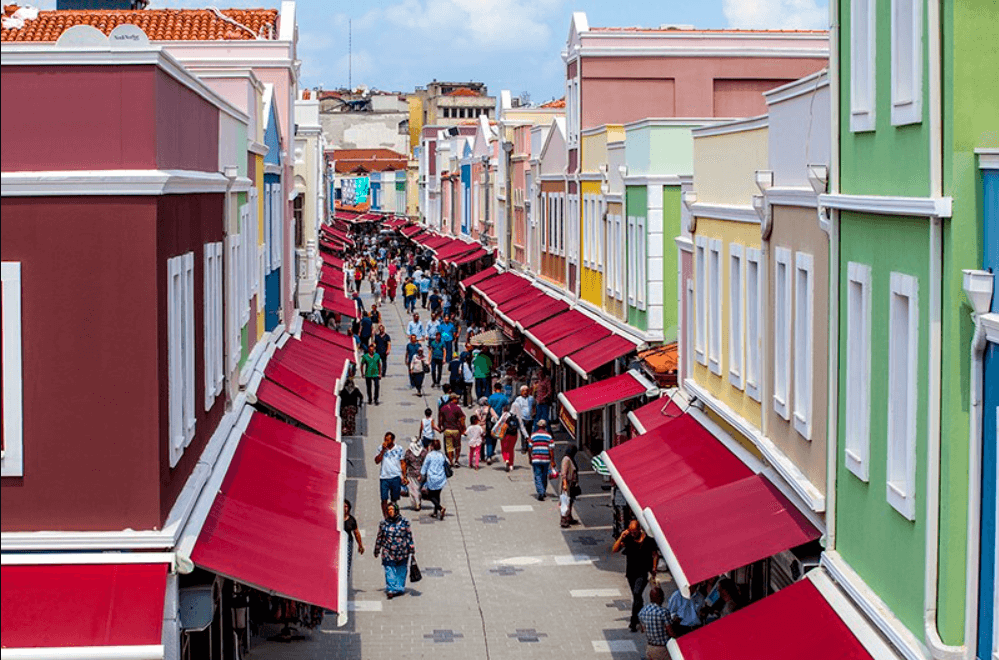
Uzunçarşı
Sakarya is governed as a metropolitan municipality through the joint efforts of central and local administrative bodies. The governorship, as the representative of the central government, ensures public order, while metropolitan and district municipalities deliver local services.
The Sakarya Governorship is managed by the governor, the highest-ranking public official, who oversees security, education, health, and public services.
The Sakarya Metropolitan Municipality is the local administrative body responsible for urbanization, infrastructure, transportation, and environmental planning.
Sakarya consists of 16 districts, each governed by its own municipality and coordinating with the metropolitan municipality.
Sakarya Büyükşehir Municipality. "Resmi Web Sitesi." Accessed February 12, 2025.https://www.sakarya.bel.tr/.
Sakarya Büyükşehir Municipality. "Önceki Başkanlarımız." Accessed February 12, 2025.https://www.sakarya.bel.tr/tr/Onceki-Baskanlarimiz.
Sakarya Valiliği. "Resmi Web Sitesi." Accessed February 12, 2025.http://www.sakarya.gov.tr/.
Sakarya Valiliği. "Sakarya - İlçelerimiz." Accessed February 12, 2025.http://www.sakarya.gov.tr/ilcelerimiz
Sakarya Valiliği. "Sakarya - Şehrimiz." Accessed February 12, 2025.http://www.sakarya.gov.tr/sehrimiz1
Türkiye Diyanet Vakfı İslam Ansiklopedisi. "Adapazarı." Accessed February 12, 2025.https://islamansiklopedisi.org.tr/adapazari.
Türkiye Kültür Portalı. "Sakarya Genel Bilgiler." Accessed February 12, 2025.https://www.kulturportali.gov.tr/turkiye/sakarya/genelbilgiler.
Eskişehir
Country | Türkiye | ||||||||
|---|---|---|---|---|---|---|---|---|---|
Region | Marmara Region | ||||||||
Population | 1,110,735 (2023) | ||||||||
Area | 4,817 km² | ||||||||
Climate | Black Sea and Marmara Climate | ||||||||
Important Structure | Orhan Mosque Taraklı Houses Earthquake Museum Sakarya Bridge | ||||||||
Area Code(s) | 264 | ||||||||
License Plate Code | 54 | ||||||||
Governor | Rahmi Doğan | ||||||||
Metropolitan Municipality Mayor | Yusuf Alemdar | ||||||||
History
Prehistoric Period
Ancient Period
Ottoman Period
National Struggle Period
Republican Period and Sakarya’s Establishment as a Province
Earthquakes and Reconstruction
Sakarya Today
Geographical Structure
Location and Boundaries
Climate
Landforms
Natural Resources and Minerals
Rivers and Dams
Economic Structure
Industry and Production
Trade and Service Sector
Infrastructure
Urban Transportation
Universities and Educational Infrastructure
Educational Infrastructure
Cuisine and Dishes
Main Dishes and Specialties
Islama Köfte
Keşkek
Kabak Tatlısı
Çerkez Tavuğu
Ayva Yemeği ve Tatlısı
Balkabağı Çorbası
Dough Products and Grain-Based Foods
Boşnak Böreği
Pırasalı Kapama
Gözleme and Bazlama
Local Beverages
Karadut Şurubu
Kızılcık Şerbeti
General Characteristics of Sakarya Cuisine
Historical Structures
Mosques and Religious Structures
Orhan Mosque
Yunus Paşa Mosque (Kurşunlu Mosque)
Hacı Hasan Mosque
Castles and Defense Structures
Harmantepe Castle
Paşalar Castle (Karaceyş Castle)
Bridges
Sakarya Bridge
II. Bayezid Bridge (Alifuatpaşa Bridge)
Tombs and Cemeteries
Keremali Tomb
Museums and Historical Structures
Sakarya Museum (Atatürk House)
Adapazarı Earthquake and Culture Museum
Other Historical Structures
Taraklı Houses and Sakin Şehir Status
Maden Stream and Historical Mining Road
Poyrazlar Lake and Surrounding Historical Remains
Administration
Governorship and Responsibilities
Governors of Sakarya:
Municipal Administration and Mayors
Mayors of Sakarya Metropolitan Municipality:
Districts and Administrations of Sakarya
Districts of Sakarya: