


This article was automatically translated from the original Turkish version.
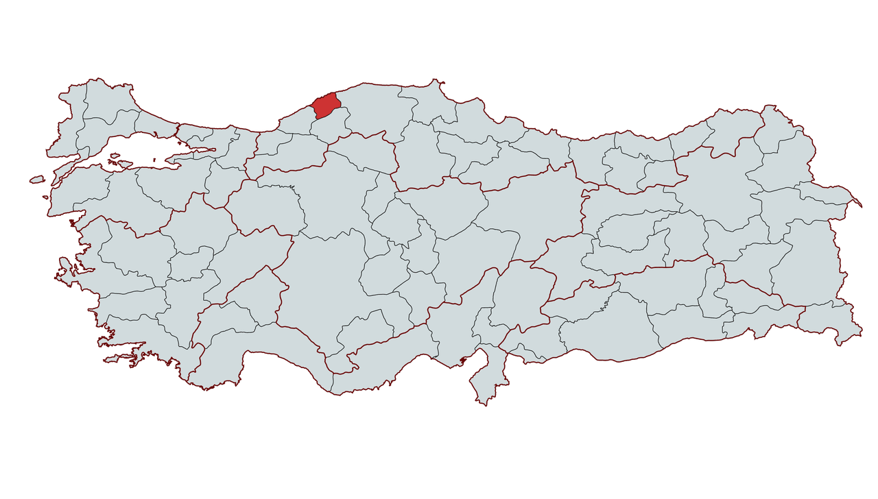
Bartın
Country | Türkiye | ||||||||
|---|---|---|---|---|---|---|---|---|---|
Region | Black Sea | ||||||||
Area | 2.120 km² | ||||||||
Population | 206.715 | ||||||||
Districts | Central Amasra Ulus Kurucaşile | ||||||||
Climate | Temperate maritime climate (Black Sea climate) | ||||||||
License Plate | 74 | ||||||||
Area Code(s) | 378 | ||||||||
Mayor | Muhammet Rıza Yalçınkaya | ||||||||
Governor | Dr. Nurtaç ARSLAN | ||||||||
Important Structure | Amasra Castle Amasra Ancient Theatre Amasra Museum Kuşkayası Road Monument | ||||||||
Bartın is a province located in the Western Black Sea subregion of Türkiye’s Black Sea Region. It gained the status of Türkiye’s 74th province in 1991 after separating from Zonguldak. The province is bordered by Kastamonu to the east, Karabük to the south, Zonguldak to the west and the Black Sea to the north. Bartın is rich in forests, and a large portion of its territory lies within the boundaries of Küre Mountains National Park. Additionally, the Bartın Çayı, the only river in Türkiye used for transportation, stands out among the province’s natural resources.
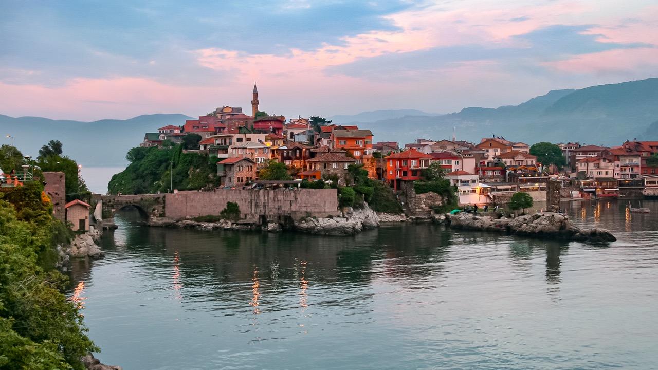
Amasra, Bartın (Photo: Jorge Franganillo, flickr.com)
In antiquity, the Bartın River was known as “Parthenios.” The settlement founded on this name was initially called “Parthenia” and gradually evolved into the modern name Bartın. In Greek mythology, Parthenios is a figure among the children of Oceanus, described as the “God of Waters.” This name is interpreted to mean “god of waters” or “magnificent flowing water,” and some interpretations suggest it also refers to “choral songs for young girls.” 【1】
Famous poet Homer, in the Iliad, notes that the heroes coming from Anatolia to defend Troy originated from the lands watered by the Parthenios River. The Amasya writer Strabo also references this river in his works, emphasizing the importance of the region’s ancient name.
Throughout history, the first known occupation of the Bartın region occurred in the 14th century BCE by the Gaskians, followed by the Hittites, Phrygians, Ionians, Cimmerians, Lydians, Persians, Hellenes, Pontic Greeks, Romans and Byzantines, as well as the Seljuks and Ottomans, who all made this territory their homeland.
Between 3000 and 2400 BCE, the Akarians are believed to have settled along the western Anatolian coast (e.g., Samsun, Sinop and Amasra regions) before establishing the Mycenaean civilization in the Aegean, introducing Chalcolithic cultural elements to the local populations. During this period, the Gaskians and Hittites were dominant in the inland areas.
Amasra, one of the leading ancient cities of Bartın and the Black Sea region, has experienced periods of independence and shared destinies throughout its 4,000-year history. Among the region’s earliest settlers were the Gaskians in the 14th century BCE and the Hittites in the 13th century BCE.
In the early 12th century BCE, the Bartın region was known as “Bithynia,” while Amasra lay within the borders of Paphlagonia. By the end of the same century, Bartın came under Phrygian control and Amasra under Phoenician rule. Subsequently, the region passed under the dominion of the Cimmerians in the 7th century BCE, the Lydians in the 6th century BCE, the Persians in 547 BCE, the Macedonians in 334 BCE, the Pontic Greeks in 279 BCE, and the Romans in 64 BCE.
Beginning with the establishment of the first Phoenician colonies on the Black Sea coast—Amasra (Sesamos) and Kurucaşile (Kromna)—in the 12th century BCE, a roughly century-long dark period followed the withdrawal of the Phoenicians and Carians in the 9th century BCE. Subsequently, in the early 7th century BCE, the region became part of the Ionian colony of Miletus under the influence of Megarian settlers. The Persian administration, which lasted from 547 BCE for over two centuries, preserved the region’s status; from 334 to 279 BCE, Bartın and Ulus were governed first by the satrap and queen Amastris (302–286 BCE), and later by General Eumenes.
The city known as “Sesamos” from the 12th century BCE to the 3rd century BCE transitioned into a city-state organized by Queen Amastris (302–286 BCE) during the Macedonian period, taking its name from her. During this brief period, it became the center of the Symoikismos League, comprising sites such as Kromna (modern Kurucaşile–Tekkeönü), Tios (Filyos–Hisarönü), and Kyteros (Gideros).
After the division of the Roman and Byzantine Empires in 395 CE, Bartın and its surroundings came under Byzantine administration. Between 1084 and 1096, the region fell under the influence of the Turkish Emirate established by Süleyman Bey, son of Kutalmış, and was later reintegrated into Byzantine territory after the Crusades. In the late 11th century, the region came under the rule of the Anatolian Seljuks, followed by the Candaroğulları Beylik in 1326 and the Ottoman Empire from 1392. During this period, Bartın and Ulus came under Turkish rule in the 11th century, while Amasra became the capital of the Pontus section of the Bitinia-Pontus province under the Roman satrapy system (64 BCE–395 CE). During the Byzantine era (395–1460), Amasra was administered as a Genoese colony from 1261 to 1460 and was incorporated into Ottoman territory by Fatih Sultan Mehmet in 1460.
During the Ottoman Empire, Bartın was part of the Bolu Sanjak under the Anatolian Beylerbeylik from 1460 to 1692. After the abolition of the Bolu Sanjak, the region was administered under the Voyvodalık system from 1692 to 1811, and then reintegrated into the newly reorganized Bolu Sanjak within the Kastamonu Vilayet in 1811. During this period, Bartın became an important commercial center known as the “Twelve Divan” marketplaces, gained district status in 1867, and established a municipality in 1876.
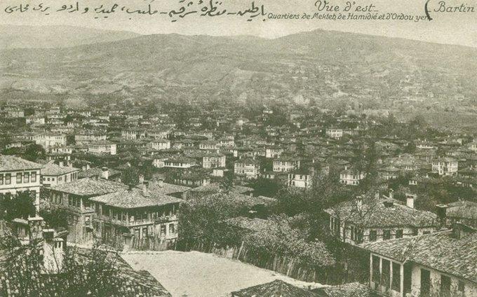
Bartın Hamidiye School and Orduyeri during the Ottoman period (Photo: Özhan Öztürk)
During the establishment of the Republic, Bartın was administered as a mutasarrıflık in 1920 and then as a district of Zonguldak province in 1924. On 7 September 1991, by Law No. 3760 dated 28 August 1991, Bartın attained provincial status. During the Republican era, some settlements that had existed as districts during the Ottoman period were restructured. Amasra was downgraded to a bucak for a period but was reinstated as a district in 1987. Similarly, Ulus became a district in 1944 and Kurucaşile in 1957. Today, Bartın consists of four districts—Merkez, Amasra, Ulus and Kurucaşile—along with five towns (Arıt, Kozcağız, Kumluca, Abdipaşa and Hasankadı) and a total of 268 villages.
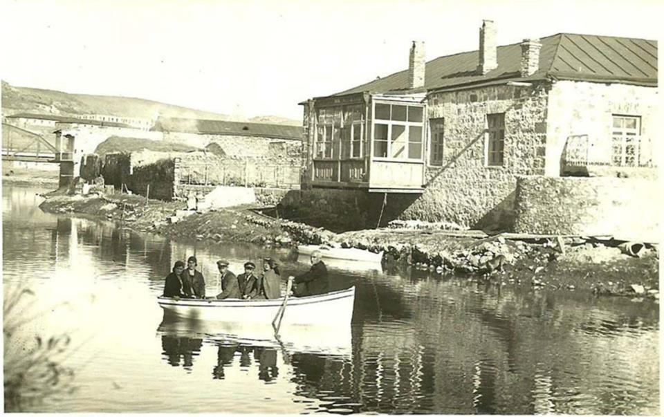
Bartın Filyos River during the Republican period (Photo: Özhan Öztürk)
Bartın is located in the western part of the Black Sea Region and has a direct coastline along the Black Sea. Geographically, it lies approximately between 41°38′ north latitude and 32°21′ east longitude. This location plays a significant role in determining the province’s climatic and geopolitical dynamics. The region shares borders with Kastamonu to the south, Çankırı and Karabük to the east, and Zonguldak to the west, and holds a strategic position due to its integrated land and sea transportation networks.
Bartın experiences a Black Sea climate characterized by warm summers and cool winters, exhibiting transitional features between the Marmara and Black Sea climatic zones. In the basin areas, the Black Sea climate dominates, while Ulus district, located behind the Black Sea Mountains, receives insufficient moisture from humid air currents and exhibits continental climate characteristics.
Its proximity to the sea and the presence of low mountain ranges parallel to the coast reduce temperature variations and increase humidity levels, while also enhancing the influence of air masses from the Balkans. Under these conditions, July, with an average temperature of 23°C, is the warmest month, while December, averaging 4.2°C, is the coldest. The region records 225 clear days, 125 rainy days and 15 snowy days annually. Climatic conditions make June, July and August the most favorable months for tourism, while April, May, September and October also offer favorable weather for visitors.
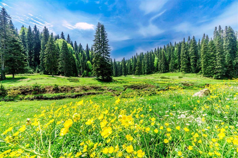
Bartın Katırovası plateau (Bartın Ministry of Culture and Tourism photo gallery)
Approximately 46% of Bartın’s total area of 2,143 km² is covered by forests, 35% by agricultural land, 7% by meadows and pastures, and 12% by non-arable land and settlements. Influenced by the Black Sea climate, the region has a mixed flora reflecting both Black Sea and Europe-Siberian phytogeographical characteristics. Bartın’s extensive forests primarily consist of broadleaf and coniferous tree species. Along the coastal strip, up to 600 meters elevation, oak, beech and hornbeam dominate; further inland and above 1,500 meters, beech, chestnut, fir and pine trees are common. Additionally, walnut, chestnut and hazelnut plantations are widespread along the coast.
In addition, Bartın’s rich undergrowth includes hundreds of species such as cranberry, quince, blackberry, linden, rosehip, fig, sage, asparagus, laurel, ivy, oleander, forest rose, hawthorn, jasmine, dogwood, hawthorn, bellflower, daisy, chicory, milkweed, clover, three-leaved clover, nettle, primrose, poplar, mastic, sumac, resin, sticky weed, yavşan, shepherd’s purse, lilac, cypress, dogwood, dönbaba, hazel, abdestbozan, cat’s claw, Arap herb, çiriş herb and oregano. This diversity is supported by the region’s soil characteristics and favorable conditions for garden and field agriculture, enabling the cultivation of nearly all types of field crops, vegetables and fruits. In recent years, high-quality strawberry cultivation has gained prominence, and festivals held in its honor highlight the modern aspects of local agriculture. However, no plant species in Bartın are protected under the Bern Convention.
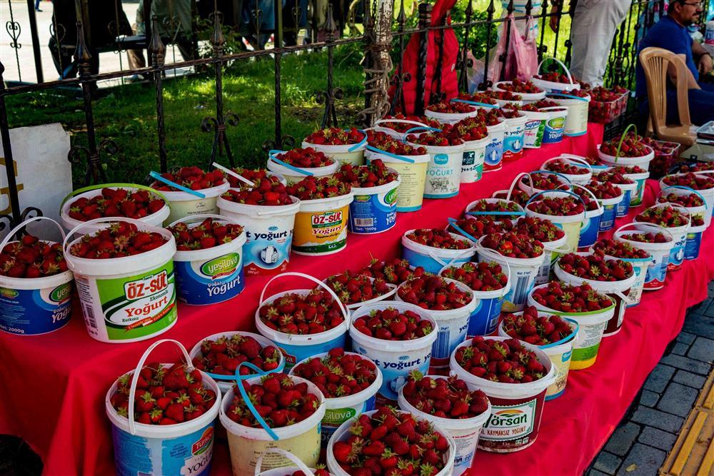
Bartın strawberry (Photo: Bartın Ministry of Culture and Tourism photo gallery)
Bartın is surrounded by mountains that do not exceed 2,000 meters in elevation in the east, west and north. Despite their modest height, these mountains are notable for their steep slopes and rugged, cliff-like formations parallel to the coast. Among the most prominent mountains are Aladağ, Kocadağ, Karadağ, Kayaardı, Karasu and Arıt Mountains. These mountains encircle the city center: Aladağ to the west, Karasu to the north and Arıt to the east. Additionally, elevations such as Halatçıyaması, Orduyeri, Kırtepe and Ömertepesi rise above the urban settlement area, forming characteristic elements of the region’s landforms and contributing to the aesthetic value of the natural landscape. This geomorphological structure not only shapes the city’s visual texture but also plays a decisive role in climate, vegetation and agricultural productivity.
The Bartın River, the province’s most important watercourse, was known in antiquity as “Parthenios” and gave its name to the city. Formed by the confluence of Koca Çay and Kocanaz Çay near Gazhane Burnu, the river flows approximately 15 kilometers before reaching the Black Sea at the Boğaz location.
The Bartın River is also of great importance for maritime transport; it has been regulated to allow the navigation of 500-ton vessels, with a flow rate of approximately 720 meters per hour and an annual discharge of about one billion cubic meters of water into the sea.
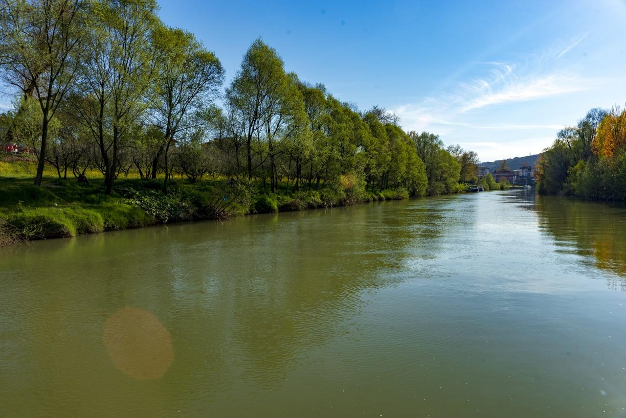
Bartın River (Photo: Western Black Sea)
Kocanaz Çay flows northward from the south through the Kozcağız region; Koca Çay originates in the Kastamonu region and is fed by various tributaries including Göksu and Eldeş Çay (Ulus Çay). In addition, Kışla Deresi, which joins Kozlu Çay formed by the Arıt and Mevren streams, along with Akpınar and Karaçay streams, are significant tributaries enhancing the flow of Koca Çay. Other important water sources in the region include Kapısuyu and Tekkeönü streams, which originate in Kurucaşile and flow into the Black Sea, and Ova Çay and İnönü streams, which irrigate Ulus and Uluyayla.
Thanks to its unique Black Sea climate and rich forest cover, Bartın supports a highly diverse wildlife. The region’s extensive forests, rivers, mountains and coastline carry both Black Sea and Europe-Siberian biogeographical influences, providing a foundation for a rich diversity of mammals, birds, reptiles, amphibians, fish and invertebrates.
The forested areas, composed primarily of broadleaf and coniferous trees, offer a favorable habitat for wildlife. In Bartın’s forests, wild boar (Sus scrofa), brown bear (Ursus arctos), red fox (Vulpes vulpes), Eurasian lynx (Lynx lynx) and various rodent species are common, while occasionally, predators such as the wildcat may be observed. Additionally, squirrels, other small mammals and bat species contribute to the region’s rich fauna diversity.
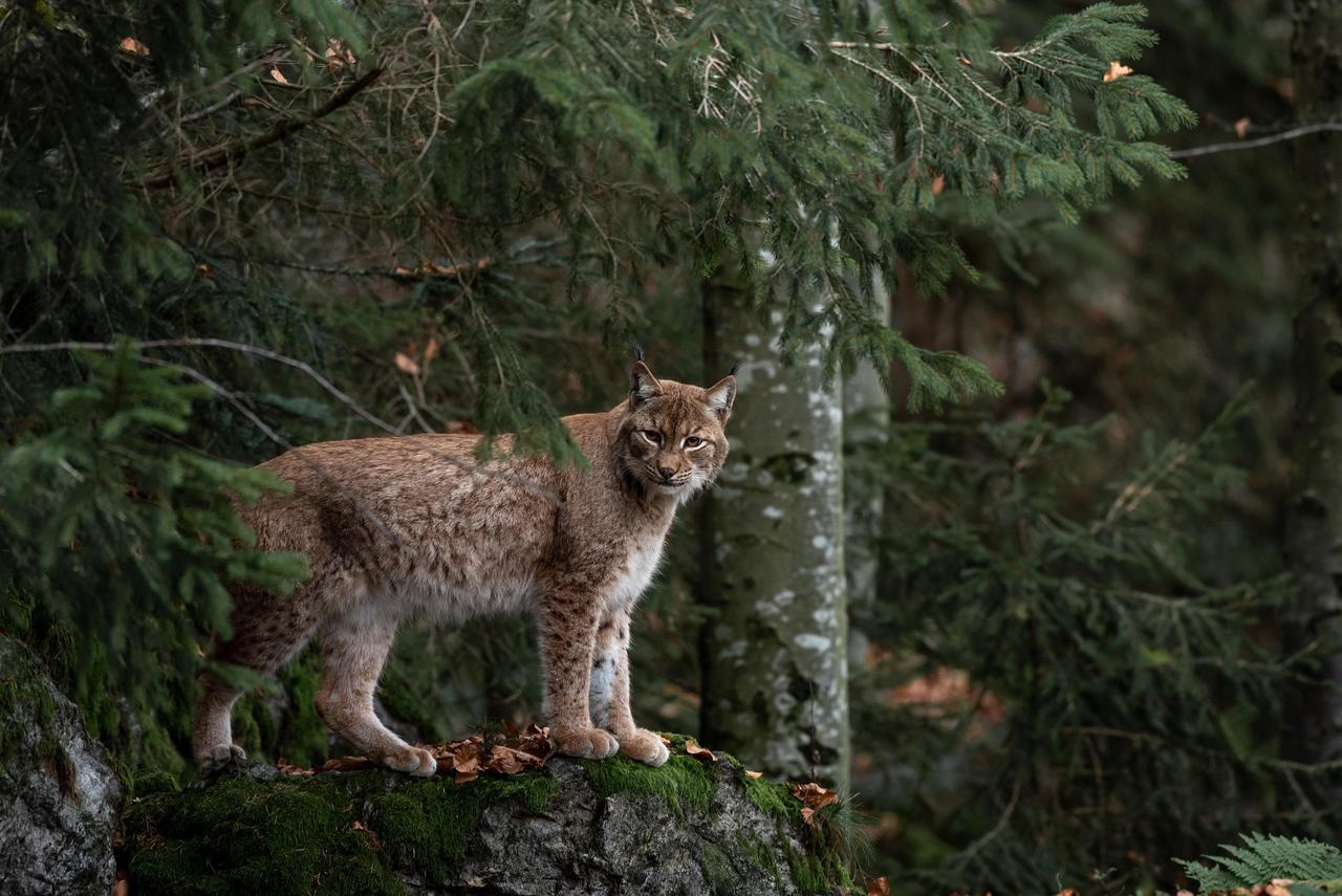
Eurasian Lynx (Photo: Miller_Eszter, pixabay.com)
In terms of bird diversity, Bartın’s forests, riverbanks and coastline host numerous species including the black kite, spotted owl, swallow, sparrow, Anatolian rock sparrow, redstart, mountain thrush, swallow, hoopoe and various waterfowl. The region, situated at the intersection of migratory routes between East and West, also serves as a seasonal stopover for migratory birds.
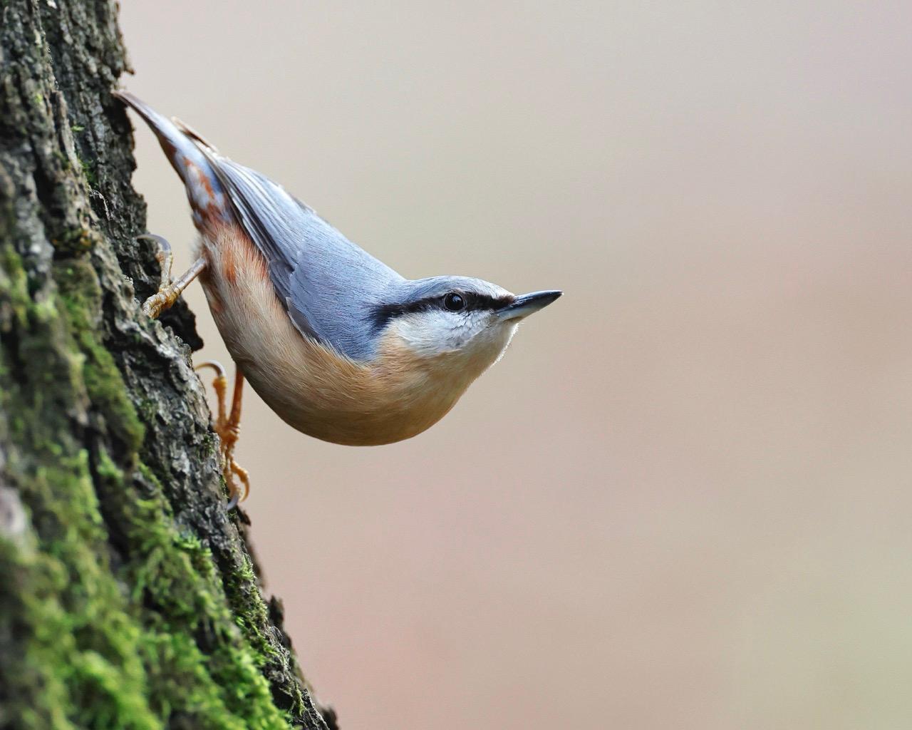
Anatolian Rock Sparrow (Photo: Sharkolot, pixabay.com)
The Bartın River and other watercourses provide suitable habitats for native fish species such as trout, carp and tench, as well as amphibians like frogs and salamanders living along the banks. Reptile diversity is represented by lizard and snake species inhabiting forested and rocky areas.
The ecological diversity of the region is further supported by protected areas such as Küre Mountains National Park. This national park aims to preserve rich flora and fauna diversity and contributes to the sustainability of the natural balance. However, factors such as deforestation, urban expansion and human intervention may negatively impact Bartın’s wildlife, making sustainable environmental policies essential for the conservation of the region’s ecosystems.
Bartın’s demographic structure exhibits a clear distribution between urban centers and rural areas. According to 2023 data, Bartın’s population is 206,715. Population density is higher in the provincial center and districts with high tourism value such as Amasra, while settlement in rural areas is more dispersed. The high proportion of young population creates significant potential in education and employment sectors, strengthening social and economic dynamism. This young and dynamic population structure supports the development of local services, infrastructure investments and commercial activities, while also providing a foundation for agriculture, forestry and small-scale enterprises in rural areas to contribute significantly to regional development. Overall, Bartın’s population distribution reflects an interweaving of urban modernization and traditional rural life, indicating a demographic structure favorable for socioeconomic growth and sustainable development.
Amasra is a town named after Queen Amastris and possesses a rich historical heritage. Before its incorporation into the Ottoman Empire by Fatih Sultan Mehmet in 1460, the city was under Genoese rule and has preserved numerous artistic works reflecting its vibrant commercial life.
The Genoese referred to Amasra as “Flowered Castle”; Pliny described it as “Elegant and Beautiful,” while Niketas called it “The Eye of the World.” Before the Ottoman conquest, Fatih Sultan Mehmet, gazing upon the city from above, expressed admiration with the words, “Lala Lala, could this be the Eye of the World?” After the conquest, two churches in Amasra were converted into mosques, a judge was appointed, and the inhabitants of Eflani Castle were relocated to the town under Fatih’s orders. During the Ottoman period, the city was administered under the Bolu Sanjak Beylik and was widely admired by Western travelers.
Throughout history, Amasra has been a strategic military base and a commercial port exporting products such as timber, shimsir, tuna and fur. Since the 1940s, Amasra has been known as the pioneer of guesthouse accommodation and tent camping in our country, earning the title “the birthplace of tourism in our nation,” and continues its activities in cultural and maritime tourism today.
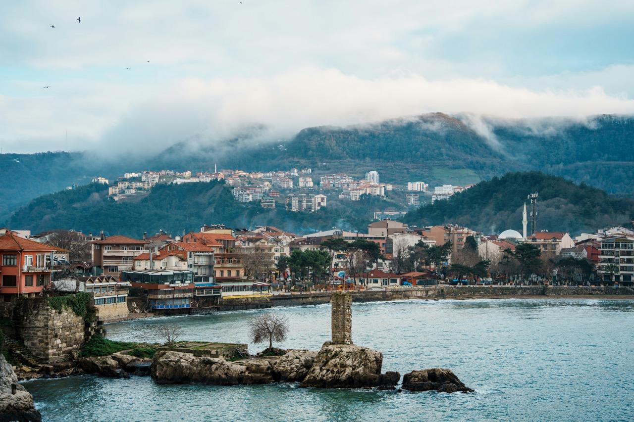
Amasra (Photo: Amo Fifty, unsplash.com)
Ulus is an important settlement area located in the southeast of Bartın province, distinguished by its historical depth. According to tradition, its name derives either from the Bozulus Turks who settled in the region in the 11th century or from the verb “üleşmek”; in either case, the name reflects the region’s cultural richness and historical continuity. Ulus’s geographical structure, situated in a wide valley where the Ulus and Eldeş rivers converge, is surrounded by natural beauty. The region offers diverse landscapes including impressive plateaus (Uluyayla, Ardıç and Gezen plateaus), Ulukaya Waterfall, as well as various caves, waterfalls and canyons.
In the early 18th century, local scholar Uluslu İbrahim Hamdi Efendi, in his work titled “Atlas,” praised the region’s rich vegetation and natural resources with the phrase, “The Ulu plateau and Gökbeli forests are sufficient for the Ottoman Empire and the entire world.” Administratively, Ulus began as a nahiye under Safranbolu and was elevated to district status under Zonguldak province on 8 August 1944. Later, under Law No. 3760 dated 28 August 1991, it was attached to Bartın province, acquiring its current administrative status.
Located in the northeast of Bartın, Kurucaşile is a historical settlement built on coves adjacent to olive and sandalwood groves. With an area of approximately 159 km², its ancient name “Kromna” means “edge people.” It is among the ancient cities sharing similar historical destinies with Amasra in the Paphlagonia region mentioned in the Iliad. The ancient settlement center of Kurucaşile is known as Tekkeönü village. Evidence of this ancient past includes the ruins of Tekkeönü Castle, its mahzen, galleries and aqueducts, as well as coins, inscribed stones and columns displaying Amazon portraits exhibited at the Amasra Museum.
During the Ottoman period, Kurucaşile attracted attention as the center for shipbuilding to meet the navy’s needs. Along with Kurucaşile, fishing villages such as Tekkeönü and Kapısuyu established this maritime tradition; today, the art of wooden yacht and boat-making, passed from father to son, continues as part of the region’s economic and cultural fabric. In addition to its historical and folkloric values, Kurucaşile offers tourists various activities through natural beauties such as Tekkeönü, Kapısuyu, Karaman and Çambu coves, Göldere Waterfall, Kümes-Akkaya Perikayaları, canyons and Düden.
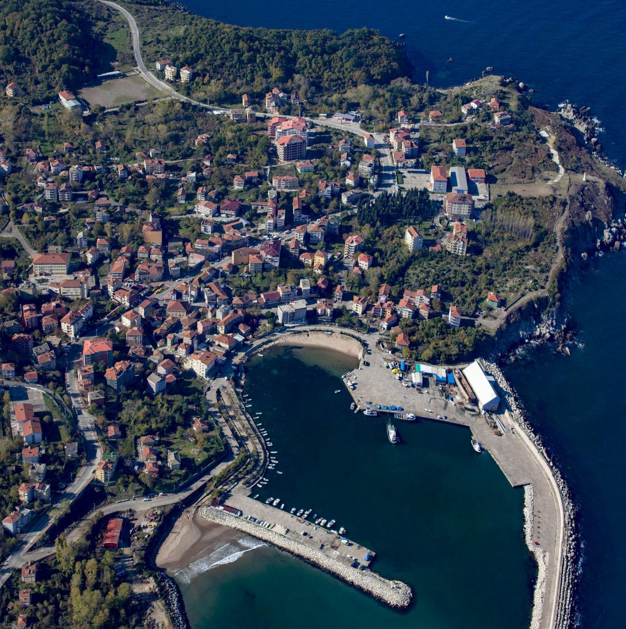
Kurucaşile (Photo: Western Black Sea)
Bartın has a multi-sectoral economic structure. When examining land use distribution across the province, approximately 46% of its total 2,143 km² area is covered by forests, 35% by agricultural land, 7% by meadows and pastures, and 12% by settlements and non-arable land. This land distribution enables the foundation of Bartın’s economy—agriculture, forestry and local industry—as well as diversification of commercial activities.【2】
Bartın’s climate and soil structure provide a favorable environment for cultivating various agricultural products. The region widely produces cereals, vegetables and fruits, with viticulture, olive cultivation and other fruit farming playing significant roles. The 35% share of agricultural land forms the backbone of rural production in the regional economy, while small and large-scale livestock farming is also widely practiced among the local population. These sectors provide not only local food production but also a significant portion of employment in the region.
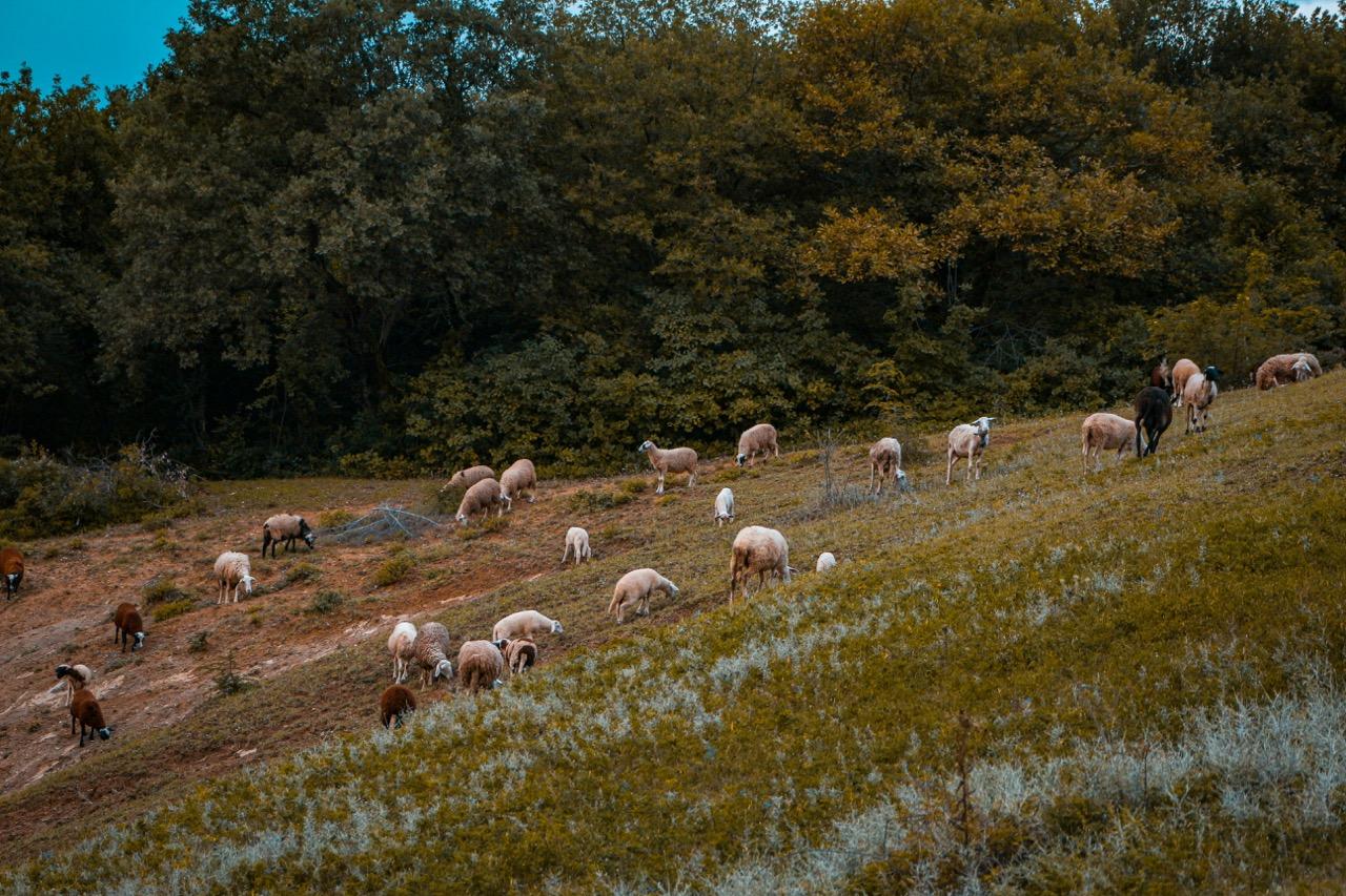
Small-scale livestock farming, Bartın (Photo: orijinal frame, pexels.com)
Bartın stands out in the forestry sector due to its rich forest resources. Forested areas covering approximately 46% of the total area contribute to the production of timber and wood products under sustainable forest management. In addition to forestry, the region’s geological structure provides favorable conditions for mining activities in certain areas. Although the mining sector is not the main driver of Bartın’s economy, mineral extraction and processing activities integrated with regional industry contribute to local economic diversity.
Bartın’s land and sea transportation networks support its strategic position as a commercial center. Particularly, the Bartın River, with its consistent flow and suitability for maritime transport, plays a vital role in commercial logistics. Small and medium-sized industrial enterprises in the region operate in food processing, textiles, machinery manufacturing, wood products and other local production sectors, increasing local employment and contributing to regional economic growth. These industrial and commercial activities are among the key drivers strengthening Bartın’s integration into national and international markets.
Bartın’s importance within the ZBKP stems from its strategic geographical location, tourism potential, cultural heritage, economic diversity and developing transportation infrastructure. The project aims to maximize Bartın’s contribution to regional development through the integration and modernization of these factors. Thus, Bartın emerges as a critical center for sustainable development at both local and regional levels.
Bartın is one of the leading tourism destinations in the Black Sea Region due to its natural beauty, historical heritage and rich cultural fabric. Amasra, one of the region’s most important tourist centers, attracts domestic and foreign tourists with its ancient ruins, historic harbor structure and stunning sea views. Bartın’s tourism potential is further enhanced by local festivals, cultural events and traditional handicraft exhibitions, contributing significantly to the local economy.
A significant component of Bartın’s cultural identity is its traditional handicrafts, passed down from generation to generation. These crafts are produced using unique techniques reflecting the region’s historical past, geographical features and local lifestyle. Artisans in the region create both functional and decorative items, enabling the preservation of Bartın’s cultural heritage and diversification of tourism.
In Bartın, metalwork is particularly notable for “wire breaking” and “wire wrapping” techniques. In these techniques, fine metal wires are skillfully broken or wrapped to create delicate and detailed decorative elements. The resulting products are used in a wide range from everyday items to decorative objects. The long-standing experience and artisanal knowledge of these techniques hold an important place in Bartın’s handicraft tradition.
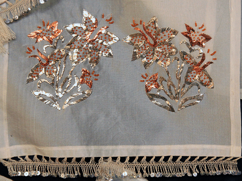
Bartın wire breaking (Photo: T.C. BARTIN VALİLİĞİ)
Kurucaşile Stone Tray, with a history of approximately 150 years, is an original handicraft product made from stone masses extracted using traditional methods. The local population uses knowledge and experience inherited from ancestors, employing traditional tools such as chisels, hammers, axes, compasses, mallets, thick nails and burins to separate the natural rock masses. The stone masses are then processed through shaving, shaping and smoothing techniques, typically resulting in round tray-shaped products. One of the key features of the product is its heat resistance. This property allows the trays to be used for cooking food items such as red and white meat and fish, for example börek or gözleme. The natural color of the stone exhibits smoky, dark bluish or blackish tones, which slightly lighten to yellowish hues during the baking process. After baking and cooling, the final product takes on a grayish appearance.
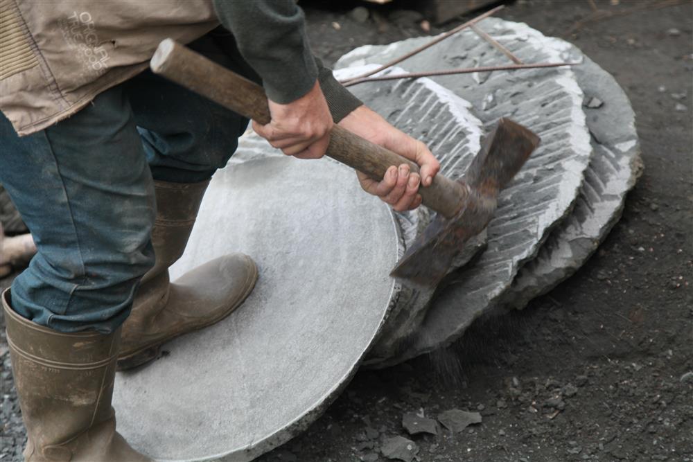
Kurucaşile stone tray (Photo: Bartın Ministry of Culture and Tourism photo gallery)
Bartın’s forest resources have provided the foundation for the development of traditional handicrafts such as wood carving. Local artisans use wood sourced from regional forests and process it using traditional methods to produce furniture, decorative items and practical tools. Wood carving, reflecting both its artistic value and the tradition of efficiently utilizing natural resources, makes significant contributions to Bartın’s cultural richness.
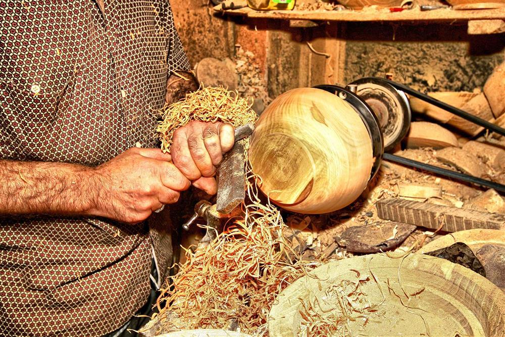
Wood carving (Photo: Bartın Ministry of Culture and Tourism photo gallery)
Çekiciler Çarşısı, located in Bartın’s historic city center, preserves traces of traditional trade. This market showcases local products, handicrafts and regional delicacies and serves as a meeting point for both locals and tourists. Its historical structure and architecture are important elements reflecting Bartın’s cultural identity.
Located in the city center, Gazhane Park offers modern relaxation areas and regularly hosts cultural events. It provides visitors with opportunities to relax in green spaces.
The Bartın City Museum possesses a rich collection documenting the historical and cultural evolution of the province. Through archaeological finds, ethnographic artifacts and historical documents, the museum provides visitors with a comprehensive historical experience.
The Amasra Museum stands out with its collection filled with artifacts from ancient times to the present. The museum consists of four halls:
Hall 1: Archaeological Artifacts
This hall displays ceramic and glass bottles, gold and bronze ornaments, amphorae, jugs, bronze figurines, bracelets, crosses, weapons, lamps and vessels from the Hellenistic, Roman, Byzantine and Ottoman periods, as well as coins from these eras.
Hall 2: Archaeological Artifacts
Marble artifacts, statues, statue heads, stelae and relief fragments from the Hellenistic, Roman, Byzantine and Genoese periods are exhibited in this hall.
Hall 1: Ethnographic Artifacts
Copper kitchenware, writing sets, weapons, candlesticks, seals, scales, ceramics and rings from the Ottoman period, as well as containers reflecting Amasra’s unique wood carving art, are displayed here.
Hall 2: Ethnographic Artifacts
This hall features regional clothing, silver ornaments, bed and pillow covers, carpets, bags, old wall clocks and copies of the Qur’an. Additionally, a 1852 map of the Mediterranean printed at the Saray Matbaası is displayed in the museum corridor, and stone artifacts from the Hellenistic, Roman, Byzantine, Genoese and Ottoman periods are exhibited in the museum garden.
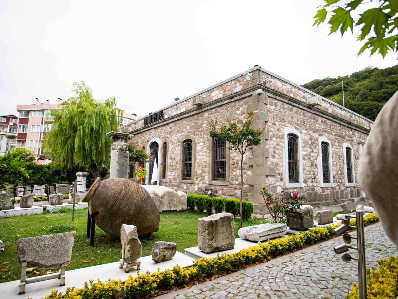
Amasra Museum (Photo: Official Turkish Museums)
The Kemal Samancıoğlu Ethnography Museum, reflecting the region’s traditional life, folklore and handicrafts, attracts visitors with local costumes, tools, household items and craft examples. The museum plays a vital role in preserving and promoting Bartın’s local culture.
Uluyayla Cave, Kemerli Cave and Gürcüoluk Cave, among Bartın’s natural beauties, are important examples of the region’s geological structure.
The Güzelcehisar Lava Columns are natural columns formed by the cooling and solidification of lava, reflecting the region’s volcanic past.
Amasra Castle is one of the region’s most important historical structures. Notable for its strategic location, the castle contains traces of various civilizations, including structural features from the Ottoman and Byzantine periods.
The Kuşkayasi Road Monument is a unique structure shedding light on Bartın’s transportation and engineering history. This monument carved into the rock symbolizes the transportation challenges and engineering achievements experienced by the region throughout its historical processes and serves as a significant landmark along the route.
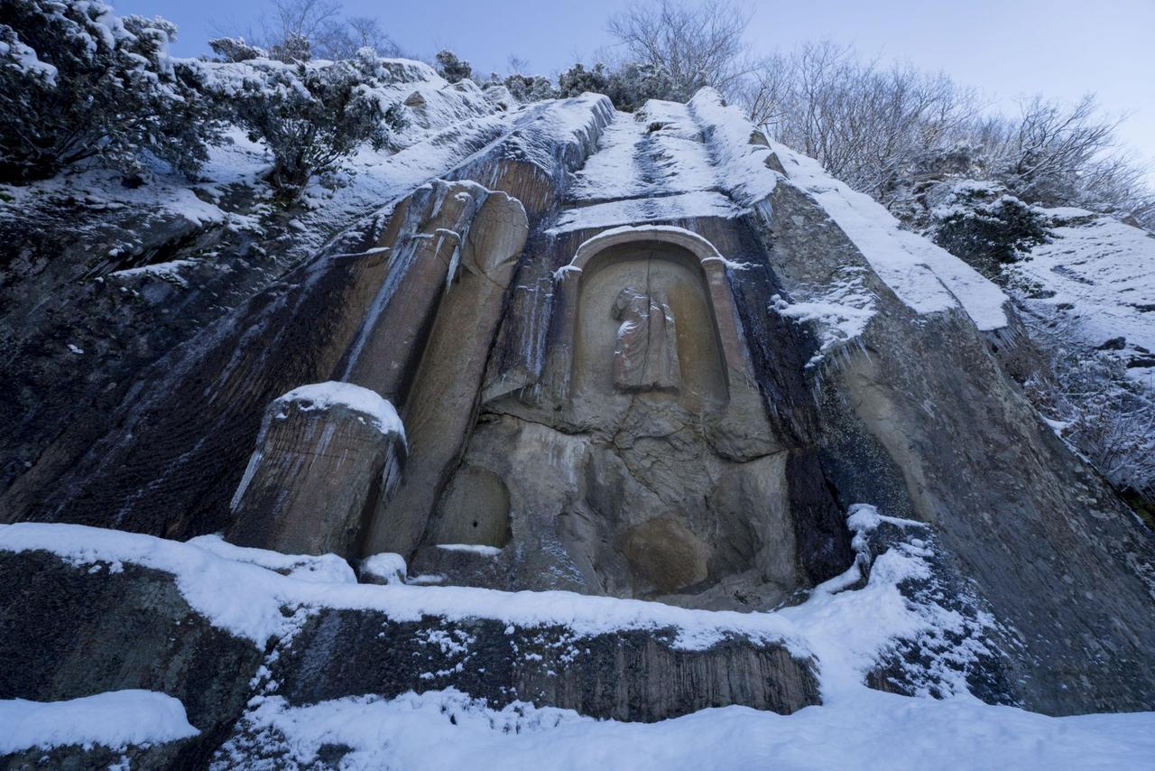
Kuşkayasi Road Monument (Photo: Western Black Sea)
The Amasra Ancient Theater, located in Amasra district, is a historical structure from the Roman period. Situated on the southern slope of Aya Yorgi Hill, the theater has a seating capacity of approximately 5,000. Unfortunately, its seating and stage sections have deteriorated over time. Today, the area where the theater once stood has been used as a cemetery since the 19th century and is now primarily known for this function. The structure in Kum Mahallesi has survived only through remnants of its entrance gate. Throughout its history, it has served as a site for numerous artifacts from the Hellenistic, Archaic, Classical, Roman, Byzantine, Genoese, Seljuk and Ottoman periods.
Halilbey Mosque, integrated into Bartın’s historical fabric, is known locally as the “Upper Mosque.” This structure reflects traditional Ottoman architectural elements and is situated in the higher part of the city.
İbrahimpaşa Mosque, located in Bartın’s bazaar and also known as the “Middle Mosque,” plays a significant role in the social and cultural life of Bartın due to its architectural features and functional use. With its historical past and regular restoration efforts, this mosque contributes to the preservation of local heritage.
Known as “Şadırvan Mosque” or locally as the “Lower Mosque,” this structure is notable for its şadırvan architecture and surrounding public spaces. It is said to have been built with funds collected from the public.
Built within the boundaries of Amasra Castle in the 9th century, the structure originally served as a Byzantine church. In 1460, during Fatih Sultan Mehmet’s conquest of Amasra, it was converted into a mosque, marking the beginning of a new era. The building retains the architectural characteristics of its time and has reached the present day following a restoration in 1887. Today, in Fatih Mosque, a unique practice is observed: the Friday sermon is delivered with a drawn sword.
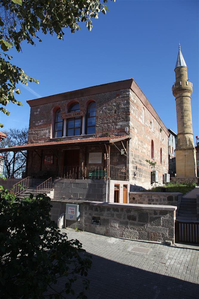
Fatih Mosque (Photo: Bartın Ministry of Culture and Tourism photo gallery)
The Aya Nikolas Church, dating from the Byzantine period, is a testament to the region’s multicultural character. In 1460, during the conquest of Amasra, it was converted into a mosque by Fatih Sultan Mehmet.【3】
The Küçüktepe Martyrium, located in the ancient Amasra region, is a structure commemorating historical events in the area.
Due to its location on the Black Sea coast, Bartın hosts various natural beaches. Amasra district, in particular, stands out with its clean sea, natural beach areas and unique views. These beaches provide ideal environments for swimming, water sports and relaxation. Strategically important for tourism, these coastal areas bring vitality to the local economy and offer a nature-integrated vacation experience.
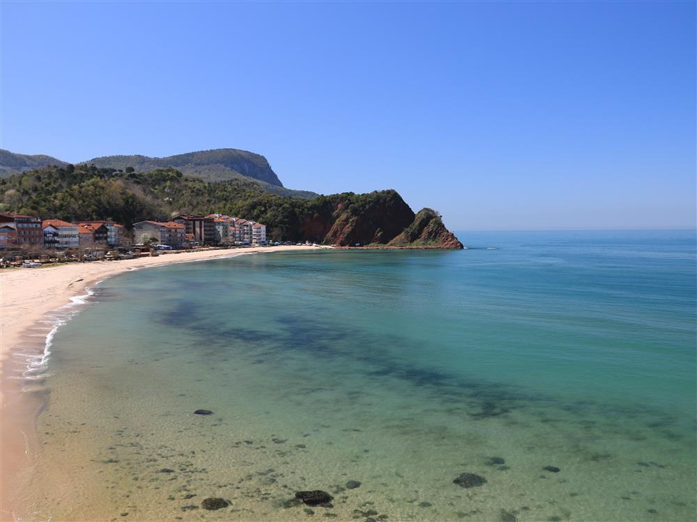
Çakrazşeyhler Beach (Photo: Bartın Ministry of Culture and Tourism photo gallery)
The Galla Market is a historic market reflecting Bartın’s traditional trade and cultural heritage. For years, this market has served as a venue for local women to display their handmade products, regional foods and crafts, becoming a center for both economic activity and social interaction. The Galla Market offers visitors an opportunity to closely experience Bartın’s local lifestyle and the continuity of traditional trade.
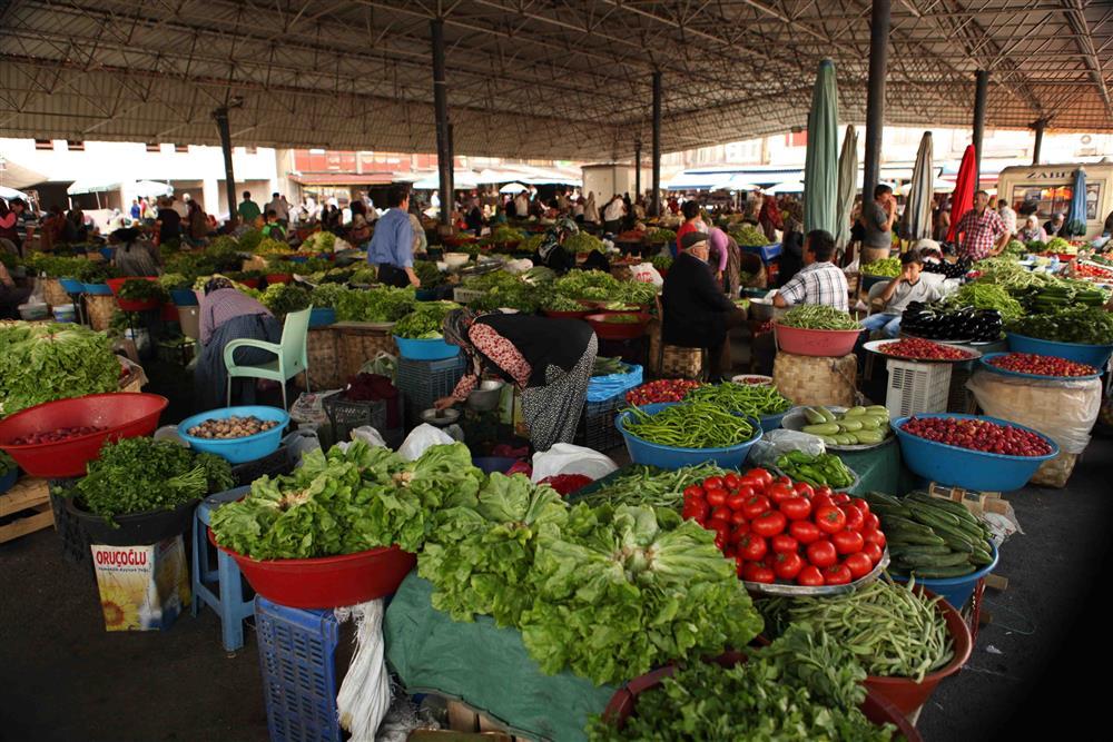
Galla Market (Photo: Bartın Ministry of Culture and Tourism photo gallery)
Amasra Salad is a salad variety reflecting the local cuisine of Amasra, prepared with fresh seasonal vegetables. Typical recipes highlight chopped tomatoes, cucumbers, peppers, onions and parsley. The salad’s flavor is enhanced by simple ingredients such as olive oil, lemon juice and salt. On top, carefully shaped and decoratively arranged slices of carrot, turnip and cucumber are added, enhancing the dish’s visual appeal.
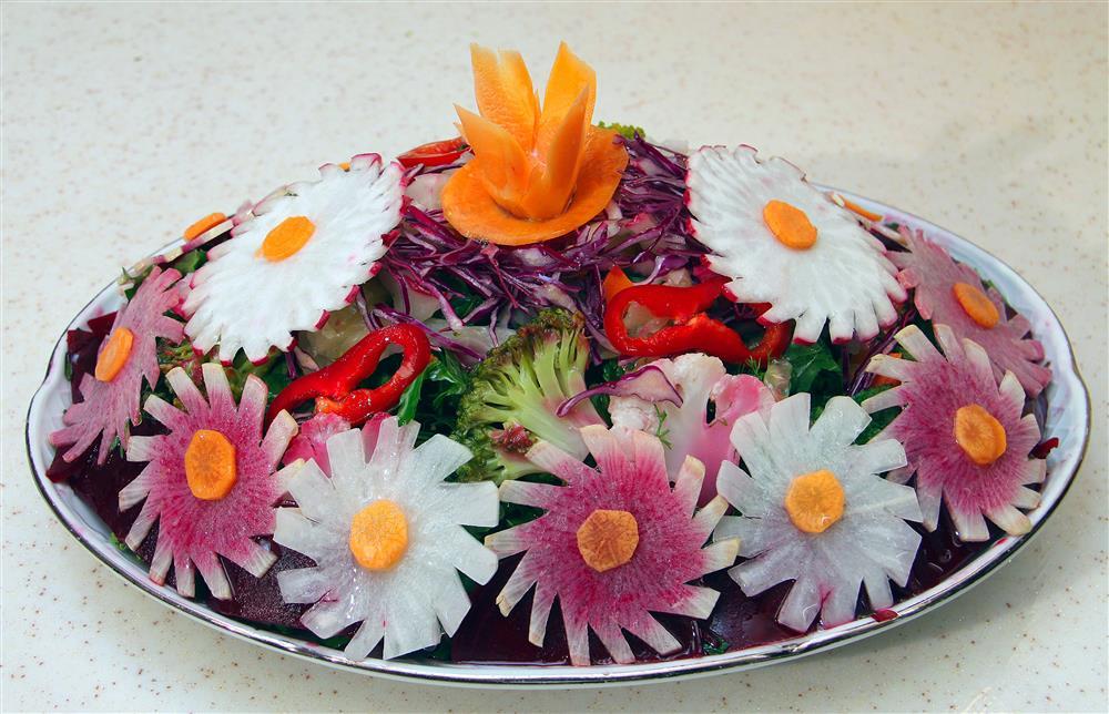
Amasra salad (Photo: Bartın Ministry of Culture and Tourism photo gallery)
Egg Isbut is one of the standout regional dishes of Bartın cuisine, widely appreciated by locals. This dish is prepared using isbut herbs grown in the region. First, the isbut herbs are carefully cleaned and boiled in a pot. After boiling, the drained herbs are mixed with fresh eggs, chopped tomatoes and peppers. This dish is served both as a main course and as a warm appetizer.
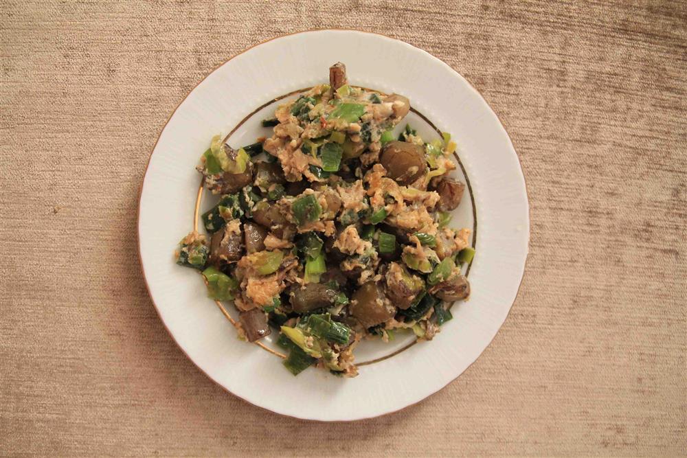
Egg isbut (Photo: Bartın Ministry of Culture and Tourism photo gallery)
Şap Köfte, one of the unique flavors of Bartın cuisine, is a type of meatball prepared using regional ingredients and traditional techniques. The meatball dough, typically made from beef or mixed meat, is kneaded with finely chopped onion, garlic and regional spices.
Bartın Kabak Burması is a light and unique dessert made with honey pumpkin and walnuts. According to historical sources from the region, this dessert was traditionally prepared in small ovens in every household’s garden after weekly bread baking. Bartın’s climatic conditions, favorable for honey pumpkin and walnut production, have enabled this dessert to be passed down through generations and remain an indispensable part of the regional cuisine.
Rice Mantı is a variation of the classic meat-filled mantı, with rice added to the filling. Thinly rolled dough is filled with a mixture of pre-roasted rice, minced meat, onion and spices. The mantı, cut into small pieces, are baked in an oven.
Amasra Pide takes its name from the famous Amasra district. This variety of pide is prepared using fresh vegetables and cheese products obtained daily. The selection of organic and natural ingredients gives the pide its distinctive taste. Amasra Pide, one of the most consumed delicacies in the region, is among the most important representatives of the local culinary culture.
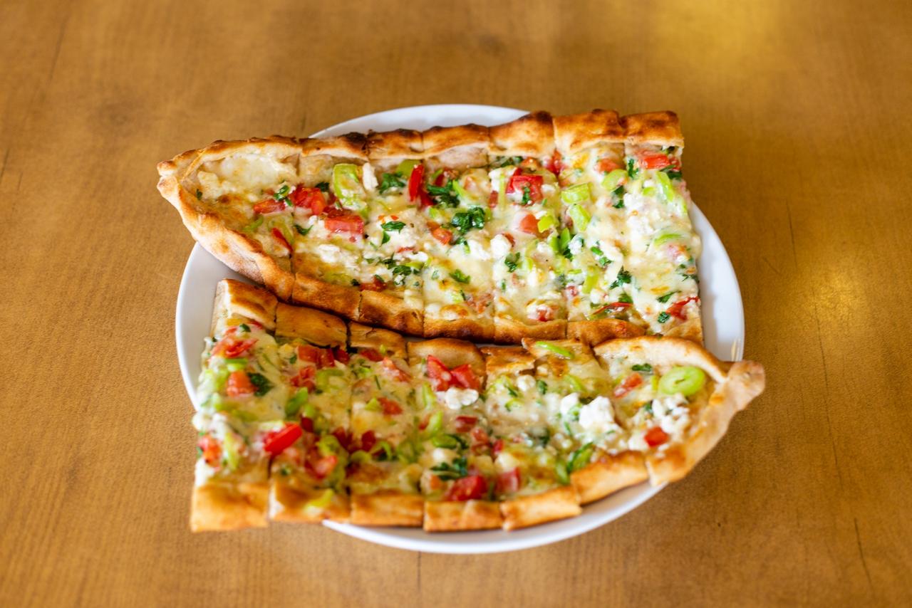
Amasra pide (Photo: Amasra Sofrası)
Bartın University, established in 2008, is one of the most important institutions in higher education in the region, offering academic education through various faculties, institutes and research centers, and providing quality educational opportunities for the local youth. Public and private schools throughout the province are supported by modern educational techniques and infrastructure investments, contributing to improved education quality and strengthened employment in the region.
Due to its strategic location on the Black Sea coast, Bartın is an important transit point for land, sea and water transportation.
Nurtaç ARSLAN is currently serving as the Governor of Bartın. He was appointed as Governor of Bartın by Presidential Decree published in the Official Gazette on 12 May 2022, numbered 2022/209.
Amasra table. Amasra bread [JPG]. Accessedhttps://amasrasofrasi.com.tr/menu/amasra-pide
Amo, Fifty (February 6, 2023). *a view of a city from across the water [JPG].* Unsplash. Accessedhttps://unsplash.com/photos/a-view-of-a-city-from-across-the-water-DrMD9CccJBk.
Bartın Kültür and Tourism Ministry. "Amasra." Accessed February 11, 2025.https://bartin.ktb.gov.tr/TR-68972/amasra.html
Bartın Kültür and Tourism Ministry. "Camiler ve Kiliseler." Accessed February 11, 2025.https://bartin.ktb.gov.tr/TR-69017/camiler-ve-kiliseler.html
Bartın Kültür and Tourism Ministry. "Fotoğraf Galerisi." Accessed February 11, 2025.https://bartin.ktb.gov.tr/TR-69036/fotograf-galerisi.html
Bartın Kültür and Tourism Ministry. "Genel bilgiler." Accessed February 11, 2025.https://bartin.ktb.gov.tr/TR-68963/genel-bilgiler.html
Bartın Kültür and Tourism Ministry. "İklim." Accessed February 11, 2025.https://bartin.ktb.gov.tr/TR-68966/iklim.html
Bartın Kültür of Culture and Tourism. "Bartın Adının Kaynağı." Accessed February 10, 2025.https://bartin.ktb.gov.tr/TR-68970/bartin-adinin-kaynagi.html
Bartın Kültür of Culture and Tourism. "Bitki Örtüsü." Accessed February 11, 2025.https://bartin.ktb.gov.tr/TR-68967/bitki-ortusu.html
Bartın Kültür of Culture and Tourism. "Coğrafya." Accessed February 11, 2025.https://bartin.ktb.gov.tr/TR-68965/cografya.html
Bartın Kültür of Culture and Tourism. "Kurucaşile Taş Sacı." Accessed February 11, 2025.https://bartin.ktb.gov.tr/TR-340223/kurucasile-tas-saci.html
Bartın Kültür of Culture and Tourism. "Tarihçe." Accessed February 11, 2025.https://bartin.ktb.gov.tr/TR-68969/tarihce.html
Fatma, Bağdatlı, Cam. “ANTİK DÖNEMDE BARTIN/PARTHENIA.” Accessed February 12, 2025.https://www.researchgate.net/publication/323617415_ANTIK_DONEMDE_BARTINPARTHENIA
Gezinomi. "Bartın’ın Meşhur Yemekleri ve Restoranları." Accessed February 11, 2025.https://www.gezinomi.com/gezi-rehberi/bartin-in-meshur-yemekleri-ve-restoranlari.html#:~:text=Amasra%20pidesi%2C%20ad%C4%B1n%C4%B1%20Amasra%20il,en%20%C3%A7ok%20t%C3%BCketilen%20lezzetler%20aras%C4%B1ndad%C4%B1r
Jorge Franganillo. *Amasra (Bartın, Türkiye) [JPG]*. Flickr. Accessedhttps://flic.kr/p/fbHfc1.
Karadeniz Doğa Gözlem Derneği. Bölgesel Fauna Araştırmaları. Trabzon: KDG Derneği Yayınları, 2021.
Miller, Eszter. "Vaşak, Orman, Doğa görseli." [JPG]. Pixabay. Accessed November 28, 2019.https://pixabay.com/tr/photos/va%C5%9Fak-orman-do%C4%9Fa-y%C4%B1rt%C4%B1c%C4%B1-canavar-4656312/
Nüfusu. "Bartın İlçeleri Nüfusu." Accessed February 11, 2025.https://www.nufusu.com/ilceleri/bartin-ilceleri-nufusu
Orijinal Frame. Bartın [JPG]. Pexels. Accessedhttps://www.pexels.com/tr-tr/fotograf/alan-tarla-saha-yemek-yiyor-13984843/.
Sharkolot. "Avrasya sıvacı kuşu, Kuş, Hayvan görseli JPG." Pixabay. Accessed November 28, 2022.https://pixabay.com/tr/photos/avrasya-s%C4%B1vac%C4%B1-ku%C5%9Fu-ku%C5%9F-hayvan-7618589/
T.C. Amasra District Governorship. "Amasra Salatası ve Balık." Accessed February 11, 2025.http://www.amasra.gov.tr/amasra-salatasi-ve-balik#:~:text=Genellikle%20en%20alta%20marul%2C%20so%C4%9Fan,s%C4%B1zma%20zeytinya%C4%9F%C4%B1%20ile%20salata%20tamamlan%C4%B1yor
T.C. Bartın Valiliği. "Görev Yapmış Valililer." Accessed February 11, 2025.http://www.bartin.gov.tr/gorev-yapmis-valililer
T.C.BARTIN VALİLİĞİ. Tel kırma [JPG]. Accessed [CITATION_LINK_0].
TARIM ve KÖYİŞLERİ BAKANLIĞI, BARTIN TARIM İL MÜDÜRLÜĞÜ. İL TARIM ve KIRSAL KALKINMA MASTER PLANLARININ HAZIRLANMASINA DESTEK PROJESİ, BARTIN TARIM MASTER PLANI. 2005.
Tuncel, Metin. “Bartın.” *İslam Ansiklopedisi*. Accessed February 11, 2025.https://islamansiklopedisi.org.tr/bartin
Turkish Museums. Bartın Amasra Museum [JPG]. Accessedhttps://turkishmuseums.com/museum/detail/1995-bartin-amasra-muzesi/1995/1.
Türkiye Kültür Portalı. Pirinçli Bartın Mantısı - Bartın. Accessed February 11, 2025.https://www.kulturportali.gov.tr/turkiye/bartin/neyenir/prncl-bartin-mantisi
Türkiye İstatistik Kurumu. Accessed [Date].
Western Black Sea. *Bartın Irmağı [JPG].* Accessedhttps://batikaradeniz.gov.tr/?p=3154.
danydory. "Avrasya sıvacı kuşu" [MP4]. Pixabay. Accessed April 17, 2021.https://pixabay.com/tr/videos/avrasya-s%C4%B1vac%C4%B1-ku%C5%9Fu-ku%C5%9F-a%C4%9Fa%C3%A7l%C4%B1k-71281/
Çelikyay, S., Cengiz, S., and Görmüş, S. (2015). Coğrafi Bilgi Sistemleri ile Bartın İli’nin Arazi Kullanım Uygunluk Analizi. Bartın Orman Fakültesi Dergisi, 17(25), 73-81.
Özhan, Öztürk. “Bartın Tarihi (Parthenius, Oniki Divan).” Accessed February 12, 2025.https://ozhanozturk.com/2018/01/06/bartin-tarihi/#_ftn16
Özkazanç, N. K. (2016). Biyolojik Mücadelede Kuşların Önemi Ve Bartın İlinde Tespit Edilen Böcekçil Kuş Türleri. Bartın Orman Fakültesi Dergisi, 18(2), 55-64.https://doi.org/10.24011/barofd.238732
Özkazanç, Nuri Kaan. “Biyolojik Mücadelede Kuşların Önemi Ve Bartın İlinde Tespit Edilen Böcekçil Kuş Türleri.” Accessed February 11, 2025.https://www.researchgate.net/publication/313284716_Biyolojik_Mucadelede_Kuslarin_Onemi_Ve_Bartin_Ilinde_Tespit_Edilen_Bocekcil_Kus_Turleri
[1]
Bartın Kültür ve Turizm Bakanlığı, “Bartın Adının Kaynağı,” Son erişim: 10 Şubat 2025
[2]
Bartın Kültür ve Turizm Bakanlığı, “Genel bilgiler,” Son erişim: 11 Şubat 2025
[3]
Bartın Kültür ve Turizm Bakanlığı, “Camiler ve Kiliseler,” Son erişim: 11 Şubat 2025

Bartın
Country | Türkiye | ||||||||
|---|---|---|---|---|---|---|---|---|---|
Region | Black Sea | ||||||||
Area | 2.120 km² | ||||||||
Population | 206.715 | ||||||||
Districts | Central Amasra Ulus Kurucaşile | ||||||||
Climate | Temperate maritime climate (Black Sea climate) | ||||||||
License Plate | 74 | ||||||||
Area Code(s) | 378 | ||||||||
Mayor | Muhammet Rıza Yalçınkaya | ||||||||
Governor | Dr. Nurtaç ARSLAN | ||||||||
Important Structure | Amasra Castle Amasra Ancient Theatre Amasra Museum Kuşkayası Road Monument | ||||||||
Etymology
History
Ancient Period and Early Settlements
Roman and Byzantine Periods
Bartın in the Ottoman Period
Bartın in the Republican Period
Geography
Location and Boundaries
Climate
Vegetation
Landforms
Water Resources
Wildlife
Demographic Structure
Population (2024)
Districts
Amasra
Ulus
Kurucaşile
Economy
Agriculture and Livestock
Mining and Forestry
Trade and Industry
Bartın within the Zonguldak, Bartın, Karabük Regional Development Project (ZBKP)
Culture and Tourism
Traditional Handicrafts
Bartın Work: Wire Breaking and Wire Wrapping
Kurucaşile Stone Tray
Wood Carving
Tourist Sites
Çekiciler Çarşısı
Gazhane Park
Bartın City Museum
Amasra Museum
Kemal Samancıoğlu Ethnography Museum
Uluyayla Cave, Kemerli Cave and Gürcüoluk Cave
Güzelcehisar Lava Columns
Amasra Castle
Kuşkayasi Road Monument
Amasra Ancient Theater
Mosques and Churches
Halilbey Mosque (Upper Mosque)
İbrahimpaşa Mosque (Middle Mosque)
Şadırvan Mosque (Lower Mosque)
Fatih Mosque
Aya Nikolas Church
Amasra Küçüktepe Martyrium
Beaches
Galla Market
Cuisine
Amasra Salad
Egg Isbut
Şap Köfte
Kabak Burması
Rice Mantı
Amasra Pide
Education
Transportation and Infrastructure
Local Administration
Governor
Former Governors