


This article was automatically translated from the original Turkish version.
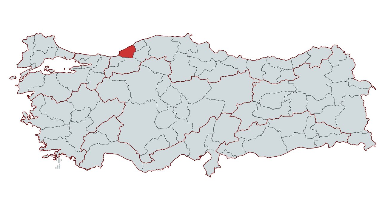
Zonguldak
Country | Türkiye | ||||||||
|---|---|---|---|---|---|---|---|---|---|
Surface Area | 3.481 km² | ||||||||
Population | 586.802 | ||||||||
Districts | Kozlu Alaplı Çaycuma Devrek Ereğli Gökçebey Kilimli | ||||||||
Climate | Temperate maritime climate (Black Sea climate) | ||||||||
License Plate | 67 | ||||||||
Area Code(s) | 372 | ||||||||
Mayor | Tahsin ERDEM | ||||||||
Governor | Osman HACIBEKTAŞOĞLU | ||||||||
Important Structure | Karadeniz Ereğli Müzesi Filyos Tios Örenyeri Zonguldak Maden Müzesi Gazi Alemdar Gemi Müzesi Orhangazi Cami | ||||||||
Zonguldak is a province located in Türkiye’s Black Sea Region, known for its coal mining industry. It is bordered by Düzce and Bolu to the west, Karabük to the south, and Bartın to the east, with its northern boundary along the Black Sea coast. City of Zonguldak possesses Türkiye’s most significant bituminous coal reserves and has developed economically through industrial and mining activities. It also holds tourism potential due to its natural beauty, caves, and forested areas along the coastline. In addition to its coal-based economy, Zonguldak is one of the region’s key trade centers due to its ports and industrial facilities.
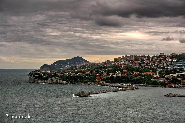
Zonguldak (Photo: Zonguldak Provincial Directorate of Culture and Tourism)
There is no consensus on the etymology of the name Zonguldak. During the Ottoman period, it is suggested that the region was known by names such as Songuldayık, Soğuldayık, or Zonğuldak【1】 gibi.
The historical development of Zonguldak is closely tied to its geographical structure and subterranean resources. Located on the Black Sea coast, the city has held a strategic position throughout history due to its rich bituminous coal reserves.
Zonguldak and its surroundings have been home to various civilizations since antiquity. The earliest settlements in the region are estimated to date back to around 2000 BCE. As part of the Paphlagonia region mentioned in Homer’s Odyssey, Zonguldak was an important settlement during the Hittite and Phrygian periods. Later, it came under the control of the Lydians and Persians, and subsequently became part of the Macedonian Empire following the campaigns of Alexander the Great in the 4th century BCE.
During the Roman and Byzantine periods, Zonguldak and its surroundings played a significant role in coastal trade, particularly with the ancient city of Heraclea Pontica (modern-day Ereğli), which flourished during this era. In the Byzantine era, the region served as a frontier zone against incursions from the east. In the late 13th century, the Genoese established trading posts in Heraclea and Amastris (modern-day Amasra) and eventually assumed administrative control over these areas.
The Spanish envoy Clavijo, who visited Amastris on his way to meet Timur, reported that the main settlement outside the fortress was largely in ruins. This condition indicates that the Genoese primarily used the harbor for trade and showed little interest in inland settlement. Additionally, remnants of coats of arms and stone carvings believed to belong to the Genoese state or prominent families of the period have been found on fortifications in the region.
Anatolia’s Turkish dominance began to strengthen, and the former cities of the Zonguldak region existed as small fortress-towns. The weakening of Byzantine administration led to increased insecurity in the region. Byzantine officials known as the Dukkai imposed heavy taxes on the population and plundered ships docking at the harbors. This situation caused the coastal piers to lose their commercial significance. Furthermore, the fortresses and castles responsible for monitoring coastal trade had fallen into the hands of uncontrolled bands.
In this chaotic environment, the first Turkish commander to arrive in the Zonguldak region was Emir Karatekin. In 1084, Emir Karatekin captured the territories of Ulus, Bartın, and Devrek, then turned toward the coast and fully conquered Zonguldak. In 1085, he took Sinop, strengthening Turkish control in the region. However, due to internal conflicts between the Great Seljuks and the Anatolian Seljuks, the region did not remain under Turkish control for long. In 1086, Zonguldak and its surroundings reverted to Byzantine control.
During the Fourth Crusade in 1204, the Latins captured Constantinople and established the Latin Empire. This prompted the Byzantines to establish the Empire of Trebizond and the Empire of Nicaea. The Nicaean Byzantines expanded their borders and incorporated the Zonguldak region into their territory. In 1261, as the Latins withdrew from the interior of Europe, the Byzantines regained Constantinople and restored political unity. During this period, the Byzantines granted the Genoese the right to use the coastal piers in the Zonguldak area for commercial activities.
The Ottoman Empire conquered Zonguldak at the end of the 14th century and incorporated the region into its territories. Initially, the city had an economy based on agriculture and animal husbandry, but it underwent a major transformation in the 19th century following the discovery of coal deposits. The presence of bituminous coal in Zonguldak was first identified in 1829 by Uzun Mehmet, an officer in the Ottoman army. This discovery held great significance for the Ottoman state’s industrialization efforts, and coal mining activities began in the region from 1848 onward.
Sultan Abdülmecid’s reign saw coal mining become an official sector, leading to rapid development in Zonguldak. To attract labor, migration occurred from other provinces. The Maadin Nizamnamesi issued in 1867 placed coal production under state control, and by the end of the 19th century, Zonguldak had become one of the Ottoman Empire’s most important industrial regions.
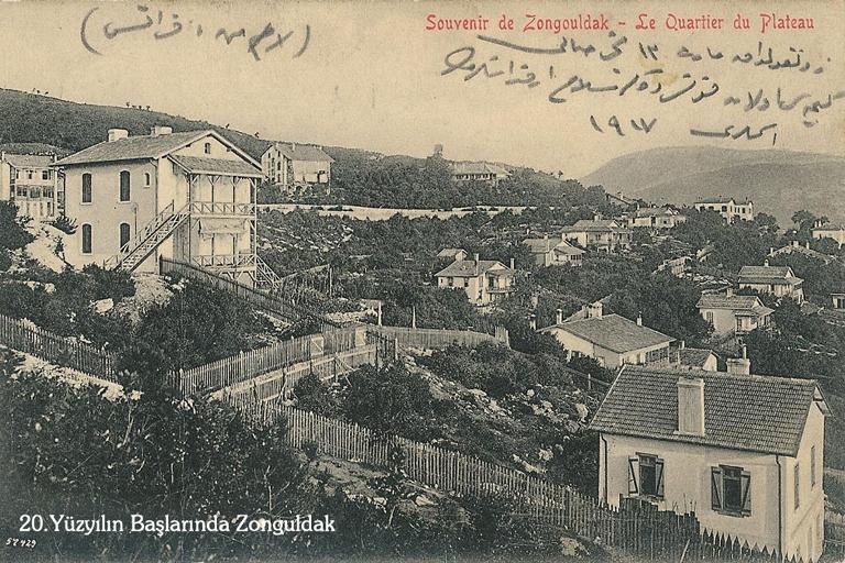
Zonguldak, 1900 (Photo: Zonguldak Provincial Directorate of Culture and Tourism)
Following the proclamation of the Republic, the coal basin of Zonguldak and its surroundings retained its strategic importance. On 1 April 1924, Zonguldak became the first province established during the Republican era. Due to its coal production, it assumed a strategic role in meeting the country’s energy needs. In the 1930s, the state-established Turkish Bituminous Coal Corporation (TTK) systematized mining activities in the region.
Geographically, Zonguldak lies between 41° 27' and 41° 50' north latitudes and 31° 33' and 32° 30' east longitudes. Bordered by the Black Sea to the north, Bartın to the east, Karabük to the southeast, Bolu to the south, and Düzce to the west, the province covers an area of 3,481 km² and features a terrain shaped by high ridges, valleys, and rivers along the coastline.
Zonguldak’s geographical position has held strategic importance throughout history for both maritime trade and mining. Its access to the Black Sea facilitated port trade and provided advantages for transporting subterranean resources. Particularly, the districts of Ereğli and Kozlu rose to prominence due to coal mining, while projects such as Filyos Port hold a significant place in the province’s economic structure.
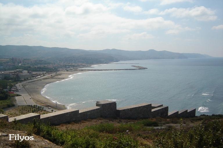
Filyos Port (Photo: Zonguldak Provincial Directorate of Culture and Tourism)
Zonguldak is located in Türkiye’s Black Sea Region and experiences a temperate Black Sea climate, characterized by rainfall throughout the year and mild seasons with no distinct dry period. The heaviest rainfall occurs in autumn and winter. The annual average temperature is approximately 13°C. Summer temperatures typically range between 20–25°C, while winter temperatures vary between 5–10°C. Snowfall is rare and, when it occurs, is usually brief and light. Zonguldak’s abundant rainfall contributes to its rich surface water resources, which in turn support a lush and diverse vegetation cover.
Approximately 56% of Zonguldak’s area is covered by forests. The main tree species include beech, oak, hornbeam, maple, Porsuk, and pine. These tree species are distributed according to varying elevations: broadleaf trees dominate the coastal areas, while coniferous species are more prevalent at higher altitudes. Along the coast, in addition to moist forests, maquis vegetation is also present. Maquis elements are found primarily near the shoreline at lower elevations, where aromatic plants such as laurel, wild olive, Kekik, and sage grow abundantly.
Zonguldak is a province located in the western part of the Black Sea Region with a rugged terrain. Its topography consists of mountains, plateaus, valleys, and coastal plains.
Zonguldak’s surface features are largely mountainous and uneven. Within its boundaries lie extensions of the Western Black Sea Mountains, which run parallel to the coast and hinder access to the interior from the sea. Important elevations in the province include Atyaylası Hill, Göldağı, Kantar Hill, Orhan Hill, Baba Mountain, Soğukoluk Hill, Kızıl Hill, and Bacaklı Yayla【2】. The average elevation across the province ranges between 500 and 1,500 meters.
The most important river in Zonguldak is the Filyos River. This river originates in the borders of Karabük and Bolu, flows into the province, and empties into the Black Sea. Other significant rivers include Alaplı Creek, Gülüç Creek, Üzülmez Creek, and Çaycuma River. Valleys are generally narrow and deep, formed by river erosion.
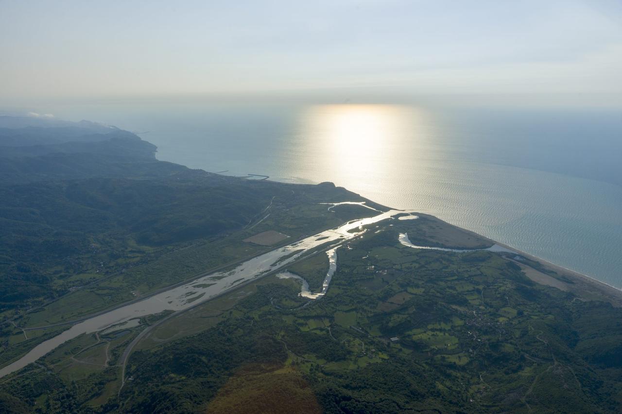
Filyos River (Photo: Western Black Sea)
Zonguldak’s Black Sea coastline is highly indented and protruding. The coasts of Ereğli, Kozlu, and Zonguldak city center feature natural harbors and coves. Along the shoreline, high cliffs and rocky areas are prominent. This structure limits the development of coastal tourism but facilitates the formation of natural harbors.
Zonguldak’s landforms have shaped its economic activities. Due to its mountainous and uneven terrain, agricultural land is limited, but mining and forestry have become dominant. Additionally, the valleys formed by rivers and the natural harbors along the coast have given the region a strategic position for transportation and trade.
Zonguldak is one of Türkiye’s most important regions for bituminous coal deposits in terms of geological structure. The province’s geological history dates back primarily to the Paleozoic and Mesozoic eras. During the Carboniferous period (approximately 300 million years ago), extensive swampy areas existed in this region. Organic matter accumulated in these swamps and, over millions of years under pressure and heat, transformed into bituminous coal. This process led to the formation of the region’s coal reserves and established Zonguldak as one of Türkiye’s most important mining centers.
When examining Zonguldak’s geological structure, it is evident that the rocks are predominantly sedimentary in origin. Sandstone, claystone, and shale from the Paleozoic era form the region’s foundation, while tectonic movements during the Carboniferous period created folded and faulted structures. Coal seams in the Zonguldak basin are concentrated particularly in the Alacaağzı and Kozlu formations. These coals, due to their high carbon content, have high calorific value and are of great industrial importance.
Coal formation in the province began in swampy areas. Millions of years ago, this coastal region was covered by dense vegetation. Over time, this organic matter became compressed under layers of mud and sand, remaining intact in an oxygen-free environment. Under the influence of geological processes, increasing pressure and temperature transformed the organic material into peat, then lignite, and finally bituminous coal. Today, the coal extracted in Zonguldak is bituminous coal (black coal), used both for energy production and industrial purposes. Zonguldak’s subterranean resources are not limited to coal; in some areas, limestone and clay, used as industrial raw materials, are also found.
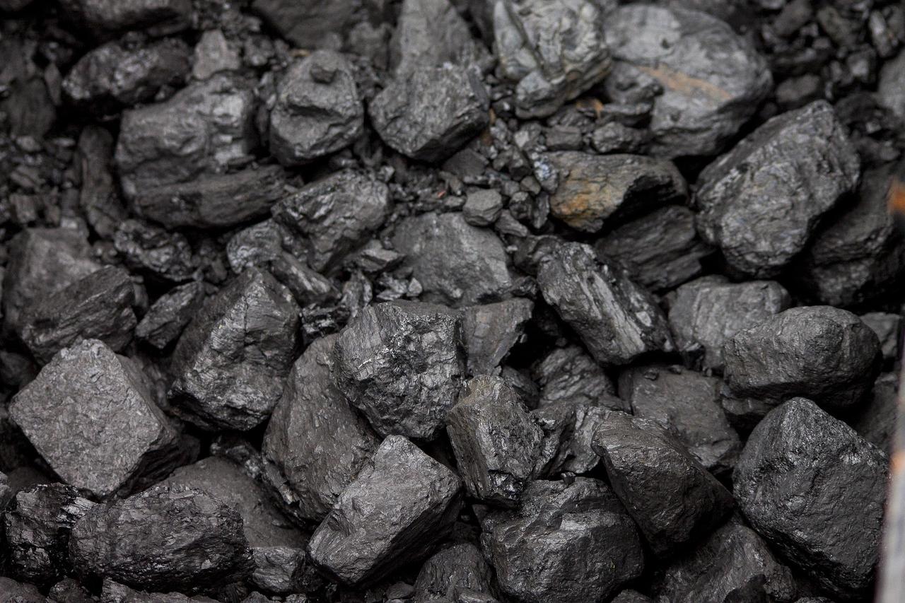
Bituminous coal (Photo: onzeCreativitijd, pixabay.com)
Zonguldak province is located in the western part of the Black Sea Region and possesses rich biological diversity. Its forested and mountainous areas provide habitat for various wild animals. In addition to large mammals such as bear, wolf, and wild boar, predators such as jackal, Bayağ vaşak, lynx, and weasel are also present. Jackals are frequently seen near village settlements and occasionally interact with humans. Weasels can cause damage to chicken farms.
Due to its location in the Black Sea Region and its diverse habitats, Zonguldak hosts a rich variety of bird species. Over 300 bird species have been recorded in the province to date.
Zonguldak Port and its surroundings serve as an important habitat for seabirds. Species such as the Mediterranean gull, black-headed gull, and various sandpipers are observed here. During winter months, rare bird species seek shelter in the port and can be easily observed. In inland and forested areas, songbirds such as sparrow, saka, and ispinoz are common. Additionally, raptors such as hawk and kestrel also inhabit the region.
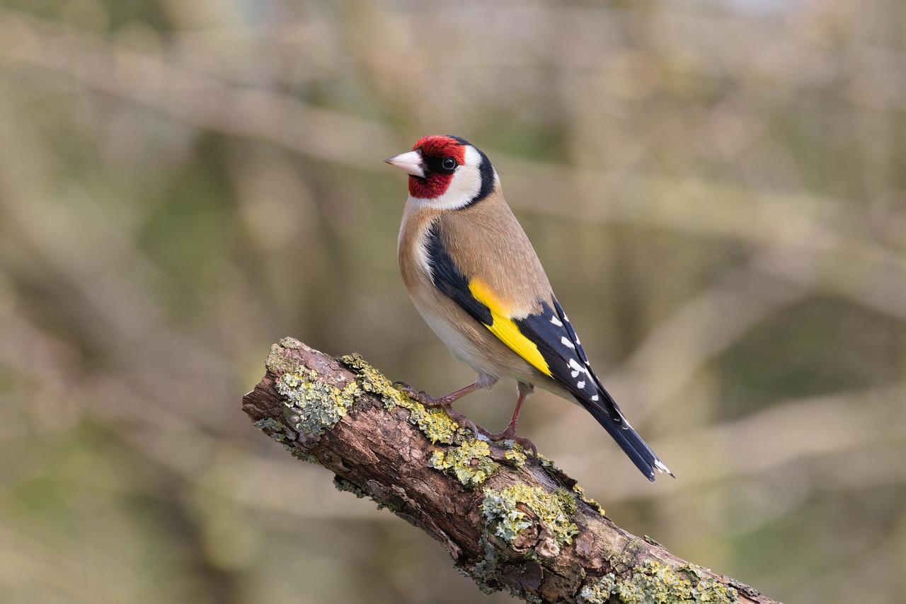
Saka bird (Photo: pixabay.com)
Rare bird species are also found in Zonguldak. For example, in 2020, the rare Black-eyed Rosefinch was observed in the Çaycuma district and recorded as Zonguldak’s 309th bird species. This diversity makes the region an important destination for birdwatchers and nature photographers.
To preserve wildlife and support sustainable hunting activities, the Yeşilöz Wildlife Development Area was established in the Devrek district of Zonguldak. Covering approximately 8,500 hectares, this area holds significant potential for hunting and nature tourism.
Zonguldak province is located in Türkiye’s Black Sea Region and, as of 2024, has a total population of 586,802. Of this population, 373,803 reside in provincial and district centers, while 212,999 live in towns and villages. The province’s annual population growth rate is recorded at -8.0. Looking back at previous years, a gradual decline in Zonguldak’s population has been observed. For instance, in 2000, the province’s population was 630,323, but by 2024, it had decreased to 586,802. This decline reflects changes in the province’s demographic dynamics.
In terms of fertility rate, Zonguldak’s total fertility rate of 1.14 children is below the national average and among the lowest in the country. These figures reveal the demographic changes and population dynamics in Zonguldak. The declining population and low fertility rate will significantly affect the province’s future demographic structure and socio-economic conditions.
Alaplı: 86,336
Çaycuma: 90,423
Devrek: 57,328
Ereğli: 174,468
Gökçebey: 42,536
Kilimli: 33,000
Kozlu: 50,820
Zonguldak’s economy is largely based on bituminous coal mining. The province holds a significant position in Türkiye’s bituminous coal production and contributes to industry and energy sectors. In addition, small-scale agriculture, animal husbandry, and fishing also form part of the economic structure.
Agricultural activities in Zonguldak are limited due to geographical constraints and fragmented terrain. Although mining is the primary livelihood, small-scale agriculture and animal husbandry are still practiced. The province is also known for geographical indication products such as Devrek Bastonu, Cevizli Kömeci, Beyaz Baklavası, Çaycuma Manda Yoğurdu, and Karadeniz Ereğli Osmanlı Çileği.

Karadeniz Ereğli Osmanlı Çileği (Photo: Culture Portal)
Zonguldak is one of Türkiye’s provinces with the most significant bituminous coal reserves. The coal deposits in the province are of strategic importance for industry and energy production. The total bituminous coal reserve in the basin is estimated at approximately 1.5 billion tons, of which 59% lies within Zonguldak’s boundaries. High-quality bituminous coal deposits are found particularly in the Kozlu, Karadon, and Üzülmez regions.
Bituminous coal has played a decisive role in Zonguldak’s economic and social structure. During industrialization, it served as a fundamental raw material in iron and steel production and the energy sector, making significant contributions to the region’s development. Mining activities also influenced Zonguldak’s demographic structure, facilitating population growth and urbanization.
Today, bituminous coal mining continues to hold an important place in Zonguldak’s economy. However, limited reserves and the environmental impacts of mining require careful planning and management for sustainability. In this context, the adoption of modern mining techniques and the evaluation of alternative energy sources are of great importance for the region’s future economic and environmental balance.
Zonguldak’s industrial structure has historically developed around bituminous coal mining. The province’s coal reserves provided the foundation for the growth of the iron and steel industry. In this context, the Ereğli Iron and Steel Works (ERDEMİR), established in the district of Ereğli, operates as one of Türkiye’s largest integrated iron and steel facilities. Additionally, organized industrial zones in the province host businesses across various sectors. For example, the Zonguldak-Ereğli Organized Industrial Zone, established in 1995, serves as a mixed industrial zone to meet the region’s industrial needs. Enterprises in this zone operate in sectors such as metal processing, machinery manufacturing, and forest products. Due to its strategic location on the Black Sea coast, Zonguldak plays a vital role in maritime trade. Its port is actively used in trade with countries bordering the Black Sea, particularly for coal exports and imports.
Chambers of Commerce and Industry operating in the province make significant contributions to organizing and developing commercial life. The Zonguldak Chamber of Commerce and Industry, established in 1919, is one of the oldest and most established institutions in the region.
Zonguldak occupies a strategic position within the Zonguldak-Bartın-Karabük (ZBK) Development Project, which aims to support economic, social, and environmental development in Türkiye’s Western Black Sea Region. Initiated in 1997 by the State Planning Organization as a continuation of regional development plans, the project was systematized in 2010 under the Western Black Sea Development Agency (BAKKA). Under the 2024–2028 TR81 Regional Plan, Zonguldak’s development is targeted in the areas of industry, mining, logistics, and tourism.
Historically, Zonguldak has emerged as Türkiye’s most important bituminous coal production center. However, over time, the sustainability of coal mining has declined, and the workforce in this sector has been redirected to other employment areas. Therefore, strategies under the ZBK Development Project include increasing industrial diversity, encouraging technology-oriented investments, and accelerating the industrial transformation process. Particularly, the Filyos Port Project enhances Zonguldak’s international trade and logistics capacity, contributing to regional industrial development. With a target capacity of 25 million tons of cargo, this port will make the ZBK region more competitive in foreign trade.
Beyond industry, Zonguldak’s agricultural and tourism potential is also being evaluated under the project. The development of sustainable agricultural techniques and the establishment of organized agricultural zones support rural development. In terms of tourism, the goal is to promote Zonguldak’s nature tourism, coastal tourism, and cultural heritage. The Küre Mountains Milli Park and Filyos Coastline are being considered within this framework.
Throughout history, Zonguldak has been known for local industries such as mining, weaving, and woodwork. The region’s natural resources and cultural structure have contributed to the development of handicrafts, particularly traditional weaving and embroidery techniques, which have acquired distinctive regional characteristics.
In Zonguldak and its surroundings, local textile types known as “elpek,” “pelemet,” and “çözme bez” form the foundation of the region’s weaving tradition. In Karadeniz Ereğli, “elpek”; in Çaycuma, “pelemet”; and in other districts, “çözme bez” are woven on handlooms called “düzen” using flax and cotton threads. These textiles were traditionally used in items such as bridal dowries, aprons, belts, and peşkir.
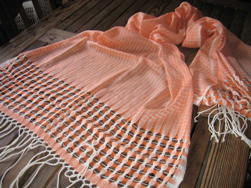
Elpek cloth (Photo: Culture Portal)
Regional embroidery styles in Zonguldak developed from the 18th and 19th centuries, using raw silk and flax as base materials. Techniques such as Turkish embroidery and hesap embroidery are used, with methods such as muşabak, plain and chain stitch, pesent, güzeme, cut lace, and wire breaking being prominent.
Devrek cane is a unique handicraft product made by hand in the Devrek district of Zonguldak. These canes, deeply associated with the region’s historical and cultural fabric, are valued both as functional tools and as aesthetic art pieces. The earliest written record about Devrek cane appears in the 1892 Kastamonu Salnamesi, which mentions cane production alongside carved wooden chests and other wood products, praising the quality and craftsmanship of canes made from dogwood. Ottoman-era master woodworkers from Devrek, who had perfected the art of carpentry, served in the imperial workshop and further developed this craft.
The traditional Classical Devrek Cane is a work of art entirely crafted by hand. The shaft is made from dogwood, while the handle is made from walnut. One of the most common motifs on the shaft is two snakes coiling toward the handle. In addition, modern cane production incorporates decorative techniques such as paint, silver, mother-of-pearl, and copper inlays. One of the most distinguishing features of the Devrek cane is that the shaft and handle are made from different materials. Additionally, buffalo horn is added to the tip to increase durability.
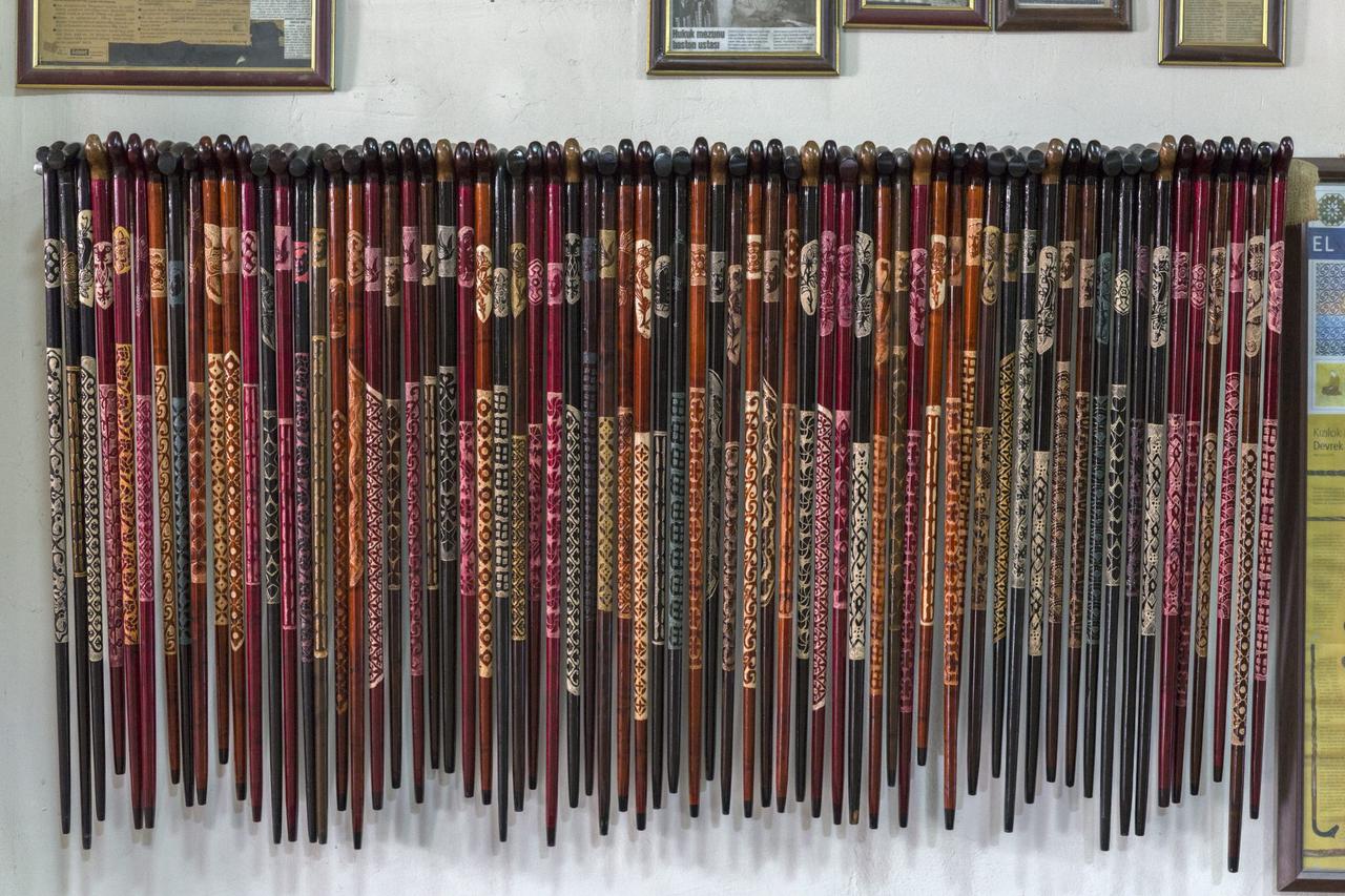
Devrek cane (Photo: Western Black Sea)
In the Alaplı district, a local fabric known as “Çekmen Bezi” is produced, consisting of thick, fine, and mixed weaves. Made from fibers of the flax plant, these fabrics are typically woven by women. Çekmen Bezi is used in garments such as göynek and şalvar, as well as in the production of peşkir and other decorative items.
Wire breaking, common in Zonguldak city and its surroundings, is a decorative technique using metal wire and a flat needle. This technique is used to embellish headscarves and women’s outerwear. Wire breaking is one of the region’s characteristic embroidery techniques and continues to be practiced today.
In the Çaycuma district and surrounding areas, basketry holds an important place among traditional handicrafts. This craft, still practiced in villages, involves making baskets of various sizes and shapes using natural materials. These handicrafts reflect Zonguldak’s cultural richness and historical heritage, forming an essential part of the region’s identity.
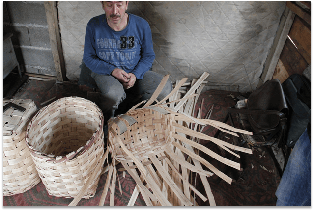
Basketry (Photo: Zonguldak Provincial Directorate of Culture and Tourism)
Zonguldak is one of the important tourism centers of the Black Sea Region due to its natural beauty, historical structures, and cultural heritage. The province features various tourist destinations such as caves, ancient cities, fortresses, coastal areas, and natural parks.
Zonguldak is one of Türkiye’s most important regions for cave tourism. The province contains numerous natural and tourist caves, some of which are open to visitors. Gökgöl Cave, located on the Zonguldak-Ankara highway, attracts attention with its illuminated walking paths and geological formations. Cehennemağzı Caves are known for their mythological and historical significance; according to ancient Greek mythology, they are the site where Heracles completed one of his twelve labors. Other caves such as Kızılelma Cave (6,630 m), Gökgöl Cave (3,350 m), Cumayanı Cave (1,100 m), and Çayırköy Cave (1,150 m) are also important destinations for nature lovers and adventure seekers.
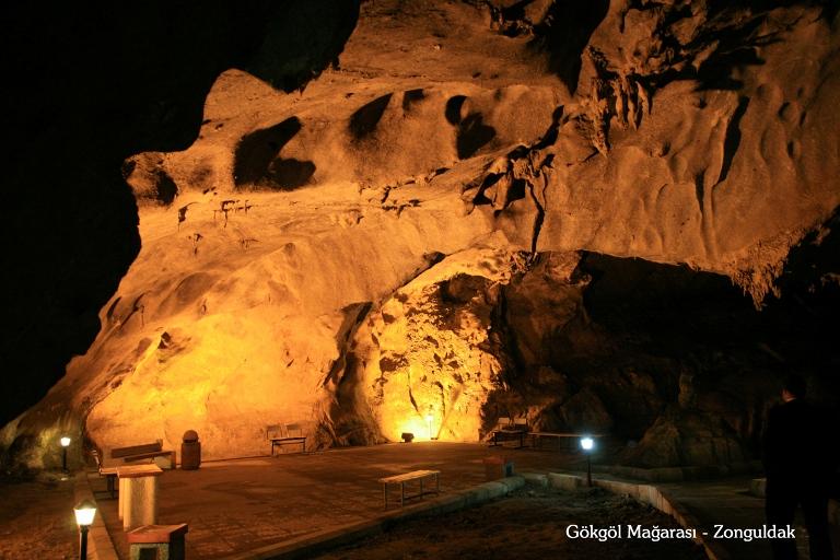
Gökgöl Cave (Photo: Zonguldak Provincial Directorate of Culture and Tourism)
Located in the Filyos village of Çaycuma district in modern-day Zonguldak, the Tios Archaeological Site has been known by various names throughout history, including Tieion, Tianon, and Tium. The city, strategically positioned between Bithynia and Paphlagonia for trade and transportation, is believed to have been founded as a colony in the 7th century BCE by the Milesian priest Tios. From its foundation, the settlement came under the control of various kingdoms and remained under the rule of the Heraclea Tyranny, Bithynia, and Pontus Kingdoms during the Hellenistic period. In 70 BCE, the city came under Roman rule and developed as an important trading center during the Roman era, later becoming a religious center during the Byzantine period.
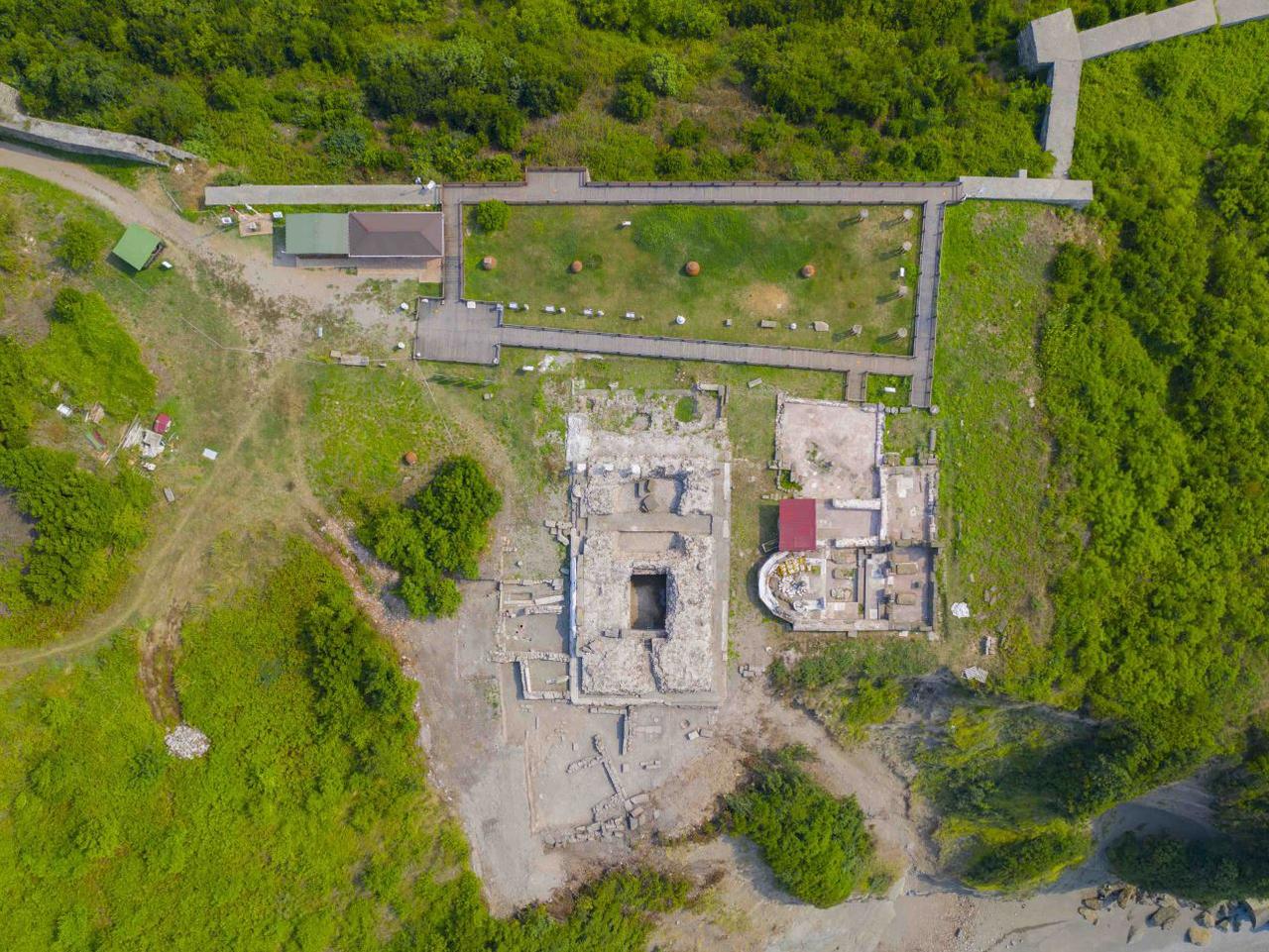
Filyos Archaeological Site (Photo: Turkish Museums)
Excavations initiated in 2006 have revealed significant information about Tios’s historical past. Initial work under the direction of Professor Dr. Sümer Atasoy was continued in collaboration with Karabük University and Kdz. Ereğli Museum. During archaeological excavations, Hellenistic-era city walls, architectural structures from the Roman and Byzantine periods, various ceramic fragments, and coins have been uncovered. In 2009, black- and red-figure pottery from the 6th century BCE and glazed ceramic fragments from the 13th century CE were discovered.
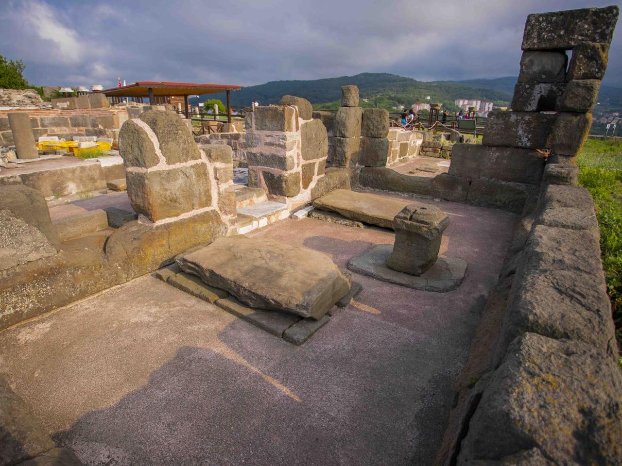
Filyos Archaeological Site (Photo: Turkish Museums)
As the first and only settlement on the Black Sea coast to be uncovered through scientific excavations, the ancient city holds great historical significance. Surface surveys and excavations indicate that the city’s roads, squares, baths, places of worship, residences, and commercial centers will gradually be revealed. Ongoing research increasingly demonstrates that Tios provides important clues about ancient maritime trade and urban life on the Black Sea coast. As excavations continue, the goal is to acquire more information about the region’s past and integrate this ancient city into tourism.
Filyos Fortress is located on a promontory overlooking the sea in the Filyos village of Çaycuma district, Zonguldak province. It is believed to have been constructed by the Romans. The large stones used in its construction give the structure a strong and imposing appearance.
The fortress remained in ruins for a long time until it was restored in 2003 by the Ministry of Culture and Tourism. The original settlement site is located on the hilltop north of the fortress. Today, remains of medieval walls and towers dating to the Hellenistic and Roman periods are visible. To the east of the fortress hilltop, marble columns and bases, inscribed marble plaques, stone sarcophagi, and brick tombs have been uncovered.
Zonguldak Mining Museum, Türkiye’s first and only mining museum, opened to the public on 9 December 2016. Located in the center of Zonguldak, in Çınartepe Neighborhood, Bülent Ecevit Street, the museum complex, built on an area of approximately 7,000 square meters, consists of 1,000 square meters of indoor exhibition space, a garden display area, and a 700-meter-long gallery, all part of the Turkish Bituminous Coal Corporation’s (TTK) educational facilities.
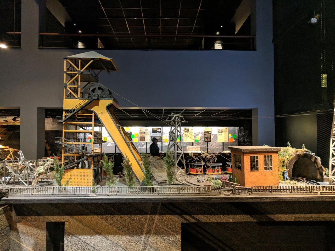
Zonguldak Mining Museum (Photo: Western Black Sea)
On the ground floor, information about the historical development of mining and the characteristics of the Zonguldak coal basin is presented. This section features a model titled “Zonguldak Basin,” created by educators from the “E.K.İ. Human Power Training Branch Directorate” and students of the 15th Cadet Course between 1983 and 1984. On the first floor, measuring instruments, personal protective and rescue equipment, medical supplies, and various objects used in social life in Zonguldak’s underground mines are exhibited. On the second floor, interactive presentations and touch-screen displays provide information on coal formation, basin geology, and fossil science. This section also introduces fossils from the Carboniferous period and methods for determining rock age.
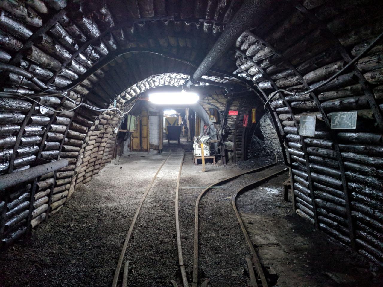
Zonguldak Mining Museum (Photo: Western Black Sea)
As part of the museum, the “Coal Experience Mine” is designed to give visitors an underground mining experience. Here, a mine elevator simulator and tools and production techniques used in mining are demonstrated. The Zonguldak Mining Museum offers visitors a comprehensive experience through its rich collection, showcasing the history of bituminous coal mining, the equipment used, and the social life of miners.
Karaelmas Mine Martyrs Museum operates in a building constructed in 1946 in the Üzülmez neighborhood of Zonguldak, originally used as a residence by the chief engineer. The building was opened as a museum on 30 December 2020. The museum provides detailed accounts of the establishment of Ereğli Coal Enterprises (EKİ), the nationalization of coal companies in the city, and the formation of the Turkish Bituminous Coal Corporation (TTK). Various materials, documents, and objects reflecting the living and working conditions of miners are exhibited. Visitors can virtually explore underground mines using virtual reality technology and experience the working environment of miners.
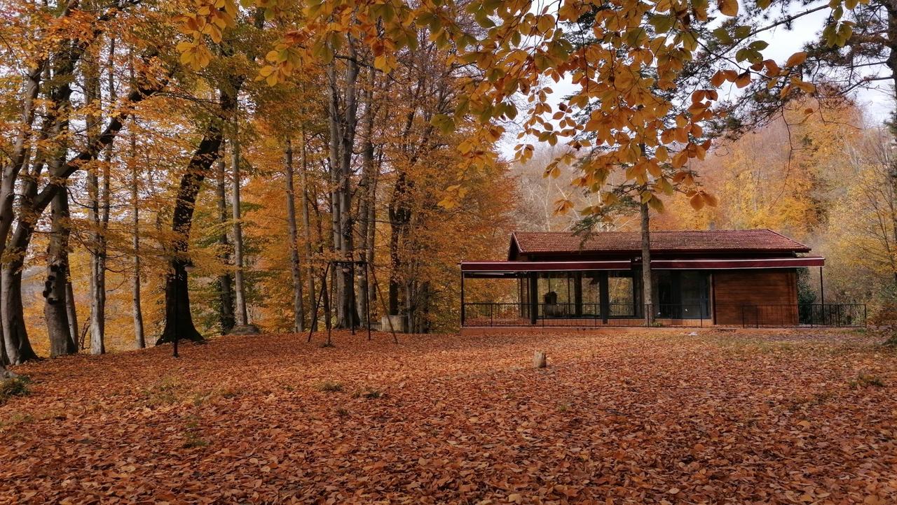
Karaelmas Mine Martyrs Museum (Photo: Zonguldak Coal Geopark)
Gazi Alemdar Ship Museum is located within Ereğli Port in the Karadeniz Ereğli district of Zonguldak. The museum is a full-scale replica of the Alemdar Ship, which played a crucial role during the War of Independence. The Alemdar Ship was seized by patriots from occupied Istanbul and brought to Karadeniz Ereğli, where it heroically defended against French attempts to capture it. This event is recorded in history as the first and only naval battle of the War of Independence. The museum opened to the public on 8 August 2008.
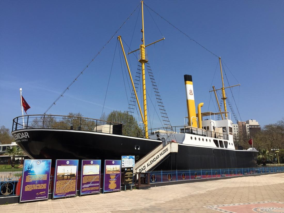
Gazi Alemdar Ship Museum (Photo: Republic of Turkey Karadeniz Ereğli Municipality)
Karadeniz Ereğli Museum is housed in a historical building constructed in the late 19th century, known as the Halil Paşa Mansion. This three-story mansion was built on the foundation of an old church during the reign of Sultan II. Abdülhamid by Halil Paşa, the district governor. After restoration, it opened as a museum in 1998. On the ground floor, archaeological artifacts from the Hellenistic, Roman, and Byzantine periods, including marble sarcophagi, sculpted column capitals, glass vessels, jewelry, various metal artifacts, lamps, and figurines are exhibited.
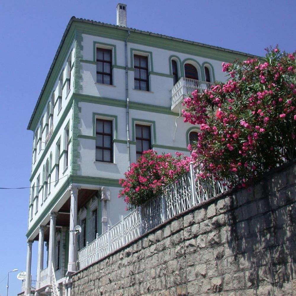
Karadeniz Ereğli Museum Halil Paşa Mansion (Photo: Republic of Turkey Karadeniz Ereğli Municipality)
On the first floor, coins from the Lydian, Greek, Roman, Byzantine, Abbasid, Umayyad, Sassanian, Artuqid, Seljuk, and Ottoman periods are displayed alongside baked clay amphorae. On the second floor, regional ethnographic artifacts such as various men’s and women’s clothing, the local woven fabric “elpek” and its threads, weaving tools, scarves, bags, coverings, weapons, seals, tobacco-related items, prayer beads, clocks, kitchen utensils, measuring and weighing instruments, and written works are exhibited. The third floor is furnished as a museum-house in the Ottoman style, featuring a sitting room, guest room, daily room, and bedroom.
In the museum’s garden, column capitals, column shafts, and bases from the Greek, Roman, Byzantine, Seljuk, and Ottoman periods, various architectural fragments, sarcophagi, and the monument of the pantomime artist Krispos are displayed. The Karadeniz Ereğli Museum is an important center reflecting the region’s cultural heritage through its rich collection and historical fabric.
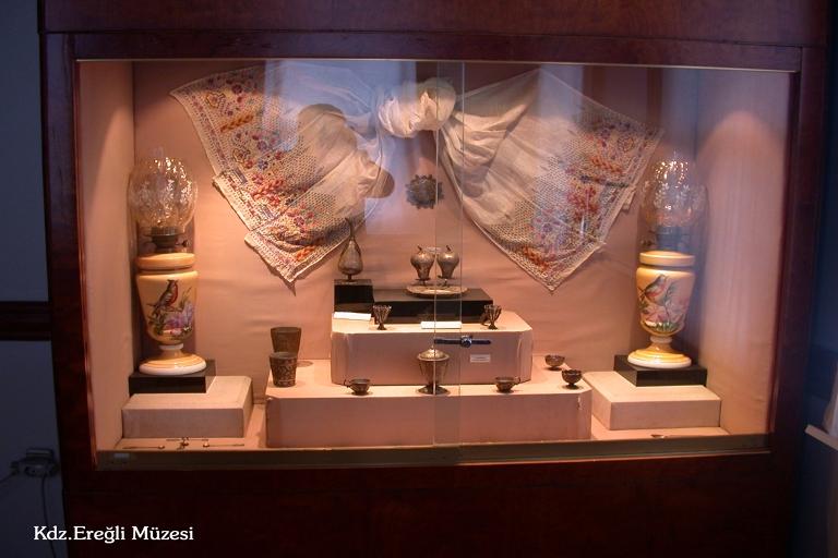
Karadeniz Ereğli Museum (Photo: Zonguldak Provincial Directorate of Culture and Tourism)
Orhangazi Mosque is located in the Orhanlar neighborhood of the Karadeniz Ereğli district of Zonguldak. Originally built as the Hagia Sophia (Holy Wisdom) Church during the Byzantine period, the structure was converted into a mosque during the Ottoman era and named Orhangazi Mosque. The three-nave basilica plan church underwent modifications when converted into a mosque. Specifically, the section previously used as the narthex during the church period was reconfigured as the final congregation area after conversion. Although the exact construction date is unknown, some sources date it to the reign of Roman Emperor Theodosius II (408–450 CE), indicating that the structure has a history of approximately 1,600 years. After Orhan Gazi conquered Ereğli, the church was converted into a mosque in the 1300s.
Yeni Mosque is located in the center of Zonguldak city, in Mithatpaşa Neighborhood, İsmet Paşa Street. Built in the early 20th century, the two-story structure is made of stone and brick, with its exterior covered in plaster. The mosque has three entrances; directly below the main entrance is an open-air şadırvan. Opposite the entrance is the mihrab, and to the left is the minbar. Parts of the mihrab, minbar, and lower walls are adorned with floral and geometric tile patterns. The ceiling is wooden, and to the right stands a single-minaret.
Zonguldak is a region offering opportunities for nature tourism due to its lush greenery and waterfalls. Harmankaya Waterfalls are a popular destination for nature hikers and photographers. Ulutan Dam and Plateau, Bölüklü Plateau offer ideal areas for camping and relaxation in nature.
Zonguldak has approximately 80 kilometers of coastline with natural beaches and sandy shores. The coastal areas attract attention for sea tourism, water sports, and natural beauty. However, the province’s coastline does not offer wide beach areas suitable for tourism. The cliff-lined coastline defines Zonguldak’s geographical character, while some pristine beaches can be considered for sea tourism.
The province’s coastline extends from the Bartın border in the east to the west, featuring various beaches. Sazköy, Filyos, Türkali, Göbü, Hisararkası, Uzunkum, Kapuz, Karakum, Değirmenağzı, Ilıksu, Kireçlik, Armutçuk, Kdz. Ereğli, Mevreke, Alaplı, and Kocaman are among the province’s important beaches. Among these, Türkali and Göbü beaches are suitable for sea tourism, while Filyos, Ereğli, and Ilıksu beaches offer suitable areas for water sports.
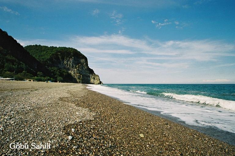
Göbü Beach (Photo: Zonguldak Provincial Directorate of Culture and Tourism)
Göbü Beach, located 28 kilometers from the city center near the Bartın border, is 800 meters long and 60 meters wide. Türkali Beach, located 30 kilometers away, has a shoreline of 1,500 meters in length and 40 meters in width. Additionally, Filyos Beach, located 35 kilometers from Zonguldak, is 3,000 meters long and varies in width between 30 and 60 meters.
Since a large part of the city’s coastline consists of cliffs, rocky formations and natural features are more prominent than wide sandy beaches. These cliff-lined coasts, formed on secondary folded limestone, offer a unique geological structure and serve as exploration points for nature lovers.
Zonguldak’s culinary culture, shaped by the natural richness of the Black Sea and regional agricultural products, features unique flavors. Vegetables, grains, and dairy products grown locally are frequently used in traditional recipes.
Uğmaç Soup is a traditional soup made from flour, water, and milk, commonly consumed during cold winter days. Prepared by mixing milk with water and flour, it is typically sweetened with butter and red pepper flakes. In rural areas, it is made using village yogurt and homemade flour.
Malay is a traditional Black Sea dish made from cornmeal. Cornmeal is added to boiling water and cooked, then topped with butter and cheese. In some regions, walnuts or sugar are added to create a sweet version. This dish, consumed for breakfast or alongside main meals, is commonly prepared in Zonguldak’s village kitchens.
Pırasalı Mancar is a traditional Black Sea vegetable dish. Leeks, barbunya, and purslane (mancar), grown in the region’s fertile soil, are prepared together. Finely chopped vegetables are sautéed with onion and cornmeal, then typically served with butter and garlic yogurt. Pırasalı Mancar, a healthy and light dish, continues to hold its place on Zonguldak’s traditional tables.
Cizleme is one of the Black Sea’s traditional crepe recipes. The dough, made from flour, dry yeast, sugar, and water, is cooked into thin pancakes on a griddle. It is commonly consumed for breakfast or with tea. Served with honey, cheese, or jam, Cizleme is a light delicacy suitable for any meal.
Çöpele is made from boiled potatoes. The boiled potatoes are finely chopped and topped with garlic yogurt. Crushed red pepper is fried in oil and poured over the yogurt before serving.
Yumurtalı Zılbıt is one of Zonguldak’s most famous vegetable dishes. “Zılbıt” refers to collard greens, stinging nettles, and similar greens. After boiling, these greens are sautéed with onion and butter, and eggs are cracked on top to finish cooking. Commonly consumed for breakfast or as a snack, this dish is notable for its high nutritional value.
Chestnut Honey is a special variety of honey produced in Zonguldak and the Western Black Sea Region. Analyses conducted by Karadeniz Technical University have confirmed this honey as the highest quality chestnut honey in Türkiye. The region’s climate and geographical structure directly influence the honey’s mineral content, making it particularly rich in calcium, potassium, manganese, and copper. This honey, derived from chestnut blossoms, is distinguished by its sharp aroma and thick consistency. Known for its antiseptic and immune-boosting properties, chestnut honey is commonly used in breakfasts and dessert recipes.
White Baklava is a dessert variant distinct from classic baklava, with less syrup and whiter pastry layers. Thinly rolled phyllo sheets are layered with generous amounts of walnuts or hazelnuts, baked, and lightly sweetened with syrup. Due to its lower sugar content, it serves as an ideal alternative for those who find traditional baklava too heavy.
Zonguldak’s Çaycuma district is renowned for its milk cow yogurt. This yogurt, characterized by its high fat content and thick consistency, is commonly used in breakfasts and dessert preparation. Rich in calcium and protein, Milk Cow Yogurt is an important flavor reflecting the region’s dairy culture.
Zonguldak province’s educational structure has been shaped by its socio-economic and cultural dynamics. According to the Turkish Statistical Institute’s (TÜİK) 2023 data, the average education duration for the population aged 25 and over in Zonguldak is 8.5 years. This figure is 7.6 years for women and 9.5 years for men. In terms of educational institutions, the province has a total of 389 schools: 10 preschools, 324 primary schools, and 59 general and vocational high schools.
In higher education, Zonguldak Bülent Ecevit University (ZBEÜ) plays a significant role. The University offers education and training across 15 faculties, 9 vocational schools, 5 colleges, 36 application and research centers, one state conservatory, and three institutes, operating from 12 separate campuses.
Due to its location on the Black Sea coast and prominence in coal mining, Zonguldak has historically required transportation and infrastructure investments. The city provides road, rail, sea, and air transportation, with ongoing projects aimed at improving its transportation infrastructure.
Zonguldak’s transportation network is shaped by state and provincial roads. According to data from the General Directorate of Highways, the province has 190 kilometers of state roads and 214 kilometers of provincial roads. Of the state roads, 127 kilometers are asphalt concrete and 63 kilometers are surface paving, while the majority of provincial roads are also surface paved.
Zonguldak was connected to Ankara and Central Anatolia via the Irmak-Zonguldak railway line, completed in 1937. Zonguldak Station serves as the northern terminal of this line. Currently, the Zonguldak-Filyos Regional Train, operated by TCDD Transportation, runs three round trips daily. These train services play an important role in local passenger transportation.
Zonguldak is one of the active port cities on the Black Sea. Zonguldak Port is the main port serving the province’s cargo and passenger transportation. Additionally, the ports of Karadeniz Ereğli and Amasra hold great importance for regional maritime trade. These ports are strategically located for the transportation of coal and industrial products. The most important port in Zonguldak province is the Filyos Port. Located in the Filyos village of Çaycuma district on the Black Sea coast, it is a strategic cargo port. Designed as Türkiye’s third-largest port, it has an annual cargo capacity of 25 million tons.
Filyos Port opened in 2021. As part of its infrastructure development, a 2,450-meter-long main breakwater, a 1,370-meter-long secondary breakwater, and a 3,000-meter-long quay with depths ranging from 14 to 19 meters have been constructed. Filyos Port was implemented as part of the Filyos Valley Project, which also includes the Filyos Industry Zone and free zone, aiming to significantly contribute to regional economic development. Additionally, construction of the Filyos Natural Gas Processing Plant is ongoing in the port area to process natural gas discovered in the Black Sea. This facility will play a critical role in processing raw natural gas transported via underwater pipelines and transferring it to the national gas grid.
Air transportation to Zonguldak is provided through Zonguldak Çaycuma Airport, located in Çaycuma district. The airport, open to domestic and international flights, attracts attention particularly for its connections to European countries. Direct flights are operated to many European countries, with Germany being the primary destination.
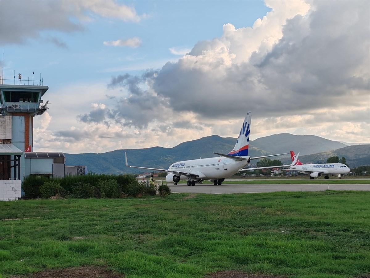
Zonguldak Çaycuma Airport (Photo: Republic of Turkey Çaycuma District Governorship)
In Zonguldak, village roads, urban transportation networks, and large-scale transportation projects are continuously being developed. The Zonguldak Provincial Special Administration carries out works such as grading, filling, asphalt, stabilized, and concrete-paved paving on village roads. Additionally, the Ministry of Transport and Infrastructure continues modernizing the province’s transportation infrastructure through its projects. In particular, road widening projects and port capacity expansions aim to enhance the province’s trade and logistics capabilities.
The current governor of Zonguldak is Osman HACIBEKTAŞOĞLU. Osman HACIBEKTAŞOĞLU, who served as Governor of Siirt from 2020 to 2023, was appointed Governor of Zonguldak by Presidential Decree No. 2023/376 published in the Official Gazette on 10 August 2023.
"Rarely seen white-browed cherry bird spotted in Zonguldak, Turkey." *Anadolu Ajansı*, January 6, 2021.https://www.aa.com.tr/tr/turkiye/turkiyede-nadir-gorulen-ak-kasli-kiraz-kusu-zonguldakta-goruntulendi/2091857
"Zonguldak Limanı Bird Colony." *Zonguldak Geoparkı*. Accessed February 14, 2025.https://www.zonguldakgeopark.com/mekan/zonguldak-limani-kus-kolonisi
"Zonguldak’ta kaç kuş türü var?" Elmas 67 Gazetesi, November 24, 2023.https://www.elmas67.com/zonguldakta-kac-kus-turu-var
Apaydın, Ahmet. "Zonguldak Şehrinin Kömüre Bağlı Tarihi Ve Talihi Üzerine Bir İnceleme". MT Bilimsel, no. 18 (July 2020): 1-20.
Hamdi, Genç. "ZONGULDAK." TDV İslam Ansiklopedisi. Accessed February 14, 2025.https://islamansiklopedisi.org.tr/zonguldak
Karadeniz Ereğli Belediyesi. "Orta Cami (Orhan Gazi Camisi)." Accessed February 14, 2025.https://www.kdzeregli.bel.tr/detay/278-orta-cami-orhan-gazi-camisi
Kaya, Ahmet. "Madencilik Sektörünün Zonguldak İlindeki Yeri ve Önemi: Ekonometrik ve İstatistiki Yöntemlerle Analiz." Academia.edu. Accessed February 14, 2025.https://www.academia.edu/26539399/
Ministry of Culture and Tourism of the Republic of Turkey. "Fotoğraf Galerisi."Zonguldak İl Directorate of Culture and Tourism. Accessed February 14, 2025.https://zonguldak.ktb.gov.tr/TR-92530/fotograf-galerisi.html
Ministry of Culture and Tourism of the Republic of Turkey. “Zonguldak İl Kültürü.” Zonguldak Provincial Directorate of Culture and Tourism. Accessed February 14, 2025.https://zonguldak.ktb.gov.tr/TR-383131/zonguldak-mutfak-kulturu.html
Ministry of Culture and Tourism. "Harmankaya Şelaleleri." *Türkiye Kültür Portalı*. Accessed February 14, 2025.https://www.kulturportali.gov.tr/turkiye/zonguldak/gezilecekyer/harmankaya-selaleleri
Ministry of Culture and Tourism. *Filyos Kalesi*. Accessed February 14, 2025.https://www.kulturportali.gov.tr/turkiye/zonguldak/gezilecekyer/filyos-kalesi?utm_source=chatgpt.com
Ministry of Transport and Infrastructure of the Republic of Türkiye. "Filyos Limanı." Accessed February 14, 2025.https://aygm.uab.gov.tr/filyos-limani
Nişanyan Yer Adları. "Zonguldak (il)." Accessed February 14, 2025.https://www.nisanyanyeradlari.com/?yer=36513&haritasi=zonguldak
Pixabay. "Saka kuşu" [JPG]. Pixabay. Accessed February 5, 2023.https://pixabay.com/tr/photos/ku%C5%9F-saka-ku%C5%9Fu-bah%C3%A7e-ku%C5%9F-g%C3%B6zlem-7768061/
T.C. Ministry of Culture and Tourism. "Geleneksel El Sanatları."Zonguldak İl Directorate of Culture and Tourism. Accessed February 14, 2025.https://zonguldak.ktb.gov.tr/TR-383132/geleneksel-el-sanatlari.html
T.C. Zonguldak Valiliği. "Coğrafya." Zonguldak. Accessed February 14, 2025.http://www.zonguldak.gov.tr/cografya
T.C. Zonguldak Valiliği. "Filyos Örenyeri." Zonguldak. Accessed February 14, 2025.http://www.zonguldak.gov.tr/filyos-orenyeri
T.C. Zonguldak Valiliği. "Kestane Balı." Zonguldak. Accessed February 14, 2025.http://www.zonguldak.gov.tr/kestane-bali
T.C. Zonguldak Valiliği. "Sahiller." Accessed February 14, 2025.http://www.zonguldak.gov.tr/sahiller
Teyit Madencilik Derneği. *Zonguldak İlinde Taşkömürü Üretiminin Ekonomik Etkileri*. Accessed February 14, 2025.https://md.teyit.org/file/1586254916411-zonguldak-ilinde-taskomuru-uretiminin-ek.pdf
Turkish Museums. "Zonguldak Maden Müzesi." Accessed February 14, 2025.https://www.turkishmuseums.com/museum/detail/2257-zonguldak-maden-muzesi/2257/1
Turkish Museums. “Zonguldak Filyos Tios Örenyeri.” Accessed February 14, 2025.https://www.turkishmuseums.com/museum/detail/22332-zonguldak-filyos-tios-orenyeri/22332/1
Türkiye Kültür Portalı. "Gazi Alemdar Gemisi Müzesi." Kültür Portalı. Accessed February 14, 2025.https://www.kulturportali.gov.tr/turkiye/zonguldak/gezilecekyer/gazi-alemdar-gemisi-muzesi
Türkiye Kültür Portalı. "Karadeniz Ereğli Müzesi." Kültür Portalı. Accessed February 14, 2025.https://www.kulturportali.gov.tr/turkiye/zonguldak/gezilecekyer/kdzeregli-muzesi
Türkiye Kültür Portalı. "Mağara Turizmi." Zonguldak Kültür Portalı. Accessed February 14, 2025.https://zonguldak.ktb.gov.tr/TR-383120/magara-turizmi.html
Türkiye Kültür Portalı. "Zonguldak Gezilecek Yerler." Türkiye Kültür Portalı. Accessed February 14, 2025.https://www.kulturportali.gov.tr/turkiye/zonguldak/gezilecekyer
Türkiye Taşkömürü Kurumu. *Zonguldak’ta Taşkömürü Madenciliği*. Accessed February 14, 2025.https://www.zonguldak.gov.tr/taskomuru
Türkiye İstatistik Kurumu. *Adrese Dayalı Nüfus Kayıt Sistemi Sonuçları, 2024*. Accessed February 14, 2025.https://data.tuik.gov.tr/Bulten/Index?p=Adrese-Dayali-Nufus-Kayit-Sistemi-Sonuclari-2024-53783
Türkiye İstatistik Kurumu. *Demografik Göstergeler ve Doğum İstatistikleri, 2024*. Accessed February 14, 2025.https://cip.tuik.gov.tr/
Türkiye İstatistik Kurumu. Accessed [Date].
Visit Zonguldak. "Yeşilöz Yaban Hayatı Geliştirme Sahası." Accessed February 14, 2025.https://www.visitzonguldak.com/place/yesiloz-yaban-hayati-gelistirme-sahasi
Visit Zonguldak. *Zonguldak Maden Müzesi ve Kömür Deneyim Ocağı*. Accessed February 14, 2025.https://www.visitzonguldak.com/place/zonguldak-maden-muzesi-ve-komur-deneyim-ocagi
Zonguldak Maden Müzesi. *Zonguldak Maden Müzesi Resmî Web Sitesi*. Accessed February 14, 2025.https://www.zonguldakmadenmuzesi.com
onzeCreativitijd (July 13, 2015). Kömür [JPG]. Pixabay. Accessedhttps://pixabay.com/tr/photos/k%C3%B6m%C3%BCr-lahana-yanm%C4%B1%C5%9F-yak%C4%B1t-siyah-842468/
[1]
Nişanyan Yer Adları, “Zonguldak (il),” Son erişim: 14 Şubat 2025
[2]
T.C Zonguldak Valiliği,“Coğrafya,” Zonguldak, Son erişim: 14 Şubat 2025
Zonguldak
Country | Türkiye | ||||||||
|---|---|---|---|---|---|---|---|---|---|
Surface Area | 3.481 km² | ||||||||
Population | 586.802 | ||||||||
Districts | Kozlu Alaplı Çaycuma Devrek Ereğli Gökçebey Kilimli | ||||||||
Climate | Temperate maritime climate (Black Sea climate) | ||||||||
License Plate | 67 | ||||||||
Area Code(s) | 372 | ||||||||
Mayor | Tahsin ERDEM | ||||||||
Governor | Osman HACIBEKTAŞOĞLU | ||||||||
Important Structure | Karadeniz Ereğli Müzesi Filyos Tios Örenyeri Zonguldak Maden Müzesi Gazi Alemdar Gemi Müzesi Orhangazi Cami | ||||||||
No Discussion Added Yet
Start discussion for "Zonguldak (Province)" article
Etymology
History
Ancient Period
Anatolian Seljuk Period
Ottoman Period
Republican Period
Geography
Location and Boundaries
Climate and Vegetation
Landforms
Mountains and Elevations
Valleys and Rivers
Coastline and Coastal Features
Geological Structure and Coal Formation
Wildlife
Demographic Structure
Districts and Population (2024)
Economy
Agriculture and Animal Husbandry
Mining
Trade and Industry
Zonguldak in the Zonguldak-Bartın-Karabük (ZBK) Regional Development Project
Culture and Tourism
Traditional Handicrafts
Devrek Cane Craft
Çekmen Cloth Weaving
Wire Breaking Craft
Basketry
Tourist Sites
Caves
Filyos Tios Archaeological Site
Filyos Fortress
Zonguldak Mining Museum
Karaelmas Mine Martyrs Museum
Gazi Alemdar Ship Museum
Karadeniz Ereğli Museum
Orhangazi Mosque
Yeni Mosque
Waterfalls and Natural Beauties
Coastlines and Beaches
Zonguldak Cuisine
Uğmaç Soup
Malay
Pırasalı Mancar
Cizleme
Çöpele
Yumurtalı Zılbıt
Chestnut Honey
White Baklava
Milk Cow Yogurt
Education
Transportation and Infrastructure
Road Transportation
Rail Transportation
Sea Transportation
Air Transportation
Infrastructure Projects
Local Administration
Governor
Former Governors