This article was automatically translated from the original Turkish version.
+1 More
Akyazı (District)
Province | Sakarya | ||||||||
|---|---|---|---|---|---|---|---|---|---|
Population | 98.098 | ||||||||
District Governor | Mustafa İkbal EŞKİ | ||||||||
Mayor | Bilal SOYKAN | ||||||||
Number of Neighborhoods | 76 | ||||||||
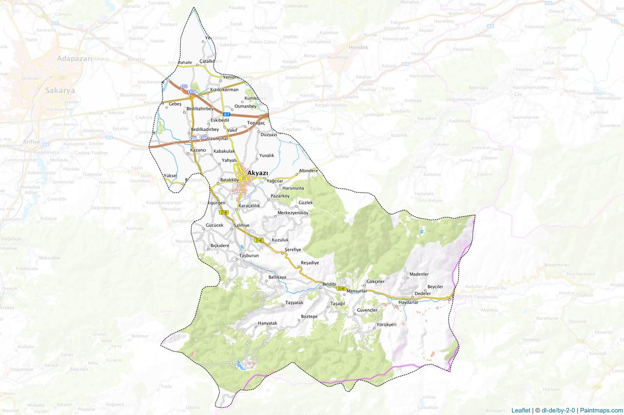
Akyazı, is located within the boundaries of Sakarya Province in the Eastern Marmara subregion of the Marmara Region. It borders Hendek and Mudurnu to the east, Erenler and Karapürçek to the west, Adapazarı to the northwest, and Bolu-Göynük to the south. According to TÜİK 2024 data, its population is 98,098.
The history of Akyazı extends back to the Mysia and Bithynia periods. It was part of the Kingdom of Bithynia, which existed from the 9th century BC to the 4th century AD. The region came under the rule of Persian King Cyrus II and later Alexander the Great. Rome took control of the area in 85 BC. During the Byzantine period, the eastern part of Sakarya was known as Regio Tersia.
The Seljuks seized the region in 1072 through Artuk Bey but later lost it to the Byzantines. In 1075, Süleyman Bey of the Kutalmışoğlu dynasty recaptured the area. The Ottoman period brought significant conquests and administrative changes to Akyazı. In 1944 the district was attached to Kocaeli, and in 1954 it was transferred to Sakarya. During the National Struggle, it played a strategic role.
Akyazı is distinguished by important natural formations such as Keremali Mountain and Kapıorman Mountains. Located in the southeast of Akova (Sakarya Plain), the district is characterized by the Mudurnu Creek and its tributaries. Natural lakes such as Sülüklü Göl and Çamlıca Lake are among the district’s key water sources.
Akyazı is known for agricultural products such as hazelnut, corn, wheat, sugar beet, and potatoes. Hazelnut, in particular, is a major source of regional income, with an average annual production of 11,000 tons. In recent years, greenhouse farming has developed significantly, and beekeeping, sericulture, and wild strawberry cultivation have also become important. Income is also derived from forest products including parquet manufacturing and timber sales. Mushroom cultivation is practiced in some villages.
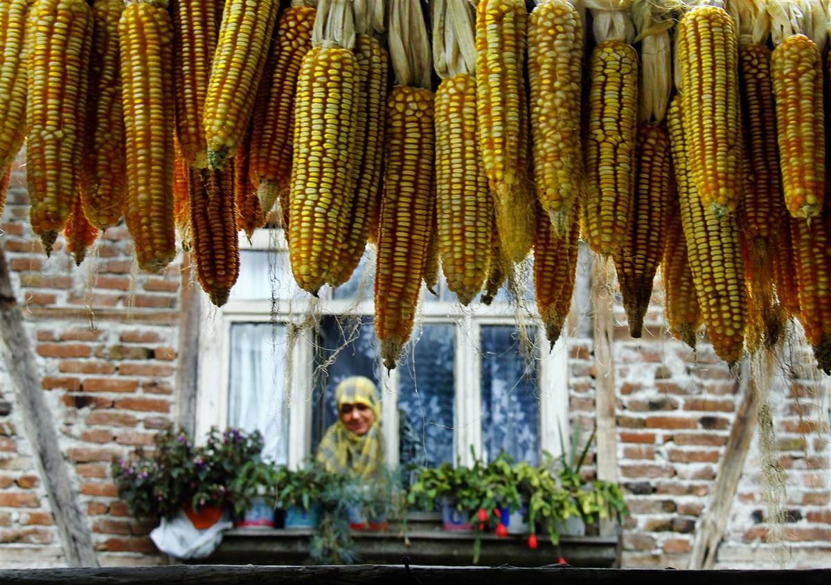
Akyazı Corn Harvest (Akyazı Municipality)
Strategically located, Akyazı lies on the E-5 and D-100 highways as well as the TEM motorway. Direct access is available to many major cities. Roads are generally asphalted and well maintained.
Akyazı exhibits characteristics of both the Marmara and Black Sea climates. The district receives abundant rainfall, and snowfall occurs in its higher elevations during winter. Its rich forests are composed of tree species such as hornbeam, beech, poplar and oak.
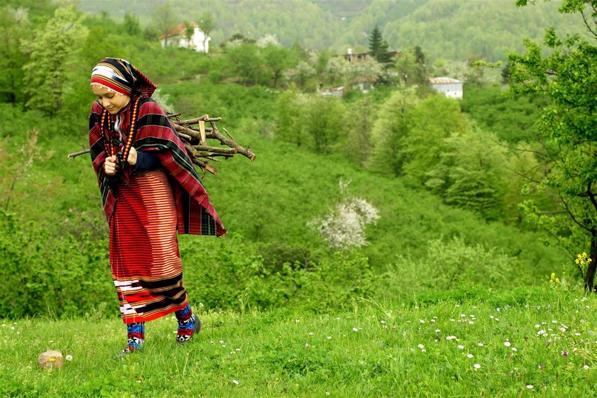
Akyazı Natural Environment (Akyazı Municipality)
According to TÜİK 2024 data, the population is 98,098. Population growth has been observed due to industrialization in the region. The thermal springs in Kuzuluk are particularly significant for tourism. Sawmilling is also one of the district’s prominent industrial sectors.
Kuzuluk Thermal Springs constitute an important site for health tourism. The springs are beneficial for stomach, rheumatic, and skin conditions.
04.12.2006, by Council of Ministers Decision No. 2006/11354, the “Sakarya Akyazı Kuzuluk Thermal Tourism Center” was officially declared. The decision was published in the Official Gazette on 16.12.2006 and entered into force.
The use of the springs dates back to the Seljuk period and has been utilized for therapeutic purposes for centuries. It is regarded as one of the best-organized thermal spas in Türkiye operated by private enterprise and is renowned for its high-curative-value waters.
The average temperature of the spring water is 84 °C. It has a distinctive odor and slightly sour taste due to its gas content. The region’s geology, particularly fault lines, has played a decisive role in the formation of the hot springs. Previous measurements have indicated increasing temperatures from north to south.
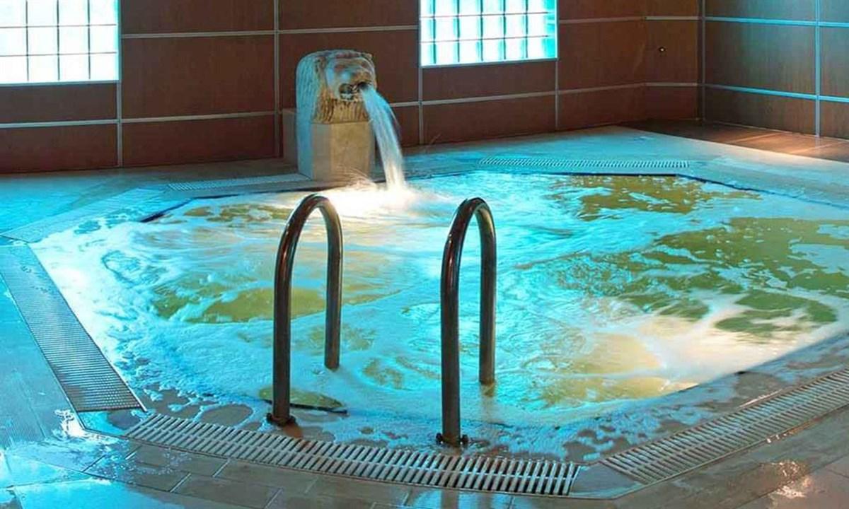
Kuzuluk Thermal Springs (Akyazı Subgovernorship)
Akyazı district of Sakarya Province hosts numerous highland pastures due to its natural geography and rich vegetation. Concentrated in the southern part of the district, these pastures attract attention for their historical background, plant diversity, geographical features, and local culture. Akyazı’s highland pastures constitute an important cultural and natural landscape area linked to settlement, agriculture, animal husbandry, and traditional festivals.
Located 35–40 km south of Akyazı at an elevation of 1,200 meters, Acelle Highland features a forest structure composed of broadleaf and coniferous trees. Low-growing plants such as forest rose and heather grow within the forest. Various mushroom species, including Kanlıca and kuzugöbeği, thrive here. A reservoir has been constructed on the Enişte Creek, which flows through the center of the highland, to combat forest fires. The creek is home to carp fish as well as frogs and water lizards.
Festivals are held every year during the last week of July, during which hundreds of tents are set up. Permanent wooden houses exist on the highland, and camping facilities are available. The highland is approximately 60 minutes from the district center. Access is possible via the Beldibi-Boztepe-Çatalkaya, Taşburun-Ballıkaya-Taşyatak-Hasyatak, or Taşburun-Ballıkaya-Taşyatak-Yanık highland routes.
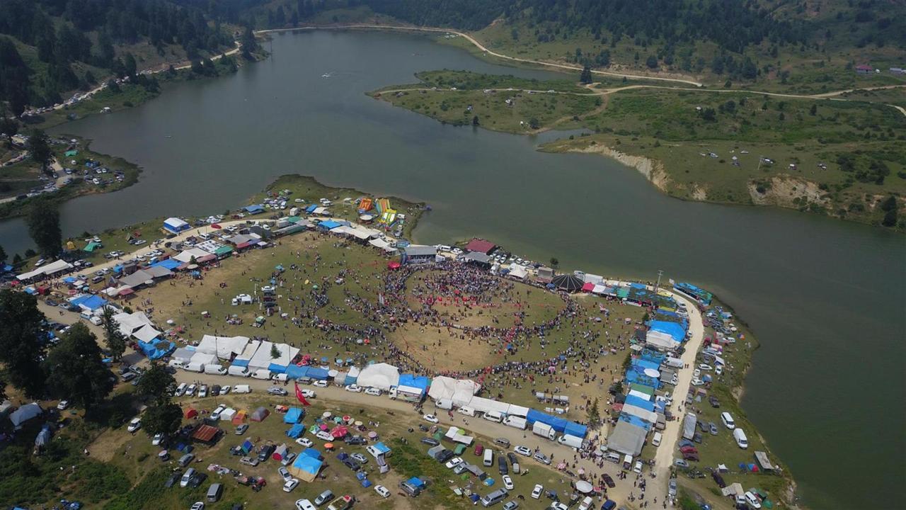
Acelle Highland (Akyazı Municipality)
At 1,541 meters, Keremali Summit is the highest point in Akyazı. It derives its name from the Keremali Türbesi located atop it. According to tradition, Keremali, who fell during campaigns against the Byzantines in the 12th century, is buried here. Due to its historical and spiritual significance, the site is a destination for visitors.
Keremali Summit offers panoramic views of Sakarya and its surroundings. To the west, one can see Akyazı, Karapürçek, Sakarya city center, Sapanca Lake, and Kartepe; to the east, Hendek and Düzce are visible. The area is suitable for hiking, cycling, motor sports, and photography. A small lake lies just below the summit, and a short walk leads to the türbe.
Sultanpınar Highland, at an elevation of 1,200 meters, was shaped by settlers migrating from the Black Sea region. It features a flat plateau surrounded by forest. Established in the mid-19th century to supply hornbeam timber for the Ottoman navy, the area is notable for its hornbeam and beech trees.
The highland has hiking trails and walking routes connecting to neighboring pastures. Accessible via the Akyazı-Dokurcun road, it is located 45 km from the district center. Transportation is provided during summer months by vehicles from Boztepe Village. Traditional highland houses are present, and long-distance walking paths link it to surrounding pastures.
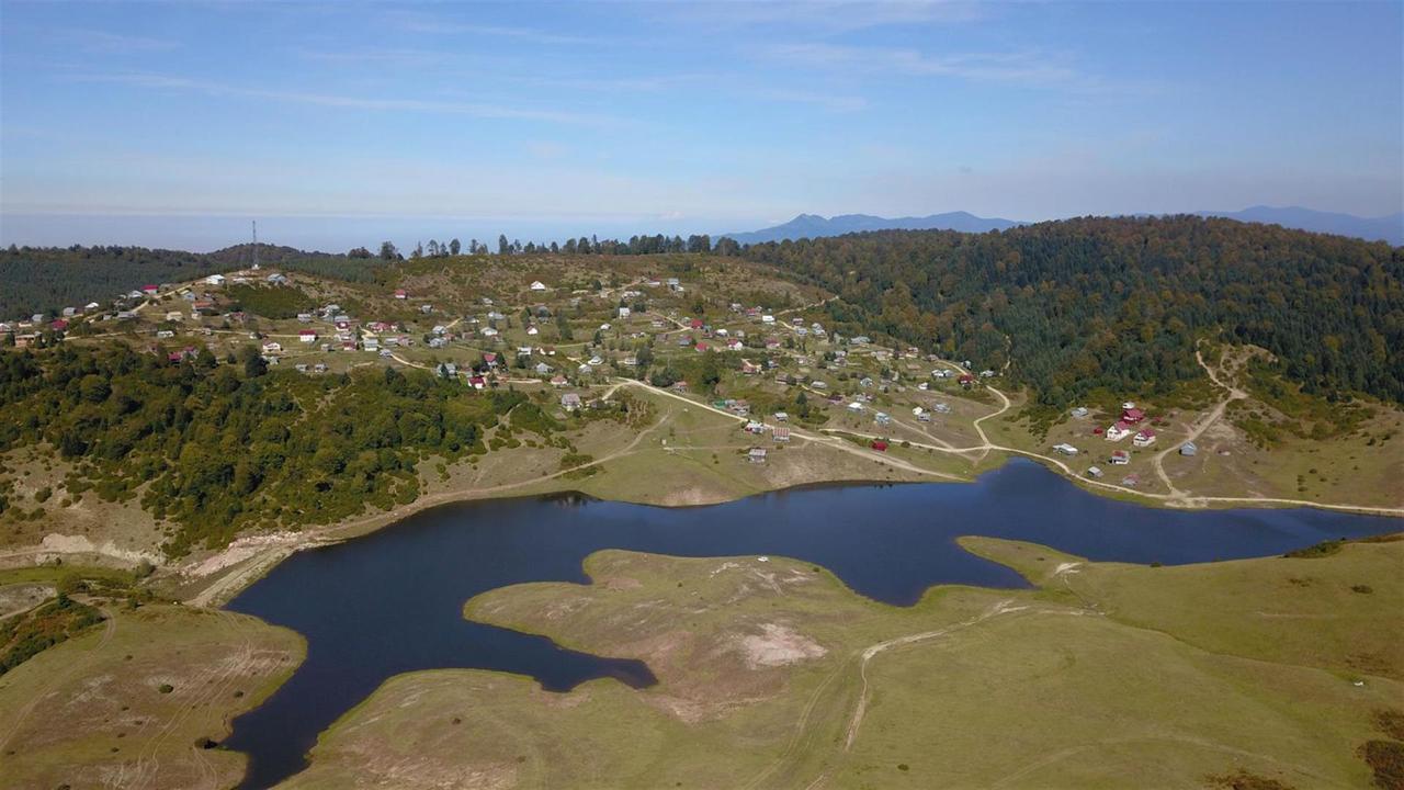
Sultanpınar Highland (Akyazı Municipality)
Located 10 km south of Dokurcun at an elevation of 1,300 meters, Davlumbaz Highland lies west of Sülüklü Göl. The name “Davlumbaz,” believed to have Georgian origins, means “summit.” The highland is particularly notable for viewpoints offering bird’s-eye views of Sülüklü Göl. It is surrounded by forests of hornbeam, pine, oriental beech, and oak; the prevalence of thyme and clean drinking water are also characteristic features.
The highland is suitable for nature walks, picnics, and camping. Wooden highland houses are present, and dairy farming and animal husbandry are practiced. Festivals are held on the first Sunday of July. Access is via stabilized roads from Dokurcun.
Akyazı Belediyesi. "Akyazı Tarım Ürünleri." Accessed August 16, 2025.https://www.akyazi.bel.tr/akyazitarimurunleri
Akyazı Belediyesi. "Coğrafi Durumu ve Nüfus Bilgileri." Accessed August 16, 2025.https://www.akyazi.bel.tr/ilcenin-cografi-durumu-ve-nufus-bilgileri
Akyazı Belediyesi. "Gezilecek Yaylalarımız." Accessed August 16, 2025.https://www.akyazi.bel.tr/gezilecek-yaylalarimiz#:~:text=Boztepe%20%C3%BCzerinden%20G%C3%BCzlek%20Yaylas%C4%B1%2C%20Sultanp%C4%B1nar%C4%B1,de%20Yan%C4%B1k%20Yaylas%C4%B1'na%20gidilir
Akyazı Belediyesi. “Akyazı’nın Tarihi.” Accessed August 16, 2025.https://www.akyazi.bel.tr/akyazinin-tarihi
Akyazı Kaymakamlığı. "Coğrafi Yapı." Accessed August 16, 2025.http://www.akyazi.gov.tr/cografi-yapi
Akyazı Kaymakamlığı. "Mahalli İdareler." Accessed August 16, 2025.http://www.akyazi.gov.tr/mahalli-idareler
PaintMaps. "Şehir Haritası Grafiği." Accessed August 16, 2025.https://paintmaps.com/tr/harita-grafikleri/sehir-haritasi-grafigi
Sakarya Valiliği. "Akyazı." Accessed August 16, 2025.http://www.sakarya.gov.tr/akyazi
T.C.Akyazı Kaymakamlığı Governorship. “Ilıca Kaplıcaları.” Accessed August 16, 2025.http://www.akyazi.gov.tr/ilica1
Türkiye İstatistik Institute (TÜİK). "Adrese Dayalı Nüfus Kayıt Sistemi Sonuçları, 2024." Publication No: 53783. Accessed August 16, 2025.https://data.tuik.gov.tr/Bulten/Index?p=Adrese-Dayali-Nufus-Kayit-Sistemi-Sonuclari-2024-53783
Zengin, Burhanettin, and Nuray Eker. “Sakarya İli Termal Turizm Potansiyelinin Değerlendirilmesi.” *Kastamonu Üniversitesi İktisadi ve İdari Bilimler Fakültesi Dergisi* 13, no. 3 (2016): 165–181. Accessed August 16, 2025.https://dergipark.org.tr/en/pub/iibfdkastamonu/issue/29634/318371
Akyazı (District)
Province | Sakarya | ||||||||
|---|---|---|---|---|---|---|---|---|---|
Population | 98.098 | ||||||||
District Governor | Mustafa İkbal EŞKİ | ||||||||
Mayor | Bilal SOYKAN | ||||||||
Number of Neighborhoods | 76 | ||||||||
History
Geographical Structure
Agriculture
Transportation
Natural Environment and Climate
Population and Industry
Tourist Sites
Kuzuluk Thermal Springs
Water Characteristics
Highland Pastures
Acelle Highland
Keremali Highland and Summit
Sultanpınar Highland
Davlumbaz Highland