

`hydrology` Related Article Results
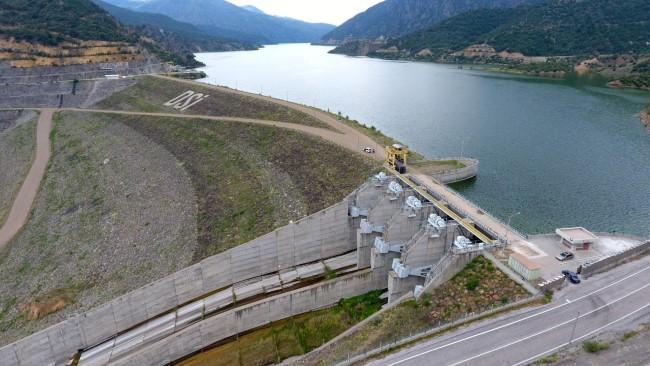
Obruk Dam Lake
Obruk Dam Lake is an artificial lake located within the boundaries of the Oğuzlar district in Çorum Province, in Türkiye’s Central Anatolia Region. The reservoir was constructed to regulate hydrological conditions in the region and meet agricultural irrigation needs. Its geography is directly linked to the topography and water resources of an area under the influence of the continental climate of Central Anatolia. History and Construction The Obruk Dam was planned to increase agricultural produc
EN
Fatma Köroğlu
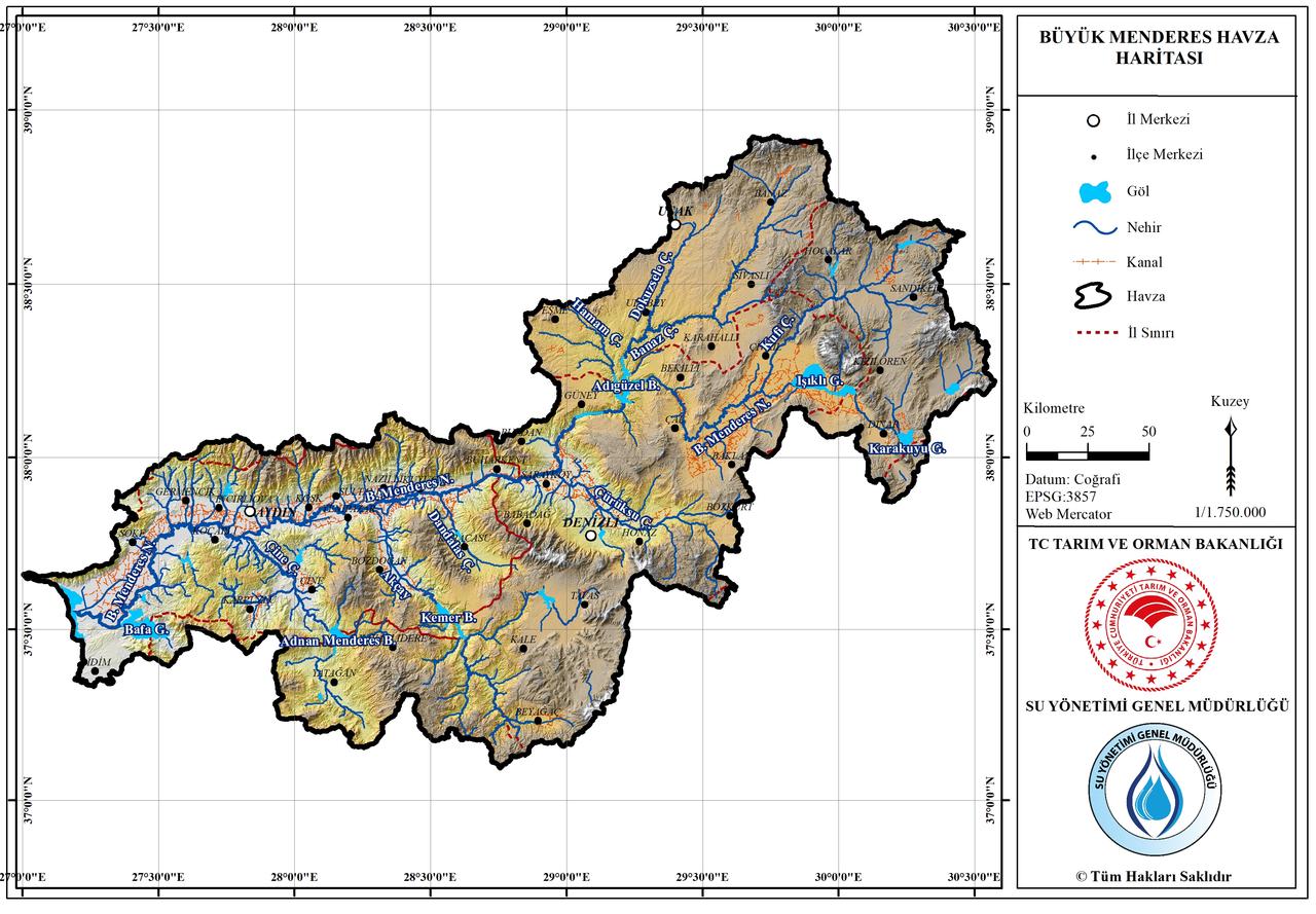
Great Menderes Basin
Great Menderes Basin is a large hydrological and ecological region centered around the Great Menderes River, one of Türkiye’s major river systems, located in Western Anatolia. The river originates in the Dinar district of Afyonkarahisar and flows approximately 584 kilometers before emptying into the Aegean Sea. The basin covers an area of about 25,987 km², encompassing the provinces of Aydın, Denizli, Uşak, Muğla, and Afyonkarahisar. Geographically situated in the southern part of the Aegean Reg
EN
Emine Sena Olcar
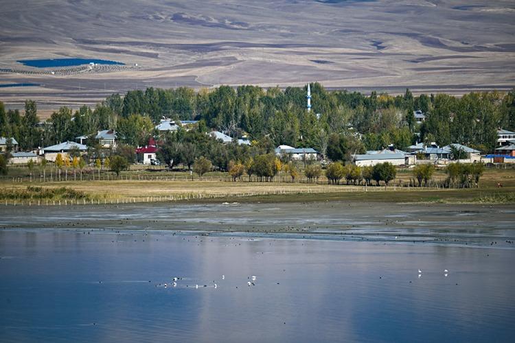
Erçek Lake
Erçek Gölü is one of the closed-basin lakes located east of Van Gölü, approximately 30 kilometers from the center of Van. Situated at an elevation of 1803 meters above sea level, the lake has a total surface area of 22,263 hectares. Geomorphologically classified as a dam lake, Erçek Gölü is one of the main wetlands within the Van Gölü Basin. The lake waters are saline and sodic, distinguishing them from freshwater ecosystems. The deepest point of the lake is 40 meters, with an average depth of 1
EN
Zelal Çakar
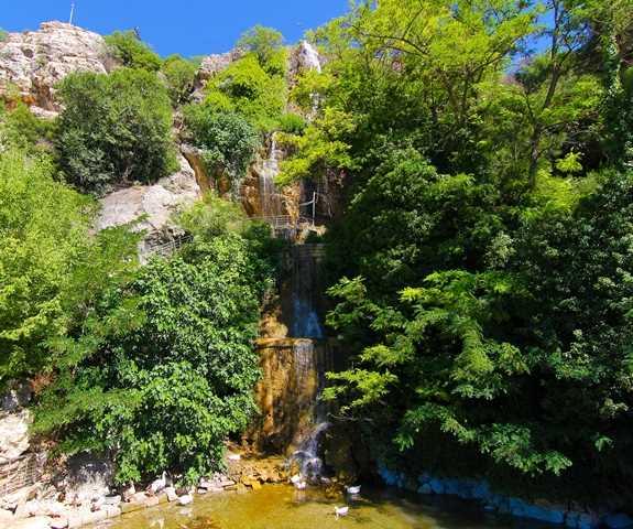
Suçıkan Park
Suçıkan Park is a natural and recreational area located in the Dinar district of Afyonkarahisar Province in Türkiye’s Aegean Region. The site is situated in the center of Dinar town and derives its name from a natural water source that gushes up from underground and sustains the surrounding area. The official address of the park is Suçıkan Mahallesi, 03400 Dinar/Afyonkarahisar.【1】 Hydrological and Geological Structure The site is recognized as the main source of the Menderes River. 【2】The local
EN
Gözde Cabadak
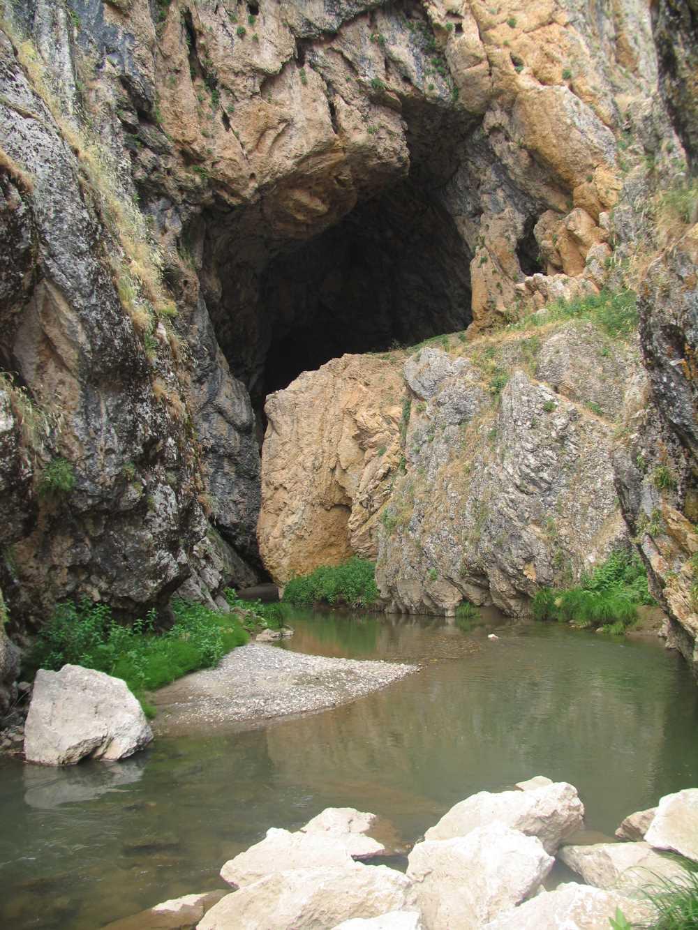
Kunav Cave
Kunav Cave is a natural formation located within the boundaries of the Varto district of Muş province in Türkiye’s Eastern Anatolia Region. It is situated near Kayadelen village, approximately 60 kilometers from the center of Muş province and 12 kilometers from the center of Varto district.【1】 The cave’s entrance is located within a deep canyon. Geomorphological and Physical Characteristics Kunav Cave is one of the rare cave types not commonly found in the Eastern Anatolian geography. Its geolog
EN
Muhammed Musab Kardaş
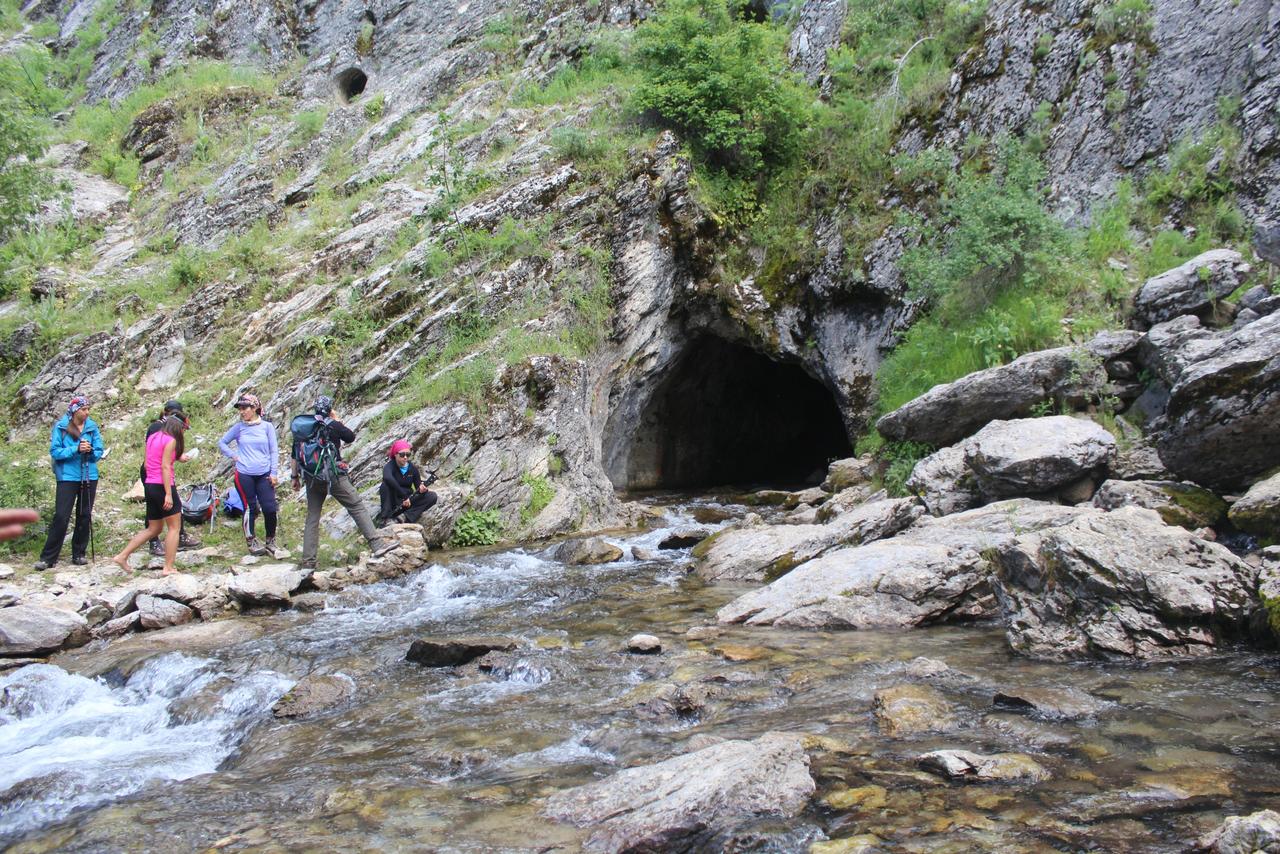
Pınargözü Cave
Pınargözü Mağarası is a natural cave exhibiting karstic features located within the boundaries of Yenişarbademli district in Isparta province in southwestern Türkiye. The cave is an active structure connected to an underground water system and ranks among the longest caves in TürkiyeKültür Portalı. “Pınargözü Mağarası.” T.C. Kültür ve Turizm Bakanlığı. Erişim tarihi: 28 Ocak 2026. https://www.kulturportali.gov.tr/turkiye/isparta/gezilecekyer/pinargozu-magarasi ">【1】. Speleological studies hav
ENSeren Yanık
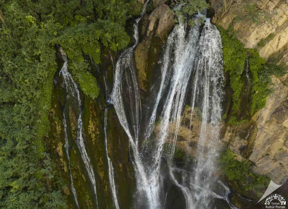
Kaval Waterfall
Kaval Waterfall is a hydrological feature located within the boundaries of Kaval Village in the Central District of Hakkâri, at the foothills of Kato Mountain, within a canyon formation.【1】 Geographical Location and Physical Characteristics Kaval Waterfall is situated in the village area of Kaval, under the Central District of Hakkâri, in a region surrounded by high-altitude mountains. The waterfall has formed as rivers flowing through rocky terrain cascade down from varying elevations.【2】 This
ENGözde Cabadak
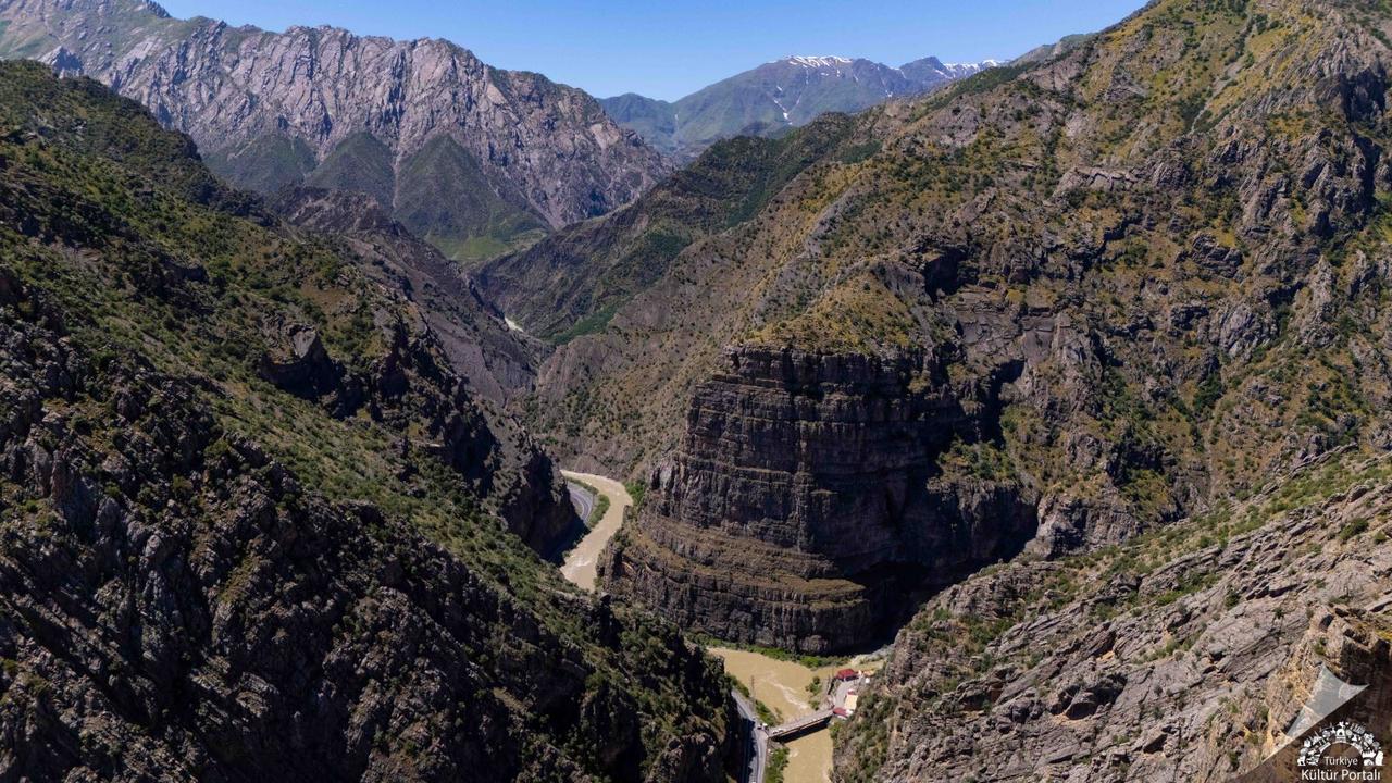
Zap Stream Valley
Zap River Valley is a valley system formed by the erosive activity of the Zap River, one of Türkiye's rivers with the highest discharge, located within the boundaries of Hakkari. It is characterized by steep slopes and deep canyon features. Physical and Hydrographic Structure The Zap River is the largest river in Hakkari province and flows into the Tigris River in the southern region of Mosul. The total length of the river is 310 kilometers, of which 189 kilometers lie within Türkiye's borders,
ENGözde Cabadak
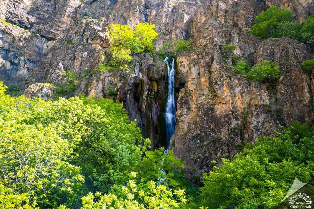
Ava Ore Falls
Ava Ore Waterfall is located within the boundaries of the Central District of Hakkâri Province in Türkiye’s Eastern Anatolia Region. Its precise address is recorded as Bahi, Ağaçdibi/Central Hakkâri. Geographically, it is classified under the category of natural and outdoor areas, as well as environmental and ecological sites.【1】 Physical and Hydrological Characteristics The waterfall cascades from a height of approximately 20 metres. Its flow regime exhibits seasonal variation depending on regi
ENGözde Cabadak