


This article was automatically translated from the original Turkish version.
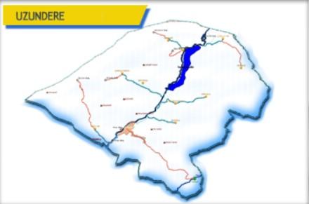
Uzundere, Erzurum District
Elevation of the District | 1.140 | ||||||||
|---|---|---|---|---|---|---|---|---|---|
Area of the District | 840 km² | ||||||||
Number of Villages in the District | 18 | ||||||||
District Governor | Kübra Demirer | ||||||||
Mayor | Muhammet Halis Özsoy | ||||||||
Located in the northeastern part of Erzurum province, it lies on the boundary of the Eastern Anatolia Region and the Eastern Black Sea Region. It borders Oltu to the east, İspir to the west, Yusufeli to the north, and Tortum to the south. The district center is situated at the base of the Tortum Çayı valley. Due to its topography, microclimate characteristics are observed. In the lower parts of the valley, influences of the Black Sea climate are evident.
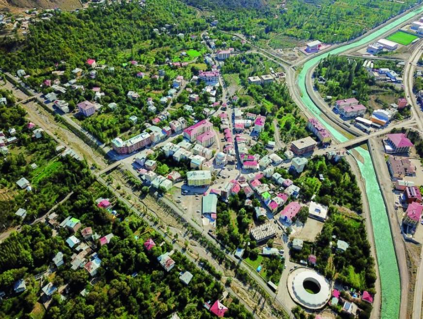
Uzundere (Uzundere Belediyesi)
The district of Uzundere has a history of approximately 3,000 years. Throughout its historical development, it has been under the rule of the Hittites, Scythians, Saka, Persians, Çoruh Bulgars, Eastern Romans, Suvars, Abbasids, Sassanids, the Ardahan-Artvin Bagratid State, the Kingdom of Vaspurakan, the Seljuks, Atabegs, Mongols, Kara Koyunlu, and Ak Koyunlu. Most recently, it was incorporated into Ottoman territories during the reign of Kanuni Sultan Süleyman.
In the 1883 Erzurum Vilayet Salnamesi, the head of the Uzundere nahiye is recorded as Şerif Ağa. During World War I, due to Russian occupation, the local population migrated to western Anatolian provinces in 1916. This period is referred to as "muhacirlik". The district of Uzundere was liberated from occupation by the Turkish army on 16 March 1918.
Previously a sub-district center under Tortum district, Uzundere attained district status following an administrative reorganization in 1987.
Uzundere is located within the Tortum Çayı valley along the Erzurum-Artvin highway. It is 84 kilometers from Erzurum. Its elevation is 1,050 meters above sea level and its area is 840 km². Within the district boundaries lies Tortum Gölü, which covers an area of 6,625,000 m². The lake is 10,800 meters long, 600 to 1,000 meters wide, 40 to 50 meters deep, and situated at an elevation of 1,027 meters. Also within the district boundaries is Tortum Şelalesi, which has a width of 22 meters and a height of 50 meters.
Important mountains in the district include Ziyaret Tepe (2,755 m), Tav Dağı (2,244 m), Murat Tepe (2,234 m), Kıllı Dağ (2,530 m), Hergavur Dağı (2,835 m), Ak Dağlar (3,030 m), and Mescit Sıradağları (3,238 m). The Tortum Çayı, which joins with the Oltu Çayı and İspir Suyu, flows into the Çoruh River and eventually empties into the Black Sea.
The climate is generally of the Eastern Black Sea type. Rainfall is heaviest in spring and autumn. The average temperature is 8°C and the annual average rainfall is 435 mm. Tree species in the district include pine, oak, fir, juniper, black poplar, poplar, and linden. Due to microclimate effects within the valleys, various fruits and vegetables are cultivated, excluding citrus.
According to the Turkish Statistical Institute's (TÜİK) 2024 Address-Based Population Registration System (ADNKS) data, the population of Uzundere is 7,664. In 2017, the population was 7,598 and in 2000 it was 12,209. Between 2023 and 2024, the population changed by -0.5%. The majority of the population resides in rural areas. Mobility is observed in the district center due to tourism-related activities. While the elderly population density is notable, an increase in the proportion of young people has also been observed.
The economy of Uzundere is based on agriculture and animal husbandry. Small enterprises produce fruit orchards, cereal crops, organic honey, mulberry molasses, pestil, and köme. In recent years, beekeeping activities have increased.
Uzundere serves as a transition point between Black Sea and Eastern Anatolian cultures. Georgian architectural influences are evident. Folklore, folk dances, and culinary traditions are diverse. Local folk dances include Uzundere Barı.
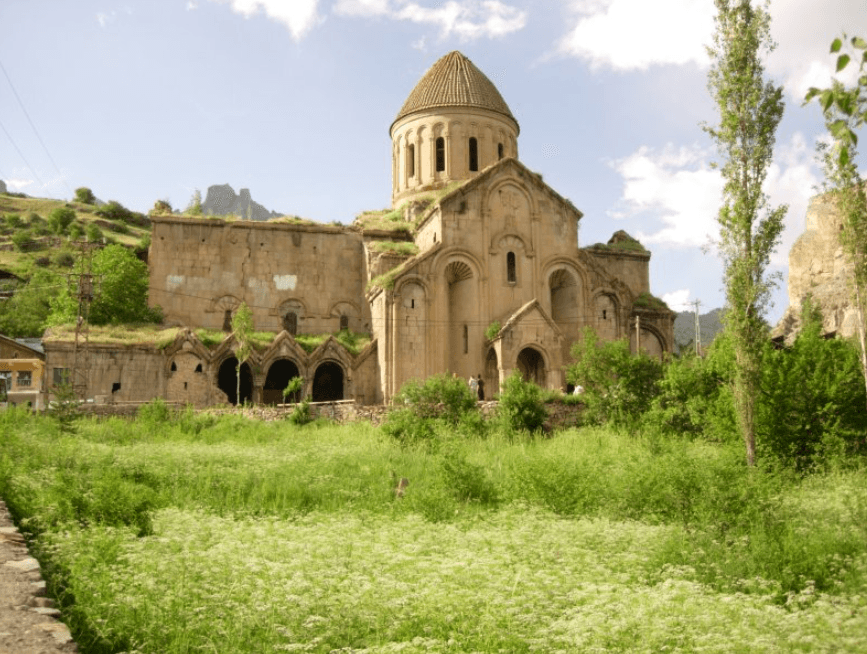
Öşvank Kilisesi (Uzundere Belediyesi)
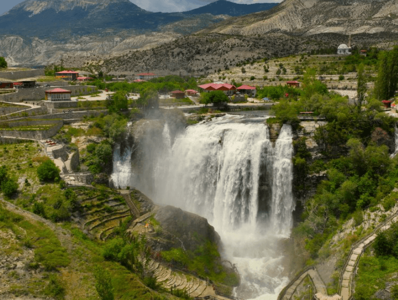
Tortum Şelalesi (Uzundere Belediyesi)
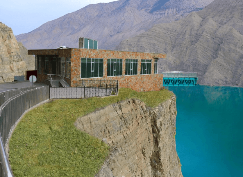
Cam Seyir Terası (Uzundere Belediyesi)
Erzurum Büyükşehir Municipality. "Uzundere İlçesi." Accessed April 20, 2025.Link
Ministry of Culture and Tourism. "Uzundere." Accessed April 20, 2025.Link
Türkiye Turizm Ansiklopedisi. "Uzundere." Accessed April 20, 2025.Link
Türkiye İstatistik Kurumu (TÜİK). "Adrese Dayalı Nüfus Kayıt Sistemi (ADNKS) Verileri – 2024." Accessed April 20, 2025.Link
Türkiye İstatistik Kurumu (TÜİK). "Coğrafi İstatistik Portalı." Accessed April 20, 2025.Link
Uzundere Belediyesi. "Galeri." Accessed April 20, 2025.Link
Uzundere Kaymakamlığı. "İlçemizin Tarihi." Accessed April 20, 2025.Link
Uzundere Valiliği. "Uzundere." Accessed April 20, 2025.Link
Uzundere, Erzurum District
Elevation of the District | 1.140 | ||||||||
|---|---|---|---|---|---|---|---|---|---|
Area of the District | 840 km² | ||||||||
Number of Villages in the District | 18 | ||||||||
District Governor | Kübra Demirer | ||||||||
Mayor | Muhammet Halis Özsoy | ||||||||
No Discussion Added Yet
Start discussion for "Uzundere (District)" article
History
Geography
Population
Economy
Tourism and Culture
Historical and Natural Sites