


This article was automatically translated from the original Turkish version.
+2 More
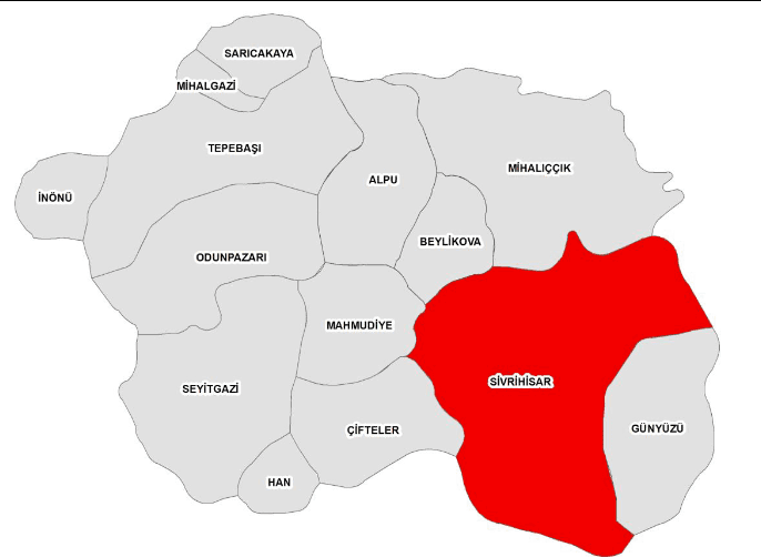
Province | Eskişehir | ||||||||
|---|---|---|---|---|---|---|---|---|---|
Geographical Region | Central Anatolia Region | ||||||||
District Governor | Hüseyin Sayın | ||||||||
Mayor | Habil Dökmeci | ||||||||
Sivrihisar is a district隶属于 Eskişehir Province in the Central Anatolia Region of Türkiye. With an area of 2,987 km², it is one of the districts with the largest surface area in Eskişehir. Archaeological findings confirm that the region has been inhabited since prehistoric times and has been under the rule of various civilizations throughout different historical periods. It acquired its current administrative status in the early years of the Republic.
Located in the southeast of Eskişehir, Sivrihisar is one of the oldest settlement centers in Central Anatolia. Archaeological research conducted in the district has revealed that human habitation in the region dates back to the Chalcolithic Age (5000–3000 BCE). The region, which experienced intensive settlement during the Bronze Age, became one of the main settlement areas of the Phrygians during the Iron Age. Pessinus, founded by the Phrygian King Midas and located 16 km from the district, became one of the region’s major cult centers.
During antiquity, the settlement known as Palia or Spaleia gained military and commercial importance during the Roman and Byzantine periods. It was restored under Emperor Justinian I (527–565 CE) and came to be known as Justinianopolis. During this period, significant religious structures were built, and Sivrihisar became a bishopric and later a metropolitan center.
After the Seljuk Turks entered Anatolia following the Battle of Manzikert in 1071, they captured Sivrihisar in 1074 and established it as a frontier beylik named Karahisar. During this period, madrasas, mosques, mosques, and caravanserais were constructed, leaving clear traces of Seljuk architecture. The Selçukiye Madrasa stands out as one of the earliest madrasas in Anatolia. This era also witnessed the flourishing of traditional crafts such as carpet weaving, kilim making, iron and copper work, and the establishment of Turkmen tribal settlements in Sivrihisar.
Sivrihisar was incorporated into Ottoman territories in 1289. Although it occasionally passed into the hands of the Karamanids, it came under firm Ottoman rule from the 15th century onward. The district continued its cultural and administrative development during the Ottoman period, achieving kaza status in 1684 and being attached to Eskişehir in 1912.
Sivrihisar was liberated from Greek occupation on 20 September 1921. Throughout its history, the district has produced numerous scholars and religious figures, including notable personalities such as Nasreddin Hoca, Şeyh Baba Yusuf, Aziz Mahmut Hüdayi, Hızır Bey, and Sinan Paşa, who were born or raised here. Today, Sivrihisar continues to be one of Anatolia’s important cultural centers, renowned for its rich historical heritage, traditional architecture, and cultural legacy.
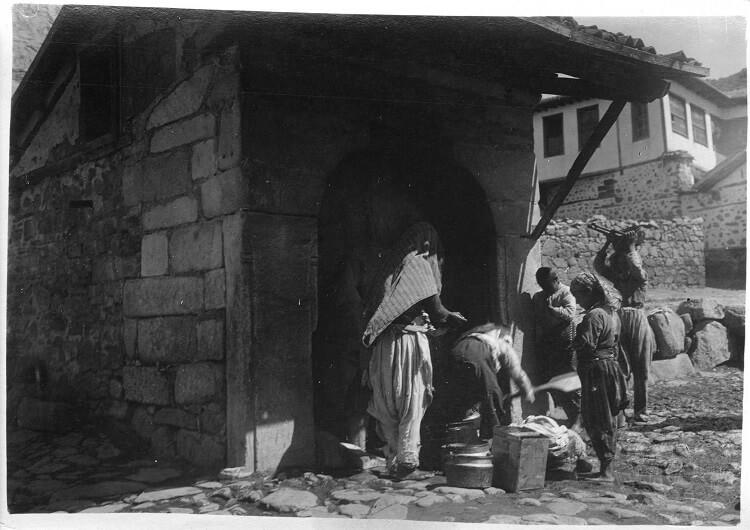
Sivrihisar (Source: Sivrihisar Municipality)
Sivrihisar is a district of Eskişehir Province in the northwestern part of the Central Anatolia Region, with a total area of 2,987 km², accounting for approximately 18% of Eskişehir’s total area. Its average elevation above sea level is 1,070 meters. The majority of the district’s territory consists of extensive steppe plains, but mountainous ridges, hills, and rocky areas are also observed in places. These features contribute to the topographical diversity of the region.
The most prominent elevation group in Sivrihisar is the Sivrihisar Mountains, which give the district its name and distinctive silhouette. The highest point in this mountainous area is Çal Dağı. Other significant peaks and hills include Arayıt Dağı, Boztepe, Büvelik Tepe, and Yediler Tepesi. These elevations, together with the flat agricultural plains, shape the physical geography of the district.
The district’s main river is the Sakarya River. The river originates within the boundaries of Çifteler District in Eskişehir and flows through Sivrihisar for approximately 50 kilometers. No other major perennial river flows within the district’s boundaries.
The dominant climate type in Sivrihisar is continental. Winters are cold and snowy, while summers are hot and dry. Precipitation levels are limited and irregular throughout the year. This condition directly affects agricultural production and vegetation cover.
In terms of transportation, Sivrihisar lies at the intersection of major Turkish highways. Roads connecting Ankara, İzmir, and Eskişehir pass through the district center. Its distances—120 km to Afyonkarahisar, 100 km to Eskişehir, 135 km to Ankara, 427 km to Istanbul, 448 km to İzmir, and 520 km to Çanakkale—ensure easy accessibility via the transportation network. In addition to vehicles operated by the Sivrihisar Birlik Bus Operators Cooperative, intercity buses passing through the district provide further transportation options.
Sivrihisar is one of the districts of Eskişehir with the largest surface area. As of 2021, the total population of the district was 23,423. Women constitute 50.10% of the population, while men make up 49.90%. The district’s population has declined in recent years, in line with the nationwide trend of rural-to-urban migration. This decline is particularly evident in village and town populations, while the district center has occasionally experienced population growth. The increase observed in the center’s population between 2010 and 2011 reflects this localized trend.
Settlement patterns in Sivrihisar are dispersed, comprising the district center, towns, and villages. The district includes numerous rural settlement units. However, due to the concentration of economic and social opportunities in the district center, its population has shown a gradual upward trend over time.
Sivrihisar has a long-standing tradition in education. Educational and cultural activities have been highly valued since ancient times. Records indicate that the first sıbyan mekteb (primary school) in Sivrihisar was established in 1218. At that time, two schools operated near Kutbittin and Taş Madrasa in Karacalar Mahallesi. Teachers such as Hafız Mehmet, Sofu Mehmet Efendi, and Hacı Mustafa Efendi served at these schools.
In 1292, a rüştiye school (equivalent to middle school level) was opened at the Hoşkadem Madrasa in Karacalar Mahallesi and operated for 38 years before closing. Between 1311 and 1322, two additional primary schools were established under the names “Burhan-ı Terakki” and “Asar-ı Feyz Hızır Bey.” These developments demonstrate that Sivrihisar remained an important educational center during the Ottoman period.
Today, in the district center of Sivrihisar, there are:
A total of 284 full-time teachers, 21 school principals, 5 deputy principals, and 21 assistant principals are employed in these educational institutions. The student population in the district is as follows:
In total, 3,152 students receive education in the educational institutions of Sivrihisar district center.
With its educational history, current institutions, and teaching staff, Sivrihisar continues to function as a significant regional educational center. The balanced gender ratio in its demographic structure and the educational advancements demonstrated in the district reflect the dynamic nature of its socio-cultural fabric.
Cereal production is dominant, with wheat and barley leading. Livestock farming has developed through red meat production and small ruminant husbandry. Industry is characterized by marble processing, construction materials, and small-scale manufacturing. Mining contributes to the local economy through marble and limestone reserves. Services and trade involve local artisanal activities and transportation-linked commercial operations.
Agriculture and livestock farming form the backbone of Sivrihisar’s economy. The district’s extensive agricultural lands are particularly suitable for dry farming. Wheat, barley, and chickpeas are among the most commonly cultivated crops. Due to the low irrigation potential of the agricultural land, production is largely rain-dependent.
The livestock sector is primarily focused on small ruminant farming. Sheep and goat breeding form the basis of red meat production, while the number of large livestock has increased in recent years. Milk production is processed through local dairy facilities and marketed to neighboring provinces.
Industrial activity in Sivrihisar has developed largely at the local level. Although there are no organized industrial zones in the district, production takes place through small and medium-sized enterprises in fields such as construction materials, stonework, and machine part manufacturing. The operation of marble quarries supports both mining and stone processing industries.
The mining sector features various natural stone reserves, primarily marble and limestone. These reserves are extracted to meet demand for construction and decorative stone, with some destined for export.
Sivrihisar’s road connections, particularly those toward Ankara-Eskişehir and Konya, remain well-developed and sustain active trade. Local markets and artisanal businesses play a vital role in the daily economic life of the region. Additionally, the sale of local specialties such as Sivrihisar muska sucuk contributes to both tourism and commercial activities.
The Sivrihisar Clock Tower was built in 1899 by the district governor Mahmut Bey and the mayor Yüzügüllü Hacı Mehmet Efendi. Located on rocky outcrops north of the town center, the tower is a defining landmark of the city. The structure is 12 meters high, three-storied, and covered by a dome. In 2015, restoration and lighting works were carried out, and a glass observation terrace was added to provide panoramic views of Sivrihisar.
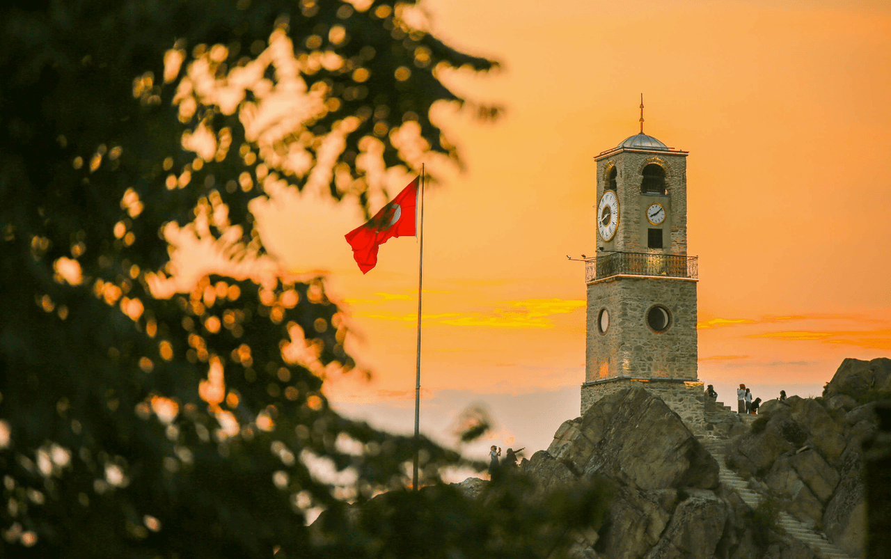
Clock Tower (Source: Sivrihisar Municipality)
Built in 1650, the Surp Yerrortutyun Church was reconstructed in 1881 after a fire in 1876. This structure, one of the three largest Armenian churches in Anatolia, is notable for its stonework and construction from local stone. It features bell towers on both sides and has survived to the present day through various historical restorations and additions. After the Armenian population migrated from the region in 1916, the building continued to serve as a cultural and religious center.
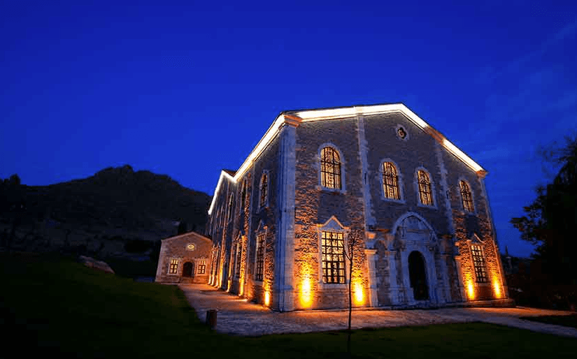
Surp Yerrortutyun Church (Source: Sivrihisar Municipality)
The Sivrihisar Ulu Cami is one of the rarest examples of Seljuk architecture and has been added to UNESCO’s tentative World Heritage List. Dating to 1231–1232, it contains the oldest known inscription in the district. Covering an area of 1,485 m², the mosque is distinguished by its 67 wooden columns. The mosque’s minbar is an exemplary piece of Seljuk woodwork. The mosque underwent repairs during the Ottoman period and has been preserved to the present day.
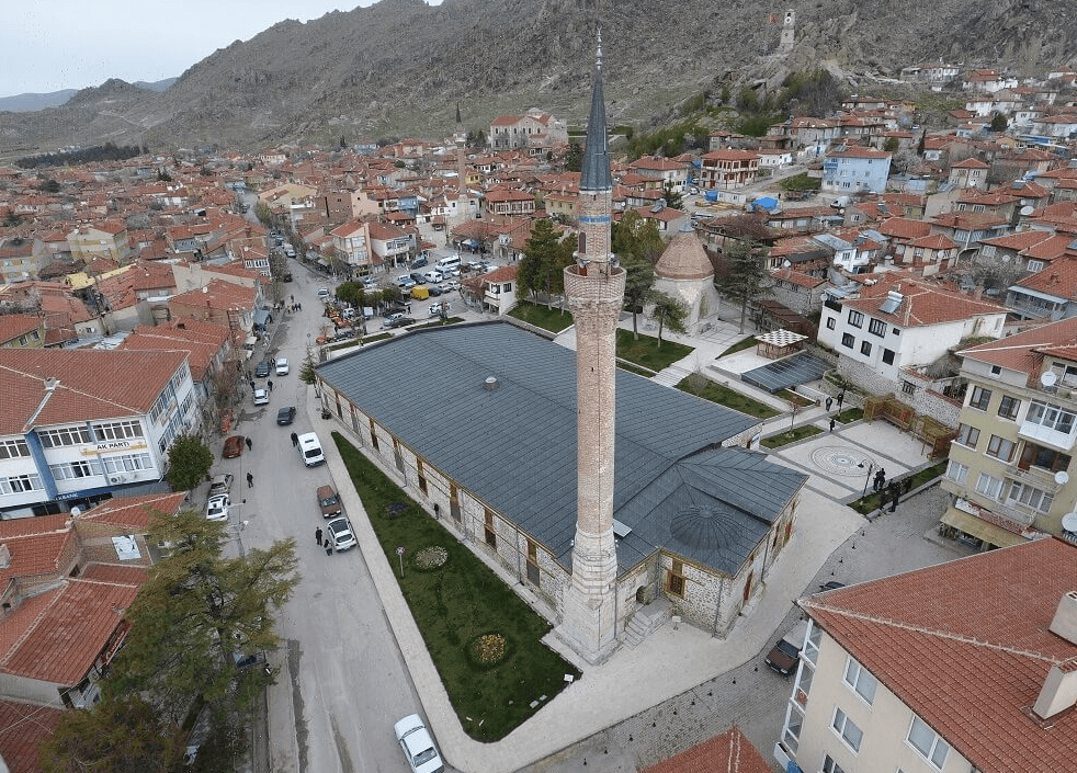
Sivrihisar Ulu Cami (Source: Sivrihisar Municipality)
Built in the 15th century by Aziz Mahmud Hüdayi, this mosque is notable for its wooden structure and dome. The entrance portal features a quadrangle and the interior decorations are enriched with Sufi and religious elements. The interior space was designed with a separate area for women to meet the needs of the congregation. Repairs carried out in 1914 adapted the mosque to contemporary conditions.
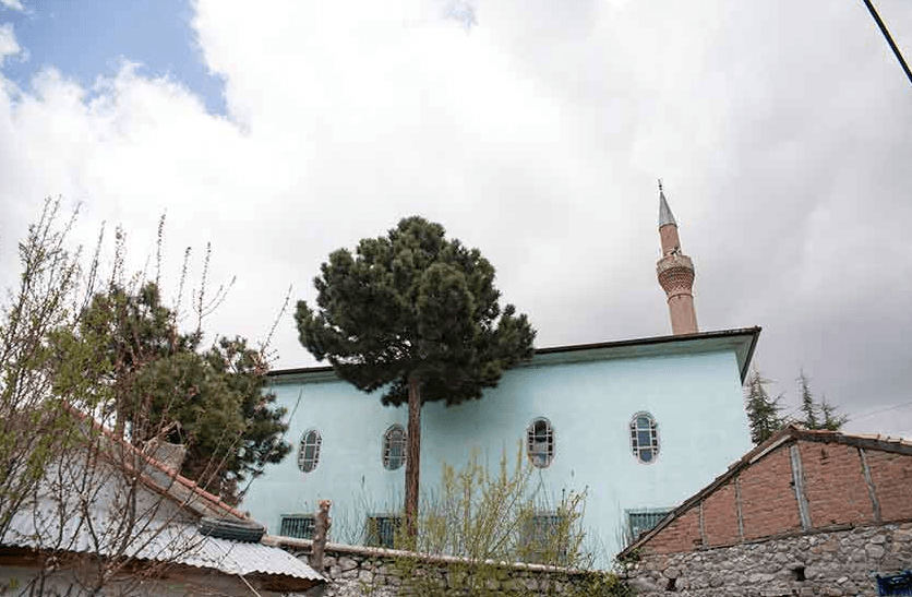
Aziz Mahmud Hüdayi Mosque (Source: Sivrihisar Municipality)
Pessinus was founded by King Midas of Phrygia and became the center of the cult of Cybele. From the 8th century BCE, it served as an important religious and cultural center and retained significant importance during the Roman Empire. Excavations have uncovered ancient structures such as temples, a theater, and necropolises. Pessinus is historically recognized as the site of the temple of Cybele.
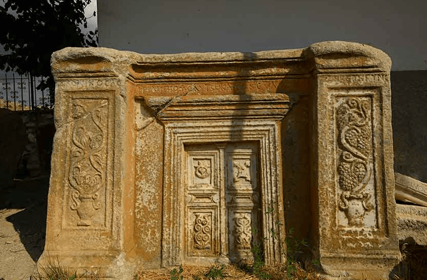
Pessinus Ancient City (Source: Sivrihisar Municipality)
Seyyid Mahmud Süzani was one of the prominent religious scholars of the Seljuk period. The külliye, built in 1348, consists of a mosque, madrasa, and guesthouse. According to an inscription in the complex, the structure was commissioned by Yakup, son of Hoca Bahadır Ömer. The tomb of Seyyid Mahmud Süzani is an integral part of the külliye and has been preserved along with its surroundings, maintaining its historical value.
"Eskişehir Sivrihisar İlçesi." Eskişehir Valiliği. Accessed April 19, 2025.
"Sivrihisar Kaymakamlığı History." Sivrihisar District Governorship. Accessed April 19, 2025.http://www.sivrihisar.gov.tr/ilcemizin-tarihcesi
"Sivrihisar Tarihi." Sivrihisar Belediyesi. Accessed April 19, 2025.https://sivrihisar.bel.tr/15-sivrihisar-tarihi.html
"Sivrihisar Tarihi." İslam Ansiklopedisi. Accessed April 19, 2025.
"Sivrihisar İlçe Raporu." BEBKA, 2021. Accessed April 19, 2025.https://www.bebka.org.tr/admin/datas/sayfas/198/sivrihisar-ilce-raporu_1568787875.pdf
"İlçemizin Durumu." Sivrihisar Kaymakamlığı. Accessed April 19, 2025.
Acaroğlu, Hakan, Zeki Kartal, and Mustafa Güllü. "Üniversitelerin Bölgesel Ekonomik Kalkınma Üzerindeki Etkisi: Eskişehir’in Sivrihisar İlçesi Üzerine Bir Araştırma." ResearchGate, 2019. Accessed April 19, 2025.https://www.researchgate.net/profile/Mustafa-Guellue/publication/330082661_Universitelerin_Bolgesel_Ekonomik_Kalkinma_Uzerindeki_Etkisi_Eskisehir'in_Sivrihisar_Ilcesi_Uzerine_Bir_Arastirma/links/5c2c8de9299bf12be3a76de9/Ueniversitelerin-Boelgesel-Ekonomik-Kalkinma-Uezerindeki-Etkisi-Eskisehirin-Sivrihisar-Ilcesi-Uezerine-Bir-Arastirma.pdf
Sivrihisar Belediyesi. "Gezi Rehberi." Accessed April 21, 2025.https://sivrihisar.bel.tr/icerikler/8-gezi-rehberi.html.

Province | Eskişehir | ||||||||
|---|---|---|---|---|---|---|---|---|---|
Geographical Region | Central Anatolia Region | ||||||||
District Governor | Hüseyin Sayın | ||||||||
Mayor | Habil Dökmeci | ||||||||
No Discussion Added Yet
Start discussion for "Sivrihisar (District)" article
History
Geographical Structure and Infrastructure
Demographic Structure
Economic Structure
Distribution of Economic Activities (2023 Data)
Agriculture and Livestock
Industry and Mining
Impact of Trade and Transportation
Tourism
Sivrihisar Clock Tower
Surp Yerrortutyun Armenian Church
Sivrihisar Grand Mosque
Aziz Mahmud Hüdayi Mosque
Pessinus Ancient City
Seyyid Şeyh Mahmud Süzani Külliyesi