


This article was automatically translated from the original Turkish version.
+1 More
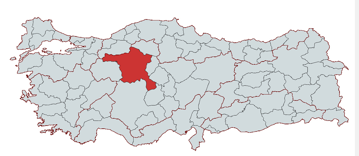
Ankara
Country | Türkiye | ||||||||
|---|---|---|---|---|---|---|---|---|---|
Region | Central Anatolia Region | ||||||||
Population | 5,864,049 (2023) | ||||||||
Area | 26,897 km² | ||||||||
Climate | Continental Climate | ||||||||
Important Structure | I. TBMM Binası Anıtkabir Ahî Şerafettin Cami CSO Ada Ankara Ankara Kalesi Hacı Bayram Veli Cami Ata Kule | ||||||||
Area Code(s) | 312 | ||||||||
License Plate Code | 06 | ||||||||
Governor | Vasip Şahin | ||||||||
Metropolitan Municipality Mayor | Mansur Yavaş | ||||||||
Ankara, as the capital of Türkiye, has also been a city throughout history that bears traces of many different civilizations and has served as a point of interaction among numerous cultures due to its strategic location. Its history extends back to the Hellenistic Period, and the city has hosted the Roman, Byzantine, Seljuk, and Ottoman Empires, playing a significant role in the foundation of the Republic of Türkiye.
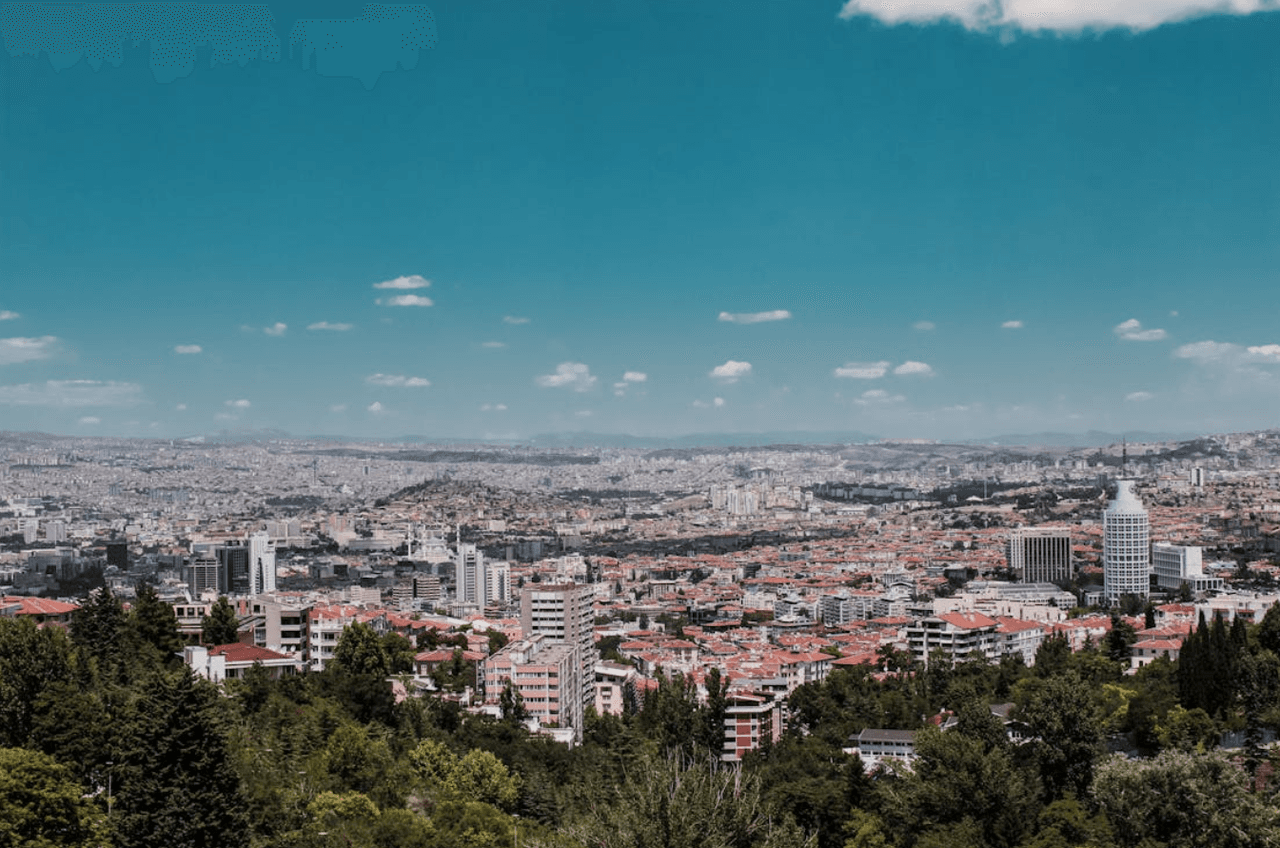
Ankara (Source: Pexels/Yunus Eren Tekneci)
Although the origin of the name Ankara is not definitively known, various theories exist. Some research suggests that the city’s original name was given by the Galatians as “Ankyra,” which means “anchor” in Greek, and it is believed that the Galatians who founded the city bestowed this name upon it. The name is accepted to have evolved over time into Ancyre, Engüri, Angora, and finally Ankara.
During the Hellenistic Period, Ankara served as the capital of the Tektosag tribe among the Galatians and assumed an important role as the provincial capital during the Roman era. In the Byzantine Empire, Ankara became a residence for emperors and during the Ottoman period, it became the center of the Anatolia Eyalet. Although the exact founding date of the city is unknown, archaeological findings in the region indicate that it was established during the period when humans transitioned to settled life.
Ankara has been under the influence of many civilizations, from the Hittites to the Phrygians, the Lydians to the Galatians. The Hittite name “Ankuwa” is thought to refer to the region where present-day Ankara is located. During the period of Phrygian dominance, Ankara became a major cultural center and is associated with King Midas of Phrygia. In the Roman period, following Augustus’s conquest of the region, Ankara became the capital of the Galatia province, and large-scale construction projects were undertaken during this time.
During the Byzantine period, Ankara also served as an important military base. After the victory of Seljuk Sultan Alparslan at the Battle of Manzikert, the city passed into Turkish hands, marking one of the pivotal turning points in its history. During the Seljuk period, it was strengthened militarily and developed with religious structures. With the annexation of the city by Orhan Gazi to Ottoman territories in 1354, Ankara became even more significant and central.
With the proclamation of the Republic, Ankara was declared the capital of Türkiye in 1923 and rapidly modernized, acquiring a new appearance. Urban development projects in the early years of the Republic shaped the city as the capital of modern Türkiye. Today, Ankara continues to be one of Türkiye’s most important cities, maintaining its cultural heritage alongside its modern infrastructure.
Ankara, with an area of 26,897 km², is located in the northwestern part of Central Anatolia. The province lies between 39°57' north latitude and 32°53' east longitude, with an average elevation of 890 meters above sea level. It is bordered by Kırıkkale and Kırşehir to the east, Eskişehir to the west, Çankırı and Bolu to the north, and Konya and Aksaray to the south.
Ankara’s geography features a structure composed of diverse landforms. The city lies between valleys formed by tributaries of the Kızılırmak and Sakarya rivers, where both forest and steppe vegetation can be observed. To the north, branches of the North Anatolian Mountains extend, while to the south lie the Tuz Gölü basin and flatlands such as Kepez and Hacıbekirözü.
Volcanic mountains near the city center are particularly notable. Elevations such as Karadağ, Paşa Dağı, and Teke Dağı shape the southern part of Ankara. Meanwhile, high mountain ranges such as İdris Dağı and Elmadağ in the north reinforce the region’s mountainous character. Natural water bodies within the city limits—including Mogan, Eymir, Karagöl (Çubuk), and Tuz Gölü—play an important role in tourism and the health sector.
Ankara’s climate exhibits clear continental characteristics. Summers are hot and dry, while winters are cold and snowy. The highest temperatures are recorded in July and August, and January is the coldest month. The city’s average annual temperature is 11.7°C, which can rise as high as 40°C and drop as low as -24.9°C. The average annual precipitation in the region is 389.1 mm.
Climatic variations in the region stem from geographical features. Particularly, the districts of Çubuk and Kızılcahamam in the north show influences of the Black Sea climate, while the Central Anatolian climate is more dominant in the south. These differences contribute to increased fog events during winter months.
Mountains and rivers play a significant role in Ankara’s geographical structure. Among the province’s most prominent mountains are Elmadağ, İdris Dağı, Karyağdı Dağı, and Paşa Dağı. These mountains shape the region’s topography and also contain various lakes and plains. Notably, Mogan and Eymir lakes are among the city’s natural assets.
In terms of rivers, the Sakarya and Kızılırmak rivers serve as major water sources within the city limits. Their tributaries—Çubuk Çayı, İncesu Çayı, and Ova Çayı—are also important components of Ankara’s water system. The agricultural lands irrigated by these rivers are vital resources for regional agricultural activities.
Ankara’s vegetation cover varies according to climate and soil structure. Steppe vegetation is widespread in the bozkır areas, while forested regions are concentrated primarily in the mountainous zones of the north. In steppe vegetation, shrubs and short grasses dominate. Common plant species include keven, ayrıkotu, yılgınotu, and kekik. In forested areas, the main tree species are black pine, juniper, and oak. These types of forests are especially dense in places like Beynam Forest.
Ankara is Türkiye’s second most developed province economically and serves as a major center contributing significantly to the national economy. As the capital, it hosts a concentrated public sector, and economic activity is shaped by state administrative functions and industries such as defense. Ankara is particularly known for its defense industry and high-technology production and is the center of Türkiye’s largest defense projects. Additionally, unique production activities specific to the city—including the manufacture of bearings and gears, which are produced nowhere else in Türkiye—enhance the diversity and competitiveness of its industry.
Ankara also has significant production volumes in sectors such as furniture, woodwork, automotive, and textiles, giving it a large share in Türkiye’s exports. Thanks to advanced infrastructure such as organized industrial zones and technology parks, the industrial sector is growing rapidly, developing innovative projects in collaboration with universities and R&D centers. Ankara also possesses strong potential in agriculture and livestock, drawing attention through unique agricultural activities such as tiftik goat farming. The city has become a growing center of trade and services, with industrial production increasingly based on high technology. As a major player in foreign trade, Ankara ranks among Türkiye’s top five provinces in terms of imports and exports. This strong economic infrastructure and high labor productivity have made Ankara an attractive destination for investors.
Ankara occupies a central position in Türkiye’s transportation infrastructure. The city offers a broad transportation network through road, rail, and air connections, effectively linking it to other regions of the country. As the hub of Türkiye’s road and railway networks, the capital is easily accessible from all parts of the country. The efficient operation of Ankara’s transportation systems makes a vital contribution to the smooth functioning of economic activities and daily life.
Road access to Ankara is provided through the Ankara Intercity Bus Terminal (AŞTİ), located in the city center. AŞTİ, one of the largest bus terminals in Europe, offers various facilities including restaurants, left-luggage services, bank ATMs, and taxi services. Due to its proximity to the city center, easy access is available to dolmuş, metro, and bus routes. AŞTİ also provides 24/7 bus service to Esenboğa International Airport.
Rail transport is one of Ankara’s key transportation networks. Ankara serves as a railway hub connecting the eastern and western parts of Türkiye. The city is linked by rail to major cities such as Istanbul, İzmir, Balıkesir, Adana, Elazığ, and Diyarbakır. The High-Speed Train Station, operational since 2016, hosts high-speed rail services and provides not only transportation but also commercial areas, restaurants, cafes, and hotels for users. High-speed train services between Ankara-Istanbul, Ankara-Eskişehir, and Ankara-Konya have made intercity travel faster and more comfortable.
Esenboğa International Airport is the primary facility providing air access to Ankara, located 28 kilometers from the city center. The airport serves domestic and international flights and offers facilities such as covered and open parking, food and shopping outlets, banks, car rental, and taxi services. Bus service via BELKOAIR operates 24 hours a day between the airport and the city, providing a practical option for travelers.
The most heavily used public transport vehicle in Ankara’s urban transport system is the metro. Municipal buses and private dolmuş routes also serve as alternative options for accessing the city. Magnetic multi-ride cards used on metro and bus systems allow two transfers within a 75-minute period. This system is a crucial transportation model that accelerates and improves accessibility to different parts of the city. These transport networks facilitate daily life and labor mobility in the capital.
Ankara rapidly developed after the proclamation of the Republic and became Türkiye’s capital. Following its designation as the capital, the organization of administrative institutions, industrial development, and internal migration led to significant population growth, particularly between 1927–1935 and 1950–1955. Once a small town before the Republic, Ankara is now Türkiye’s second most populous city in terms of population density.
According to the 1927 census, the total population of Ankara province was recorded as 404,581. Within 88 years, this population increased thirteenfold, reaching 5,270,000 by 2015. During the same period, Türkiye’s population increased approximately sixfold. Ankara’s population growth rate was 34.7% annually between 1927 and 1935 and 24.4% annually between 1990 and 2000. In 1927, Ankara accounted for 3.2% of Türkiye’s total population; by 2000, this share had risen to approximately 6%.
Significant changes have occurred in Ankara’s socio-demographic structure. According to the 1927 census, 53% of the population was born in Ankara; by 2000, this figure had dropped to 52%. The largest share of those born outside Ankara came from Çorum, followed by Yozgat, Çankırı, and Kırşehir.
The expansion of the metropolitan municipality boundaries has further emphasized Ankara’s metropolitan character, leading to rapid population growth. In 1955, the average household size was seven; by 2000, it had decreased to 3.8. This change reflects the intensification of settlement patterns and the transformation during the urbanization process.
Ankara’s demographic structure reveals significant changes over time in age groups and gender ratios. In 1927, the age distribution was unbalanced, with a notably higher male population in the working-age group. By 2000, this imbalance had diminished, and the male and female populations in the 15–64 age group had become equal. In 2000, the 0–14 age group constituted 25% of the population, while the 15–64 age group accounted for 70%, representing a significant share. The elderly population ratio was 5%, below the national average.
The urbanization rate of the population also rose rapidly, reaching nearly 90% in Ankara by 2000. This rate has positioned Ankara as the most urbanized city in the Central Anatolia Region. In 2000, metropolitan districts of Ankara stood out due to high population densities. Districts such as Keçiören, Etimesgut, Sincan, and Yenimahalle experienced high population growth rates, while districts like Gölbaşı and Çubuk maintained lower population densities.
Ankara’s migration patterns have played a crucial role in shaping its metropolitan structure. As the most important migration center in the Central Anatolia Region, Ankara has rapidly increased its population through migration over the years. Between 1990 and 2000, Ankara’s net migration exceeded that of other provinces in the region. Migration activity particularly increased the working-age population, leading to a concentration of young people in the city.
The current governor of Ankara is Vasip Şahin. Şahin was appointed to the position of Ankara Governor by Presidential Decree No. 2018/202 dated 26 October 2018 and assumed office on 6 November 2018. The governors who have served in the city from the past to the present are as follows:
Ankara Büyükşehir Municipality. "Ankara’nın Kısa Tarihi." Accessed February 8, 2025.https://www.ankara.bel.tr/ankara-kent-rehberi/ankara-nin-kisa-tarihi
Ankara Ticaret Borsası. *Ankara Tarihi.* Accessed February 8, 2025.https://www.ankaratb.org.tr/lib_upload/Ankara%20Tarihi.pdf.
Ankara Valiliği. "Ankara'nın Tarihçesi." Accessed February 8, 2025.http://ankara.gov.tr/tarihce
Ankara Valiliği. "Dağlar, Akarsular, Yapay ve Doğal Göller." Accessed February 8, 2025.http://www.ankara.gov.tr/daglar-ve-akarsular-ile-yapay-ve-dogal-goller
Ankara Valiliği. "Ekonomik Durum." Accessed February 8, 2025.http://www.ankara.gov.tr/ekonomik-durum.
Ankara Valiliği. "Genel Coğrafya ve Yeryüzü Şekilleri." Accessed February 8, 2025.http://www.ankara.gov.tr/genel-cografya-ve-yeryuzu-sekilleri
Ankara Valiliği. "Nüfus ve İdari Durum." Accessed February 8, 2025.http://www.ankara.gov.tr/nufus-ve-idari-durum.
Bilgi Paketi. "Ankara." Accessed February 8, 2025.https://bilgipaketi.cankaya.edu.tr/Ankara
Hacı Bayram Veli Üniversitesi. "Ankara Hakkında." Accessed February 8, 2025.https://hacibayram.edu.tr/iso/ankara-hakkinda?lang=tr-TR.
Islam Encyclopedia. "Ankara." *TDV İslâm Ansiklopedisi.* Accessed February 8, 2025.https://islamansiklopedisi.org.tr/ankara.
Kalkınma Kütüphanesi. *Ankara Kalkınma Planı.* Accessed February 8, 2025.https://www.kalkinmakutuphanesi.gov.tr/assets/upload/dosyalar/78.pdf.
Ministry of Culture and Tourism. "Ankara Genel Bilgiler." Accessed February 8, 2025.https://www.ktb.gov.tr/yazdir?67927A2F4D87EE98FC9D090954FDF53F
Ministry of Culture and Tourism. "Ankara İli Tarihçesi." Accessed February 8, 2025.https://ankara.ktb.gov.tr/TR-370255/ilimiz-tarihcesi.html
T.C.Ankara Büyükşehir Municipality. *Ankara Stratejik Plan Raporu 2022.* Accessed February 8, 2025.https://s.ankara.bel.tr/files/2022/04/06/f8f05216033abeeb63bc31531a023928.pdf.

Ankara
Country | Türkiye | ||||||||
|---|---|---|---|---|---|---|---|---|---|
Region | Central Anatolia Region | ||||||||
Population | 5,864,049 (2023) | ||||||||
Area | 26,897 km² | ||||||||
Climate | Continental Climate | ||||||||
Important Structure | I. TBMM Binası Anıtkabir Ahî Şerafettin Cami CSO Ada Ankara Ankara Kalesi Hacı Bayram Veli Cami Ata Kule | ||||||||
Area Code(s) | 312 | ||||||||
License Plate Code | 06 | ||||||||
Governor | Vasip Şahin | ||||||||
Metropolitan Municipality Mayor | Mansur Yavaş | ||||||||
History
Geographical Structure
Climate Characteristics
Mountains and Rivers
Vegetation Cover
Economic Structure
Infrastructure
Road Transport
Rail Transport
Air Transport
Urban Transport
Demographic Structure
Administration
Governor