


This article was automatically translated from the original Turkish version.
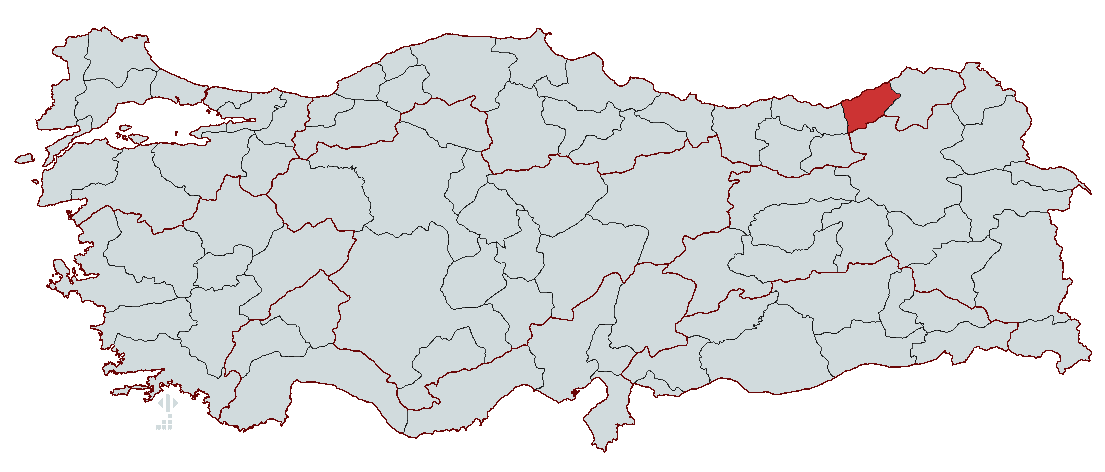
Country | Türkiye | ||||||||
|---|---|---|---|---|---|---|---|---|---|
Region | Black Sea Region | ||||||||
Population | 350506 | ||||||||
Area | 250.1 km² | ||||||||
Climate | Black Sea Climate | ||||||||
Governor | İhsan Selim Baydaş | ||||||||
Mayor | Rahmi Metin | ||||||||
Area Code | 464 | ||||||||
License Plate Code | 53 | ||||||||
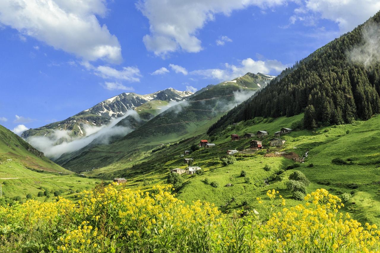
A highland in Rize (Photo:
Information about Rize’s prehistoric past is limited. The region’s dominant forest cover has hindered archaeological excavations, and as a result, no concrete historical findings from this area have been uncovered to date. Therefore, Rize’s history can only be assessed in relation to its neighboring provinces and regions. There are differing views regarding the origin of the name Rize. According to one theory, the name derives from the Greek word “Rhisos,” meaning “rice.” Additionally, in Rumelian Greek, the term “Riza” refers to the “foot of a mountain.” In Ottoman Turkish, the word “Rize” meant “small fragments” or “debris.” Another view suggests that the name Rize originated from “Eriza,” a name associated with the Saka period in Erzincan, after the initial “e” was dropped.
After Alexander’s death, his generals fought for dominance. During this period, Mithridates Ktistes declared independence and established the Kingdom of Pontus, expanding his territory along the Black Sea coast as far as Sinop. In 180 BCE, King Pharnaces of Pontus invaded Rize and incorporated the region into his domain. In the 5th century BCE, the Greek historian Herodotus mentioned a tribe called the Alazon (Alaz) among the Saka people. Between 23 and 79 CE, the Roman writer Pliny the Elder reported the presence of a people known as the “Laz” (Lazoi) in the same region. The Roman geographer Arrian, who traveled the Black Sea coast in 133 CE, also referred to the Laz who dominated the eastern Black Sea region.
Rize remained under Roman rule from 10 to 395 CE and then under the Byzantine Empire from 395 onward. The Amadunuler, a tribe of the Saka people living between Kars and Iğdır, near Gökçegöl and Alagez Mountain, migrated across the Çoruh River under the leadership of their chieftain Hamam in 626 CE to escape Iranian pressure and settled in the Dampur region of Rize. This settlement is known today as Hemşin. In 646 CE, this region was placed under Arab taxation, and in 737 CE, it briefly came under Arab control.
From the 11th century onward, Turkmen raids intensified in Rize. After the Battle of Manzikert in 1071, Turkish emirates were established in territories taken from the Byzantines, and the Erzurum-Saltuqids incorporated the Rize region, along with the Çoruh River basin, into their domains. The commanders of Sultan Melikshah, son of Alp Arslan, Ebu Yakup and Emir Isa Böri, achieved victory at the Posof-Kol Battle on 24 June 1080, defeating the Apkaz-Georgia Kingdom and ending Byzantine rule in the eastern Black Sea region. This development led to Rize’s incorporation into the territories of the Great Seljuk State during its period of ascendancy.
Following these events, the Çepni and Kurdish tribes settled along the eastern Black Sea coast and in Rize’s İkizdere region. In 1098, the Danishmendids briefly held control over the region. However, under the influence of the Crusades, the Byzantines regained strength and captured Trabzon and Rize in 1098. In 1195, the Kubasar family and their followers, belonging to the Kipchak tribe residing in the Çoruh Valley, settled in the Rize and Trabzon regions. The 60 families in İkizdere and Sürmene are descendants of the Kumbasar clan. During the Fourth Crusade, after the Franks captured Constantinople, the Komnenos dynasty established the Empire of Trebizond in 1204, and Rize became part of its territory.
The Trabzon Greeks began paying taxes to the Ottoman State in 1456. Following the Ottoman annexation of Trabzon in 1461, Rize and its surroundings came under Turkish rule as part of Fatih Sultan Mehmet’s conquests. In 1470, Rize and its environs passed under Turkish administration following a campaign led by Ottoman commander Ali Paşa, accelerating the region’s integration into Anatolian Turkish unity. After 1461, migrations occurred from regions such as Çorum, Amasya, Samsun, and Tokat. To prevent the revival of the Karamanoğlu Beylik, which was destroyed in 1466, people were relocated from the Konya region. After Shah Ismail destroyed the Akkoyunlus in 1501, Turkmen from Tabriz and its surroundings were settled in Rize. After the elimination of the Dulkadir Beylik in 1515, the Dulkadir Turkmen from Mara-Elbistan were relocated to the Rize region.
During the reign of Yavuz Sultan Selim, certain estates east of Trabzon were under the control of the renowned Oghuz tribe, the Çepnis. However, the Çepni settlement in the Rize region became more prominent in subsequent centuries. The Çepnis, through their bravery in both land and sea battles, established themselves in the region and formed large communities. A dense Çepni settlement is observed in the city center of Rize and its surroundings. This settlement is one of the primary reasons why only Turkish is spoken in Rize today. Additionally, families named “Çepni” are found in Rize’s villages, and the term “Çepni” is used by the local population to mean “hero,” “sharp-eyed,” “brave,” and “resolute.” During the same period, Gülbahar Hatun, wife of Sultan Bayezid II, built a mosque in Rize bearing her name, making it a significant structure of the era. In the early 19th century, rebellions by the Tuzcuoğulları occurred periodically in Rize, but they were suppressed in 1834, after which the Tuzcuoğulları were resettled in Rumelia. According to the 1867 Vilayet Nizamnamesi, Rize was one of the six kazas under the central sanjak of Trabzon Vilayet. In 1877, it became a nahiye under the central sanjak. After the Ottoman-Russian War of 1877–1878, the Lazistan sanjak was established, and Rize was designated both as a kaza and its administrative center. During the First World War, Rize was occupied by Russian forces on 9 March 1916 and regained its independence on 2 March 1918.
Before the Republic, Rize served as the center of a sanjak. On 20 April 1924, it attained provincial status. Under Law No. 2885, enacted on 2 January 1936, the district of Yusufeli, previously attached to Erzurum, was transferred from Rize’s Pazar district and incorporated into the newly formed Artvin Province under the name Çoruh, leaving Rize Province with only the Pazar district. Today, Rize is a province comprising a total of 12 districts, including Pazar.
Located in the Eastern Black Sea Region, Rize reflects the region’s characteristic geographical and cultural features. It differs from other parts of Anatolia both in its topography and cultural elements. Steep-sided valleys, mountain peaks accessible to hikers, glacial lakes, and extensive highlands define the region’s natural landscape. Additionally, historical arched bridges, fortresses, and river systems are key components of Rize’s geographical diversity.
Rize Province is bordered by Trabzon to the west, Erzurum and Bayburt to the south, Artvin to the east, and the Black Sea to the north. Its total area is 3,920 km² and is generally rugged and mountainous. The coastline extends 80 km and varies in width between 20 and 150 meters. Along the coast, plains formed by alluvial deposits from rivers are found. Rize’s coastline is high and generally has a simple appearance, with occasional cliffs and terraces. Immediately behind the coast, hills reach heights of 150–200 meters, from which rivers descending into the Black Sea carve narrow, deep valleys. Steep, “V”-shaped valleys extend up to approximately 2,000 meters, while between 2,000 and 3,200 meters, flat ridges and “U”-shaped valleys with steep slopes are observed. At these elevations, glacial cirques and moraine-dammed lakes are widespread. Areas exceeding 3,000 meters form Rize’s steepest terrain, where the province’s highest point, Kaçkar Peak, is located.
Rize Province lies under the influence of the Black Sea climate, characterized by cool summers, mild winters, and rainfall distributed throughout the year. This condition is linked to the parallel alignment of the mountains with the coast. Rize’s average annual temperature is 14°C, with the lowest recorded temperature at -7°C and the highest at 38°C. The coldest month is January, and the warmest is July. The average annual rainfall exceeds 2,301.2 mm, making Rize the province with the highest rainfall in Turkey. Rainfall is evenly distributed across the year, with no distinct dry season. Spring rainfall is relatively low, while the highest rainfall occurs in autumn. The average humidity level in the region is generally above 75%.
Rize’s terrain lies within the Eastern Black Sea Mountain System and is primarily formed on a Paleozoic (First Era) substrate. During the Cretaceous (Third Era intermediate period), a major orogeny (mountain-building process) brought granodiorite and Cretaceous flysch to the surface. Additionally, Neogene deposits are observed in some areas. The coastal zone is largely characterized by Upper Cretaceous volcanic cover and tuffs. For example, the cliffs along the sea side of the tunnels between Çayeli and Pazar consist of coarse conglomerates formed by andesite and ophiolites mixed with fine conglomerates and agglomerates.
Cretaceous sediments are widespread on slopes near the coast, but in some areas, these sediments are covered by Eocene flysch series. In valley floors, trachyte, andesite, and basalt columns occasionally emerge beneath these coverings. In higher mountainous areas, igneous rocks dominate. Granite, andesite, and basalt masses are common at elevations exceeding 3,000 meters. Alluvial deposits are found along the major river valleys, extending up to 10 kilometers from the sea.
Due to its high rainfall and balanced temperature regime, Rize has a dense and diverse vegetation cover, which varies according to elevation.
The area from the coast up to approximately 750 meters is covered by broadleaf coastal forests. In some places, coniferous species extend down the ridges to lower elevations. This area, characterized by dense forest cover and rich understory vegetation, is known as the “Kelşik Flora.” The dominant species is the bearded alder (Alnus barbata), with other species including hornbeam, chestnut, linden, alder, black poplar, wild Trabzon fig, wild blackberry, wild cherry, laurel, plane tree, dogwood, oak, ash, and boxwood. Particularly, bearded alder and wild blackberry extend up to the forest’s upper limit along river valleys. The forest understory is dominated by the “Kumar,” or forest rose (Rhododendron), which, along with various herbaceous and woody plants, forms the ecosystem.
The zone between 800 and 1,400 meters is a mixed forest belt. In this belt, broadleaf tree species such as bearded alder, hornbeam, chestnut, and alder coexist with coniferous species such as fir and pine. The forest understory consists of forest roses and other herbaceous and woody plants, similar to lower elevations. As elevation increases, coniferous species become dominant. From 1,600 meters onward, coniferous trees prevail, with Oriental spruce (Picea orientalis) as the dominant species. As the forest limit is approached, Caucasian fir (Abies nordmanniana) spreads, and black pine (Pinus nigra) is among the important species of this zone.
The forest cover ends at approximately 2,000–2,200 meters and gives way to alpine meadows. This area serves as habitat for various herbaceous species such as orange and white mountain lilies and daisies. In certain areas, low-growing forest rose shrubs are also observed. Due to deforestation for firewood in this heavily used highland area, forest rose shrubs are observed to be declining.
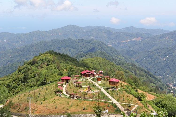
Rize vegetation, Arapdüzü Nature Park (Rize Provincial Directorate of Culture and Tourism)
Rize, located on the northern slope of the Eastern Black Sea Coastal Range, has a generally mountainous and rugged topography. However, vertical variations are observed, allowing the region’s topography to be divided into three main sections.
Rize’s coastal strip has a narrow topographic structure, unique within the region’s overall topography. The coastline is approximately 80 km long and, excluding river valleys, varies in width between 20 and 150 meters. The broadest flat areas along the coast, formed by river-borne alluvium, can be described as valley-bottom plains. These plains, formed entirely by alluvial deposits, extend from the river mouths inland up to 500–600 meters and widen into terrace plains up to 9–10 km. The width of these plains along the coast ranges from approximately 200 to 1,000 meters and is largely occupied by settlements. The widest of these is the valley-bottom plain of the Fırtına River near the district center of Ardeşen.
Rize’s coast belongs to the category of high coasts and generally has a simple, natural appearance. The coastline consists of small, asymmetrical indentations and projections. Along the coast, small rocky islets, 5–25 meters from the shore and 5–15 meters in size, are present. Although significant damage occurred during highway construction in these areas, some terraces and cliffs are still observable.
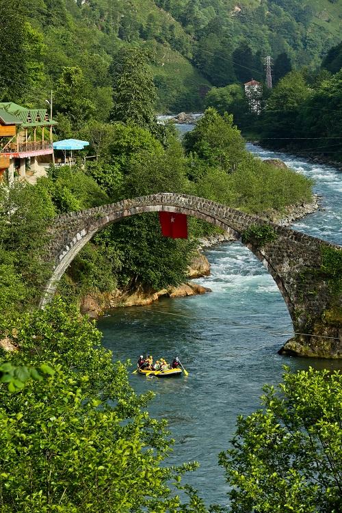
Fırtına River (Photo: Rize Provincial Directorate of Culture and Tourism)
Immediately behind Rize’s coastal plain, the topography rises abruptly to elevations of 150–200 meters. From this point, the terrain is deeply dissected by narrowing river valleys. Both the main rivers and their numerous tributaries have strongly eroded the landscape, creating a complex topographic structure. These sharp ridges and steep slopes encircling “V”-shaped valleys form the characteristic topography of this area, extending up to approximately 2,000 meters.
Beginning at approximately 2,000 meters, the terrain between 3,000 and 3,200 meters is shaped by flat ridges and steep “U”-shaped valleys. This area, heavily eroded by glacial activity during the Quaternary glacial periods, contains numerous small cirque and moraine-dammed lakes. Areas above 3,000 meters constitute Rize’s most rugged and irregular sections. These areas feature extensive bare and rocky peaks with sharp ridges between them, forming a terrain too steep for human passage. Rize’s highest points are the summits between these ridges. Some of these peaks include Kaçkar Peak (3,937 m), the province’s highest point and still home to a glacier, Verçenik Peak (3,709 m), Koyunsokağı Vacakar Mountain (3,458 m), Çaymakçur Peak (3,420 m), Gudashevsivrisi Peak (3,406 m), Koyunsokağı Peak (3,342 m), Marsis Peak (3,334 m), and Aşağı Karataş Peak (3,322 m). This rugged topography begins to lose its steepness and elevation south of the district center of Fındıklı.
Rize has a dense hydrographic network due to its rainy climate and abundant groundwater sources. On average, a river occurs every 250–300 meters across the province from east to west. This pattern aligns with the region’s surface features. However, since no comprehensive measurement of river density has been conducted nationwide, it cannot be definitively stated that Rize has the densest river network in Turkey.
Rize’s rivers are generally short, steep, and fast-flowing. There are 23 rivers within the province exceeding 5 km in length. Of these, 16 flow directly into the Black Sea, while the rest feed into these main rivers. The longest rivers flowing directly into the Black Sea include Çağlayan Creek (34.7 km), Arılı Creek (31.5 km), Fırtına River (68.0 km), Hemşin Creek (38.5 km), Sabuncular Creek (46.0 km), Taşlı Creek (34.0 km), and İyi Creek (78.4 km). Additionally, the tributaries of the Fırtına River, Durak Creek (33.0 km) and Hala Creek (32.5 km), and the tributary of Taşlı Creek, Balamya Creek (22.6 km), are notable for their length.
The longest river in Rize is the İyi Creek (78.4 km), while the Fırtına River has the largest drainage basin at 1,149.3 km². In terms of basin area, İyi Creek ranks second at 1,047.4 km², and the Fırtına River ranks second in length at 68 km. Since basin area is the primary criterion in hydrological and regime analyses, the Fırtına River is used as the representative example for characterizing Rize’s rivers. Additionally, since all of Rize’s rivers lie entirely within the province and share similar climatic and topographic conditions, further analysis of a second river is unnecessary.
Rize’s rivers are fed by rainfall, snowmelt, and springs. Classified as the “Rainy Black Sea Regime,” these rivers exhibit two rising phases and one recession phase. The rising periods occur from mid-September to November and from March to August. The recession phase lasts from mid-November to March. For example, according to 25 years of measurements, the Fırtına River reaches its lowest level in January (11.3 m³/s). During this period, rivers are fed only by springs and lakes, as precipitation typically falls as snow. Starting in March, snowmelt causes river levels to rise. By June, influenced by spring rains, the rivers reach their highest levels (65.2 m³/s for the Fırtına River). During summer, water levels decline due to reduced snowmelt. However, levels remain higher than in other months until September. From mid-September to November, a second rise occurs due to autumn rains.
The discharge of Rize’s rivers is high compared to many rivers in Turkey. For example, the Fırtına River’s average discharge is 28.4 m³/s, higher than the Gediz River (26 m³/s). In terms of minimum discharge, the Fırtına River (4.6 m³/s) exceeds the Kızılırmak (1.7 m³/s) and Gediz River (0.07 m³/s), though it is approximately half that of the Tigris River (9.4 m³/s). Compared to other Turkish rivers, Rize’s river regime is relatively stable. In addition, they differ in terms of hydropower potential and sediment load. Rize’s rivers carry less sediment than other Turkish rivers, making them advantageous for energy production. Within the Eastern Black Sea Basin, these rivers rank third in annual hydropower potential after the Euphrates and Tigris Basins. The Eastern Black Sea Basin’s annual hydropower potential is estimated at approximately 12 billion kWh.
Nineteen small lakes have been identified in Rize’s mountainous areas above 2,400 meters, formed by glacial erosion and deposition. The largest are Ambar Lake (2,950 m, 0.07 km²) and Büyük Deniz Lake (2,900 m). The smallest, at 0.01 km², is Öküzyatağı Lake (2,775 m). Some of these lakes are cirque lakes, while others are moraine-dammed lakes.
Numerous highlands, ideal for escaping crowds and immersing oneself in nature, are located at the foothills of the Kaçkar Mountains. Among these are Handüzü, Çağrankaya, Vaşa, Petran, Demirkapı (Homeze), Sivrikaya, Anzer, Ovit, Gölyayla, Sal, Pokut, Hazindağ, Samistal, Golezana, Palovit, Elevit, Amlakit, Çat, Verçenik, Hacivanak, Aşağı Kavron, Yukarı Kavron, Ambarlı, and Kito.
Highland life typically lasts three months, beginning at the start of June and ending in the first week of September. In the highlands, the “Vartavor” festival is celebrated with joy, where people greet each other by sprinkling rosewater as a symbol of prosperity. Horon dances and misty landscapes are characteristic features and indispensable elements of highland life.
Today, Ayder is one of Rize’s most popular destinations, located 19 km southeast of Çamlıhemşin District. At an elevation of 1,218 meters, the highland offers walking access to the cascading Gürgendibi and Gelintülü Waterfalls, accompanied by the soothing sound of the Fırtına River, and serves as a gateway to many natural beauties in the region.
It is also known as the starting point for northern ascents of the Kaçkar Mountains. Ayder offers a wide range of accommodations, from bungalows to traditional highland houses, family pensions, and hotels. Fully developed infrastructure has given Ayder the appearance of a resort town. In addition to its rich flora and fauna, it is renowned for its healing thermal springs. Located amid pine forests and the impressive scenery of the Kaçkar Mountains, Ayder also offers visitors a unique taste experience through its famous famous Ayder Honey.
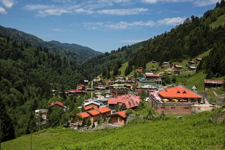
Ayder Highland (Photo: Rize Provincial Directorate of Culture and Tourism)
Located 16 km from the Güneysu district center at an elevation of 1,790 meters, Handüzü has lost some of its authentic character over time but has become a well-developed and easily accessible highland due to its proximity to the center. This popular highland serves as an important junction connecting to many other highlands to the south and southwest.
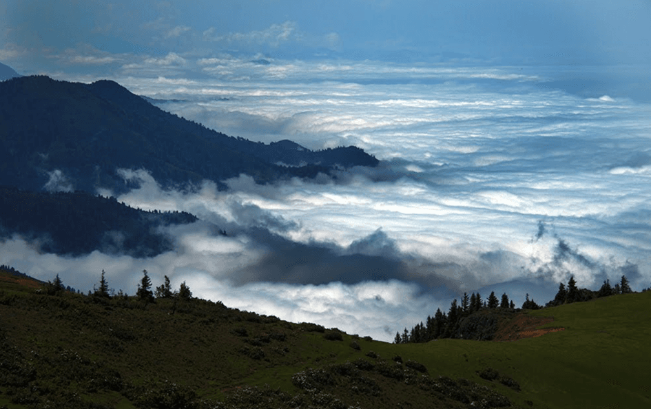
Handüzü Highland (Güneysu District Governorship)
Located in İkizdere District at an elevation of 2,392 meters, Çağrankaya is one of Rize’s largest highlands. It serves as the central hub where roads from İkizdere, Çayeli, Güneysu, and Çamlıhemşin converge. The highland is characterized by intensive concrete construction, and its population increases significantly during summer months.
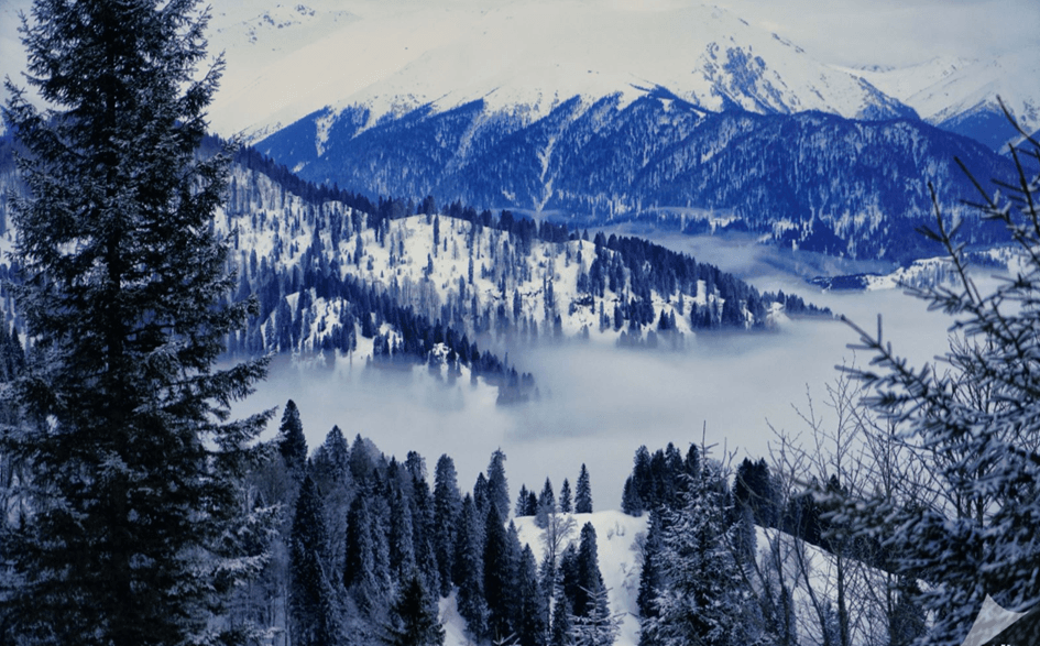
Çağrankaya Highland (Turkey Culture Portal)
Located in İkizdere District at 2,643 meters, Vaşa Highland retains all its authentic architectural features. It is also an area where animal husbandry and highland pastoralism continue. Due to its height and commanding position, it offers an important viewpoint for viewing surrounding natural beauties.
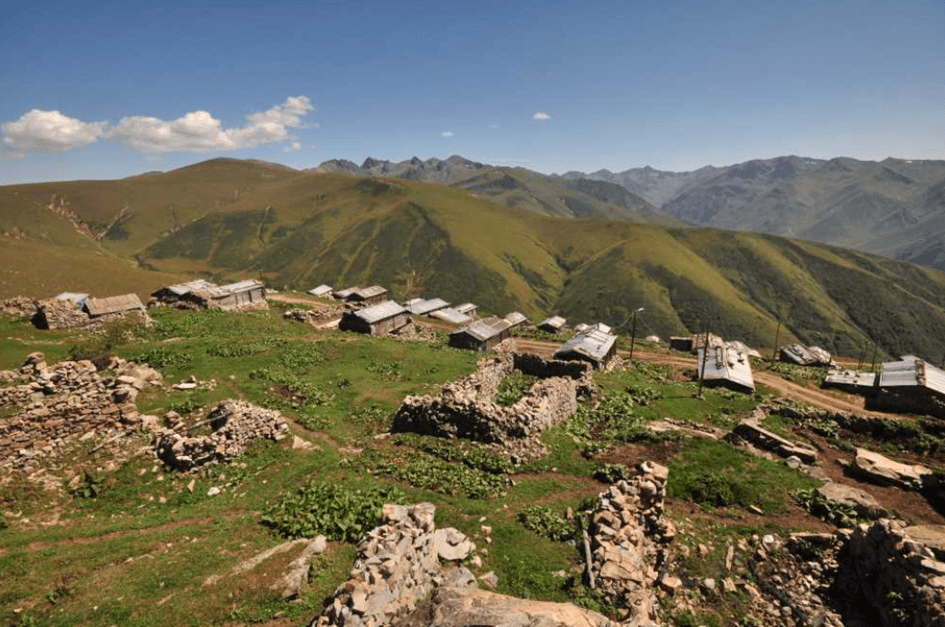
Vaşa Highland (Turkey Culture Portal)
Accessible via a path branching off from the “Kamanın Dibi” location on the Anzer Highland route, Petran Highland can be reached by vehicle depending on seasonal conditions.
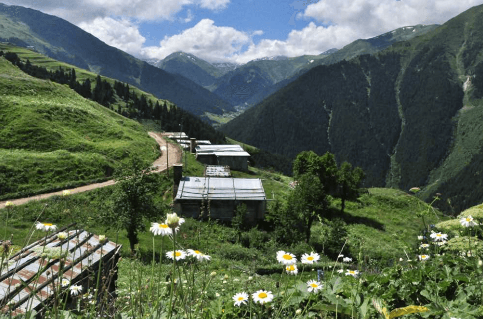
Petran Highland (Turkey Culture Portal)
Located in İkizdere District at 2,368 meters, Homeze Highland is characterized by new developments carefully constructed using primarily wooden materials. With its 360-degree panoramic views, it stands out as an important viewpoint.
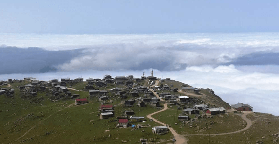
Homeze Highland (Turkey Culture Portal)
Located 25 km from İkizdere District at 1,875 meters, this highland features local wooden architecture amidst forests and expansive meadows.
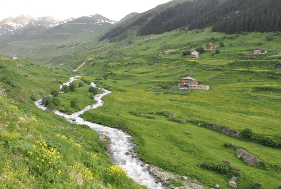
Sivrikaya Highland (Turkey Culture Portal)
Located in İkizdere District at 2,105 meters, Anzer Highland is 85 km from the district center and accessible via İkizdere. Also known as Ballıköy, it connects to the Çoruh River and the province of Bayburt on one side and the Trabzon Uzungöl Tourism Center on the other. Its location, along with neighboring highlands such as Meles, Petran, Kabahor, and Garzavan, gives it significant potential for cultural richness and nature tourism. Its position at the foot of Kırklardağ makes it an important highland center. The highland offers food and accommodation facilities and provides an environment for nature walks and photography. The world-famous Anzer Honey is produced from the region’s countless flowers. In summer, the area turns into various shades of green; in winter, it is dominated by yellow and red hues, offering a captivating experience for nature lovers.
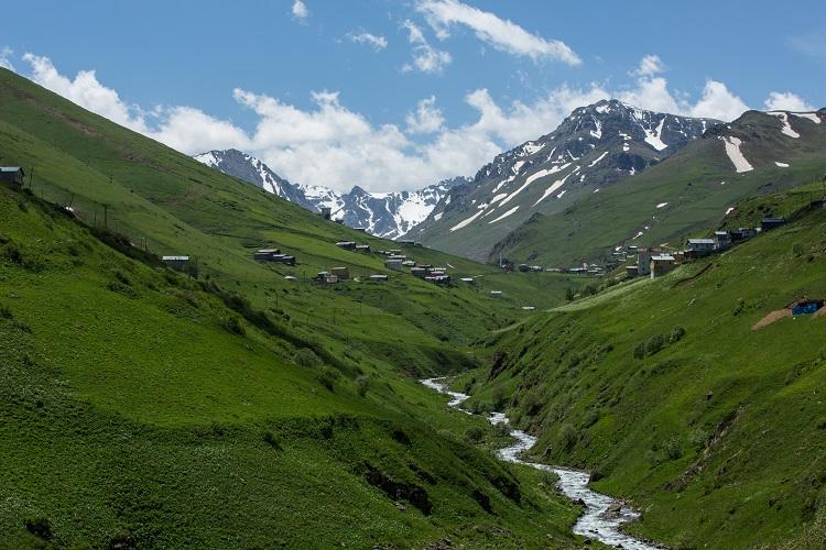
Anzer Highland (Photo: Rize Provincial Directorate of Culture and Tourism)
Located approximately 36 km from İkizdere District, Ovit Highland and its surroundings have been declared a “Winter Tourism Center.” While the area hosts mountain climbing and trekking in summer, it also holds great potential for winter sports. Its geographical structure provides suitable conditions for winter sports, and further development of this potential is planned. Ovit Highland is poised to become an attractive destination for nature lovers throughout the year.
Located in Çamlıhemşin District at 2,002 meters, Sal Highland preserves its authentic character through traditional wooden houses. The highland stands out for its natural environment and architecture and is suitable for those seeking nature walks and cultural experiences.
Located at 2,032 meters near the forest limit, between the valleys of the Fırtına and Hala rivers in southern Çamlıhemşin District, Pokut Highland offers a suitable environment for walking and relaxation. It is known for its rich biodiversity and unique architecture. Located 15 km from Çamlıhemşin District, the highland is recognized for its misty views and authentic wooden houses. Accommodation is available in highland houses functioning as pensions.
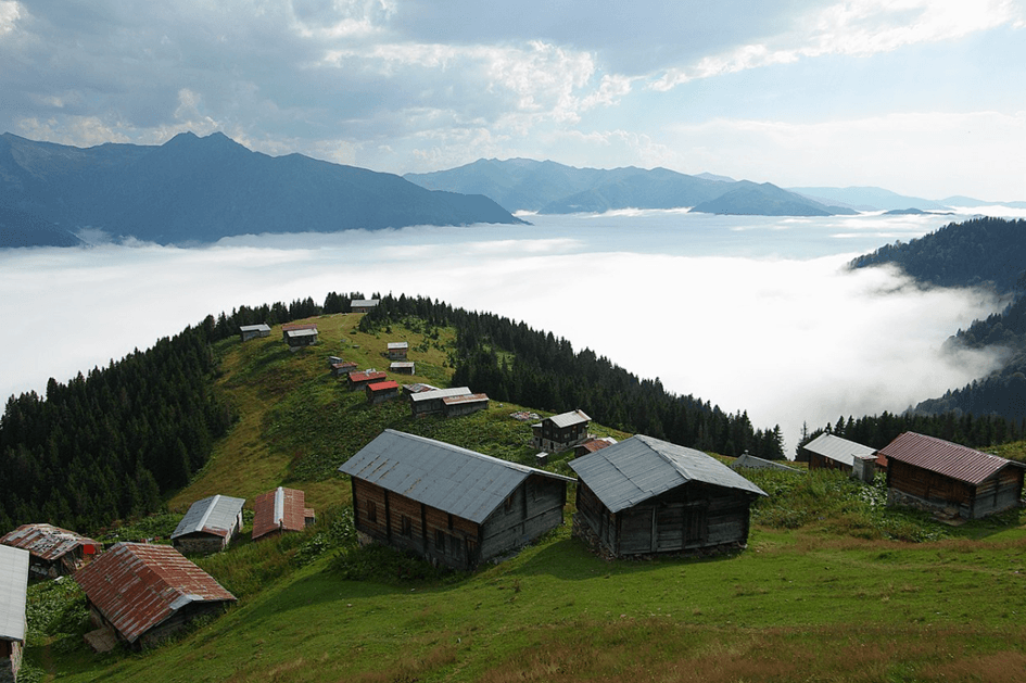
Pokut Highland (Photo: Turkey Culture Portal)
Located 4 hours by vehicle from Çamlıhemşin district center at 2,338 meters, Palovit Highland is distinguished by its traditional stone highland houses and lies on the northwestern slope of the Kaçkar Mountains. One side of Palovit Highland is entirely covered by forests, while the other rests against a mountain slope, making it one of the most beautiful elevations of the Black Sea.
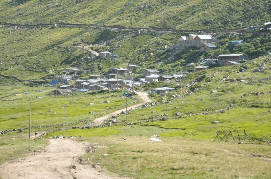
Palovit Highland (Photo: Turkey Culture Portal)
Located in Çamlıhemşin District at 1,884 meters, Elevit Highland is primarily visited by diaspora members during summer months. The highland offers accommodation in traditional highland houses and is famous for its horon dances, with festivals held in August. Wild animals native to the Black Sea, including the wild goat, are found on the highland.
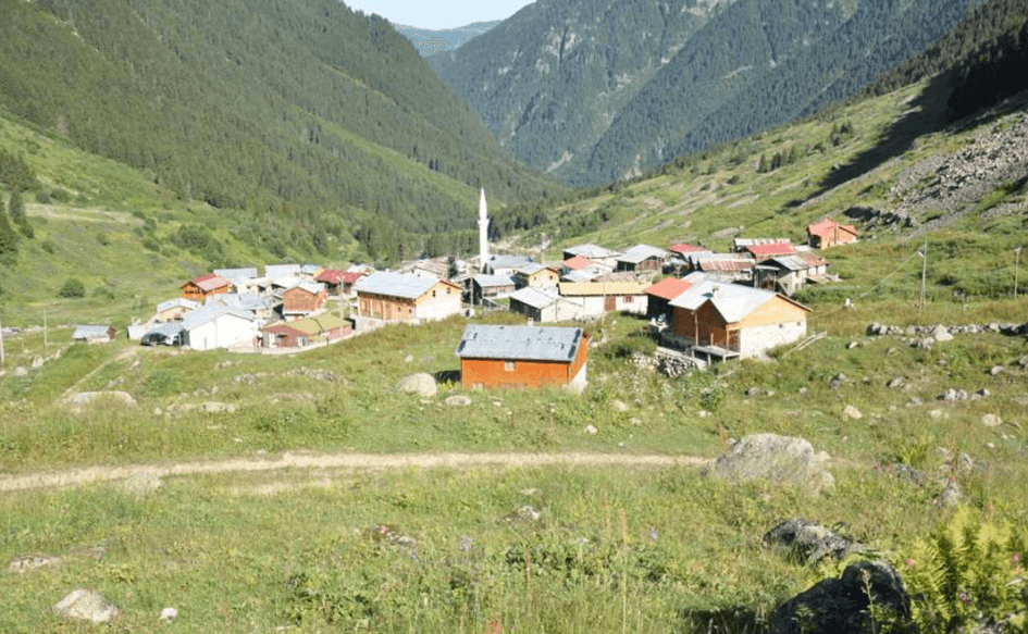
Elevit Highland (Photo: Turkey Culture Portal)
In the Eastern Black Sea Region, dwellings are typically situated on slopes in a scattered arrangement due to the topography. These settlements often consist of small groups of family members or are located 1–2 km apart. Integrated harmoniously with the natural environment and green spaces, these dwellings have a visually striking appearance. However, access to these structures is generally provided via narrow, winding footpaths.
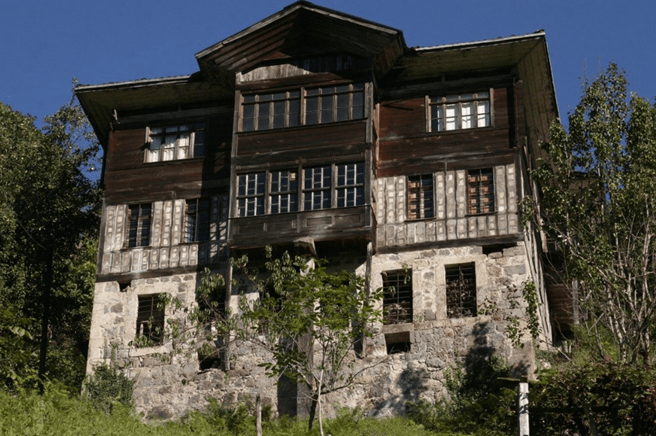
(Photo: Rize Provincial Government)
In traditional Rize residential architecture, wood and stone are the most commonly used materials. Wood, a natural resource of the region, is preferred for its workability and durability. Durable wood types such as pine, fir, and hornbeam are widely used; chestnut is common along the coast, while pine dominates inland areas. Harder woods such as walnut, oak, and black poplar are less common but have been used in some structures. In addition to wood, stone, though less abundant, is used as a secondary building material due to its durability. In coastal areas, brick and tile made from fired clay are preferred for roofs and chimneys.
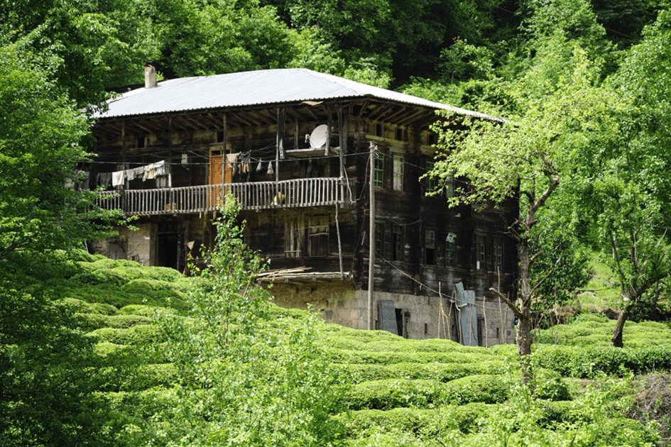
(Photo: Rize Provincial Government)
Three main construction systems are used in the region. The first is the timber-frame system, in which horizontal wooden elements are stacked without vertical posts to form walls. This system is common in inland areas and highlands where timber is abundant. The second system is the timber-frame or skeleton structure, also known as “çatma,” which uses vertical posts. The third system is the mixed construction system, in which a 50 cm thick rubble stone foundation wall supports a timber-frame superstructure.
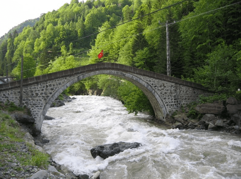
Arched bridge (Photo: Rize Provincial Government)
Climate conditions determine the roof design in Rize. Due to heavy rainfall, wide eaves are used to protect walls. Ventilation systems are incorporated into roofs to prevent moisture-related decay. Roofs are typically three- or four-pitched and locally known as “semer,” “three shoulder,” and “four shoulder.” Traditionally, roofs were covered with hand-hewn wooden planks (“hartama”), but in more recent times, they have been covered with “alaturka” tiles.
In regional dwellings, the basement level is typically used as a stable. In structures with two stable sections, arched vaults and stone masonry are notable. In traditional Black Sea homes, the kitchen (“ahşaphane”) is the center of daily life. From the kitchen, access is gained to the “hayat,” or living room. The living room is usually oriented toward the slope and open to the view. Adjacent rooms are connected to the living room, and in some homes, these rooms have independent external entrances.
Serenders, unique to the Black Sea region, are designed for food storage and preservation. These wooden structures are elevated on pillars and accessed via a removable ladder. Their facades often feature wooden decorations.
In Rize’s highlands, wooden and stone houses are common. Wooden houses are preferred near forests, while stone houses are more common in areas farther from forests. In wooden highland houses, kitchens, pantries, and living areas are typically constructed from wood. Stone highland houses are built without mortar, with stones carefully arranged, and generally consist of a single room.
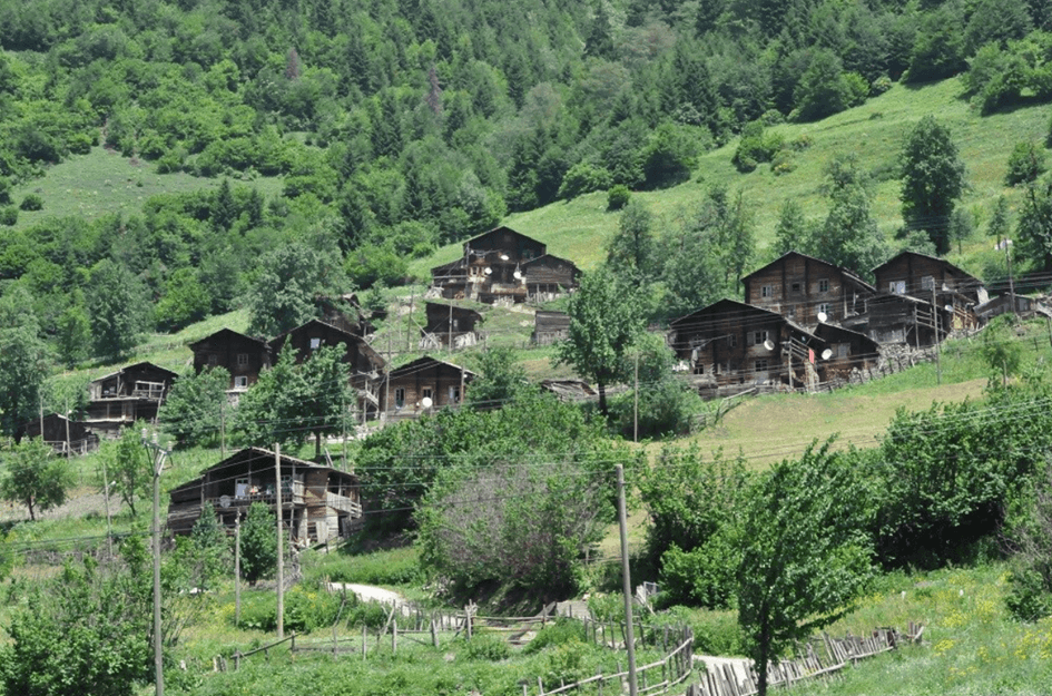
Highland House (Photo: Rize Provincial Government)
Rize’s culinary culture parallels its traditional folk culture, though some transformations have occurred in recent years. The traditional kitchen structure continues to be preserved, especially in villages. Due to limited agricultural land and climatic conditions, the variety of vegetables and fruits cultivated is restricted. Tea and, since the 1990s, kiwi cultivation are the primary agricultural products. In addition, beekeeping and honey production, especially of regional products such as Anzer Honey and Deli Honey, remain widespread. Production of grape and pear molasses is also among the region’s traditional methods.
Main ingredients in Rize cuisine include cornmeal, black cabbage, beans, and squash, while herring holds a prominent place in the region’s culinary culture. Animal products, particularly meat and dairy, complement and diversify Rize cuisine. Due to the region’s year-round closed, rainy weather, sun-drying food is generally not possible; instead, preservation methods such as pickling and salting are more common. Typical dishes of Rize’s culinary culture include hamsikoli, muhlama, herring pilaf, Laz böreği, enişte lokum, cornbread, herring fritters, molasses squash, and pepeçura.
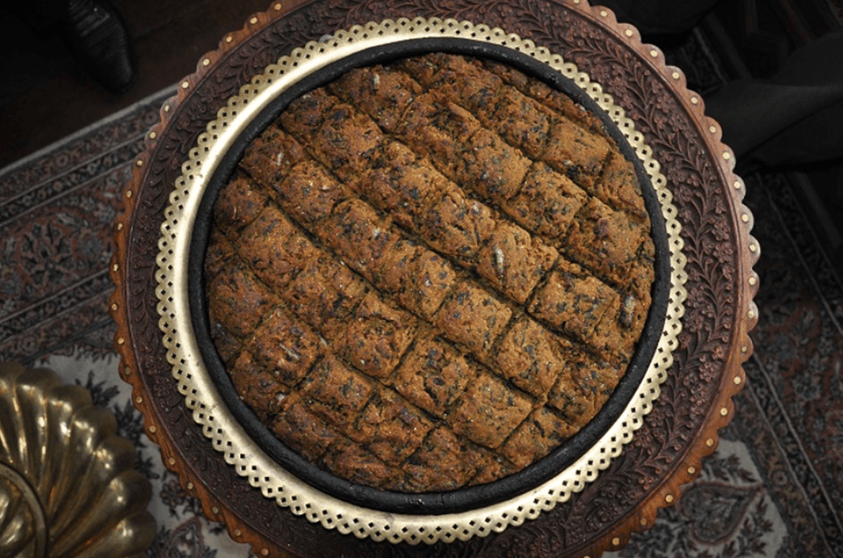
Herring Pilaf (Photo: Rize Provincial Directorate of Culture and Tourism)
Tea is the second most consumed beverage in the world after water and has a history of approximately 5,000 years. According to legend, tea was discovered when a leaf fell into boiling water drunk by the servant of the Chinese Emperor Shen Nung. The first comprehensive research on tea was conducted by Lu Yu, who lived between 733 and 804 CE. In his book “The Classic of Tea,” Lu Yu provided detailed information on tea production and consumption. Europe became acquainted with tea in the 17th century. The British embraced tea as a lifestyle and rapidly adopted it, establishing tea plantations in the 18th century. To transport tea quickly to Europe, fast sailing ships were used. In Turkey, tea was introduced in 1787 through seeds brought from Japan, but early attempts in Bursa failed due to climatic conditions. In 1917, Ali Rıza Erten’s efforts led to official approval for tea cultivation in Rize in 1924, laying the foundation for tea production. Production increased after the first factory was established in 1947. Although Turkey’s acquaintance with tea came late, it became widespread among the population and is now an integral part of daily life.
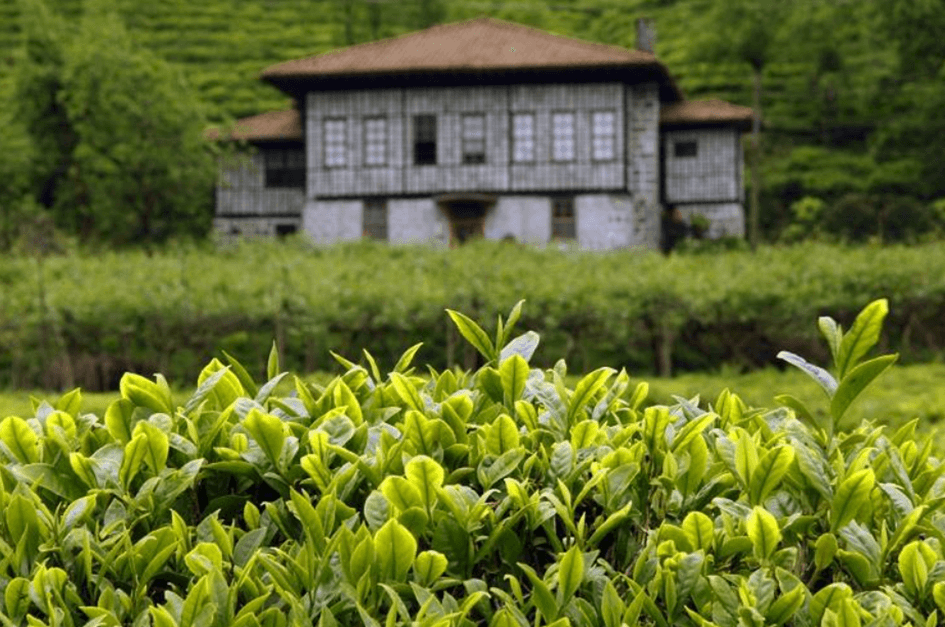
Rize Tea (Photo: Rize Provincial Directorate of Culture and Tourism)
Rize folk music is shaped around instruments such as the kemençe and tulum, and folk songs. The unique characteristics of Black Sea folk songs make them easily recognizable. Typically, songs consist of four lines, with rhyme between the second and fourth lines. The first two lines and the last two lines may be independent in meaning, or sometimes interdependent.
Folk songs can be sung by a single person or collectively by multiple people. Love songs and exile songs are among the most common examples. The most important types are “atma” and “karşı beri atma” songs. Atma songs are monologues sung by one person, while karşı beri atma songs are dialogues between two people. Songs are typically sung in couplets or four-line stanzas. As part of daily life, almost everyone can sing atma songs. Atma songs are commonly exchanged between relationships such as boy and girl, woman and girl, father and child, bride and mother-in-law, bride and father-in-law, wife and husband.
Atma songs can be sung on any topic and emerge spontaneously without prior preparation.
Kemençe is the common name for two distinct bowed instruments used in Ottoman music and Black Sea folk music. The first instrument, known until the mid-20th century as “armudî kemençe” or “fasıl kemençe,” is now referred to as the “classical kemençe.” The second instrument is widely used in folk music as the “Black Sea kemençe.”
The classical kemençe is a small instrument measuring 40–41 cm in length and 14–15 cm in width. Its body, shaped like a half pear, is carved from a single piece of wood, with the rounded part called the “head” and the neck the “fingerboard.” Two large D-shaped openings are carved on the front, with rounded edges facing outward. The back features a “spine groove.” When played, the tailpiece is placed on the left knee, and the instrument is held against the chest or between the knees. The strings are positioned 7–10 mm above the fingerboard and are plucked lightly from the side with the fingernails to produce sound.
The Black Sea kemençe is also carved from a single piece of wood for the body and neck, but its shape is quite different. While dimensions vary, models are typically 56 cm long. The body is usually made from plum or juniper wood, while the soundboard is made from fir or spruce. To withstand the pressure from the strings, a dome-shaped protrusion is added to the soundboard. The pegs are small and inserted from the front. The strings are placed very close to the fingerboard, as the Black Sea kemençe is played with the fingertips. When standing, the musician holds the instrument in the left hand; when seated, it is placed between the knees.
The tulum is a wind instrument widely used in the mountain villages of the Black Sea Region. It is typically made from goat skin and is also known as “Gada” in some areas. The tulum is frequently played at weddings, festivals, and during the transition to highland pastures.
One of the most suitable areas for river sports in Rize is the Fırtına River. This river is formed by the convergence of streams descending from the Black Sea-facing slopes of the Kaçkar Mountains. Due to this feature, it is considered one of the most important sites for river tourism in Rize. The Fırtına River flows into the Black Sea approximately 2 km west of Ardeşen and is 57 km long. It flows through tea and fruit orchards, passing beneath historic stone arched bridges. The region offers not only opportunities for water sports but also a chance to experience Rize’s culture.
Access to the area is via the Rize-Ardeşen highway, turning south. After approximately 22 km, Çamlıhemşin District is reached. The river sports route can begin approximately 1 km south of Çamlıhemşin. Attention must be paid to large boulders at the 5th kilometer and hazardous passages at the 7th, 8th, and 9th kilometers. The river’s discharge and flow direction must be carefully examined in these areas.
At the 12th kilometer, the Duygulu Waterfall on the western slope is a significant natural feature and can be considered a separate attraction. The route can be concluded at a suitable point before the Fırtına River reaches the Black Sea. The 23-kilometer route features a rocky riverbed and includes sections of difficulty levels 3, 4, and 5, depending on river discharge. Caution is required, especially after heavy rainfall when water levels rise.
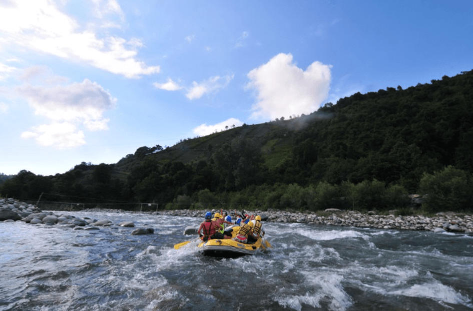
River Sports (Photo: Rize Provincial Directorate of Culture and Tourism)
The Eastern Black Sea Mountains, home to some of Turkey’s highest peaks, hold significant potential for mountaineering. The highest point of this mountain range is Kaçkar Mountain, at 3,937 meters. As Turkey’s fourth-highest peak, Kaçkar hosts two major glaciers, one of which is the country’s third-largest glacier. The Eastern Black Sea Mountains, forming Rize’s borders with Erzurum and Artvin, are also known for other peaks such as Verçenik Mountain at 3,709 meters, Bulut Mountain at 3,562 meters, and Altıparmak Mountain at 3,492 meters.
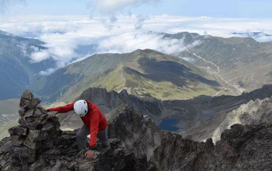
Nature hiking is a key component of tourism in Rize, offering various trails of different difficulty levels. The region’s natural landscape makes hiking a year-round activity. Nature hiking goes beyond physical exercise, offering opportunities for relaxation, sport, photography, birdwatching, and botany. Village and highland paths and trails provide diverse alternatives for this activity.
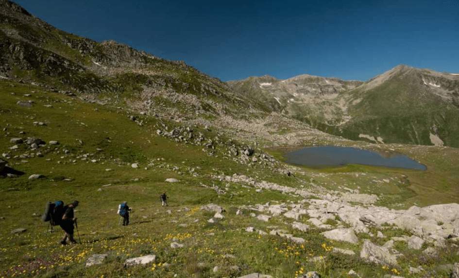
Nature Hiking (Photo: Turkey Culture Portal)
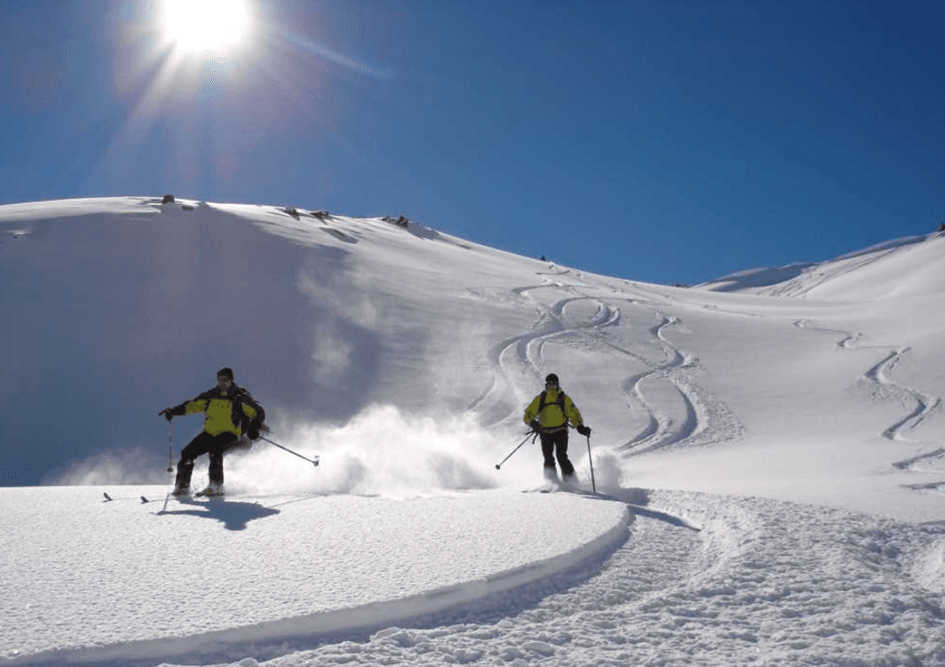
Heliski is considered one of the most challenging outdoor sports worldwide and was long practiced only in the Swiss Alps, the Himalayas, and Canada. Since 2004, tours targeting the Kaçkar Mountains have been organized for European skiers. Skiers and snowboarders stay at Ayder Highland before being transported by helicopter to the high and steep peaks of the Kaçkar Mountains, where they then perform freestyle descents. Heliski, accessible only to professional skiers, requires specialized equipment and advanced experience. Heliski is conducted between January and April in the foothills of the Kaçkar Mountains, particularly in Ayder, İkizdere, Ovit, and other high-altitude areas. Various initiatives are underway to promote skiing in the region. Approximately 500 skiers visit annually for heliski.
The Rize highlands stretching from İkizdere to Fındıklı attract attention with dirt and highland roads that follow riverbanks and connect various locations. Along this route, visitors can briefly escape daily life by cooling off in front of waterfalls. The region offers opportunities for nature, history, culture, camping, and hiking activities in one setting and can be considered a form of on-site tourism.

Rize’s economy is largely based on tea cultivation and tea processing. In addition, fisheries, particularly fishing, and forest products make significant contributions to the economy. Approximately 70% of the active population works in agriculture. Rize’s most famous products are tea, herring, and Rize cloth made from hemp.
Rize’s terrain is mountainous and rugged, leaving very little flat land. Only 1% of the province’s land is flat. When referring to agriculture in Rize, tea is the first product that comes to mind, as two-thirds of Turkey’s tea production occurs here. Tea cultivation is widespread due to Rize’s climate and abundant rainfall. Tea farming became established between 1940 and 1950 and rapidly expanded after 1950. Approximately 400,000 tons of tea are produced annually on 40,000 hectares of tea plantations. Vegetable farming in Rize is limited to crops such as corn, beans, and potatoes. Due to the dominance of tea farming, vegetable production is minimal. Fruit cultivation is also an important income source after tea. Apples, pears, hazelnuts, and mandarins are grown. Rize-grown mountain rice requires no irrigation and is highly renowned. Puro tobacco is also cultivated in the Pazar district of Rize.
The expansion of tea farming led to a decline in corn cultivation, causing animal husbandry to lose its former importance. However, Rize’s highlands and plateaus are covered with rich pastures and meadows, making them suitable for animal husbandry. Beekeeping is also rapidly expanding. Anzer honey from İkizdere is particularly famous.
Rize’s fishing industry is highly developed, ranking fourth in Turkey for fish production. Rize’s coast has abundant and high-quality fish potential. Fishermen operate large vessels for open-sea fishing. Valuable fish species found in abundance along Rize’s coast include herring, mullet, mackerel, bonito, barbel, kalkan, zargana, izmarit, mezgit, lüfer, kingfish, torik, karagöz, tirsi, and sea bass.
Rize Province has 150,000 hectares of forest and 35,000 hectares of shrubland. Rize’s forests include hornbeam, red pine, chestnut, bearded alder, black poplar, trembling aspen, ash, alder, oak, ash, and other tree species. There are 46 forest villages in these areas, producing 100,000 m³ of industrial timber and 70 ster of firewood annually.
Although copper, manganese, and kaolin deposits exist in Rize, only small quantities of manganese are extracted. Industry is primarily centered around tea processing factories and workshops. Rize has 20 tea factories, 15 tea workshops, and various industrial establishments, including flour mills, sawmills, foundries, confectionery factories, and aluminum kitchenware manufacturers.
Newly constructed ports in Rize accommodate large ships. Additionally, fishing harbors exist in Çayeli, Pazar, and Fındıklı districts. Regular ship services operate between Istanbul and Rize. Rize is 1,200 km from Istanbul, 839 km from Ankara, and 1,422 km from İzmir by road.
Güneysu Kaymakamlığı. *Handüzü Yaylası [JPG].* Accessed February 20, 2025.http://guneysu.gov.tr/handuzu-yaylasi
Iyidere Municipality. "Economic Structure." Iyidere.bel.tr. Accessed February 20, 2025.https://www.iyidere.bel.tr/Sayfa/ekonomik_yapi-67.html#:~:text=Daha%20%C3%A7ok%20m%C4%B1s%C4%B1r%2C%20fasulye%20ve,elma%2C%20f%C4%B1nd%C4%B1k%20ve%20mandalina%20yeti%C5%9Fir
Karadeniz Balayı Oteli. "Rize'nin Olmazsa Olmazı: Çay Tarımı." Accessed February 19, 2025.https://karadenizbalayioteli.com/rizenin-olmazsa-olmazi-cay-tarimi/
Meteorology General Directorate. "İl ve İlçeler İstatistikleri." Mgm.gov.tr. Accessed February 20, 2025.
Ministry of Culture and Tourism. "Akarsu Sporları."Rize İl Directorate of Culture and Tourism. Accessed February 19, 2025.https://rize.ktb.gov.tr/TR-112795/akarsu-sporlari.html
Ministry of Culture and Tourism. "Doğa Yürüyüşü (Trekking)." Kültür Portalı. Accessed February 19, 2025.https://www.kulturportali.gov.tr/turkiye/rize/turizmaktiviteleri/doga-yuruyusu--trekking-
Ministry of Culture and Tourism. "Doğa Yürüyüşü (Trekking)." Kültür Portalı. Accessed February 19, 2025.https://www.kulturportali.gov.tr/turkiye/rize/turizmaktiviteleri/doga-yuruyusu--trekking-
Ministry of Culture and Tourism. "Heliski." Kültür Portalı. Accessed February 19, 2025.
Ministry of Culture and Tourism. "Jeep Safari." Kültür Portalı. Accessed February 19, 2025.
Ministry of Culture and Tourism. "Rize İl." Rize Provincial Directorate of Culture and Tourism. Accessed February 19, 2025.
Ministry of Culture and Tourism. "Sivrikaya Yaylası Source:Rize İl Directorate of Culture and Tourism Photo Archive [JPG]." Kültür Portalı. Accessed February 20, 2025.https://www.kulturportali.gov.tr/medya/fotograf/fotodetay/2828
Ministry of Culture and Tourism. Palovit Yaylası Source:Rize İl Directorate of Culture and Tourism Photo Archive [JPG]. Culture Portal. Accessed February 20, 2025.https://www.kulturportali.gov.tr/medya/fotograf/fotodetay/44877
Ministry of Culture and Tourism. İstanbul's Historical Peninsula [JPG]. Kültür Portalı. Accessed February 19, 2025.https://www.kulturportali.gov.tr/medya/fotograf/fotodetay/49616
Ministry of Culture and Tourism.Petran Yaylası Source:Rize İl Directorate of Culture and Tourism Photo Archive [JPG].Türkiye Kültür Portal. Accessed February 19, 2025.
Ministry of Culture and Tourism.Rize İl [JPG]. Rize Provincial Directorate of Culture and Tourism. Accessed February 19, 2025.
Rize Sivil Toplum Örgütleri. "Rize Coğrafi Yapısı." Rizeso.org.tr. Accessed February 20, 2025.https://www.rizetso.org.tr/sayfa/177/rize-cografi-yapisi#:~:text=Co%C4%9Frafi%20Konum&text=%C3%87ok%20engebeli%20ve%20da%C4%9Fl%C4%B1k%20bir,genellikle%20sade%20bir%20g%C3%B6r%C3%BCn%C3%BC%C5%9Fe%20sahiptir
T.C. Kültür ve Turizm Bakanlığı, Rize İl Kültür ve Turizm Müdürlüğü. "Halk Mutfağı." Rize Ktb.gov.tr. Accessed February 20, 2025.
T.C. Kültür ve Turizm Bakanlığı, Rize İl Kültür ve Turizm Müdürlüğü. Halk Mutfağı [JPG]. Rize Ktb.gov.tr. Accessed February 20, 2025.https://rize.ktb.gov.tr/TR-191577/halk-mutfagi.html
T.C. Kültür ve Turizm Bakanlığı. "Kültür Portalı." Accessed February 20, 2025.https://www.kulturportali.gov.tr/
T.C. Ministry of Culture and Tourism. "Homeze Yaylası - Rize [JPG]." Kültür Portali. Accessed February 20, 2025.https://www.kulturportali.gov.tr/turkiye/rize/gezilecekyer/homeze-yaylasi
T.C. Ministry of Culture and Tourism. "Çağırankaya Yaylası [JPG]." Accessed February 19, 2025.https://www.kulturportali.gov.tr/turkiye/rize/gezilecekyer/cagirankaya-yaylasi
T.C. Ministry of Culture and Tourism. *Elevit Yaylası. [JPG].* Kültür Portalı. Accessed February 20, 2025.https://www.kulturportali.gov.tr/turkiye/rize/gezilecekyer/elevit-yaylasi
T.C. Ministry of Culture and Tourism. *Pokut Yaylası- Rize [JPG].* Kültür Portalı. Accessed February 20, 2025.https://www.kulturportali.gov.tr/turkiye/rize/gezilecekyer/pokut-yaylasi
T.C. Ministry of Culture and Tourism. Ayder Yaylası [JPG].Rize İl Directorate of Culture and Tourism. Accessed February 19, 2025.https://rize.ktb.gov.tr/TR-55435/fotograf-albumu.html
T.C. Ministry of Culture and Tourism. Fırtına Deresi [JPG].Rize İl Directorate of Culture and Tourism. Accessed February 20, 2025.https://rize.ktb.gov.tr/TR-55435/fotograf-albumu.html
T.C. Ministry of Culture and Tourism.Arapdüzü Doğa Park and Picnic Area [JPG].Rize İl Directorate of Culture and Tourism.
T.C. Ministry of Industry and Technology. Rize [JPG]. Eastern Black Sea Development Agency. Accessed February 20, 2025.https://www.doka.org.tr/bolgemiz_Rize-TR.html#galeri_1-10
T.C. Rize Valiliği. "Rize'nin Tarihçesi." Rize.gov.tr. Accessed February 20, 2025.http://www.rize.gov.tr/rizenin-tarihcesi
T.C. Rize Valiliği. Taş ve Ahşap Yapılar [JPG]. Rize.gov.tr. Accessed February 20, 2025.
T.C. Rize İl Tarım ve Orman Müdürlüğü. "Coğrafi Yapı." Accessed February 20, 2025.https://rize.tarimorman.gov.tr/Menu/12/Cografi-Yapi#:~:text=Bitki%20%C3%96rt%C3%BCs%C3%BC,s%C4%B1rtlar%20boyunca%20a%C5%9Fa%C4%9F%C4%B1lara%20sarkt%C4%B1%C4%9F%C4%B1%20g%C3%B6r%C3%BCl%C3%BCr
T.C. Rize İl Tarım ve Orman Müdürlüğü. "Kültür." Accessed February 20, 2025.https://rize.tarimorman.gov.tr/Menu/14/Kultur
T.C. Türkiye İstatistik Kurumu (TÜİK). "Adrese Dayalı Nüfus Kayıt Sistemi Sonuçları 2024." Tuik.gov.tr. Accessed February 20, 2025.https://data.tuik.gov.tr/Bulten/Index?p=Adrese-Dayali-Nufus-Kayit-Sistemi-Sonuclari-2024-53783
T.C. Türkiye İstatistik Kurumu (TÜİK). "CIP - Cumhuriyet İstatistik Programı." Tuik.gov.tr. Accessed February 20, 2025.

Country | Türkiye | ||||||||
|---|---|---|---|---|---|---|---|---|---|
Region | Black Sea Region | ||||||||
Population | 350506 | ||||||||
Area | 250.1 km² | ||||||||
Climate | Black Sea Climate | ||||||||
Governor | İhsan Selim Baydaş | ||||||||
Mayor | Rahmi Metin | ||||||||
Area Code | 464 | ||||||||
License Plate Code | 53 | ||||||||
History
Pontus and Seljuk Periods
Ottoman Period
Republican Period
Population (2023)
Population Distribution by District
Geography
Geographical Location
Climate
Temperature and Precipitation Data
Geological Structure
Vegetation
Landforms
Coastal Strip and Alluvial Plains
Mountainous Area with Deep Valleys
High Mountainous Area and Glacial Topography
Rivers and Lakes
Highlands
Ayder Highland
Handüzü Highland
Çağrankaya Highland
Vaşa Highland
Petran Highland
Homeze Highland
Sivrikaya Highland
Anzer (Ballıköy) Highland
Ovit Highland
Sal Highland
Pokut Highland
Palovit Highlands
Elevit Highland
Local Architecture
Traditional Dwellings
Material Selection
Construction Systems
Roofing Systems
Architectural Features
Black Sea Serenders
Highland Houses
Rize Cuisine
History of Tea in Rize
Folk Music and Folklore
Kemençe
Tulum
Tulum Structure:
Outdoor Sports
River Sports
Mountaineering
Nature Hiking
Heliski (Helicopter Skiing)
Jeep Safari
Economic Structure
Agriculture
Animal Husbandry
Fishing
Forestry
Mining and Industry
Transportation