


This article was automatically translated from the original Turkish version.
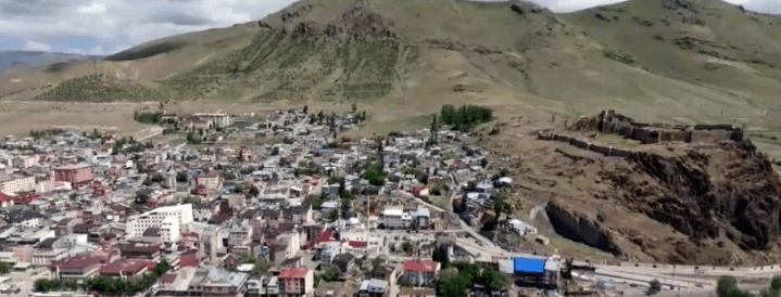
Pasinler, Erzurum District
Rakım | 1.670 | ||||||||
|---|---|---|---|---|---|---|---|---|---|
Surface Area | 1460 km² | ||||||||
Number of Villages in the District | 72 | ||||||||
Mayor | Ünsal Sertoğlu | ||||||||
District Governor | Yunus Emre TEMEL | ||||||||
Erzurum province’s eastern region is home to the district of yer, situated on a vast plain surrounded by alternating gentle or steep slopes. Pasinler, an ancient settlement located along the historic Silk Road, is renowned for its fertile plains, thermal springs, and historical structures. Agriculture and animal husbandry are the primary sources of livelihood for the local population. The district center was historically known as Hasankale, named after the settlement, and lies approximately 40 kilometers from the city center of Erzurum.
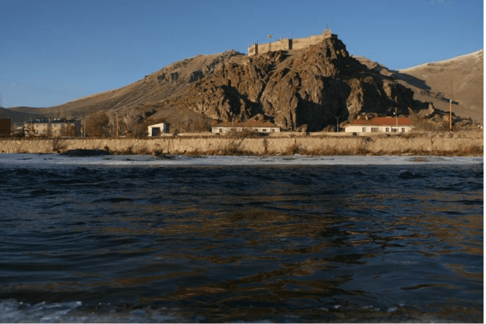
Pasinler-Hasankale Castle (Source: Directorate of Religious Affairs)
The history of Pasinler-Hasankale, which served as the administrative center for the villages of Lower and Upper Pasin, extends back to the 4000s BCE. During the Urartian period, Pasinler was an important settlement. From the 9th century BCE onward, following successive invasions across Anatolia, it came under the control of the Oghuz Turks and later the Turkic rulers of Erzurum. The Battle of Pasinler in 1048 holds great significance in Anatolian history. In this battle, the army commanded by Ibrahim Yınal, governor of Azerbaijan under the Great Seljuk State, defeated the Byzantine forces and brought Eastern Anatolia and Hasankale under Turkish control. This victory marked the first major success of the Turks seeking to establish their homeland in Anatolia and laid the groundwork for the eventual triumph at the Battle of Manzikert in 1071. Consequently, since September 18, 2017, the Victory of Pasinler has been officially commemorated in the district with ceremonial events.
Following the invasions into Anatolia and the victory at Manzikert, Hasankale came fully under Turkish control and fell within the domain of the Saltukids, as did Erzurum and its surroundings. In 1202, Hasankale was incorporated into the Anatolian Seljuk State. After the Seljuks’ defeat at the Battle of Kösedağ, it passed under the rule of the Ilkhanids and subsequently the Sutayids. The castle of Hasankale, built on a hill south of Hasan Baba Mountain by Hacı Togay, son of the Sutayid leader Hasan, replaced the former Kaputrut Castle. As Hasan was buried within the castle walls, it came to be known as Hasan Kale. After the Sutayid period, Hasankale successively came under the control of the Kara Koyunlu, Timurids, Ak Koyunlu, Safavids, and finally the Ottomans. Its strategic location along major east-west migration and trade routes conferred enduring importance.
During the Ottoman Empire, Hasankale experienced periods of both development and conflict. When the Ottoman State entered World War I in 1914, Hasankale became a defensive frontline against Russian advances into Eastern Anatolia and served as a rear guard during the Sarıkamış Campaign. It also functioned as a logistical center due to the presence of hospitals for the Third Army. Although it suffered Russian occupation during the 1877–1878 Russo-Turkish War, its most severe hardships occurred between 1914 and 1920. Following the Ottoman Army’s heavy defeat and retreat from Sarıkamış, Hasankale was occupied by Russian forces. Armenian irregulars serving in the Russian army carried out violent actions that resulted in significant civilian casualties in Hasankale and surrounding villages. Between 1915 and 1920, civilians in the region, including residents of Hasankale, were targeted based on ethnic identity. The highest loss of life occurred in Yastıktepe (Ketvan), Yeniköy, Tımar Eğilmez (Sülügü), and Köprüköy, now a district. Liberation from Armenian occupation occurred on March 13, 1918. In 1952, the name Hasankale was officially changed to Pasinler. Subsequently, Horasan was separated from Pasinler in 1954 and Köprüköy in 1991 to become independent districts.
Pasinler is located in the Eastern Anatolia Region between 41° 40’ 54” east longitude and 39° 58’ 53” north latitude. Its area is 1,460 km². It is bordered by Tortum and Uzundere to the north, Köprüköy to the east, Erzurum to the west, and Karayazı and Tekman to the south. To the north lie the Kargapazarı Mountains, while to the south extend the Dikenli and Maden Mountains, part of the Palandöken range. Between these two mountain chains lies the Pasinler Plain. The total drainage area of the Pasinler Plain is 1,420 km². Tributaries flowing from all directions feed into the Hasankale River, which runs through the district center and flows year-round. The river, flowing west to east, empties into the Aras River near Çobandede. The district’s terrain bears traces of internal and external geological forces from various geological periods. The region’s hot springs are also a result of these internal forces. Compared to Erzurum, Pasinler experiences hotter summers and colder winters, resulting in a more pronounced continental climate. The elevation difference between the plain and surrounding mountains is approximately 1,500 meters. The major valleys in the district are those of the Tımar and Miyadin rivers. The Demirdöven Dam is located in the Tımar River Valley. The Pasinler Plain, forming the base of the Pasinler Basin, covers approximately 350 km². It is separated from the Erzurum Plain by the volcanic Deveboynu Pass (1,950 m) and is an alluvial graben situated at an elevation of 1,600–1,700 meters.
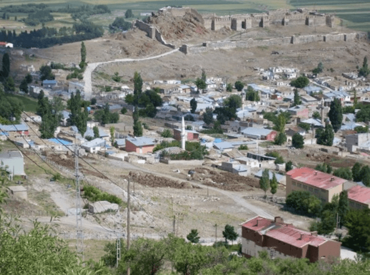
Pasinler (Source: Erzurum Encyclopedia)
A continental climate dominates in Pasinler. Summers are hot and dry, while winters are cold and snowy. Annual average temperatures are low. During winter months, temperatures frequently fall below freezing, and snow cover can persist for extended periods. Spring and autumn are mild transitional seasons.
According to the Turkish Statistical Institute (TÜİK) 2017 Address-Based Population Registration System (ADNKS) data, the population of Pasinler district is 29,302. A significant portion of this population resides in Hasankale, the district center. Compared to other districts of Erzurum, Pasinler has a relatively dense population. However, in recent years, migration from rural areas to the district center and larger cities has been observed.
Agriculture and animal husbandry are the main sources of livelihood in Pasinler district. Grain cultivation is widespread across the extensive plains. In recent years, significant developments have occurred in livestock farming, particularly in meat and dairy production, alongside traditional agriculture.
Pasinler is a region open to tourism due to its thermal springs and historical sites. Throughout history, Hasankale culture has been closely linked with Erzurum in the fields of education and culture, becoming a center of cultural exchange.
Pasinler district hosts numerous thermal springs, which are valued for their economic and social contributions. These thermal facilities and services have regional significance in terms of accommodation and tourism. Some of the renovated thermal facilities in Pasinler include the Nenehatun Thermal Spa along the Erzurum road and the Kale Tourist Hotel thermal baths in the district center. The water temperature at these facilities ranges from 41 to 46 °C. Approximately 40,000 to 45,000 people use these spas annually, with a significant portion visiting during the summer season.
The oldest thermal bath in Pasinler is the Great Bath, constructed in 1390 and renovated in 1749 and 1892. Its water temperature is 40–41 °C, and its pool can accommodate 100–150 people simultaneously. Annual visitors reach approximately 300,000. The Small Bath, with water temperature of 32–33 °C, can serve 90–100 people at once and receives 150,000 to 160,000 visitors annually. The Pasinler Thermal Baths are located in the district center, along the Erzurum–Tehran international transit route, within the boundaries of the Pasinler Municipality. The baths are situated at the foot of Hasan Baba Mountain, north of the Pasinler Plain, at an elevation of 1,869 meters above sea level. Access to the thermal complex is provided via the Erzurum–Tehran international highway. It is 40 kilometers from Erzurum Airport and connected by rail to the train station in the provincial center. The chemical composition of the spring water is bicarbonate (50.42 miliequivalents per liter), chloride (46.74%), sodium (71.56 miliequivalents per liter), and carbon dioxide (423.8 mg/l), partially radioactive (1,308 poi/l), and contains metaboric acid (37.66 mg/l). The total mineralization is 4,051 mg/l dissolved minerals. The water temperature ranges from 39 to 45 °C.
The castle located on Hasan Dede Mountain in the district center derives its name from Hasan, son of Hacı Togay, a leader of the Sutayids of Mongol origin, and was historically known as Hasan Castle. During the historic Battle of Pasinler in 1048, the Seljuk State defeated Byzantine forces and took control of the castle.
Erzurum Ansiklopedisi. "Hasankale – Pasinler İlçesi." Accessed April 19, 2025.http://erzurumansiklopedi.com/hasankale-pasinler-ilcesi/.
Erzurum Büyükşehir Municipality. “İlçeleri.” Accessed April 19, 2025.https://www.erzurum.bel.tr/AltIcerikDetay/1044/I/10.
Erzurum Valiliği. "Pasinler." Accessed April 19, 2025.http://www.erzurum.gov.tr/pasinler.
Erzurum İl Kültür ve Turizm Müdürlüğü. "Pasinler." Accessed April 19, 2025.https://erzurum.ktb.gov.tr/TR-56049/pasinler.html.
Erzurum İl Müftülüğü (Diyanet İşleri Başkanlığı). "Müftülüğüm." Accessed April 19, 2025.https://erzurum.diyanet.gov.tr/pasinler/Sayfalar/contentdetail.aspx?MenuCategory=Kurumsal2&ContentId=muftulugum.
Erzurum İl Müftülüğü (Diyanet İşleri Başkanlığı). "Müftülüğümüz." Accessed April 19, 2025.https://erzurum.diyanet.gov.tr/pasinler/Sayfalar/contentdetail.aspx?
Pasinler Belediyesi. "Pasinler Belediyesi Resmi Web Sitesi." Accessed April 19, 2025.https://www.pasinler.bel.tr/#.
Pasinler Kaymakamlığı. “İlçemiz.” Accessed April 19, 2025.http://www.pasinler.gov.tr/ilcemiz.
Pasinler İlçe National Education Directorate. "İlçemiz Hakkında." Accessed April 19, 2025.https://pasinler.meb.gov.tr/www/ilcemiz-hakkinda/icerik/19.
T.C. Kültür ve Turizm Bakanlığı. "Çat – Erzurum." Accessed April 19, 2025.https://erzurum.ktb.gov.tr/TR-56056/cat.html.
Türkiye İstatistik Institute (TÜİK). "Adrese Dayalı Nüfus Kayıt Sistemi (ADNKS) 2017 Verileri." Accessed April 19, 2025.https://biruni.tuik.gov.tr/medas/?kn=Nufus_(Ilce)
Türkiye İstatistik Kurumu (TÜİK). "Coğrafi İstatistik Portalı." Accessed April 19, 2025.https://cbs.tuik.gov.tr/.
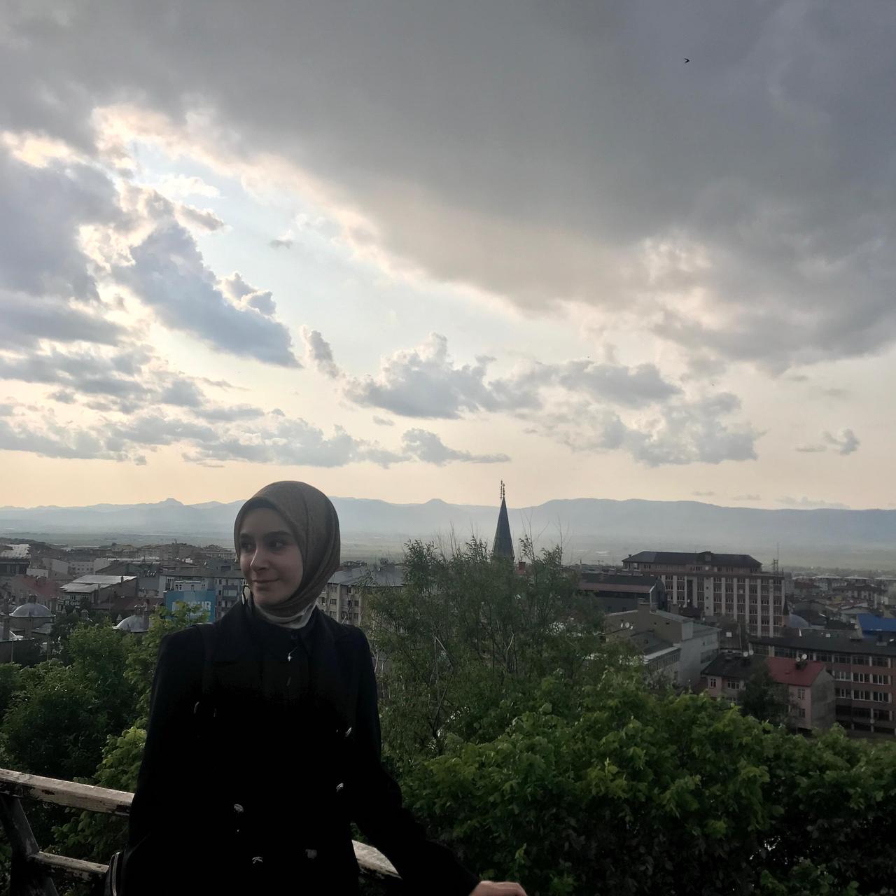
Pasinler, Erzurum District
Rakım | 1.670 | ||||||||
|---|---|---|---|---|---|---|---|---|---|
Surface Area | 1460 km² | ||||||||
Number of Villages in the District | 72 | ||||||||
Mayor | Ünsal Sertoğlu | ||||||||
District Governor | Yunus Emre TEMEL | ||||||||
No Discussion Added Yet
Start discussion for "Pasinler (District)" article
History
Geography
Climate
Population and Demographics
Economy
Tourism – Culture – Cuisine
Pasinler Thermal Springs
Hasankale