


This article was automatically translated from the original Turkish version.
+2 More
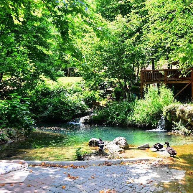
Viaduct
Province | Adana | ||||||||
|---|---|---|---|---|---|---|---|---|---|
District Governor | Muhammed Ali Çelik | ||||||||
Population 2022 | 22.042 | ||||||||
Places to Visit | Dokuzoluk Kanyonu Yerköprü Mesire Alanı Varda(Alman) Köprüsü Kapıkaya Kanyonu | ||||||||
The history of Karaisalı extends back to antiquity. Structures such as Milvan Castle and Keçi Castle located in the region bear traces from the Roman period. During the Middle Ages, the region was under the control of the Seljuk Turks and the Kingdom of Cilician Armenia. Subsequently, Karaisalı came under the rule of the Mamluks and was incorporated into Ottoman territory in 1517 during the campaign of Yavuz Sultan Selim. The district’s name was changed to Karaisalı in memory of a bey from the Ramazanoğulları Beylik. During the War of Independence, Karaisalı was not occupied and became one of the important centers of resistance in the Çukurova region.
Karaisalı, with an area of 1,165 km², is one of the important districts of Adana. It is situated on the southern slopes of the Taurus Mountains and features a rugged terrain. The district contains the Çatalan and Nergizlik dam lakes. Natural formations such as Kapıkaya Canyon, Körkün Canyon, and Dokuzoluk contribute to the district’s geographical richness.
Karaisalı experiences a Mediterranean climate. Summers are hot and dry while winters are mild and rainy. The annual average temperature ranges between 18 and 20°C. The vegetation cover consists primarily of maquis and pine forests. In higher elevations, black pine and cedar forests are also found.
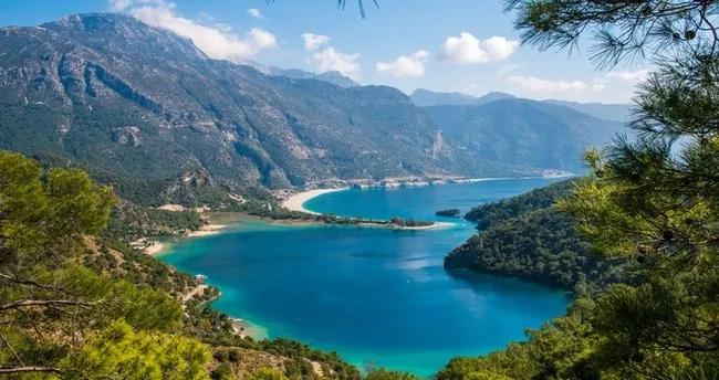
Maquis vegetation (Source: Sabah Newspaper)
As of 2022, the population of Karaisalı is 22,042. The district comprises 62 neighborhoods. The majority of the population is engaged in agriculture and animal husbandry. Traditional lifestyles and cultural values continue to hold significance in the district.
The economy of the district is based on agriculture, animal husbandry, and forestry. Crops such as wheat, barley, corn and olives are cultivated. Both large and small livestock farming are widespread. In addition, forest products and beekeeping are important economic activities.
Karaisalı possesses significant tourism potential due to its natural and historical richness.
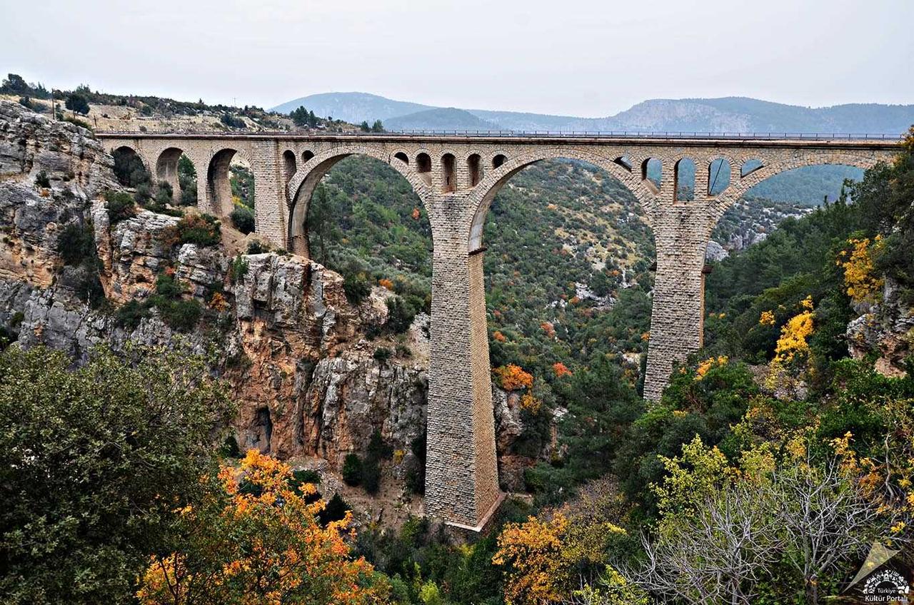
Varda (German) Bridge (Source: Culture Portal)
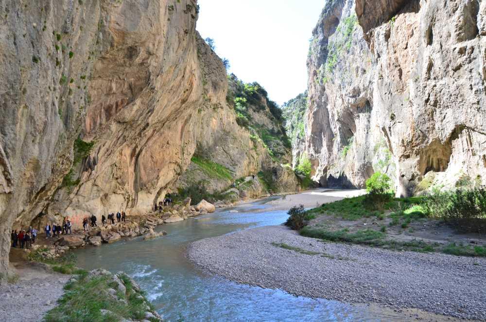
Kapıkaya Canyon (Source: Türkiye Culture Portal)
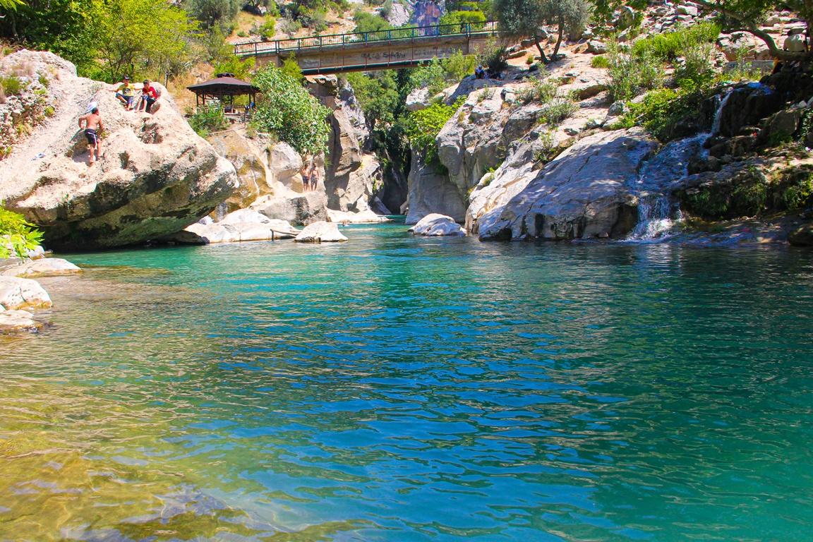
Dokuzoluk Canyon (Source: Karaisalı Municipality)
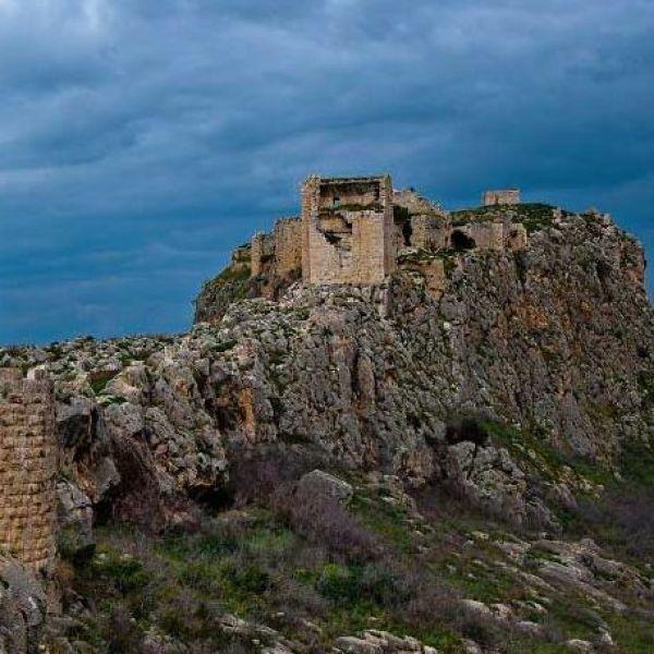
Milvan Castle (Source: Türkiye Tourism Guide)
The Karaisalı Municipality is implementing various projects to enhance the district’s tourism potential. Through nature walks, festivals, and cultural events, the district is progressing toward becoming one of Adana’s prominent tourism centers.
As of 2022, the population of Karaisalı is 22,042. The majority of the population resides in rural areas.
Karaisalı is a first-level district under Adana Province. It completed its administrative organization in 1923 after the proclamation of the Republic as one of Adana’s central kazas. Today, Karaisalı consists of one municipality (Karaisalı Municipality) and 60 neighborhoods. Most neighborhoods have a rural settlement character and are spread across mountainous and highland areas. The district hosts the Kaymakamlık, Municipality Presidency, district police command, gendarmerie command, directorates of agriculture and forestry, population directorate, and other essential public institutions. The Kaymakamlık coordinates public services as the representative of the central government.
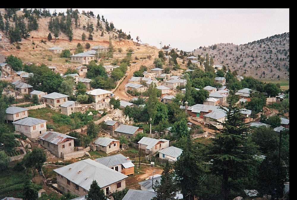
Kızıldağ Highland (Source: Culture Portal)
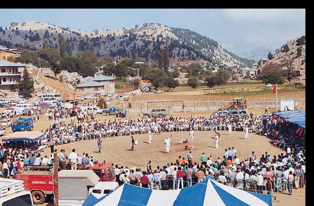
Annual Kızıldağ Karakucak Wrestling Festival held at Kızıldağ Highland (Source: Culture Portal)
Adana İl Kültür ve Turizm Müdürlüğü. *Karaisalı İlçesi Tanıtımı.* Accessed April 16, 2025.https://adana.ktb.gov.tr/TR-110869/karaisali.html
Culture Portal. "Adana Karaisalı Varda Köprüsü (Fotoğraf)." Accessed April 16, 2025.https://www.kulturportali.gov.tr/medya/fotograf/fotodokuman/6033/adana-karaisali-varda-koprusu
Karaisalı Belediyesi. "Milvan Kalesi Gezi Rehberi." Influence.cool. Accessed April 16, 2025.https://turkiye.influence.cool/tr/adana/karaisali/gezi-rehberi/milvan-kalesi/
Karaisalı Belediyesi. *Karaisalı Doğa ve Kültür Rotaları*. Accessed April 16, 2025.https://www.karaisali.bel.tr
Karaisalı Kaymakamlığı Governorship. Home Page. Accessed April 16, 2025.http://www.karaisali.gov.tr
Karaisalı Kaymakamlığı. *Karaisalı’nın Coğrafi ve Tarihi Yapısı*. Accessed April 16, 2025.https://www.karaisali.gov.tr
Kültür Portalı. "Karaisalı Kızıldağ Yaylası." Accessed April 16, 2025.https://www.kulturportali.gov.tr/turkiye/adana/gezilecekyer/karaisali-kizildag-yaylasi
Ministry of Culture and Tourism. *Turkey Culture Portal:Varda Köprüsü andKapıkaya Kanyonu. Accessed April 16, 2025.https://www.kulturportali.gov.tr
Ministry of Transport and Infrastructure of the Republic of Turkey. *Tarihi Demiryolu Yapıları*. Accessed April 16, 2025.https://www.uab.gov.tr
Sabah Gazetesi. “Maki Bitki Örtüsü Nedir, Nerede Görülür?” Accessed April 16, 2025.https://www.sabah.com.tr/egitim/maki-bitki-ortusu-nedir-nerede-hangi-bolgede-gorulur-maki-bitki-ortusu-ozellikleri-ve-agaclari-hakkinda-bilgiler-e1-5215659
Turkish Statistical Institute (TÜİK). *Adrese Dayalı Nüfus Kayıt Sistemi Sonuçları, 2022*. Accessed April 16, 2025.https://data.tuik.gov.tr

Viaduct
Province | Adana | ||||||||
|---|---|---|---|---|---|---|---|---|---|
District Governor | Muhammed Ali Çelik | ||||||||
Population 2022 | 22.042 | ||||||||
Places to Visit | Dokuzoluk Kanyonu Yerköprü Mesire Alanı Varda(Alman) Köprüsü Kapıkaya Kanyonu | ||||||||
No Discussion Added Yet
Start discussion for "Karaisalı (District)" article
History
Geographical Structure
Climate and Vegetation
Social Structure
Economic Structure
Tourism Potential
Demographic Structure
Administrative Structure
Additional Information