


This article was automatically translated from the original Turkish version.
+1 More
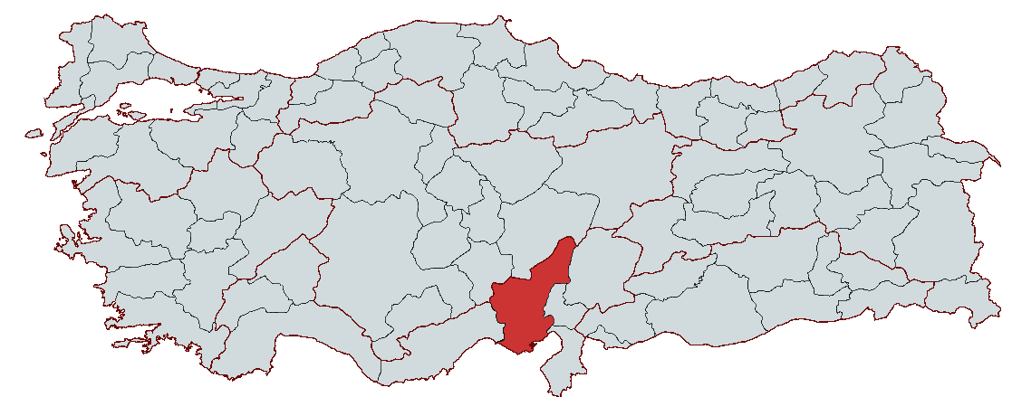
Adana
Country | Türkiye | ||||||||
|---|---|---|---|---|---|---|---|---|---|
Region | Mediterranean Region | ||||||||
Population | 2,280,484 | ||||||||
Area | 13,844 km² | ||||||||
Climate | Mediterranean climate | ||||||||
Important Structure | Taşköprü Varda Bridge Büyük Saat Kulesi | ||||||||
Area Code(s) | 322 | ||||||||
License Plate Code | 01 | ||||||||
Governor | Yavuz Selim Köşger | ||||||||
Metropolitan Municipality Mayor | Zeydan Karalar | ||||||||
Located on the fertile soils of Çukurova in the Mediterranean Region, Adana has borne the traces of numerous civilizations throughout history, including the Hittites, Assyrians, Persians, Romans, Byzantines, and Ottomans. Fed by the Seyhan and Ceyhan rivers, the region has become an important trade center due to its agricultural production, industry, and strategic location. The city, experiencing hot summers and mild winters under the influence of the Mediterranean climate, attracts attention with its rich cuisine, historical structures, and natural beauty. Today, Adana continues to be one of Türkiye’s important cities, characterized by its advanced transportation network, industrial zones, and cultural richness.

Adana (Source: Pexels/Kaan Durmuş)
Adana has a deep-rooted history extending back to 3000 BCE. Believed to have been established along the Seyhan River and recognized as one of the earliest human settlements, Adana was one of the most important cities of Ancient Cilicia. Throughout its historical development, the region served as a cradle for many civilizations and hosted numerous different peoples and states.
The earliest written record of Adana is found in the Hittite Kava Tablets, where the region is referred to as “Uru Adania” (Town of Adana). This indicates that the name Adana has a history of approximately 3,640 years. Additionally, the Tepebağ Höyüğü, dated to around 6000 BCE, reveals significant archaeological evidence of early Neolithic settlement in the region.
Around 1900 BCE, Adana came under the rule of the Luwian Kingdom, followed by the Arzawa Kingdom (1500–1333 BCE). During the Hittite Kingdom’s dominance between 1900 and 1200 BCE, the region became part of the Hittite Federation. In the 9th century BCE, the Assyrians seized control, followed by the Iranians in the 7th century BCE. In 333 BCE, Adana came under Macedonian rule when Alexander the Great’s army passed through the region, which served as a backdrop to the Battle of Issus. After Alexander’s death, the region became part of the Seleucid Kingdom.
With the rise of the Roman Empire, Adana came under Roman control in the 1st century BCE and became one of Rome’s most important trade centers. During the Byzantine period (4th century CE), the region gained strategic importance due to its favorable geographic position.
During the Middle Ages, Adana successively came under the control of the Arabs (Umayyads and Abbasids), Byzantines, and Seljuks. After the Umayyads conquered the region in 638 CE, Adana became an important center of Islamic culture. During the Seljuk period (1083–1097), numerous Turk tribes settled in the region, and it began to bear the marks of Turkic-Islamic culture. During the Crusades, Adana briefly came under the rule of the Armenian Kingdom. In the 14th century, under Mamluk administration, Adana became home to many Turkmen tribes.
Adana served as the capital of the Ramazanoğlu Beylik, established in 1352. After the Ottoman Empire conquered the beylik in 1517, Adana was incorporated into Ottoman territory. During the 16th and 17th centuries, the region became one of the Ottoman Empire’s key military and trade centers. During Yavuz Sultan Selim’s campaign to Egypt, Adana became a major strategic base. Extensive construction activities took place in the Adana region until the mid-19th century, resulting in the building of important structures.
After World War I, Adana was occupied by the French on 24 December 1918. The people of Adana mounted a strong resistance against the French occupation, organizing as the “Cilician National Forces Organization.” Victories against the French in 1920 strengthened the Turkish resistance in the region. Through the Ankara Agreement of 1921, the French fully withdrew from Adana, and on 5 January 1922, Adana was reintegrated into Turkish territory. This date is celebrated annually as Adana’s Liberation Day.
Adana is located in southern Türkiye, within the Çukurova region of the Mediterranean Region. The city is situated on the southern slopes of the Taurus Mountains and along the Seyhan River. Adana lies approximately 160 kilometers from the Mediterranean Sea and is one of the major land and rail transport corridors connecting Europe and Asia. The province’s territory presents diverse geographical features, including both mountainous and plain areas.
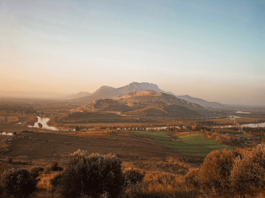
Adana (Source: Pexels/Mehmet Turgut Kırkgöz)
Adana lies within the Çukurova Delta in southern Türkiye and borders Osmaniye, Hatay, and Kahramanmaraş to the east. To the west it borders Mersin, and to the northeast it shares land borders with Kayseri and Niğde. The southern boundary of Adana is formed by the Mediterranean Sea. The city, situated on both banks of the Seyhan River, lies between 35° and 38° north latitudes and 34° and 36° east longitudes.
Adana’s topography is a combination of mountainous and plain areas. The Taurus Mountains rise in the north, northeast, and east of the province, and the fertile foothills of these mountain ranges form the plains. The city consists of 49% mountainous terrain, 23% highland pastures, and 27% plains and flatlands. The Taurus Mountains are characterized by peaks exceeding 2,500 meters that descend toward the Mediterranean. The Gülek Pass is a significant geographical corridor enabling passage from south to north through the Taurus range. The Seyhan and Ceyhan rivers originate in Inner Anatolia, flow through these mountains, and reach the Mediterranean.
Adana is fed by the Seyhan and Ceyhan rivers. The Seyhan River, originating in the Taurus Mountains, is one of the region’s most important water sources. The Ceyhan River is the region’s second major river. These two rivers have also given rise to several reservoir lakes. Important dams such as the Seyhan Dam, Çatalan Dam, and Kozan Dam serve critical purposes for irrigation and energy production. Additionally, the Yedi Göller in the Taurus Mountains form natural beauties as glacial lakes.
Adana is under the influence of the Mediterranean climate. Summers are hot and dry, while winters are mild and rainy. The average annual rainfall is 625 mm, with the highest precipitation occurring during the winter months. During the summer months, particularly July and August, temperatures reach 28°C, while the coldest month, January, has an average temperature of around 9°C. The city’s average relative humidity is 66%, rising to as high as 90% during summer. Climatic conditions vary between the northern and southern parts of the province due to the influence of the high mountains and the Taurus range.
Adana’s vegetation is shaped by the Mediterranean climate. Lowland areas are dominated by maquis communities. Between 700 and 800 meters, plants such as myrtle, sandalwood, pine, and zakkum are common, while above 800 meters, deciduous oaks and coniferous pine species predominate. In the Taurus Mountains, above 2,000 meters, alpine meadows and alpine vegetation are found. In the southern part of Çukurova, natural vegetation has been largely destroyed due to intensive agricultural activity.
Adana’s geological structure is marked by contrasts between mountainous and plain areas. The Taurus Mountains are generally young mountains formed during the second half of the Tertiary geological period. Regions such as the Aladağlar and Bolkar Mountains consist of limestone deposits from the late Carboniferous to early Permian. These mountains were shaped by numerous earthquakes and volcanic activity similar to the Alpine chain. The plains are composed of alluvial materials and host major agricultural areas such as Çukurova and Yukarıova.
Adana, located in the Çukurova region, is one of Türkiye’s most important agricultural and industrial centers. The agricultural sector plays a major role in the province’s economy, contributing significantly to the production of soybeans, peanuts, citrus, watermelon, cotton, and maize. Adana accounts for 69% of Türkiye’s soybean production, 41% of its peanut production, and 18% of its watermelon production. It also contributes 28% to the country’s citrus production.
Adana’s total agricultural land area is 539,000 hectares, with 40% under irrigation. Due to favorable irrigation opportunities and climatic conditions, agricultural output continues to grow. Between 2005 and 2011, vegetable production increased by 27.8% and fruit production by 10.2%.
Industry also holds a significant place in Adana’s economy. The Hacı Sabancı Organized Industrial Zone, which generates annual exports of $750 million, serves as the engine of the provincial economy. Between 2012 and 2013, Adana attracted 23% of Turkey’s energy investments.
With its strong agricultural sector and industrial investments, Adana possesses significant economic growth potential. This structure ensures Adana’s strong position both in the domestic market and in international trade.
Çukurova International Airport, which also facilitates cargo transportation, is expected to boost the region’s exports. Road transport is the most important mode of transportation in Adana; the total road network spans 5,597 kilometers and is critical for the distribution of agricultural products. The railway network is 183 kilometers long. Adana also has important seaports; the ports of Yumurtalık, Ceyhan, and Karataş are open to international shipping. The TAYSEB Port stands out for its capacity to serve large vessels. These transportation networks play a vital role in enhancing Adana’s foreign trade capabilities.
Adana is Türkiye’s seventh most populous province, with a population of 2,149,260. Its population density of 154 people per square kilometer exceeds the national average, and its urbanization rate has reached 88.76%. The city’s young population represents a significant potential for economic and social development, with an annual population growth rate of approximately 1.1%. However, its net migration rate of -5.7‰ indicates that Adana has been experiencing outward migration in recent years.
Adana’s population growth has slowed compared to previous decades. Between 2012 and 2013, the city received 50,598 migrants but lost 62,933 residents. While Adana was once among Türkiye’s top cities for population inflow, this situation has changed in recent years. The separation of Osmaniye in 1996 and economic factors have reduced migration activity in the city. Today, Adana experiences outward migration primarily due to unemployment and decline in the industrial sector.
In the ranking of Türkiye’s most populous provinces, Adana is currently seventh. This ranking reflects a significant change compared to the 1990s, when Adana ranked fourth. Since the 2000s, declining population inflow and contraction in the industrial sector have caused its position to fall. Adana’s demographic structure has paralleled the decline in its industrial and agricultural sectors, leading to increased unemployment and prompting its young population to seek employment in other provinces.
These demographic changes in Adana have been shaped by transformations in labor, industry, and agriculture, resulting in a slowdown in population growth.
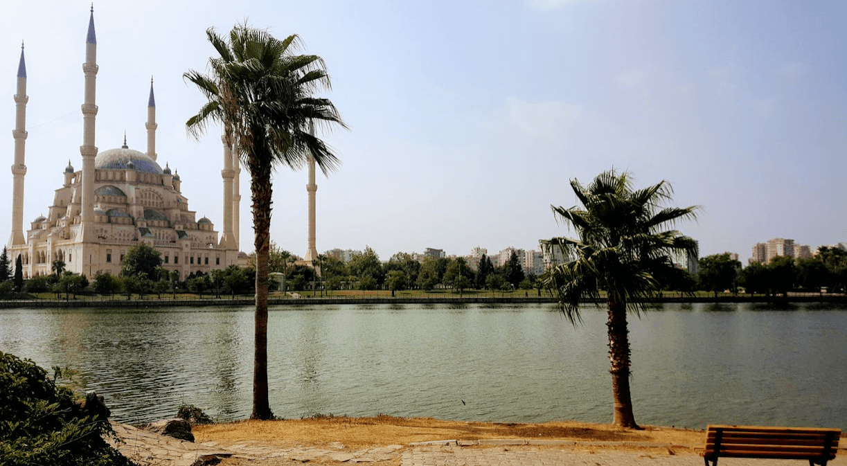
Seyhan River and Sabancı Mosque (Source: Pexels/Mernuka)
Adana Valiliği. "Vali Yavuz Selim Köşger." Accessed February 13, 2025.http://adana.gov.tr/vali-yavuz-selim-kosger.
Adana Çevre ve Şehircilik İl Müdürlüğü. "İlimizi Tanıyalım." Accessed February 13, 2025.https://adana.csb.gov.tr/ilimizi-taniyalim-i-1222.
Adana İl Kültür ve Turizm Müdürlüğü. "Diğer Tarihi Yerler." Accessed February 13, 2025.https://adana.ktb.gov.tr/TR-60729/diger-tarihi-yerler.html.
Adana İl Kültür ve Turizm Müdürlüğü. "Genel Bilgiler." Accessed February 13, 2025.https://adana.ktb.gov.tr/tr-60704/genel-bilgiler.html.
Culture Portal. "Adana Genel Information." Accessed February 13, 2025.https://www.kulturportali.gov.tr/turkiye/adana/genelbilgiler.
Devlet Hava Meydanları İşletmesi (DHMI). "Adana Şehir Tarihçesi." Accessed February 13, 2025.https://www.dhmi.gov.tr/sayfalar/havalimani/adana/SehirTarihcesi.aspx.
Independent Türkçe. "30 Yıllık Demografik Değişimin Kodları: Bir Dönem En Kalabalık Dördüncü Şehir Olan..." Accessed February 13, 2025.https://www.indyturk.com/node/532616/ya%C5%9Fam/30-y%C4%B1ll%C4%B1k-demografik-de%C4%9Fi%C5%9Fimin-kodlar%C4%B1-bir-d%C3%B6nem-en-kalabal%C4%B1k-d%C3%B6rd%C3%BCnc%C3%BC-%C5%9Fehir-olan.
Ministry of Agriculture and Forestry. "Adana Şehir Rehberi." Accessed February 13, 2025.https://egitim.tarimorman.gov.tr/adana/belgeler/belgeler/adana%20sehir%20rehberi.pdf.
Çukurova Kalkınma Ajansı. "Bir Bakışta Adana." Accessed February 13, 2025.https://www.cka.org.tr/dosyalar/bir_bakista_adana.pdf.

Adana
Country | Türkiye | ||||||||
|---|---|---|---|---|---|---|---|---|---|
Region | Mediterranean Region | ||||||||
Population | 2,280,484 | ||||||||
Area | 13,844 km² | ||||||||
Climate | Mediterranean climate | ||||||||
Important Structure | Taşköprü Varda Bridge Büyük Saat Kulesi | ||||||||
Area Code(s) | 322 | ||||||||
License Plate Code | 01 | ||||||||
Governor | Yavuz Selim Köşger | ||||||||
Metropolitan Municipality Mayor | Zeydan Karalar | ||||||||
History
Ancient Times and Antiquity
Middle Ages
Ottoman Period
Modern Era and War of Independence
Geographical Structure
Geographical Location and Boundaries
Topography
Rivers and Lakes
Climate
Vegetation
Geological Structure
Economic Structure
Infrastructure
Demographic Structure
Historical Sites and Tourism
Administration
Governor