


This article was automatically translated from the original Turkish version.
+1 More
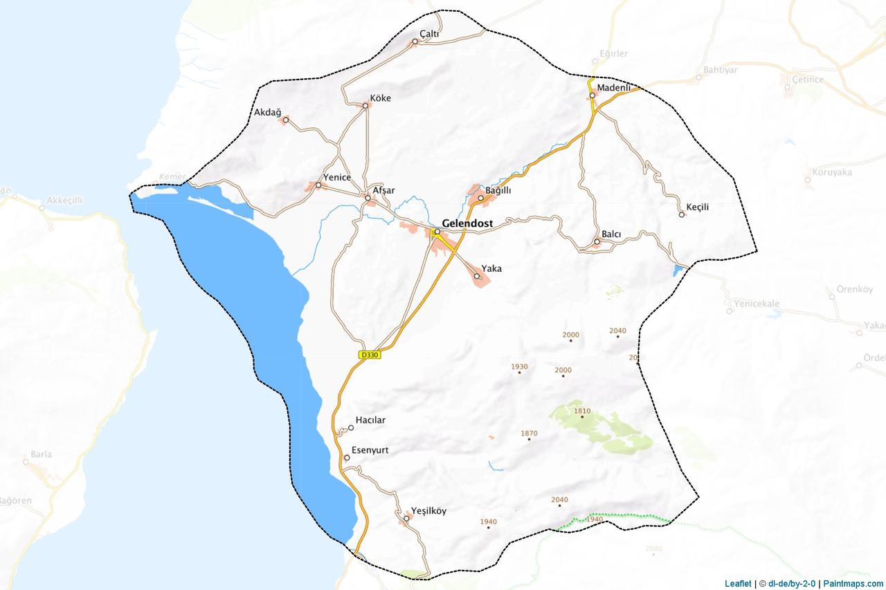
Gelendost (district)
Province | Isparta | ||||||||
|---|---|---|---|---|---|---|---|---|---|
Geographic Region | Mediterranean Region | ||||||||
Surface Area | 624 km² | ||||||||
Elevation | 940 metres | ||||||||
Population | 14.235 (2024) | ||||||||
License Plate Code | 32 | ||||||||
Telephone Code | 0246 | ||||||||
District Governor | Mehmet Arsoy | ||||||||
Mayor | Hakan Yılmaz (Acting) | ||||||||
Historical Structures | Ertokuş Han Abdulgaffar Mosque Afşar Mosque Avşar Bridge | ||||||||
Gelendost is a district of Isparta province in Türkiye’s Mediterranean Region, located on the eastern shore of Eğirdir Gölü along the Isparta–Konya highway. It covers an area of 624 km² and has an average elevation of approximately 940 meters above sea level. The district experiences a transitional climate between the Mediterranean and Inner Anadolu continental climates; summers are hot and dry while winters are cold and snowy. Due to its proximity to Eğirdir Gölü, the lakeside areas have milder climatic conditions. Thanks to its fertile soils and transportation access, the region has sustained significant economic and cultural development.
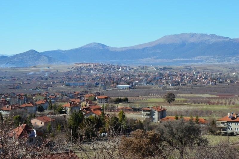
Gelendost settlement center (T.C. Gelendost Kaymakamlığı)
The settlement history of Gelendost extends back to the 35th century BCE. The region was founded by the Anamurla (Anaminli) Miryalı, a branch of the Hittites, under the names “Mirya” or “Miryo.” This earliest settlement functioned as an independent city-state under the Hittite Empire. It was governed by local deities known as “Paçeşi,” regarded as the son of the sun. In 547 BCE, the region came under Persian control after their conquest of the Pisidians. Following Persian victories in 533 BCE, the administrative center shifted to Akamaia (Akmescit) on the lakeshore. During the Hellenistic period, the city experienced renewed development after Alexander the Great defeated the Persians. It lost significance during the Byzantine era but briefly came under Arab rule in the 8th century CE before returning to Byzantine control.
Gelendost was weakened by Turkish raids between 1112 and 1116 and was conquered in 1116 by Emir Madanoğlu Nurettin on behalf of Anatolian Seljuk Sultan I. Mesut. During this period, the settlement began to be known as “Gelende” or “Gelindi,” and numerous Turkmen tribes were settled in the area. The Arab traveler Ibn Bibi, in his Muhtasar Selçuknâmesi, describes “Gelende” as a summer residence and recreational center of the Anatolian Seljuk Sultan. The Battle of Myriokephalon, fought on 17 September 1176 in the Gelendost Plain, marked a turning point in the Byzantine–Seljuk conflict and secured permanent Seljuk control over the region. In 1301, Gelendost was incorporated into the territory of the Hamitoğulları Beylik centered in Eğirdir. After a brief period of Ilkhanid administration, it returned to Hamitoğulları rule and came under Ottoman control in 1390. Although there was a temporary interruption after the Battle of Ankara, Ottoman authority was reestablished by 1415 and the district was attached to the Konya Vilayet.
During the Ottoman period, the settlement known as “Gelende” was part of the Afşar nahiye in the 16th century. Over time, this village developed into the administrative center of the nahiye. In the Republican era, Gelendost replaced Afşar as a nahiye in 1930 and gained district status by Law No. 6324 dated 6 March 1954. Throughout history, Gelendost has been referred to in medieval sources as “Miryokatolof” and by various other names including “Ablada,” “Sabinae,” “Myro,” “Miryona,” “Glende-Abad,” and “Gelendoz.” The current name dates back to the reign of Fatih Sultan Mehmet.
The district is located approximately 81–82 kilometers northeast of the provincial center, within the geographical region known as the Lake District, on the eastern shore of Eğirdir Gölü. With a surface area of 624 square kilometers, Gelendost has an average elevation of 940 meters above sea level. To its east lie Şarkikaraağaç and Yalvaç districts, to the north Yalvaç, to the south Eğirdir, and to the west Eğirdir Gölü. The district has a shoreline of approximately 27 kilometers along the lake. Due to its position on the Isparta–Konya highway, Gelendost holds significant regional transportation importance. Its infrastructure has been developed to meet modern service standards. The district center has adequate water, electricity, sewage, and road infrastructure. Village connections are maintained via asphalt roads, and transportation to the provincial centers of Eğirdir and Isparta is conducted by road.
Gelendost lies within a transitional climate zone between the Mediterranean and Inner Anatolian continental climates. Summers are hot and dry, while winters are cold and snowy. Near yakın the shores of Eğirdir Gölü, the lake’s moderating influence makes conditions somewhat milder. As a result, agricultural areas near the lakeshore benefit from favorable climatic conditions that enhance production efficiency. The dominant climate has led to diverse vegetation patterns. Lower elevations feature oak woodlands and pınar shrublands, while higher elevations are largely barren and exhibit steppe characteristics. Forest cover is very limited. Most agricultural crops require irrigation due to summer droughts.
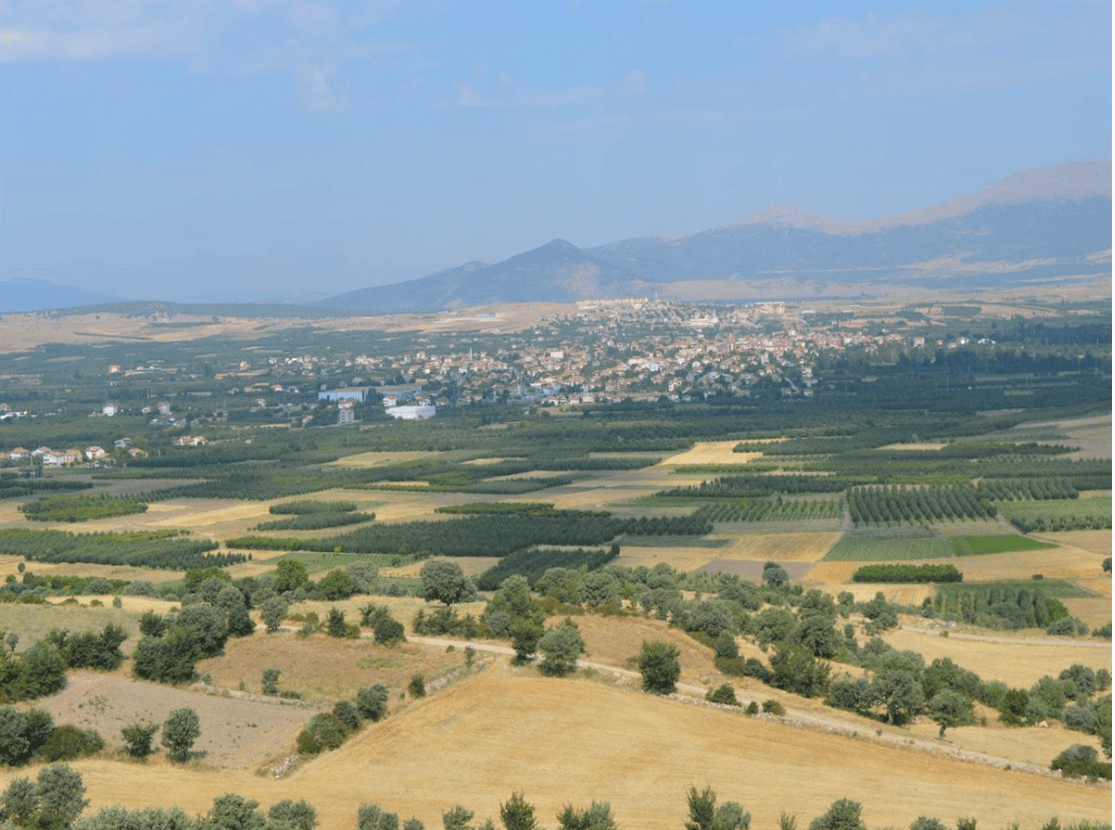
Gelendost (T.C. Gelendost Kaymakamlığı)
According to 2024 data from the Turkish Statistical Institute (TÜİK), the total population of Gelendost district is 14,235. Of this, 7,049 are male (49.52%) and 7,186 are female (50.48%). The gender distribution is balanced, with the female population slightly exceeding the male population.
In terms of settlement units, a significant portion of Gelendost’s population resides in rural areas. Major villages with high population density, besides the district center, include Afşar, Yaka, Bağıllı, Madenli, Yeşilköy, and Balcı. For example, according to 2016 data, the population of Yaka village was 1,798 and that of Bağıllı village was 1,519.
The demographic structure has been shaped by long-standing migration dynamics. Traditional agricultural and livestock-based production methods remain prevalent in Gelendost; however, a portion of the youth population migrates to large cities due to educational and employment opportunities. This trend has led to an increase in the average age, particularly in rural areas, and a general aging of the population. Nevertheless, traditional family structures, social solidarity, and local cultural değerler are largely preserved.
The economy of Gelendost district is largely based on agriculture. Its geographical location, soil structure, and climatic conditions have favored the development of fruit cultivation. The most widespread and economically valuable agricultural product in the district is apple. The microclimatic conditions around Eğirdir Gölü support balanced growth of apple trees, resulting in apples that are juicy, sweet, and have a long shelf life. Gelendost apples are among the highest quality products in Türkiye.
Apple production is carried out both at the individual and commercial levels. To preserve and market the harvest, a total of 38 cold storage facilities have been established in the district. These facilities have a combined storage capacity of 158,111 tons and play a strategic role in the regional economy. In addition to supplying the domestic market, apples are exported in certain years. Furthermore, the processing of apples into by-products such as apple juice, jam, and vinegar has enabled the development of small-scale agro-based industry in Gelendost.
Apart from agriculture, livestock farming is another significant economic activity in the district. Small ruminant farming, particularly sheep and goat breeding, remains an important source of livelihood in rural areas. Meat and dairy products are produced for both household consumption and local markets. Livestock farming is supported by natural pasturelands in areas where the vegetation exhibits steppe characteristics.
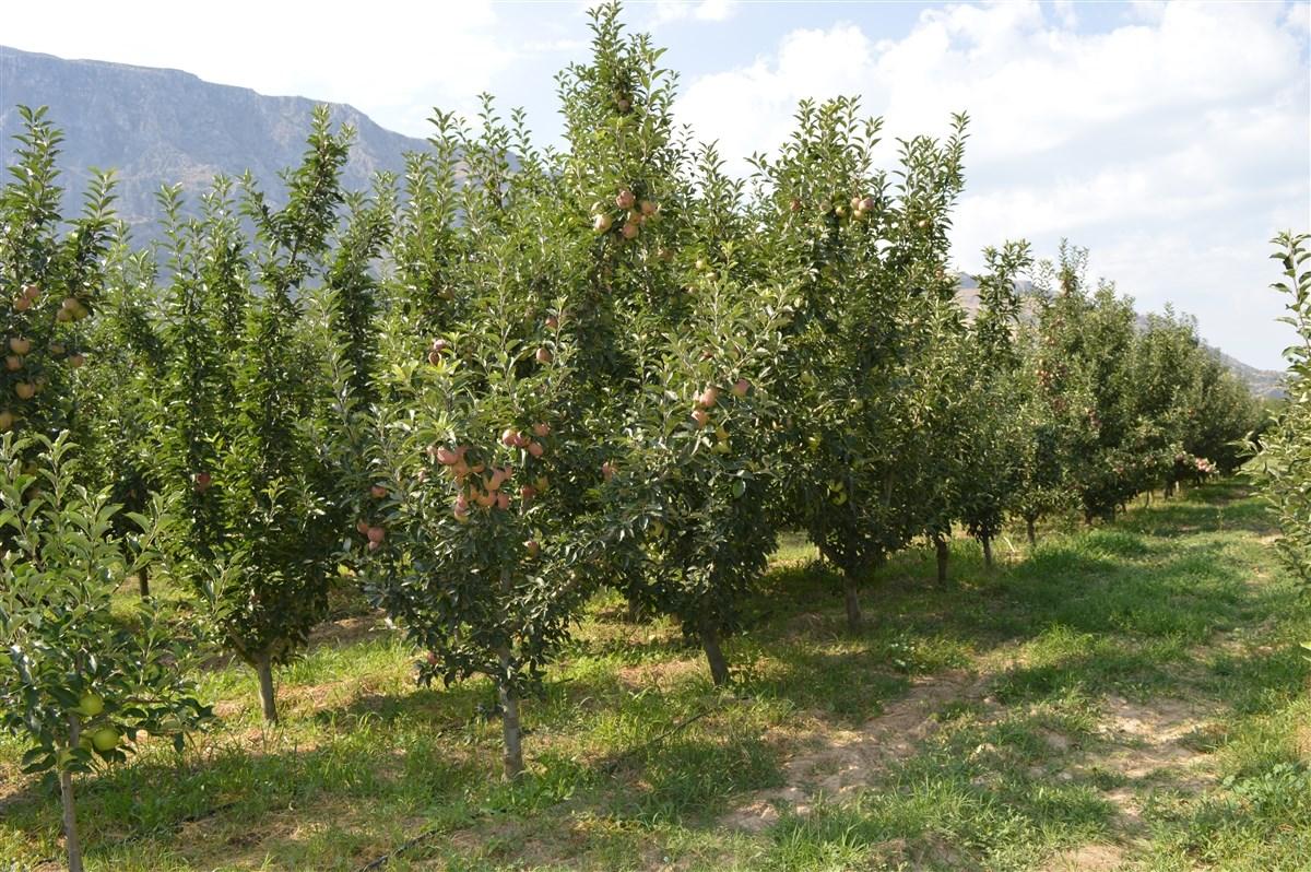
Gelendost Apple Orchards (T.C. Gelendost Kaymakamlığı)
In addition, small-scale agro-based industries and service sector activities operate in the district. These enterprises typically provide supporting functions such as processing, storing, and marketing agricultural products. In recent years, the widespread adoption of modern irrigation systems and increased availability of technical advisory services have positively impacted productivity. Overall, Gelendost’s economy presents an agriculture-centered structure, with apple production and related industrial activities playing a defining role in the district’s economic identity.
Gelendost is one of the districts of Isparta province with significant tourism potential due to its historical heritage and natural beauty. Its location on the eastern shore of Eğirdir Gölü provides a major natural landscape advantage. Recreational areas along the lake are popular among day-trippers during summer months, and lakeside rural areas attract interest for agricultural tourism and rural lifestyle experiences.
One of the most prominent historical structures in the district is the Ertokuş Han, built in 1223 by the Seljuk Atabek Mubarazeddin Ertokuş. This structure exhibits characteristic features of Seljuk caravanserai architecture and is a typical “karma tip” caravanserai with both open and enclosed sections. Historically, the han served a strategic function as a lodging and security point along trade routes; today, it is one of the focal points of cultural tourism due to its historical and architectural value.
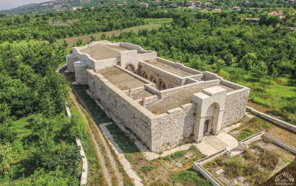
Gelendost Ertokuş Hanı (Türkiye Kültür Portalı)
Another significant historical structure along the route connected to Ertokuş Han is the Avşar Bridge. This two-arched, pointed-arch bridge was constructed using unadorned rubble stones. Its architecture and location make it one of the original structures along Seljuk-era caravan routes. The bridge is part of the historic caravan road leading toward Afşar Village and holds importance both in terms of transportation history and architecture.
Another important historical structure in Gelendost is the Abdulgaffar Mosque, built in 1878. Constructed from rubble stone, this mosque is an example of late Ottoman mosque architecture, featuring wooden craftsmanship, calligraphic decorations, and a central dome supported by baldachin-style columns. Another notable historical structure is the Afşar Mosque, dated to the 14th or 15th century, which stands out for its traditional wooden ceiling decorations and use of rubble masonry.
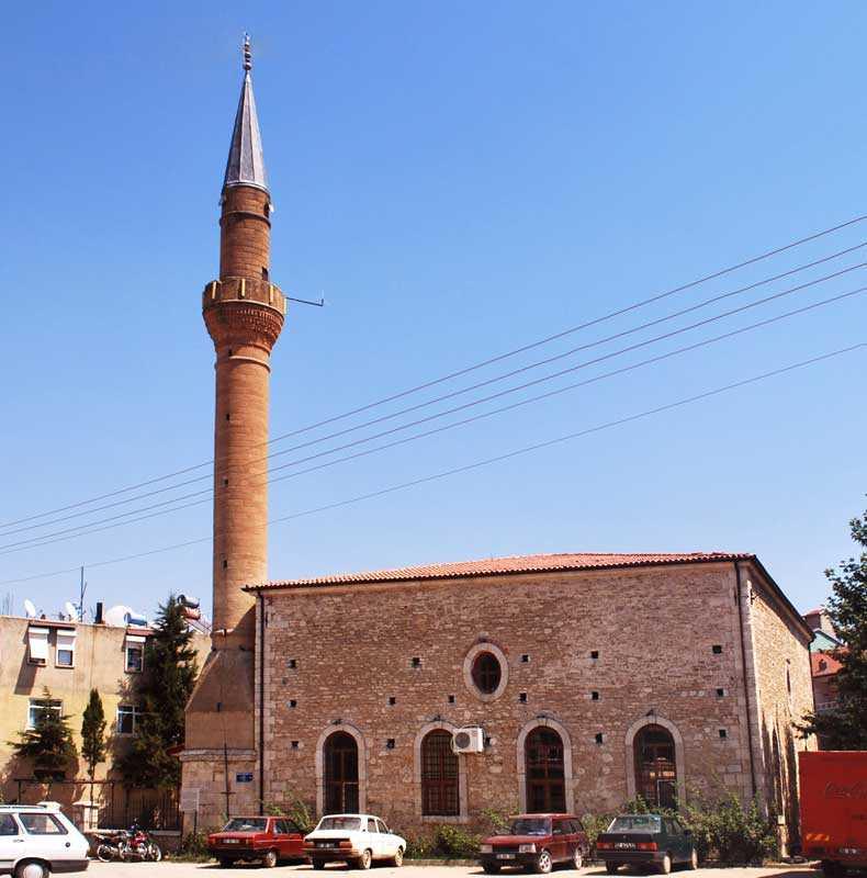
Abdulgaffar Mosque (Türkiye Kültür Portalı)
Annually on 17 September, the Miryakefalon and Apple Festival is held in Gelendost, serving as a major cultural event that unites the district’s historical and economic identity. The festival commemorates the anniversary of the 1176 Battle of Myriokephalon and provides a social gathering platform where apple producers showcase their products alongside concerts, exhibitions, and competitions. The festival also offers regional cuisine and handicrafts to visitors; notably, kaymaklı baklava produced in Afşar Village is a standout culinary attraction for gastronomy tourism.
Akyüz, Fatma. “Tarihi Süreçte Gelendost’un Sosyoekonomik Yapısı.” Ahi Evran Üniversitesi Sosyal Bilimler Enstitüsü Dergisi 6, no. 2 (2020): 274–296.https://dergipark.org.tr/tr/pub/aeusbed/article/712454
T.C. Gelendost Kaymakamlığı. "Gelendost Elması." Accessed April 15, 2025.http://www.gelendost.gov.tr/gelendost-elmasi
T.C. Isparta Belediyesi. “Gelendost.” Isparta Belediyesi. Accessed April 15, 2025.https://www.isparta.bel.tr/gelendost
T.C. Isparta Valiliği. "Gelendost." Isparta Valiliği. Accessed April 15, 2025.http://www.isparta.gov.tr/gelendost
T.C. Ministry of Culture and Tourism. "Abdulgaffar Camii." Türkiye Kültür Portalı. Accessed April 15, 2025.https://www.kulturportali.gov.tr/turkiye/isparta/kulturenvanteri/abdulgaffar-camii
T.C. Ministry of Culture and Tourism. "Gelendost Ertokuş Kervansarayı (Kudret Han)." Türkiye Kültür Portalı. Accessed April 15, 2025.https://www.kulturportali.gov.tr/turkiye/isparta/gezilecekyer/gelendost-ertokus-kervansarayi-kudret-han?ysclid=m9o1vzqgb9658533009
T.C.Gelendost Kaymakamlığı Governorship. "Foto Galeri." Accessed April 15, 2025.http://www.gelendost.gov.tr/foto-galeri
T.C.Gelendost Kaymakamlığı Governorship. "Genel Bilgiler." Accessed April 15, 2025.http://gelendost.gov.tr/genel-bilgiler
T.C.Isparta İl Directorate of Culture and Tourism. "Gelendost." T.C. Kültür veTurizm Bakanlığı Resmî Sitesi. Accessed April 15, 2025.https://isparta.ktb.gov.tr/TR-165534/gelendost.html
Türkiye İstatistik Kurumu. "Isparta." TÜİK. Accessed April 15, 2025.

Gelendost (district)
Province | Isparta | ||||||||
|---|---|---|---|---|---|---|---|---|---|
Geographic Region | Mediterranean Region | ||||||||
Surface Area | 624 km² | ||||||||
Elevation | 940 metres | ||||||||
Population | 14.235 (2024) | ||||||||
License Plate Code | 32 | ||||||||
Telephone Code | 0246 | ||||||||
District Governor | Mehmet Arsoy | ||||||||
Mayor | Hakan Yılmaz (Acting) | ||||||||
Historical Structures | Ertokuş Han Abdulgaffar Mosque Afşar Mosque Avşar Bridge | ||||||||
No Discussion Added Yet
Start discussion for "Gelendost (District)" article
History
Geographical Structure
Location and Boundaries
Climate and Vegetation
Demographic Structure
Economic Structure
Tourism and Culture
Miryakefalon and Apple Festival