This article was automatically translated from the original Turkish version.
+2 More
Erbaa
COUNTRY | Türkiye | ||||||||
|---|---|---|---|---|---|---|---|---|---|
Province | Tokat | ||||||||
License Plate Code | 60 | ||||||||
Area Code | 0356 | ||||||||
District Governor | Dr. İsmail Altan DEMİRAYAK | ||||||||
Mayor | Ertuğrul Karagöl | ||||||||
CLIMATE | Black Sea - Continental Transition Climate | ||||||||
Important Structures and Natural Areas | Horoztepe Ancient City Boğazkesen (Kale) Bridge Silahtar Ömer Paşa Camii | ||||||||
Population (Count) | 93555 | ||||||||
Elevation | 248 | ||||||||
Area | 1037 | ||||||||
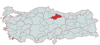
Tokat’s one of its largest and most developed districts, Erbaa, is situated in a fertile plain where the Kelkit and Tozanlı streams converge to form the Yeşilırmak River, in the Central Black Sea Region. Due to its agricultural land, strategic location, and its role throughout history as a home to numerous civilizations, Erbaa has been an important cultural and economic center.
Erbaa’s history extends back to the Chalcolithic Age (5000–3000 BCE). Excavations in the region have shown that it has been an important settlement since the Hittite period. Throughout history, the region has been ruled successively by the Hittites, Phrygians, Persians, the Kingdom of Pontus, the Romans, the Byzantines, the Danişmendids, the Anatolian Seljuks, the Ilkhanids, and the Ottomans.
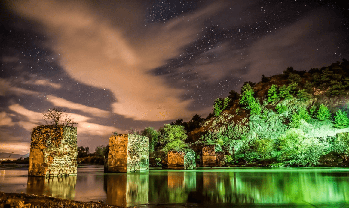
Erbaa Kale Köprüsü - Orta Karadeniz Kalkınma Ajansı
Although the Byzantines briefly regained control of the region in the 11th century, it was once again incorporated into the Anatolian Seljuk State during the reign of II. Kılıçarslan.
Due to its location on the North Anatolian Fault Line, Erbaa has been affected by numerous major earthquakes throughout history.
After these earthquakes, construction and urban planning in Erbaa were made more resilient, accelerating the process of modernization.
Erbaa lies within the Yeşilırmak Basin, bordered by the Canik Mountains to the north and the Sakarat and Boğalı Mountains to the south. The district covers an area of 1,177 km² and is located 85 km from the city of Tokat.
Its climate exhibits transitional characteristics between the Black Sea and Central Anatolian climates:
Erbaa is notable for its geographically protected agricultural and gastronomic products:
Erbaa offers visitors a variety of cultural and historical experiences:
Erbaa lies along major routes connecting the Black Sea region with Central Anatolia:
Throughout history, Erbaa has served as a home to multiple civilizations. Despite being destroyed by earthquakes, it has been rebuilt each time and continued to develop. Today, it remains one of Tokat’s most important districts through its strong agricultural sector, growing industry, and cultural richness.
Erbaa Belediyesi. *Official Website.* Accessed March 26, 2025.https://erbaa.bel.tr/Site/
Orta Karadeniz Kalkınma Ajansı. *Erbaa İlçe Raporu*. 2018. (https://oka.gov.tr/assets/upload/dosyalar/erbaa-ilce-raporu.pdf)
T.C. Kültür ve Turizm Bakanlığı. *Tokat İl Kültür ve Turizm Müdürlüğü – Genel Bilgiler.* Accessed March 26, 2025.https://tokat.ktb.gov.tr/tr-60574/genel-bilgiler.html.
Tokat Valiliği. *Resmi Web Sitesi.* Accessed February 17, 2025.https://www.tokat.gov.tr/.
Yılmaz, Y. (2020). *Antikçağ’dan Osmanlı Dönemi’ne Kadar Erbaa Şehrinin Yerleşme Tarihi.* Oltu Beşeri ve Sosyal Bilimler Fakültesi Dergisi, 1(1), 1–12. (https://dergipark.org.tr/en/download/article-file/1199654)

Erbaa
COUNTRY | Türkiye | ||||||||
|---|---|---|---|---|---|---|---|---|---|
Province | Tokat | ||||||||
License Plate Code | 60 | ||||||||
Area Code | 0356 | ||||||||
District Governor | Dr. İsmail Altan DEMİRAYAK | ||||||||
Mayor | Ertuğrul Karagöl | ||||||||
CLIMATE | Black Sea - Continental Transition Climate | ||||||||
Important Structures and Natural Areas | Horoztepe Ancient City Boğazkesen (Kale) Bridge Silahtar Ömer Paşa Camii | ||||||||
Population (Count) | 93555 | ||||||||
Elevation | 248 | ||||||||
Area | 1037 | ||||||||
History
Ancient Period (5000 BCE – 395 CE)
Byzantine Period and the Arrival of the Turks (395 – 1392)
Ottoman Period and the Formation of Erbaa as a District (1392 – 1923)
Significant Events
Earthquakes in Erbaa and the 1942 Great Earthquake
Economic Development and Industrialization
Geography and Climate
Geographically Protected Products
1. Erbaa Narince Grape
2. Erbaa Vine Leaves
3. Erbaa Pekmez
Culture and Historical Structures
Transportation