


This article was automatically translated from the original Turkish version.
+1 More
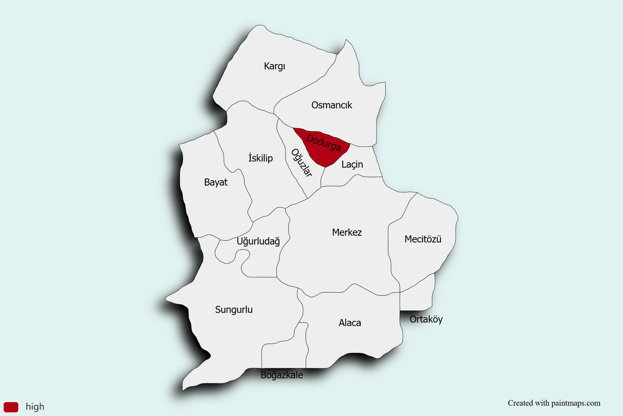
Dodurga (District)
Province | Çorum | ||||||||
|---|---|---|---|---|---|---|---|---|---|
Region | Black Sea | ||||||||
Elevation | 510 m | ||||||||
Population (2024) | 5.325 | ||||||||
Mayor | Mustafa Aydın | ||||||||
District Governor | Bilge Yıldırım | ||||||||
Postal Code | 19060 | ||||||||
Economy | Agriculture (Wheat Barley rice) Animal Husbandry Lignite Mining | ||||||||
Dodurga is a settlement located in the northwestern part of Çorum that gained district status in 1990. The main economic activities in the district are agriculture, animal husbandry, and lignite mining. Natural and historical sites include the Obruk Dam and Dodurga Canyon.
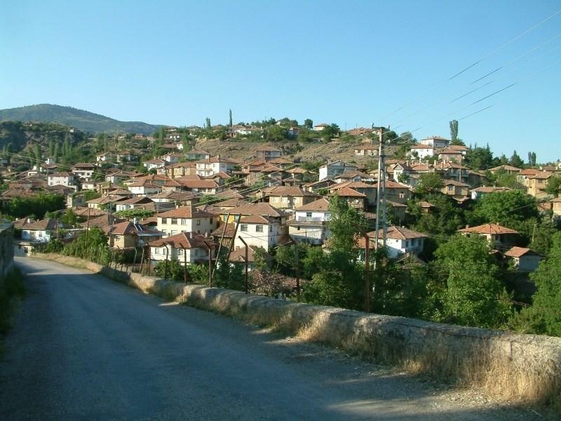
Dodurga (Dodurga Kaymakamlığı)
The name Dodurga derives from the Toturgalar, one of the 24 Oghuz tribes mentioned by Kaşgarlı Mahmud in his work Divânü Lûgâti’t-Türk. According to Yazıcıoğlu, the toponym Dodurga is associated with the meanings “to settle” and “to live,” and its emblem is symbolized by the Bozkır Eagle bird motif. Following the Turkish migrations after the Battle of Malazgirt in 1072, Danişment Ahmet Gazi captured Harşana Castle and handed the region over to Osman Bey of the Alayuntlu lineage; Osman Bey appointed his brother Ayhan Bey as the uch bey of Dodurga. In 1074, the village was rebuilt by Ahmet Bey of the Kızılkanatoğulları and the Kızılkanat Camii was constructed.
Dodurga, sharing the Seljuk heritage, came under the administration of Sencer, son of Sultan II. Kılıçarslan, after the latter’s succession. Following the Battle of Kösedağ in 1243, the region fell under Mongol rule and was placed under the governance of Hamik Bey within the vassal system subordinate to Keykavus. In the first half of the 20th century, earthquakes in 1910, 1935, 1942 and 1943 caused extensive damage to the settlement, and a large portion of the male population perished during the First World War. After active participation in the National Struggle, population and settlement patterns declined; however, the commencement of lignite mining operations in the region during the first two decades of the Republic facilitated recovery. Dodurga attained municipal status in 1963, was officially registered as a district on 9 May 1990, and formally began operations with its subdistrict units on 1 September 1991. Rain prayer ceremonies, the tradition of horse sacrifice, and words still in current use such as “caydak,” “sincap,” and “yüğürtmek” are examples of cultural continuity reflecting direct Central Asian influences.
Dodurga lies in the southeastern part of the Western Black Sea region of the Black Sea Region, between latitudes 40°20′ and 40°35′ N and longitudes 34°20′ and 34°30′ E. Located 42 km from the city center of Çorum, the district covers an area of 214 km² with an average elevation of 510 meters above sea level. It is surrounded by the districts of Osmancık to the north, İskilip to the west, and Laçin to the northeast, and is situated 20 km south of the Istanbul–Samsun highway.
Geotectonically, the area lies near the Pontide belt and within the North Anatolian Fault Zone. The district center is situated on a Miocene basin with a bowl-like shape, open to the east and surrounded by hills on the other three sides. It is bounded to the northwest by Bakacak (1,425 m), Budama (1,456 m), Çakırkıran (1,306 m), and Dikmen (1,115 m), and to the south by Dededağı (1,396 m). Plateau terrain between 500 and 1,100 meters constitutes 64.5% of the total area, base valleys account for 23.5%, and mountainous areas make up 12%. The main valleys include the Kızılırmak-based valley, 17 km long with a width varying between 750 m and 4 km, and the incised valleys formed by the Alpagut and Kuyucak streams flowing from the northwest to the east.
The climate exhibits transitional characteristics between the continental climate of Central Anatolia and the Middle Black Sea type. The average annual temperature is 13.3 °C, with the warmest months being July (24.4 °C) and August (25.0 °C), and the coldest months being January (1.5 °C) and February (3.6 °C). The average number of frost days is 15. Annual precipitation averages 373.2 mm, with spring rainfall accounting for 35.6%, summer rainfall for 18.5%, and August recording the lowest monthly rainfall at 11.6 mm. The dominant wind direction is from the northeast as Poyraz, followed by easterly and southeast winds; lodos, yıldız, and keșişleme winds occur less frequently.
Vegetation consists of forests in higher elevations and steppe formations in lower areas, composed of shrublands and low grasses. Hydrographically, the Kızılırmak is the largest river. The Alpagut and Kuyucak streams increase their water levels during winter and spring rains; however, the Alpagut Stream is less affected by summer drought due to its flow from lignite mine springs. Groundwater resources are limited, and the district center’s drinking water needs are met by water supplied from Hamamözü (Amasya). The predominant soil types are alluvial, colluvial, and brown forest soils.
The total population of Dodurga district was 8,292 as of 2007, declining to 5,325 by 2024. During this period, population increases of 50, 464, and 521 were recorded in 2016–2017, 2017–2018, and 2022–2023 respectively, while other years saw fluctuations in decline. According to 2024 data, the male population stands at 2,599 (48.81%) and the female population at 2,726 (51.19%), with gender differences generally remaining within a few hundred people. Annual population changes have followed a fluctuating trend attributable to various factors including local registration updates and migration patterns.
The economy of Dodurga is based on agriculture and mining. During the summer season, despite high temperatures and drought, crops such as rice, wheat, chickpea, green lentil, and onion reach maturity and constitute traditional cultivated areas. Topographical and climatic conditions have led to routine agricultural activity in the basin and valley areas where irrigation opportunities are limited. The lignite reserves brought into operation during the first two decades of the Republic transformed settlement dynamics by providing employment and contributing significantly to the regional economy.
Dodurga’s unique vegetation, undisturbed soil conditions, and proximity to Obruk Dam offer potential for ecotourism, agrotourism, rural tourism, hunting tourism, and health tourism. Visitors to the region can participate in activities along natural slopes and recreational areas around the dam as part of agro-ecological tours.
Cultural heritage elements such as Mehmetdede Camii, Mehmetdede Türbesi, and Hüssem Dede Türbesi stand out as major sites attracting visitors within the framework of faith tourism. Additionally, rain prayer ceremonies and the ancient shamanistic practice of horse sacrifice, though no longer practiced, have preserved their presence in oral culture through words such as “caydak,” “sincap,” and “yüğürtmek,” representing intangible heritage tied to the region’s historical and ethnographic identity.
The local cuisine combines a wheat and legume-based food culture with unique products such as quince and caper plants. Keşkek, flour halva, tarhana soup, toyga aşı, lamb kebab, and grape leaves stuffed with rice form the foundation of local meals, while Dodurga quince and capers cultivated under natural local conditions hold both culinary and commercial value.
T. C. Dodurga Belediyesi. n.d. “Coğrafi Yapısı.” Dodurga Belediyesi. Accessed May 4, 2025.https://dodurga.bel.tr/cografi-yapisi-18.html
T. C. Dodurga Kaymakamlığı. n.d. “Dodurga’dan Görüntüler.” Dodurga Kaymakamlığı. Accessed May 4, 2025.http://www.dodurga.gov.tr/dodurgadan-goruntuler
T. C. Dodurga Municipality. n.d. “İlçemizin Tarihi.” Dodurga Belediyesi. Accessed May 4, 2025.https://dodurga.bel.tr/ilcemizin-tarihi-19.html
T. C. Kültür ve Turizm Bakanlığı Çorum İl Kültür ve Turizm Müdürlüğü. "Dodurga." Çorum İl Kültür ve Turizm Müdürlüğü. Accessed May 4, 2025.https://corum.ktb.gov.tr/TR-58696/dodurga.html
T. C. Ministry of National EducationDodurga İlçe National Education Directorate. n.d. “İlçemiz Hakkında.” Dodurga District National Education Directorate. Accessed May 4, 2025.https://dodurga.meb.gov.tr/www/ilcemiz-hakkinda/icerik/107
T. C. Çorum Valiliği. "Dodurga." Çorum Valiliği. Accessed May 4, 2025.http://www.corum.gov.tr/dodurga
T. C.Dodurga Kaymakamlığı Governorship. n.d. “İlçemizin Kısa Tarihi.” Dodurga District Governorship. Accessed May 4, 2025.http://www.dodurga.gov.tr/ilcemizin-kisa-tarihi
Turkiye Statistical Institute (TÜİK). Address-Based Population Registration System Results, 2024. Accessed April 20, 2025.https://data.tuik.gov.tr/Bulten/Index?p=Adrese-Dayali-Nufus-Kayit-Sistemi-Sonuclari-2024-53783

Dodurga (District)
Province | Çorum | ||||||||
|---|---|---|---|---|---|---|---|---|---|
Region | Black Sea | ||||||||
Elevation | 510 m | ||||||||
Population (2024) | 5.325 | ||||||||
Mayor | Mustafa Aydın | ||||||||
District Governor | Bilge Yıldırım | ||||||||
Postal Code | 19060 | ||||||||
Economy | Agriculture (Wheat Barley rice) Animal Husbandry Lignite Mining | ||||||||
History
Geography and Climate
Population and Demographics
Economy
Tourism, Culture and Cuisine