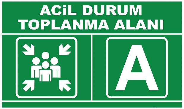


This article was automatically translated from the original Turkish version.
Function | Coordination and Support | ||||||||
|---|---|---|---|---|---|---|---|---|---|
Planning | Pre-determination | ||||||||
Feature | Open and Accessible Area | ||||||||
Purpose | Security and Routing | ||||||||
Place | Remote Location | ||||||||
Post-disaster gathering areas are temporary spaces designated for people to assemble safely after disasters such as earthquake, flood, fire, and similar emergencies, where they can meet their basic needs and access information and assistance services.【1】 These areas are established to reduce panic and disorder following a disaster, ensure individual safety, and facilitate the process of directing people to temporary shelter facilities.【2】
Post-disaster gathering areas are planned spaces designed to enable individuals to quickly leave hazardous zones and gather in safe locations immediately after a disaster or emergency. These areas serve as one of the initial points in the organized response process, helping to manage the uncertainty and chaos that arise in the early moments of a disaster.【3】
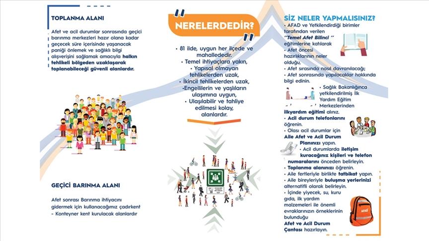
Afet Sonrası Toplanma Alanları (Anadolu Ajansı)
The definition of these areas encompasses not only physical gathering spaces but also the coordination and directional functions that are integral parts of the disaster management system. Through these areas, individuals are directed to safe locations, provided with accurate information, and enabled to communicate with public institutions.
One of the primary purposes of post-disaster gathering areas is to reduce the panic that follows a disaster and ensure that individuals can gather in a controlled and safe manner.【4】 This enables search and rescue and logistics operations to be conducted in a more orderly and effective way.
Another purpose is to enable the fulfillment of individuals’ basic needs. These needs include communication, access to information, contact with family members, access to first aid services, and participation in emergency support activities. Gathering areas function as temporary centers where these needs can be met.
In addition, these areas serve as transitional points until temporary shelter centers are established.【5】 During this period, the safety of individuals is ensured, their needs are assessed, and they are directed to appropriate shelter locations.
From a disaster management perspective, another objective of gathering areas is to facilitate the coordination of response activities. These areas allow for the organized deployment of aid teams, distribution of supplies, and systematic delivery of services.【6】
In conclusion, post-disaster gathering areas are not merely physical spaces where people assemble; they are also fundamental components of disaster management that integrate functions related to safety, communication, coordination, and direction.
Post-disaster gathering areas are typically open and spacious, selected from easily accessible locations such as parks, squares, and public lands.【7】 These areas must be located in positions that allow people to reach them quickly and safely.
When selecting these areas, factors such as accessibility, safety, infrastructure availability, and distance from environmental hazards are considered. Proximity to infrastructure capable of providing basic needs such as electricity, water, and sanitation is a key criterion.【8】 Additionally, these areas are ideally flat, spacious, and located away from risks associated with built-up structures.
The selection of locations for post-disaster gathering areas is a decisive stage in ensuring their functionality and safety. Site selection is based on a multidimensional evaluation process that considers both physical environmental conditions and population and infrastructure characteristics.
One of the primary criteria is accessibility. Gathering areas are situated close to residential zones and connected to transportation networks. The ability to reach these areas on foot within a short time is considered essential, particularly given the potential disruptions to transportation systems after a disaster. At the same time, connections to main roads are established to enable rapid and orderly evacuation.【9】
Population density is another important criterion in site selection. The capacity of gathering areas must be compatible with the size of the population they are intended to serve. Therefore, area size and the amount of space allocated per person are calculated and determined during the planning process.
Under safety criteria, gathering areas are located away from primary and secondary hazards. Proximity to fault lines, flood risks, landslides, liquefaction, and other natural hazards are taken into account during site selection.【10】 Additionally, the risk of collapse of surrounding buildings, high building density, and other potentially hazardous elements are included in the evaluation.
Topographic features are also decisive factors in site selection.【11】 The area should be as flat and level as possible, facilitating accessibility and providing a suitable surface for temporary use. Sloped and uneven terrain is considered unsuitable for safety reasons.
Infrastructure availability is another essential criterion for the effective use of gathering areas. Proximity to electricity, water, sewage, and communication infrastructure ensures that basic needs can be met.【12】 Furthermore, access to health services and emergency response units is a significant evaluation criterion.
Social and spatial compatibility are also considered during site selection. Preference is given to areas that are compatible with existing land use, publicly owned, and suitable for multiple purposes. Open and green spaces, parks, and large public lands are therefore frequently designated as gathering areas.
In international approaches, standardized criteria such as walking distance, area size, and space per person are emphasized. Within this framework, gathering areas are located within a specified distance, meet minimum size requirements, and provide sufficient space for the population.
In conclusion, the site selection of post-disaster gathering areas is a multi-criteria planning process requiring the simultaneous assessment of accessibility, safety, capacity, infrastructure, and environmental suitability. Meeting these criteria is considered essential for the effectiveness of post-disaster response operations.
Post-disaster gathering areas are spaces that enable individuals to assemble safely immediately after a disaster and provide the foundation for response activities. These areas play a functional role in reducing the uncertainty, panic, and communication breakdowns that emerge in the early stages following a disaster.【13】
One of the primary uses of gathering areas is to ensure that individuals move away from hazardous zones and assemble in safe locations. During this process, individuals not only secure their physical safety but also protect themselves from surrounding risks. At the same time, these areas facilitate organized movement of people and help prevent chaotic displacement.
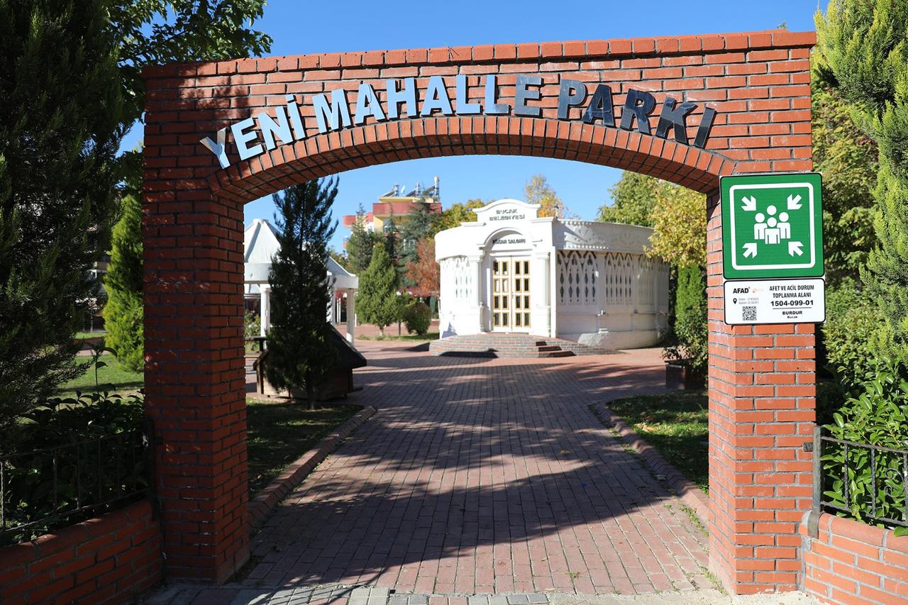
Afet ve Acil Durum Toplanma Alanı (Bucak Belediyesi)
These areas also function as centers for information dissemination after a disaster. Individuals can receive official updates, obtain information about developments, and follow directions provided by authorities. This contributes to coordination within the disaster management process.
Another function of gathering areas is to enable the fulfillment of individuals’ basic needs. In the initial phase after a disaster, these areas serve as temporary service points to meet urgent requirements such as shelter, water, food, healthcare, and communication. Individuals can receive assistance, participate in relief activities, and benefit from social support mechanisms within these areas.
From a health and emergency response perspective, gathering areas also serve a critical function. Initial medical treatment for the injured, organization of medical teams, and planning of referrals in necessary cases can all be carried out through these areas. In this regard, gathering areas are regarded as one of the primary contact points for post-disaster healthcare services.
Gathering areas are also used to coordinate logistics activities. The distribution of relief supplies, coordination of response teams, and planning of support services are organized through these areas. This ensures that post-disaster response operations are conducted in a more orderly and effective manner.
Another important function of these areas is to serve as an intermediate stage during the transition to temporary shelter centers. Until permanent or semi-permanent shelter facilities are established, individuals remain in these areas and are directed to appropriate locations. This enables a planned and systematic sheltering process.【14】
Planning post-disaster gathering areas is one of the fundamental stages of disaster management and involves pre-determining their location, capacity, and functionality. This planning process is carried out as part of pre-disaster preparedness efforts and includes decisions aimed at reducing potential risks.
During this process, gathering areas are typically designated by relevant public institutions and local authorities at the neighborhood or district level. In selecting these areas, population distribution, existing land use, transportation networks, and environmental hazards are taken into account. The goal is to ensure that each settlement unit has accessible areas with sufficient capacity.
The size and capacity of gathering areas are critical considerations during planning. The number of people to be served is taken into account to calculate the area allocated per person, and appropriate adjustments are made. However, rapid population growth and unplanned urbanization can lead to these areas becoming inadequate over time.
Another important aspect of planning is evaluating the physical and technical characteristics of the areas. Accessibility, transportation connections, infrastructure availability, and environmental safety are examined during the planning process. Proximity to essential infrastructure services such as electricity, water, and sewage is among the key factors considered for effective use.
During implementation, it is essential to inform the public about the designated gathering areas and ensure their accessibility.【15】 Information campaigns are conducted to ensure that individuals are aware of the locations of these areas. Through digital platforms and public information systems, users are enabled to locate the nearest gathering area based on their current position.
In practice, gathering areas are most commonly selected from open and green spaces or areas owned by public institutions. Parks, schoolyards, squares, and similar social infrastructure spaces are used for this purpose. This preference stems from the fact that these areas are spacious, accessible, and available for public use.
However, various challenges arise during implementation. Urbanization, construction pressure, and changes in land use can lead to the reduction or loss of functionality of previously designated gathering areas. Additionally, the repurposing of some areas for other uses creates limitations for their post-disaster application.
The effectiveness of the planning and implementation process depends on the regular evaluation and updating of these areas. Analyzing the adequacy of existing areas, identifying gaps, and planning new locations ensure the continuity of this process. This enables post-disaster response operations to be conducted in a more orderly and effective manner.
Afet ve Acil Durum Yönetimi Başkanlığı (AFAD). "Toplanma Alanını Öğren ki Canın Sağ Olsun." Accessed March 23, 2026. https://www.afad.gov.tr/toplanma-alanini-ogren-ki-canin-sag-olsun
Ardahan Üniversitesi. "Afet Sonrası Toplanma ve Barınma Alanları." Accessed March 23, 2026.
Kara, Gülten, and Kadir Kaan Yavruoğlu. "Afet ve Acil Durum Toplanma Alanlarının İncelenmesi ve Potansiyel Alanların Önerilmesi: Trabzon Akçaabat Örneği." Doğal Afetler ve Çevre Dergisi 11, no. 1 (2025): 340–353.
Karabağlar Belediyesi. "Afet Sonrası Toplanma Alanları." Accessed March 23, 2026.
Planlama Dergisi. "Afet Sonrası Toplanma Alanları Üzerine Çalışma." Accessed March 23, 2026.
[1]
Gülten Kara ve Kadir Kaan Yavruoğlu, “Afet ve Acil Durum Toplanma Alanlarının İncelenmesi ve Potansiyel Alanların Önerilmesi: Trabzon Akçaabat Örneği,” Doğal Afetler ve Çevre Dergisi 11, no. 1 (2025): 340–353, https://doi.org/10.21324/dacd.1606775.
[2]
Afet ve Acil Durum Yönetimi Başkanlığı (AFAD), “Toplanma Alanını Öğren ki Canın Sağ Olsun,” erişim 23 Mart 2026, https://www.afad.gov.tr/toplanma-alanini-ogren-ki-canin-sag-olsun.
[3]
Ardahan Üniversitesi, “Afet Sonrası Toplanma ve Barınma Alanları,” erişim 23 Mart 2026, https://aadk.ardahan.edu.tr/tr/page/afet-sonrasi-toplanma-ve-barinma-alanlari/17514.
[4]
Afet ve Acil Durum Yönetimi Başkanlığı (AFAD), “Toplanma Alanını Öğren ki Canın Sağ Olsun,” erişim 23 Mart 2026, https://www.afad.gov.tr/toplanma-alanini-ogren-ki-canin-sag-olsun.
[5]
Afet ve Acil Durum Yönetimi Başkanlığı (AFAD), “Toplanma Alanını Öğren ki Canın Sağ Olsun,” erişim 23 Mart 2026, https://www.afad.gov.tr/toplanma-alanini-ogren-ki-canin-sag-olsun.
[6]
Ardahan Üniversitesi, “Afet Sonrası Toplanma ve Barınma Alanları,” erişim 23 Mart 2026, https://aadk.ardahan.edu.tr/tr/page/afet-sonrasi-toplanma-ve-barinma-alanlari/17514.
[7]
Gülten Kara ve Kadir Kaan Yavruoğlu, “Afet ve Acil Durum Toplanma Alanlarının İncelenmesi ve Potansiyel Alanların Önerilmesi: Trabzon Akçaabat Örneği,” Doğal Afetler ve Çevre Dergisi 11, no. 1 (2025): 340–353, https://doi.org/10.21324/dacd.1606775.
[8]
Karabağlar Belediyesi, “Afet Sonrası Toplanma Alanları,” erişim 23 Mart 2026, https://www.karabaglar.bel.tr/sayfa/afet-sonrasi-toplanma-alanlari.
[9]
Gülten Kara ve Kadir Kaan Yavruoğlu, “Afet ve Acil Durum Toplanma Alanlarının İncelenmesi ve Potansiyel Alanların Önerilmesi: Trabzon Akçaabat Örneği,” Doğal Afetler ve Çevre Dergisi 11, no. 1 (2025): 340–353, https://doi.org/10.21324/dacd.1606775.
[10]
Gülten Kara ve Kadir Kaan Yavruoğlu, “Afet ve Acil Durum Toplanma Alanlarının İncelenmesi ve Potansiyel Alanların Önerilmesi: Trabzon Akçaabat Örneği,” Doğal Afetler ve Çevre Dergisi 11, no. 1 (2025): 340–353, https://doi.org/10.21324/dacd.1606775.
[11]
Gülten Kara ve Kadir Kaan Yavruoğlu, “Afet ve Acil Durum Toplanma Alanlarının İncelenmesi ve Potansiyel Alanların Önerilmesi: Trabzon Akçaabat Örneği,” Doğal Afetler ve Çevre Dergisi 11, no. 1 (2025): 340–353, https://doi.org/10.21324/dacd.1606775.
[12]
Gülten Kara ve Kadir Kaan Yavruoğlu, “Afet ve Acil Durum Toplanma Alanlarının İncelenmesi ve Potansiyel Alanların Önerilmesi: Trabzon Akçaabat Örneği,” Doğal Afetler ve Çevre Dergisi 11, no. 1 (2025): 340–353, https://doi.org/10.21324/dacd.1606775.
[13]
Afet ve Acil Durum Yönetimi Başkanlığı (AFAD), “Toplanma Alanını Öğren ki Canın Sağ Olsun,” erişim 23 Mart 2026, https://www.afad.gov.tr/toplanma-alanini-ogren-ki-canin-sag-olsun.
[14]
Gülten Kara ve Kadir Kaan Yavruoğlu, “Afet ve Acil Durum Toplanma Alanlarının İncelenmesi ve Potansiyel Alanların Önerilmesi: Trabzon Akçaabat Örneği,” Doğal Afetler ve Çevre Dergisi 11, no. 1 (2025): 340–353, https://doi.org/10.21324/dacd.1606775.
[15]
Gülten Kara ve Kadir Kaan Yavruoğlu, “Afet ve Acil Durum Toplanma Alanlarının İncelenmesi ve Potansiyel Alanların Önerilmesi: Trabzon Akçaabat Örneği,” Doğal Afetler ve Çevre Dergisi 11, no. 1 (2025): 340–353, https://doi.org/10.21324/dacd.1606775.

Function | Coordination and Support | ||||||||
|---|---|---|---|---|---|---|---|---|---|
Planning | Pre-determination | ||||||||
Feature | Open and Accessible Area | ||||||||
Purpose | Security and Routing | ||||||||
Place | Remote Location | ||||||||
No Discussion Added Yet
Start discussion for "Disaster Collection Areas" article
Definition and Purpose
Characteristics
Site Selection Criteria
Use and Functions
Planning and Implementation