


This article was automatically translated from the original Turkish version.
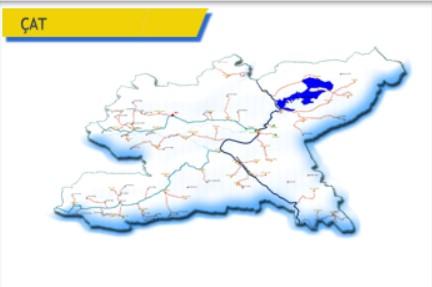
Çat District, Erzurum
Surface Area | 1386 km² | ||||||||
|---|---|---|---|---|---|---|---|---|---|
Elevation | 1980 m | ||||||||
Number of Villages in the District | 45 | ||||||||
Mayor | Arif Hikmet Kiliç | ||||||||
District Governor | İrem Baha YAĞAN | ||||||||
Erzurum province’s southwest lies yer district, a settlement notable for its historical and natural attractions. Under the influence of a continental climate, the district is distinguished by its fertile plains and mountainous terrain. Agriculture and livestock farming are among the main sources of livelihood in Çat, which is located approximately 115 kilometers from the city center of Erzurum. The population as of 2022 was 16,239, and the district comprises 45 mahalle and 32 mezras.
The history of Çat and its surroundings extends back to very ancient periods. Archaeological research in the region has revealed settlements dating to the Paleolithic Çağ. Çat came under the rule of the Hittites, Urartians, Romans, and Byzantine Empire, and after the Battle of Manzikert, it fell under Turkish control. It maintained its significance as an important settlement during the Seljuk and Ottoman periods.
In the 18th century, a bucak center was established around the area of today’s Yavi Mahallesi, where Ottoman Sipahi units gathered. Initially subordinate to Kığı district, this bucak center was transferred to Tercan district in 1914 due to transportation difficulties and geographical factors. In 1934, Aşağı Çat village became the district center, but in 1938 it was reverted to a bucak center and attached to Aşkale district. In 1946, it was again attached to Erzurum Merkez district under bucak status. Finally, in 1954, administrative reorganization established and organized Çat district with Oyuklu village as its center. The same year, Çat Municipality was founded and began operations. The first Belediye Mayor was Burhanettin Saydın (1954–1977), followed successively by Hamit Yaşar (1977–1980), Mirza Kurt (1984–1994), Seyfettin Sarı (1994–2004), Şibli Saydın (2004–2014), Arif Hikmet Kılıç (2014–2019), and Melik Yaşar (2019–present).
With the enactment of Law No. 6360 on 30 Mart 2014, Erzurum province became a metropolitan municipality, and all villages under the district gained mahalle status. Yavi, previously a town, lost its legal personality and became a mahalle. This yasa integrated Çat district into the boundaries of the Erzurum Metropolitan Municipality, abolished special administrative structures, and reorganized the division of duties and authority between the metropolitan and district municipalities.
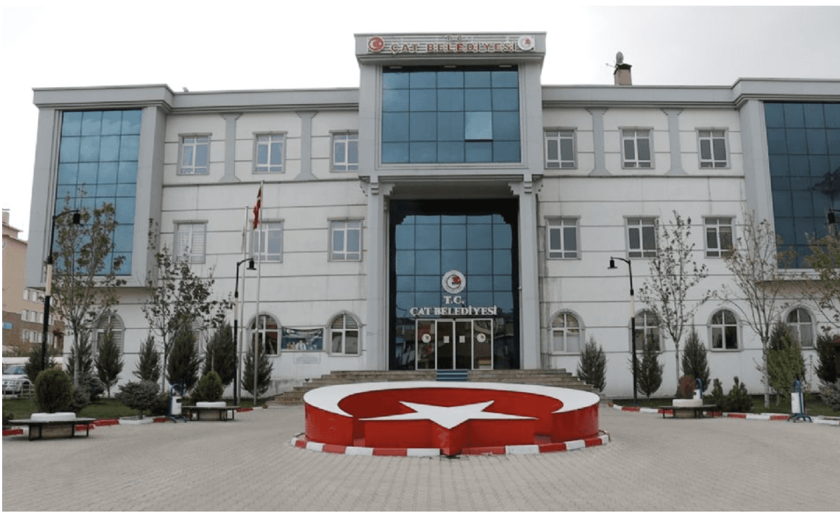
Çat Belediyesi (Source: Çat belediyesi)
Çat district is located in the southwest of Erzurum. It borders Tekman and Hınıs to the east, Karlıova district of Bingöl to the west, Erzurum center to the north, and Varto district of Muş to the south. The district’s terrain is generally mountainous and rugged. Extensions of the Bingöl Mountains lie in the western part of the district. Between these mountains are fertile plains and plateaus. Important rivers in the district include the Hınıs Çayı. Due to the mountainous terrain and extensive high plateaus, arable land is limited, and this durum has facilitated the development of livestock farming. Underground resources include salt deposits such as “Muhlis” in Bozyazı Mahallesi, “Karagöl” within the boundaries of Karaşeyh Mahallesi, and “Çögender” in Tuzluca Mahallesi.
A continental climate hüküm prevails in Çat. Summers are hot and kurak, while winters are cold and snowy. The annual average temperature is low. Especially during kış months, temperatures frequently fall below zero, and snow cover may remain uzun süre. Spring and sonbahar are mild transitional seasons. The district has an elevation of 1,980 meters and a surface area of 1,386 km².
According to the Turkish Statistical Institute (TÜİK) 2022 Address-Based Population Registration System (ADNKS) data, the population of Çat district is 16,239. Due to the predominance of rural settlements, the population is generally low. The majority of the population resides in the district center and surrounding villages. In recent years, a migration trend toward large cities has been observed due to economic and social factors.
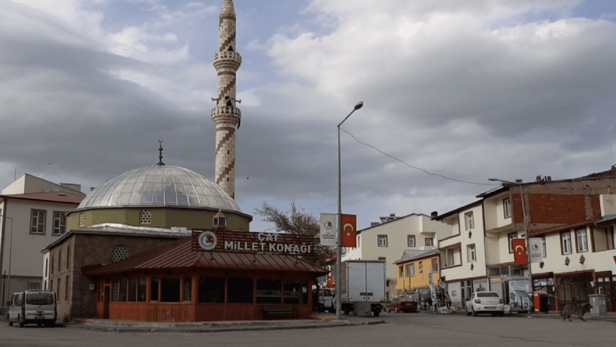
Çat Millet Konağı (Source: Çat belediyesi)
The economy of Çat district is largely based on agriculture and livestock farming. In fertile plains, crops such as buğday, arpa, and şeker pancarı are cultivated. Livestock farming includes both small and large animal husbandry. In recent years, beekeeping has become an important economic faaliyet. Small-scale ticaret and zanaat activities are also present in the district center.
Çat possesses tourism potential due to its natural beauty and historical fabric. The natural landscapes, highland pastures, and rivers of the Bingöl Mountains offer suitable areas for hiking and photography. The district also contains historical structures from the Seljuk and Ottoman periods.
Hölenk Hot Springs: A spa located in Hölenk village, previously little known, is famous for its healing waters, which, according to legend, surface once every seven years.
Çarşı Çeşmesi: A 250-year-old çeşme located in the district center, this is an Ottoman-era inscribed fountain.
Bardakçı Village Mosque and Fountain: An Ottoman-era structure dating to the late 19th century.
Çat Dam: It has added a distinctive renk to the district. For the past five years, it has supplied drinking water to Erzurum.
Additionally, Çat features several visited makam and sites, including Ardıç, Çamlık, Güney tepe, Cilli Göz, Kumaşlı, and Oyuklu.
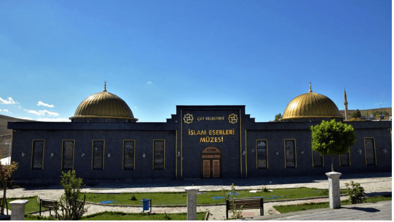
Çat Belediyesi İslam Eserleri Müzesi (Source: Çat belediyesi)
Çat cuisine reflects the general characteristics of Erzurum and Doğu Anadolu regions. Due to harsh winter conditions, meals are typically hearty and nutritious. Key local delicacies include cağ kebabı, su böreği, hıngel, ayran aşı, and katmer. Additionally, naturally produced local bal and cheese varieties hold significant importance.
Erzurum Büyükşehir Municipality. "İlçe Tanıtımları - Çat." Accessed April 17, 2025.https://www.erzurum.bel.tr/AltIcerikDetay/1044/I/1007.html
T.C. Erzurum Valiliği. "Çat." Accessed April 17, 2025.
T.C. Kültür ve Turizm Bakanlığı. *Çat - Erzurum.* Accessed April 17, 2025.
Türkiye İstatistik Institute (TÜİK). "Coğrafi İstatistik Portalı." Accessed April 17, 2025.https://cbs.tuik.gov.tr/
Türkiye İstatistik Kurumu (TÜİK). "Adrese Dayalı Nüfus Kayıt Sistemi (ADNKS)." Accessed April 17, 2025.https://adnks.tuik.gov.tr/
Çat Belediyesi. "Çat." Accessed April 17, 2025.https://www.cat.bel.tr/Default
Çat Fotoğrafları. "Çat Photographs." Accessed April 17, 2025.https://www.erzurumcat.bel.tr/galeri/0/13/1/cat-
Çat Kaymakamlığı. *Çat Tarihçesi.* Accessed April 17, 2025.http://www.cat.gov.tr/tarihce
Çat Kaymakamlığı. Çat. Accessed April 17, 2025.
Çat District, Erzurum
Surface Area | 1386 km² | ||||||||
|---|---|---|---|---|---|---|---|---|---|
Elevation | 1980 m | ||||||||
Number of Villages in the District | 45 | ||||||||
Mayor | Arif Hikmet Kiliç | ||||||||
District Governor | İrem Baha YAĞAN | ||||||||
History
Geography
Climate
Population and Demographics
Economy
Tourism and Culture
Cuisine