


This article was automatically translated from the original Turkish version.
Tekman (District)
Tekman
Elevation of the District | 1800 | ||||||||
|---|---|---|---|---|---|---|---|---|---|
Area of the District | 2197 km² | ||||||||
Number of Villages in the District | 71 | ||||||||
Mayor | Abdurrahman Sever | ||||||||
District Governor | Hasan Raşit Taşkın | ||||||||
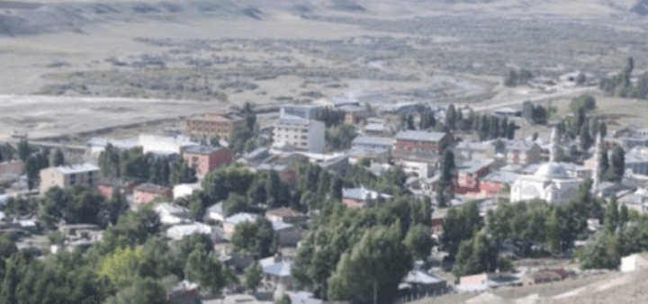
Erzurum province, the district of Tekman is situated on the high and rugged terrain of the Eastern Anatolia Region. Defined by its proximity to the historic Silk Road route and its distinctive geographical structure, the district possesses various cultural elements and natural resources. Tekman’s economy is primarily based on agriculture and animal husbandry, and in recent years it has begun to reveal its tourism potential.
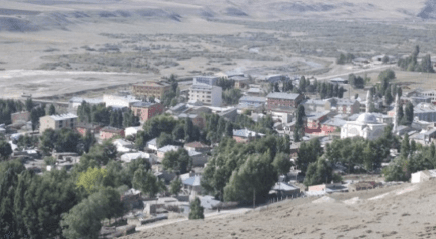
Tekman (Source: Erzurum Encyclopedia)
The history of Tekman and its surroundings is very ancient, with settlement traces extending back to the Neolithic Period. The region has been under the rule of various civilizations throughout history including the Hurrians, Urartians, Assyrians, Medes, Persians, Romans, Byzantines and Sassanids. Following the Seljuk Turks’ expansion into Anatolia after the 1071 Battle of Manzikert, Tekman came under Turkish rule. After the Seljuks, the region was controlled by the Ayyubids, the Anatolian Seljuk State and the Ilkhanids, and later became a battleground between the Akkoyunlu and Karakoyunlu states.
In the early 15th century, with the rise of the Ottoman Empire, Tekman was incorporated into Ottoman territory. During the Ottoman period it was administered as a sanjak under the Erzurum Beylerbeylik and played a role in the region’s commercial and cultural activities. During the decline of the Ottoman Empire, Tekman and its surroundings came under the influence of Russian invasions and wars. The Ottoman-Russian wars of the 19th century caused extensive destruction in the region. With the establishment of the Grand National Assembly of Türkiye and the victory of the War of Independence, Tekman became part of the Republic of Türkiye and, after the proclamation of the Republic, gained the status of a district under Erzurum province.
Tekman is located approximately 130 kilometers south of the city center of Erzurum. The district is situated on a mountainous and elevated plateau. It borders Çat and Hınıs to the north, Karayazı to the east, Karlıova district of Bingöl to the south, and Varto district of Muş to the west. The district’s average elevation exceeds 2,000 meters. Tekman’s geographical structure is characterized by deep valleys, high mountains and extensive plateaus. Among its significant mountains are the Tekman Mountains, an extension of the Allahuekber Mountains. Important rivers in the district include tributaries of the Murat River.
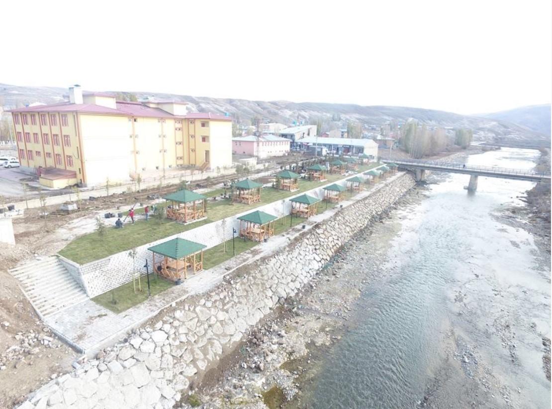
Tekman Park (Source: Tekman District Governorship)
Tekman experiences the typical continental climate of the Eastern Anatolia Region. Summers are short, cool and dry, while winters are long, cold and snowy. The annual average temperature is low and the difference between day and night temperatures is pronounced. Snowfall generally begins in October and can continue until April, with snow depth reaching significant levels in some areas. Spring and autumn are short and mild transitional periods.
According to the Turkish Statistical Institute’s (TÜİK) 2024 Address-Based Population Registration System (ADNKS) data, the total population of Tekman district is 7,248. Of this population, 3,156 live in the district center (43.5%) and 4,092 reside in rural settlements (56.5%). The district’s population has fluctuated over time due to geographical conditions and economic factors. Population density in rural areas is lower than in the district center.
When examining the age structure, the presence of a young population is notable. However, due to limited economic opportunities, migration to larger cities is a prominent phenomenon in the district. The gender distribution is generally balanced, though seasonal variations occur due to migration patterns. Ethnically, the district is home to a predominantly Turkish and Kurdish population. Socio-cultural life follows a structure where traditional ways of living are maintained. Educational levels have increased in recent years due to investments, but geographical conditions limit access to education in some areas.
Tekman’s economy is largely based on agriculture and animal husbandry. Agricultural activities are generally conducted using traditional methods, with main products including wheat, barley, rye and forage crops. High altitudes and climatic conditions limit agricultural diversity. Animal husbandry is widespread, particularly in the form of small livestock (sheep and goats). The extensive pasture and plateau areas provide favorable conditions for animal husbandry activities.
The industry and trade sectors in the district have not developed significantly. Small-scale enterprises catering to local needs exist. In recent years, limited alternative economic activities such as beekeeping and the production of regional products have been implemented. Efforts are underway to assess the district’s tourism potential with support from the state and local administrations. However, transportation and infrastructure challenges remain negative factors affecting economic development.
Tekman’s tourism potential, shaped by its natural features and historical traces, has not yet been sufficiently developed. The ancient settlement sites and fortresses in the district serve as valuable sources for historical research. High plateaus and mountainous areas offer suitable environments for activities such as hiking and mountaineering. However, inadequate tourism infrastructure prevents the full utilization of this potential.
Tekman’s cultural structure reflects the general characteristics of the Eastern Anatolia Region, while also preserving local traditions and customs. Folk dances, handicrafts and oral literature are prominent components of local culture. The cuisine has been shaped by the region’s geographical and economic structure. Staple food items include flour, meat and dairy products. Local dishes include meat prepared in a tandır oven, baked dough products and various delicacies made from dairy.
Erzurum Büyükşehir Municipality. *Tekman*. Accessed April 19, 2025.https://www.erzurum.bel.tr/AltIcerikDetay/1044/I/1022.html
Erzurum Valiliği. *Tekman*. Accessed April 19, 2025.http://www.erzurum.gov.tr/tekman
Erzurum İl Kültür ve Turizm Müdürlüğü. *Tekman*. Accessed April 19, 2025.https://erzurum.ktb.gov.tr/TR-56051/tekman.html
Tekman Belediyesi. "Anasayfa." Accessed April 19, 2025.https://www.tekman.bel.tr/
Tekman Kaymakamlığı. "Anasayfa." Accessed April 19, 2025.http://www.tekman.gov.tr/
Tekman Kaymakamlığı. *Tekman Parkımız Hayırlı Olsun*. Accessed April 19, 2025.http://www.tekman.gov.tr/tekman-parkimiz-hayirli-olsun
Tekman İlçesi. Erzurum Ansiklopedisi. Accessed April 19, 2025.http://erzurumansiklopedi.com/tekman-ilcesi/
Türkiye İstatistik Institute (TÜİK). *Resmî Web Sitesi*. Accessed April 19, 2025.https://www.tuik.gov.tr/
Tekman (District)
Tekman
Elevation of the District | 1800 | ||||||||
|---|---|---|---|---|---|---|---|---|---|
Area of the District | 2197 km² | ||||||||
Number of Villages in the District | 71 | ||||||||
Mayor | Abdurrahman Sever | ||||||||
District Governor | Hasan Raşit Taşkın | ||||||||
History
Geography
Climate
Population and Demographics
Economy
Tourism – Culture – Cuisine