


This article was automatically translated from the original Turkish version.
+2 More
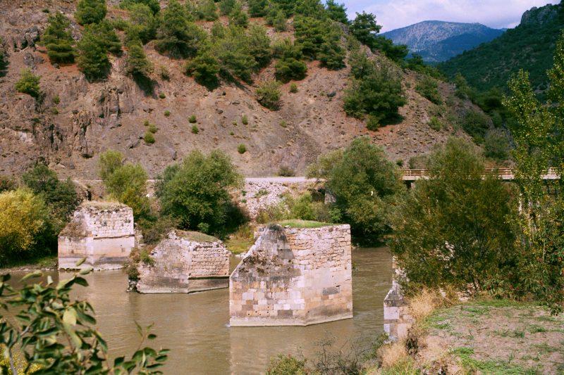
Boğazkesen Bridge
Location | Tokat Erbaa Kale Village | ||||||||
|---|---|---|---|---|---|---|---|---|---|
River | Confluence of Kelkit Creek and Yeşilırmak | ||||||||
Connections | Amasya – Tokat | ||||||||
Historical Period | Roman, Byzantine, Seljuk, Ottoman | ||||||||
Construction Material | Cut stone | ||||||||
Boğazkesen Bridge, where Kelkit meets Tozanlı, has served as a strategic crossing point throughout history, connecting Amasya and Niksar. With its distinctive architectural structure, thebridgebears traces of various civilizations from different periods.
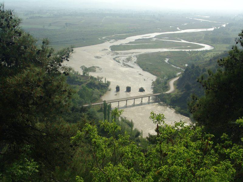
Boğazkesen bridge - Erbaa Municipality
TheBoğazkesen Bridgewas constructed during the Roman Empire period at the confluence of the Kelkit River and the Yeşilırmak, to facilitate regional transportation. According to historical sources, it is one of two important bridges located along theSilk Road. The other significant structure is the Talazan Bridge, attributed to theSeljuks. Due to its strategic location, the Boğazkesen Bridge facilitated trade and military movements across the region and was repeatedly repaired and used by various civilizations.
The bridge piers believed to date from theByzantineperiod are set into the ground using sturdy, precisely cutrectangularstones, with four piers submerged in the water. The lower half and upper sections of the piers differ architecturally. On the second pier near the bank ofKaleVillage, two carvedcrosssymbols are engraved on a cut stone. This confirms the bridge’s significance during the Byzantine period.
During theSeljukandOttomanperiods, the upper section of the bridge was rebuilt, allowing it to remain in use for many years. According to tradition, Yavuz Sultan Selim crossed this bridge during his 1514 Chaldiran Campaign. Another account claims that a double-headed eagle motif, the emblem of the Seljuks, once adorned the bridge but gradually eroded and disappeared over time.
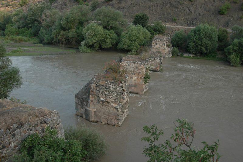
Boğazkesen bridge current condition - Erbaa Municipality
The Boğazkesen Bridge has been exposed to numerous natural disasters and floods over the centuries. Frequent flooding in theKelkitValley caused significantdamageto the upper structure, eventually leading to its collapse. Today, only the supporting piers remain standing. Although well known to the local population, this structure has not been adequately developed for tourism, despite its great historical and cultural significance.
Today, while the remaining parts of the bridge continue to withstand the passage of time, they remain in a state ofruindue to the absence of comprehensive restoration efforts. Work is needed to preserve its historical value and integrate it into regional tourism.
Erbaa Belediyesi. "Boğazkesen Köprüsü." Erbaa Belediyesi Resmi Web Sitesi. Accessed March 28, 2025.https://erbaa.bel.tr/Site/foto/bogazkesen-koprusu.
T.C. Erbaa District Governorship. "İlçemizin Genel Bilgileri." T.C. Erbaa Kaymakamlığı Resmi Web Sitesi. Accessed March 28, 2025. http://www.erbaa.gov.tr/tarihi

Boğazkesen Bridge
Location | Tokat Erbaa Kale Village | ||||||||
|---|---|---|---|---|---|---|---|---|---|
River | Confluence of Kelkit Creek and Yeşilırmak | ||||||||
Connections | Amasya – Tokat | ||||||||
Historical Period | Roman, Byzantine, Seljuk, Ottoman | ||||||||
Construction Material | Cut stone | ||||||||
History
Current Condition