


This article was automatically translated from the original Turkish version.
+1 More
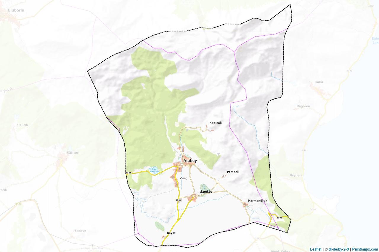
Atabey
Province | Isparta | ||||||||
|---|---|---|---|---|---|---|---|---|---|
Geographic Region | Mediterranean Region | ||||||||
Area | 202 km² | ||||||||
Elevation | Average 959 m | ||||||||
Population | 6.090 (2024) | ||||||||
Postal Code | 32670 | ||||||||
License Plate Code | 32 | ||||||||
Telephone Code | 0246 | ||||||||
District Governor | Selami IŞIK | ||||||||
Mayor | Serdar PEHLİVAN | ||||||||
Atabey is a district of Isparta province in Türkiye’s Mediterranean Region. The district center is located approximately 21–23 kilometers from Isparta. Covering an area of 202 square kilometers, Atabey lies between the extensions of Barla Mountain and the Bozanönü Plain. Within its boundaries, historical and cultural assets include the ancient city of Seleukeia Sidera, the Ertokuş Medresesi, various tumuli, traditional structures, and museums.
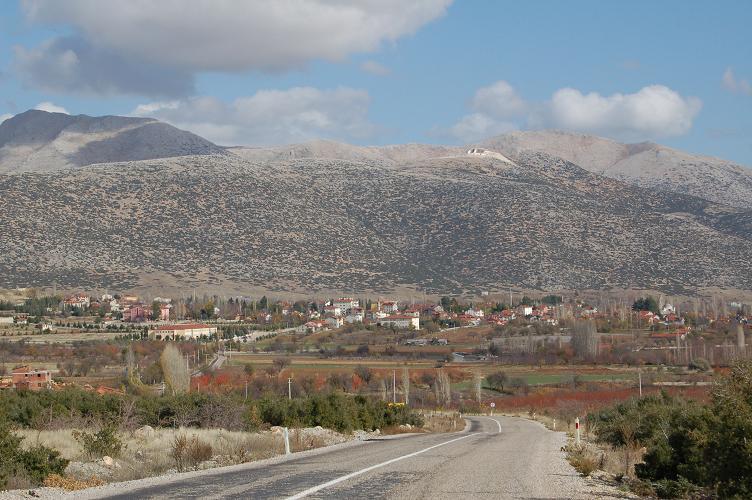
Atabey District (Isparta Provincial Directorate of Culture and Tourism)
The settlement history of Atabey extends back to the Chalcolithic Age. Archaeological excavations at the Pembeli Höyük within the district boundaries have uncovered artifacts dating to the Early Chalcolithic period. Excavations at the Göndürle I and II Höyüks in Harmanören Village demonstrate continuous habitation in the region from the 3rd millennium BCE through the Early and Middle Bronze Age. During antiquity, this region, known as Agrai or Agpia, came under the dominion of Alexander the Great in 334 BCE. The city of Seleukeia, founded by Antiochus I Soter, son of Seleucus I Nicator, one of Alexander’s generals, is located within the boundaries of present-day Bayat Village. During the Roman period, the city acquired the epithet Sidera, meaning “iron,” becoming known as Seleukeia Sidera. In the Byzantine period, it was incorporated into the Bishopric of Agrai.
Following the Battle of Manzikert, the region was conquered in 1224 by Mübarizeddin Ertokuş, Governor of Antalya and Su-Başı under the orders of Seljuk Sultan I. Alaeddin Keykubad. In the same year, Ertokuş commissioned the construction of a medrese in the district; this structure remains one of the most significant monuments documenting the region’s intellectual and architectural importance during the Seljuk period. By the early 13th century, Atabey had become fully Turkicized and retained its significance during the Ottoman period, recorded in the 16th century as one of 16 market centers subordinate to the Hamit Sanjak. The fabric known as “Donluk,” produced from cotton cultivated especially in Pembeli Village, was well known in Ottoman markets. In the 1478, 1501, 1522, and 1568 registers, Atabey appears as a subdistrict under Eğirdir; in the 17th century, it is listed as a kaza in Katip Çelebi’s Cihannüma. During the Republican era, the settlement was officially named “Atabey” by a decision of the Turkish Grand National Assembly in 1926, became a subdistrict in 1953, and attained district status on 1 April 1960.
The district is bordered by Senirkent and Uluborlu to the north, Gönen to the west, Eğirdir to the east, and Isparta center district to the south. The total area of the district is 202 km². The northern and western sections are characterized by the rugged topography of Barla Mountain, which extends in a northeast-southwest direction. South of Barla Mountain lie plateaus ranging in elevation from 1,000 to 1,500 meters above sea level. These plateaus are partially covered by rich pastures and meadows. A portion of the Bozanönü Plain in the south also falls within Atabey’s boundaries. The northern extension of the Isparta Plain reaches Atabey’s territory through the ridges of Araptepe, Bozanönü, Erenler, and Çeşme hills. In this transitional zone, where the plains meet the mountainous areas, oak woodlands are found.
Atabey district lies within a transitional zone between Mediterranean and continental climates. Summers are hot and dry, while winters are cold and wet. This climatic transition has led to diversified agricultural activities and a complex vegetation structure. The district’s average annual precipitation is approximately 330 kilograms per square meter, concentrated mainly in winter and spring months.
Vegetation varies according to topography and climatic conditions. In mountainous areas, particularly along the slopes of Barla Mountain, natural oak woodlands occur sporadically. Shrub formations and maquis species are also present in these zones. Plateaus are dominated by pastures and meadows, indicating the district’s suitability for animal husbandry. In the plain areas, orchards of fruit trees, field crops, and especially rose cultivation are prominent. The village of İslamköy in Atabey is a major agricultural center known for its rose gardens and rose oil production.
The economy of Atabey district is primarily based on agriculture and animal husbandry. The district’s natural features and climatic conditions provide a favorable environment for these two key economic activities. Apple, cherry, olive, and grape are the most widely cultivated fruit crops. Grain, legumes, and sugar beet production are also practiced. The most notable agricultural activity is rose cultivation, concentrated especially around İslamköy. Factories in this area process roses to produce various products, primarily rose oil. This production, emblematic of Isparta and its surroundings, plays a decisive role in Atabey’s economy.
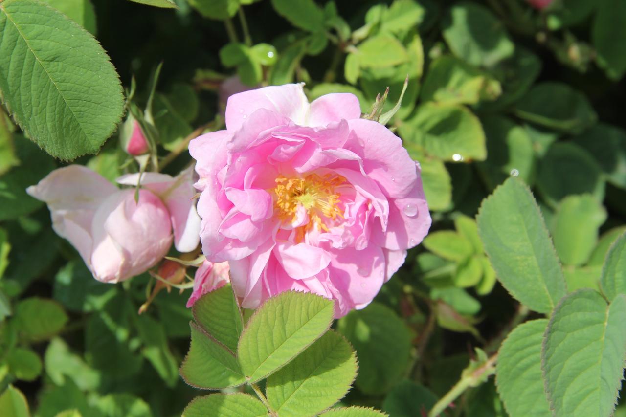
Isparta Rose (Isparta Provincial Directorate of Agriculture and Forestry)
Historically, textile production also held an important place in Atabey’s economy. During the Ottoman period, cotton grown in Pembeli (Pamuklu) Village was woven into fabric known as “Donluk,” which enjoyed popularity in domestic markets. Today, small-scale industrial facilities operate to process and market agricultural products. Animal husbandry continues in traditional form, supported by the abundance of pastures and meadows, with both small and large livestock farming and milk production being practiced.
In recent years, organic farming practices have been encouraged in the district. Additionally, small enterprises producing fruit juice have emerged. Developments have also been observed in non-agricultural economic sectors, with increased efforts to promote industrial initiatives and rural tourism potential. Integrating agriculture-based industry with natural and historical heritage for tourism purposes is among the initiatives aimed at diversifying Atabey’s economy.
Atabey district is a small settlement with one of the lowest population densities in Isparta province. According to 2024 data, the total population is 6,090. Since the Republican era, the population has remained relatively stable, with limited fluctuations.
Demographically, Atabey is a rural settlement with a tendency toward out-migration. A large portion of the young population migrates to the provincial center or larger cities due to education, employment, and living conditions. In contrast, a significant portion of the resident population is engaged in agriculture and animal husbandry; the age distribution is weighted toward middle and older age groups. The district includes the town of İslamköy and four villages (e.g., Bayat and Harmanören). The social and cultural fabric reflects a traditional lifestyle, strong family structures, and a settled community.
Educational services in Atabey district are provided through institutions under the Ministry of National Education. As of 2024, the district has a total of 11 schools and institutions. These institutions operate 85 classrooms with 109 teachers serving 811 students. Educational institutions include: 1 preschool, 2 primary schools, 2 middle schools, 1 Imam Hatip middle school, 1 Anatolian high school, 1 vocational and technical Anatolian high school, 1 community education center, and 1 teachers’ house and evening art school. Additionally, the Atabey Vocational School, affiliated with Isparta Applied Sciences University, operates in the district, offering programs in Computer Technologies and Office Services and Secretarial Studies.
Atabey district, with its historical structures, archaeological sites, and natural landscape, holds potential for cultural and nature tourism. One of its most notable historical structures is the Ertokuş Medresesi, built in 1224 by Antalya Governor Mübarizeddin Ertokuş. This structure is a significant example of Seljuk stone masonry, featuring a closed-type medrese architectural style. Its square courtyard, pool, arched dome, and stone mihrab attract visitor interest both architecturally and historically. Adjacent to the medrese is the Ertokuş Kümbeti, one of the monumental tomb structures of the period, still in use for visits today.
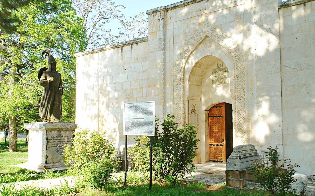
Ertokuş Medresesi (Turkey Culture Portal)
Located within Atabey’s boundaries, the Seleukeia Sidera Ancient City is situated in Bayat Village and features a layered historical record from the Hellenistic, Roman, and Byzantine periods. Archaeological remains, including the acropolis, theater, rock sanctuary, temple podium, and necropolis, attract both scholarly attention and cultural tourism. Roman-era aqueduct and cistern remains illuminate the city’s infrastructure system.
Another major tourism site in the district is the Süleyman Demirel Democracy and Development Museum in İslamköy. Built in a külliye style, the complex includes a main museum building, a mosque, a library, and an archive. The museum presents excerpts from the life of the 9th President of Türkiye, Süleyman Demirel, and houses documents and artifacts reflecting Türkiye’s recent political and economic development. This museum, a destination for both domestic and international visitors, sheds light on the region’s contemporary history.
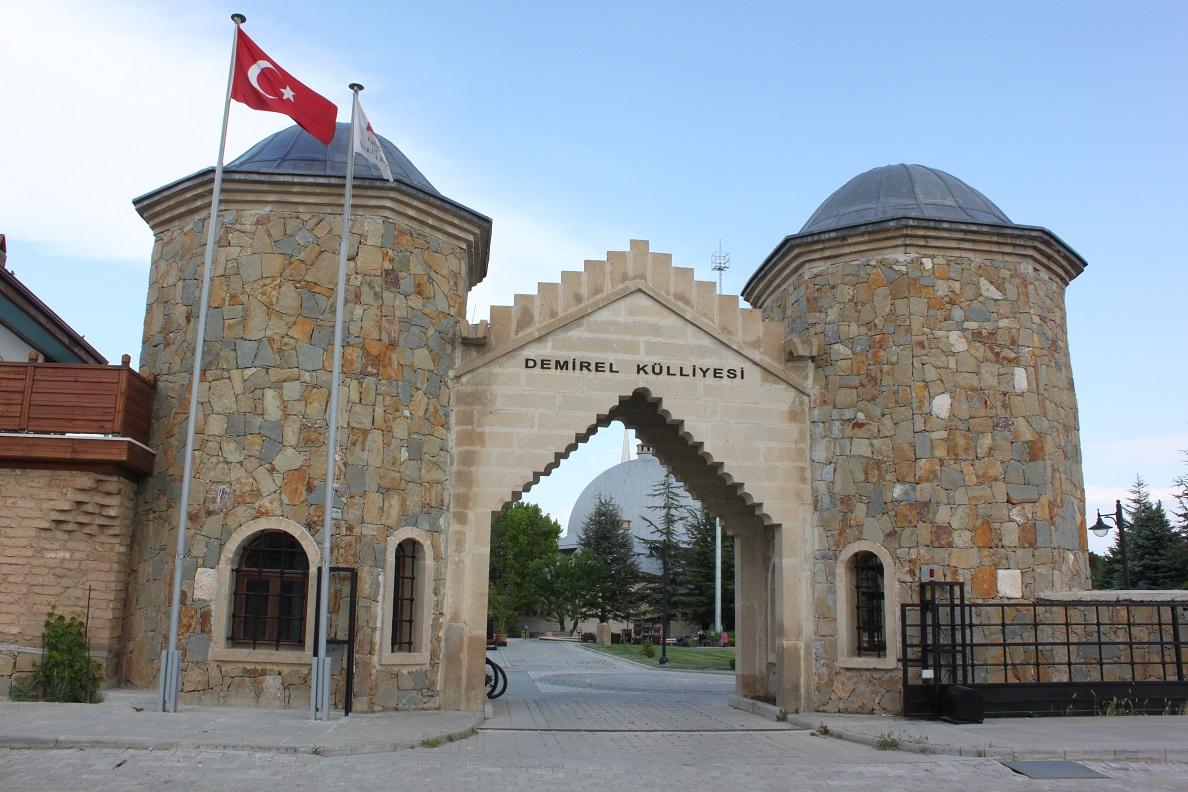
Süleyman Demirel Democracy and Development Museum (Isparta Provincial Directorate of Culture and Tourism)
Aya Yorgi, also known as the İshotya Church, is located in the Doğancı Neighborhood of Isparta city center and dates to the mid-19th century. Its construction is dated between 1857 and 1860. The inscription above the entrance door is preserved today in the Isparta Museum. As a typical example of 19th-century Anatolian Christian architecture, it holds cultural heritage significance for regional tourism.
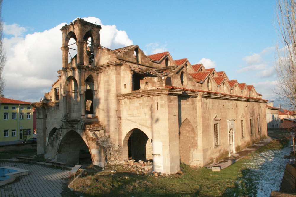
Aya Yorgi Church (Turkey Culture Portal)
Atabey also offers opportunities for nature tourism. The slopes near Bayat Village are suitable for paragliding, with steep hills and prevailing wind conditions providing an alternative destination for nature sports enthusiasts. Additionally, the high plateaus with yayla characteristics offer potential for hiking and rural tourism.
Atabey Belediyesi. "İlçemiz Tarihçesi." Accessed April 13, 2025.https://www.atabey.bel.tr/ilcemiz-tarihcesi.html
Isparta İl Directorate of Culture and Tourism. "Atabey." T.C. Kültür veTurizm Bakanlığı. Accessed April 13, 2025.https://isparta.ktb.gov.tr/TR-165532/atabey.html
Isparta İl Directorate of Culture and Tourism. "Süleyman Demirel Democracy and Development Museum." T.C. Kültür veTurizm Bakanlığı. Accessed April 13, 2025.https://isparta.ktb.gov.tr/TR-162906/suleyman-demirel-demokrasi-ve-kalkinma-muzesi.html
T.C. Isparta Belediyesi. "Atabey." Isparta Belediyesi. Accessed April 13, 2025.https://www.isparta.bel.tr/atabey
T.C. Isparta Valiliği. "2015-2019 Stratejik Plan." İl Milli Eğitim Müdürlüğü. Accessed April 13, 2025.Accessed adresi.
T.C. Isparta Valiliği. "Atabey." Isparta Valiliği. Accessed April 13, 2025.http://www.isparta.gov.tr/atabey
T.C. Kültür ve Turizm Bakanlığı. "Aya Yorgi Kilisesi / İshotya Kilisesi - Isparta." *Türkiye Kültür Portalı*. Accessed April 13, 2025.https://www.kulturportali.gov.tr/turkiye/isparta/gezilecekyer/aya-yorgi-ishotya-kilisesi
TÜK. "Coğrafi İstatistik Portalı." Accessed April 13, 2025.https://cip.tuik.gov.tr/

Atabey
Province | Isparta | ||||||||
|---|---|---|---|---|---|---|---|---|---|
Geographic Region | Mediterranean Region | ||||||||
Area | 202 km² | ||||||||
Elevation | Average 959 m | ||||||||
Population | 6.090 (2024) | ||||||||
Postal Code | 32670 | ||||||||
License Plate Code | 32 | ||||||||
Telephone Code | 0246 | ||||||||
District Governor | Selami IŞIK | ||||||||
Mayor | Serdar PEHLİVAN | ||||||||
History
Geographical Structure
Location and Boundaries
Climate and Vegetation
Economic Structure
Demographic Structure
Education
Tourism