


This article was automatically translated from the original Turkish version.
For safe aircraft operations, pilots must effectively use the navigation instruments located in the cockpit. Navigation instruments provide pilots with critical information on the aircraft’s position, direction, speed, and other essential data, enabling them to make accurate decisions.
Navigation instruments are used to monitor the aircraft’s movement in airspace and facilitate navigation.
Instrument subcategories are as follows:
Instruments in this category are used to determine the aircraft’s position and heading relative to the Earth.
This is the primary instrument that indicates the aircraft’s heading relative to magnetic north. However, its accuracy can be reduced due to magnetic field fluctuations. During flight, turbulence, speed changes, and magnetic deviations can cause compass errors. Therefore, pilots strive to ensure accuracy by cross-referencing the magnetic compass with other instruments together.
This instrument displays the aircraft’s orientation relative to the horizontal axis. It is especially helpful for pilots in maintaining aircraft balance during low visibility conditions. The attitude indicator determines the aircraft’s pitch angle and bank angle to ensure level and stable flight.
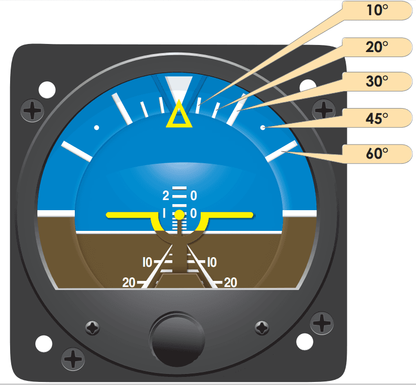
Attitude Indicator
A gyroscope-based instrument used to compensate for the magnetic compass’s lack of precision. Unlike the magnetic compass, it is unaffected by sudden accelerations or turbulence. However, due to friction and movement over time, it may drift and therefore requires periodic calibration against the magnetic compass.

Directional Gyro
Moving map displays used in modern aircraft show the aircraft’s real-time position on a digital map. This system, which is GPS-based, includes airways, airspace boundaries, runway information, and navigation waypoints.

Moving Map Display
Global Positioning System (GPS)-based navigation instruments are used to determine the aircraft’s precise location and flight direction. GPS systems operate via satellite signals and provide highly accurate direction and position data.
These are critical instruments that assist pilots in monitoring speed and altitude during flight.
This instrument determines the aircraft’s airspeed (IAS – Indicated Airspeed). Different colored zones indicate safe speed ranges:

Airspeed Indicator
This is a critical instrument that measures the aircraft’s altitude above sea level. There are three main types:
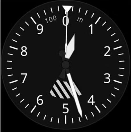
Altimeter
This instrument indicates the rate of climb or descent in feet per minute. It helps pilots maintain stability by measuring rapid changes such as those caused by turbulence.
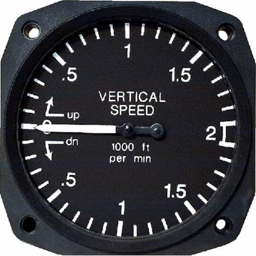
Vertical Speed Indicator
These instruments provide pilots with essential data to ensure efficient engine operation.
Monitors fuel levels to ensure the flight proceeds as planned. In twin-engine aircraft, separate fuel gauges are provided for each engine.

Fuel gauge for a twin-engine aircraft
Measures the rotational speed of the engine in propeller-driven aircraft. Jet-powered aircraft use N1 and N2 indicator systems.
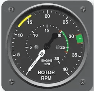
RPM Indicator
Used to monitor engine performance and ensure efficient combustion. Temperature variations provide information about engine health.
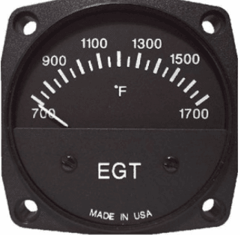
Exhaust Gas Temperature Indicator
With advancing technology, analog instruments in the cockpit have been replaced by digital displays. “Glass Cockpit” systems provide pilots with enhanced situational awareness, making flight safer and more efficient.
EFIS presents speed, altitude, heading, weather, and engine data on a single digital display.
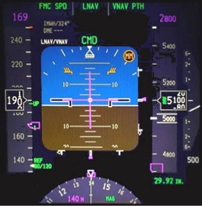
Electronic Flight Instrument System
Supports pilots during low-visibility conditions by using real-time maps and terrain data to generate a three-dimensional representation of the external environment.
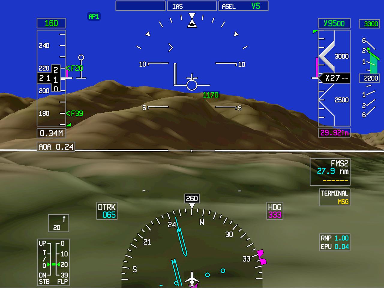
Synthetic Vision System
Allows pilots to view critical flight information without looking down from the windshield. This system is widely used in military aircraft and modern commercial airliners.

Head-Up Display simulation example
Federal Aviation Administration. (2012). *Instrument Flying Handbook.* U.S. Department of Transportation Federal Aviation Administration Flight Standards Service.https://www.faa.gov/sites/faa.gov/files/regulations_policies/handbooks_manuals/aviation/FAA-H-8083-15B.pdf
Southern Wings. (2024). Aircraft Flight Instruments Explained. Accessed February 4, 2025.

No Discussion Added Yet
Start discussion for "Aircraft Instruments" article
Primary Functions of Navigation Instruments
Direction and Position Instruments
Magnetic Compass
Attitude Indicator
Directional Gyro
Moving Map Display
GPS Navigation Instrument
Speed and Altitude Instruments
Airspeed Indicator
Altimeter
Vertical Speed Indicator
Fuel and Engine Performance Instruments
Fuel Gauge
RPM Indicator
Exhaust Gas Temperature Indicator (EGT Indicator)
Modern Avionics and Digital Instruments
Electronic Flight Instrument System (EFIS)
Synthetic Vision System (SVS)
Head-Up Display (HUD)