


This article was automatically translated from the original Turkish version.
+2 More
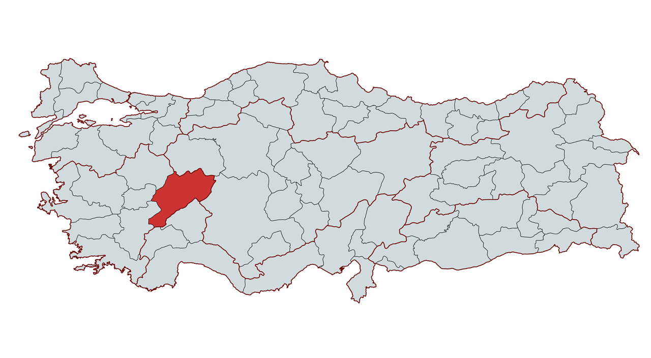
Afyonkarahisar
Country | Türkiye | ||||||||
|---|---|---|---|---|---|---|---|---|---|
Region | Aegean Region | ||||||||
Population (Number) | 750193 | ||||||||
Important Structure | Sahipata Kervansarayı Peribacaları Afyonkarahisar Kalesi Aslankaya Mevlevihane Gedik Ahmet Paşa Külliyesi Ulu Camii | ||||||||
Governor | Kübra Güran Yiğitbaşı | ||||||||
Mayor | Burcu Köksal | ||||||||
Area Code | 272 | ||||||||
License Plate Code | 03 | ||||||||
Anatolia’s center, Afyonkarahisar is a crossroads between the east and the west, and one of Türkiye’s important cities due to its rich historical and cultural heritage. The city is characterized by the Afyonkarahisar Castle, which rises on a volcanic rock mass 226 meters high. This castle has been used by various civilizations throughout history and has been known by different names. The Hittites called it Hapanuva, the Romans and Byzantines Akroinon, and the Seljuks and Ottomans named it Karahisar-ı Devle or Karahisar-ı Sahip.
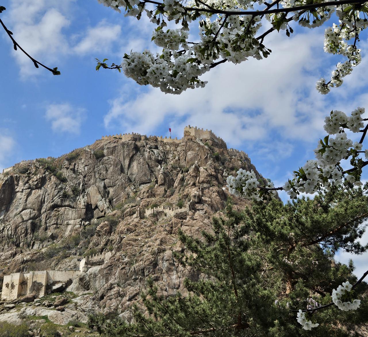
Afyonkarahisar Castle (Photo: Meryem Şentürk Çoban)
The city’s name derives from the word opium, which refers to the sap of the opium poppy plant grown in the region and is pronounced as Afyon in Turkish. The name Afyonkarahisar first appears in 17th-century court records. It is also known that during the Roman and Byzantine periods, the city was called Phrygia Salutaris (Healing Phrygia) due to its thermal springs.
According to archaeological findings, Afyonkarahisar and its surroundings have been inhabited since the 3000s BCE. Excavations in the regions of Kusura Höyük, Kaklık, and Karaoğlan have uncovered artifacts from the Bronze Age. During this period, tools and implements made of stone, clay, bone, and bronze, textile equipment, and grave goods have been discovered.
During the Hittite period, Afyonkarahisar lay along an important trade route. The Boğazköy-Apassa (Ephesus) trade route would later be known as the King’s Road. Excavations from this period have revealed Hittite cube tombs, hieroglyphic stelae, and bronze figurines at the Seydiler Yanarlar site.
The Phrygians settled in the region in the 9th century BCE and left a strong cultural legacy. Important Phrygian monuments such as Yazılıkaya (Midas City), Aslankaya, and Göynüş Valley are located in the rocky area between Afyonkarahisar and Eskişehir. Phrygian culture remained influential in the region until the Byzantine period.
During the Lydian period, significant settlements were established around Dinar and Dazkırı. The Lydians, the first civilization in history to mint coins, strengthened trade in the region. The Persians administered the area, making Dinar their provincial capital.
After Alexander the Great defeated the Persians in 333 BCE, the region was divided among the Hellenistic kingdoms. Subsequently, under Roman rule, Afyonkarahisar became an important marble trading center. Marble from İscehisar (Dokimeion) was exported throughout Roman territories. Important cities such as Apameia (Dinar), Synnada (Şuhut), and Dokimeion (İscehisar) were established in the region.
During the Byzantine period, Afyonkarahisar, especially the area around Amorium (Hisarköy), became a religious and military center. Fortified border outposts were constructed during the 9th and 10th centuries to defend against Arab and Turk raids. However, after the Battle of Manzikert in 1071, the city came under Turkish control.
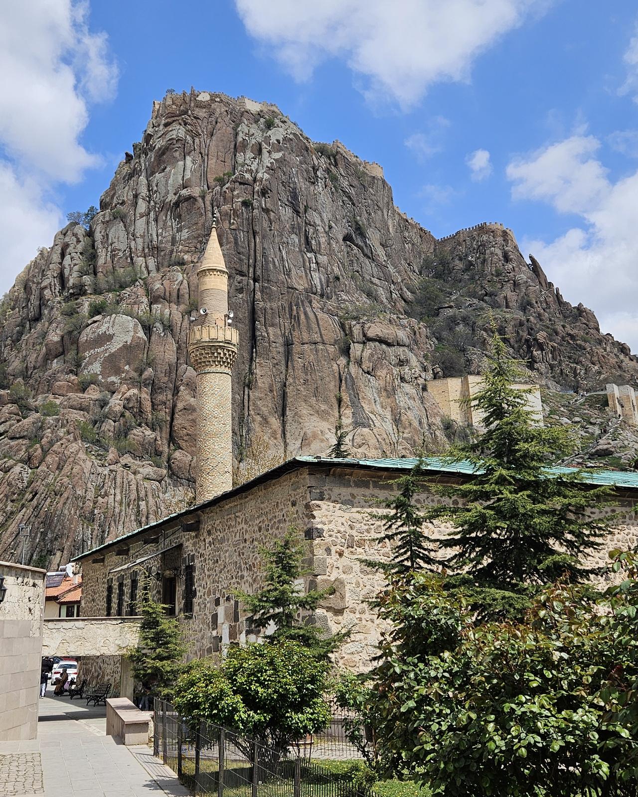
Ulu Camii and Afyonkarahisar Castle (Photo: Meryem Şentürk Çoban)
After the Battle of Manzikert, the Seljuks who entered Anatolia placed great importance on Afyonkarahisar. Under I. Alaeddin Keykubat, the castle’s towers and walls were strengthened, and madrasas and caravanserais were built. Some important Seljuk-era monuments in the city include:
After the Battle of Kösedağ in 1243, the Anatolian Seljuk State weakened and Afyonkarahisar became the capital of the Afyonkarahisar Sahipataoğulları Beylik. Later, under the Germiyanoğulları, the city was ceded to the Ottomans by the will of II. Yakup Bey.
During the Ottoman period, Afyonkarahisar held a strategic position as a transit point between Rumelia and Central Anatolia. It became an important center during Fatih Sultan Mehmet’s campaign against Karaman. Although affected by events such as the Celali rebellions, the Karamanogulları, and the Crusades in the 17th century, the city continued to grow during the Ottoman era. The Mevlevi order became widespread in the city during this period.
During the Ottoman period, tanning, sugar refining, marble processing, and trade flourished in the city. Important monuments from this era include the Grand Mosque, Gedik Ahmet Paşa Complex, and Mevlevihane.
Afyonkarahisar held great strategic importance during the War of Independence. After the Armistice of Mudros, French and Italian forces occupied the region, and on 28 March 1921, it was captured by the Greeks. On 26 August 1922, the day the Great Offensive began, the Turkish army repelled the enemy via the Afyonkarahisar-Kocatepe route, and the city was liberated on 27 August 1922.
With the proclamation of the Republic, Afyonkarahisar began to develop rapidly and became an industrial center. The sugar, cement, flour, animal feed, leather, and marble industries strengthened the city’s economy. With the development of thermal tourism, Afyonkarahisar’s thermal spas became a national and international tourism hub.
Today, Afyonkarahisar continues to be one of Türkiye’s important tourist and cultural centers, thanks to its historical fabric, thermal facilities, rich cuisine, and natural beauty.
Afyonkarahisar is one of the rare provinces in Türkiye that spans three geographical regions. The majority of the province lies within the Inner Western Anatolia section of the Aegean Region, while its eastern areas are influenced by Central Anatolia and its southwestern areas by the Mediterranean Region. Due to this location, it forms a transition zone between the Aegean, Central Anatolian, and Mediterranean regions.
The province borders Konya to the east, Uşak to the west, Kütahya to the northwest, Denizli to the southwest, Burdur to the south, Isparta to the southeast, and Eskişehir to the north. Located between 37° 45' and 39° 17' north latitude and 29° 40' and 31° 43' east longitude, the province has an average elevation of 1,034 meters above sea level.
Afyonkarahisar, situated at the convergence point of three regions, features a natural landscape of high plateaus, mountains, plains, and significant water sources. The region experiences a continental climate with cold, snowy winters and hot, dry summers. Due to its distance from the sea and high elevation, temperature variations are pronounced. Afyonkarahisar remains an important center for agriculture, industry, tourism, and trade, shaping the region’s economic and social life through its climate, water resources, and geographical structure.
Afyonkarahisar forms the southern part of a highland corridor extending from north to south, connecting Western Anatolia to Central Anatolia. As such, it serves as a natural transit corridor and is a key intersection point for road and rail networks.
Within the provincial boundaries, mountains cover 47.5%, plateaus 32.6%, and plains 19.9%. The surface features of Afyonkarahisar generally consist of high mountains, extensive plateaus, and plains.
Afyonkarahisar possesses significant rivers and lakes as water sources.
Although located within the Aegean Region, Afyonkarahisar does not exhibit a typical Aegean climate due to its position as a transition corridor to Central Anatolia. The high elevation and distance from the sea make the effects of a continental climate prominent. Nevertheless, air currents from the Aegean and Mediterranean regions partially moderate the city’s climate.
Generally, the climate features hot and dry summers, warm and rainy springs, and cold and snowy winters.
The direction and speed of winds in Afyonkarahisar are determined by general atmospheric circulation, frontal effects, and topographic conditions.
Afyonkarahisar has been under the influence of various civilizations throughout history and has remained a significant settlement center due to its geographical location. Its population structure has been influenced by various factors such as urbanization, economic activities, migration movements, and agrarian living conditions.
During the Ottoman period, Afyonkarahisar developed as an important trade and craft center and experienced population growth. In the 16th century, approximately 8,500 people lived in the city. By 1572, this number had reached 9,400, and the population consisted of Muslims, Christians, and Jews. According to Evliya Çelebi’s 17th-century records, the city’s population was approximately 20,000.
In the 19th century, with the construction of railways and the beginning of industrialization, population growth accelerated. In 1890, the city’s population was recorded as 17,436, rising to 33,000 by 1902. During this period, the city continued to grow through migration and commercial activities.
After the proclamation of the Republic, population growth in Afyonkarahisar continued, and the city expanded through industrial and transportation investments. In 1927, the city’s population did not reach 25,000, but it increased in subsequent years as follows:
During this period, Afyonkarahisar became one of the main centers for agriculture, industry, and trade, and population density increased.
In Afyonkarahisar, the urban population is increasing, while the rural population, tied to agricultural production and livestock, remains less dense. Alongside the agrarian economy, the development of industry and trade has affected population mobility and increased the rate of urbanization.
According to 2024 data, the total population of Afyonkarahisar is 750,193. According to 2024 figures, the male population is 375,263 and the female population is 374,930.
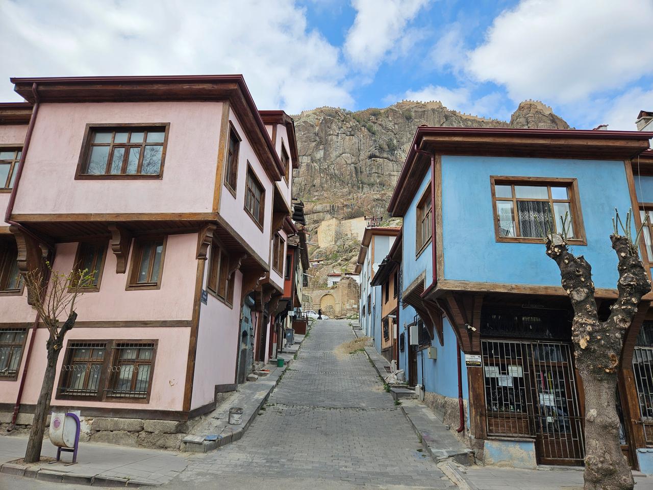
Streets of Afyonkarahisar (Photo: Meryem Şentürk Çoban)
Afyonkarahisar is a city that maintains its importance as a strategic transit point due to its geographical location, with growth in agriculture, livestock, industry, and trade. The convergence of traditional production activities and modern investments has contributed to the diversification and expansion of the province’s economic structure.
Agriculture and livestock are among the foundational pillars of Afyonkarahisar’s economy. Arable and non-arable land is evenly distributed across the province.
The province’s total area is 1,423,000 hectares, of which 48% is arable agricultural land.
Agriculture in Afyonkarahisar is concentrated primarily in the plains, with vegetable and fruit production taking precedence.
Afyonkarahisar is undergoing a transition from traditional to modern livestock farming. Beef cattle farming is particularly intensive in the central region and its surroundings.
Industry in Afyonkarahisar began with agriculture-based activities but diversified and expanded over time.
Industrial facilities in Afyonkarahisar have generally developed based on local resources.
The sectoral distribution of industrial facilities in Afyonkarahisar is as follows:
Afyonkarahisar is an important center for road and rail transportation due to its geographical location.
Afyonkarahisar, located at the intersection of major highways and railways, has significantly contributed to the rapid development of trade. This advantage has accelerated the growth of the organized industrial zone.
Afyonkarahisar has significant potential in thermal tourism, cultural tourism, and nature tourism. Thermal spa and tourism activities make a major contribution to the economy. Particularly the thermal centers of Gazlıgöl, Sandıklı-Hüdai, Ömer-Gecek, and Bolvadin-Heybeli are of great importance for health tourism.
Afyonkarahisar is a city with rich tourism potential due to its historical and natural beauty, thermal springs, cultural heritage, and handicrafts. The province, marked by archaeological remains, historical structures, caves, thermal springs, fairy chimneys, open-air temples, and traditional cuisine from thousands of years of civilizations, serves as a destination for many forms of tourism besides seaside tourism.
However, Afyonkarahisar has not fully benefited from the opportunities provided by the tourism sector. The main reasons include:
In recent years, the Ministry of Culture and Tourism has developed various projects to sustain and diversify tourism throughout the year, with increased investments in thermal tourism. As a result of these investments, Afyonkarahisar has begun to reach its rightful position and has become one of Türkiye’s most important thermal tourism centers.
Afyonkarahisar’s tourism potential is categorized as follows:
Afyonkarahisar is among the few provinces in Türkiye renowned for its spas and thermal springs. The healing waters of its thermal sources are used to treat numerous health conditions, particularly rheumatic diseases, skin disorders, and musculoskeletal disorders.
The province has four major thermal centers officially designated as “Tourism Centers” by the Ministry of Culture and Tourism:
These centers feature modern hotels, spa facilities, cure centers, and spas, providing year-round services to visitors seeking healing. In recent years, investments in thermal tourism in Afyonkarahisar have accelerated, and the number of five-star thermal hotels has increased.
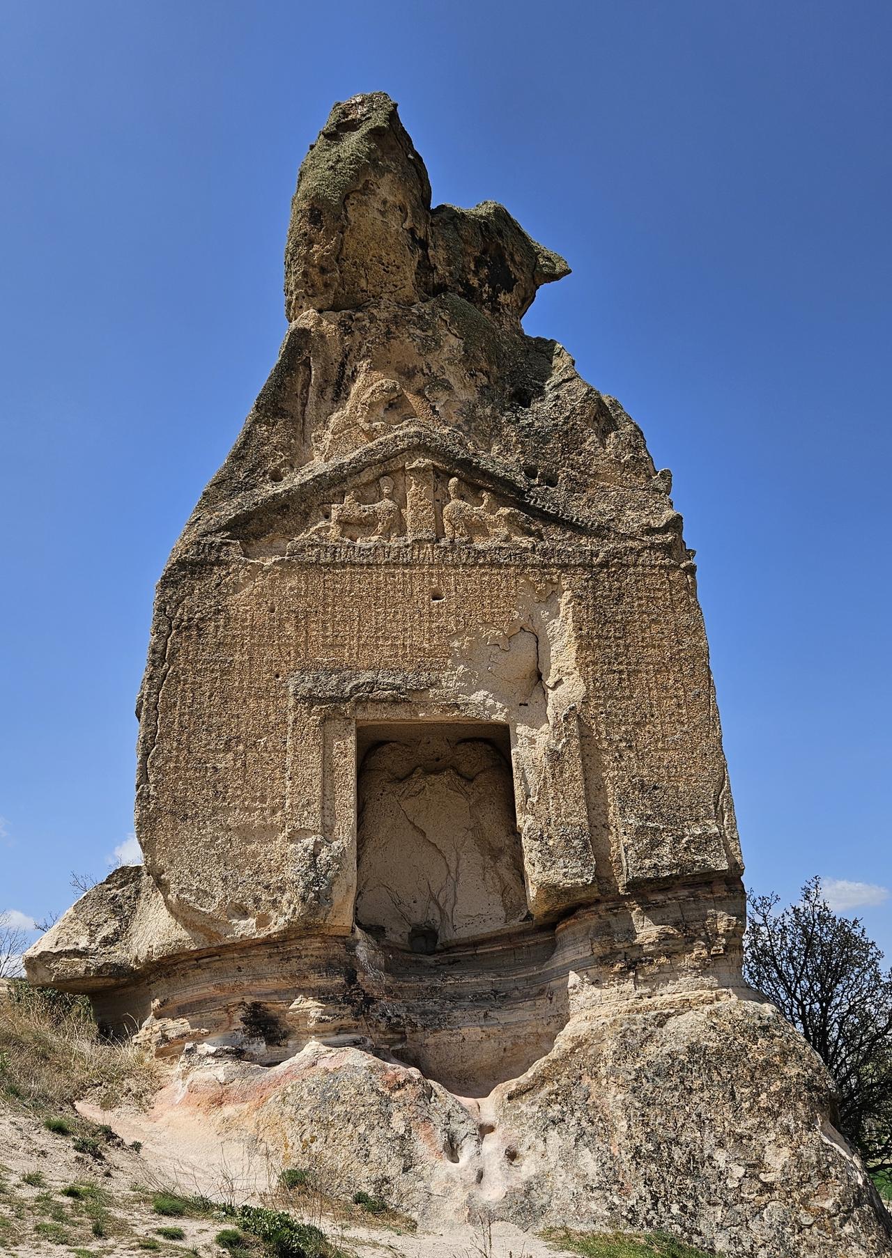
Aslankaya (Photo: Meryem Şentürk Çoban)
Afyonkarahisar possesses great potential for cultural tourism due to its historical monuments and archaeological remains. The city bears traces of many civilizations, including the Hittites, Phrygians, Lydians, Romans, Byzantines, Seljuks, and Ottomans.
The main cultural and historical tourism sites include:
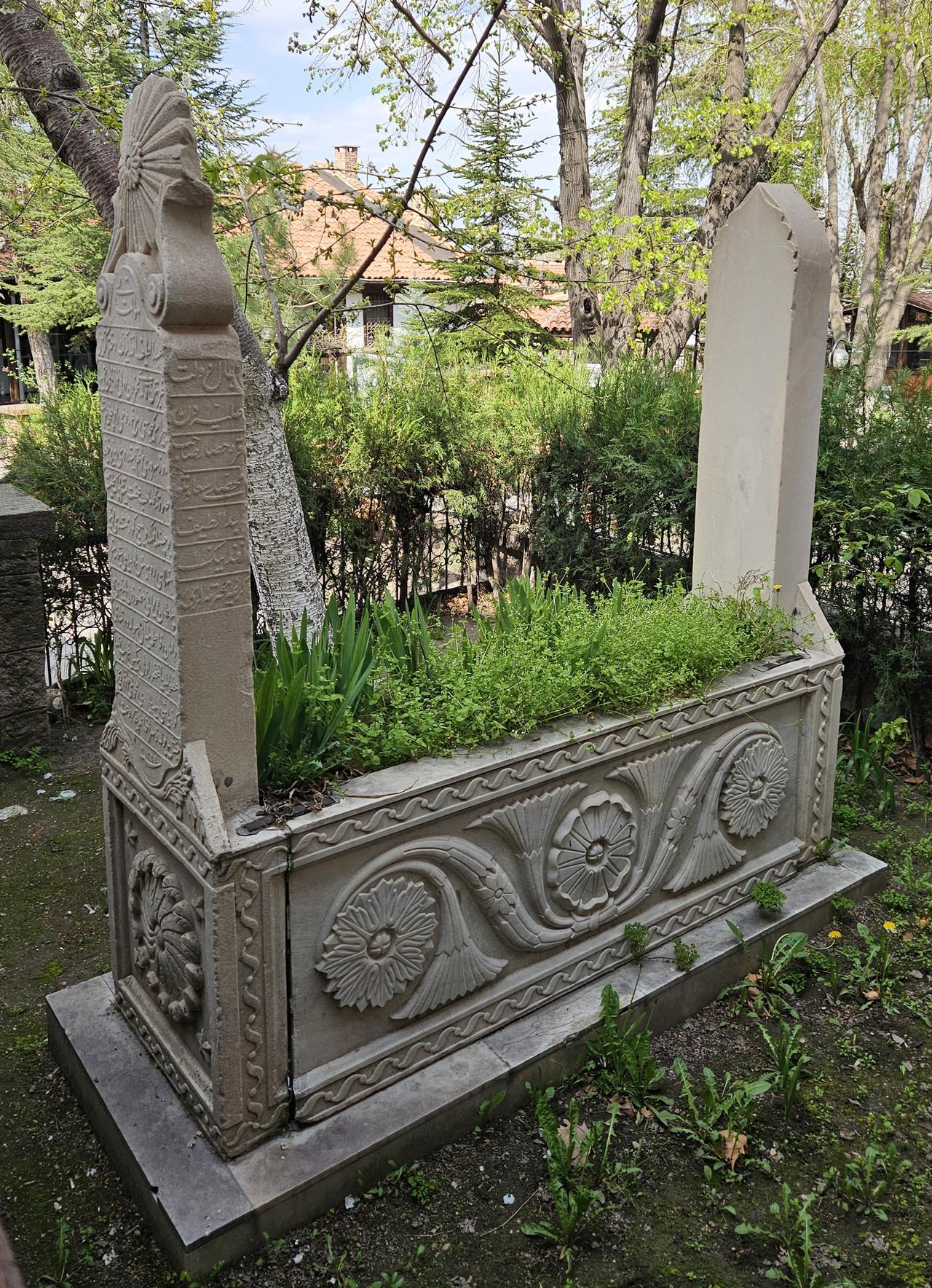
The grave of Fatıma Zehra Hanım, mother of Namık Kemal, located in the Mevlevihane cemetery (Photograph: Meryem Şentürk Çoban)
Afyonkarahisar is also notable for its natural beauty and natural areas.
The main nature tourism sites include:
Various cultural and tourism festivals are held throughout the year in Afyonkarahisar. These festivals are important events for promoting the city’s cultural values and revitalizing tourism.
The main festivals include:
Afyonkarahisar is an attractive destination for tourists due to its local products and traditional handicrafts. The city is renowned for centuries-old handicrafts, whose products are a significant shopping resource for visitors.
The main local products include:
Afyonkarahisar has numerous facilities with tourism operation licenses. Particularly thermal hotels and spas offer luxurious and comfortable accommodation options for domestic and foreign tourists.
Additionally, the city has travel agencies and guiding services that operate to develop tourism.
As of 18 May 2022, the governor of Afyonkarahisar is Kübra Güran Yiğitbaşı. The mayor is Burcu Köksal. Köksal is also, as of 31 March 2024, the first female mayor of Afyonkarahisar. Afyonkarahisar has 17 districts, 60 municipalities, 42 towns, and 421 villages.
The districts of Afyonkarahisar are:
Emecen, Feridun. "Afyonkarahisar." *Türkiye Diyanet Vakfı İslam Ansiklopedisi*. Accessed February 13, 2025.https://islamansiklopedisi.org.tr/afyonkarahisar
T.C. Afyonkarahisar Valiliği. "Valilik, Yöneticilerimiz." Accessed February 13, 2025.http://www.afyonkarahisar.gov.tr/yoneticilerimiz
T.C. Kültür ve Turizm Bakanlığı Afyonkarahisar İl Kültür ve Turizm Müdürlüğü. "Tarihçe." Accessed February 13, 2025.
T.C.Afyonkarahisar Belediyesi. "Başkan." Accessed February 13, 2025.https://www.afyon.bel.tr/baskan
T.C.Afyonkarahisar Belediyesi. "Konumu." Accessed February 13, 2025.https://www.afyon.bel.tr/idet/4/4/konumu
T.C.Afyonkarahisar Belediyesi. "Sanayi." Accessed February 13, 2025.https://www.afyon.bel.tr/idet/8/8/sanayi
T.C.Afyonkarahisar Belediyesi. "Tarih." Accessed February 13, 2025.https://www.afyon.bel.tr/icerikler/58/3/tarih
T.C.Afyonkarahisar Belediyesi. "Tarım." Accessed February 13, 2025.https://www.afyon.bel.tr/idet/7/7/tarim
T.C.Afyonkarahisar Belediyesi. "Turizm." Accessed February 13, 2025.https://www.afyon.bel.tr/idet/10/709/afyonkarahisarda-turizm
T.C.Afyonkarahisar Belediyesi. "İklim." Accessed February 13, 2025.https://www.afyon.bel.tr/idet/6/6/iklim
T.C.Afyonkarahisar Belediyesi. "İlimizi Tanıyalım, İlçelerimiz." Accessed February 13, 2025.https://www.afyon.bel.tr/icerikler/58/17/ilcelerimiz
T.C.Afyonkarahisar Valiliği. "İlçelerimiz." Accessed February 13, 2025.http://www.afyonkarahisar.gov.tr/ilcelerimiz
Türkiye İstatistik Kurumu. "Afyonkarahisar." Accessed February 13, 2025.https://cip.tuik.gov.tr/

Afyonkarahisar
Country | Türkiye | ||||||||
|---|---|---|---|---|---|---|---|---|---|
Region | Aegean Region | ||||||||
Population (Number) | 750193 | ||||||||
Important Structure | Sahipata Kervansarayı Peribacaları Afyonkarahisar Kalesi Aslankaya Mevlevihane Gedik Ahmet Paşa Külliyesi Ulu Camii | ||||||||
Governor | Kübra Güran Yiğitbaşı | ||||||||
Mayor | Burcu Köksal | ||||||||
Area Code | 272 | ||||||||
License Plate Code | 03 | ||||||||
No Discussion Added Yet
Start discussion for "Afyonkarahisar (Province)" article
The History of Afyonkarahisar
Prehistory and Antiquity in Afyonkarahisar
Afyonkarahisar in History
Hittites (1800–1200 BCE)
Phrygians (1200–546 BCE)
Lydians (660–546 BCE) and Persians (546–333 BCE)
Hellenistic Period and Roman Empire (333 BCE–395 CE)
Byzantine Period (395–1176)
Turkish Rule in Afyonkarahisar
Seljuks and Beylik Period (1071–1428)
Ottoman Period (1428–1922)
War of Independence and Afyonkarahisar
Afyonkarahisar in the Republican Era
Geography
Landforms
Rivers and Lakes
Rivers:
Lakes:
Climate
Winds and Meteorological Observations
Population
Population of Afyonkarahisar Through History
Population Development of Afyonkarahisar in the Republican Era
Contemporary Population Structure of Afyonkarahisar
Economy
Agriculture and Livestock
Agricultural Products
Livestock
Industry
Industrial Zones and Organized Industrial Areas
Key Industrial Sectors
Distribution of Industrial Facilities
Trade and Transportation
Tourism and Its Contribution to the Economy
Tourism
Thermal Tourism and Spas (Health Tourism)
Phrygian Rock Monuments and Open-Air Temples
Cultural and Historical Tourism
Afyonkarahisar Castle
Grand Mosque and Gedik Ahmet Paşa Complex
Mevlevihane
Afyonkarahisar Archaeology Museum
Nature Tourism and Natural Beauty
Festivals and Celebrations
Shopping and Local Products
Tourism Facilities and Accommodation Options
Administrative Structure