

`satellite-images` Related Article Results
Spectral Resolution in Satellite Images
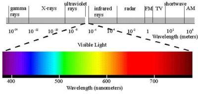
Satellite imaging systems play a critical role in remote sensing applications. In these systems, spectral resolution defines which bands of the electromagnetic spectrum a sensor can detect and is an important factor in image analysis. Sensors with higher spectral resolution can distinguish between different types of materials and land cover more precisely by collecting data in narrower band intervals. Spectral resolution can be achieved through hyperspectral and multispectral imaging systems. Th
EN
Betül Kırımlıoğlu
Damage Detection in Forest Fire Areas Using Satellite Imagery
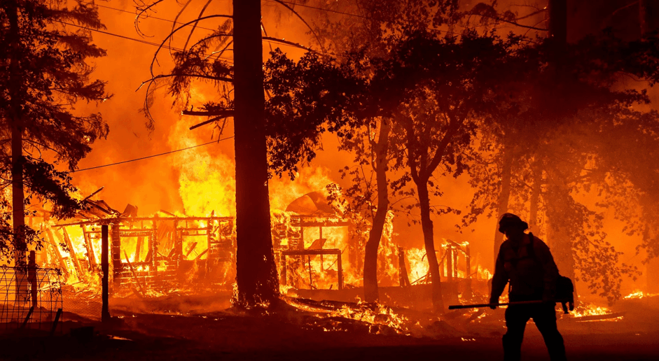
Forest fires are natural disasters that cause severe damage to ecosystems. Accurate assessment of damage after Fire is critical for monitoring ecological recovery and planning reforestation initiatives to do. Satellite imagery is one of the most effective methods for fire detection, as it can cover vast areas in short time. Remote perception technologies enable the identification of fire-affected areas, classification of damage levels, and analysis of long-term ecosystem impacts long. One image
EN
Betül Kırımlıoğlu
Google Earth Engine (GEE)
Google Earth Engine (GEE) is a cloud-based Geographic Information System (GIS) and remote sensing platform developed by Google that enables the analysis of planetary-scale environmental data. GEE provides advanced computational infrastructure for monitoring, modeling, and analyzing environmental data over time such as surface temperature vegetation cover land use and water presence. By utilizing data derived from satellite imagery it offers a wide range of applications including land classificat
ENBetül Kırımlıoğlu
 Go
GoGoogle Earth
Google Earth is a virtual globe, map, and geographical information program that presents a three-dimensional representation of World, primarily based on satellite imagery. Developed by Google, this program enables users to explore different regions around the world using high-resolution graphics. Google Earth is not only a simple navigation tool but has also become a versatile platform for education, research, and exploration by offering features such as historical imagery, ocean exploration, an
EN
Abdurrahman Abdul Mujeeb
Spectral Resolution in Satellite Images
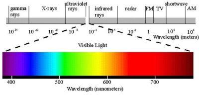
Satellite imaging systems play a critical role in remote perception applications. In these systems, spectral resolution defines which bands of the electromagnetic spectrum a sensor can detect and is a key factor in image analysis important. Sensors with higher spectral resolution can distinguish between different material and land cover types in greater detail by collecting data in narrower band intervals data. Spectral resolution can be achieved through hyperspectral and multispectral imaging s
ENBetül Kırımlıoğlu
Google Earth Engine (GEE)
Google Earth Engine (GEE) is a cloud-based Geographic Information System (GIS) and remote sensing platform developed by Google that enables the analysis of planetary-scale environmental data. GEE provides advanced computational infrastructure for monitoring, modeling, and analyzing environmental data over time such as surface temperature, vegetation cover, land use, and water presence. By utilizing data derived from satellite imagery, it offers a wide range of applications including land classif
ENBetül Kırımlıoğlu
GoGoogle Earth
Google Earth is a virtual globe, map, and geographical information program that presents a three-dimensional representation of the Earth, primarily based on satellite imagery. Developed by Google, this program enables users to explore different regions of the world using high-resolution graphics. Google Earth is not only a simple navigation tool but has also become a versatile tool for education, research, and entertainment by offering features such as historical imagery, ocean exploration, and
EN
Abdurrahman Abdul Mujeeb
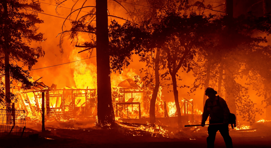
Damage Detection in Forest Fire Areas Using Satellite Imagery
Orman fires are natural disasters that cause severe damage to ecosystems. Accurate assessment of post-fire damage is critical for monitoring ecological recovery and planning reforestation efforts. Satellite imagery is one of the most effective methods for damage detection, as it can cover large areas in a short time. Remote sensing technologies enable the identification of fire-affected areas, classification of damage severity, and analysis of long-term impacts on ecosystems. An image from a U.S
ENBetül Kırımlıoğlu