


This article was automatically translated from the original Turkish version.
+1 More
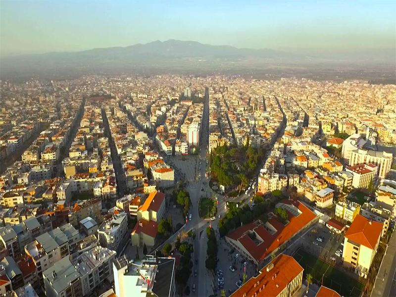
Turgutlu (District)
Province | Manisa | ||||||||
|---|---|---|---|---|---|---|---|---|---|
Region | Aegean Region | ||||||||
Surface Area | 530 km² | ||||||||
Elevation | 78 m | ||||||||
Population | 180,000 (2023) | ||||||||
Climate | Mediterranean climate | ||||||||
Number of Neighborhoods | 61 | ||||||||
Postal Code | 45410 | ||||||||
Telephone Code | 0236 | ||||||||
Turgutlu is a district in western Türkiye, subordinate to Manisa province, known for its historical heritage and significant agricultural and industrial production. Located on the plains of the Gediz River, the district has served as an economic and cultural center throughout history due to its strategic location.
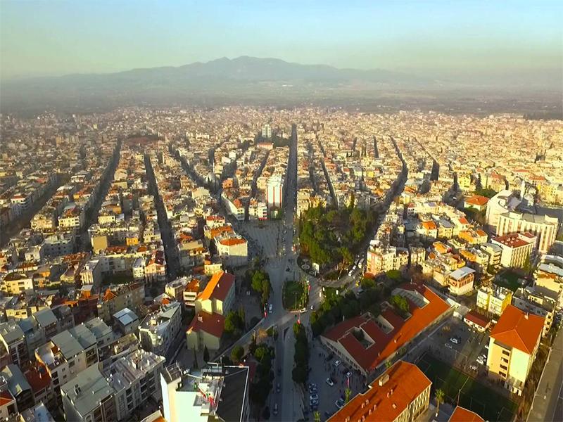
Turgutlu (Turgutlu Adliyesi)
Turgutlu’s history extends back to antiquity. The region was ruled by civilizations including Lydia, Persia, Rome, and Byzantium. During the Ottoman period its strategic importance increased, especially after the opening of the İzmir-Kasaba (Turgutlu) railway line in 1866, which transformed it into a commercial hub. This line is significant as one of the first areas in Anatolia to be connected by railway.
The district’s former name was “Kasaba,” which gradually changed to “Turgutlu.” It is traditionally believed that the name derives from the Turgutlu tribe of the Oghuz Turks. In the early 20th century, the district suffered a major catastrophe: on 7 September 1922, the day Greek occupation ended, a large portion of the town was burned and destroyed. As a result of this fire, approximately 9,000 buildings were completely destroyed, and the town entered a prolonged reconstruction process. During the Republican era, Turgutlu was reshaped through planned urbanization and public investment.
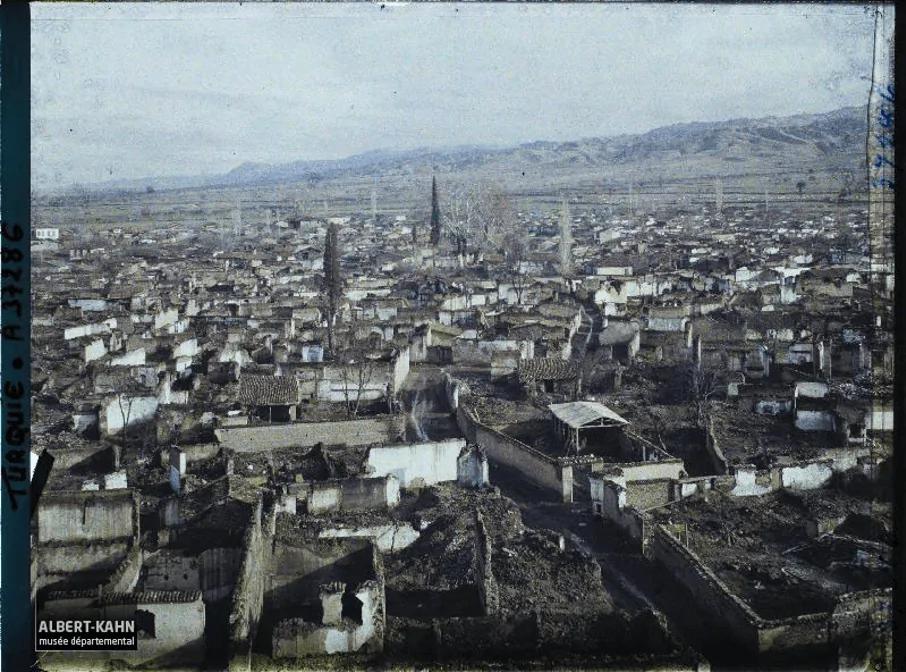
Turgutlu after the occupation (Turgutlu Belediyesi)
Turgutlu is situated on a broad and fertile plain watered by the Gediz River. To the east lies Ahmetli, to the west Manisa, to the north Saruhanlı, and to the south Kemalpaşa district of İzmir. With an area of approximately 530 km², 45 percent of Turgutlu is covered by agricultural land and 27 percent by forests and shrublands.
The climate exhibits typical Mediterranean characteristics: hot and dry summers, and mild, rainy winters. This climatic structure positively influences agricultural production and also provides favorable conditions for nature tourism.
According to 2023 TÜİK data, Turgutlu’s population is approximately 180,000. The majority of this population resides in the district center. There are 61 neighborhoods in the district. While the age distribution is balanced, the proportion of young people is high. Due to its status as a destination for migration, the social structure is diverse.
Turgutlu lies on the İzmir-Ankara Highway and the İzmir-Uşak railway line. It is 45 km from İzmir and 31 km from the city center of Manisa. The well-developed road and rail infrastructure provides advantages for marketing both agricultural and industrial products. Additionally, its proximity to İzmir Adnan Menderes Airport (approximately 50 km) creates a strategic position for foreign trade and transportation.
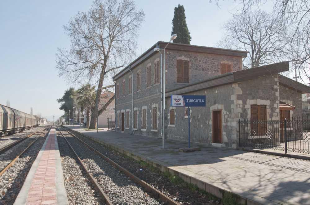
Turgutlu Train Station (Kültür Portalı)
Turgutlu is one of the districts recognized for simultaneously developing agriculture and industry:
Thanks to the fertile soils of the Gediz Plain, a wide variety of products are cultivated, including tomatoes, grapes, watermelons, cotton, olives, and corn. The district holds a share in Türkiye’s export of fresh vegetables and fruits. Modern irrigation systems and greenhouse farming are also advancing.
The industrial sector is the engine of Turgutlu’s economy. The Turgutlu Organized Industrial Zone (TOSBİ) hosts numerous domestic and foreign companies. Industrial facilities operating in textiles, metal processing, automotive ancillary industries, packaging, plastics, and machinery manufacturing serve as major sources of employment. Industrial investments have also accelerated migration into the district.
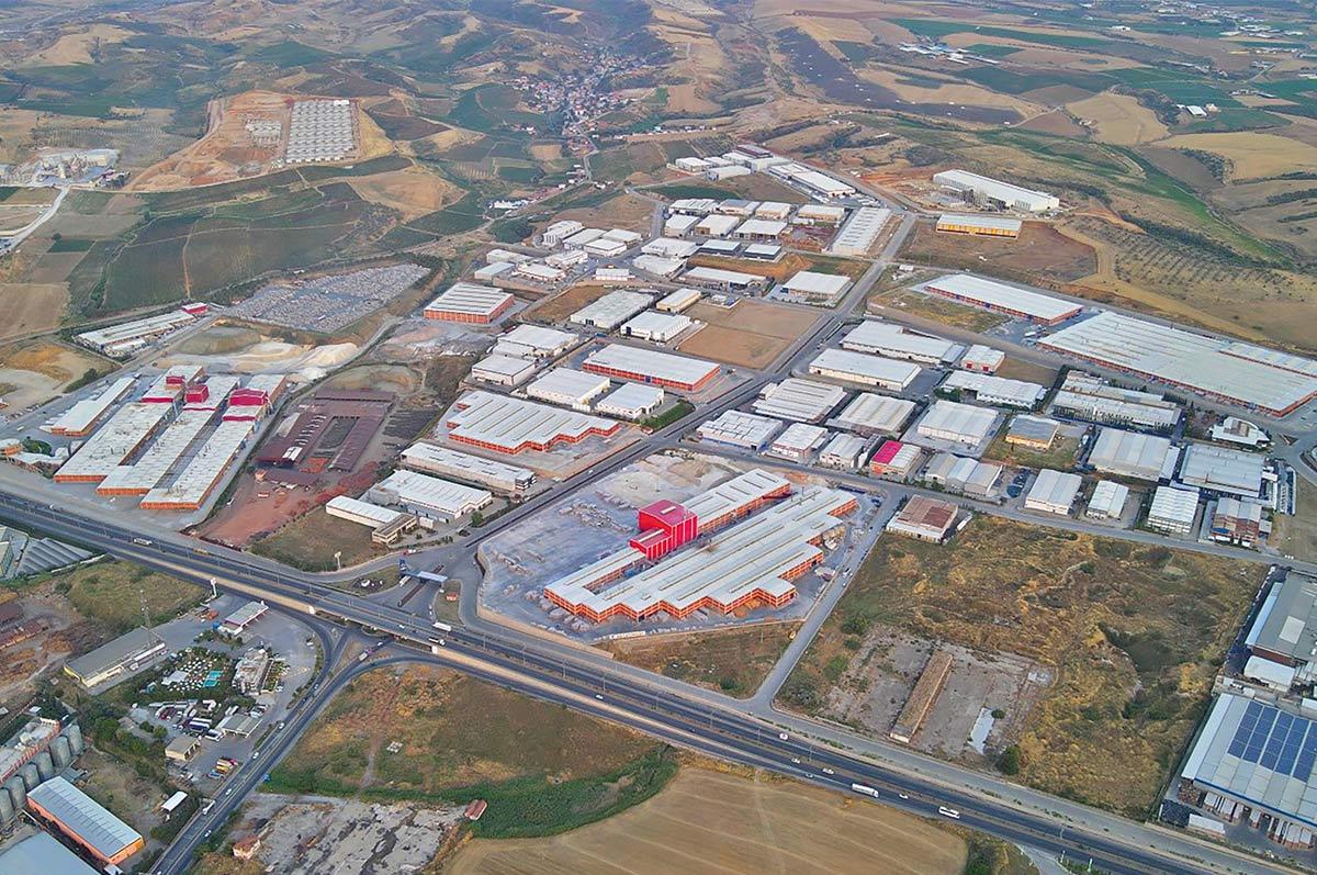
Turgutlu 1st OSB (Sanayi Portalı)
The district has a well-developed commercial network. The Turgutlu Chamber of Commerce and the Turgutlu Chamber of Industry and Commerce support local producers and manufacturers through various initiatives.
The district has numerous primary schools, middle schools, high schools and the Turgutlu Vocational School affiliated with Manisa Celal Bayar University. The educational infrastructure expands every year.
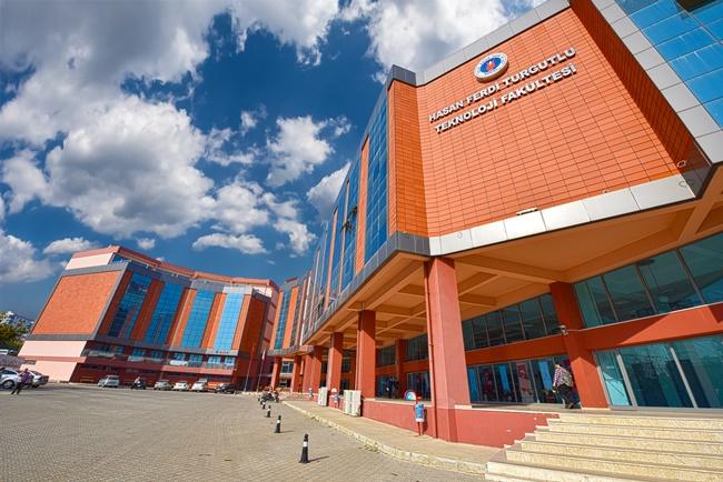
Hasan Ferdi Turgutlu Faculty of Technology (MCBÜ)
Culturally, the Turgutlu City Museum, opened in 2014, preserves and promotes the district’s historical memory. The museum displays archaeological finds, artifacts from the Ottoman period, historical photographs, and objects reflecting traditional ways of life.
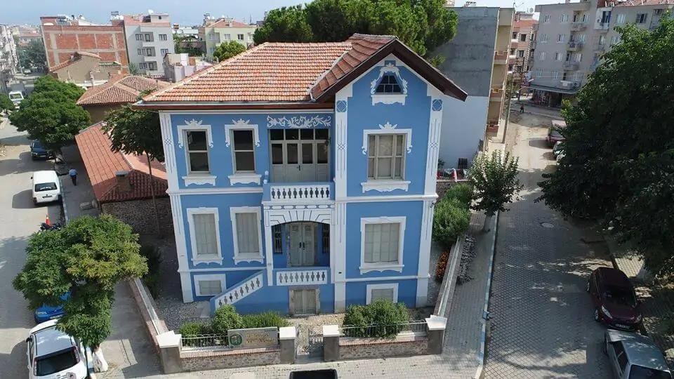
Turgutlu City Museum (Turgutlu Belediyesi)
Known for their therapeutic properties, the mineral-rich thermal waters are beneficial for rheumatism, skin diseases, and muscular disorders.
Offer suitable environments for hiking trails, forested areas, and nature-based sports.
Turgutlu Ulu Camii, Çifte Hamam, and various Ottoman-era houses reflect the district’s historical fabric.
Festivals, concerts, and fairs organized by the Turgutlu Municipality help sustain local culture.
The Turgutlu Municipality and the Turgutlu District Governorship are responsible for the district’s administrative and social management. Through a social municipal approach, initiatives support disadvantaged groups, environmental improvements, cultural activities, and sports investments.
Manisa İl Directorate of Culture and Tourism. "Turgutlu." Ministry of Culture and Tourism of the Republic of Turkey,https://manisa.ktb.gov.tr/TR-152080/turgutlu.html. Accessed June 12, 2025.
Turgutlu Belediyesi. "Coğrafi Yapı." Accessed June 12, 2025.
Turgutlu Belediyesi. "Kent Müzesi." Accessed June 12, 2025.
Turgutlu Belediyesi. "Kent Tarihi." Accessed June 12, 2025.
Turgutlu Belediyesi. "Sosyo-Ekonomik Yapı." Accessed June 12, 2025.
Turgutlu Belediyesi. “Turizm.” Accessed June 12, 2025.
Turgutlu Kaymakamlığı. "Sanayi." Accessed June 12, 2025.
Turgutlu Kaymakamlığı. "Tarihten Günümüze Turgutlu." Accessed June 12, 2025.
Turgutlu Ticaret Borsası. "Hakkında." Accessed June 12, 2025.
Turgutlu Ticaret Borsası. "Nüfus ve Ulaşım." Accessed June 12, 2025.
Turgutlu Ticaret of Commerce. "Tarihçe." Accessed June 12, 2025.

Turgutlu (District)
Province | Manisa | ||||||||
|---|---|---|---|---|---|---|---|---|---|
Region | Aegean Region | ||||||||
Surface Area | 530 km² | ||||||||
Elevation | 78 m | ||||||||
Population | 180,000 (2023) | ||||||||
Climate | Mediterranean climate | ||||||||
Number of Neighborhoods | 61 | ||||||||
Postal Code | 45410 | ||||||||
Telephone Code | 0236 | ||||||||
No Discussion Added Yet
Start discussion for "Turgutlu (District)" article
History
Geography and Climate
Population and Demographics
Transportation
Economy
Education and Culture
Tourism and Natural Riches
Urganlı Thermal Springs
Footsteps of Spil Mountain
Historic Structures
Cultural Events:
Administration and Social Structure