


This article was automatically translated from the original Turkish version.
Tortum, Erzurum
District Area | 1467 km² | ||||||||
|---|---|---|---|---|---|---|---|---|---|
Number of Villages in the District | 57 | ||||||||
Elevation of the District | 1.450 | ||||||||
Population of the District | 14.391 | ||||||||
District Governor's First and Last Name | Fatih Bayram | ||||||||
Mayor | Muammer Yiğider | ||||||||
Erzurum province’s northeastern region is home to the district of yer, known for its natural landscapes, historical structures, and especially the Tortum Waterfall, regarded as one of Türkiye’s highest waterfalls. The district, characterized by a mountainous and rugged terrain, also holds tourism potential through Tortum Lake and its surrounding recreational areas. Located 52 kilometers from the city center of Erzurum, it lies along the Erzurum-Artvin road, which is fully divided asphalt.
The history of Tortum and its surroundings extends back to ancient times. Research in the region indicates settlement as early as the Early Bronze Age. Under the rule of the Urartians, Romans, and Byzantines, Tortum came under Turkish control following the 1071 Battle of Manzikert. During the Seljuk and Ottoman periods, it maintained its status as an important settlement. Particularly during the Saltukid era, Tortum Castle served as a significant military and administrative center. Due to its location within the basin, Tortum functions as a transitional and blending point between Black Sea culture and inland traditions, hosting diverse cultural elements from cuisine to folk dances.
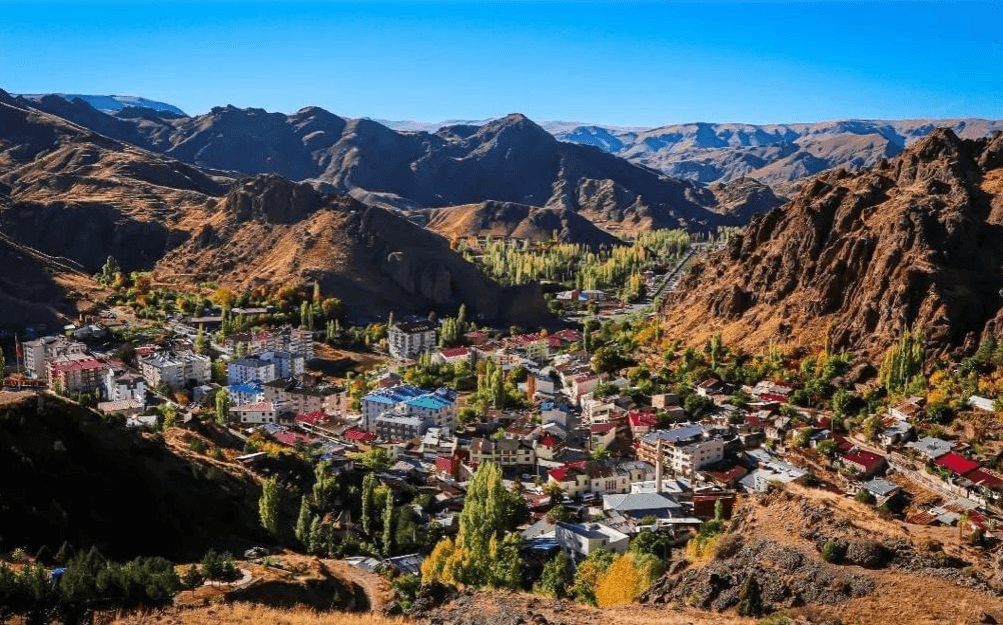
Tortum (Source:Tortum District Governorship)
Tortum district is located in the northeast of Erzurum. It borders Uzundere to the east, Erzurum center and Pasinler to the south, İspir to the west, and Yusufeli district of Artvin to the north. Its area is 1,484 km². The district’s terrain is predominantly mountainous and rugged. The southern extensions of the Kaçkar Mountains lie in the northern part of the district, where deep valleys and rivers are found. The most important water source in the district is Tortum Lake. The Tortum River flows out of this lake, forming the Tortum Waterfall—one of Türkiye’s best-known waterfalls—before emptying into the Çoruh River. The district’s land, situated along the Erzurum-Artvin road, features mountainous terrain with deep valleys. Villages along these valleys contain fruit orchards and notable natural features. In the south and west of Tortum, located north of Erzurum, a continental climate prevails, while the north and east exhibit a moderate Black Sea climate.
Tortum exhibits transitional characteristics between Eastern Black Sea and continental climates. Summers are mild and rainy, while winters are cold and snowy. The annual average temperature is low. Winters are especially harsh and prolonged in higher altitude areas. Spring and autumn months are marked by variable weather conditions.
Population in Tortum ranks 12th among Erzurum’s districts. According to 2023 TÜİK data, its total population is 17,418, of which 49.64% (8,699) are male and 50.36% (8,719) are female. In the 2000 census, the population was approximately 34,100, equating to about 23 people per km². The district includes four towns (Bağbaşı, Pehlivanlı, Şeyyurt, and Yukarı Katıklı) and 47 villages, typically situated along small valleys. The literacy rate in the district is 95% according to TÜİK data. Tortum has a total of 34 primary and secondary schools, 136 classrooms, 209 teachers, and 1,469 students. Additionally, the Tortum Vocational School of Higher Education, affiliated with Atatürk University, provides services in the district.
Tortum’s economy is based on agriculture, animal husbandry, and tourism. Fruit cultivation (especially apricot, walnut, grape, mulberry, and locally abundant mulberry molasses), vegetables, and cereals are cultivated in valley bottoms. In the southern areas, animal husbandry—particularly small livestock—is the main source of livelihood. Beekeeping is also an important economic activity. Tourism, due to the district’s natural beauty and historical structures, especially Tortum Lake and the Tortum Waterfall, is becoming increasingly significant to the local economy.
Tortum is a valuable district for tourism due to its striking natural beauty and historical heritage. Its location in the northern basin has endowed it with a rich and diverse cultural legacy.
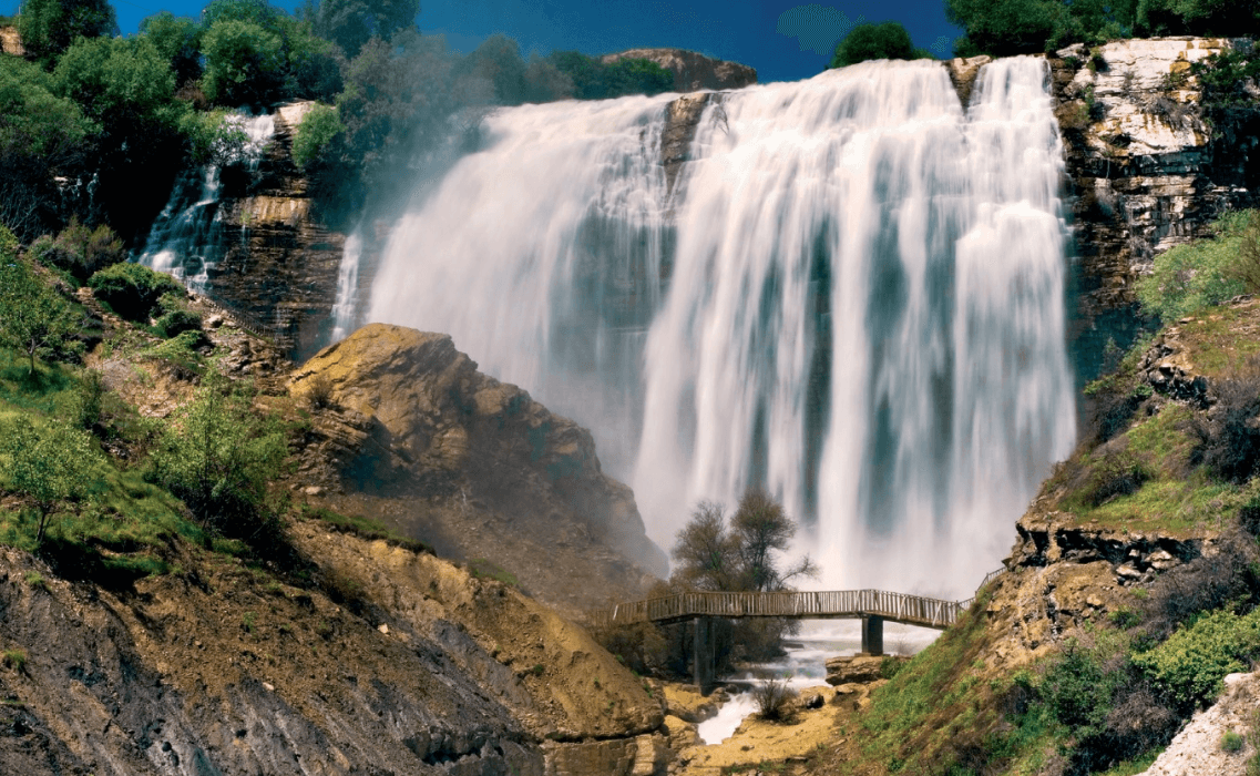
Tortum Waterfall (Source:Erzurum Governorship)
Located in the Uzundere district of Erzurum, the Tortum Waterfall is considered one of Türkiye’s highest waterfalls. It lies on a landslide mass between the northern end of Tortum Lake and Tev Valley, with a width of 22 meters and a height of 48 meters. Water flowing over resistant limestone layers creates a rainbow above and a striking rock basin below. Picnic areas are located around the waterfall. A hydroelectric power plant constructed between 1952 and 1960 has been used for regional energy production.
This 15-meter-high waterfall in Uzundere district attracts tourist interest during summer months due to its refreshing water. Water levels may occasionally decrease due to irrigation needs for agricultural fields.
Tortum Lake is a natural dam lake formed by a landslide. It attracts attention with its clear waters and natural surroundings. The lake is navigable by boat and features picnic and camping areas along its shores. Trout farming is also practiced in the lake.
Tortum Castle, situated on a hill dominating the district center, has an uncertain construction date, though its architectural style suggests an Ottoman origin. According to Evliya Çelebi’s Seyahatname, it was built by the Georgian king Mameroz-Mağmeral. It was captured and brought under Turk control in 1282 during the reign of Alaaddin Keykubat.
Tortum’s cuisine reflects the interaction between Erzurum and Black Sea culinary traditions. Dishes made from locally grown fruits and vegetables are prominent. Apricot and mulberry are among the region’s key products. Mulberry molasses is widely consumed locally. Other regional delicacies include mıhlama, karalahana sarması, hıngel, and the Erzurum-specific cağ kebab.
Erzurum Büyükşehir Municipality. *İlçe Tanıtımları - Tortum*. Accessed April 18, 2025.https://www.erzurum.bel.tr/AltIcerikDetay/1044/I/1021.html
Erzurum Valiliği. *Tortum Coğrafyası*. Accessed April 18, 2025.http://www.tortum.gov.tr/tortum-cograftasi
Erzurum Valiliği. *Tortum Şelalesi*. Accessed April 18, 2025.http://www.erzurum.gov.tr/tortumselalesi
Erzurum İl Kültür ve Turizm Müdürlüğü. *Tortum*. Accessed April 18, 2025.https://erzurum.ktb.gov.tr/TR-56048/tortum.html
Türkiye İstatistik Kurumu (TÜİK). *Coğrafi İstatistik Portalı*. Accessed April 18, 2025.https://cbs.tuik.gov.tr/
Tortum, Erzurum
District Area | 1467 km² | ||||||||
|---|---|---|---|---|---|---|---|---|---|
Number of Villages in the District | 57 | ||||||||
Elevation of the District | 1.450 | ||||||||
Population of the District | 14.391 | ||||||||
District Governor's First and Last Name | Fatih Bayram | ||||||||
Mayor | Muammer Yiğider | ||||||||
History
Geography
Climate
Population and Demographics
Economy
Tourism - Culture - Cuisine
Tortum Waterfall
Uzundere Sudökülen Waterfall
Tortum Lake
Tortum Castle
Other Historical and Natural Sites
Cuisine