


This article was automatically translated from the original Turkish version.
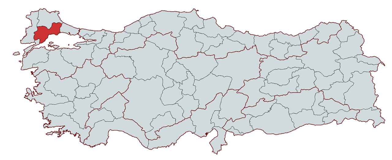
Tekirdağ
Country | Türkiye | ||||||||
|---|---|---|---|---|---|---|---|---|---|
Region | Marmara Region | ||||||||
Population | 1,187,162 | ||||||||
Area | 6,190 | ||||||||
Climate | Marmara Transition Climate | ||||||||
Important Structure | Süleymaniye Camii (Çorlu) Namık Kemal House Rakoczi Museum Hora Lighthouse Rüstem Paşa Camii | ||||||||
Governor | Recep Soytürk | ||||||||
Metropolitan Municipality Mayor | Candan Yüceer | ||||||||
Area Code(s) | 282 | ||||||||
License Plate Code | 59 | ||||||||
Tekirdağ is a province located in the northwestern part of Türkiye, within the Thrace region of the Marmara Region. It is bordered by Istanbul to the east, the Marmara Sea and Çanakkale to the south, Edirne to the west, Kırklareli to the north, and the Black Sea to the northeast. It gained metropolitan municipality status following local elections held on 30 March 2014. The central district of Tekirdağ is Süleymanpaşa. As of the end of 2023, the province’s population was 1,187,162 and its area is 6,190 km².
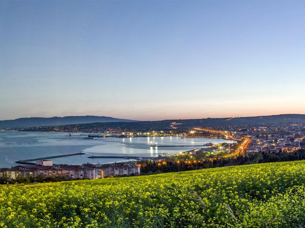
Tekirdağ - Süleymanpaşa Shore
Throughout history, Tekirdağ has been home to various civilizations including the Thracians, Greeks, Romans, Byzantines and Ottomans. Due to its strategic geographical location, the city has achieved significant development in trade, agriculture and industry. During the Ottoman period, Tekirdağ emerged as an important port and agricultural center, and with the advent of the Republic, it began to grow rapidly in industry and commerce.
The oldest known settlement traces in Tekirdağ extend back to the Lower Paleolithic Age. Archaeological excavations in the region, particularly near the village of Karansıllı, have uncovered stone tools dating from one million to 250,000 years ago at sites such as Yatak, Kuştepe and Balıtepe. It is known that from the Chalcolithic Age onward, Tekirdağ hosted various settlements. Excavation sites such as Menekşe Çatağı Höyüğü indicate continuous habitation since the 5th century BCE.
Like other regions of Thrace, Tekirdağ was settled by Thracian tribes. The region came under the control of powerful states such as the Odrysian Kingdom. One of the most important ancient settlements in the area was Bisanthe. In the 6th century BCE, Greek colonists from the island of Samos founded the city of Bisanthe near the present-day village of Barbaros. During this period, commercial and cultural interactions occurred between the Thracians and the Greeks.
In the 2nd century BCE, Tekirdağ came under Roman control and was known as Rhaedestos. During the Roman era, the city became an important trade center as part of the Via Egnatia. Ancient historians such as Pliny and Procopius wrote about the region.
After the division of the Roman Empire, Tekirdağ remained within the borders of the Eastern Roman (Byzantine) Empire. During the Byzantine period, the city was known as Rodosto and became one of the empire’s major grain production centers. Tekirdağ was periodically attacked by Bulgars and Pechenegs. Significant destruction occurred following Bulgar raids in 813 and 1206.
The Ottomans conquered Tekirdağ in 1357 under the leadership of Şehzade Murad (Murad I). After the conquest, under Ottoman administration, Tekirdağ developed into a thriving trade and agricultural center. The Ottomans initially named the city Rodosçuk. From the 18th century, the name Tekfur Dağı was used, and during the Republican period, it was changed to Tekirdağ.
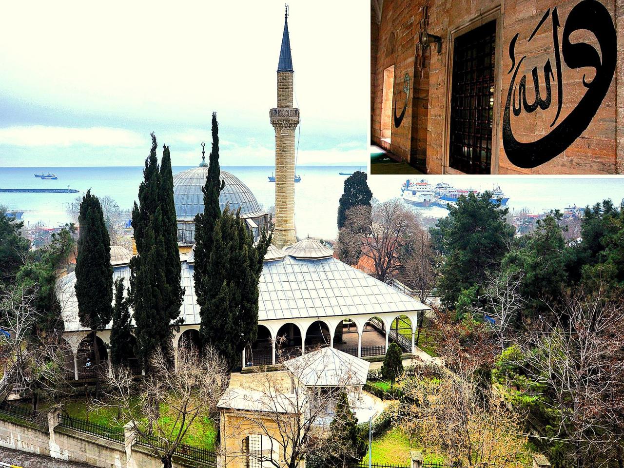
Rüstem Paşa Camii
In the 17th century, Grand Vizier Rüstem Paşa, one of the most important state officials of the Ottoman Empire, commissioned the construction of a mosque, bathhouse and market in Tekirdağ. Evliya Çelebi visited Tekirdağ in the 17th century and described it as a major port city. In 1703, Hungarian Prince Francis II Rákóczi settled in Tekirdağ with Ottoman permission and lived there in exile. Today, Rákóczi’s house is preserved as a museum.
During the 19th-century Ottoman-Russian wars, the region suffered extensive damage. During the Russo-Turkish War of 1877–1878, Russian forces entered Tekirdağ, but the city was later returned to Ottoman control under the Treaty of Berlin. In 1912, during the Balkan Wars, the Bulgarian army occupied Tekirdağ; this occupation ended in 1913.
Following the defeat of the Ottoman Empire in World War I, Tekirdağ was occupied by the Greek army on 20 July 1920. During the occupation, the city suffered severe damage and its population was forced to migrate. However, with the Armistice of Mudanya and subsequently the Treaty of Lausanne, the Turkish army entered the city on 13 November 1922 and Tekirdağ was reintegrated into Turkish territory.
During this period, under the Population Exchange Agreement of Lausanne, the Greek population of Tekirdağ was relocated to Greece, and Muslim immigrants from Anatolia were settled in the region.
Tekirdağ was officially declared a provincial center on 15 October 1923. In the early years of the Republic, the economy was primarily based on agriculture and livestock. The establishment of the Tekel Alcohol Factory in 1931 marked a significant step in the development of industry in the city. Tekirdağ gained metropolitan municipality status under Law No. 6360 enacted in 2012, and metropolitan municipality administration was extended across the entire province. Today, it is a rapidly developing city in industry, agriculture and trade.
Tekirdağ is predominantly a lowland region. To the north lies the Ergene Plain, to the west the Ganos Mountains, and to the south the Marmara Sea coastline. In terms of climate, it exhibits a transitional climate characteristic of the Marmara Region. The province features fertile agricultural land, coastal strips, rivers and dams, resulting in a diverse economic and ecological structure.
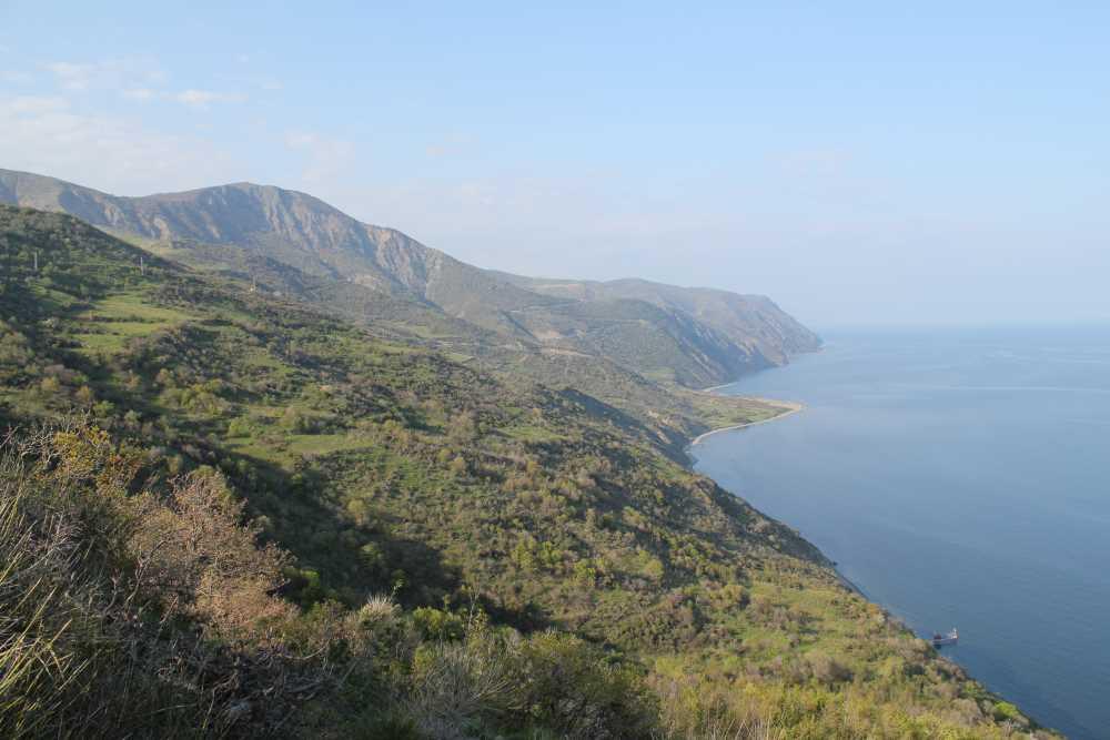
Tekirdağ, Uçmakdere
Tekirdağ is located in the northwestern part of Türkiye, within the Thrace subregion of the Marmara Region. Geographically, it lies between 40° 36′ and 41° 31′ north latitudes and 26° 43′ and 28° 08′ east longitudes. It is bordered by Istanbul to the east, the Marmara Sea and Çanakkale to the south, Edirne to the west, Kırklareli to the north, and the Black Sea to the northeast.
Tekirdağ has an area of 6,190 km² and is the second largest province in Thrace by area. The total length of its land borders is 310 km and its coastline is 133 km long.
The terrain of Tekirdağ is generally composed of plains. A large portion of the province lies on the Ergene Basin and has an open plain character. However, in the western section, the Ganos Mountains (Işıklar Dağı) and elevated hills along the coast are present.
Overall, Tekirdağ does not have large mountain ranges, but the hills rising along the Marmara coast in the southern part are particularly noticeable.
Tekirdağ has no major rivers with continuous flow, but it does have smaller rivers and seasonal streams.
Tekirdağ has no natural lakes, but it has several dams and reservoirs.
Tekirdağ’s coastline along the Marmara Sea is approximately 133 kilometers long. Its Black Sea coastline is limited to the area around Kastro Koyu and its surroundings. The province’s coastal strip extends from east to west through the coasts of Marmaraereğlisi, Süleymanpaşa, Şarköy and Uçmakdere.
Important bays and beaches along the Marmara Sea coast:
In terms of islands, Tekirdağ’s coastline has no natural islands.
The climate of Tekirdağ is dominated by the Marmara climate, a transitional climate combining characteristics of Mediterranean and continental climates.
The average temperature is 14°C and the annual precipitation is approximately 589 mm. The highest recorded temperature is 40.2°C (June 2000) and the lowest is -13.3°C (February 1929). Tekirdağ’s windy nature, particularly along the Marmara coast with consistently blowing winds, makes it suitable for wind energy power plants.
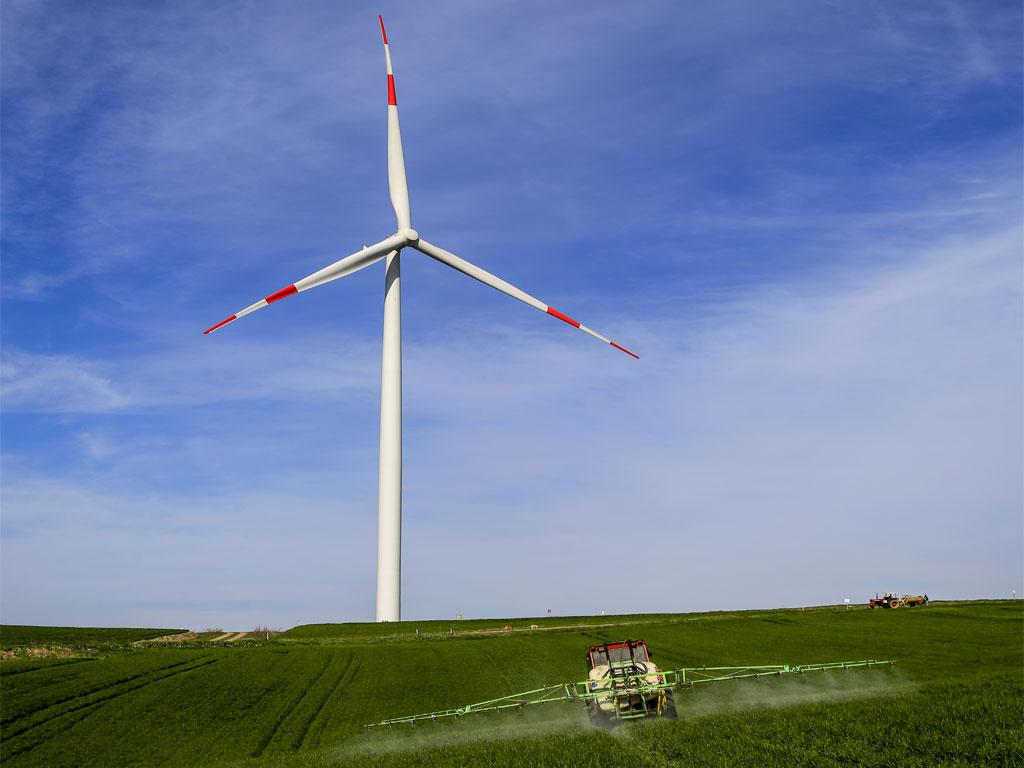
Wind Turbine in Tekirdağ
The climate along the Marmara coast is relatively mild, but as one moves inland, continental characteristics increase. Coastal areas such as Şarköy and Marmaraereğlisi have a milder climate, while winters are colder in districts such as Malkara and Hayrabolu.
The vegetation of Tekirdağ consists of maquis along the Marmara coast, forests in mountainous areas, and steppe in other regions.
In recent years, reforestation efforts have increased, with particular emphasis on planting pine and cedar trees.
Tekirdağ has an economy characterized by the simultaneous development of agriculture, industry, trade and tourism. Its proximity to Istanbul, fertile soils, advanced industrial infrastructure and strong logistics network give it a high degree of economic diversity. Industry and agricultural activities are the main pillars of the provincial economy. As of 2024, Tekirdağ is Turkey’s sixth largest exporting city with exports totaling 981 million US dollars.
Tekirdağ’s extensive and fertile plains have made agriculture the center of its economic activity. The Ergene Plain and Hayrabolu Plain are among Turkey’s most important agricultural regions. The province’s leading agricultural products are wheat, sunflower, barley, sugar beet and canola, and it is particularly known as one of the country’s leading producers of sunflower.
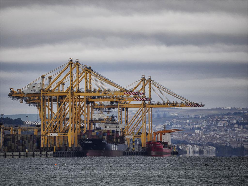
Barbaros Port
Viticulture has also developed in the province. The Şarköy and Mürefte regions are especially known for their vineyards. Grapes grown in this area are used for wine production and processed in Tekirdağ’s wineries. The winemaking tradition, dating back to the Ottoman period, continues today with modern production facilities.
Vegetable and fruit production also hold an important place in the province. Cherries, peaches, pears, watermelons, tomatoes and peppers are among the main products cultivated in Tekirdağ. Cherry production, in particular, is promoted and marketed through the annual Tekirdağ Cherry Festival.
Livestock farming is concentrated mainly in the districts of Malkara and Hayrabolu. Both large and small livestock farming are widespread, and milk production is significant. Facilities processing milk and dairy products contribute to regional markets. Poultry farming is also well developed, with large-scale chicken farms operating in the province.
Tekirdağ has become one of Turkey’s largest industrial centers, with industrial facilities concentrated especially in Çorlu, Çerkezköy, Kapaklı and Ergene districts. Its proximity to Istanbul and well-developed transportation networks have accelerated industrial growth.
The textile sector is one of the most important components of Tekirdağ’s industry. Factories producing cotton, yarn and ready-made garments are located throughout the province, especially in Çerkezköy and Çorlu. Products manufactured in these facilities are sold domestically and exported to European countries.
The chemical industry also holds a significant position in the region. Factories producing plastics, paint, detergent and pharmaceuticals are concentrated especially in Ergene and Çorlu districts. These industrial sectors account for a large share of imports and exports.
Tekirdağ also has automotive component, food processing, furniture and metalworking facilities. Organized Industrial Zones (OSB) throughout the province have contributed to increased industrial production and the adoption of modern manufacturing processes. By 2014, the number of factories in Tekirdağ had reached 1,605.
Due to its position as a bridge between Istanbul and Europe, Tekirdağ holds great importance in trade and logistics. Tekirdağ Port plays an active role in trade with Europe. Sea transport is integrated with road and rail networks to facilitate import and export processes.
Proximity to Istanbul has led to the establishment of major logistics centers in Tekirdağ. Customs and logistics centers facilitate the domestic and international transportation of products from industrial facilities.
Retail trade in the province is also highly developed. Large shopping centers, food wholesalers and businesses trading in industrial materials constitute a significant portion of commercial activity.
Tekirdağ’s tourism sector is growing due to its coastal resorts and historical sites. Şarköy, Kumbağ, Marmaraereğlisi and Uçmakdere are popular destinations for summer tourism. Sea tourism, nature tourism and activities such as paragliding contribute to the regional economy.
Historical and cultural heritage also forms another pillar of tourism. Historical structures such as the Rákóczi Museum, Rüstem Paşa Camii, and the Tekirdağ Archaeology and Ethnography Museum attract visitors. Additionally, the Tekirdağ Vine Harvest and Grape Festival brings tourist activity to the region.
The service sector has developed alongside tourism, with accommodation, restaurants, entertainment and transportation sectors playing a significant role in the provincial economy.
Investments in renewable energy in Tekirdağ are increasing. Wind power plants are concentrated especially in the districts of Şarköy, Malkara and Süleymanpaşa. The consistently blowing winds along the Marmara coast provide a favorable environment for electricity generation from wind energy.
In addition, solar energy and biogas plants have been established, promoting environmentally friendly energy production.
Throughout history, Tekirdağ has hosted various civilizations and developed a rich cultural structure. Traces of Thracians, Greeks, Romans, Byzantines and Ottomans are visible in the city’s cultural heritage. Traditional Thrace culture is particularly prominent in music and folk dances. Energetic melodies performed with davul, zurna and clarinet are an inseparable part of social events in the region. Folk dances such as karşılama, hora and misket, commonly seen at weddings and celebrations, reflect Tekirdağ’s cultural identity.
In literature, Namık Kemal, one of the most important poets of the Ottoman period, was born in Tekirdağ. A monument and a house converted into a museum are dedicated to him. This structure provides information about the literary and intellectual atmosphere of the era and offers visitors detailed insights into Namık Kemal’s life and works.
Tekirdağ cuisine is based on agriculture and livestock. One of the region’s most famous dishes is Tekirdağ köfte, prepared with spices and served using special cooking methods. In addition, Hayrabolu sweet, made with lor cheese and semolina, is an example of the region’s sweet culture. Cheese halva made from goat, sheep or cow milk is also commonly consumed in the local cuisine.
Tekirdağ is also notable for its historical structures. The Rüstem Paşa Camii, dating from the Ottoman period, is considered one of the important examples of classical Ottoman architecture. The house where Hungarian Prince Francis II Rákóczi lived after seeking refuge in the Ottoman Empire has been converted into a museum and opened to the public as the Rákóczi Museum. Personal belongings of the prince and various documents reflecting Ottoman-Hungarian relations are exhibited here. Additionally, the Tekirdağ Archaeology and Ethnography Museum houses ancient artifacts from local excavations as well as objects reflecting the traditional lifestyle of Thrace.
Due to its geographical structure, Tekirdağ offers various opportunities for coastal tourism. The city has numerous beach areas that attract heavy crowds during summer months. The coasts of Marmaraereğlisi, Süleymanpaşa and Şarköy are among the most preferred areas for summer tourism. The shoreline along Şarköy is notable for its length and the quality of its seawater. For nature tourism, the Ganos Mountains and Uçmakdere region offer suitable areas for hiking and paragliding.
Festivals in Tekirdağ are events that sustain the region’s cultural fabric. The annual Tekirdağ Cherry Festival, held in June, is a traditional event aimed at promoting the region’s cherry production. Various shows, concerts and competitions are organized during the festival. The Vine Harvest and Grape Festival, held in September, highlights Tekirdağ’s viticulture culture and is associated with grape harvesting in Şarköy and Mürefte. Additionally, commemorative days organized in memory of Hungarian Prince Rákóczi are events that preserve historical and cultural heritage.
Tekirdağ is one of Turkey’s 30 metropolitan municipalities. Under Law No. 6360, the entire province is under the administration of the metropolitan municipality. As a result of this arrangement, all town municipalities in the province were closed and converted into neighborhoods. Tekirdağ Metropolitan Municipality manages local government services throughout the province.
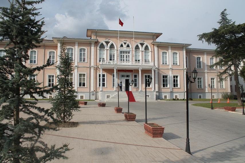
Historic Governor’s Building
The province’s administrative structure is based on the governorship, metropolitan municipality and district municipalities. Tekirdağ Governorship is a public institution under the Ministry of Interior representing central government and coordinates security, education, health and other public services. It is managed by a governor appointed directly by the central government. Tekirdağ Metropolitan Municipality is responsible for providing municipal services throughout the province, and its mayor is elected by the public. The metropolitan municipality is responsible for infrastructure, transportation, water and sewage, environmental planning and public transportation.
As a metropolitan municipality, Tekirdağ has a two-tier local government system consisting of the metropolitan municipality and 11 district municipalities. District municipalities perform duties within their own boundaries such as park and garden planning, cleaning services and regulation of local market areas, while the metropolitan municipality implements large-scale projects across the province.
The 11 districts of Tekirdağ are:
Before gaining metropolitan status, Süleymanpaşa was the central district of Tekirdağ. After the transition to the metropolitan municipality system, the central district was officially named Süleymanpaşa and all other districts were incorporated directly into the metropolitan municipality’s boundaries.
The administration of districts in Tekirdağ is carried out by district governors. District governors serve as representatives of the governor and oversee the operation of state institutions in the district and ensure the delivery of public services. District governors are appointed by the Ministry of Interior and act as representatives of central government in the district.
At the neighborhood level, the smallest administrative units are muhtarliks. Neighborhood muhtars are the smallest administrative representatives who convey the demands of neighborhood residents to municipal and governorship authorities. Tekirdağ has a total of 366 neighborhoods, each managed by a muhtar.
Due to population growth and the development of industrial zones, Tekirdağ has a dynamic administrative structure. Especially districts such as Çorlu, Çerkezköy, Kapaklı and Ergene, which host dense industrial zones, are priority areas in the metropolitan municipality’s infrastructure and transportation planning. Coastal districts such as Şarköy and Marmaraereğlisi require different management and environmental regulations due to tourism and coastal settlement.
Under the metropolitan law, local government services in Tekirdağ are planned from a single central authority, but implementation is tailored to local needs. Infrastructure projects, environmental planning, transportation planning and expansion of industrial zones fall under the authority of the metropolitan municipality, while services such as cleaning and the management of local parks and recreation areas are carried out by district municipalities.
Tekirdağ has a well-developed transportation network due to its proximity to Istanbul and the concentration of industrial zones. Road, rail and sea transport are the main components of its logistics infrastructure.
Road: Tekirdağ lies on Turkey’s most important transportation corridors, including the D100 (E-5) Highway and the TEM Motorway. It is connected to Istanbul and Edirne via the O-3 European Motorway. Roads within the province have been developed to link industrial zones with ports and population centers. In industrial districts such as Çorlu, Çerkezköy and Ergene, road widening and new connection projects are being implemented to address traffic congestion.
Rail: Tekirdağ is included in the Halkalı-Kapıkule High-Speed Train Project, one of Turkey’s rail lines connecting to Europe. Once completed, rail transport through Tekirdağ will be accelerated and the logistics infrastructure of industrial zones will be strengthened. Additionally, rail connections have been established to organized industrial zones in Çerkezköy and Çorlu to facilitate freight transport.
Sea: Due to its location on the Marmara Sea, Tekirdağ has important ports. Tekirdağ Port is one of the largest ports in Thrace for cargo transport. Marmaraereğlisi and Barbaros Ports are also key points for industrial and logistics transport. As a major development in sea transport, Ro-Ro shipping enables commercial cargo flow from Thrace to Bursa and other southern Marmara cities.
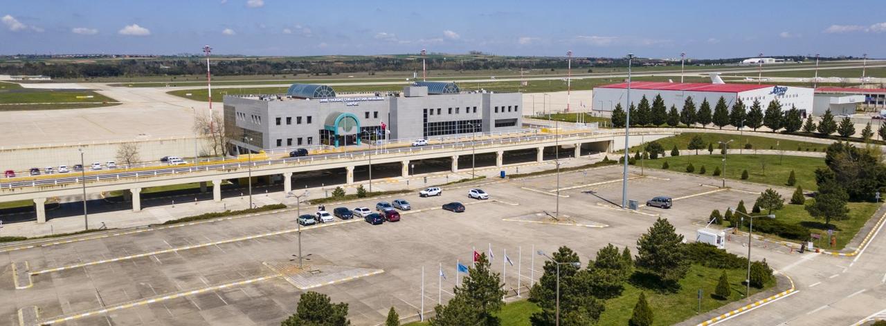
Tekirdağ Çorlu Atatürk Airport
Air: Tekirdağ has the Tekirdağ Çorlu Atatürk Airport for civil and commercial air transport. The airport is actively used for cargo transport to support the import and export activities of industrial zones. Although considered an alternative airport to Istanbul for passenger transport, international passenger traffic remains limited.
Tekirdağ, located in the Thrace subregion of the Marmara Region, has a diverse population structure shaped by industry, agriculture and trade. According to 2023 TÜİK data, the total population of Tekirdağ is 1,167,059. The population density is 188 people per km².
Tekirdağ’s population has increased in recent years due to industrial investments. Its proximity to Istanbul and extensive industrial zones have made it a destination for migration. Between 2022 and 2023, the population growth rate in the province was recorded at 2.13%.
The districts with the highest population density are Çorlu, Çerkezköy, Kapaklı and Ergene, which are industrial centers, while the districts with the lowest population density are Malkara, Hayrabolu and Şarköy, which are agricultural and rural areas.
Population distribution by district (2023):
The industrial districts of Çorlu and Çerkezköy stand out as the areas with the highest population growth during the metropolitanization process. Çorlu district accounts for approximately 25% of the province’s population.
Due to its developed industrial and commercial opportunities, Tekirdağ is a migration-receiving province. Migration from Istanbul and internal migration are the main causes of population growth. Labor migration from different regions of Turkey is directed toward the districts of Çerkezköy, Çorlu, Kapaklı and Ergene, where organized industrial zones are concentrated.
At the same time, population in rural areas is declining, and the young population is moving toward larger districts due to employment opportunities. Population growth in districts such as Malkara, Hayrabolu and Şarköy remains at lower levels.
Tekirdağ has a population structure dominated by young and middle-aged groups.
The high proportion of the working-age population indicates that Tekirdağ has an active labor force for economic activities. The proportion of young labor force in the province is close to the national average, due to the industrial sector. However, the elderly population ratio is higher in rural areas.
The literacy rate in Tekirdağ is higher than the national average. The literacy rate in the province is 98.2%. The proportion of the population receiving primary and secondary education is high. Additionally, the presence of institutions such as Namık Kemal University contributes to the improvement of education levels.
Education in Tekirdağ is delivered through public and private schools, vocational training institutions and Namık Kemal University. There are more than 600 schools at the preschool, primary, middle and high school levels across the province. Tekirdağ High School, Çorlu High School and Anatolian High Schools are prominent institutions for academic achievement.
Vocational and technical education is concentrated especially in industrial zones such as Çorlu, Çerkezköy and Kapaklı. Vocational high schools and vocational colleges train workforce for industry.
Namık Kemal University (NKÜ), established in 2006, provides education in engineering, agriculture, economic sciences, health and arts and sciences faculties. The university has vocational colleges in various districts.
In addition, Public Education Centers offer vocational and technical courses, while private educational institutions provide alternative educational opportunities. The education infrastructure has been developed in connection with the industry and agriculture sectors.
"Heraion Teikhos" ancient city excavation works, 2000-2010, N. Atik,Tekirdağ Değerlendirme Symposium 2010, p.1.
Ateş, Hacer. "Tekirdağ." *TDV İslâm Ansiklopedisi.* Accessed February 6, 2025.https://islamansiklopedisi.org.tr/tekirdag#1.
Mehmet Salih Çoban. "Tekirdağ Köftesi." Küre Ansiklopedi. Accessed February 6, 2025.https://preprod.kureansiklopedi.com/detay/tekirdag-koftesi-2.
Ministry of Trade of the Republic of Türkiye. "2024 Yılı Mart Ayı İhracatı İllere Göre Dağılım Listesi." Accessed February 6, 2025.https://ticaret.gov.tr/haberler/2024-yili-mart-ayi-ihracati-illere-gore-dagilim-listesi
Ministry of Transport and Infrastructure, Republic of Türkiye, State Airports Authority (DHMİ). "Çorlu Havalimanı Genel Bilgiler." Accessed February 6, 2025.https://www.dhmi.gov.tr/Sayfalar/Havalimani/Corlu/GenelBilgiler.aspx
Süleymanpaşa Belediyesi. "Rakoczi Müzesi." Accessed February 6, 2025.https://www.suleymanpasa.bel.tr/bilgi/Rakoczi-M%C3%BCzesi--17
Süleymanpaşa Belediyesi. "Süleymanpaşa'nın Tarihi." Accessed February 6, 2025.https://www.suleymanpasa.bel.tr/kategori/suleymanpasanin-tarihi
T.C. Meteoroloji Genel Müdürlüğü. "Tekirdağ İklim ve Hava Durumu İstatistikleri." Accessed February 6, 2025.https://www.mgm.gov.tr/veridegerlendirme/il-ve-ilceler-istatistik.aspx?m=TEKIRDAG#sfB
T.C. Ministry of Culture and Tourism. "Rakoczi Müzesi." Türkiye Kültür Portalı. Accessed February 6, 2025.https://www.kulturportali.gov.tr/turkiye/tekirdag/gezilecekyer/rakoczi-muzesi.
T.C. Tekirdağ Valiliği. "Rakoczi Müzesi." Accessed February 6, 2025.http://www.tekirdag.gov.tr/rakoczi-muzesi.
T.C. Tekirdağ Valiliği. "Şehrimiz." Accessed February 6, 2025.http://www.tekirdag.gov.tr/sehrimiz.
T.C. Türkiye İstatistik Kurumu (TÜİK). "CIP Portalı." Accessed February 6, 2025.https://cip.tuik.gov.tr/
Tekirdağ NamıkKemal Üniversitesi, School of Health Services. "Duyurular ve İlanlar." Accessed February 6, 2025.https://shmyo.nku.edu.tr/ilanlarr/index.html
Tekirdağ
Country | Türkiye | ||||||||
|---|---|---|---|---|---|---|---|---|---|
Region | Marmara Region | ||||||||
Population | 1,187,162 | ||||||||
Area | 6,190 | ||||||||
Climate | Marmara Transition Climate | ||||||||
Important Structure | Süleymaniye Camii (Çorlu) Namık Kemal House Rakoczi Museum Hora Lighthouse Rüstem Paşa Camii | ||||||||
Governor | Recep Soytürk | ||||||||
Metropolitan Municipality Mayor | Candan Yüceer | ||||||||
Area Code(s) | 282 | ||||||||
License Plate Code | 59 | ||||||||
No Discussion Added Yet
Start discussion for "Tekirdağ (Province)" article
History
Ancient Age
Roman and Byzantine Period
Ottoman Period
World War I and Occupation Period
Republican Era and Present Day
Geography
General Geographic Location
Landforms
Mountains and Elevations
Plains
Rivers and Lakes
Rivers
Lakes and Dams
Coasts and Islands
Climate
Temperature Data:
Vegetation
Economy
Agriculture and Livestock
Industry
Trade and Logistics
Tourism and Service Sector
Energy and Renewable Resources
Culture and Tourism
Administrative Structure of Tekirdağ
Transportation Infrastructure
Demographics of Tekirdağ
Population Distribution and Growth Rate
Migration and Population Mobility
Age Distribution and Population Structure
Education and Literacy Rate