


This article was automatically translated from the original Turkish version.
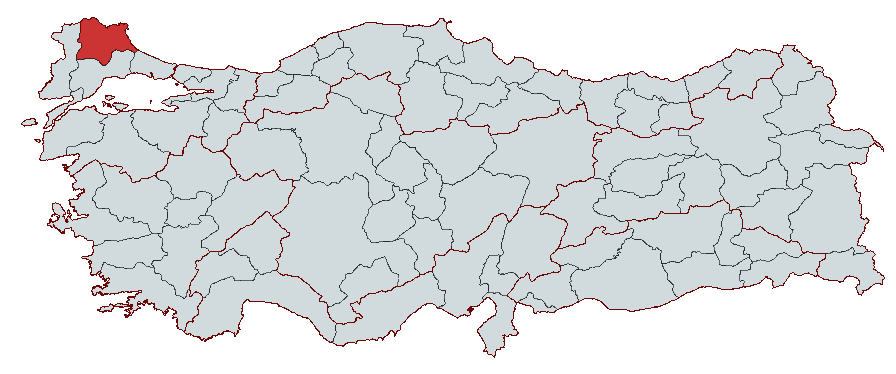
Kırklareli
Country | Türkiye | ||||||||
|---|---|---|---|---|---|---|---|---|---|
Region | Marmara Region | ||||||||
Population | 379.031 | ||||||||
Area | 6.459 km² | ||||||||
Climate | Continental Climate - Black Sea Climate | ||||||||
Important Structure | Hızırbey Külliyesi Vize Ancient Theatre Kıyıköy Castle Ayas Nikola Monastery Sokollu Mehmet Pasha Külliyesi | ||||||||
Governor | Uğur Turan | ||||||||
Mayor | Derya Bulut | ||||||||
Area Code(s) | 288 | ||||||||
License Plate Code | 39 | ||||||||
Kırklareli is a province located in the northwestern part of Türkiye, within the Thrace region of the Marmara Region. It borders the Black Sea to the east, Edirne to the west, Tekirdağ to the south, and Bulgaria to the north. Throughout history, Kırklareli has been home to numerous civilizations including the Thracians, Persians, Macedonians, Romans, and Byzantines. During the Ottoman period, it also became an important settlement center. Today, the province, where agriculture, industry and trade are carried out together, has developed particularly in food and textile industries. Under the influence of a continental and semi-humid climate, the province is notable for its extensive forested areas, natural lakes, and coastal strip. Its cultural heritage includes tumuli, mounds, mosques, and structures dating back to the Byzantine era.
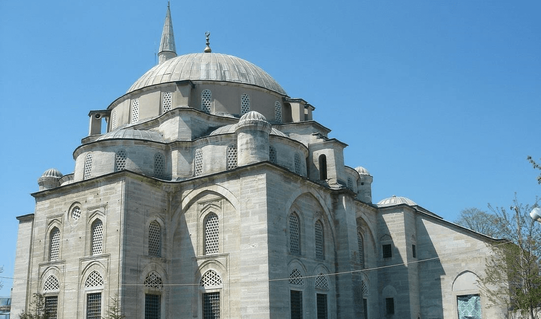
Babaeski Cedid Ali Paşa Camii
Kırklareli has been home to many civilizations throughout history and has continuously been under the influence of different cultures due to its strategic location. Settlement in the province dates back to the Neolithic Age (6000 BCE), and human activity remained intense during the Chalcolithic, Bronze, and Iron Ages.
The earliest known inhabitants of the region, as in the broader Thrace area, were the Thracians. The Thracians were an Indo-European people who established settlements across a vast territory stretching from the Balkans to Anatolia beginning in the 2000s BCE. While Thracian tribes lived as city-states or feudal principalities, they faced external threats from groups such as the Scythians and Greek colonies.
In 513 BCE, the region was invaded by the Persian King Darius I and became part of the Persian Empire’s Thracian satrapy. However, this rule did not last long, as the region was conquered by King Philip II of Macedon in the 4th century BCE. After the Macedonians, Kırklareli suffered invasions by the Celts (Galatians) and ultimately came under the rule of the Roman Empire in the 2nd century BCE.
During the Roman Empire, Kırklareli and its surroundings became part of the province of Thrace and emerged as an important center along trade routes. After the Roman Empire split in 395 CE, the region remained within the territory of the Eastern Roman (Byzantine) Empire.
During the Byzantine period, the city known as Saranta Ekklisies (Forty Churches) lay along a defensive line protecting the northern frontier of Thrace. Under Emperor Justinian I (527–565), the walls and fortresses in the region were strengthened, and the walls of Vize and Kıyıköy were constructed. However, as Byzantine power gradually weakened, the region became vulnerable to attacks by nomadic groups such as the Ostrogoths, Avars, Pechenegs, and Bulgarians. Thrace suffered heavy destruction during the Hunnic invasions of 441–447 CE, and Kırklareli, along with cities such as Lüleburgaz and Filibe, sustained significant damage.
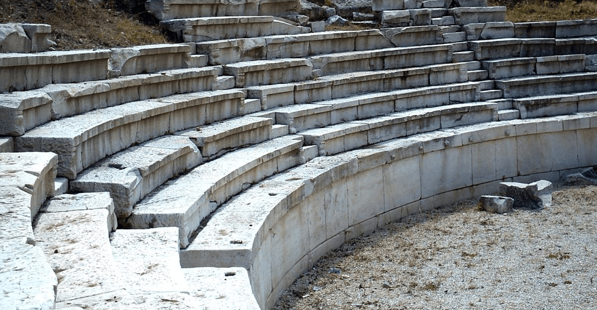
Vize Antik Tiyatrosu
Kırklareli was conquered by the Ottoman State in 1362. During the reign of Sultan I. Murad Hüdavendigar, Ottoman forces under the command of Demirtaş Paşa captured the Byzantine-held Saranta Ekklisies and incorporated it into Ottoman territory. After the conquest, the region became a strategic base for the Ottoman advance into the Balkans.
Under Ottoman administration, Kırklareli was initially governed as a town subordinate to the Sanjak of Vize and later became a sanjak within the Edirne Vilayet. During the Ottoman period, numerous architectural structures including mosques, baths, covered markets, and bridges were constructed. Notable examples that have survived to the present day include the Hızırbey Külliyesi, Sokollu Mehmet Paşa Külliyesi, Beyazıt Camii, and the Arasta (Bedesten).
During the Russo-Turkish War of 1877–1878 (the 93 War), Kırklareli was occupied by Russian forces and suffered extensive damage. After the war, the Treaty of San Stefano (Treaty of Yeşilköy) ceded the region to the Principality of Bulgaria. However, the area was soon regained by the Ottomans.
During the Balkan Wars of 1912–1913, following a major defeat of the Ottoman State, the Bulgarian army occupied Kırklareli. However, during the second phase of the war, Ottoman forces recaptured Kırklareli along with Edirne.
After World War I (1914–1918), Kırklareli was occupied by the Greek army in 1919. It was returned to Turkish territory under the Mudanya Armistice Agreement of 1922. The city was fully liberated on 10 November 1922.
After the proclamation of the Republic, Kırklareli gained provincial status in 1924. During this period, infrastructure projects were undertaken, new state institutions were established, and industry began to develop. Agriculture, animal husbandry, and industrial production expanded rapidly during the Republican era. From the 1980s onward, the food and textile industries became particularly prominent.
Today, Kırklareli continues to exist as a city that has modernized while preserving its historical fabric and has developed both culturally and economically.
Kırklareli is a province located in the northwestern part of Türkiye within the Thrace region of the Marmara Region. It borders the Black Sea to the east, Edirne to the west, Tekirdağ to the south, and Bulgaria to the north. It shares a 180-kilometer land border with Bulgaria. Additionally, its 60-kilometer coastline along the Black Sea gives it an important position on Türkiye’s northern coast.
The province has a total area of 6,459 km² and an average elevation of 203 meters. The provincial center and southern areas consist of lower, flat terrain, while the northern regions rise into the Istranca Mountains.
The topography of Kırklareli can be divided into three main regions:
Istranca Mountains (Yıldız Mountains):
Located in the north and northeast of the province, the Istranca Mountains are among the most significant highlands in Thrace. Stretching from the Bulgarian border to the Black Sea, their highest peak, Mahya Tepe, reaches 1,031 meters. The Istranca Mountains form the province’s most important forested areas and feature plateau-like characteristics in places.
Ergene Plain:
The Ergene Plain, located in the southern part of Kırklareli, consists of flatter, agriculturally suitable land. This area, within the Ergene Basin, serves as the province’s primary agricultural production center.
Black Sea Coastline:
The coasts of İğneada and Kıyıköy in the eastern boundary mark the province’s access points to the Black Sea. The İğneada Longoz Forests, located along this coastal stretch, host one of Turkey’s rarest ecosystems. The sandy beaches and coastal plains along the Black Sea enhance the province’s tourism potential.
Kırklareli exhibits characteristics of a continental and semi-humid climate. The northern and eastern parts of the province are influenced by the Black Sea climate, while the interior areas experience stronger continental effects.
During winter months, temperatures in the Istranca Mountains and interior regions fall below zero, while summer temperatures can exceed 30°C. The annual average temperature ranges between 12 and 14°C.
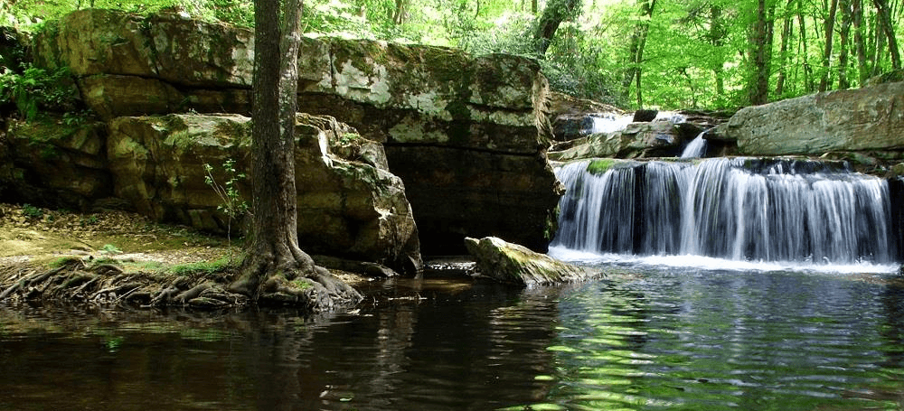
Istrancalar
Precipitation patterns are irregular, with the highest rainfall occurring in autumn and winter. Summer months are relatively dry. The northeastern Black Sea coast receives more rainfall than the inland areas.
Winds generally blow from the north, and severe northerly winds in winter can cause significant temperature drops. The Black Sea coast, by contrast, maintains a milder climate throughout the year.
As of 31 December 2023, the population of Kırklareli was recorded at 377,156, an increase of 7,809 compared to the previous year.
The population includes 190,769 males (50.58%) and 186,387 females (49.42%).
Population distribution by age group:
Population distribution by district (2023):
The average age in Kırklareli is 40.8 years.
In terms of population size in Türkiye:
The annual population growth rate in Kırklareli is recorded at 20.9 per thousand.
Due to its history as a home to numerous civilizations, Kırklareli possesses a rich cultural heritage. Artifacts from the Ottoman, Byzantine, Roman, and Thracian periods form the core of its cultural identity. Additionally, the province holds significant potential for nature tourism.
Kırklareli stands out for its traditional Thrace regional folk culture. Traditional music, folk dances, and folkloric elements hold an important place in Thrace’s cultural structure. Folk dances performed to the rhythm of Roman music accompanied by davul and zurna are widespread. Traditional celebrations such as Hıdırellez and Mart Dokuzu (Nevruz) continue to be observed.
Kırklareli contains numerous historical structures, many of which date from the Ottoman and Byzantine periods.
Kırklareli holds significant tourism potential due to both its historical heritage and natural beauty.
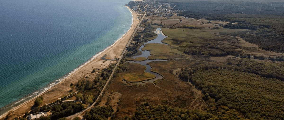
İğneada Longoz Ormanları
Nature Tourism
Sea Tourism
Festivals
Kırklareli continues to develop across various tourism sectors through its historical structures and natural beauty.
Ministry of Environment, Urbanization and Climate Change of the Republic of Türkiye. "General Information - Kırklareli." Accessed February 7, 2025.https://kirklareli.csb.gov.tr/genel-bilgiler-i-3772
T.C. Kültür Varlıkları ve Müzeler Genel Müdürlüğü. "Kırklareli Kültürel Mirası." Accessed February 7, 2025.http://www.kulturvarliklari.gov.tr/yazdir?EF9A4520A9335CF7CFB964D5DAAED8B0.
T.C. Kültür ve Turizm Bakanlığı. "Kırklareli." Accessed February 7, 2025.https://kirklareli.ktb.gov.tr/.
T.C. Kırklareli Valiliği. "Şehrimiz." Accessed February 7, 2025.http://www.kirklareli.gov.tr/sehrimiz.
T.C. Türkiye İstatistik Kurumu (TÜİK). "CIP Portalı." Accessed February 7, 2025.https://cip.tuik.gov.tr/
Tuncel, Metin. "Kırklareli." *TDV İslâm Ansiklopedisi.* Accessed February 7, 2025.https://islamansiklopedisi.org.tr/kirklareli.

Kırklareli
Country | Türkiye | ||||||||
|---|---|---|---|---|---|---|---|---|---|
Region | Marmara Region | ||||||||
Population | 379.031 | ||||||||
Area | 6.459 km² | ||||||||
Climate | Continental Climate - Black Sea Climate | ||||||||
Important Structure | Hızırbey Külliyesi Vize Ancient Theatre Kıyıköy Castle Ayas Nikola Monastery Sokollu Mehmet Pasha Külliyesi | ||||||||
Governor | Uğur Turan | ||||||||
Mayor | Derya Bulut | ||||||||
Area Code(s) | 288 | ||||||||
License Plate Code | 39 | ||||||||
No Discussion Added Yet
Start discussion for "Kırklareli (Province)" article
The History of Kırklareli
Early Settlements and the Thracians
Roman Period
Ottoman Period
The 93 War and the Balkan Wars
World War I and the War of Independence
Republican Period
Geography
Landforms
Climate
Population
Culture and Tourism
Cultural Heritage
Important Historical and Cultural Structures
Tourism