


This article was automatically translated from the original Turkish version.
+2 More
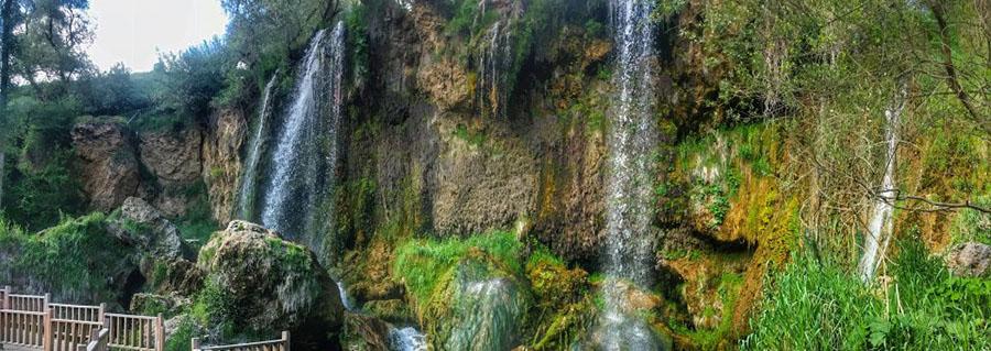
Sızır Waterfall
Location | Sızır Village Gemerek District Sivas Türkiye | ||||||||
|---|---|---|---|---|---|---|---|---|---|
Transportation | It is approximately 18 km from Gemerek District. It can be reached by private vehicle or local transportation. | ||||||||
Distance | 105 km from Kayseri 135 km from Sivas 22 km from Gemerek | ||||||||
Area | Located within the Çat Forests | ||||||||
Activities | Picnicking, nature walking, photography | ||||||||
Facilities | There are trout facilities and recreational areas | ||||||||
Protection Status | Declared a Natural Site Area in 2019 | ||||||||
River | Göksu Creek (a tributary of the Kızılırmak) | ||||||||
Formation | Spring waters flowing from a travertine terrace | ||||||||
Sızır Waterfall is located within the boundaries of the Sızır village in the Gemerek district of Sivas Province, in Türkiye’s Central Anatolia Region. The waterfall is approximately 1 kilometre from the town of Sızır, 22 kilometres from the Gemerek district centre, 135 kilometres from the Sivas provincial centre, and 105 kilometres from Kayseri. Sızır Waterfall is situated on the Göksu Stream (also known as Sızır Water), a tributary of the Kızılırmak River. The waterfall forms as the water cascades over travertine terraces of the Göksu, one of the region’s major natural water sources.
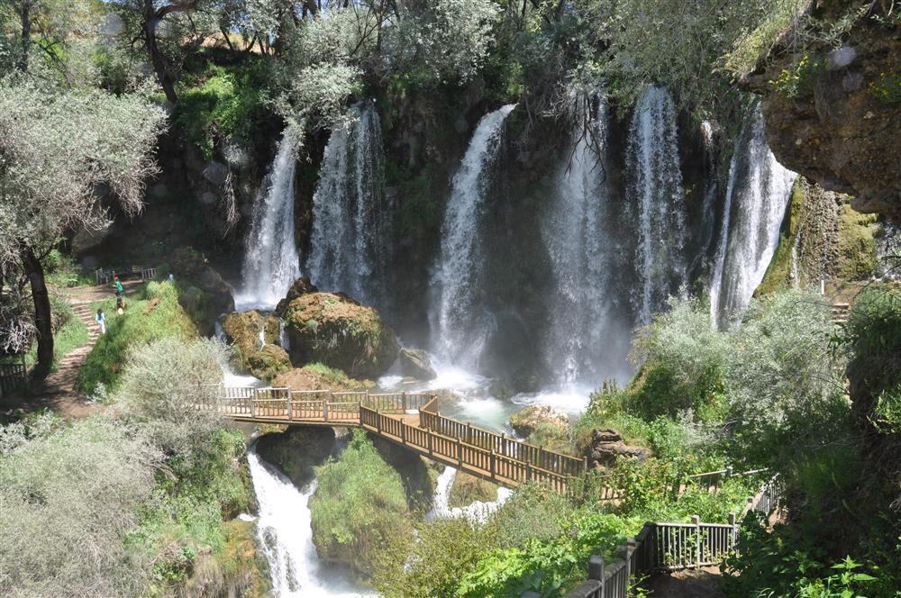
Sızır Şelalesi (T.C. Kültür ve Turizm Bakanlığı)
Sızır Waterfall was officially registered as a “Natural Site – Qualified Natural Conservation Area” by Ministry Decree dated 21 October 2019 and numbered 246674. It has also been declared a SİT area and placed under protection. This status is significant for both preserving the natural environment and promoting sustainable tourism practices.
The waterfall is located within the Çat Forests, in an area densely covered by vegetation. The region attracts attention for its natural landscape and biological diversity. The surroundings are suitable for recreational activities such as nature walking, camping, and picnicking. Wooden walkways and staircases provide access to the lower sections of the waterfall.
Sızır Waterfall and its surroundings are used as a leisure area by local residents and visitors. The site includes trout facilities, tea gardens, seating areas, and walking trails. The waterfall offers seasonal attractions: cooling relief during summer months and frozen landscapes during winter. Remnants from the Roman and Byzantine periods, nearby caves, and highland pastures further enrich the cultural and historical value of the area.
Access to Sızır Waterfall is possible by road or rail. By road, it is approximately 135 kilometres from the city centre of Sivas and 22 kilometres from the district centre of Gemerek. By rail, trains reach Gemerek, from where a short journey leads to the waterfall.
The Sızır springs that feed the waterfall discharge from partially karstified and fractured-marble aquifers of the Paleozoic-aged Akdağmadeni Lithodeme. The average discharge rate of this aquifer system is approximately 4 m³/s. Hydrological analyses indicate that the active storage capacity of this aquifer is 117 million m³, with approximately 60 million m³ remaining in the system after the withdrawal period. Hydrogeological studies have identified two distinct spring types in the region:
The recharge area of the springs has been determined to extend beyond topographic drainage boundaries into extensive marble formations.
In the Upper Kızılırmak Basin, where the Sızır springs are located, water quality varies seasonally depending on lithology. However, the marble aquifer feeding the Sızır springs is unsuitable for settlement or agricultural activity due to its steep topography. This condition largely protects the springs from anthropogenic pollution. Consequently, springhead protection measures are recommended. Unlike low-storage seasonal springs, the Sızır springs can be sustainably developed.
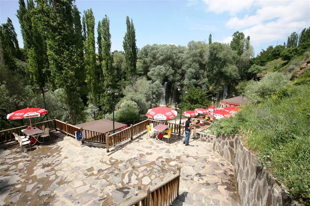
Sızır Şelalesi Mesire Alanı (T.C. Kültür ve Turizm Bakanlığı)
Aydın, Harun, and Ekmekçi, Mehmet. "Sızır (Gemerek-Sivas) Kaynakları Akiferinin Hidrojeolojik ve Hidrojeokimyasal Özellikleri." Harun Aydın ve Mehmet Ekmekçi. *Yerbilimleri*, vol. 26, no. 2 (March 2005): 15–32. Accessed May 14, 2025.https://dergipark.org.tr/tr/pub/yerbilimleri/issue/13628/165116. "Gemerek İlçesi Sızır Beldesi Sızır Şelalesi." Çevre, Şehircilik ve İklim Değişikliği Bakanlığı Sivas İl Müdürlüğü. Accessed May 14, 2025.https://sivas.csb.gov.tr/2--gemerek-ilcesi-sizir-beldesi-sizir-selalesi-i-4778. "Mesire Alanlarımız." Sivas Belediyesi. Archived August 2, 2016. Accessed May 14, 2025.https://web.archive.org/web/20160802131021/http://sivas.bel.tr/icerik/43/18/mesire-alanlarimiz.aspx. "Sızır Şelalesi." Gemerek Kaymakamlığı. Accessed May 14, 2025.http://www.gemerek.gov.tr/sizir-selalesi. "Sızır Şelalesi." Sivas Valiliği. Accessed May 14, 2025.http://www.sivas.gov.tr/sizir-selalesi. "Sızır Şelalesi - Sivas." Kültür ve Turizm Bakanlığı Kültür Portalı. Accessed May 14, 2025.https://www.kulturportali.gov.tr/turkiye/sivas/gezilecekyer/sizir-selales.
Sızır Waterfall
Location | Sızır Village Gemerek District Sivas Türkiye | ||||||||
|---|---|---|---|---|---|---|---|---|---|
Transportation | It is approximately 18 km from Gemerek District. It can be reached by private vehicle or local transportation. | ||||||||
Distance | 105 km from Kayseri 135 km from Sivas 22 km from Gemerek | ||||||||
Area | Located within the Çat Forests | ||||||||
Activities | Picnicking, nature walking, photography | ||||||||
Facilities | There are trout facilities and recreational areas | ||||||||
Protection Status | Declared a Natural Site Area in 2019 | ||||||||
River | Göksu Creek (a tributary of the Kızılırmak) | ||||||||
Formation | Spring waters flowing from a travertine terrace | ||||||||
Legal and Conservation Status
Geographical and Natural Structure
Tourism and Infrastructure
Accessibility Information
Hydrogeological Characteristics
Hydrogeochemical Characteristics and Water Quality