


This article was automatically translated from the original Turkish version.
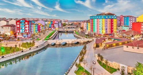
Silivri
Former Name | Selymbria | ||||||||
|---|---|---|---|---|---|---|---|---|---|
Conquest | The Ottomans conquered Silivri in the 1360s. | ||||||||
Area | 860km² | ||||||||
Mayor | Bora Balcıoğlu | ||||||||
Neighborhoods | AKÖREN MAHALLESİ, ALİBEY MAHALLESİ, ALİPAŞA MAHALLESİ, BEKİRLİ MAHALLESİ, BEYCİLER MAHALLESİ, BÜYÜK ÇAVUŞLU MAHALLESİ, BÜYÜK KILIÇLI MAHALLESİ, BÜYÜK SİNEKLİ MAHALLESİ, CUMHURİYET MAHALLESİ, ÇANTA BALABAN MAHALLESİ, ÇANTA SANCAKTEPE MAHALLESİ, ÇAYIRDERE MAHALLESİ, ÇELTİK MAHALLESİ, DANAMANDIRA MAHALLESİ, DEĞİRMENKÖY FEVZİPAŞA MAHALLESİ, DEĞİRMENKÖY İSMETPAŞA MAHALLESİ, FATİH MAHALLESİ, FENER MAHALLESİ, GAZİTEPE MAHALLESİ, GÜMÜŞYAKA MAHALLESİ, KADIKÖY MAHALLESİ, KAVAKLI HÜRRİYET MAHALLESİ, KAVAKLI İSTİKLAL MAHALLESİ, KURFALLI MAHALLESİ, KÜÇÜK KILIÇLI MAHALLESİ, KÜÇÜK SİNEKLİ MAHALLESİ, MİMAR SİNAN MAHALLESİ, ORTAKÖY MAHALLESİ, PİRİ MEHMET PAŞA MAHALLESİ, SAYALAR MAHALLESİ, SELİMPAŞA MAHALLESİ, SEMİZKUMLAR MAHALLESİ, SEYMEN MAHALLESİ, YENİ MAHALLESİ, YOLÇATI MAHALLESİ | ||||||||
Number of Neighborhoods | 35 35 33 | ||||||||
Population Values | Male: 130.562 Total: 232.156 Female: 101.594 | ||||||||
Silivri is a district located on the coast of the Marmara Sea in the western part of İstanbul. Due to its proximity to İstanbul, it is a significant settlement both historically and culturally. With its growing industry and agricultural sectors, the region has been expanding rapidly in recent years. Silivri’s historical roots extend back to Ancient Greece and over time it was ruled by the Roman Empire, the Byzantine Empire and the Ottoman Empire. As a result, Silivri possesses a rich cultural and historical heritage.
Silivri’s origins trace back to the Thracians. In antiquity, the city known as Selymbria became an important port city during the Roman Empire. During the Byzantine period, it evolved into a strategically significant settlement. The Ottomans captured Silivri in the 1360s and transformed it into an important village and settlement. During the Ottoman era, agriculture, maritime activities and animal husbandry flourished. After the proclamation of the Republic, Silivri’s integration with İstanbul initiated its modernization process.
Silivri is situated in the northwestern part of the Marmara Region and has a coastline. The district is approximately 70 kilometers from the center of İstanbul. Silivri’s demographic structure has changed rapidly in recent years due to migration and population growth, particularly driven by the increase in seasonal residences.
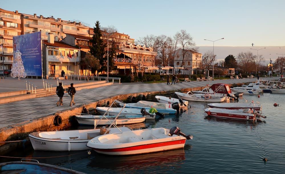
A view from Silivri - Gezigo
Silivri’s economy is largely based on agriculture and industry. Agricultural production includes olives, sugar beet and wheat, while industry centers on textiles, food processing and construction. In addition, Silivri’s coastline attracts both domestic and international tourists during the summer months, making tourism a significant economic activity.
Silivri is a meeting point of Thrace cuisine and the distinctive flavors of İstanbul. Some of the most commonly consumed foods in the region include:
The area has many local restaurants and farmhouses. Establishments serving traditional Thrace breakfasts are also widespread.
Silivri attracts visitors with its natural beauty, beaches along the sea and historical structures. One of its best-known tourist sites is the Silivri Castle, an ancient structure that has been restored. In addition, Silivri Beach and its surrounding beaches become very crowded during the summer months. Neighborhoods such as Gümüşyaka and Selimpaşa also attract tourist interest.
One of Silivri’s oldest and most important historical structures, Silivri Castle was known in antiquity as Selymbria Castle. This Byzantine-era castle is rectangular in shape, with its southern side bordered by natural cliffs. The castle underwent various renovations during the Ottoman period and is now preserved as a site open to tourists. Social facilities for rest and breaks are also available within the castle grounds.
One of Silivri’s important historical structures is the Mimar Sinan Bridge. Built in 1568, this bridge spans the Silivri Creek and is a refined work by Mimar Sinan. To preserve its historical integrity, vehicle traffic is prohibited on the bridge, which lies along the Old İstanbul–Edirne route. The bridge is notable not only for its history but also for its elegant design.
Located in the center of Silivri, the Silivri Bazaar is an ideal place for both shopping and nostalgic strolls, featuring both modern shops and historic stalls. This bazaar offers a wide variety of products including food, clothing, accessories and souvenirs, reflecting the region’s traditional atmosphere.
Selimpaşa Beach has been developed by the municipality into a beautiful coastal profile. In addition to areas where visitors can enter the sea, you can enjoy pleasant picnics in the organized picnic spots. The walking paths and green areas along the beach provide an immersive experience with nature.
One of Silivri’s most popular areas, Silivri Beach is famous for its fish restaurants and bars. During the summer months, the beach becomes very crowded with both local residents and tourists, making it one of Silivri’s most lively spots thanks to its entertainment venues and diverse restaurants. In the evenings, you can stroll along the shore and enjoy the sea views.
Another notable feature of Silivri is its horse farms. Horseback riding is one of the most popular activities among visitors. You can visit the extensive horse farms scattered across the region and ride horses. In addition, many farms offer services such as barbecues and breakfasts, allowing you to enjoy a pleasant meal and a fun day.
Silivri is an important district deeply intertwined with İstanbul’s historical and cultural heritage. It has shown significant development through its historical fabric and modernization process. In the future, with increased investment and tourism, Silivri is expected to become one of İstanbul’s key districts.

Silivri
Former Name | Selymbria | ||||||||
|---|---|---|---|---|---|---|---|---|---|
Conquest | The Ottomans conquered Silivri in the 1360s. | ||||||||
Area | 860km² | ||||||||
Mayor | Bora Balcıoğlu | ||||||||
Neighborhoods | AKÖREN MAHALLESİ, ALİBEY MAHALLESİ, ALİPAŞA MAHALLESİ, BEKİRLİ MAHALLESİ, BEYCİLER MAHALLESİ, BÜYÜK ÇAVUŞLU MAHALLESİ, BÜYÜK KILIÇLI MAHALLESİ, BÜYÜK SİNEKLİ MAHALLESİ, CUMHURİYET MAHALLESİ, ÇANTA BALABAN MAHALLESİ, ÇANTA SANCAKTEPE MAHALLESİ, ÇAYIRDERE MAHALLESİ, ÇELTİK MAHALLESİ, DANAMANDIRA MAHALLESİ, DEĞİRMENKÖY FEVZİPAŞA MAHALLESİ, DEĞİRMENKÖY İSMETPAŞA MAHALLESİ, FATİH MAHALLESİ, FENER MAHALLESİ, GAZİTEPE MAHALLESİ, GÜMÜŞYAKA MAHALLESİ, KADIKÖY MAHALLESİ, KAVAKLI HÜRRİYET MAHALLESİ, KAVAKLI İSTİKLAL MAHALLESİ, KURFALLI MAHALLESİ, KÜÇÜK KILIÇLI MAHALLESİ, KÜÇÜK SİNEKLİ MAHALLESİ, MİMAR SİNAN MAHALLESİ, ORTAKÖY MAHALLESİ, PİRİ MEHMET PAŞA MAHALLESİ, SAYALAR MAHALLESİ, SELİMPAŞA MAHALLESİ, SEMİZKUMLAR MAHALLESİ, SEYMEN MAHALLESİ, YENİ MAHALLESİ, YOLÇATI MAHALLESİ | ||||||||
Number of Neighborhoods | 35 35 33 | ||||||||
Population Values | Male: 130.562 Total: 232.156 Female: 101.594 | ||||||||
Historical Development
Geographical and Demographic Characteristics
Economy and Industry
Cuisine and Culinary Culture
Tourism and Places to Visit
Silivri Travel Guide
1. Silivri Castle (Selymbria Castle)
2. Mimar Sinan Bridge
3. Silivri Bazaar
4. Selimpaşa Beach
5. Silivri Beach
6. Horse Farms