


This article was automatically translated from the original Turkish version.
+1 More
Shalpazarı (District)
Şalpazarı
Country | Türkiye | ||||||||
|---|---|---|---|---|---|---|---|---|---|
Province | Trabzon | ||||||||
Elevation | 450 m | ||||||||
Population | 10.760 (2023) | ||||||||
License Plate Code | 61 | ||||||||
Area Code(s) | 0462 | ||||||||
Climate | Black Sea Climate | ||||||||
Area | 164 km² | ||||||||
District Governor | Zekeriya Murat Şahan | ||||||||
Mayor | Refik Kurukız | ||||||||
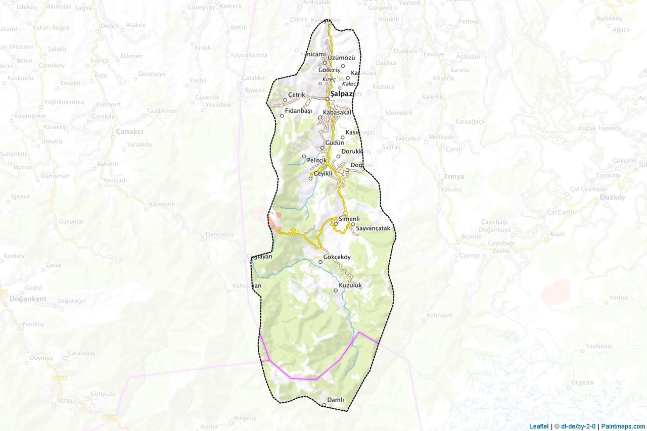
Şalpazarı is a mountainous district of Trabzon province in Türkiye’s Black Sea Region. The district borders Beşikdüzü and Tonya to the east, Vakfıkebir and Giresun province directly to the west, and is located 55 kilometers from the city center of Trabzon. With an area of 164 km², Şalpazarı is characterized by its mountainous and rugged terrain. Situated along valleys extending from the coast toward inland areas, its most significant river is the Ağasar Stream. Şalpazarı, with its abundant forests and traditional cultural structure, is one of the settlements preserving its regional identity.

Trabzon Şalpazarı District (Şalpazarı Municipality)
The historical development of Şalpazarı parallels the broader historical trajectory of Trabzon and its surroundings. The region was part of the cultural sphere of the ancient Colchian and Pontic civilizations and later became part of the Eastern Black Sea hinterland during the Roman and Byzantine periods. Turkish settlement in the area began with the incorporation of Trabzon into the Ottoman Empire in 1461. During the Ottoman era, this region was administratively subordinate to the Tirebolu Sanjak. In the late 19th century, it was attached to the Görele district of Giresun and later to the Vakfıkebir kazas. In 1936, Şalpazarı became a subdistrict of Beşikdüzü. Finally, by Law No. 3392 dated 19 June 1987, Şalpazarı gained independent district status under Trabzon province.
Due to its location away from major historical transit routes, Şalpazarı experienced only limited large-scale migrations, a factor that contributed to the preservation of its traditional social and cultural structure. The settled population of Şalpazarı, the Çepniler, are one of the 24 tribes of the Oghuz Turks and descend from Turkmen groups who settled in the region during the Anatolian Seljuk and Beylik periods. This ethnic and cultural structure continues to manifest in the traditions still practiced in Şalpazarı today.
Şalpazarı is a mountainous district located in the western interior of Trabzon province in Türkiye’s Black Sea Region. Situated 55 kilometers from the city center of Trabzon, it is bordered by Beşikdüzü and Tonya to the east, Vakfıkebir and Giresun’s Eynesil district to the west. While its northern boundary does not directly reach the Black Sea coast, its topography, shaped by valleys extending inland, forms a natural transition zone distinct from coastal districts. Covering 164 km², the district has a narrow and elongated terrain oriented north-south. Its principal river is the Ağasar Stream, and settlements are largely concentrated along its valley. Natural boundaries create both administrative continuity and transitional zones with other western districts of Trabzon and neighboring Giresun province.
Although located within the Black Sea Region, Şalpazarı, being an inland area without direct coastal access, exhibits a semi-humid microclimate with reduced maritime influence. Annual precipitation is high, but snowfall is more common during winter months compared to coastal districts. The summer season is mild and cool, while winters are cool and rainy. Cloudy and humid conditions prevail throughout the year.
These climatic conditions have supported the development of a rich vegetation cover typical of the Black Sea forest ecosystem. Due to the district’s high and rugged topography, the natural vegetation remains largely intact. Surrounding forests consist predominantly of beech, hornbeam, oak, chestnut, and fir trees. Understory flora includes various shrub species and herbaceous plants that are widespread. The topography has resulted in a layered and locally dense vegetation structure.
Şalpazarı Kadırga Plateau (Şalpazarı Municipality)
The economy of Şalpazarı is largely based on agriculture and animal husbandry. Although its mountainous and rugged terrain is unsuitable for large-scale farming, hazelnut production, along with maize, potato, and vegetable cultivation, forms the primary livelihood sources for the local population. In particular, hazelnut production is notable for its contribution to household economies and its significant role in regional agricultural activities.
Animal husbandry is typically conducted on a small-scale family basis. Livestock farming, both large and small, is closely intertwined with the tradition of transhumance. During summer months, herders move animals to highland pastures, sustaining traditional production methods. By-products such as milk, butter, and cheese are commonly consumed domestically or sold in limited local markets.
Trade and industry activities are very limited. Small-scale craftsmen and service sectors operate primarily to meet basic community needs. The district center serves as a commercial and service hub for surrounding villages. Seasonal labor migration from Şalpazarı to neighboring provinces and districts is also a significant component of the local economy.
According to the Turkish Statistical Institute (TÜİK) 2023 Address-Based Population Registration System (ADNKS) data, Şalpazarı’s current population is recorded as 10,760, comprising 5,365 males and 5,395 females. The gender distribution is balanced, and the density of rural settlements directly influences the district’s demographic structure.
The district includes central neighborhoods and approximately 30 villages (settlement units with neighborhood status); a significant portion of the population resides in these rural areas. Migration, particularly among the youth, is a defining phenomenon, with a trend toward relocation to large cities for education and employment. Nevertheless, during summer months—especially during the transhumance season—the population experiences temporary growth as diaspora members return to contribute to social and cultural vibrancy.
Educational activities in Şalpazarı are carried out through institutions under the Ministry of National Education. The educational infrastructure is distributed between central and village schools, reflecting the settlement pattern. As of the 2022–2023 academic year, the district has a total of 27 educational institutions: 10 preschools, 8 primary schools, 7 middle schools, and 2 secondary schools (high schools). A total of 135 teachers are employed, and 817 students are enrolled in formal education.
Secondary education in the district is provided by Şalpazarı Multi-Program Anatolian High School and Şalpazarı Imam Hatip High School. Under the multi-program high school framework, both general and vocational education are offered. Some primary and middle schools operate under the mobile education system. Due to the high number of rural settlements, mobile education is widely applied, particularly at the middle school level.
The school enrollment rate is close to the national average; however, declining student numbers and migration trends have led to periodic closures or consolidation of classrooms in some village schools. The physical infrastructure of educational institutions meets basic standards, and cultural events, sports activities, and competitions are occasionally organized to support students’ academic and social development.
Şalpazarı is one of the rare districts in the interior of the Black Sea region where traditional life has been preserved. Historically a region of dense Çepni Turkmen settlement, it exhibits a unique social structure reflecting the continuity of Turk culture in Anatolia. Çepni identity encompasses a broad cultural practice extending from daily life and weddings to folk dances and traditional attire.
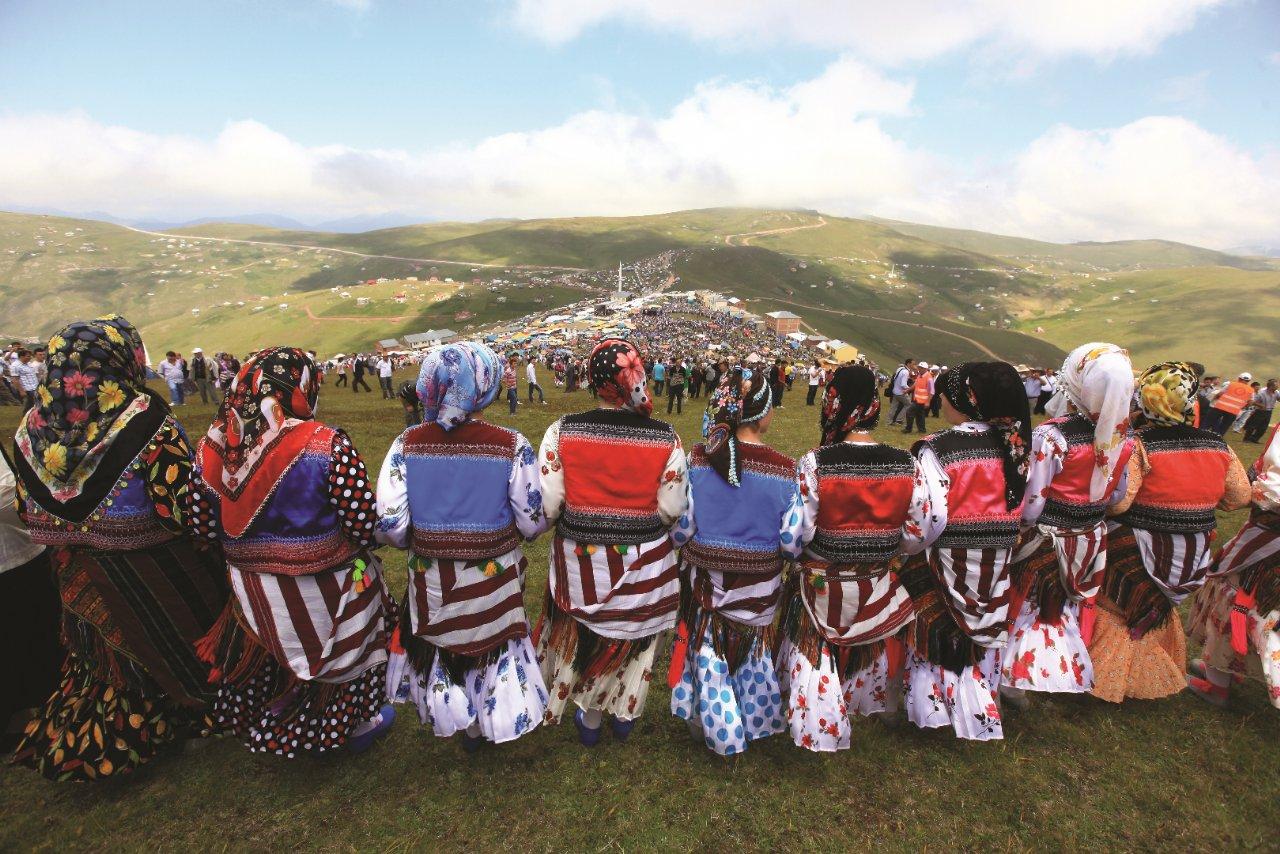
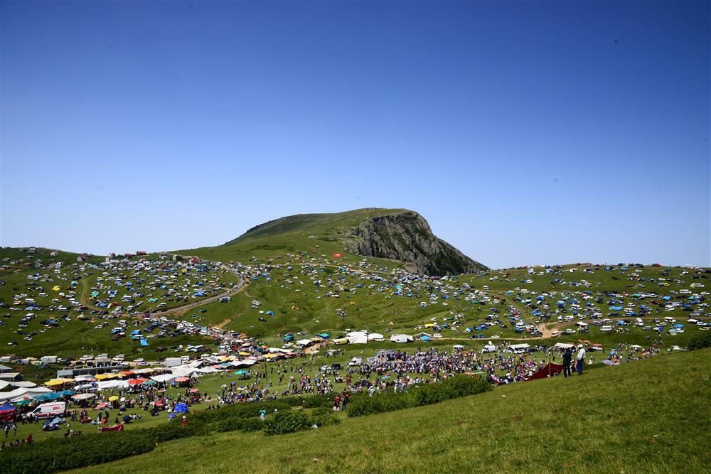
Şalpazarı possesses significant potential for nature tourism due to its natural beauty and highland pastures. Sis Dağı Plateau, Kadırga Plateau, Alaca Plateau, and Ağasar Valley are ideal for hiking, camping, and nature photography. Traditional festivals held on the plateaus also attract local and international tourists.
Annually held Sis Dağı Plateau Festivals are among the most important events that unite Şalpazarı’s cultural heritage with its tourism potential. These festivals take place on the slopes of Sis Dağı on the third Saturday of July and welcome numerous participants from neighboring provinces and abroad. Events highlight Çepni-style horon dances accompanied by kemençe, regional costumes, davul-zurna performances, and folk songs. Similarly, the Acısu Plateau Festivals, held during summer months, serve as comparable cultural gatherings.
Şalpazarı Plateaus (Şalpazarı Municipality)
Şalpazarı’s cuisine is shaped by typical Black Sea ingredients. Maize bread, cabbage dishes, black cabbage soup, kuymak (mıhlama), and maize grits soup are commonly consumed dishes. Additionally, butter and cheese produced on the plateaus play an important role in household food production.
T.C. Ministry of Culture and Tourism. "Şalpazarı."Trabzon Kültür and Tourism Directorate. Accessed April 20, 2025.https://trabzon.ktb.gov.tr/TR-57626/salpazari.html
T.C.Şalpazarı Kaymakamlığı Governorship. "Culture, Art and Tourism." Accessed April 20, 2025.http://www.salpazari.gov.tr/ilce-tarihi
T.C.Şalpazarı Kaymakamlığı Governorship. "Tarihçe." Accessed [insert date if provided].http://www.salpazari.gov.tr/tarihce2
T.C.Şalpazarı Kaymakamlığı Governorship. "Yaylalarımız." Accessed April 20, 2025.http://www.salpazari.gov.tr/yaylalarimiz
T.C.Şalpazarı Kaymakamlığı Governorship. "Şalpazarı." Accessed April 20, 2025.http://www.salpazari.gov.tr/salpazari
Şalpazarı Belediyesi. "Alaca Yaylası." Accessed April 20, 2025.https://salpazari.bel.tr/Resim/4/10129/alaca-yaylasi
Şalpazarı Belediyesi. "Culture and Tourism." Şalpazarı Municipality. Accessed April 20, 2025.https://salpazari.bel.tr/#gsc.tab=0
Şalpazarı Belediyesi. "Economic Situation." Şalpazarı Municipality. Accessed April 20, 2025.https://salpazari.bel.tr/#gsc.tab=0
Şalpazarı Belediyesi. "Eğitim ve Öğretim." Şalpazarı Belediyesi. Accessed April 20, 2025.https://salpazari.bel.tr/Sayfa/18/egitim-ogretim
Şalpazarı Belediyesi. "Tarihçe." Accessed April 20, 2025.https://salpazari.bel.tr/Sayfa/15/tarihce
Shalpazarı (District)
Şalpazarı
Country | Türkiye | ||||||||
|---|---|---|---|---|---|---|---|---|---|
Province | Trabzon | ||||||||
Elevation | 450 m | ||||||||
Population | 10.760 (2023) | ||||||||
License Plate Code | 61 | ||||||||
Area Code(s) | 0462 | ||||||||
Climate | Black Sea Climate | ||||||||
Area | 164 km² | ||||||||
District Governor | Zekeriya Murat Şahan | ||||||||
Mayor | Refik Kurukız | ||||||||
No Discussion Added Yet
Start discussion for "Şalpazarı (District)" article
History
Geographical Structure
Location and Boundaries
Climate and Vegetation
Economic Structure
Demographic Structure
Education
Tourism and Culture
Cuisine