


This article was automatically translated from the original Turkish version.
+2 More
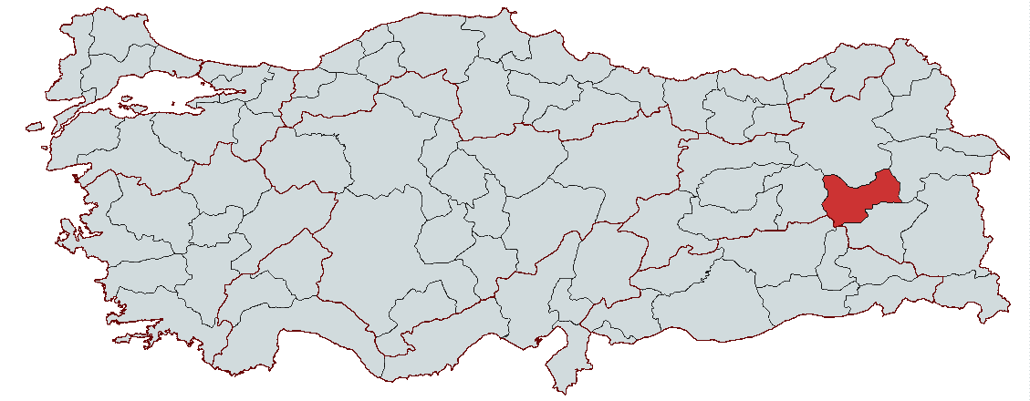
Muş
Country | Türkiye | ||||||||
|---|---|---|---|---|---|---|---|---|---|
Region | Eastern Anatolia Region | ||||||||
Population | 392.301 (2023) | ||||||||
Area | 8196 km² | ||||||||
Climate | Continental Climate | ||||||||
Important Structure | Malazgirt Castle Historical Murat Bridge Monastery of the Holy Apostles Hacı Şeref Mosque | ||||||||
Area Code(s) | 436 | ||||||||
License Plate Code | 49 | ||||||||
Governor | Avni Çakır | ||||||||
Mayor | Sırrı Söylemez | ||||||||
Muş is an important regional center that bears traces of numerous civilizations throughout its historical past. The city was established in the 4th century and has a history extending back to the Urartian period. The Urartians named Muş after one of their great kings, and this name remained long in popular use among the general population. Over time, through linguistic evolution, it came to be known as "Muş" in its current form.
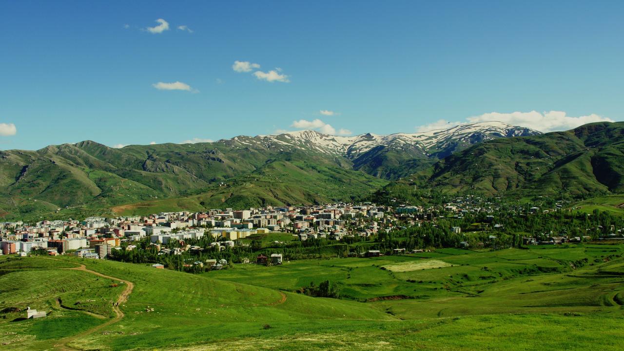
Muş (Photo: Muş Provincial Directorate of Culture and Tourism)
Although definitive information about the founding of Muş is lacking, the region’s historical record begins with the Urartian Kingdom. The Urartians established dominance over eastern Anatolia as a unified kingdom in the 9th century BCE. Muş occupied a strategic position as a key center along the western route of the Urartian kingdom. The Urartians established significant settlements in the region, likely settling in the Muş Plain as early as the 12th century BCE. Muş frequently appears in Assyrian sources and became an important settlement center during the period of expanding Urartian control.
Throughout the Middle Ages, Muş and its surroundings came under the rule of various civilizations. During this period, the region successively fell under the influence of the Medes, Persians, Romans, Parthians, and the Sassanian Empire. Particularly, the Persian consolidation of power in eastern Anatolia around 550 BCE reinforced Muş’s strategic importance. The region remained under Sassanian control for an extended period before being captured by the Byzantine Empire. During the Arab incursions of the 7th century, Muş remained under Byzantine rule and gradually came under Turkish influence.
In the 11th century, following their victory at the Battle of Manzikert, the Seljuks established dominance over eastern Anatolia. Muş experienced a major period of development under Seljuk administration, and Turkish settlement in the region increased significantly. In the 13th century, Muş and its surroundings passed under the control of the Ahlatshahs Beylik, then changed hands between the Artuqids and the Ayyubids.
Muş joined the Ottoman Empire in 1515. Yavuz Sultan Selim incorporated the region into Ottoman territory, and Muş gradually became a district center subordinate to the Bitlis Eyalet. During the Ottoman period, the city witnessed numerous local uprisings and external threats. Nevertheless, Muş continued to develop culturally and economically, and by the 19th century it had become a major transportation hub following the construction of a railway connection.
Following the proclamation of the Republic, development initiatives were launched in Muş, and with local administrative reforms, the city was declared a province in 1923. However, Muş remained a site of various political and social events during this period. The Sheikh Said Rebellion of 1925 triggered significant unrest in eastern Anatolia, particularly around Muş, but the rebellion was suppressed by the Republican government. During the First World War, Muş was occupied by Russian forces but was recaptured by the Turkish army after a short period. The struggles against Armenians and the Russian occupation altered the region’s demographic structure and led to several massacres. During this period, Muş’s economy continued to rely primarily on agriculture and animal husbandry.
Muş Province is located in the Eastern Anatolia Region, between latitudes 39°29' and 38°29' north and longitudes 41°06' and 41°47' east. It covers an area of 8,196 km², accounting for 1.1% of Türkiye’s total land area. Muş is bordered by Ağrı Province’s Patnos and Tutak districts to the east, Bitlis Province’s Ahlat and Adilcevaz districts to the south, Erzurum Province’s Karayazı, Hınıs, Tekman, and Karaçoban districts to the north, Bingöl Province’s Karlıova and Solhan districts to the west, and Diyarbakır Province’s Kulp and Batman Province’s Sason districts, as well as Bitlis Province’s Göroymak and Mutki districts to the south. Muş Province lies on the northern slopes of Kurtik Mountain, one of the prominent peaks of the Haçreş Mountains, which are an extension of the Southeastern Taurus Mountains, between the valleys of the Çar and Karni rivers.
Muş features a high and mountainous terrain, with 34.9% of its territory covered by mountains. These mountains are young formations associated with the Alpine-Himalayan fold system and generally rise above 1,250 meters in elevation. The province also includes plains, which cover 27.2% of its area, and undulating, fertile alluvial plateaus, which account for 37.9%. The Murat Valley cuts through the province from east to west, forming a major natural feature.
The main mountains surrounding Muş Province are extensions of the Southeastern Taurus Mountains. Once forested, these mountains have become largely bare over time. The province’s principal mountains include Akdoğan (Hamurpet) Mountain, Şerafettin Mountains, Bilican Mountains, Bingöl Mountains, Haçreş Mountains, Otluk Mountains, and Yakupağa Mountains.
The plateaus of Muş Province cover 37.9% of its territory. These plateaus lie between the Murat Valley’s highlands and the mountain peaks and generally have a flat topography. They are rich in water and pastureland, making animal husbandry the most developed agricultural activity in Muş.
The valleys of Muş Province were primarily carved by the Murat River and its tributaries. The largest and most significant of these is the Murat Valley. Plains cover 27.2% of the province’s area, with the most important being Muş, Bulanık, Malazgirt, and Liz Plains.
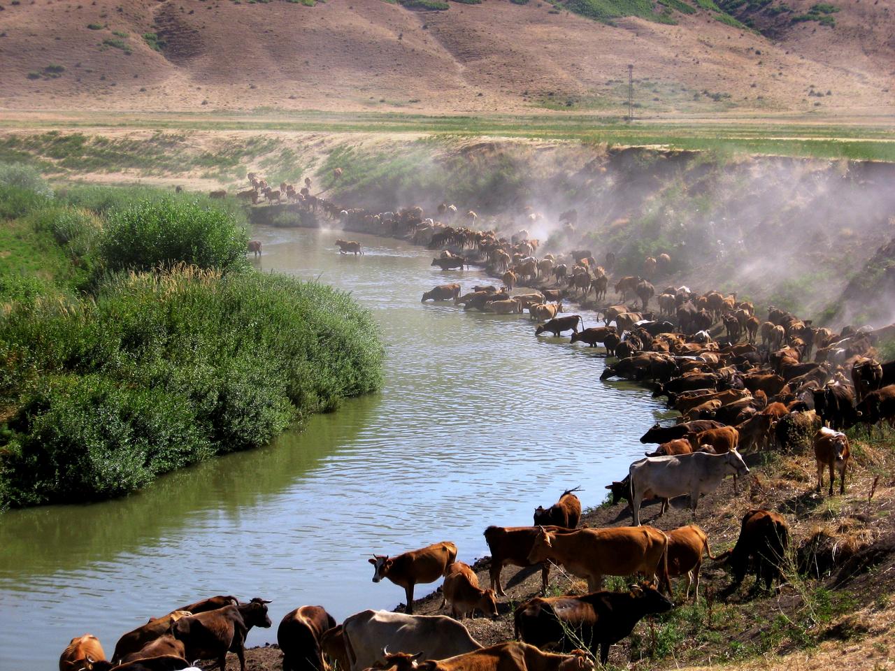
Malazgirt Plain (Photo: Muş Provincial Directorate of Culture and Tourism)
Muş Province lies within the Euphrates Basin, and its most important rivers are the Murat River and its tributary, the Karasu.
The main lakes within Muş Province are:
Muş Province is one of Türkiye’s less economically developed regions, with its economy largely based on agriculture and animal husbandry. The industrial sector has lagged behind in development, and a closed economy centered on agriculture has dominated for many years. However, in recent years, private sector initiatives and incentives have led to the establishment of small-scale industrial enterprises.
Agriculture and animal husbandry play a central role in Muş’s economy. Agricultural land totals 342,198 hectares, most of which is cultivated. Major agricultural products include wheat, barley, sugar beet, sunflower, tobacco, and cereals. Animal husbandry is also a vital subsector, particularly small-scale livestock farming, with sheep and goat rearing being the most common activities. However, productivity in agriculture and animal husbandry remains low due to traditional production methods. This situation is a major factor limiting economic development in the region.
Despite possessing one of Türkiye’s largest plains, Muş cannot fully utilize its arable land due to harsh climatic conditions and insufficient water resources. In particular, inadequate irrigation infrastructure in the Muş Plain contributes to low agricultural yields. However, the completion of the Alparslan II Dam and other irrigation projects is expected to improve this situation.
Industry plays a minor role in Muş’s economic structure. The main reasons for its underdevelopment include insufficient capital accumulation, unfavorable climatic conditions, and limited raw materials. Large-scale industrial enterprises in the province are limited. These include the Muş Sugar Factory and the Muş Cement Factory. Medium-scale enterprises include textile mills, brick factories, dairy plants, and food production facilities. However, it is anticipated that small industrial enterprises established through private sector initiatives will contribute to industrial growth in the province.
The Muş Organized Industrial Zone, operational since 2008, has made significant contributions to industrial development. Planned to accommodate 54 factories, the zone currently hosts production across various sectors.
Trade is a vital component of the provincial economy. Commercial activity remains vibrant in the provincial center and surrounding districts. The bulk of trade consists of foodstuffs, construction materials, agricultural products, and durable consumer goods. A significant portion of locally produced plant products, especially chickpeas and beans, is exported outside the province. Livestock products are also an important component of trade.
Employment in Muş is heavily concentrated in agriculture and animal husbandry. The agricultural sector accounts for 56.2% of total employment, while the industrial sector accounts for only 2%. This low share reflects the province’s limited industrialization. Unskilled labor constitutes the majority of the workforce in agriculture and animal husbandry, and unemployment rates remain periodically high.
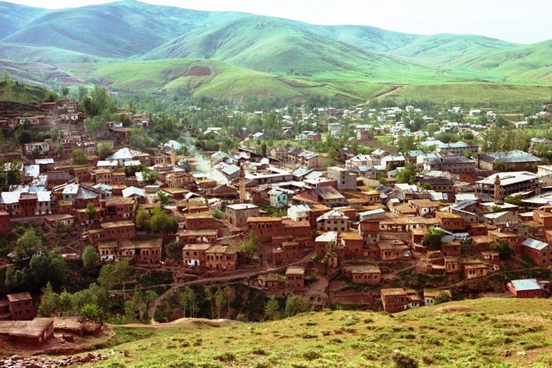
Muş houses (Photo: Muş Provincial Directorate of Culture and Tourism)
Muş’s cuisine offers a rich variety centered on meat. Key regional dishes include Muş Köftesi (Hafta Direği), Hez Dolması, Tomato-Stuffed Cabbage (Kırkçikli Kelem Dolması), Çorti, and Keşkek.
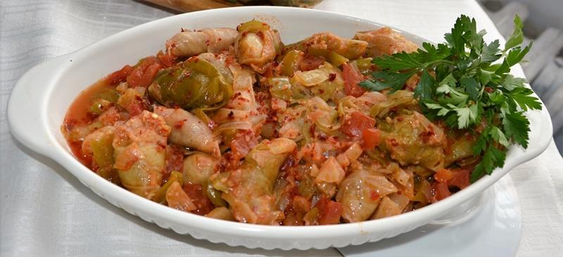
Kelem dolması (Photo: Muş Provincial Directorate of Culture and Tourism)
Avni Çakır currently serves as the Governor of Muş. He was appointed to the position by Presidential Decree No. 2023/376 dated 10 August 2023 and assumed office on 18 August 2023.
Devlet Hava Meydanları İşletmesi (DHMİ). "Muş Havalimanı ve Şehir Tarihçesi." Accessed February 18, 2025.https://www.dhmi.gov.tr/Sayfalar/Havalimani/Mus/SehirTarihcesi.aspx.
Ministry of Culture and Tourism. "Muş İl Directorate of Culture and Tourism." Accessed February 18, 2025.https://mus.ktb.gov.tr/
Ministry of National Education. "Milli Eğitim Bakanlığı Resmi Web Sayfası." Accessed February 18, 2025.https://www.meb.gov.tr/.
Muş Valiliği. "Muş Valiliği Resmi Web Sayfası." Accessed February 18, 2025.http://www.mus.gov.tr/
T.C. Ministry of Culture and Tourism. "2024Muş İl." Muş Provincial Directorate of Culture and Tourism. Accessed February 18, 2025.
T.C. Ministry of Culture and Tourism. "Genel Bilgiler."Muş İl Directorate of Culture and Tourism. Accessed February 18, 2025.

Muş
Country | Türkiye | ||||||||
|---|---|---|---|---|---|---|---|---|---|
Region | Eastern Anatolia Region | ||||||||
Population | 392.301 (2023) | ||||||||
Area | 8196 km² | ||||||||
Climate | Continental Climate | ||||||||
Important Structure | Malazgirt Castle Historical Murat Bridge Monastery of the Holy Apostles Hacı Şeref Mosque | ||||||||
Area Code(s) | 436 | ||||||||
License Plate Code | 49 | ||||||||
Governor | Avni Çakır | ||||||||
Mayor | Sırrı Söylemez | ||||||||
History
Ancient Period
Middle Ages
Seljuk and Ottoman Periods
Republican Period
Geographical Structure
Landforms
Mountains
Plateaus
Valleys and Plains
Rivers
Lakes
Economic Structure
Agriculture and Animal Husbandry
Industry
Trade
Employment and Labor Force
Historical Sites
Regional Cuisine
Administration
Governor