


This article was automatically translated from the original Turkish version.
+2 More
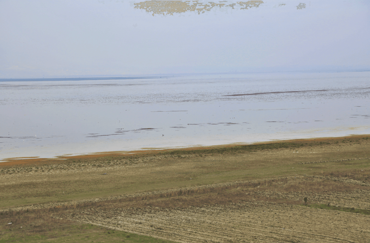
Marmara Lake
Location | Manisa | ||||||||
|---|---|---|---|---|---|---|---|---|---|
Surface Area | 3,200–6,912 ha (Seasonal Variation) | ||||||||
Depth | Average 3–4 m / maximum 7.2 m | ||||||||
Water Sources | Ahmetli Pump Station Gediz River (Adala Regulator) Kumçayı (Çömlekçi Regulator) | ||||||||
Marmara Gölü is a freshwater lake located within the boundaries of Manisa Province in Türkiye’s Aegean Region, situated between the districts of Gölmarmara, Salihli, and Ahmetli. The lake lies at an elevation of 74–80 metres and covers an area of 6,912 hectares. It has been transformed into a reservoir by a 5.75-kilometre-long dam on its eastern and southeastern sides. To the east of the lake lies Keçidağ, to the south the Salihli Plain, to the west Çal Dağı (1034 m), and to the north the Gölmarmara Plain.
Marmara Gölü is an inland water body formed within a tectonic depression of the Gediz Graben System, one of the active tectonic zones of Western Anatolia. It is classified as an alluvial dam lake.
The lake occupies a naturally closed depression with locally shallow basinal characteristics, shaped by the accumulation of alluvium deposited by the Gediz River and Kumçayı. This depression is bounded by active faults oriented northwest–southeast. The area surrounding the lake is surrounded by various formations of the Menderes Massif. To the west of the lake is Çaldağ (1034 m), to the east Dibek Dağı, to the north the Gölmarmara Plain, and to the south the Salihli Plain. The terrain is represented by various geological units including gneiss, micaschist, amphibolite, marble, crystalline limestone, marl, sandstone, gravel, radiolarite, and ophiolite. This complex geology has resulted in a highly varied and topographically intricate landscape around the lake. Particularly in the northwestern sector, abandoned marble quarries are the origin of the lake’s name. These quarries, referred to by Evliya Çelebi as “Mermere,” are located on the mountain known as the Marmara Dağı, from which the lake derives its name, Marmara Gölü.
The formation of the lake is linked to subsidence processes active during the Pliocene and Pleistocene epochs. Alluvial deposits carried by Kumçayı from the north and the Gediz River from the south gradually accumulated in the low-gradient area between Salihli and Gölmarmara, forming a natural dam. As a result, waters accumulated in a basin to form Marmara Gölü.
The region’s climate (semi-arid to semi-humid) causes pronounced seasonal fluctuations in the lake’s water budget. Water levels rise during winter and decline in summer due to higher temperatures and evaporation. This leads to significant annual variations in the lake’s water level and surface area.
The lake’s catchment area is approximately 1,780 km². The lake has no natural outlet, making it susceptible to salinization. However, various artificial interventions since the 1930s—including canals, regulators, and pumps—have altered these natural processes and transformed the lake into a seasonally managed reservoir.
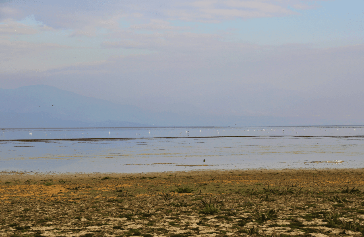
Marmara Gölü (T.C. Tarım ve Orman Müdürlüğü)
The main water sources are the Çömlekçi Regulator fed by Kumçayı, the Adala Regulator fed by the Gediz River, and the Ahmetli Pump Station. With a capacity of 320 million cubic metres, the lake serves as the primary water source for irrigation in the region. Depending on the year, the lake’s surface area varies between 25 and 72.9 km², and its volume between 15.58 and 377.7 hm³.
Marmara Gölü supports 162 bird species, 11 fish species, 26 algae species, 6 zooplankton species, 33 amphibian species, 32 mammal species, and 355 plant species. Among these are endemic species such as Ladigesocypris mermere, endemic to Türkiye, and Kripowitschia mermere, endemic to the lake. The lake serves as a breeding and wintering ground for bird species including the Dalmatian pelican (Pelecanus crispus), the spiny-tailed lapwing (Vanellus spinosus), the ferruginous duck (Aythya nyroca), and the little bittern (Ardeola ralloides).
Marmara Gölü was designated as a wetland under the “Regulation on the Protection of Wetlands” in 2002 and declared a National Importance Wetland in 2017. In the same year, it was also officially registered as a natural site. In 2022, it was reclassified into a buffer zone (24,893 ha), a sustainable use zone (1,495 ha), and a controlled use zone (552 ha).
The area surrounding the lake is intensively used for agriculture and livestock farming. Crops such as watermelon, melon, cotton, and tobacco are cultivated. Both large and small livestock graze in the vicinity. There are 102 licensed fishermen and 51 registered fishing boats. Settlement areas experienced a 173% population increase between 1986 and 2011, while pasture and aquatic plant areas have suffered significant declines.
The lake was enclosed by a dam between 1938 and 1945 to function as a reservoir. From the 1950s onward, it began to be fed by water transfer canals from Kumçayı, the Gediz River, and the Ahmetli Regulator. Water release for irrigation is managed through the Marmara Regulator, spillways, and discharge channels. Marmara Gölü is used to irrigate approximately 40,000 hectares in the Gediz Plain.
Marmara Gölü (Youtube)
Between 1975 and 2018, the lake’s area shrank by 43%. Particularly between 2011 and 2018, it contracted by 38%, and by 2021 the lake had completely dried up. Primary causes of this drying include climate change, water transfer projects based on the Gördes Dam, excessive irrigation, narrowing of agricultural canals, conversion of wetlands into farmland, and illegal fishing.
The drying process has affected both biodiversity and the livelihoods of local communities. Fishing activities have ceased entirely, and agricultural productivity has declined in surrounding villages. The loss of the lake has contributed to regional aridification and disruption of the local water cycle.
The Ege University Bird Observation Group and the Ege Association for the Conservation of Natural Life conduct monitoring and inventory studies at the lake. The General Directorate of State Hydraulic Works and the Ministry of Agriculture are currently planning new water retention projects. Since 2021, scientists have been evaluating alternative water sources and nature-based solutions to restore the lake.
Akarsu, Ferdi, Orhan Gül, and Barış Uzilday. EGE025 – Marmara Gölü. Önemli Doğa Alanları Kitabı. Ankara: Doğa Derneği Yayınları, 2011.
Girgin, Mustafa. “Marmara Gölü.” *Atatürk Üniversitesi Kazım Karabekir Eğitim Fakültesi Dergisi*. Accessed June 1, 2025.https://dergipark.org.tr/en/download/article-file/26767.
Gülersoy, Ali Ekber. “Marmara Gölü Yakın Çevresindeki Arazi Kullanım Faaliyetlerinin Zamansal Değişimi (1975-2011) ve Göl Ekosistemine Etkileri.” *Türk Coğrafya Dergisi*, no. 61 (2013): 31–44. Accessed June 1, 2025.https://dergipark.org.tr/en/download/article-file/198494
Körbalta, Hasibe. “Marmara Gölü Neden Kuruyor?” *Kent Akademisi: Kent Kültürü ve Yönetimi*, Volume 12, no. 3 (2019): 441–459. Accessed June 1, 2025.https://dergipark.org.tr/tr/download/article-file/834736

Marmara Lake
Location | Manisa | ||||||||
|---|---|---|---|---|---|---|---|---|---|
Surface Area | 3,200–6,912 ha (Seasonal Variation) | ||||||||
Depth | Average 3–4 m / maximum 7.2 m | ||||||||
Water Sources | Ahmetli Pump Station Gediz River (Adala Regulator) Kumçayı (Çömlekçi Regulator) | ||||||||
Geological and Morphological Structure
Hydrological Characteristics
Ecosystem and Biodiversity
Conservation Status
Human Activities and Land Use
Reservoir Function and Water Management
Drying Process and Threats
Ecological and Socioeconomic Impacts
Conservation and Monitoring Efforts