


This article was automatically translated from the original Turkish version.
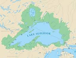
Lake Superior
Location | North America: USA (MN-WI-MI) on the border with Canada (ON) | ||||||||
|---|---|---|---|---|---|---|---|---|---|
Lake Type | freshwater lake | ||||||||
Surface Area | 82,103 km² | ||||||||
Volume | 12,100 km³ | ||||||||
Average Depth | 147 m | ||||||||
Maximum Depth | 406 m | ||||||||
Maximum Length | 560 km | ||||||||
Maximum Width | 260 km | ||||||||
Inflow Rivers | Michipicoten rivers Nipigon St. Louis Pigeon Pic Kaministiquia White | ||||||||
Lake Superior is the largest freshwater lake in the world by surface area, located in North America with an area of approximately 82,103 km² (31,700 sq mi). It holds a volume of 12,100 km³ of water, equivalent to three quadrillion gallons. This amount is sufficient to cover both North and South America with a layer of water 30 cm deep. Approximately 8% of the Earth’s surface freshwater is contained in this lake.【1】 Lake Superior is shared between the United States states of Minnesota, Wisconsin, and Michigan, and the Canadian province of Ontario.
The lake attracts attention not only for its size but also for its natural characteristics. With an average water temperature of 4°C (40°F), Lake Superior is described as the world’s most oligotrophic lake due to its clarity and low nutrient levels. It was named Gichi-Gami, meaning “Great Sea,” by the indigenous Ojibwe people. The lake also became known as Gitche Gumee through Henry Wadsworth Longfellow’s 1855 poem “Hiawatha.” In the 17th century, French explorers named it Le Lac Supérieur (“the upper lake”), a name later adopted into English as Lake Superior.
Lake Superior is 563 km long and 257 km wide. Its shoreline stretches 4,387 km, a distance equivalent to the length of the Bahamas if all its curves were straightened. The lake’s average elevation is 183 metres (602 feet) above sea level, with its deepest point reaching 406 metres (1,300 feet). The lake is fed by approximately 200 rivers and streams. Its watershed extends from Wabakimi Park in Ontario to Pictured Rocks in Michigan. In some areas, the shoreline extends 257 km inland, while in others it is only 8 km wide.
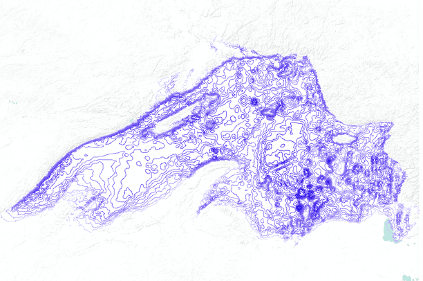
Superior Gölü Batimetrik Haritası (Databasin)
The shoreline exhibits great diversity, ranging from sandy beaches and high volcanic cliffs to forested bluffs and low rocky shores. It contains numerous islands including Isle Royale, the Apostle Islands, and the Susie Islands. Duluth (Minnesota) and Thunder Bay (Ontario) are the largest cities on the lake’s shore and serve as economic hubs for the region, important for transportation, mining, and trade.
The hydrography of Lake Superior is notable for both its scale and complexity. The lake is fed by more than 200 streams, primarily the Nipigon, St. Louis, Pigeon, Pic, Kaministiquia, White, and Michipicoten rivers. The Ogoki and Long Lac rivers, located outside the main basin, contribute additional water to the lake. The only outflow is the St. Marys River, which carries water into Lake Huron.
Lake Superior’s water turnover is slow: a drop of water entering the lake takes approximately 191 years to exit. The lake does not freeze completely; only between 40% and 95% of its surface may be covered by ice during some winter months. Average water clarity is 8 metres (27 feet), reaching up to 30 metres (100 feet) in some areas. This characteristic makes the lake both ecologically sensitive and valuable for environmental monitoring.
The geological history of Lake Superior extends back 1.1 billion years. During the Midcontinent Rift System event, the continental crust split open and lava erupted in layered flows. This process formed the foundation of the lake basin. The rift extends from northeastern Canada to Kansas in the southwest and into Michigan in the southeast. As the lava layers cooled, they solidified into volcanic rock, while slowly crystallizing magmatic bodies beneath the surface, such as the Duluth Complex, formed coarse-grained granite structures.
Over time, sandstone sediments filled the rift, and during the subsequent glacial period, these sedimentary layers were eroded to form the basin of Lake Superior. The lake reached its current elevation only about 2,000 years ago. Resistant volcanic rocks along the shoreline form steep and stable cliffs, while weaker sedimentary rocks such as sandstone eroded easily. Regions such as Isle Royale and the Keweenaw Peninsula represent the opposing edges of the rift and host significant copper deposits.
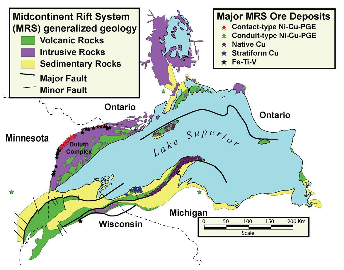
Superior Gölü Genel Jeolojik Haritası (USGS)
In addition, the bedrock along the Ontario shoreline dates back 2.7 billion years and is among the oldest rocks on Earth.
Lake Superior is a large inland water body that significantly influences the surrounding climate. The region lies within a humid continental climate zone. Spring arrives late, summers are cool, and autumn and winter are stormy. During summer months, sunset on the western shore occurs 35 minutes later than on the eastern shore. The average water temperature is 4°C, rising to 13°C in summer. Complete freezing is rare; the last recorded full freeze occurred briefly in 1996.【2】
The southern shores of Lake Superior, particularly Michigan’s Keweenaw Peninsula, experience annual snowfall exceeding five metres, making them the site of the world’s most intense lake-effect snowfall. This phenomenon occurs when cold air masses collide with the relatively warm lake waters during autumn. Such lake-effect snow events are rare and occur only in a few regions: around the Great Lakes, the eastern coast of Hudson Bay, and certain coastal areas of Japan. The size of Lake Superior affects not only temperature and precipitation patterns but also wind systems, fog formation, and ecosystem balances.
The cold, clean, and nutrient-poor (oligotrophic) waters of Lake Superior support a simple yet balanced ecosystem. Approximately 80 fish species inhabit the lake, including native species such as lake trout, lake whitefish, cisco, and longnose sucker, as well as introduced species like Atlantic salmon, carp, and Pacific salmon.
The boreal and St. Lawrence forests surrounding the lake host 58 species of orchids and various cold-climate plants. Particularly in valleys along the northern shore, species similar to those of the Arctic zone are found. These are known as “Arctic disjunctions.” The lake’s shores also serve as a critical stopover for migratory birds, providing essential transit and breeding grounds for thousands of waterfowl and songbirds during spring and autumn. Hawk Ridge in Duluth is a major migration route where up to 100,000 raptors may pass in a single day. Mammalian fauna includes red squirrel, wolf, lynx, and even woodland caribou.
The shores of Lake Superior have been inhabited for thousands of years. The first human groups to settle the region after the last glacial period were the Paleo-Indians, who lived by hunting. Around 5000 BCE, Shield Archaic communities emerged, engaging in trade. Later, the Laurel people developed fishing practices, particularly along the Michipicoten and Pic rivers. By the 17th century, the Ojibwe people lived in large communities around the lake. The Ojibwe and broader Anishinaabe groups became central to the region’s commercial system through fur and food trade with European traders, especially the French.
In the 18th century, the Hudson’s Bay Company took control of trade in the region. In the 19th century, new settlements arose with the expansion of copper mining, logging, and commerce. During this period, one of the world’s richest silver mines operated in areas such as Silver Islet. Today, the region contributes to the economy through tourism, mining, forestry, and fishing. The ports of Thunder Bay and Duluth continue to maintain their importance as key transportation and trade hubs for Lake Superior.
DATA BASIN. “Lake Superior bathymetric contours (depth in meters).” Databasin.org. Accessed May 1, 2025.https://databasin.org/datasets/88d305616c3e44cabbd465dde0d916c7/
Hayes, Marques. “Geography of Lake Superior.” Geography Realm. Accessed May 1, 2025.https://www.geographyrealm.com/geography-of-lake-superior/
Lake Superior Magazine. “Why Is the Big Lake Called ‘Gitche Gumee?’” Lake Superior. Accessed May 1, 2025.https://www.lakesuperior.com/the-lake/lake-superior/281almanac/
Lakehead Region Conservation Authority. “The Lake Superior Watershed.” Lakeheadca. Accessed May 1, 2025.https://lakeheadca.com/great-lakes/lake-superior-watershed
Linder, Douglas O. “Simply Superior: The World's Greatest Lake.” University of Missouri–Kansas City. Accessed May 1, 2025.http://law2.umkc.edu/faculty/projects/ftrials/superior/superior.html
Miller, Jim. “An Introduction to the Geology of the North Shore.” *Lake Superior Streams.* Accessed May 1, 2025.https://www.lakesuperiorstreams.org/understanding/geology.html
Mishaci, John. “Lake Superior.” WorldAtlas. Accessed May 1, 2025.https://www.worldatlas.com/lakes/lake-superior.html
NOAA (National Oceanic and Atmospheric Administration). “Historical Ice Cover.” GLERL. Accessed May 1, 2025.https://www.glerl.noaa.gov/data/ice/index.html#historical
National Park Service. “Lake Superior Geology.” nps. Accessed May 1, 2025.https://www.nps.gov/articles/000/lake-superior-geology.htm
USGS. “Mineral Map of Lake Superior.” USGS Science for a changing world. Accessed May 1, 2025.https://www.usgs.gov/media/images/mineral-map-lake-superior
USGS. “Understanding the Mineral Resources of the Midcontinent Rift.” USGS Science for a changing world. Accessed May 1, 2025.https://www.usgs.gov/news/science-snippet/understanding-mineral-resources-midcontinent-rift
Urban, N. R., M. T. Auer, S. A. Green, X. Lu, D. S. Apul, K. D. Powell, and L. Bub. “Carbon Cycling in Lake Superior.” *Journal of Geophysical Research: Oceans* 110, no. C6 (June 16, 2006).https://doi.org/10.1029/2003JC002230
Water Science School. “How Much Water is There on Earth?” USGS Science for a Changing World. Accessed May 7, 2025.https://www.usgs.gov/special-topics/water-science-school/science/how-much-water-there-earth#overview
[1]
Water Science School, “How Much Water is There on Earth?” USGS Science for a changing world, Son erişim: 7 Mayıs 2025, https://www.usgs.gov/special-topics/water-science-school/science/how-much-water-there-earth#overview
[2]
NOAA (National Oceanic and Atmospheric Administration), “Historical Ice Cover, ” GLERL, son erişim: 1 Mayıs 2025, https://www.glerl.noaa.gov/data/ice/index.html#historical

Lake Superior
Location | North America: USA (MN-WI-MI) on the border with Canada (ON) | ||||||||
|---|---|---|---|---|---|---|---|---|---|
Lake Type | freshwater lake | ||||||||
Surface Area | 82,103 km² | ||||||||
Volume | 12,100 km³ | ||||||||
Average Depth | 147 m | ||||||||
Maximum Depth | 406 m | ||||||||
Maximum Length | 560 km | ||||||||
Maximum Width | 260 km | ||||||||
Inflow Rivers | Michipicoten rivers Nipigon St. Louis Pigeon Pic Kaministiquia White | ||||||||
Geography
Hydrography
Geology
Climate
Ecology and Biodiversity
Human Settlement and Cultural History